INTRODUCTION TO GEOSERVER - Jharkhandjsac.jharkhand.gov.in/pdf/EDUSAT/Lecture/Introduction to...
59
INDIAN INSTITUTE OF REMOTE SENSING, DEHRADUN Introduction to Web technology for GIS- Mapserver and Geoserver Dr. Harish Karnatak
Transcript of INTRODUCTION TO GEOSERVER - Jharkhandjsac.jharkhand.gov.in/pdf/EDUSAT/Lecture/Introduction to...

I N D I A N I N S T I T U T E O F R E M O T E S E N S I N G , D E H R A D U N
Introduction to Web technology for GIS- Mapserver and
Geoserver
Dr. Harish Karnatak

I N D I A N I N S T I T U T E O F R E M O T E S E N S I N G , D E H R A D U N
What is Distributed GIS?
Distributed GIS concerns itself with GI Systems that do not
have all of the system components in the same physical
location. This could be the processing, the database, the
rendering or the user interface.
Examples of distributed systems are web-based GIS, Mobile
GIS, and GRID computing.

I N D I A N I N S T I T U T E O F R E M O T E S E N S I N G , D E H R A D U N
What is web service?
“Web services” is an effort to build a distributed
computing platform for the Web;
Web services allows us to build a highly distributed
infrastructure;
Each web services can be dedicated to a specific
task.

I N D I A N I N S T I T U T E O F R E M O T E S E N S I N G , D E H R A D U N
What is web service?
– A Service-Oriented Architecture (SOA) is a collection of services or software agents that communicate freely with each other.
– Web Services protocols and standards are the technology that promote the sharing and distribution of information and business data.
– A protocol is a standard method for transmitting data through a network. There are many different specialized protocols to accommodate the many kinds of data that might be transmitted.

I N D I A N I N S T I T U T E O F R E M O T E S E N S I N G , D E H R A D U N
Technically…
Web services-
Identified by a URL
Interfaces defined using XML
Can be discovered by other systems
Interact using XML based messages conveyed by
Internet protocols.

I N D I A N I N S T I T U T E O F R E M O T E S E N S I N G , D E H R A D U N
XML Messaging: SOAP
SOAP (Simple Object Access Protocol) is an XML-based
messaging protocol. It defines a set of rules for
structuring messages that can be used for simple one-
way messaging but is particularly useful for performing
RPC-style (Remote Procedure Call) request-response
dialogues.
I N D I A N I N S T I T U T E O F R E M O T E S E N S I N G , D E H R A D U N
Web Services and GIS

I N D I A N I N S T I T U T E O F R E M O T E S E N S I N G , D E H R A D U N
Web Services and GIS
The web service concept defines the
relationships between the three major actions in
geo-spatial data access:
Service providers who publish services;
Service requestor who search and use services;
The service registry that matches the request with
the existing services.

I N D I A N I N S T I T U T E O F R E M O T E S E N S I N G , D E H R A D U N
GIS Web Services Provides Framework for Distributed System
Focused Applications
Sensor Networks
Consumer Mapping
Location Based Services
Situational Awareness
GIS Networks
Enterprise Integration
GeoWeb
Over Time
• Expanded GIS Services
• More Synergy
• Easier Exploration Tools
• Pervasive Use
Supporting Many Geospatial Communities
Data at different location can accessed and visualized for better
planning and decision making. This framework provide better
utilization and value addition on data and information
I N D I A N I N S T I T U T E O F R E M O T E S E N S I N G , D E H R A D U N
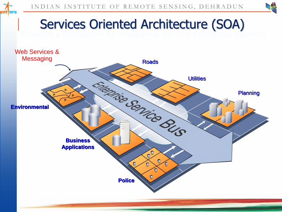
Environmental
Business
Applications
Police
Planning
Roads
Utilities
Services Oriented Architecture (SOA) Provides a Framework for Integrating GIS and Enterprise Systems
Web Services & Messaging

I N D I A N I N S T I T U T E O F R E M O T E S E N S I N G , D E H R A D U N
Interoperability is Important in Web services
Flat File
Network/Hierarchal
DBMS/RDBMS
Integration
. . . Focus Is on simple and
practical approaches that work
Web Services
GIS Server
There Are Many Standards . . .
XML/SOAP
OGC Compliant
WMS/WFC/WCS are standards

I N D I A N I N S T I T U T E O F R E M O T E S E N S I N G , D E H R A D U N
Web Mapping Services
• A web mapping service is a means of displaying and interacting with maps on the Web. The first web mapping service was the Xerox PARC Map Viewer built in 1993.
• There have been 3 generations of web map service: – The first generation was from 1993 onwards- consisted of simple image
maps which had a single click function.
– The second generation was from 1996 onwards- and still used image maps the one click function. However, they also had zoom and pan capabilities (although slow) and could be customized through the use of the URL API.
– The third generation was from 1998 onwards- utilise AJAX technology which enables seamless panning and zooming. They are customisable using the URL API and can have extended functionality programmed in using the DOM (Document Object Model, a way to refer to XML or HTML elements as objects).
I N D I A N I N S T I T U T E O F R E M O T E S E N S I N G , D E H R A D U N
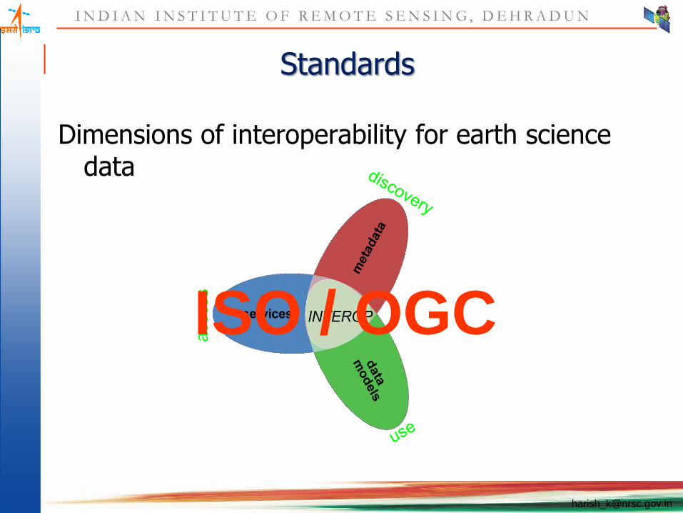
Standards
Dimensions of interoperability for earth science data
access
ISO / OGC

I N D I A N I N S T I T U T E O F R E M O T E S E N S I N G , D E H R A D U N
OGC Web Services (OWS) Initiatives
• OGC has started a series of web-based interoperability
initiatives since 1999.
• The purpose of those initiatives is to develop a set of
interoperability specifications for considering as official OGC
specifications.
– Web map services specification (WMS);
– Web coverage services specification (WCS);
– Web feature services specification (WFS);
– Web registries services specification (WRS).

I N D I A N I N S T I T U T E O F R E M O T E S E N S I N G , D E H R A D U N
A standard encoding of spatial information(content) for
encoding geographic information.
GML allows us to leverage the world of XML;
Graphical Drawing (2D and 3D);
Querying and Element Selection;
Meta-data & Relationships (Semantics);
Transformations (spatial and non-spatial).
GML Overview

I N D I A N I N S T I T U T E O F R E M O T E S E N S I N G , D E H R A D U N
Geoserver

I N D I A N I N S T I T U T E O F R E M O T E S E N S I N G , D E H R A D U N
What is Geoserver?
Java based, platform independent, server side software
What does it do:
take you data and publish it on a network with a variety of protocols
with a strong emphasis on OGC standards (WMS, WFS, WCS)
but with extensions for mass market ones too (Google Earth, Bing Map, GeoRSS, GeoJSON)

I N D I A N I N S T I T U T E O F R E M O T E S E N S I N G , D E H R A D U N
OGC protocols compliance
GeoServer is:
WMS 1.1.1 compliant
WFS 1.0 and 1.1 reference implementation
WCS 1.0 compliant, and soon to become WCS
1.1 reference implementation as well
I N D I A N I N S T I T U T E O F R E M O T E S E N S I N G , D E H R A D U N
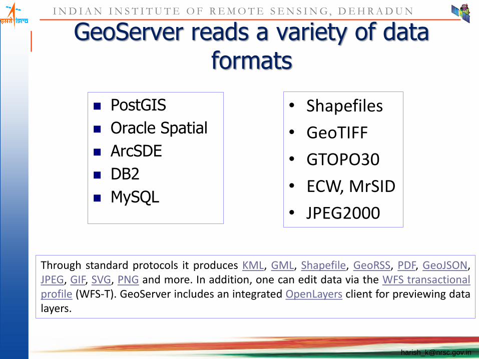
GeoServer reads a variety of data formats
PostGIS
Oracle Spatial
ArcSDE
DB2
MySQL
Through standard protocols it produces KML, GML, Shapefile, GeoRSS, PDF, GeoJSON, JPEG, GIF, SVG, PNG and more. In addition, one can edit data via the WFS transactional profile (WFS-T). GeoServer includes an integrated OpenLayers client for previewing data layers.
• Shapefiles
• GeoTIFF
• GTOPO30
• ECW, MrSID
• JPEG2000
I N D I A N I N S T I T U T E O F R E M O T E S E N S I N G , D E H R A D U N
Styles
Styled Layer Descriptor (SLD)
An XML document driving map generation,
allows for attribute and scale dependent styling
SLD file creation
GeoServer has a very simple style generator
Use uDig or gvSig to generate SLD files
No easy to use editor with full support for SLD styles
I N D I A N I N S T I T U T E O F R E M O T E S E N S I N G , D E H R A D U N
GeoServer Features
Fully compliant to WMS 1.1.1, WFS (1.0 and 1.1, transactions and
locking) and WCS (1.0 and 1.1) specifications, as tested by the CITE
conformance tests. GeoServer additionally serves as Reference
Implementation for WCS 1.1 and WFS 1.0 and 1.1
Easy to use web-based configuration tool - no need to touch long,
complicated config files.
Mature support for PostGIS, Shapefile, ArcSDE, DB2 and Oracle.
MySQL, MapInfo, and Cascading WFS are also supported formats.
Native Java support for GeoTIFF, GTOPO30, ArcGrid, WorldImages,
ImageMosiacs and Image Pyramids.

I N D I A N I N S T I T U T E O F R E M O T E S E N S I N G , D E H R A D U N
GeoServer Features Support for MrSID, ECW, JPEG2000, DTED, Erdas Imagine, and NITF
through GDAL ImageIO Extension. Any format that GDAL supports
can be added with a bit of coding.
On the fly re-projection, for WMS and WFS, with an embedded EPSG
database supporting hundreds of projections by default.
Excellent Google Earth Support, ability to 'publish' data to Google's
geo crawlers, so data from GeoServer can be exposed on Google
Maps and Earth searches.
Integration with GeoWebCache, for accelerated tile mapping (like on
Openlayers)
Raw vector data available as GML (2.1.2 and 3.1.1), GeoJSON
(JavaScript Object Notation), and zipped Shapefiles through the WFS.

I N D I A N I N S T I T U T E O F R E M O T E S E N S I N G , D E H R A D U N
GeoServer Features Integrated OpenLayers as a default AJAX viewer and preview engine.
Standards compliant 'by default' - no need to figure out complex
configuration options just to serve basic data.
Performance, on par with the fastest open source mapping servers,
sometime faster rendering than any major proprietary server.
Support for atomic database transactions through the standard WFS-T
protocol, available on all data formats.
Versioning WFS to support wiki-style history, attribution, and rollbacks
on geospatial data.
Integrated Security to secure individual services and layers to groups
of users.

I N D I A N I N S T I T U T E O F R E M O T E S E N S I N G , D E H R A D U N
GeoServer Features
User Interface translated in to French, German, Spanish,
Portuguese, Dutch, Japanese, Chinese, Russian and more.
Support for Component WMS / Feature Portrayal Service
Streaming data readers: no memory bound limit to the amount of
data that can be returned.
Full SLD support, the open standard to define map styles, including
both user defined (POST and GET) and used natively in styling
configuration.
Innovative validation Engine that checks inserted features against a
configured set of topological and attributed based rules, to maintain
backend integrity.
I N D I A N I N S T I T U T E O F R E M O T E S E N S I N G , D E H R A D U N
GeoServer Features
Java (J2EE) servlet-based, can run in any servlet container. This means it
easily support 64-bit architectures and advanced multi-threading capabilities.
Easy to write new data formats with GeoTools DataStore interfaces and
helper classes, making GeoServer the standards based interface to legacy
data.
Modularized Codebase for pluggable services.
Documentation that details everything in easy to understand language.
Active email lists for quick support.
Commercial grade installation, support, customization and improvements
available from an eco-system of companies, non-profits, and consulting
individuals.

I N D I A N I N S T I T U T E O F R E M O T E S E N S I N G , D E H R A D U N
Support
User Mannual:
http://docs.geoserver.org/stable/en/user/
Online documentation (wiki)
http://docs.codehaus.org/display/GEOS/Home
Mailing lists (subscribe, archives):
http://sourceforge.net/mail/?group_id=25086
Mailing lists, as forums on Nabble:
http://www.nabble.com/GeoServer-f1193.html
IRC channel
#geoserver on irc.freenode.net

I N D I A N I N S T I T U T E O F R E M O T E S E N S I N G , D E H R A D U N
Mapserver (Formerly UMN Map Server)

I N D I A N I N S T I T U T E O F R E M O T E S E N S I N G , D E H R A D U N
MapServer Origins
Developed at UMN Remote Sensing Lab
Funded by NASA “Mission to Planet Earth”
Started as Arc/Info AML generation script
Built on top of standard OpenSource projects like GD, Flex, Bison, FreeType, Proj.4 and libTIFF

I N D I A N I N S T I T U T E O F R E M O T E S E N S I N G , D E H R A D U N
System Characteristics
OpenSource software
Implemented as a CGI program
Written in ANSI C/C++
Source distribution
UNIX: autoconf and automake
95/98/NT: VC++ makefiles

I N D I A N I N S T I T U T E O F R E M O T E S E N S I N G , D E H R A D U N
Basic Functionality
Map creation
Map component (eg. legend, scalebar and reference map) automation
Web application building
Simple feature query
Basic Demonstration Application

I N D I A N I N S T I T U T E O F R E M O T E S E N S I N G , D E H R A D U N
Advanced Functionality ...
On-the-fly projection (w/Proj.4)
Feature annotation including scaling, rotation, outlines and drop shadows
TrueType labels and symbols (w/FreeType)
Feature classification- string comparision, regex and logical expressions
Scale dependent display and query
I N D I A N I N S T I T U T E O F R E M O T E S E N S I N G , D E H R A D U N
… Advanced Functionality...
Query by point, area or feature across multiple layers
Quad-tree spatial indexing for shapefiles
Support for tiled datasets (raster or vector)
Label collision removal
URL based configuration
I N D I A N I N S T I T U T E O F R E M O T E S E N S I N G , D E H R A D U N
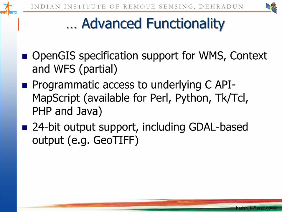
… Advanced Functionality
OpenGIS specification support for WMS, Context and WFS (partial)
Programmatic access to underlying C API- MapScript (available for Perl, Python, Tk/Tcl, PHP and Java)
24-bit output support, including GDAL-based output (e.g. GeoTIFF)

I N D I A N I N S T I T U T E O F R E M O T E S E N S I N G , D E H R A D U N
Supported File Formats
Vector Formats
ESRI Shapefiles and SDE layers
Inline vector features
Database sources- SDE, Oracle Spatial, PostGIS
Raster Formats (8-bit only)
TIFF*/GeoTIFF
EPPL7
WMS
Numerous additional formats via GDAL/OGR
* indicates files that must be accompanied by an ESRI world file for georeferencing
I N D I A N I N S T I T U T E O F R E M O T E S E N S I N G , D E H R A D U N
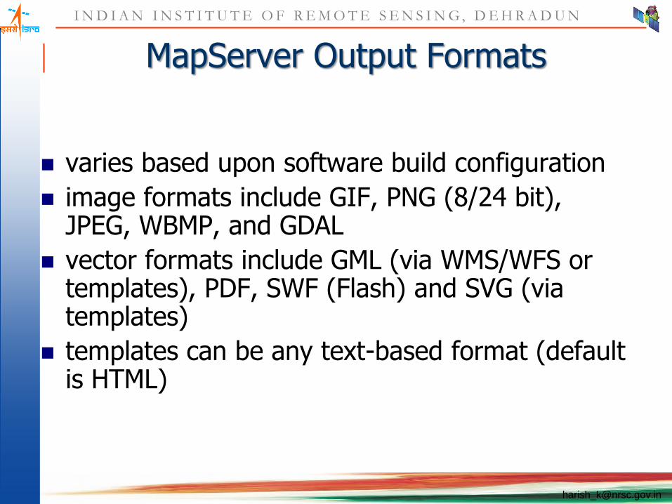
MapServer Output Formats
varies based upon software build configuration
image formats include GIF, PNG (8/24 bit), JPEG, WBMP, and GDAL
vector formats include GML (via WMS/WFS or templates), PDF, SWF (Flash) and SVG (via templates)
templates can be any text-based format (default is HTML)
I N D I A N I N S T I T U T E O F R E M O T E S E N S I N G , D E H R A D U N
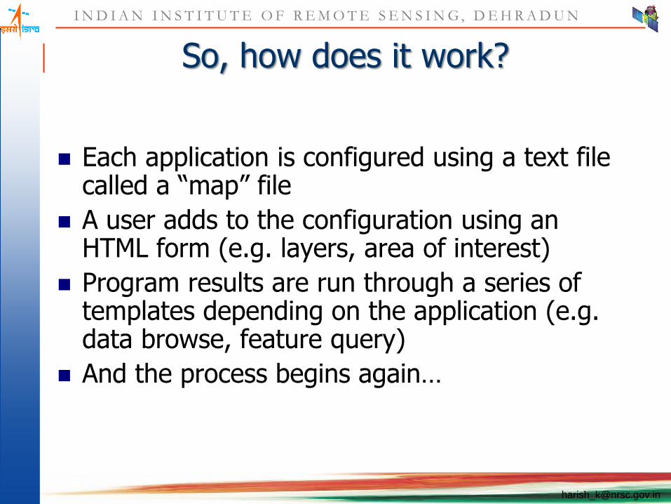
So, how does it work?
Each application is configured using a text file called a “map” file
A user adds to the configuration using an HTML form (e.g. layers, area of interest)
Program results are run through a series of templates depending on the application (e.g. data browse, feature query)
And the process begins again…

I N D I A N I N S T I T U T E O F R E M O T E S E N S I N G , D E H R A D U N
How MapServer Works…
web server
MapServer CGI
HTTP
spatial data
config files
template files
HTTP
MapServer application

I N D I A N I N S T I T U T E O F R E M O T E S E N S I N G , D E H R A D U N
… How MapServer Works
MapServer CGI
request (HTTP)
response (HTTP)
config files
augment config with user input via request (e.g. what layers and where)
spatial data
create map components and/or execute a query,
write components to temporary web space
template files

I N D I A N I N S T I T U T E O F R E M O T E S E N S I N G , D E H R A D U N
Typical Application Layout
test (whole application stored in one place)
test.map file
graphics (images used in application)
symbols (symbol files and icons)
fonts (font files and index list)
data (GIS data)
*.html (supporting HTML and templates)
Map file is referred to using it’s full path relative to the location of the
MapServer CGI binary.

I N D I A N I N S T I T U T E O F R E M O T E S E N S I N G , D E H R A D U N
MapServer Map Files
Text based, hierarchical
Control all aspects of an application legends, scalebars, reference maps layer definitions web template definitions
simple one layer example

I N D I A N I N S T I T U T E O F R E M O T E S E N S I N G , D E H R A D U N
Map Object
MAP
NAME application name
STATUS ON|OFF
IMAGECOLOR r g b
UNITS METERS|FEET|INCHES|…
FONTSET filename
SYMBOLSET filename
SIZE x y
…Layers, Scalebar, Legend…
END

I N D I A N I N S T I T U T E O F R E M O T E S E N S I N G , D E H R A D U N
Basic Layer Object
LAYER
NAME name
GROUP name
DATA filename
STATUS ON|OFF|DEFAULT
TYPE ANNOTATION|POINT|LINE|POLYGON|RASTER|QUERY
MINSCALE n (MAXSCALE)
CLASSITEM column name
CLASS …parameters… END (up to 50)
LABELITEM column name
END
I N D I A N I N S T I T U T E O F R E M O T E S E N S I N G , D E H R A D U N
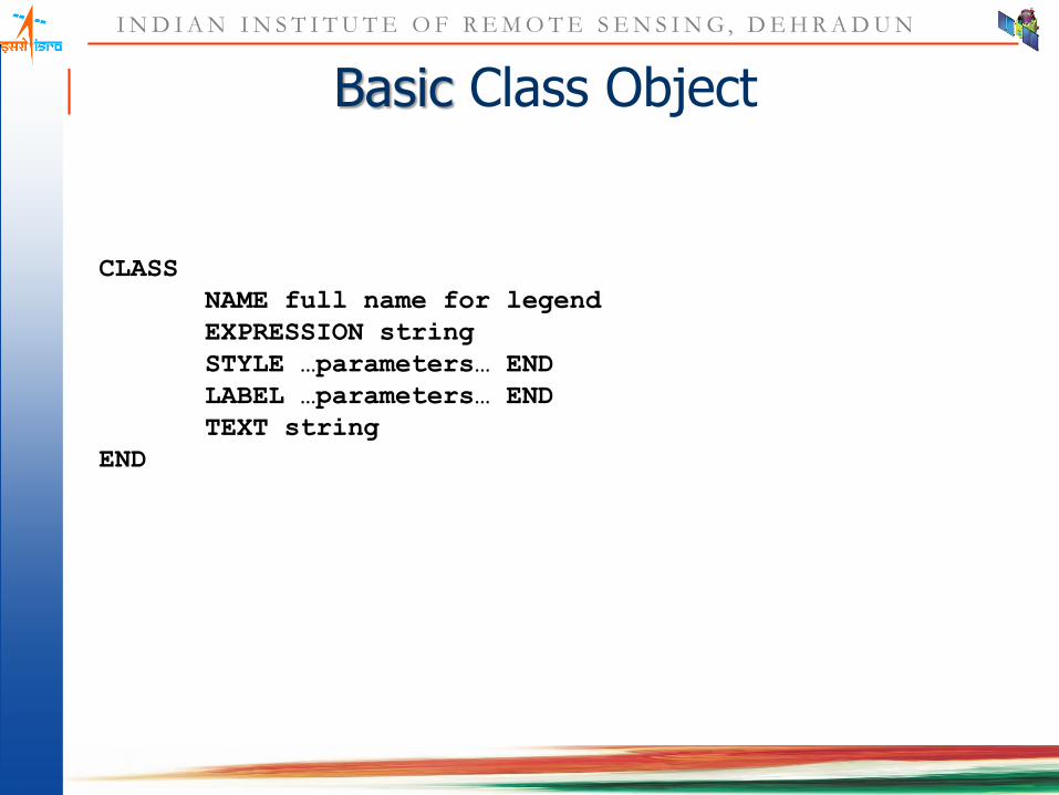
Basic Class Object
CLASS
NAME full name for legend
EXPRESSION string
STYLE …parameters… END
LABEL …parameters… END
TEXT string
END

I N D I A N I N S T I T U T E O F R E M O T E S E N S I N G , D E H R A D U N
Basic Style Object
STYLE
ANTIALIAS TRUE|FALSE
BACKGROUNDCOLOR r g b
COLOR r g b
OFFSET dx dy
OUTLINECOLOR r g b
SIZE n
SYMBOL n|name
END
I N D I A N I N S T I T U T E O F R E M O T E S E N S I N G , D E H R A D U N
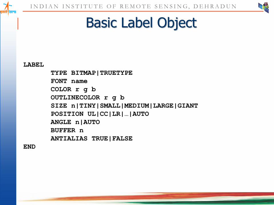
Basic Label Object
LABEL
TYPE BITMAP|TRUETYPE
FONT name
COLOR r g b
OUTLINECOLOR r g b
SIZE n|TINY|SMALL|MEDIUM|LARGE|GIANT
POSITION UL|CC|LR|…|AUTO
ANGLE n|AUTO
BUFFER n
ANTIALIAS TRUE|FALSE
END

I N D I A N I N S T I T U T E O F R E M O T E S E N S I N G , D E H R A D U N
Legend Object
LEGEND
STATUS ON|OFF
KEYSIZE x y
KEYSPACING x y
LABEL …parameters… END
IMAGECOLOR r g b
END
I N D I A N I N S T I T U T E O F R E M O T E S E N S I N G , D E H R A D U N
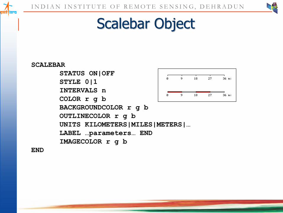
Scalebar Object
SCALEBAR
STATUS ON|OFF
STYLE 0|1
INTERVALS n
COLOR r g b
BACKGROUNDCOLOR r g b
OUTLINECOLOR r g b
UNITS KILOMETERS|MILES|METERS|…
LABEL …parameters… END
IMAGECOLOR r g b
END

I N D I A N I N S T I T U T E O F R E M O T E S E N S I N G , D E H R A D U N
Reference Map Object
REFERENCE
STATUS ON|OFF
SIZE x y
EXTENT minx miny maxx maxy
COLOR r g b
OUTLINECOLOR r g b
IMAGE filename
END

I N D I A N I N S T I T U T E O F R E M O T E S E N S I N G , D E H R A D U N
CGI vs Servlets
I N D I A N I N S T I T U T E O F R E M O T E S E N S I N G , D E H R A D U N
CGI
Was designed in the early days of the web
has evolved into a powerful and a useful model for server-side programming
The Common Gateway Interface, or CGI, is a standard for external gateway programs to interface with information servers such as HTTP servers

I N D I A N I N S T I T U T E O F R E M O T E S E N S I N G , D E H R A D U N
recent developments include use of Perl on the client-side too
when a web server receives a CGI request, it needs to start a script, allow it to run, get back the results and pass them back to the web client.
Dynamic environment
CGI
I N D I A N I N S T I T U T E O F R E M O T E S E N S I N G , D E H R A D U N
Servlets
Servlets is the opposite to the applets
it’s a server-side applet
run inside the environment of the web server
the browser can submit a request to the servlet for execution
developed by Javasoft to support server-side programming
a parallel to the CGI model

I N D I A N I N S T I T U T E O F R E M O T E S E N S I N G , D E H R A D U N
The servlets execute in the JVM loaded by the Web Server. Its loaded only once, and live until it is explicitly unloaded.
Results in better performance, higher speed.
Brings in platform-independence, power of a full-blown language - Java, and compatibility with other popular environments like COM, CORBA and C++.
The web server basically supports the Java Servlet API. It defines how the web server communicates with the servlet engine.

I N D I A N I N S T I T U T E O F R E M O T E S E N S I N G , D E H R A D U N
The Servlet Engine is responsible to actually load and unload the servlets and communicate with the web server. The engine in principal is a set of servlets which together do the work.

I N D I A N I N S T I T U T E O F R E M O T E S E N S I N G , D E H R A D U N
Comparison
Servlets use the Java environment. All the positive features of Java are a strong motivation for a secure, scalable and robust deployment over the Internet/Intranet.
Servlets has all benefits of a CGI-type language
Servlets are an easier and friendlier development environment

I N D I A N I N S T I T U T E O F R E M O T E S E N S I N G , D E H R A D U N
Servlets has a increasingly strong developer base and expertise. CGI has a better base, and larger support, as of now.
In servlets, the developer need not worry about inner workings of the web server. Faster design and development. In contrast, it looses the tremendous control and customization which the CGI model brings along.
This control is especially important when you are working in multiple different environments with different security and administration needs.
I N D I A N I N S T I T U T E O F R E M O T E S E N S I N G , D E H R A D U N
CGI-Perl combo is the most popular. Perl is interpreted. So, it brings in all the positive and negatives of an interpreted language. For example, simplicity, customization - +ve, and slower speed, a newer and a semi-language, not memory-resident
servlets have a powerful named - servlet chaining. Do not have a similar philosophy in CGI-Perl.
CGI-Perl has a strong backing of most of industry and educational institutions. Servlets are newer, but gaining acceptance.

I N D I A N I N S T I T U T E O F R E M O T E S E N S I N G , D E H R A D U N
CGI-Perl model is proven, unlike Servlets (although reports are coming in on the awesome speed and efficiency of the servlets).
CGI-Perl is a big security risk. Servlets can take advantage of the Java Security Model
CGI is going to stay. Servlets are however gaining popularity.
An interface between CGI-Perl and the Servlets is a good direction to move to. This solution is currently being worked on (alpha version is available).

![State: Jharkhandjsac.jharkhand.gov.in/pdf/crop/JKD1-Garhwa-10.08.12[1].pdf · Cauliflower 0.520 0.520 Medicinal and Aromatic crops - Plantation crops - Fodder crops - Total fodder](https://static.fdocuments.in/doc/165x107/5e984abdba1859541f1aa068/state-1pdf-cauliflower-0520-0520-medicinal-and-aromatic-crops-plantation.jpg)