Intro to GIS | Fall 2012 Attribute Tables – Part 1...Relational Database (RDBMS) • Supports the...
31
Intro to GIS | Fall 2012 Attribute Tables – Part 1
Transcript of Intro to GIS | Fall 2012 Attribute Tables – Part 1...Relational Database (RDBMS) • Supports the...
Intro to GIS | Fall 2012 Attribute Tables – Part 1
DATABASES
Why do we care about Databases?
• Integrated sets of data
• Focused on a particular area and subject
• Form the basis of GIS analysis and decision-making
• Must be well-structured in order for us to best access the information stored in them
How are Databases Managed?
• Database Management System (DBMS) = system or software program(s) that enables you to store, modify and extract information from a database

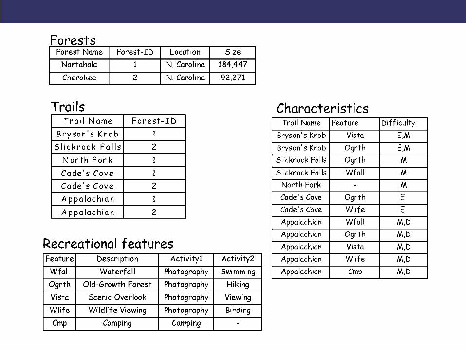
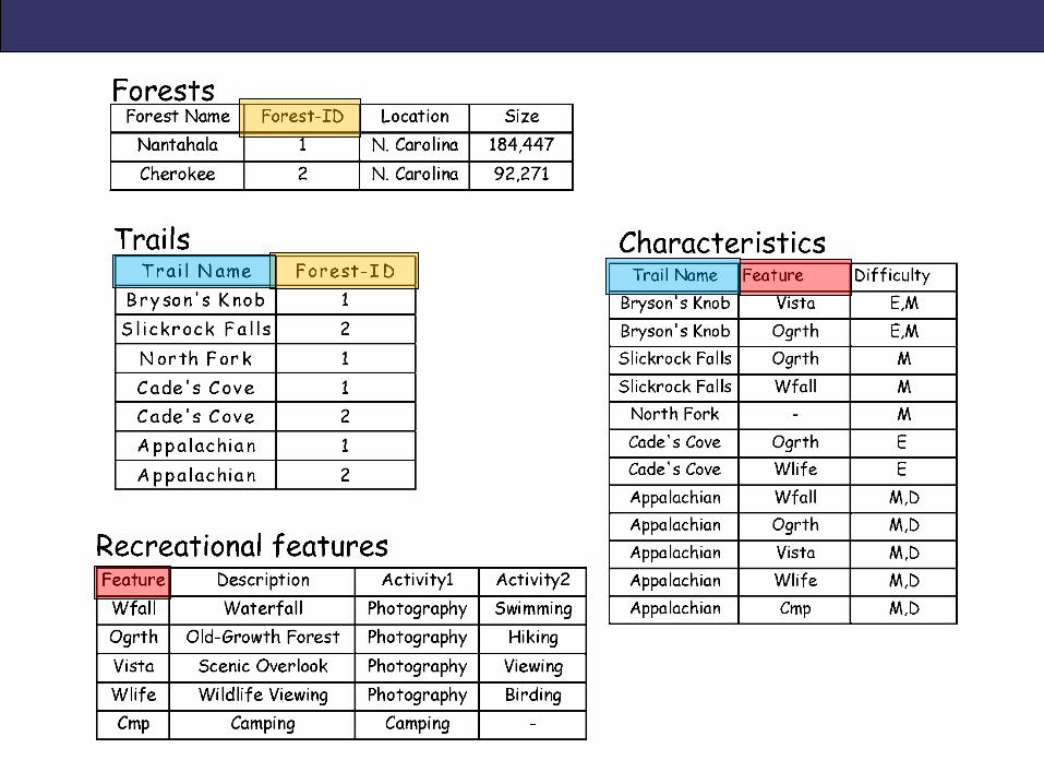
Relational Database (RDBMS)
• Supports the representation of data as a set of tables that are related to each other
• Each table = a list of records containing attributes about features
• Tied together by a “Attribute Key” = an attribute field common to both tables
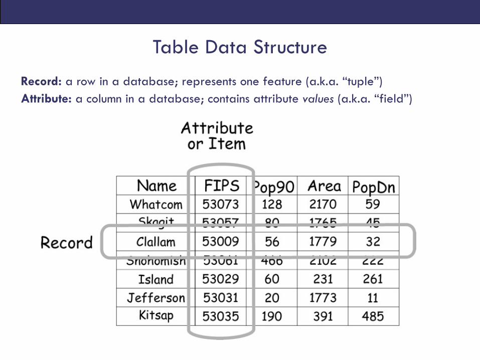
Record: a row in a database; represents one feature (a.k.a. “tuple”) Attribute: a column in a database; contains attribute values (a.k.a. “field”)
Table Data Structure
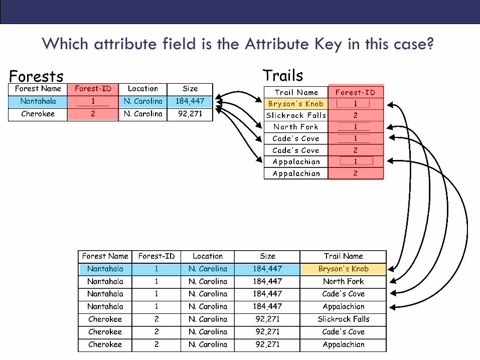
Which attribute field is the Attribute Key in this case?
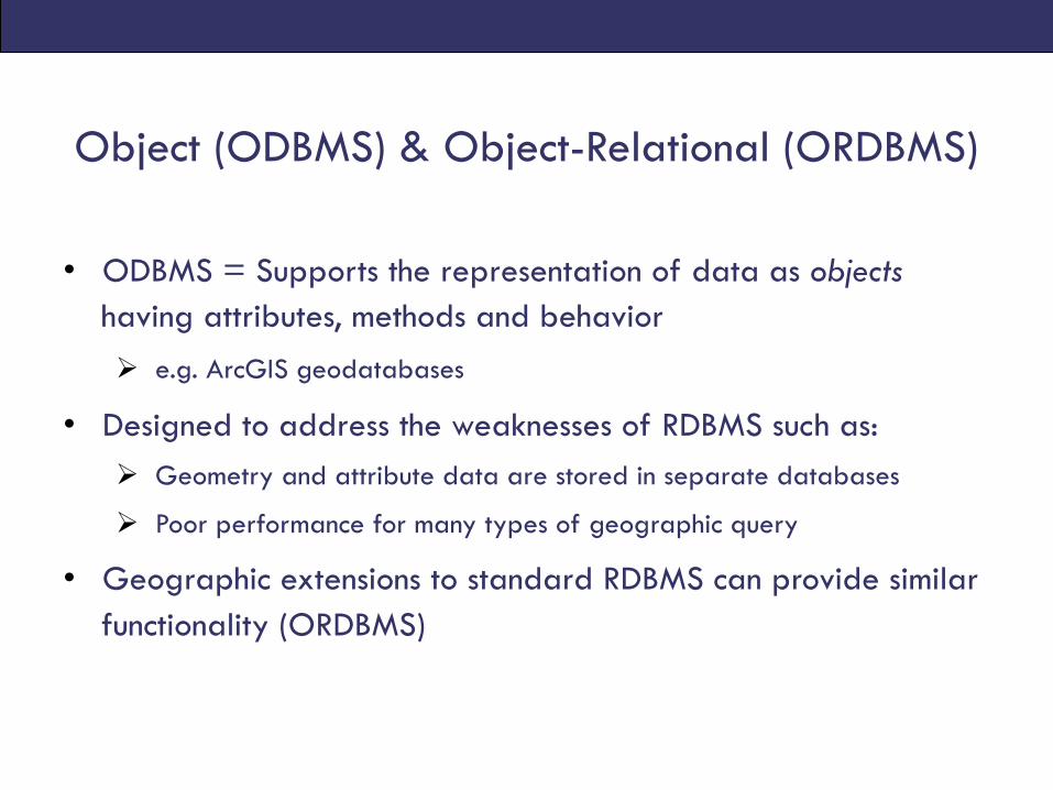
Object (ODBMS) & Object-Relational (ORDBMS)
• ODBMS = Supports the representation of data as objects having attributes, methods and behavior Ø e.g. ArcGIS geodatabases
• Designed to address the weaknesses of RDBMS such as: Ø Geometry and attribute data are stored in separate databases
Ø Poor performance for many types of geographic query
• Geographic extensions to standard RDBMS can provide similar functionality (ORDBMS)
GEOGRAPHIC (SPATIAL) DATABASES
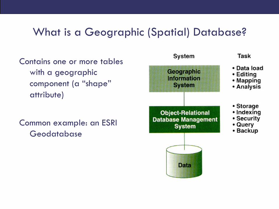
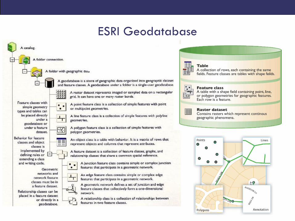
What is a Geographic (Spatial) Database?
Contains one or more tables with a geographic component (a “shape” attribute)
Common example: an ESRI Geodatabase
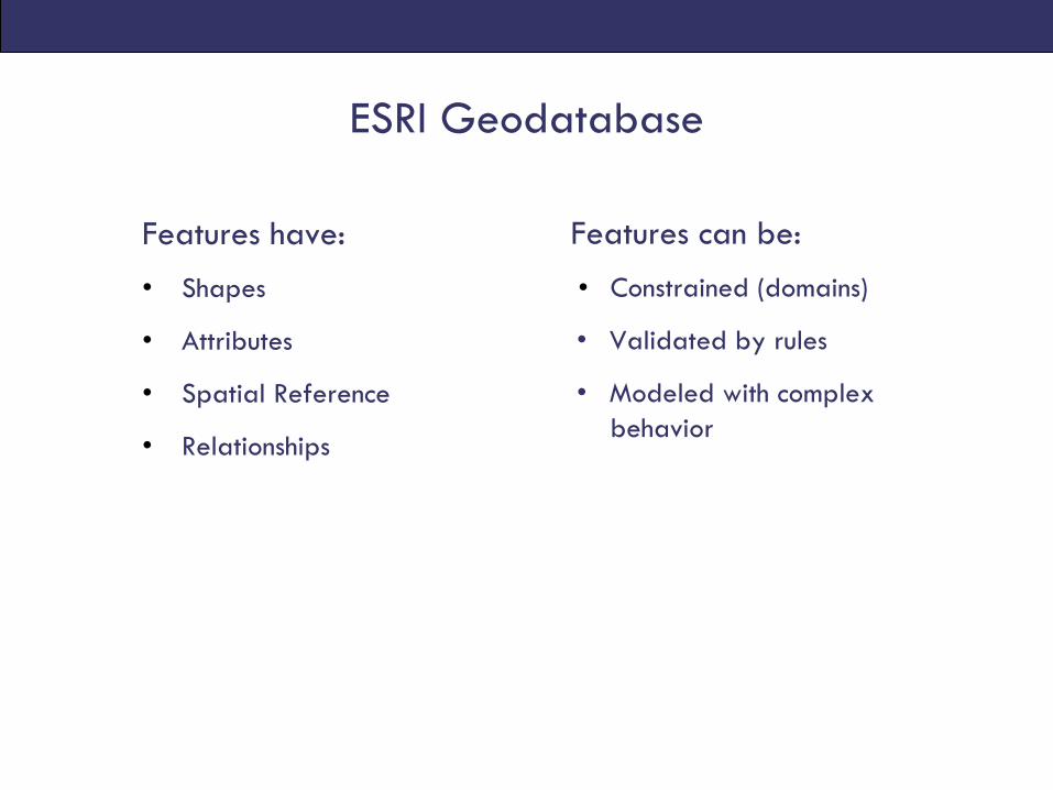
ESRI Geodatabase
Features have:
• Shapes
• Attributes
• Spatial Reference
• Relationships
Features can be:
• Constrained (domains)
• Validated by rules
• Modeled with complex behavior
ESRI Geodatabase
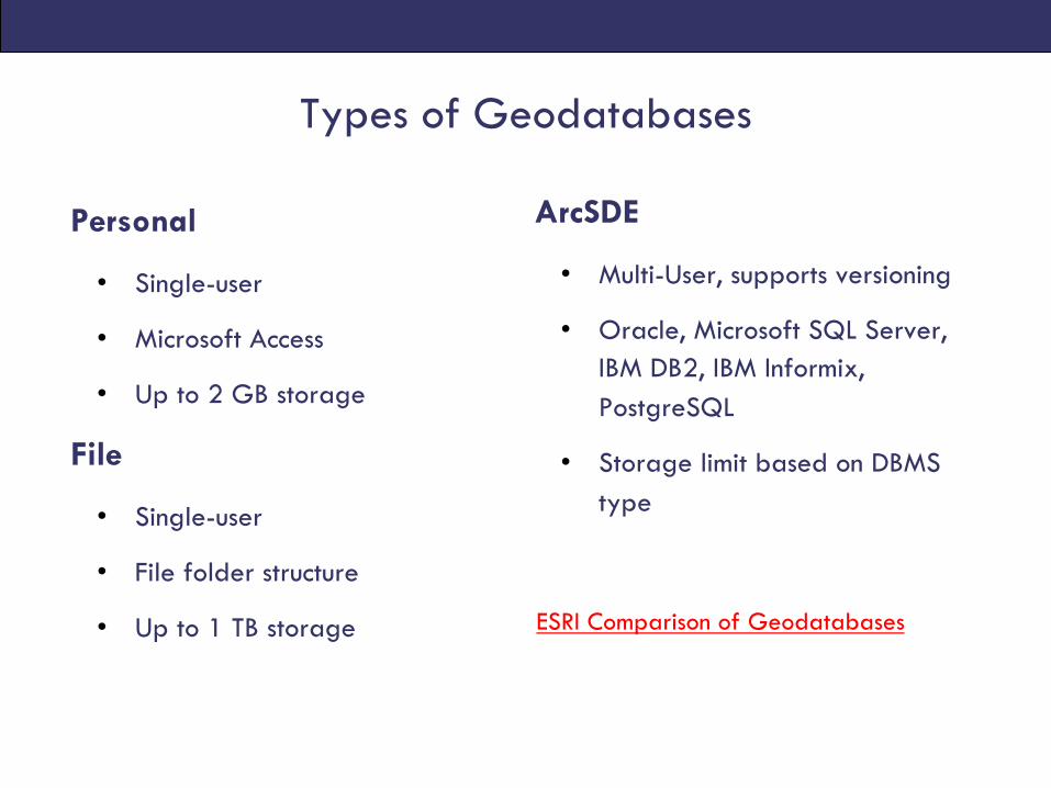
Types of Geodatabases
Personal
• Single-user
• Microsoft Access
• Up to 2 GB storage
File
• Single-user
• File folder structure
• Up to 1 TB storage
ArcSDE
• Multi-User, supports versioning
• Oracle, Microsoft SQL Server, IBM DB2, IBM Informix, PostgreSQL
• Storage limit based on DBMS type
ESRI Comparison of Geodatabases
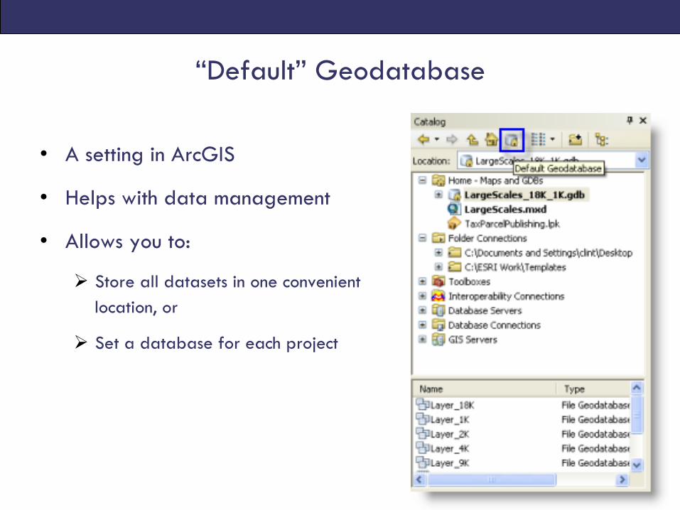
“Default” Geodatabase
• A setting in ArcGIS
• Helps with data management
• Allows you to:
Ø Store all datasets in one convenient location, or
Ø Set a database for each project
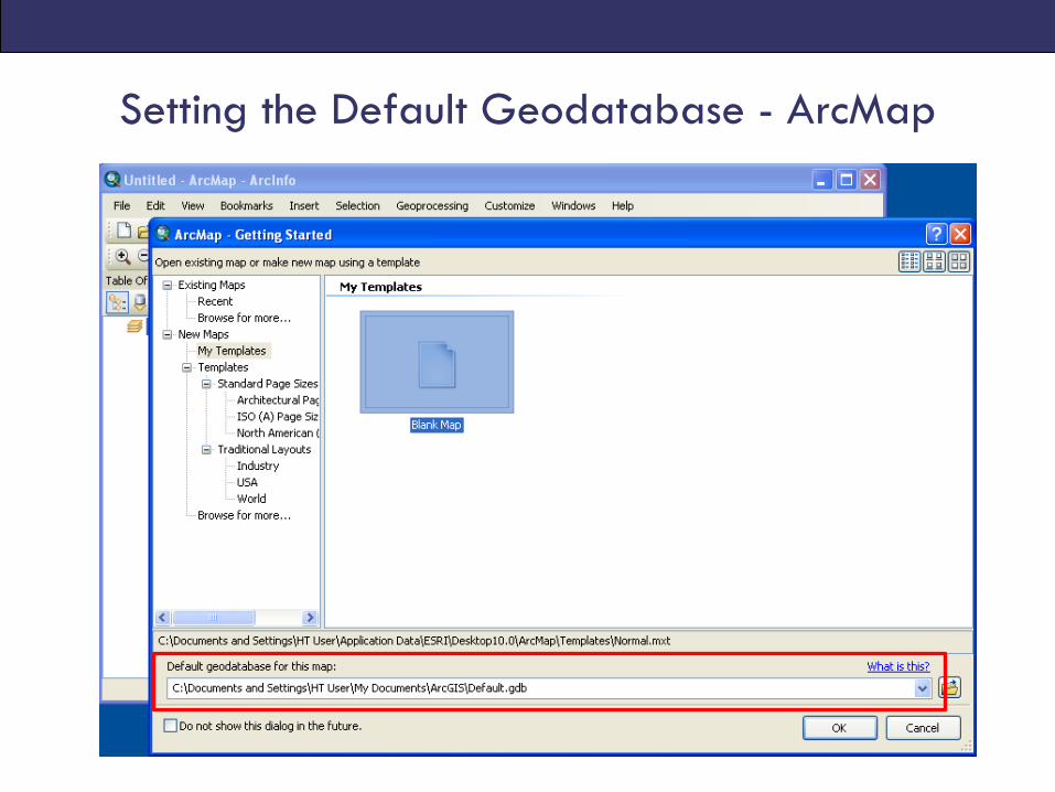
Setting the Default Geodatabase - ArcMap

Change location of Default Geodatabase
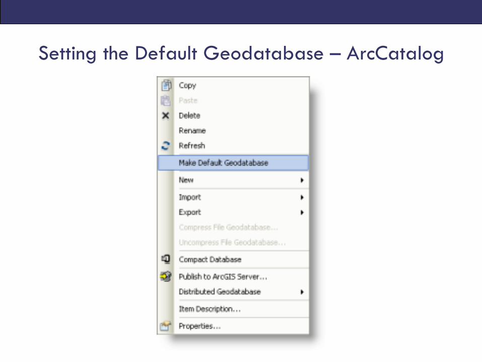
Setting the Default Geodatabase – ArcCatalog
QUERYING GIS DATA
Getting Information from GIS data
• Query = to question or inquire about a feature(s) shown on a map (and by extension, in a GIS dataset)
• Output is a selected set of records
• Two approaches:
Ø Attribute queries
Ø Spatial queries
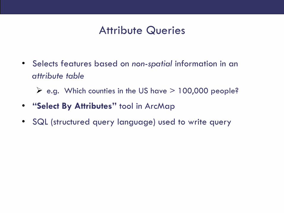
Attribute Queries
• Selects features based on non-spatial information in an attribute table
Ø e.g. Which counties in the US have > 100,000 people?
• “Select By Attributes” tool in ArcMap
• SQL (structured query language) used to write query
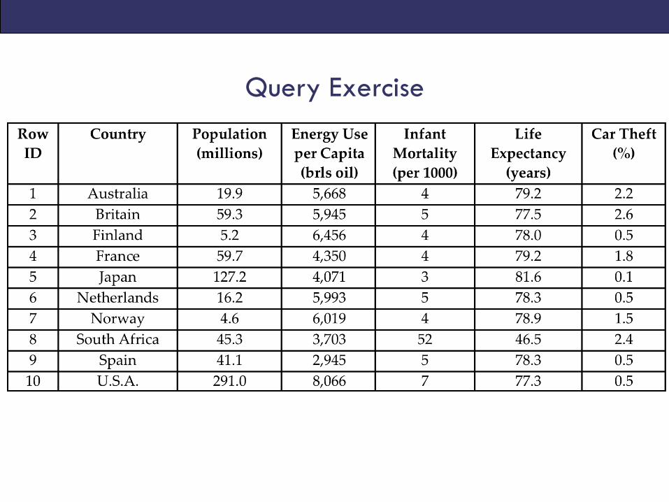
Query Exercise
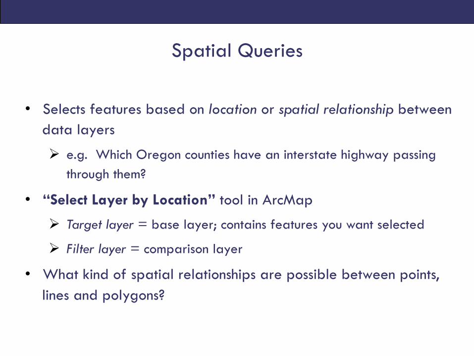
Spatial Queries
• Selects features based on location or spatial relationship between data layers
Ø e.g. Which Oregon counties have an interstate highway passing through them?
• “Select Layer by Location” tool in ArcMap
Ø Target layer = base layer; contains features you want selected
Ø Filter layer = comparison layer
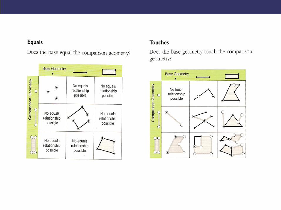
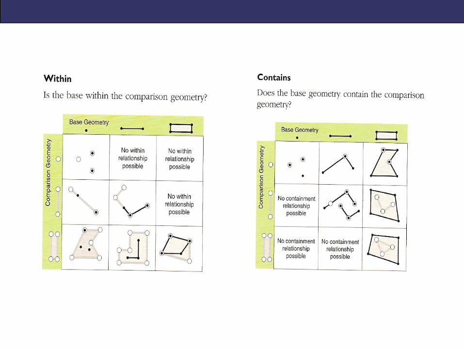
• What kind of spatial relationships are possible between points, lines and polygons?
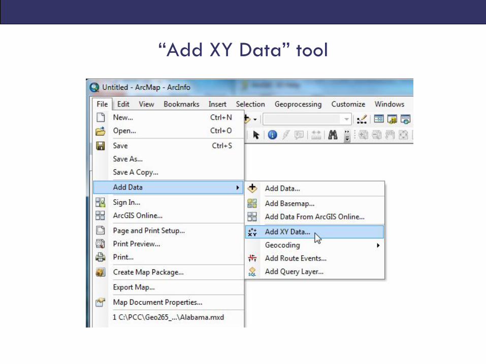
“Add XY Data” tool
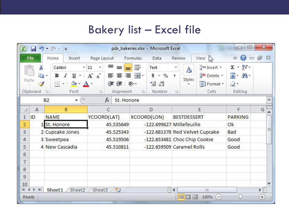
Bakery list – Excel file
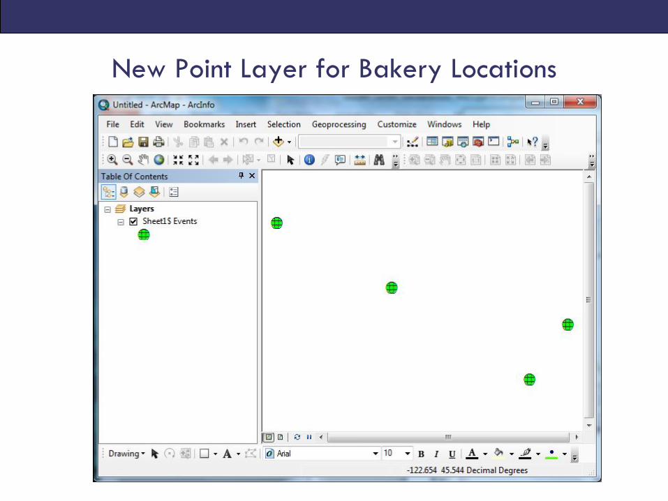
New Point Layer for Bakery Locations