Intro to GIS and ESRI Trainers: Randy Jones, GIS Technician, Douglas County Jon Fiskness, GISP GIS...
7
Intro to GIS and Intro to GIS and ESRI ESRI Trainers: Randy Jones, GIS Technician, Trainers: Randy Jones, GIS Technician, Douglas County Douglas County Jon Fiskness, GISP Jon Fiskness, GISP GIS Coordinator, City of Superior GIS Coordinator, City of Superior
-
Upload
kristina-newton -
Category
Documents
-
view
228 -
download
2
Transcript of Intro to GIS and ESRI Trainers: Randy Jones, GIS Technician, Douglas County Jon Fiskness, GISP GIS...

Intro to GIS and ESRIIntro to GIS and ESRITrainers: Randy Jones, GIS Technician,Trainers: Randy Jones, GIS Technician,
Douglas CountyDouglas CountyJon Fiskness, GISPJon Fiskness, GISP
GIS Coordinator, City of SuperiorGIS Coordinator, City of Superior
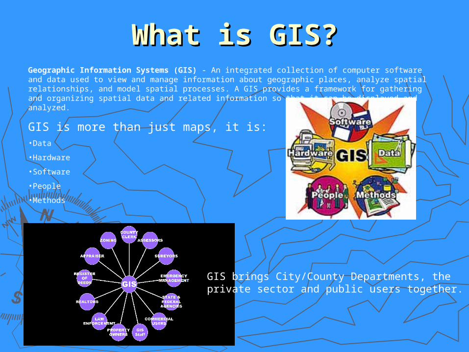
What is GIS?What is GIS?Geographic Information Systems (GIS) - An integrated collection of computer software and data used to view and manage information about geographic places, analyze spatial relationships, and model spatial processes. A GIS provides a framework for gathering and organizing spatial data and related information so that it can be displayed and analyzed.
GIS is more than just maps, it is:•Data
•Hardware
•Software
•People
•Methods
GIS brings City/County Departments, the private sector and public users together.
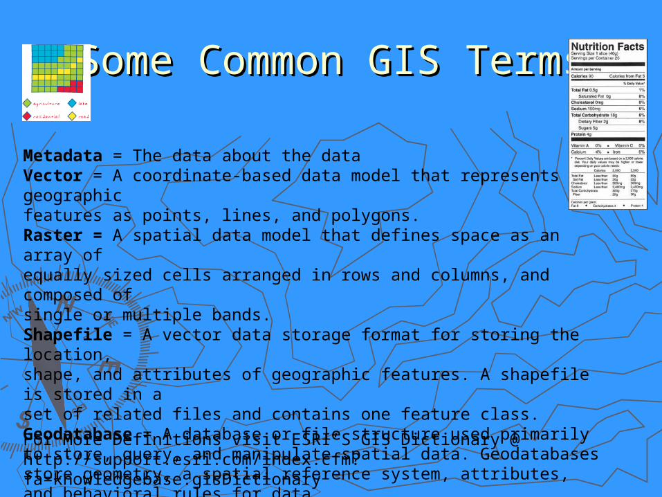
Some Common GIS TermsSome Common GIS Terms
Metadata = The data about the dataVector = A coordinate-based data model that represents geographic features as points, lines, and polygons. Raster = A spatial data model that defines space as an array of equally sized cells arranged in rows and columns, and composed of single or multiple bands. Shapefile = A vector data storage format for storing the location, shape, and attributes of geographic features. A shapefile is stored in a set of related files and contains one feature class.Geodatabase = A database or file structure used primarily to store, query, and manipulate spatial data. Geodatabases store geometry, a spatial reference system, attributes, and behavioral rules for data. Map Service - A type of Web service that generates maps.
For More Definitions visit ESRI’S GIS Dictionary @ http://support.esri.com/index.cfm?fa=knowledgebase.gisDictionary

Using ArcCatalogUsing ArcCatalog
►Viewing MetadataViewing Metadata►ArcToolboxArcToolbox►Enterprise Geospatial Data Enterprise Geospatial Data
InfrastructureInfrastructure►Finding GIS FilesFinding GIS Files

Using ESRI’s ArcMapUsing ESRI’s ArcMap
► 1. Creating/Opening & Saving an ArcMap 1. Creating/Opening & Saving an ArcMap projectproject
► 2. Adding & Viewing Data2. Adding & Viewing Data► 3. Templates and Layers3. Templates and Layers► 4. Functions and Queries4. Functions and Queries
Searching for an address or parcelsSearching for an address or parcels
► 5. Layout Views and Cartography5. Layout Views and Cartography► 6. Questions6. Questions

GIS ResourcesGIS Resources
►ESRI Global Account Creation for ESRI ESRI Global Account Creation for ESRI Free Virtual Training www.esri.comFree Virtual Training www.esri.com
►Online Resources HandoutOnline Resources Handout►Books AvailableBooks Available
Training Data from ESRITraining Data from ESRI
►Questions and SupportQuestions and Support [email protected]@ci.superior.wi.us

GIS @ Douglas County and the GIS @ Douglas County and the City of SuperiorCity of Superior
►ESRI Enterprise License AgreementESRI Enterprise License Agreement►Metadata for GIS Metadata for GIS ►Periodic ArcMap Training Sessions Periodic ArcMap Training Sessions ►Web Site and Web ApplicationsWeb Site and Web Applications►GIS DAY in NovemberGIS DAY in November►Pictometry is HerePictometry is Here