INTER-AMERICAN DEVELOPMENT BANK STRATEGIC...
41
Prime Engenharia / Museo Noel Kempff Mercado / Asociación Potlatch Consortium Executive Summary - i INTER-AMERICAN DEVELOPMENT BANK STRATEGIC ENVIRONMENTAL ASSESSMENT OF THE SANTA CRUZ - PUERTO SUAREZ CORRIDOR BOLIVIA (PROJECT No. TC-9904003-BO) FINAL REPORT EXECUTIVE SUMMARY CONSORTIUM PRIME Engenharia BRAZIL Museo Noel Kempff Mercado BOLIVIA Asociación POTLATCH COLOMBIA JULY, 2000
Transcript of INTER-AMERICAN DEVELOPMENT BANK STRATEGIC...
Prime Engenharia / Museo Noel Kempff Mercado / Asociación Potlatch Consortium Executive Summary - i
INTER-AMERICAN DEVELOPMENT BANK
STRATEGIC ENVIRONMENTAL ASSESSMENT OF THESANTA CRUZ - PUERTO SUAREZ CORRIDOR
BOLIVIA
(PROJECT No. TC-9904003-BO)
FINAL REPORT
EXECUTIVE SUMMARY
CONSORTIUM
PRIME Engenharia
BRAZIL
Museo Noel Kempff Mercado
BOLIVIA
Asociación POTLATCH
COLOMBIA
JULY, 2000

Prime Engenharia / Museo Noel Kempff Mercado / Asociación Potlatch Consortium Executive Summary - ii
PRESENTATION
This document is the Final Report of the Strategic Environmental Assessment (SEA) andreview/complementation of the Environmental Impact Study (EIS) of the Santa Cruz – Puerto SuarezTransportation Corridor Project.
The document has been prepared by the Prime Engineering – Noel Kempff Mercado Museum –Potlatch Association Consortium, in the context of the Contract agreed to with the Inter-AmericanDevelopment Bank (IADB) on October 26, 1999.
The document is structured in eight volumes, with the following main content:• Volume 1/8: Contains the EIS and SEA Executive Summary• Volume 2/8: Contains Project Description (of the highway project), Analysis of Project Alternatives, and the
Definition of the Project Areas of Influence.• Volume 3/8: Presented in two Sections A and B, contains the Social – Environmental Base-line study of the
Area of Indirect Influence (AII).• Volume 4/8: Contains the Social – Environmental Base-line study of the Area of Direct Influence (AID
according to the Spanish Acronym) and the Intervention Area (AI according to the Spanish Acronym), aswell as the Political, Legal and Institutional Framework.
• Volume 5/8: Contains the Impact Analysis and Mitigating Measures as identified by the EIS.• Volume 6/8: Contains the Environmental Management Plan for the EIS• Volume 7/8: Presented in two sections A and B, provides information on Secondary, Long-term Impacts and
Future Scenarios, as well as an Action Plan as part of the SEA. This chapter also contains a description ofthe Project Geographic Information System (GIS)
• Volume 8/8: Contains several maps (0.90 x 1.20 M) illustrating components of the EIS and SEA.
There are also three annex volumes:Annex 1: Contains Report on Phase one of the Public ConsultationAnnex 2: Contains Report on Phase two of the Public ConsultationAnnex 3: Contains Photographic Documentation of the Consultancy.
According to terms of the Contract, ten sets of the document have been distributed to IADB and theBolivian Government, as specified by the IADB. The document has also been provided in a digitalformat and a complete version of the document, including the maps, will be distributed on CD-ROM.
The study is fully integrated as part of a Geographic Information System (GIS) incorporating information for allof the AII and is resident in the Noel Kempff Museum information system. The GIS incorporates digital imagesderived from aerial videography documenting the current conditions of entire highway right of way (ROW).
The studies were completed during a 10-month period, starting October 4, 1999. Pursuant the contract andfurther agreements, the following intermediate products were produced:• First Draft of the Programs, on December 20, 1999• Progress Report No 1, on February 9, 2000• Progress Report No 2, on May 28, 2000
This Final Report includes the observations received from the IADB and the Bolivian Government followingtheir evaluation of these preliminary reports.

Prime Engenharia / Museo Noel Kempff Mercado / Asociación Potlatch Consortium Executive Summary - iii
The studies were carried out with ample consultation and participation by the public, the national governmentand local authorities. Consequently, the results reflect not only the technical analysis of the impact of thetransportation Corridor, but also the communities’ opinions and expectations.
Two complete rounds of Public Consultation took place, with a total of 24 workshops (13 in municipalities and11 with indigenous populations), where nearly 1000 citizens participated, many as formal representatives of theircommunities. Attendance records show that representatives of the majority of the rural, indigenous, and peasantfarmer communities from all six municipalities that are most directly involved in the Project, participated inthese workshops.
The population directly affected by the highway Right of Way was consulted regarding the impact and theirexpectations of compensation. As part of a wide-ranging field survey, meetings were held in all the affectedrural communities and urban nuclei involving individual land owners.
In addition to the Consultation workshops, the team organized several technical meetings and seminars onspecific issues, such as land titling processes, Indigenous Peoples Development (PDPI), protected areamanagement, institutional strengthening, public participation, so as to ensure consensus on the proposalsincorporated into the Programs of the Environmental and Socioeconomic Action Plan. Additional contacts andmeetings were held with authorities, governmental technicians, indigenous leaders, representatives of socialsectors, business guilds, and non governmental organizations (NGOs), in order to collect information andexchange ideas on the variety of issues under discussion.
The execution of field work for the physical and biotic surveys, engineering studies, and especially thesocioeconomic surveys constituted important opportunities to learn the population’s vision and experience of thesocial and environmental problems in the region.
The monthly meetings with the Participation and Consultation Committee were of special importance, since themembers made observations, criticism and valuable contributions to the Consortium’s work, allowing it to enrichits study and fine tune it’s conclusions according to society’s expectations,
The Prime – Museo – Potlach Consortium mobilized a team of 70 people for the study, most are Bolivianresidents with the participation of key international consultants. All worked with dedication and professionalismto ensure innovative and effective solutions for Environmental and Social Protection in the Area that will beaffected by the construction of the Transportation Corridor.
The progress reports previously presented by the Consortium have been evaluated by the Government and theIADB; these reports covered in detail the themes defined in the Scope of Work. Consequently, with theadditions and corrections added in this Final Report, the Consortium considers that it has faithfully fulfilled theContract Terms of Reference with regard to content, as well as the requirement to ensure the participation of thepopulation in the development of the study and recommendations.
Santa Cruz, July 31, 2000.

Prime Engenharia / Museo Noel Kempff Mercado / Asociación Potlatch Consortium Executive Summary - i
FINAL REPORTSUMMARY
VOLUME 1/8 – Executive SummaryPresentationExecutive Summary1. Problem Presentation, Conclusions and Recommendations2. Influence Areas3. Public Consultation4. Social-Cultural and Environmental Base-Line Study (Diagnosis)5. Legal and Institutional Framework6. EIS Impact and Mitigating Measures
6.1. Impact of Creating the Right of Way (ROW)6.2. Impact on the Physical Environment6.3. Impact on the Biotic Environment6.4. Impact on the Socioeconomic and Cultural Environment
7. Environmental Management Plan (PASA – Spanish language initials)7.1. Loss Compensation and Socioeconomic Rehabilitation Program of the Affected Population7.2. Archaeological Investigation, Monitoring and Rescue Program7.3. Environmental Construction Plan (PAC – Spanish language initials)7.4. Revegetation Program7.5. Environmental Liability Correction Program7.6. Dangerous Cargo Transportation Management Program7.7. Social Communication Program7.8. Environmental Supervision and Monitoring System7.9. Complementary Work Program
8. Indirect, Synergistic, Accumulative and Long-term Impacts9. Strategic Environmental Assessment (SEA) Action Plan
9.1. Program for Deed and Title Perfection – Territorial Ordering9.2. Indigenous Peoples Development Program (Regional PDPI)9.3. Environmental Conservation and Management Program
9.3.1. Subprogram for Protected Areas’ Management9.3.2. Conservation Outside Protected Areas Subprogram9.3.3. Environmental Education Subprogram9.3.4. Regional Conservation Fund
9.4. Socioeconomic Compensation and Community Development Program9.4.1. Socioeconomic Compensation9.4.2. Community Development
9.5. Sustainable Development Incentive Program9.5.1. Agricultural and Micro-entrepreneur Subprograms9.5.2. Sustainable Forest Use Subprogram
9.6. Institutional Strengthening Program9.7. Regional Social – Environmental Institutional Management System
9.7.1. System for Implementing Action Plan9.7.2. Management System at the Program Level9.7.3. Social – Environmental Management Entities9.7.4. Management System at the Municipal Level9.7.5. Program Interrelation and Precedence

Prime Engenharia / Museo Noel Kempff Mercado / Asociación Potlatch Consortium Executive Summary - ii
9.8. Community Consultation and Participation
VOLUME 2/8 Project Description, Analysis of Project Alternatives, Influence Areas
PresentationProfessional Team Responsible1. Project Description2. Analysis of Project Alternatives3. Definition of Project Areas of Influence
VOLUME 3/8 – Social – Environmental AII Diagnosis
SECTION A4. Social – Environmental AII Diagnosis
4.1. Geology4.2. Geomorphology4.3. Climate and Water Resources4.4. Flora and Vegetation4.5. Fauna and Wildlife Management4.6. Population, Socioeconomic Characteristics4.7. Regional Economy4.8. Agricultural Production Systems4.9. Forest Use4.10. Mining Potential
SECTION B4.11 Basic Services and Infrastructure4.12 Indigenous Peoples4.13 Land-use and Land-use change4.14 Land Tenure4.15 Institutions and Social Organizations4.16 Potential Resources for Implementing the Action Plan
VOLUME 4/8 Social – Environmental Diagnosis of the AID and the Intervention Area, Policy, Legal andInstitutional framework
5. Social – Environmental Diagnosis for the Direct Influence Area (AID)5.1. AID Geomorphology5.2. AID Water Resources5.3. AID Vegetation5.4. AID Fauna5.5. Environmental Quality / Pollution Control in the AID5.6. Socioeconomic Dynamics of the AID Municipalities5.7. Chiquitos Province5.8. German Busch Province5.9. Social Liabilities in the AID Municipalities
6. Social-environmental Base-Line Study (Diagnosis) of the Area of Intervention (AI)6.1. Environmental Characterization6.2. Archaeology6.3. Population Directly Affected within the ROW

Prime Engenharia / Museo Noel Kempff Mercado / Asociación Potlatch Consortium Executive Summary - iii
7. Political, Legal and Institutional Framework related to the Environment and Natural Resources,7.1. Environmental Management7.2. Protected Areas and Conservation Management7.3. Land-Tenure Issues7.4. Land-Use
VOLUME 5/8 EIS Impact and Mitigating Measures8. Identification, Analysis and Evaluation of Impact and Possible Mitigating Measures
8.1. Methodology8.2. Impact of Establishing the Right of Way (ROW)8.3. Impact of Constructing and Operating the Highway on the Physical Environment8.4. Impact of Constructing and Operating the Highway on the Biotic Environment8.5. Impact of Constructing and Operating the Highway on the Socioeconomic and Cultural
Environment8.6. Synthesis of the Impact and Possible Mitigating Measures According to Pertinent Social Players
VOLUME 6/8 Environmental Management Plan (PASA)
9. Environmental Management Plan (PASA)9.1. Loss Compensation and Socioeconomic Rehabilitation Program of the Affected Population9.2. Archaeological Investigation, Monitoring and Rescue Program9.3. Environmental Construction Plan (PAC – Spanish language initials)9.4. Revegetation Program9.5. Environmental Liability Correction Program9.6. Dangerous Cargo Transportation Management Program9.7. Social Communication Program9.8. Environmental Supervision and Monitoring System9.9. Complementary Work Program
VOLUME 7/8 Impact of Induced Development and Action Plan, Geographic Information System
VOLUME 7/8 – Section A
10. Analysis and Evaluation of Indirect, Synergistic, Accumulative, Long–term Impacts10.1 Project Characterization10.2 Principal Processes in the Evolution of the Regional Dynamics10.3 Constructing Future Scenarios10.4 Evaluating Scenes
11. Action Plan11.1. Action Plan Methodology, Objectives and Means11.2. Programs: Contribution to territorial ordering in the AII11.3. Indigenous Peoples Development Program (PDPI – Spanish Language initials)11.4. Conservation and Environmental Management Program
VOLUME 7/8 – Section B11.5. Socioeconomic and Community Development Program11.6. Sustainable Development Incentive Program11.7. Sustainable Forest Use Program11.8. Institutional Strengthening Program

Prime Engenharia / Museo Noel Kempff Mercado / Asociación Potlatch Consortium Executive Summary - iv
11.9. Regional Social – Environmental Institutional Management Program11.10. Permanent Consultation and Participation Program
12. Geographic Information System13. Bibliographic references employed
VOLUME 8/8 – Maps
Map List1. DIRECT INFLUENCE AREA - MAP I2. DIRECT INFLUENCE AREA - MAP II3. DIRECT INFLUENCE AREA - MAP III4. DIRECT INFLUENCE AREA - MAP IV5. DIRECT INFLUENCE AREA - MAP V6. DIRECT INFLUENCE AREA - MAP VI7. DIRECT INFLUENCE AREA - MAP VII8. AGRARIAN UNITS AFFECTED BY RIGHT OF WAY 1/39. AGRARIAN UNITS AFFECTED BY RIGHT OF WAY 2/310. AGRARIAN UNITS AFFECTED BY RIGHT OF WAY 3/311. FUTURE SCENARIOS - PRESENT STATE OF SOIL USE AND OCCUPANCY12. FUTURE SCENARIOS – PROJECTION OF SOIL USE AND OCCUPANCY WITHOUT HIGHWAY13. FUTURE SCENARIOS – PROJECTION OF SOIL USE AND OCCUPANCY WITH HIGHWAY
AND WITHOUT ACTION PLAN14. FUTURE SCENARIOS – PROJECTION OF SOIL USE AND OCCUPANCY WITH HIGHWAY
AND WITH ACTION PLAN15. PROPOSAL FOR PROTECTED AREAS: LAGUNA CONCEPCIÓN AND SERRANÍA DE
CHIQUITOS16. PROPOSAL FOR PROTECTED AREAS: TUCAVACA VALLEY17. LAND TITLING PROJECT (CAT–SAN)18. SOIL USE PLAN, FOREST CONCESSIONS, ORIGINAL COMMUNITY LANDS AND
PROTECTED AREAS.19. VEGETATION MAP.
ANNEX 1: Report on Phase one of the Public ConsultationANNEX 2: Report on Phase two of the Public ConsultationANNEX 3: Photographic Documentation

Prime Engenharia / Museo Noel Kempff Mercado / Asociación Potlatch Consortium Executive Summary - 1
STRATEGIC ENVIRONMENTAL ASSESSMENT (SEA)AND
REVIEW AND COMPLEMENTATION OF THEENVIRONMENTAL IMPACT STUDY (EIS)
FOR THESANTA CRUZ – PUERTO SUAREZ TRANSPORTATION CORRIDOR
EXECUTIVE SUMMARY
1. PROBLEM PRESENTATION, CONCLUSIONS AND RECOMMENDATIONS
The construction of a highway between Santa Cruz and Puerto Suarez is an old aspiration of the BolivianGovernment and the regional population. This 600 km axis between the city of Santa Cruz and the Brazilianborder (next to the city of Corumbá) is connected by railroad and by a primitive road that is essentially uselessduring the rainy season.
It is necessary to improve this transportation corridor for the following purposes:
1. Improve the efficiency of the export corridor between the agricultural production region surrounding SantaCruz and the Puerto Aguirre Waterway terminal on the Paraguay – Parana waterways, with links to oceanictransportation;
2. Improve the competitiveness of the productive sectors established in Santa Cruz (soybeans, lumber, meat,other agri-industrial products), by reducing transportation costs for supplies and products, as well ascreating greater access to the production areas;
3. Promote social and economic development of the far-eastern region of Bolivia, which has hitherto beenhindered by difficult access.
4. Complete the missing link for the inter-oceanic land transportation route and promote economic integrationin the MERCOSUR countries, especially between Bolivia and Brazil.
The export of agri-industrial products and the import of Brazilian and other commercial products between PuertoSuarez-Quijarro and Santa Cruz is done mainly by railway. The monopoly held by the Empresa FerroviariaOriental (EFO) and the infrastructure deficiencies of EFO result in high rates and inefficient services.Investments made by EFO after the capitalization process have improved the situation, but only bulk cargo, suchas soybeans have integrated their logistic systems to benefit from these improvements. In contrast, most of thelocal economic players pay a high price for low-quality services.
The railway, which is under private management, functions according to a logical economic rationale: site to sitetransportation of bulk cargo. The function of putting regional economic activity in motion, interconnectingthousands of small scale producers and consumers within the territory, and establishing an efficient market, canonly be achieved by road transportation, which has the flexibility to adapt to multiple scales and needs. Themissing backbone is a modern highway that can be used year-round and which is designed for the projectedtraffic volume.
The Santa Cruz - Puerto Suarez Corridor project, presented by the Bolivian national government to the IADB forfinancing, includes:• Implementing 566 km of highway with a raised gravel surface between Pailon and Puerto Suarez,
connecting with sections already paved on each terminus; and• Building a 1404 m bridge over the Rio Grande, plus 4.4 km of access routes to resolve an existing bottleneck
located at the river crossing caused by a one-way railway bridge, that generates long lines and hours oftraffic delays.

Prime Engenharia / Museo Noel Kempff Mercado / Asociación Potlatch Consortium Executive Summary - 2
The total direct investment in this construction project is US$ 250 million and will involve several financiers.Highway and bridge construction is foreseen to be carried out in four major stages (the bridge and three sectionsof road), with each stage lasting 2.5 years each, spread over a total of 4.5 years starting in January 2002, andending in June 2006.
Feasibility studies have shown that the Project is viable, even with the modest traffic projections based only onthe demand generated within national territory. The Corridor’s function as a bi-oceanic link between Brazil andports on the Pacific Coast is an uncertain possibility that has not been taken into consideration as economicjustification for the project. In the event that this additional use is manifest at high levels upon completion of theroad project, the paving of the highway may become feasible as a private concession.
The regional population, especially the municipalities along the Corridor axis, demand the construction of thehighway. They justifiably visualize it as an end to their economic isolation and permit their integration into theregional economy, permitting them to participate in the economic growth that has characterized Santa Cruz inthe past decade. Public support for the highway is manifest, in greater or lesser degree, in all the social sectors.
In spite of the social need, the economic importance, the presence of strong local support, and the priority it hasbeen given by the national government, the implementation of the Corridor Project has progressed slowly in thepast few years. Bolivia can only undertake investments of this magnitude by means of grants and resources frommultilateral lending agencies and international cooperation. Budget limitations are compounded by the priorityassigned to other projects, especially reforms being undertaken within the economic, social and institutionalsectors of the country. In addition, the Corridor Project itself has been the cause of controversy due to the socialand environmental impacts that its construction will cause.
Without the appropriate orientation and the development of sound social-environmental guidelines the Projectwill not meet the conditions for approval by international financiers. Consequently, the preparation of a StrategicEnvironmental Assessment (SEA) and the complementation of the Environmental Impact Study (EIS), thatincorporate the Multilateral Banks’ guidelines were steps agreed upon by the Bolivian national government andthe IADB, in order to:
1. Verify under what conditions the Project is environmentally and socially viable;2. Establish an Environmental and Social Management Program and identify the economic resources necessary
to implement the priority actions in the area of influence of the Corridor, and3. Establish the benchmarks to be met as criteria for the disbursement of economic resources for the project,
with the goal of assuring that the mitigation measures are efficiently implemented in a timely manner, andthat there are conditions in place to reach the proposed objectives.
Concerns regarding the highway’s environmental and social impact are completely justifiable. The influencearea shelters an enormous natural area that is largely pristine, containing valuable ecosystems such as theChiquitano Dry Forest, Gran Chaco Forest, Cerrado Savannas, and the Gran Pantanal Wetland. Of particularimportance are the inherent limitations of the soil resources in the region, with the exception of a restricted areaof relatively fertile soils in the region known as the Eastern Lowlands or more recently as the AgriculturalExpansion Zone1.
Experience in other parts of the world in the past decades show grave environmental consequences resultingfrom new highways in previously remote areas; improved access induces rapid expansion of the economic
1 An area of approximately 100 km east of the Rio Grande river, where the Lowlands Project, financed by the World Bank,induced rapid conversion of forests to agricultural areas.

Prime Engenharia / Museo Noel Kempff Mercado / Asociación Potlatch Consortium Executive Summary - 3
frontier, for colonization, agriculture, ranching establishments, lumber exploitation, etc. This results in massivedeforestation, degradation of ecosystem functionality and the loss of biodiversity. The Eastern LowlandsProject in Santa Cruz, as well as the construction of BR 364 in Rondonia, and the Cuiaba–Santarem road inMato Grosso in Brazil are recent examples in nearby geographic regions that clearly demonstrate the phenomenathat will be unleashed.
The principal mechanism that foments both territorial occupation and deforestation is the increase in the value ofland and the accompanying speculation caused by outside financial capital. The productive sector and itsparticipants mainly enter into the equation after land values are rising and after deforestation is fully underway.The process can seem highly irrational, with the “productive habilitation” of areas whose use is severely limitedover the long- to medium-term; in these instances, these lands are degraded and are either abandoned or areconverted into large-scale cattle production. Bolivia will lose in three separate and distinct ways by such anirrational development process: (i) lose ecosystem resources and biodiversity in the area, (ii) squander the long-term lumber production obtainable via sustainable management practices, and (iii) poorly invest capitalresources in projects with a relatively low rate of return over both the medium and long term. Everyone loses,except the speculators that secure dubious rights to land and make their profit before reality shows its face.
The risk that this process will occur in the Corridor Area of Influence is particularly high due to the confusingstate of the land-tenure situation in Bolivia in general and in the region in particular. The land reform and titlingprocess prescribed by the National Agrarian Reform Law (known as INRA by its Spanish Acronym) haspractically made no progress. Many of the claims filed under the previous systems show enormous territorialoverlap. There are numerous and blatant cases of private seizure of public lands, where individuals have“planted files” that lack the legal steps required by the law and which consist of properties that do not fulfill an“economic and social function”, as they are clearly established in pristine areas devoid of human occupation.
In the past years, important progress has been achieved in the designation of areas as protected areas, including:the 3.4 million hectare Kaa-Iya Gran Chaco National Park and the Natural Area of Integrated Management(ANMI – Spanish language initials), similar management areas in the Pantanal de Otuquis measuring 1.0 millionhectares, and the San Matias ANMI measuring 2.9 million hectares. Only Kaa-Iya, which is under theadministration of the organization of the Guarani People (CABI) has made significant progress in implementinga viable management mechanism, using support from Wildlife Conservation Society and USAID, as well asresources granted as part of the compensation from the Bolivia – Brazil Gas pipeline. San Matias still has afledgling administration, while Otuquis is devoid of any type of management structure. Even considering thestrengthening of the National System of Protected Areas (SNAP – Spanish language initials) under the GEF–IIproject, that will be undertaken soon, the concrete perspective is that improved access will cause irreversibleoccupation, habitat fragmentation, and ecosystem degradation in these areas, which are essentially protectedonly by paper documents.
Socially speaking, the situation is no less serious. The region shelters a considerable social and ethnic diversity:the urban population (mainly low income), indigenous peoples (Chiquitanos, Ayoreos and Izoceño-Guarani),peasant farmers, colonists from other regions of the country, Mennonite colonists, small scale landholders, cattleranches, agricultural companies, day laborers, etc. The confused land-tenure situation, in combination withsevere rural poverty, creates a scenario where the less affluent sectors are highly vulnerable and these will bedisenfranchised if steps are not taken to protect their rights.
The IPDP for the Bolivia – Brazil gas pipeline, and later the IDP for the lateral Cuiaba gas pipeline, establishedprograms to support the land-titling process for indigenous lands. This was a very important step that hasallowed: (i) the revalorization of ethnic identity, particularly among the Chiquitanos, (ii) strengthening ofindigenous organizations and (iii) considerably advancing the land claims of the indigenous groups (known as
Prime Engenharia / Museo Noel Kempff Mercado / Asociación Potlatch Consortium Executive Summary - 4
TCOs) and other community lands. The process has not yet concluded, and there are claims for additional TCOsthat are being prepared and that will be presented to INRA in the near future.
Peasant farmer communities, small scale landowners, and individual title holders are also in a position that isjudicially fragile, since they typically occupy land with no legal title, and for which they aspire to achieve legaltitle.
The new INRA law and its regulations represent important steps forward, creating the legal and institutionalinstruments for a fair land distribution. However, an eventual “case by case application” (known as SAN-SIM atrequest of the interested party), the non-specific guidelines for defining “social and economic function”, thecomplexity (and cost) of the paperwork, and existing legal confusion, may lead to the eventual inapplicability ofthe land-titling system. Consequently, there exists a large probability that intervention of prevailing politicalinterests will result in the social exclusion of the less affluent, consisting principally of the actual ruralpopulation.
The development induced by the highway will bring together the interaction of modern production systems, thatare fully integrated into global commercialization system with traditional subsistence based agriculturalmethods, as well as an increasing rural middle class. The increased value of the land and the permeability of theChiquitano and peasant farmer communities for new members will accentuate the already existent socialdifferentiation processes and accelerate the process of private appropriation of community lands. That is, therisk that the poorest sectors will be “expelled” does not originate solely in eventual legal procedures, but also asa complex natural tendency for a small sector of society to take over the better part of the benefits brought aboutby development.
The region’s relative isolation has made it possible for the protagonists of these processes to live together foryears with these problems. The difficult access limited the pressure on the soil and the impact on the mostvulnerable ecosystems and populations. There is already increased economic movement (jobs, investments) andspeculative activity, due to the construction of the two gas pipelines and the expectations surrounding thehighway construction. In the future the greater accessibility will increase property value, and will tend to expandthe economic occupancy frontier, and accentuate the social and environmental conflicts.
In the institutional field, the situation is ambiguous. On the one hand, the country has a rather advanced legalframework, the product of a series of reforms put into effect in the past few years, We can highlight theEnvironmental Law, the Agrarian Reform (INRA) Law, the Forestry Law, the Popular Participation Law, andtheir respective regulations. In addition, the PLUS zoning program (Soil Use Plan in Santa Cruz) and theGeneral Regulations for Protected Areas provide an workable framework for land-use planning. The country hasalso advanced in the creation of institutions in charge of implementing these laws and the management ofpotential conflicts. However, the institutional capacity to execute these tasks is weak in general and theirpresence in the field is often nonexistent.
Analysis of the legal framework and the competency of the responsible institutions shows that, theoretically,there are existing instruments for social and environmental management of the processes and risks described.There are very few cases in which new laws would be necessary (Law for the Conservation of BiologicalDiversity), or changes would have to be made to laws already in effect. However, the examples where newregulations and/or administrative mechanisms must be improved are numerous and essential. Nonetheless, theinstitutional limitations show that the State does can not intervene effectively to enforce the spirit of the law or toprovide order for the development process.
In the social arena, it is the Consortium’s impression that the general understanding within the population of therisks and the extent of the changes that the future holds is severely limited. Social demands made by the

Prime Engenharia / Museo Noel Kempff Mercado / Asociación Potlatch Consortium Executive Summary - 5
population are concentrated on the understandably immediate concerns to relieve the dire needs for basicservices. Indigenous people and peasant farmers also demand land titling support and assistance for increasingagricultural productivity. There is an important degree of grass roots organization, although its capacity foraction is weak in spite of their insistent demands to participate in the decision making process.
This is, in concise synthesis, the scenario that profiles the implementation of a highway under current conditions,assuming that no additional actions are taken, other than those that the law imposes as an obligation for the partylegally responsible for the project to mitigate the direct impacts.
The first conclusion is that there is a gap between the need and the priority given to the project, and theinstitutional capacity in place to control the negative effects on the environment and the most vulnerable socialsectors. This is the challenge that the Action Plan for the Strategic Environmental Assessment hopes to meet.
In summary, the basic mechanism considered in the Strategic Environmental Assessment is the following:

Prime Engenharia / Museo Noel Kempff Mercado / Asociación Potlatch Consortium Executive Summary - 6
The environmental evaluation provides: (i) a comprehensive environmental and social diagnosis of the project’sseveral areas of influence; (ii) An ample process of Public Consultation and interaction with the Nationalgovernment and with the various local social sectors involved; (iii) the analysis of the project’s indirect,synergetic, accumulative and long term impact, resulting from the development caused by the Corridor ininteraction with other projects; (iv) the construction and evaluation of long-term scenarios in order to visualizethe region under different hypothetical actions; (v) design of preventive, mitigating and compensating measuresfor the impact; (vi) organizing these measures in a group of programs to plan their execution; (vii) design aparticipation-focused institutional and project management system.
The entire environmental evaluation process took place in a participation context, and therefore it canbe said that the results presented herein are not only technical analysis, but also the community’sopinions and expectations.
The fundamental conclusion is Conditional Social–Environmental Feasibility. In order to become socially andenvironmentally feasible, the Santa Cruz – Puerto Suarez Transportation Corridor requires the implementation ofa wide array of protective measures, some under the responsibility of the Servicio Nacional de Caminos, andmany others under the competency of other government entities.
Moreover, the nature of the impacts requires preventive actions, implying that an important and decisive part ofthose measures must be implemented prior to beginning construction, and that other must follow the workschedule pari passu (and the respective financing disbursements).
The following is a summary of the main actions required to insure the Project’s social–environmental feasibility.More elements and justifications are presented throughout this Executive Summary. The completedocumentation of the environmental evaluation is in the various volumes of the Final Report.
Highway construction
Increased Accessibility+
Synergy with other Projects
Induced DevelopmentWidened frontier of economic occupation
Context of Socioeconomic Vulnerability
Impact / risksDeforestationEnvironmental degradationSocial exclusion
Action Plan: Determines
Minimum social and environmentalfeasibility conditions

Prime Engenharia / Museo Noel Kempff Mercado / Asociación Potlatch Consortium Executive Summary - 7
1. Loss Compensation and Socioeconomic Rehabilitation of the Affected Population• Indemnify for the land and the improvements at replacement cost, for all the land owners and
occupants affected (collective and individual persons); implement mitigating measures as indicated,such as fencing off the frontage of the ROW, cattle passes and drinking ponds.
• Replace the land and indemnify for improvements at replacement cost for all indigenous communitiesand peasant farmers impacted. Implement mitigating measures as indicated, such as wiring off thefrontage of the ROW, rural markets, indigenous cultural centers, cattle passes and drinking ponds.
• Replace impacted rural homes, subject to required quality pattern.• Implement an urban resettlement project in Robore, pursuant indicated guidelines• Develop the program with public participation of the affected persons through co-management
committees.• Conclude indemnification for land, improvements, and home replacement no less than one month prior
to the start of construction work in each sector.
2. Environmental Construction Plan (PAC – Spanish language initials)Include PAC norms in the specifications for the bids for the construction work, and make their fulfillmentmandatory for the Contractors, Engineering Supervisors and the Servicio Nacional de Caminos. Create andimplement a Conduct Code, widely publicize it and demand its strict obedience from all participants in theProject.
3. Environmental Supervision and Monitoring• Create an Environmental Supervision and Monitoring System separately from the Engineering
Supervision with the characteristics indicated by the EIS.• Hire the services of a company specializing in Environmental Supervision and Monitoring for the
work, including a team of social and environmental inspectors.• Include an Environmental Auditor, the Supervisory Committees and an Ombudsman in the System.
4. Environmental Mitigation in the Work Area and Surroundings• Replant the intervened areas, as indicated in the program• Correct the environmental liabilities left by previous interventions surrounding the highway.
5. Social Communication• Implement a proactive communications system with the community, in order to provide timely and
accurate information to the various social sectors.• Develop mechanisms for interacting with the local population.
6. Dangerous Cargo Transportation Management• Implement a pilot program as a first step towards adjusting the norms and training of Bolivian
organizations to the agreements on this subject signed by MERCOSUR nations.
7. Complementary Works
Include, as a minimum, the following complementary interventions in the roadway Project:• Improved access to all the settlements found less than 3 – 4 km from the main highway, so they will be
functional year – round.• Institute a parallel rustic path for cattle circulation and animal drawn carts and wagons, in those areas
where these activities will interfere with the route’s operability or safety.• Implement an access route to the Puerto Aguirre waterway terminal and to the frontier post at Arroyo
Concepcion (Brazilian border).

Prime Engenharia / Museo Noel Kempff Mercado / Asociación Potlatch Consortium Executive Summary - 8
All the above (numerals 1 – 7), are the responsibility of the SNC. The following numerals (except asindicated) are the responsibility of the Action Plan for the SEA, subject to the MDSP.
8. Title and Deed Perfection (S&T – Spanish language initials)• Execute the CAT-SAN process to resolve land title for the all of Chiquitos, German Busch and Angel
Sandoval (8.9 Million Hectares) provinces within a period of 4 years. Later, extend this process to theneighboring provinces and municipalities within the AII.
• Carry out the land titling process in the context of appropriate land-use, inter-sector coordination, andinstitutionalized participation by the social protagonists, that will guarantee the rights of and supportsmall-scale landowners. Offices should be located in each town, activities should be based on arotational self-financing system, based on appropriate rural and urban municipal zoning.
9. Indigenous Peoples Development Program (Regional IPDP)• Set up a trust fund supporting the organizational and institutional strengthening of the 6 zone-based
indigenous organizations in the area, under the institutional coverage of the Indigenous FundAgreement. Capitalize the fund with US$ 2 Million, plus additional costs
• Insure the conclusion of the land-titling processes for all indigenous lands under consideration for the6 AID municipalities, prior to beginning highway construction.
• Insure the application of set minimum percentages of resources of the Socioeconomic Compensationand Community Development Program, and the Sustainable Development Incentive Program, in favorof indigenous communities.
10. Environmental Conservation and Management• Declare the following areas adjacent to the highway as Protected Areas: (i) Wetlands and adjacent
catchment basins surrounding Laguna Concepcion; (ii) The Serranias de Chiquitos, Chochis andSantiago mountain range; (iii) Tucavaca Valley.
• Take immediate measures to avoid the expiration of the protection granted under the PLUS for theReserva de Inmovilización Serranias de Santiago and Tucavaca Valley (coinciding with a large part ofthe areas proposed above) prior to September 2000.
• Zone, draft management plans, provide personnel, infrastructure, resources and effectively implementthe management of the PN and ANMI Pantanal de Otuquis, and the San Matias ANMI. The same mustbe done for the new areas proposed. Strengthen the Kaa-Iya PN and ANMI management.
• Develop participation by Management Committees. Improve the dynamics of the administration of theprotected Areas by a decentralized SERNAP district in Santa Cruz (known as desconcentrationaccording to SERNAP terminology).
• Zone the forested areas of the AII according to the categories set forth in the regulations of the ForestryLaw, with a priority towards securing large continuous forest areas.
• Support micro-zoning of the conservation areas on private property using the concept and procedureknown as POPs (within property zoning for appropriate land-use), in conjunction with the land titlingprocess.
• Implement protective measures for wildlife and promote wildlife management with the communities.• Carry out environmental education activities.• Implement financial mechanisms that insure the existence of long-term resources to cover the
continuous expenditures for protecting and managing the regional Protected Areas, funds should residein a regional Conservation Fund within the FUNDESNAP (Fundacion del Sistema Nacional de AreasProtegidas) framework. Capitalize fund with donations from the international community with aminimum of US$ 15 M.
11. Socioeconomic Compensation and Community Development.
Prime Engenharia / Museo Noel Kempff Mercado / Asociación Potlatch Consortium Executive Summary - 9
• Compensate the communities and municipalities directly impacted by the highway’s construction andoperation with the allotment of US$ 2.4 M as part of the Highway project, these destined to prioritysocial infrastructure projects.
• Compensate the AII municipalities and territories affected by the induced development caused by theconstruction of the highway by allotting, as part of the Action Plan, the sum of US$ 2.6 million forpriority social infrastructure projects.
• Commitment by the National Government to secure an additional US$ 5 million as a counterpart forthe program, by allotment of funds from the Fondo de Inversion Social (FIS); Fondo de DesarrolloCampesino (FDC), Fondo Nacional de Desarrollo Regional (FNDR), and PROSABAR
• Manage the process to insuring efficiency and results, social participation, project sustainability,integration to regional education and health systems, municipal execution, and the fair distribution ofresources among the communities.
12. Sustainable Development Incentive:• Enable, as a minimum, the program to support the non-mechanized small scale producers, promoting
fruit cultivation and handicrafts.• Foment the Fundacion Trópico Humedo (FTH) so that it will act as the managing unit for the program,
and channel resources from the Agricultural Services Program.• Give priority to proposals to promote the forestry sector.
13. Institutional Strengthening:• Support institutional training in the agencies that are key for Action Plan Success.
14. Regional System for Social – Environmental Institutional Management• Efficient operation of the Program’s Executing Unit, under the MDSP, and the Coordination and
Oversight Committee, (CCS) and Consultation and Participation Committee (CPC).• Contract the services of a specialized company to act as the Project’s Technical Office to provide
technical–operative support and speed the implementation of the social–environmental programs. Thisshould be contracted in conjunction with the Environmental Supervision.
• Establish management units and institutional systems by program, with a clear definition of theresponsibilities of each of the different public and private protagonists involved.
• Create directive committees for each program, with faculties to deliberate and a balancedgovernment–society composition, to act as the main mechanism of institutional management.
• Institutionalize the system at the municipality level, by strengthening the Surveillance Committee andthe creation of a Municipal Committee for Territorial and Environmental Management.
• Establish operating regulations for each program with clear rules for managing processes and resourcemanagement.
15. Consultation and Participation• Validate the Action Plan by a Third Consultation round.• Develop a group of seminars with local community leaders and representatives to train them to
participate in program implementation.• Implement or activate specific social participation mechanisms in each program, with Program
Support, such as Supervision Committees (works), Management Committees (Protected areas),Productive Committees (Agricultural programs), Co-management committees (compensation,relocation), Zoning Committees (Land title issues).
The extent and institutional complexity of the proposed measures make the Socioeconomic Feasibility of theCorridor Project a challenge, since the viability of the program itself is not obvious. The main factors that mustbe present in order for it to be achieved are:
Prime Engenharia / Museo Noel Kempff Mercado / Asociación Potlatch Consortium Executive Summary - 10
• Political will, commitment, and coordination by the National government• Guaranteed resources, by a firm support by the Multilateral Banks and International Cooperation
In March 2000, after reviewing Progress Report Number 1 presented by the consortium, the Boliviangovernment requested the IADB support to finance part of the Action Plan that will be implemented in theinfluence area, as a first step towards financing the highway construction. In response to this request, the IADBbegan to process the Social and Environmental Protection Program in the Santa Cruz Puerto Suarez Corridor(BO-0033), by which it is hoped that the Action Plan programs will be well underway prior to beginningconstruction work on the highway.
The resources that tentatively would be available for the proposed measures are:• BO-0033: US$15 Million from IADB and US$ 3 Million as National contribution.• Highway improvement Project; the resources necessary to mitigate and compensate the Corridor’s direct
impact, (numerals 1 – 7, plus US$2.4 Million for socioeconomic compensation);• Donated contribution to the sum of US$ 15 million to promote long-term environmental conservation;• Channeling resources from funds and National Programs already in progress;• Contributions by NGOs and private conservationist entities.
It is not possible, with the information in hand, to make a complete estimate of the resource requirements andavailability. The costs for the measures are subject to adjustments depending on operative details, and thepotential resources also depend on high-level negotiations.
Nonetheless, an effort to make the Corridor Project viable is worthwhile and can be viewed as a win – winsituation, because: (i) the Route project will generate large economic development; and (ii) the social andenvironmental measures represent a significant steps forward and will bring intrinsic benefits to the region.Most of the measures, particularly the more expensive ones, are not related to direct project impacts, but are partof the standard social liabilities that Bolivia must confront in order to manage its natural wealth with the limitedfinancial resources of the country. The highway increases the gravity of problems that have existed for decadesand the urgency with which they must be addressed.
For these same reasons, to impede highway construction is not in the public’s interest. Without the highway,Santa Cruz will lose (or postpone) an important opportunity for development and insertion into competitiveglobal markets. In addition, there is no guarantee that the fragile ecosystems and vulnerable social sectors willbe protected from the threats that exist and which will remain latent in the future without the highway project.
The Corridor Project, local communities and the environment will become “partners” that work together insearch of solutions that will benefit all and avoid a situation where everyone loses.
Therefore, the recommendation of the present environmental assessment is to:1. Complete the creation of proposals for individual programs and establish a concrete framework for
agreements and institutional coordination, in order to reduce the natural risks associated to the execution of acomplex program.
2. Confirm the commitment of potential resource identified by the SEA study and attract other potentialfinanciers.
The Environmental and Social Protection Action Plan will contribute:• To secure the property rights of the indigenous people, peasant farmers and small-scale landowners, greatly
reducing the risk of social exclusion.• Improve land-use and reduce conflicts regarding ownership rights and natural resource use, by means of
adequate title granting mechanisms and appropriate land-use zoning.

Prime Engenharia / Museo Noel Kempff Mercado / Asociación Potlatch Consortium Executive Summary - 11
• Improve the population’s quality of life, specifically the indigenous peoples, the peasant farmers and the lessaffluent sectors of urban centers, by improving basic services’ infrastructure, and its accessibility.
• Provide and enforce land-use and forest use guidelines in the economic occupancy frontier, thus reducinghighway-induced deforestation and protecting sensitive areas and critical habitats.
• Substantially improve the management of protected areas.• Provide greater incentives and an adequate regulatory framework for sustainable use of natural resource, and• Improve the capacity to coordinate and manage social–environmental issues, within a system of citizen
participation.
The Program’s design was based on the IADB’s approved strategy for Bolivia and the Government OperativeAction Plan for the 1997 – 2002 period, that have as a main objective to combat poverty. The priorities areconsistent with three of the four major themes or “pillars”: (i) economic growth that generates opportunities,including environmental consideration (Opportunity Pillar); (ii) develop human resources and provide access tobasic social services (Equality Pillar); and (iii) improve institutional management and consolidation of reforms(Institutional Pillar).
The proposed activities are oriented towards economic growth and creating opportunities in a sustainablemanner, particularly oriented towards small-scale producers, while promoting environmental protection andpromoting social equality. Simultaneously, the management mechanisms will help consolidate the reforms bydecentralization.
The Corridor Project and the Program will complement the Government’s strategy to optimize the exploitationof the natural resources, creating basic infrastructure for national integration and improving Bolivia’s physicalaccess to international markets.
The complexity of the proposed Social and Environmental Program and the multiplicity of the national andinternational participants involved in its implementation dictates that the execution be contracted to a primaryconsulting firm that coordinates the actions of other consultants contracted for specific tasks. The primaryconsultant will assume management of the technical and operative aspects of the programs, allowing thegovernmental agencies to focus on institutional development and policy decisions, without being concerned bythe day-by-day management of the project.
The Program’s special aspects are:• Coordinate the activities with the Highway Improvement Project (BO-0036);• The large number of activities planned for implementation as part of the Programs;• The design of an institutional scheme to insure coordination and timely implementation of the proposed
actions;• The prominent participation of the civil sector in all phases of the project;• The coordination of the actions projected and the availability of the economic resources necessary for timely
implementation.
2. INFLUENCE AREAS

Prime Engenharia / Museo Noel Kempff Mercado / Asociación Potlatch Consortium Executive Summary - 12
The Influence Areas are defined according to the Project’s impact and the spatial scale of those impacts on thesocial and environmental environment. The impacts were classified according to the following impactgenerating factors:
• Acquisition of Areas within the right of way (ROW)• Highway construction work, including all installations and auxiliary services• Vehicle traffic on an improved highway• Improved access provided by the highway, considering all secondary roads and private roads• Induced development resulting from increased access, including potential synergism with other projects,
planned or implemented in the region, such as new colonization, agricultural and lumber companies, and theconsequential expansion of the economic occupancy frontier.
Three levels of influence areas were defined, with progressively increased scopes:• Intervention Area• Direct Influence Area• Indirect Influence Area
The Intervention Area (AI – Spanish Language Initials) corresponds to the sites where construction willoccur, including the right of way (ROW), the borrow pits and landfills, access routes, camps, industrial plantsand other installations areas that will be used during the construction phase. Essentially, this is a long, narrowstrip of land (approx. 100 M wide and 600 Km long), with certain small areas adjacent to the main strip.
The Direct Influence Area (AID – Spanish language initials) are the areas that will be directly impacted bythe highway construction and operation. The physical and biotic impacts are considered within a ~ 20 km stripalong both sides of the ROW. The socioeconomic aspects are considered for the entire municipal area for eachof the six municipalities that are transected by the proposed highway, with a total surface area of 65,180 km2 anda population of 86,500 inhabitants.
The Indirect Influence Area (AII – Spanish language initials) are those regions that will be affected byindirect impacts caused by the increased accessibility and the induced development generated by the improvedhighway and its synergy with other projects. A very large AII is justified due to: 1) the existence or proposal forseveral Protected Areas, 2) the existence of large important ecosystems (Gran Chaco, Chiquitano Forest,Cerrado, Gran Pantanal), 3) large areas land occupied by indigenous peoples, as well as its 4) potentiallysynergistic interaction with the gas pipeline to Cuiabá, 5) the Paraguay Waterway, and the 6) existing terrestrialroute Santa Cruz – San Matias – Cuiabá. The AII was defined as a polygon of about 226,000 km2, consisting of2/3 of the Department of Santa Cruz and 1/5 of the national territory, including 15 municipalities, (somepartially) and a total population of 240,000 inhabitants.
3. PUBLIC CONSULTATION
In compliance with the terms of reference, the Consortium devised and executed a program of publicconsultation with the affected communities, to ensure their informed participation in the process of projectpreparation.
The Public Consultation was designed to involve the stakeholders present in the Corridor influence area, toachieve internal agreements and consensus among the stakeholders, to assist them articulate their proposals inthe context of the design of Action Plan’s. In addition, the process provided the consultants with necessaryinformation to complete the socioeconomic and cultural base-line studies.

Prime Engenharia / Museo Noel Kempff Mercado / Asociación Potlatch Consortium Executive Summary - 13
The first phase of public consultation contemplated 13 workshops, 7 in municipalities and 6 in the Ayoreo,Izoceño – Guarani and Chiqitano indigenous communities. These took place between October 5 and November13, 1999, with participation by 451 citizens, authorities and representatives of 106 communities.
After the conclusion of the workshops, the first meeting of the Participation and Consultation Committee washeld, as well as a consultation and information workshop was held with a variety of civil organizations(November 15 – 16, 1999 respectively).
Several NGOs recommended that it would be necessary to extend the consultation process, hold meetings in themore remote areas and dedicate a greater effort in reaching smaller communities, so that they can betterunderstand the repercussions of the Project and make a informed decision to support the Complete Action Planrather than rely solely on summarized version. Consequently, the Consortium’s work plan was modified toallow: (i) extend the scope of the Second Round, and (ii) Hold a third round of consultations to discuss theconclusions and proposals of the study as a whole.
The extension and amplification of the Second round of consultation implied (i) the preparation and distributionof a document with program proposals, so serve as an instrument for second phase discussions; (ii) organizationof workshops in each municipal capital (instead of regional forums as foreseen in the original work plan); (iii)organization of workshops with representatives of each indigenous community, according to their ethnic andregional organizations (more extensive than the regional organization meetings projected in the original WorkPlan).
The Consortium accepted the request to accelerate the preparation of the First Draft of the Action Plan and itswide–scale distribution. On December 20, the document was concluded and sent to authorities in the SNC,VMARNDF, and IADB, several government institutions, indigenous organizations and NGOs. The documentwas widely publicized in the 6 municipalities affected by the highway, reaching the different levels of municipalgovernment, the local media, civil committees, producers organizations, NGOs, OTBs and the great majority ofthe rural communities. From December 20 to January 5, 225 copies of the document were distributed. Eachdocument included a volume with the reports on the First Phase workshops, so that there would be access to allthe opinions expressed during the workshops. In the principal towns of each municipality, there was large-scaleradio and television publicity, inviting the population to examine copies of the document left in public locationsfor those interested in its content.
The second phase of Public Consultation was held from January 24 to February 20, 2000, contemplating eleven2-day workshops: (i) in the populations of Puerto Quijarro, Puerto Suarez, El Carmen, Robore, San Jose andPailon, and (ii) with representatives of the indigenous communities associated with the Turubó, Amanecer andGerman Busch Chiquitano Centers, as well as with representatives of the Ayoreo community, in an eventcoordinated by CANOB, and with the Izoceño–Guarani, in an event coordinated by CABI. There was also aninformal meeting with CIDOB to present the preliminary results of the consultation.
There was nearly 100% participation of all the communities found in the highway influence area (AID), withrepresentatives of 126 communities, with a total of 464 persons attending. However, there were more attendingthan the attendance records show, since in the Izozog workshop alone, more than 200 people were counted asbeing present, even though only 112 were registered. Workshops in the indigenous communities had coverage ofrepresentatives from 100% of the communities.
The results of the Second Round and the subsequent technical meetings with government authorities, indigenousorganizations, and other civil organizations were used to modify the plan, as reflected in Progress ReportNumber 2.

Prime Engenharia / Museo Noel Kempff Mercado / Asociación Potlatch Consortium Executive Summary - 14
The Third round will be held based on the Final EIS and Strategic Environmental Assessment (SEA) Report. Inthe Third Round, the community representatives themselves (chosen in the second round meetings) will promotethe discussion of the Action Plan in each community, so as to consolidate the conclusions in municipalworkshops and indigenous zones, and a final workshop. It is hoped that several thousand people will participatedirectly in these discussions.
Annexes 1 and 2 of this Final report widely document the entire Consultation process and its results.
4. ENVIRONMENTAL AND SOCIAL-CULTURAL BASE-LINE STUDIES (Diagnoses)
The Strategic Environmental Assessment provides a base-line study of the present situation of the Project’sinfluence areas as the foundation for identifying the transformations that the construction and operation of thehighway will cause in the region. The Consortium systemized the information from multiple sources,complementing these with original studies based on satellite images, field observations and the publicconsultation process. The result is a comprehensive characterization of the regional reality, and organizedknowledge regarding: (i) outstanding aspects of the natural environment, (ii) the main stakeholders andphenomena in the social, economic and cultural environment, and (iii) territorial occupancy and natural resourceuse.
The diagnosis was organized to focus systematically on the three different scales of impact, usingmethodological approaches appropriate for each scale. The AII diagnosis presents the region’s generalpanorama, with wide coverage of all the issues relevant to the study. The AID diagnosis focuses in more detailon the social-environmental components that will interact more closely with the Highway Project. Thirdly, thediagnosis of the Intervention Area specifically documents the components that will be affected by theconstruction phase of the project.
All these elements were incorporated to the Project’s Geographic Information System, which allow an integratedand precise view of the regional reality.
AII DIAGNOSIS
The Physical – Biotic Diagnosis of the AII presents a characterization of the geology, geomorphology, soils,climate, water resources, vegetation and wildlife. It is organized according to large ecological units within theregion and highlights the habitat diversity and the outstanding aspects of each one. Emphasis has been placedon: (i) interrelation among the natural and human factors and processes that determine the present state of theareas; (ii) summarizing the degree of knowledge available; (iii) the relative importance of the environments forconserving biodiversity; and (iv) the state of conservation and endangered species.
Previous studies conducted in the region by different institutions, among them the NKM Museum, provide animportant store of basic information to establish the conservation importance of Chiquitano Dry Forest, theCerrado Savannas, the Gran Chaco Forest, and the Gran Pantanal.
The information incorporated in the base-line study provides a systematic framework for: (i) evaluation of theimportance of the existing protected areas; (ii) the identification within these reserves of priority areas thatshould receive strictest protection status; (iii) identification of other areas to be designated as protected areas, inorder to ensure adequate protection for the ecosystems found in the AII; (iv) identification of the critical habitatsand biological corridors for protection; and (v) identifying priority areas for sustainable forest management, thatwould permit a reasonable compromise between economic exploitation and conservation in lands that are outsideprotected areas.
Prime Engenharia / Museo Noel Kempff Mercado / Asociación Potlatch Consortium Executive Summary - 15
The Socioeconomic Diagnosis of AII focuses on the main protagonists, processes and dynamics of territorialoccupation, natural resource use, and social interaction among stakeholder groups. The existing statistical base-line data is somewhat outdated, but it was possible to collect information from additional sources and fromoriginal field work, in order to develop a representative perspective of the region.
The following are presented in specific sections: (i) population, with descriptions of demographic characteristicsand living condition indicators; (ii) dynamics of the regional economy; (iii) basic services and infrastructure; (iv)land-use and occupancy; (v) land tenure; (vi) social and institutional organization.
The report presents a detailed analysis of Chiquitano, Ayoreo and Izoceño-Guarani indigenous peoples,including descriptions of their history, social organization, cultural traits, survival strategies during the pasthistorical cycles, productive systems, and territorial use. As well as, detailed characterization of their role incurrent socioeconomic system, organizational and institutional systems, legal situation of land ownership, andany programs and projects in which the groups are involved. The study diagnosis is essential for: (i)understanding the peculiarities of each people and their vulnerability to development processes, and (ii)identifying the complementary actions necessary to insure minimum conditions for maintaining their ethnicidentity and traditional social organization in a future with the highway.
The regional economy is approached from several angles: (i) structure and processes that characterize thecurrent economic system; (ii) economic analysis of the principal productive systems; (iii) specific dynamics ofthe productive systems for each of the social groupings. The last of these approaches is of special importance,since several social stakeholder groups with distinct productive systems co-inhabit the region: small-scalesubsistence agriculture (with different levels of sufficiency and integration to local markets), cattle ranching(with several types of social organization, size and productive strategies), and mechanized agriculture (withseveral forms of social organization, size and productive strategies). Specialized evaluation of each of the socialgroupings according to that groups insertion in the productive sphere, is one of the main facets of the StrategicAssessment. Each group will react differently to the stimuli, opportunities and threats posed by the presence ofthe transportation corridor, and there will be important competition among the groups for appropriation of landand economic space. The social focus of the Action Plan is translated into specific measures to protect andsupport the most vulnerable sectors.
Forest use is particularly important in the region, due to the enormous potential of the Chiquitano Forest. Thereport dedicates an entire section to this subject, with updated information on the lumber sector that was the basefor the formulation of proposals for improving its sustainability. Of special importance, is the reduction oftransportation costs that will create, within certain limits, a favorable situation for the lumber industry. Themining sector, although currently operating only in reduced dimensions, does have important potential for futuredevelopment.
The study of Land-use is also organized by ecological region and provides an integrated description of soilcharacteristics, productive capacity and use limitations, and is presented in the context of the zoningrecommendations of the Plan de Uso de Suelos de Santa Cruz (PLUS) and the present actual predominant use. Itcan be seen, in general, that human occupation (and deforestation) has occurred preferentially in the regionsidentified by the PLUS as appropriate for agriculture and cattle ranching. Nonetheless, one can observe thetendency to advance into restricted use areas on the frontier areas of human settlement. It is no surprise that thecurrent land-use follows the PLUS, since the plan is only five years old and the zoning recommendations tookinto consideration well-established development trends allowing for multiple use in areas surroundingestablished human settlements and transport corridors.
The study of land-use change provides an impressive panorama of how deforestation has advanced in theAgricultural Expansion Zone in the past two decades, under the impulse of incentives to implant modern export-
Prime Engenharia / Museo Noel Kempff Mercado / Asociación Potlatch Consortium Executive Summary - 16
oriented agriculture. The deforestation patterns permit differentiation between the different social protagonistsand recent studies show that most of the deforestation can be attributed to large-scale agricultural enterprises,moderately large land-clearing due to Mennonite colonists, with relatively low levels of land clearing bytraditional colonists and subsistence based agriculture.
One troubling finding was that due to poor weather conditions and a drop in international soybean prices, animportant part of previously deforested areas are either fallow or are being converted to cattle production, witheconomic returns that do not justify the investments made during the speculative euphoria of the initial boom ofthe early 1990s.
Another worrisome factor is the inadequacy of the PLUS recommendations with regard to theChiquitano Forest, the majority of which has been zoned for “Forestry Use and Regulated CattleProduction”. The forestry sector and the conservation groups fear that this may lead, in the long run, tothe gradual loss of forest cover, negatively impacting both its economic potential as a lumber sourceand its biological worth. At that time of the elaboration of the PLUS (early 1990s) the conservationimportance of the Chiquitano Forest was incipient, and strong political pressure by the cattle producingsector was successful in avoiding the designation of large areas for forest production only. This sectorstill opposes the designation of lands that restrict the possible future expansion of their economicactivity.
After five years, the situation is different: (i) there is national and international recognition of the worth of theChiquitano Forest; (ii) the Forestry Law and its Regulations have been passed, and these establish categoriesapplicable in this case, such as Land for Permanent Forest Production and Protected Areas; (iii) a new forestmanagement and oversight system has been developed with much more solid technical base. The conditions areright to resolve the problem, and this may lead to the passage of a Supreme Decree on the Mancha Verde, aforest sector initiative to reform the current land-use designation.
The Land Tenure Diagnosis had as its base a complete survey of INRA files that summarize the claimprocesses for land titles in the region. Since there has been practically no processing of land-tiles in the AII byINRA under the new law, most of the existing land title claims or in process of evaluation were filed under theprevious legal framework. In order to be validated or brought to conclusion, each must be reviewed andvalidated using the criteria of Economic and Social Function.
The results illustrate a critical situation, with enormous spatial overlap of alleged ownership rights that weregranted over the past 40 years. In the municipality of Pailon, in the middle of the Agricultural Expansion Zone,there were 514 agrarian units registered with a total area twice the actual surface area of the municipality, whilein Robore, there is 11% more land in title claims than present in surface area. Nearly 60% of the files could begeo-referenced and integrated into a GIS and the subsequent maps show immense overlapping of polygons ofcertain specific areas, that are even greater than what the averages indicate. In San Jose and German Busch, thesituation is less critical, at least with regard to surface area, but conflicts of overlapping claims in the area near tothe proposed highway axis are also important.
The files also show the trend to concentrate the land holdings in a reduced number of landowners. For example,in the Chiquitos province, large landowners with units greater than 2,500 ha, comprise 18% of all families but64% of the land title demands; in contrast, small land owners and collective units constitute 57% of the families,but only 12% of the land title demands.

Prime Engenharia / Museo Noel Kempff Mercado / Asociación Potlatch Consortium Executive Summary - 17
These numbers reflect only the land-title claims filed in INRA. There are an important, although unknown, butprobably large number of small landowners, both individuals and communities that do not even appear in officialstatistics.
There are many land title claims that have been clearly “planted” before the extinct CNRA, these typically entail“perfect” 10,000 ha polygons, often times situated in the middle of a forest without any sort of access route. TheTucavaca Valley, an area legitimately defined by PLUS as an Immobilization Reserve, is plagued by this type oftitle claim, in spite of its temporary status as a reserved area and the inaccessibility of most of the terrain.
It is clear that due to the virtual absence of oversight by the State, some people have over the past decadescreated a conflict-ridden situation with the intent to seize land for personal gain. This is a dormant problem thatwill explode with increased access to the area and as property values increase. The INRA Law and the land-titling reforms were designed precisely to resolve these problems. Deed and Title review in the entire AII is anabsolute necessity, if the development that will be induced by the highway project is to occur with order andsocial fairness. The conditions are appropriate for the application of the process established by the INRA law,for all the provinces and municipalities to be declared a CAT–SAN region.
It is important to point out that the only deed certification processes underway are those being organized forIndigenous Peoples and this is being supported due to compensation programs associated with both gaspipelines.
A preliminary effort was made to spatially integrate the various territorial claims and concessions within theregional context, as part of the GIS. Forestry concessions, protected areas, critical habitats (including thoseestablished by PLUS as Use Capacity Class VIII), and other smaller areas as urban areas, highway and pipelineright of ways, were identified as lands not available for allocation for agricultural or cattle raising purposes. Thistotal area composes nearly 40% of the total extension of the Chiquitos, G. Busch and Angel Sandoval provinces.
After discounting these areas, the degree of over-demand for lands compared to the actual area available is evenmore critical. The gravest cases occur in the Chiquitos Province, where the demands total more than 4.0 millionhectares and there are only 2.6 million hectares available, producing a deficit of nearly 1.4 million hectares, andan overlap rate of 52%. At the municipal level, the most complicated cases are in Pailon, with an overlap rate ofmore than 100%, and Robore with a rate of 90%.
This type of situation is even more complex than a simple case of border conflicts between owners andoccupants, as it also enters the area of land-use designation, according to the PLUS zoning system, as well asfollowing guidelines established according to the Forestry Law. Consequently, any land-titling process must becarried out within the land-use designation as legally established.
The AII diagnosis also dealt with the resources necessary for implementing the Action Plan. In two senses: (i)the institutions and social organizations that are active in the region, their initiatives, programs and projects (the“social fabric”), and (ii) the financial resources that may be put in motion starting with the programs underwayfinanced by multilateral banks and National Funds (FIS, FDC, FNDR)
AID Base-line Studies (Diagnosis)
The AID diagnosis put the social-environmental components that will interact directly with the highway projectunder a magnifying glass. In the AII the work scale was 1:250,000 and the maps are presented at 1:750,000 (topermit visualization on a single A0 sheet). In the AID, the work scale was 1:50,000 and most of the maps wereprinted at 1:100,000, which provides greater detail.
Prime Engenharia / Museo Noel Kempff Mercado / Asociación Potlatch Consortium Executive Summary - 18
The AID study is based, to a greater degree on information collected in original field work, using surveys,samples, interviews, social overviews, and economic summaries, as well as in the data provided by the residentpopulation during the Public Consultation workshops.
Forest inventories were conducted in the several types of forests that would be penetrated by the highway, andan overview of mammals, birds, reptiles, amphibians, and fish in representative habitats that will be affected bythe Project.
The physical–biotic AID diagnosis describes the variety of environments (geomorphologic units, watersheds,vegetation types, faunal communities) that are found along the 40 km wide territorial strip associated with theCorridor.
Both the proposed highway and existing railway go through a transitional area between the Chiquitano Forest(north) and the Gran Chaco region (south). On the western terminus is the agricultural expansion area, whileGran Pantanal region is on the eastern border with Brazil. The AID corridor has strong transverse gradients,since the railway and the highway follow the Chiquitana Mountain ranges, sometimes situated to the northsometimes to the south, thereby crossing a large variety of habitats that are relatively close to each other. Thehighway also crosses several important biological corridors, which are generally forests associated with watercourses, establishing connection between protected areas (or highly ecologically valuable areas) found north andsouth of the route axis.
In the AII diagnosis the universe for analysis was the AII itself and data is summarized by municipality. In thesocioeconomic AID diagnosis, the universe of analysis is each municipality and data is summarized at theindividual rural community level. The characterization includes 6 municipalities, with the nearly 100 ruralcommunities and includes information on public works, education, health, water, transportation access andprevailing productive systems.
The most notorious traits are (i) accentuated dominance of indigenous communities in the central portion of theCorridor axis and (ii) the high degree of poverty and the lack of basic services, especially in the rural areas.
Based on the demands presented by the populations in the Public Consultation workshops, a primary estimate ofthe social deficit (liability) of the six municipalities, counting only education, health, water and rural roads wasapproximately US$ 30 M, which represents US$ 350 per inhabitant. Although high, it is not out of thedimension established by the Project. It is feasible to add a program to the Action Plan, in order to attend themost urgent community needs and contribute to reducing the social liability.
The diagnosis also focused on the value of the farming and cattle raising production (local main productiveactivity) and the Municipal income. Except for Pailon, whose productive activity generates nearly US$ 96 Mper year, the other municipalities are in an extremely weak productive situation, with figures of about US$ 6.5million in San Jose, and US$ 2 million per year in Robore, El Carmen and Puerto Suarez. The twomunicipalities along the border with Brazil have more intensive industrial, commercial and service orientedactivities, but in the central area, (between San Jose and El Carmen) only lumber activity and public service addincome to the local economies.
The municipal income also reflects the region’s poverty and the municipal governments’ miniscule capacity toface the torrent of social demands. In this case, Pailon does not fall outside the general panorama; all haveannual total incomes of between US$ 500,000 and US$ 1 M, most of which comes from co-participation innational taxes (Popular Participation Law).
Prime Engenharia / Museo Noel Kempff Mercado / Asociación Potlatch Consortium Executive Summary - 19
Intervention Area (AI) Diagnosis
The Intervention Area (AI) diagnosis focused on three themes: (i) the environmental situationsurrounding the route and the projected borrow pits; (ii) the archaeological patrimony that may beaffected by construction, and (iii) the population that will be directly affected by expropriation forcreating the right of way.
The analytical instruments used included: (i) geological and geo-technical surveys of the existing environmentalliabilities; (ii) an archaeological exploratory survey; (iii) interviews and socioeconomic consultations carried outwith the urban and rural populations that will be affected; (iv) aerial videography of the entire route of theprojected highway, incorporated as digital images in a GIS. The biotic aspects of the impact analysis weredetermined using a combination of satellite images and videography, extrapolating the results of the samplingsdone in the AID study in areas very close to the projected route.
Field studies showed a high number of existing environmental liabilities associated with the existing road, thesemust be corrected during the construction work (see Environmental Liability Correction Program).
A quick archaeological reconnaissance identified a site near Quimome, and significant potential for cave art inthe Chiquitana Mountains. The elements collected permitted the formulation of an Archaeological Investigative,Monitoring and Rescue Program.
The most fundamental aspect of the AI is the identification of how the highway impacts the rural properties andthe urban area of Robore. Identification of the degree of impact on the agrarian units and the population wasdone by participative investigation, using socioeconomic surveys, and meetings in the communities to discussthe Project’s impact and the expectations of compensation.
The surveys were concluded with a highly representative sampling of the affected population in the diversecategories of social groupings. Nearly all the 35 communities and collective units, 64% of the individual ruralproperties and 73% of the 64 urban families affected were surveyed. The results are presented in the sectionanalyzing the impact of the creation of the ROW.
5. LEGAL AND INSTITUTIONAL FRAMEWORK
The study presents an analysis and evaluation of the policy, legal and institutional framework for environmentand natural resource management. It focuses on: (i) environmental management; (ii) management of protectedareas and conservation; (iii) land title and deed issues; (iv) land-use classification.
The study provides (i) a summary of the institutions in charge of managing these areas, highlighting theattributions, activities in progress and weaknesses/ impediments which may inhibit their actions; (ii) analysis ofthe legislation and procedures in effect, highlighting the strong points that can be used to the Action Plansadvantage and the gaps or overlaps that may hinder its implementation; (iii) conclusions on issues that requireadditional development or institutional strengthening.
Generally, Bolivia has a modern, advanced legal and institutional framework as a result of the reforms institutedin the past decade, but still faces serious limitations with regard to resources, functional stability and operativecapacity to enforce the law.
Some institutions, such as SERNAP, INRA and the Forestry Superintendence have sufficient capacity andresources for implementing a variety of ongoing projects; these institutions are capable of assuming additionaltasks proposed in the Action Plan. In other cases, such as the Agrarian Superintendence, there is total imbalance
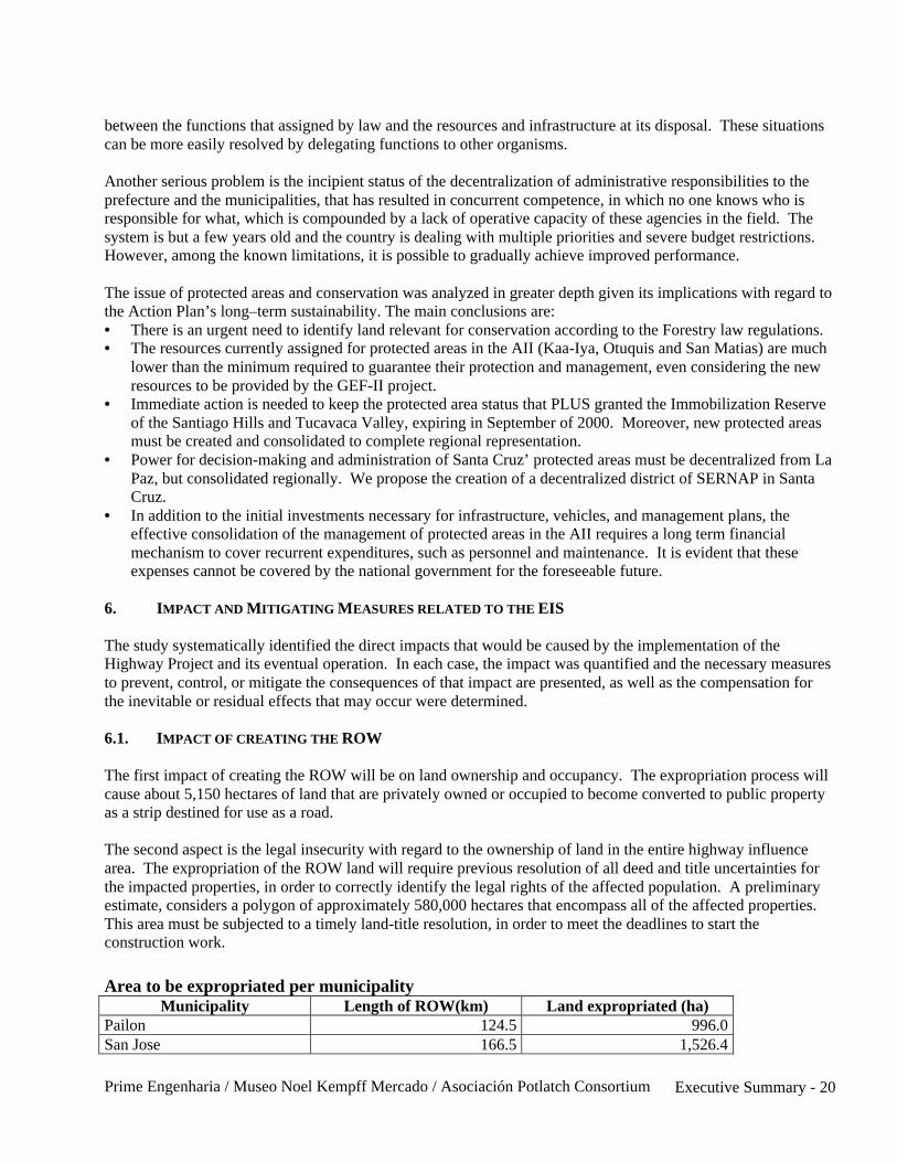
Prime Engenharia / Museo Noel Kempff Mercado / Asociación Potlatch Consortium Executive Summary - 20
between the functions that assigned by law and the resources and infrastructure at its disposal. These situationscan be more easily resolved by delegating functions to other organisms.
Another serious problem is the incipient status of the decentralization of administrative responsibilities to theprefecture and the municipalities, that has resulted in concurrent competence, in which no one knows who isresponsible for what, which is compounded by a lack of operative capacity of these agencies in the field. Thesystem is but a few years old and the country is dealing with multiple priorities and severe budget restrictions.However, among the known limitations, it is possible to gradually achieve improved performance.
The issue of protected areas and conservation was analyzed in greater depth given its implications with regard tothe Action Plan’s long–term sustainability. The main conclusions are:• There is an urgent need to identify land relevant for conservation according to the Forestry law regulations.• The resources currently assigned for protected areas in the AII (Kaa-Iya, Otuquis and San Matias) are much
lower than the minimum required to guarantee their protection and management, even considering the newresources to be provided by the GEF-II project.
• Immediate action is needed to keep the protected area status that PLUS granted the Immobilization Reserveof the Santiago Hills and Tucavaca Valley, expiring in September of 2000. Moreover, new protected areasmust be created and consolidated to complete regional representation.
• Power for decision-making and administration of Santa Cruz’ protected areas must be decentralized from LaPaz, but consolidated regionally. We propose the creation of a decentralized district of SERNAP in SantaCruz.
• In addition to the initial investments necessary for infrastructure, vehicles, and management plans, theeffective consolidation of the management of protected areas in the AII requires a long term financialmechanism to cover recurrent expenditures, such as personnel and maintenance. It is evident that theseexpenses cannot be covered by the national government for the foreseeable future.
6. IMPACT AND MITIGATING MEASURES RELATED TO THE EIS
The study systematically identified the direct impacts that would be caused by the implementation of theHighway Project and its eventual operation. In each case, the impact was quantified and the necessary measuresto prevent, control, or mitigate the consequences of that impact are presented, as well as the compensation forthe inevitable or residual effects that may occur were determined.
6.1. IMPACT OF CREATING THE ROW
The first impact of creating the ROW will be on land ownership and occupancy. The expropriation process willcause about 5,150 hectares of land that are privately owned or occupied to become converted to public propertyas a strip destined for use as a road.
The second aspect is the legal insecurity with regard to the ownership of land in the entire highway influencearea. The expropriation of the ROW land will require previous resolution of all deed and title uncertainties forthe impacted properties, in order to correctly identify the legal rights of the affected population. A preliminaryestimate, considers a polygon of approximately 580,000 hectares that encompass all of the affected properties.This area must be subjected to a timely land-title resolution, in order to meet the deadlines to start theconstruction work.
Area to be expropriated per municipalityMunicipality Length of ROW(km) Land expropriated (ha)
Pailon 124.5 996.0San Jose 166.5 1,526.4

Prime Engenharia / Museo Noel Kempff Mercado / Asociación Potlatch Consortium Executive Summary - 21
Robore 140.5 1,405.0El Carmen Rivero Torres 72.0 720.0Puerto Suarez 62.4 499.2TOTAL 565.9 5,146.6
The highway, like the railway, will pass through the area with the densest human settlement in the regionbetween Santa Cruz and Puerto Suarez. For this same reason, it affects a significant number of agrarian units:• The 257 individual properties represent 16.5% of the total of 1,570 agrarian units with titles or processes
registered in INRA in the Chiquitos and German Busch provinces;• The 18 indigenous communities affected represent 34% of the total of 53 communities legally recognized
registered in both provinces;• The 11 peasant farm communities (syndicates and cooperatives) affected represent 25% of the total
registered in INRA for both provinces.
Components affected by ROW, by agrarian unit categorySurf. AffectedAgrarian Unit Category No Pop. Homes
affect. Ha %Ponds(hrs.)
WiringM.
Indigenous Communities 18 3,498 13 609.9 11.85 3 15,048Peasant Farmer Communities 6 1,165 8 129.1 2.51 0 0Syndicates 2 --- 0 39.0 0.76 35 1,200Cooperatives 4 >200 12 182.4 3.54 0 10,480Mennonite colonies 2 3,050 0 188.0 3.65 0 5,800Community land 3 -- 0 131.5 2.56 0 11,159Public Institutions 2 -- 0 149.2 2.90 0 NaIndividual owners 257 Na 9 3,717.5 72.23 251 Approx.
300,000TOTAL 294 42 5,146.6 100.00 289 352,108
Obs.: In the peasant farmer communities, the El Carmen R.T. and Taperas communities have been excluded, toavoid indicator distortion.
Land Use in Area Affected by ROW, by social categoryCrops (ha) Pastures (ha)Agrarian Unit Category Fallow or
Forest Annual Perenn. Cult. Nat.
Road(ha)
TotalAffected
Indigenous Communities 423.5 -- 1.0 118.0 56.0 11.4 609.9Peasant farm communities 120.6 -- -- 5.0 -- 3.5 129.1Syndicates 28.5 -- 0.5 6.5 -- 3.5 39.0Cooperatives 132.0 32.0 -- 7.5 -- 10.9 182.4Mennonite Colony 2.0 68.5 -- -- -- 117.5 188.0Community land 24.5 -- -- 19.5 74.0 13.5 131.5Public Institutions 116.7 5.0 0.5 -- -- 27.0 149.2Individual Owners 1,661.4 360.0 3.5 745.3 351.8 595.5 3,717.5Total 2,509.2 465.5 5.5 901.8 481.8 782.8 5,146.6
The 42 rural homesteads affected constitute a relevant impact, not only because of the number of familiesinvolved, but also because there will be structural changes to some of the communal nuclei (Pororó, Limoncito).The homes impacted must be replaced using a fair standard, that will be notably better than the majority of thepresent structures. Only homes of greater worth will be indemnified.
Prime Engenharia / Museo Noel Kempff Mercado / Asociación Potlatch Consortium Executive Summary - 22
In the majority of the 18 indigenous communities, territorial loss is small compared with the total surface area.Values of about 1% predominate, with some communities experiencing with losses of between 3 and 5%. Twocases with a loss of between 10 – 11% (Santiagoma and Santa Ana), and a there is critical case of nearly totalloss for the Ayoreo community at El Carmen Rivero Torres, where there is a small, extremely poor, urbansettlement. In the last case, EIS recommends a slight adjustment to the route drafted, in order to pass it by. Ifthis weren’t possible, it will be necessary to resettle the community.
There are several cases of community members that have individual properties within the communal territorythat are informally recognized by their community. In the consultations done during the surveys, it was evidentthat the community was willing to accept this situation and that the individual affected receive compensation forthe improvements made to that property.
Three peasant farmer communities suffer territorial losses between 10% and 13% (Ipiás, Motacusito [Robore]and Yacuses), but these are areas actually covered by brush and fallow. Areas under cultivation and pasturesthat will be affected are very small. There is no loss of ponds or fencing. In addition to the territory, the mainimpact will be on housing, with a total of 8 households affected. Five of them are found in Yacuses, where theEIS recommends that there be a slight modification of the road to avoid affecting these homes and therebysignificantly reducing the impact.
The three agricultural communes in the Taperas region suffer small territorial losses, amounting to 1 and 2% oftheir total area, but the impact on pastures and fencing is more significant. Two rural syndicates suffer effects onless than 1% of their territory, including cultivated pastures and fenced areas. The 13 de Junio syndicate inPuerto Suarez will loose 179 fruit trees,
In the two cooperatives surveyed, the affected area represents less than 1% of the total land area. However, inthe case of the Basilio Cooperative, 12 homes will be affected, thereby causing destruction of the incipientcommunal nucleus.
In all the cases of collective property (communes, syndicates, cooperatives and colonies) it is important to detailthe losses and compensation among partners, since the communal land is divided among them. Nonetheless,only some individuals will be affected and in different (and unknown) proportions, which will be greater than the1 – 2% of the total land area. Although the leadership councils of the cooperatives have expressed a willingnessto manage the matter internally, the Loss Compensation Program must guarantee effective compensation for thepeople who have really been affected.
Most of the individual land holdings will suffer little effects, with between 1 and 2 % of total surface area.However of the 165 landowners surveyed, 22 cases will suffer impacts greater than 10% of the total propertyarea, and nine of these will suffer impacts of more than 25% of the total surface area. These are instancesinvolving of small scale producers with properties smaller than 30, 50 or 100 hectares. In all, 25 units smallerthan 30 ha, and 41 smaller than 50 hectares were identified. In the estimation involving all property units, thereis an estimate of 72 units smaller than 50 hectares.
All these are high vulnerability cases, in which the impact of the loss of land is higher and there is a need forspecific actions for socioeconomic rehabilitation in the remaining property area. A total of 7 seven smallproperties will be affected in such a way by the ROW, that their productive viability will be seriouslycompromised.
In these cases, the territorial loss must be compensated with another, equivalent parcel of land nearby. If this isimpossible because the surrounding lands are occupied by legally established properties that meet the standardsof INRA, then the Project must assign equivalent land in the same geographic region. If the available land is
Prime Engenharia / Museo Noel Kempff Mercado / Asociación Potlatch Consortium Executive Summary - 23
farther away from the highway or is of inferior quality, then compensation will be made by granting a greatersurface area. Only as a last resort will there be monetary compensation.
Compensation will be made according to the following criteria:
• Indigenous and peasant farmer territories must be compensated by land in an adjacent area. For individualproperty owners, cooperatives, colonies etc., compensation will be in cash, at the price of land withoutimprovements.
• Improvements, such as clearing, stump removal, cultivated pastures, fencing, will be indemnified atreplacement cost.
• Community nuclei will have homes and services relocated to retain community integrity and social function.
Another impact is property segmentation, that may cause alterations in the productive infrastructure, especiallyfor cattle ranching. Wire fencing will be necessary to avoid accidents where animals roam freely crossing thehighway in search of water or forage, thus creating a serious risk of accident. It will be necessary to constructwater tanks in certain large extensions of land, so as to avoid the need to herd the animals to one place or anotherto feed or drink.
The following are mitigating measures for these impacts:• Install wire fencing on both sides of the ROW, (and compensate lost fencing in the event that this had
already been installed)• Construct water tanks in communities with extensive territory and on the properties where only one of the
segmented sides contains a water source.• Build cattle access ramps (i) from 1 – 3 in each community, depending on the frontage length along the
ROW; (ii) for cattle properties segmented by the ROW, there will be a need for approximately 90 passes inthe section Paraiso – San Jose, 60 ramps in San Jose – Santiagoma and 60 in the Santiagoma – PuertoSuarez.
• Education for owners and community members, traffic signs warning of cattle ramps.• As compensation for the multiple impacts, it is proposed that in some communities a small rural market be
installed near the highway to avoid irregular and unsafe occupation of the ROW by informal merchants.
Even the properties that have not been segmented will need an access ramp for access to the highway to avoidthat the vehicles have to access the highway in steep angles. Taking into consideration the productive units as agroup and their distribution along the route, it will be necessary to install one ramp every 2.5 km, approximately.
The ROW will affect a total of 64 urban homes of which 56 are in Robore and 8 in Puerto Ibañez. InRobore, the homes will also lose a total of 825 fruit trees that represent a source of income for theaffected families. In addition to the homes, empty lots and municipal urban infrastructure will also beaffected.
The impact on Batallon Junin military facility in Robore is a major problem, since the routing of the ROWpractically eliminates the base’s viability and there is the fear that the government will choose not to replace theinstallations. Battalion representatives participated in the consultation workshops in the municipality and haveformulated their compensation demands, which are expensive.
The solution for this problem is conflictive for the Municipality since it does not have at its disposal enough landto compensate the affected area. At the same time, the military base is of singular importance, since itspersonnel constitute a considerable consumer unit. The threat of the eventual removal or reduction in militarypersonnel is highly negative for the incipient local economy.
Prime Engenharia / Museo Noel Kempff Mercado / Asociación Potlatch Consortium Executive Summary - 24
Technical Documents Available:• Land tenure map along the ROW (three sheets 1:100,000); map of each affected community.• Dossier with a synthesis of the impact and mitigating measures applicable for each community.• Results of the surveys of the affected properties, compensation expectations.
Compensation: Loss Compensation and Socioeconomic Compensation Programs.
6.2. IMPACT ON THE PHYSICAL ENVIRONMENT
Highway construction involves, fundamentally, the removal of a large amount of earth materials from differentquarries and borrow pits (according to the quality required), and their deposition in several compacted layers andpavement. It also implies cutting through mountains, crossing rivers, creeks and wetlands. These operationsrequire a large amount of mobilization in terms of machinery and personnel, truck traffic, campsite operations,and auxiliary plants. The main impacts on the physical environment are:
Impact on Soils• Alterations to quarries and borrow pits• Induced erosive processes in large areas after removal of vegetation cover• Risk of rock slides due to de-stabilization of slopes during excavation processes• Soil compaction in the ROW, traffic routes, and work sites• Soil contamination by wastes and accidental oil and fuel spills.
Impact on Hydrological Systems• Changes to drainage system; insufficient drainage, in number or capacity, can generate flood risks upstream,
water erosion downstream, and alterations to floodplains.• Reduction of subsurface water recharge, cuts in water table, impermeabilization of soil surface• Formation of ponds in lateral borrow pits without adequate drainage• Changes in river channel during temporary crossings, bank destabilization.
Impact on Water Quality• Sediment in water systems, if erosion is uncontrolled and banks are not protected.• Deterioration of water quality, by sediment, wastes and oil and fuel spills• Accident risk with dangerous cargo, when spills reach water courses.
Impact on Air and Sound Quality• Dust lifted by vehicle traffic along unpaved sectors• Vehicle emissions by highway operation• Noise from machinery, vehicles and worksite operations
Impact prevention and Mitigation:
These impacts can be reasonable prevented or controlled by fulfilling the Environmental Technical Norms of theEnvironmental Construction Plan - PAC (Spanish language initials), specifically:• Environmental Management of Campsites, Lodging and Worksite Installations• Environmental Management of Construction Activities• Handling and Disposal of Wastes and Dangerous Materials• Risk Management and Spill Prevention and Control• Restoration and revegetation of intervened areas.

Prime Engenharia / Museo Noel Kempff Mercado / Asociación Potlatch Consortium Executive Summary - 25
The fulfillment of norms and monitoring the environmental effects, must be checked systematically by theProject Environmental Supervision.
6.3. IMPACT ON THE BIOTIC ENVIRONMENT
Impacts on Vegetation• Uprooting along ROW (59% is covered by natural vegetation) and in borrow pits. This will affect 1,600 ha
of Chiquitano forest, 1,000 ha of Cerrado and 200 ha of Chaqueño forests, a total of approximately 1.5million trees
• Border effects on 8 large patches of forest habitat, with extension of between 5 and 75 km (only on oneside), for a total of 144 km (25% of the highway)
• Loss of gallery forest along 114 river crossings, affecting 277 hectares; 91 crossings have major drainagestructures (for fauna crossings) as part of the project design.
• Forests loss and interruption of existing biological corridors that connect important habitats: Quimome andTucavaca Rivers, the areas of Santa Ana, El Carmen and Tacuaral.
Impacts on Fauna• Habitats lost and fragmentation• Highway barrier effect (interruption of genetic exchange)• Road killing• Increase in hunting, fishing and other wildlife use• Impact on aquatic ecosystems, as a result of sedimentation and eventual spills.
Direct impacts on Critical Habitats and Protected AreasCritical habitats at risk: Hills (Otuquis), Gallery Forests, Steep Hills (Chochis)
Impacts in Protected Areas, eventual spills in key places can reach:Quimome River and tributaries → Concepción LagoonTucavaca River and tributaries → Bañados OtuquisBetween Yacuses and P. Suarez → Caceres Lagoon (Gran Pantanal)
Mitigating Measures: Replanting, Restoration of Gallery Forest at the Biological Corridors and FaunaCrossings; Erosion and Spill Control; Adequate Campsite Location; Fulfillment of Conduct Code (faunaprotection), Control of Wildlife Use (Conservation and Environmental Management Program). Priority:Protection of Biological Corridors.
These are important impacts, but in a scale much lower than those foreseen for the AII due to InducedDevelopment. Although the construction of the highway should directly affect only about 3,000 hectares offorests, estimates of deforestation due to land-use change vary depending upon to different developmentscenarios, ranging from 3 million Ha (without the construction of the highway) to 5 million hectares (with thehighway but without the Action Plan) and 1.5 million hectares with the highway and the action plan) (See FutureScenarios)
Compensation:The mitigating measures are essential, but only achieve partial attenuation of the effects on the bioticenvironment. Compensation Measures are necessary: establish new protected areas and improve environmentalmanagement in areas outside of protected areas.
6.4. IMPACTS ON THE SOCIOECONOMIC AND CULTURAL ENVIRONMENT
Prime Engenharia / Museo Noel Kempff Mercado / Asociación Potlatch Consortium Executive Summary - 26
Economic Impacts• Temporary job creation. Relevant Positive effect: Demand is about 3,000 laborers, for an estimated male
working population of 17,000 persons.• Economic activation during construction will inject about US$ 5 M per year into the local economy• Improvement of certain portions and deterioration of the already existing roadway infrastructure.• Increased property worth: Generally positive effect, but with negative impact on the more vulnerable
populations.• ROW lost production: about US$ 236,000 per year, can be made up for in remaining areas.• Reduced transportation costs: major benefit of the highway project.
Social Impact of Construction Works• Migration and Temporary Population Flow• Social Interaction of communities with outside workers• Community member occupational reorientation• Increased demand for infrastructure and social services• Accident risks (for workers, local population and vehicle drivers)• Public Health risks.
Impacts on Archaeological and Cultural AssetsEventual archaeological sites in the ROW, destruction of cave art by visitors, illegal commerce of archaeologicaland/or cultural wealth.
Impact on Circulation and the Urban Network• Increased vehicle traffic in construction phase• Improved population mobility, increase in number of private vehicles in circulation• Passing of the highway or complementary routes within urban nuclei: Robore, Quijarro.• Community segmentation• Circulation conflicts in urban areas and adjacent villages• Induction of new urban development vectors• Improved access to small towns and cities (recommendation as complementary construction)
Impact on Road Safety• Risks on Upward Ramps (probable need for third lane)• Risks in intersections (design improvement recommendation)• Crossing of urban areas and adjacent villages (signs, educational projects)• Cattle circulation and animal drawn carts (lateral lane, with cattle passes and wire fencing along the
highway)
Mitigating the Impact of the Construction Work: Obedience of Campsite Norms, the Conduct Code and thePAC Norms, Social Impact Inspections, Social Communication.
Compensation: Socioeconomic Compensation Program
7. ENVIRONMENTAL MANAGEMENT AND MONITORING PLAN (PASA – Spanish Language Initials)
The programs comprising the PASA describe and organize the mitigation and compensation measures,establishing clear implementation procedures. SNC is responsible for their execution.

Prime Engenharia / Museo Noel Kempff Mercado / Asociación Potlatch Consortium Executive Summary - 27
7.1. LOSS COMPENSATION AND SOCIOECONOMIC REHABILITATION PROGRAM FOR THE AFFECTED
POPULATION
The main actions to be taken are:• Establish criteria (guidelines) for compensating affected parties• Support the participation of the affected parties. Forming co-management nuclei• Declaration of the ROW area as a Necessary Public Utility• Create legal regulations for compensation and rehabilitation• Socioeconomic census of the affected areas and families• Land titling for all agrarian units affected by the ROW (INRA’s responsibility)• Allotment of lands to communities, as replacement of affected land.• Adjudication of Urban Property• Appraisal of land and improvements• Negotiation and Payment in cash of the convened indemnification• Construction of houses, improvements and other installations to be replaced for the affected parties.• Technical support for productive rehabilitation (vulnerable population only).
Robore Urban Resettlement Project• Acquisition, partitioning and provision of infrastructure for the urban site• Building homes, extending public services to the new neighborhood• Social and productive rehabilitation of family households (fruit trees, family basic consumption)
Community Compensation and Rehabilitation Project• Allotment of land equivalent to that expropriated (eventual indemnification if other alternatives are not
feasible)• Replacement / indemnification of improvements• Replacement of affected homes, in a basic pattern better than the present one• Relocation and reordering nucleus (Pororó, Limoncito, Basilio Cooperative)• Construction of access, plaza and community market• Construction of community cultural center in legally acknowledged indigenous communities
Individual, Cooperative and Colony Compensation and Rehabilitation Project• Cash indemnification with self rehabilitation (large landowners)• Replacement of improvements and conducted rehabilitation in remaining cases (vulnerable cases)• Resettlement of some displaced small-scale occupants.
Implementation requisitesSNC operative training, supported by Program Technical OfficeSecure resources in the highway budget (indemnification value is not subject to financing)Participation by affected parties in the entire process by Co-management NucleiReplacement concluded one month before starting the work in each sector.
7.2. ARCHAEOLOGICAL INVESTIGATION, MONITORING, AND RESCUE PROGRAM
Includes the following activities (to be carried out prior to starting work in each section)• Detailed archaeological prospecting in the entire ROW, and the borrow pits• Salvage excavations in sites found around the intervention areas• Museum and lab work in the collected material. Systemization and results report• Formulation of a conservation and valorization policy for the archaeological and historical wealth.
Prime Engenharia / Museo Noel Kempff Mercado / Asociación Potlatch Consortium Executive Summary - 28
7.3. ENVIRONMENTAL CONSTRUCTION PLAN (PAC–Spanish language initials)
The Environmental Construction Plan’s goals are: to avoid, minimize, control and mitigate thepotential social-environmental impacts associated with Highway Construction and Maintenance, and toinsure implementation of applicable environmental legislation. The Plan establishes the guidelines thatmust be adhered to by the contractors during the construction phase of the project.
Most of the impacts to the physical environment, vegetation, wildlife, and human communities will be localized,both spatially and chronologically. Some impact will be inevitable, but most can be mitigated to acceptablelevels by the procedures outlined by the PAC.
Highway construction is a sequential process involving: ROW demarcation, clearing and preparing the land,extracting and transporting materials from the quarries and borrow pits, compacting the soil, making terrain cuts,building bridges and drainage elements, placing gravel or pavement, restoring degraded areas, replanting andcampsite demobilization.
Parallel to these measures, a series of other activities must be implemented to ensure sound water management;erosion control, avoidance of landslide, opening access routes, and disposal of generated waste, as well as safetyissues regarding campsite operation, machinery, vehicles and auxiliary plants. All the construction activities canhave their impact minimized by the norms established in this PAC.
The Environmental Construction Plan (PAC) will be part of the Bid Specifications and their implementation willbe mandatory. The Plan includes the following Programs:
• Environmental Management of Campsite, Lodging and Worksite Installations• Conduct Code and workers’ environmental education• Environmental Management of the Construction and Maintenance Activities• Handling and Disposal of Wastes and Dangerous Materials• Risk Management / Spill Prevention and Control• Occupational Health and Safety.
7.4. RE-VEGETATION PROGRAM
The goals of the Re-vegetation Program are:• Protect the engineering work from erosive processes• Conserve the soil and water natural resources• Minimize the highway’s impact on critical habitats• Provide a roadside area offering increased safety and beauty.
Most of the ROW will be replanted with sown grasses or restored to allow natural regeneration. Grasses will besown in (i) slopes of the road’s embankment; (ii) steep grades in mountainous areas, (iii) strips situated laterallyto the ROW, along side the embankment; (iv) borrow pits.
The gallery forests and wetlands associated with the rivers and creeks that are crossed by the highway are alsocorridors for vertebrate movement from the northern to southern sides of the road. These critical habitats will beproactively revegetated using native species. The goal is to restore the woody stratum to provide practicallycontinuous coverage from the natural forests to the bridges and drainage culverts so as to limit the barrier effect.A total of 28 km of highway (279 ha) cross gallery forests and 20 km of wetlands (204 ha).

Prime Engenharia / Museo Noel Kempff Mercado / Asociación Potlatch Consortium Executive Summary - 29
In the areas surrounding small towns, ornamental and native species will be planted to improve the aesthetics ofthe highway and reduce the traffic noise. The planting arrangement will be organized according to basicprincipals of landscape architecture, using solitary trees (landscape frame), tree groups (lookouts), tree lines(highway guides), living fences (highway conduction), groups of bushes and trees, enclosed groups of bushesand trees, and forest groupings. These techniques will improve the functionality of the highway landscape, aswell as create ecological connections for isolated bio-types.
The replanting work will be done while highway construction is underway, by local subcontractors, who will bein charge of a nursery and organizing local laborer.
Activities to be carried out:• Collect reproductive material (seeds, slips, bulbs, etc.) of native species, in addition to conduct an inventory
of the zone’s vegetation.• Identification of critical habitats.• Installation of nurseries• Growing plants to the sapling stage nurseries• Preparing the terrain for proactive revegetation.• Planting bushes and trees• Sow grass. Total of around 4,500 Ha.• Soil rehabilitation and natural re-growth in the wetlands (swamps)• Follow up and monitoring for one year following replanting.
7.5. PROGRAM FOR CORRECTING ENVIRONMENTAL LIABILITIES
Environmental Liability is any environmental problem or impact that hasn’t been properly mitigated or remediedfollowing the original intervention. The Program’s objective is to restore the existing degraded areas in thepresent road and its surroundings, which are the result of inadequate maintenance practices, quarry and borrowpit exploitation, in order to avoid environmental damage to the adjacent areas and communities.
The most frequently observed environmental problems identified during field inspections were: abandoned soilquarry areas, road interference with population centers, interference with natural drainage systems, and others oflesser magnitude and importance.
Restoring borrow pits created to construct and maintain the present road is the most difficult issue, since thereare several with different problems. In these areas environmental control measures will be applied that areappropriate for construction activities.
Typical Borrow Pits Problems: Main planned activities:• Vegetation degradation Revegetation• Pile of unused material Level and protect terrain surface• Superficial stream erosion Dig “crowning ditches”• Water accumulation Create drains for accumulated water
In the sectors where the projected highway coincides with the present road, the construction operations willresolve the majority of the route’s and shoulders’ liabilities, since the entire area will be intensely intervened andessentially re-engineered. The old borrow pits found more than 50 meters from the present roads axis will alsobe corrected.
The portions of the present road that are farther from the ROW will probably remain as local roads, that willprovide access to small population centers and rural properties. For example: (i) 38.5 km sector between El

Prime Engenharia / Museo Noel Kempff Mercado / Asociación Potlatch Consortium Executive Summary - 30
Tinto and Quimome (road along ridge); (ii) the entire 127 km sector of present road (southbound) betweenTaperas and Robore, and (iii) part of the 115 km portion between Robore and El Carmen. The liabilities alongthe road should be resolved during construction or they will become a future maintenance problem inherited bythe municipalities or the prefecture. Future problems on the non-improved sectors of the existing road will bereduced since the traffic and the weight of the vehicles will diminish notably.
The extensive portions of the road that will be parallel to the new highway, some 200 to 300 meters from thenew road, will be of no use for local transport. These should be restored and revegetated and incorporated intoexisting properties or they will become focal points for soil erosion.
Actions to resolve existing environmental liabilities will be a part of the activities that the contractors willcomplete as part of the construction work. The consulting firm contracted for environmental supervision mustsupervise and enforce the implementation of these responsibilities.
7.6. PROGRAM FOR MANAGING THE TRANSPORTATION OF DANGEROUS CARGO
The program will have as its main objective the establishment of mechanisms for managing this activity, toadjust the norms and training of Bolivian institutions, so as to bring them into compliance with Mercosuragreements. This will include accident prevention and response to eventual emergency situations, so as toensure that the impact of any future event on the environment and the general population’s health and safety willbe minimized.
The program will include the following activities:• Participation by the institutional protagonists involved in the matter;• Proposal of Specific Regulations for the transportation of dangerous cargo, in complementation with the
existing Regulations for Activities with Dangerous Substances;• Diagnosis of the risks associated with the main cargoes to be transported on the highway system;• Environmental vulnerability analysis and Prevention Plan;• Design and Implementation of the Control Program for transporting dangerous cargo;• Creation of an Emergency Action Plan for response in the case of accidents with dangerous cargo;• Human Resource training and preparation;• Design, specifications, yard construction and acquisition of special equipment;• Implementation of a Prevention Plan and an Emergency Action Plan.
We recommend that the Program be instituted first in a pilot sector, where the efficiency of procedures can betested and later extended to the entire highway system.
The Program will be based on Bolivian environmental and transportation legislation. The specificcomplementary norms will be based on international norms and legislation, such as:• United Nations regulations• The European Agreement on the transportation of Dangerous Products• Facilitation Agreement for Transporting Dangerous Products in Mercosur.
The Servicio Nacional de Caminos will be responsible for executing this Program, through its environmentaldivision. Gradually, as the management mechanisms for transportation of Dangerous Cargo are implemented,the responsibility for coordinating this system will be in the Highway Operating sector. In the practical sense,the Technical Office will be the operative branch of the SNC for implementing the Program.
7.7. SOCIAL COMMUNICATION PROGRAM

Prime Engenharia / Museo Noel Kempff Mercado / Asociación Potlatch Consortium Executive Summary - 31
The Program will adopt a transparency policy with regard to the Project, with the goal of taking proactivelyapproach to make timely and truthful communication to all social sectors. The Program will be implementedduring the construction phase and in the first operative year of the Project, with actions differentiated accordingto the following target publics:
1. International Public Opinion2. National Public Opinion3. National Scientific Community and NGOs4. Government Organizations, Regulatory Entities5. Municipalities directly affected by the Highway route6. Affected Communities7. School-age population in the towns close to the highway
Social Communication Instruments• Mobile Information and Orientation Booths in areas close to construction sites.• Informative Bulletin on construction progress and implementation of compensation measures• Municipal office with a system to receive citizen suggestions and complaints• INTERNET Website updated regularly with technical information and studies• Participation in radio and television programs, publication of ads and articles in newspapers and magazines• Pamphlets, videos, technical publications• Press releases, to support up newspaper publicity regarding the Highway in local press• Periodic publications in local papers or periodicals with wider circulation• Creation of Dial-a-Highway, a free phone line to attend to the publics need for problem solving and doubts,
receiving complaints and suggestions.• Expositions in urban and rural schools close to the ROW, distribution of informative material and
accelerated teacher training; incentives for extracurricular activities, fostering interest in environmentalprotection.
Responsibility: SNC Social Communication Sector, supported by the Technical Office
Mechanisms for interaction with the rural population• Visits to settlements in the Project influence area, meetings, debates, expositions, interviews and new
programs divulged in local communications media.• Meetings with local communities to prepare them for the presence of construction workers, machinery and
job-site camp operations. Presentation of the workers’ Conduct Code to local authorities and leaders.• Dialogue with residents, meetings and conferences to keep them informed of the construction and,
later, on how to live with the highway.• Orientation activities in terms of environmental education, traffic safety during the construction and
operative phases.
A communications channel must be kept open with the local community during the entire construction process,and the Social Inspectors must participate in the process.
7.8. ENVIRONMENTAL SUPERVISION AND MONITORING SYSTEM
The Environmental Supervision and Monitoring System is the part of the Corridor Project’s RegionalSocial–Environmental Management System in charge of managing the social and environmental aspects relatedwith Highway Construction. The following institutions are also protagonists in this process, with specificfunctions:
Prime Engenharia / Museo Noel Kempff Mercado / Asociación Potlatch Consortium Executive Summary - 32
1. National Government. Is the sponsor of the Santa Cruz – Puerto Suarez Corridor Project, thatincludes the Highway Improvement Project, as well as the Corridor’s social and environmentalprotection programs. It also assumes financial responsibility for the loans with the internationalfinancial organizations for both components.
2. Ministry of Sustainable Development and Planning (MDSP – Spanish language initials). Is the mainexecutive entity for the Social and Environmental Action Plan, responsible for coordination and mediationbetween the executive entities for each program on one side, and the National Government, organized civilsociety and financial organizations on the other. It will act fundamentally through the Projects’ ExecutiveUnit, and is responsible for the Action Plan before the Competent Environmental Authority (VMARNDF).
3. Project Executive Unit. The entity for managing the Social and Environmental Action Plan, answering toMinistry of Sustainable Development and Planning. It carries out functions as coordinator and mediation forthe MDSP as described above. Its scope of action is the Transportation Corridor’s insertion into the region’snatural and social environment.
4. National Road Service (Servicio Nacional de Caminos – SNC) Is the entity executing the Santa Cruz –Puerto Suarez Highway Improvement Project, and as such, responsible for the roadway project before thecompetent environmental authority.
5. Vice-minister of Environment, Natural Resources and Forestry Development (VMARNDF–Spanishlanguage initials) Is the competent environmental authority, with regard to the roadway project as well asthe Action Plan. As such, the VNARNDF will issue the Environmental Licenses and be responsible forenvironmental supervision of the Roadway Project and the Action Plan.
6. Financing Organisms. IADB, World Bank and other international cooperation entities. These institutionshave specific social and environmental policies for the loans that they grant and negotiate agreements withthe debtors that include the fulfillment of certain procedures and social-environmental standards.
Protagonists Directly Involved in Project Construction
1. Project Supervision. A multidisciplinary team from SNC responsible for all construction aspects relatedwith the Project. It reports directly to SNC.
2. Engineering Supervision. Consulting firm responsible for project engineering, program fulfillment, qualitycontrol, contractor operation supervision, approval and measurement of services executed by theContractors. It will have Direct Operative Authority over the Contractors by the delegation of Supervisoryfaculties and will report directly to Project Supervision.
3. Social-Environmental Supervision. Consulting firm responsible for supervising the social andenvironmental aspects related to construction. Will provide specialized technical support for EngineeringSupervision in the definition of construction methods and protective measures, as well as monitor theProject’s social-environmental impacts. It has no operative authority over the Contractors. It reports to theCorridor Project Executive Unit.
4. Job Contractors. Construction companies hired by SNC responsible for doing the construction work. Theyreport, generally, to Project Supervision, and for day to day operative matters, to Engineering Supervision.
5. Environmental Auditor. Independent Specialist responsible for certifying the fulfillment of theenvironmental procedures and standards, including licenses and permits granted by national authorities, aswell as those established by the financing organisms. It reports to the Executive Unit and the FinancingOrganisms.
6. Ombudsman. An independent professional responsible for channeling the general publics doubts andcomplaints regarding the Project to the Project’s management structure. He reports to the Executive Unitand Financing Organisms.
7. Surveillance Committees. Representatives from the surrounding communities organized by job sector.They will assist in supervising the impact caused by the Project outside the job site boundaries, and insolving any eventual problems with the communities.

Prime Engenharia / Museo Noel Kempff Mercado / Asociación Potlatch Consortium Executive Summary - 33
Agile coordination mechanisms will be established to facilitate communication between protagonists andstakeholders, consisting of: (i) Environmental Committee, including SNC Supervision, Engineering Supervisionand Environmental Supervision; and (ii) Environmental Field Committees, established in each constructionsector, will include the Contractors Environmental Officer, the Engineering Inspector and the Social andEnvironmental Inspectors.
The attached Organizational diagram shows the organization of the Environmental Supervision and MonitoringSystem.
Scope of the Social–Environmental Supervision ServicesSocial-Environmental Supervision will verify compliance with the environmental technical norms defined in theEnvironmental Construction Plan (PAC). These include: construction procedures, installation and operation ofcampsites, worker conduct standards, environmental activities implemented by the Contractor andsubcontractors, the implementation of mitigating measures and all the remaining factors set forth in the PAC. Itwill monitor all the activities during the construction phase with regard to the following matters:
• Erosion Control Measures• Measures Protecting Vegetation and Fauna• Procedures for handling and disposing of solid, sanitary and dangerous wastes• Air Quality Protection and Noise Control• Spill Prevention and Control Procedures• Standard and Specialized Construction Procedures.• Accidental Discovery of Archaeological Sites or Human Remains• Rehabilitating Access Routes• Correcting Environmental Liabilities• Environmental Restoration of Borrow Pits Areas• Abandon and Dismantling Job Campsites• Restoring and Revegetation the Right of Way• Direct impacts to the communities surrounding the job site, enforcing responsible parties to repair or resolve
problems.
The Social-Environmental Supervision team will be made up of:• 1 Environmental Supervisor, with basic instruction in geotechnical engineering• 1 Social Supervisor, working 1/2 time, sharing tasks with other programs in the Technical Office.• 1 Junior engineer for social-environmental supervision• Environmental inspectors: 2 inspectors for each of the three main sections of the construction project.• Specialists in water quality, hydrology/hydraulics, revegetation and job planning, for support in specific
moments throughout the construction process.
7.9. COMPLEMENTARY WORK PROGRAM
This program encompasses a set of highway related projects, not previously contemplated in the CorridorProject, but that are considered essential for minimum operability, safety and integration within the region. Theproposed components are:
• Roadway connection with the Highway to Puerto Aguirre and the border town of Arroyo Concepcion.• Paving the two-way route in Robore• Upgrading and gravel on the access routes to the towns of San Jose, Robore and El Carmen.• Making improvements to access routes to the rural populations closest to the highway.

Prime Engenharia / Museo Noel Kempff Mercado / Asociación Potlatch Consortium Executive Summary - 34
• Construction of a pass adjacent to the Highway, but within the ROW for herding cattle and animal-drawncarts, in selected portions of the highway.
These measures not only address impact preventive/mitigating issues, but provide solutions toproblems that, if not resolved, will become bottlenecks for the Corridor’s adequate operation.Therefore, the following is proposed:
• Incorporate the elements mentioned above into the Project.• Include them in the engineering design review planned to adjust the Project specifications for
gravel instead of asphalt pavement.
Incorporate construction cost to the Project’s civil construction budget (as a preliminary estimate, thecost of these interventions should be US$ 9.5 million, that is, 5% of the civil construction work’s cost)
Chart – Estimate of the Investment Cost for the Proposed Complementary WorkComponent Description Cost (US$)
Connection to Border Town Build 1 Km gravel road 331,000
Connection to Puerto Aguirre Improve and asphalt pavement for 2Km roads and 2 Km urban streets
1,800,000
Paving in Robore Asphalt pavement for 3.6 Km two-wayroad
1,040,000
Access to towns (San Jose,Robore and El Carmen)
Design improvement and gravel (6.3km) roads
1,187,200
Access to nearest rural villages Improvements to 37.6 Km AccessRoutes
1,504,000
Parallel cattle paths 1M compacting on a 7 M platform,about 100Km
3,673,500
TOTAL 9,535,700