
Intelligent Transportation Systems: The @CRUiSE Project · 2018-03-14 · Ref: José Fajardo, José...
27
Intelligent Transportation Systems: The @CRUiSE Project http://transportes-tema.web.ua.pt Margarida C. Coelho University of Aveiro Dept. Mechanical Engineering
Transcript of Intelligent Transportation Systems: The @CRUiSE Project · 2018-03-14 · Ref: José Fajardo, José...

Intelligent Transportation Systems: The @CRUiSE
Project
http://transportes-tema.web.ua.pt
Margarida C. CoelhoUniversity of AveiroDept. Mechanical Engineering

1. Impacts of transportation systems
2. Intelligent Transportation Systems (ITS)
3. LCA of alternative energy vectors for road vehicles
4. Active modes (cycling & walking)
“Transportation Technology” Research Group - Research Lines
On-going Projects:
- @CRUiSE- MobiWise- CISMOB

BACKGROUND

Motivation
• Europe: ~33% of energy consumption fromtransportation sector
• ~73% of transportation-related GHG are fromroad transport
• Vehicle emissions important source for airpollution (NOx, PM)
• Conventional fuels are expected to remainpredominant over the next decades
There is the need to optimize the use ofthe road infrastructure
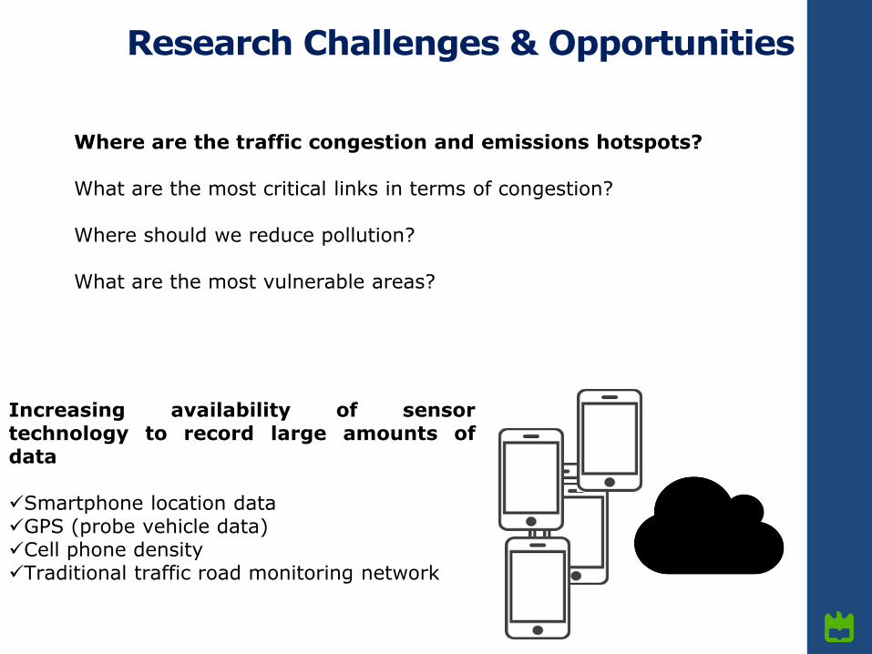
Increasing availability of sensortechnology to record large amounts ofdata
Smartphone location dataGPS (probe vehicle data)Cell phone densityTraditional traffic road monitoring network
Research Challenges & Opportunities
Where are the traffic congestion and emissions hotspots?
What are the most critical links in terms of congestion?
Where should we reduce pollution?
What are the most vulnerable areas?

THE @CRUiSE PROJECT:
Advanced Impact Integration Platform for Cooperative Road Use

Goal: To integrate road traffic impacts into asingle analytical framework for use in advancedtraffic management systems (ATMS).
3 main pillars:a) Designing a conceptual methodology for
assigning a link-based indicator that canevaluate different traffic-relatedexternalities, adjusted to local contextsof vulnerability;
b) Improving the interoperability betweentraffic-related models and new sources oftraffic information;
c) Optimizing the network operations bymeans of a decision support system.
Consortium:TEMA (leader), CESAM, ITInternational expertise: North Carolina StateUniversity;University of Salerno
Objectives of @CRUiSE
http://project-cruise.weebly.com/

Task 1• Literature review and experimental setup
Task 2• Experimental work - Road and environmental conditions monitoring
Task 3• Development, integration and validation of related-traffic models
Task 4• Dynamic link-based eco-indicator
Task 5• Data fusion and data management
Task 6• Network optimization and design of a decision support system
Task 7• Prototype / Software and applications development
Task 8• Dissemination and Reports
Main deliverable: Prototype of an integrated decision support system for selecting theappropriate traffic management measures.
Tasks

METHODOLOGY

Experimental measurements
Mobile application developed to
collect data from sensors and send
to a server
Ref: Daniel Silva, MSc. Thesis in Telematics,
UA, 2017.

Experimental measurements

Portable Emissions Monitoring System (PEMS)
Experimental measurements

Traffic modeling

Emissions, air quality, noise and safety modeling
Emissions Vehicle Specific Power (VSP)
31.1 9.81 sin arctan 0.132 0.000302VSP v a grade v
Noise
Air quality
VADIS
Safety
SSAM model
Multi-objective criteria
Fast Non-Dominated Sorting Genetic Algorithm – NSGA-II
Semi-dynamic Model
Quartieri, Guarnaccia et al.

RESULTS

Correlation between traffic variables and emissions
Ref: João Teixeira, Paulo Fernandes, Jorge M. Bandeira & Margarida C. Coelho, Information Management for Smart and Sustainable Mobility,
96th Transportation Research Board Annual Meeting, Washington D.C., January 2017
• Urban links: knowledge on travel time helps to anticipate emissions
• Correlation of aggregated VSP Modes with congestion algorithms + CO2
emissions, enables the understanding of driving behavior and emissions impacts
• Driving behavior: the most important factor on characterizing arterial routes

GIS-based modelling structure with data on noise levels, CO2 emission factors and costs
Impacts Modeling
Concentrations fields (µg∙m-3)

Route choice impacts on pedestrians/residents
Ref: Jorge M. Bandeira, Claudio Guarnaccia, Paulo Fernandes, Margarida C. Coelho, Advanced impact integration platform for cooperative road
use, International Journal of Intelligent Transportation Systems Research, 2016.
• Trade-offs identified in the minimization of environmental indicators
• The most obvious conflict: between the minimization of environmental costs
and the exposed population to local traffic externalities

RBT2
RBT1
a
b
Crosswalk location assessment
PC
Rail
Line
Ref: P. Fernandes, J. Teixeira, A. Sousa, C. Guarnaccia, M.C. Coelho, Multi-Criteria Assessment of Crosswalk Location in Corridors with
Roundabouts or Traffic Lights: The Importance of Noise Levels Estimation, 20th Euro Working Group on Transportation - EWGT 2017, Budapest.
Multi-Criteria Assessment on a Corridor with Roundabouts
Pedestrian travel
time
Vehicle Delay/
Emissions / Noise
• Crosswalk near the present location (PC = 33 m) achieved a good balance
among traffic and pedestrian performances, CO2 and NOX emissions, and noise
• Noise criteria dictated some optimal locations near roundabout exit section
(between 13-23 m)

Ref: P. Fernandes, J. Teixeira, C. Guarnaccia, J. Bandeira, E. Macedo, M.C. Coelho, The Potential of Metering Roundabouts: Influence in
Transportation Externalities, Proceedings of 97th Transportation Research Board Annual Meeting, Washington D.C., 2018.
• Specific objectives:
- To evaluate corridor operations in an integrated way: link-specific travel
time, fuel use, CO2, NOX, and noise costs.
-To propose an optimization model for partial metering based-strategy.
• Using the metering system, overall costs could decrease up to 11%
compared to the unmetered condition.
Multi-Criteria Assessment on a Corridor with Roundabouts

VRUs Safety: On-Board Platform of Sensors on Bicycles
Ref: José Fajardo, José Paulo Santos, Margarida C. Coelho, An On-Board Platform of Sensors for
Enhancing Safety of Cyclists, Scientists for Cycling, UA, 2016.

VRUs Crashes Predictive Modeling
Ref: Mariana Vilaça, Eloisa Macedo, Pavlos Tafidis, Margarida C. Coelho, Frequency and severity of crashes involving vulnerable road
users – An integrated spatial and temporal analysis, 97th Transportation Research Board Annual Meeting, Washington D.C., 2018.

VRUs Crashes Spatial and Temporal Analysis
Ref: Mariana Vilaça, Eloisa Macedo, Pavlos Tafidis, Margarida C. Coelho, Frequency and severity of crashes involving vulnerable road users –
An integrated spatial and temporal analysis, 97th Transportation Research Board Annual Meeting, Washington D.C., 2018.
•Most crashes occur near high attraction places, with speed limits under 50km/h
• VRU gender and age, weather conditions statistically significant predictor
variables

VRUs: Impacts Modeling on Different Routes
Ref: Behnam Bahmankhah, Margarida C. Coelho, Multi-objective optimization for short distance trips in an urban area: choosing between motor
vehicle or cycling mobility for a safe, smooth and less polluted route, Transportation Research Procedia, 2017.
• Multi-objective model based on user's criteria
• Pareto fronts: Travel time, CO2 and Conflicts for motor vehicle
and bicycle users; Travel time, NOx and Conflicts for motor vehicle
and bicycle users

CONCLUSIONS

Sinergy + Multi-criteria evaluation
Sustainable Mobility
Behaviouralchange
Technology
Vehicle Infrastructure
ITS as a strategical choice to help decarbonising the transportation sector

Thank you for your attention!
©MCCoelho
http://transportes-tema.web.ua.pt
http://project-cruise.weebly.com/