Integrated Motorized & Non-Motorized Alternative ... · City of Cordova City of Valdez ... Rails to...
61
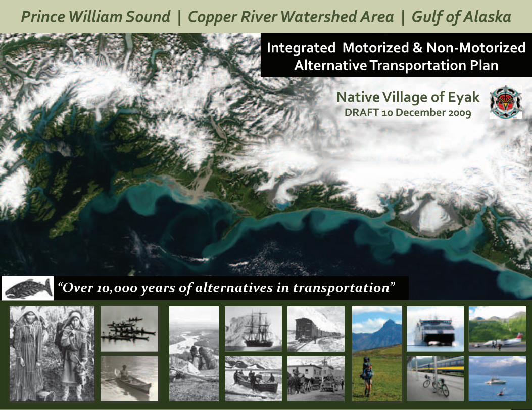
Prince William Sound | Copper River Watershed Area | Gulf of Alaska Integrated Motorized & Non-Motorized Alternative Transportation Plan Native Village of Eyak DRAFT 10 December 2009 “Over 10,000 years of alternatives in transportation”
-
Upload
vuongkhanh -
Category
Documents
-
view
235 -
download
0
Transcript of Integrated Motorized & Non-Motorized Alternative ... · City of Cordova City of Valdez ... Rails to...
Page
1
Prince William Sound | Copper River Watershed Area | Gulf of Alaska
Prince William Sound | Copper River Watershed Area | Gulf of Alaska
Integrated Motorized & Non-Motorized Alternative Transportation Plan
Native Village of EyakDRAFT 10 December 2009
“Over 10,000 years of alternatives in transportation”
Page
2
Prince William Sound | Copper River Watershed Area | Gulf of AlaskaIntegrated Motorized & Non-Motorized Alternative Transportation PlanPage
2
Integrated Motorized & Non-Motorized Alternative Transportation PlanPage
2
Thank You to Our Partners
Integrated Motorized & Non-Motorized Alternative Transportation Plan
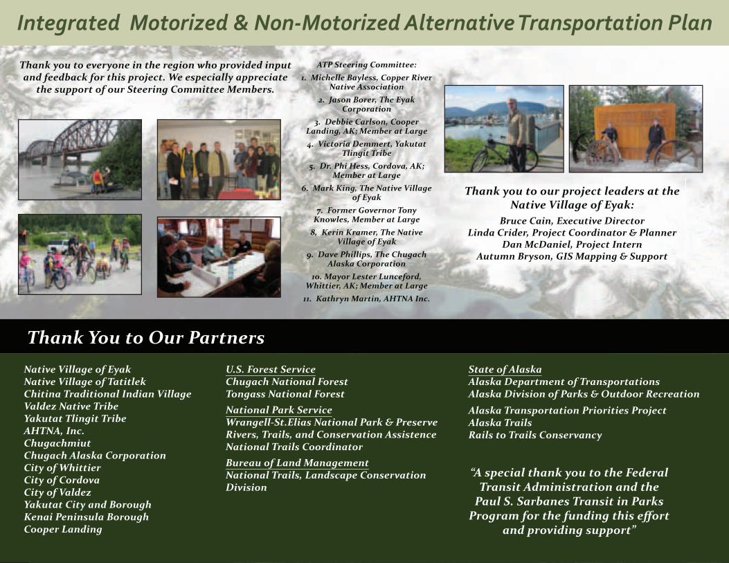
Thank you to our project leaders at the Native Village of Eyak:
Bruce Cain, Executive DirectorLinda Crider, Project Coordinator & Planner
Dan McDaniel, Project InternAutumn Bryson, GIS Mapping & Support
Native Village of EyakNative Village of Tatitlek Chitina Traditional Indian VillageValdez Native TribeYakutat Tlingit TribeAHTNA, Inc.ChugachmiutChugach Alaska CorporationCity of WhittierCity of CordovaCity of ValdezYakutat City and BoroughKenai Peninsula BoroughCooper Landing
U.S. Forest ServiceChugach National ForestTongass National ForestNational Park ServiceWrangell-St.Elias National Park & PreserveRivers, Trails, and Conservation AssistenceNational Trails CoordinatorBureau of Land ManagementNational Trails, Landscape Conservation Division
State of AlaskaAlaska Department of TransportationsAlaska Division of Parks & Outdoor Recreation
Alaska Transportation Priorities ProjectAlaska TrailsRails to Trails Conservancy
“A special thank you to the Federal Transit Administration and the
Paul S. Sarbanes Transit in Parks Program for the funding this eff ort
and providing support”
Thank you to everyone in the region who provided input and feedback for this project. We especially appreciate
the support of our Steering Committee Members.
ATP Steering Committee: 1. Michelle Bayless, Copper River
Native Association 2. Jason Borer, The Eyak
Corporation3. Debbie Carlson, Cooper
Landing, AK; Member at Large4. Victoria Demmert, Yakutat
Tlingit Tribe5. Dr. Phi Hess, Cordova, AK;
Member at Large6. Mark King, The Native Village
of Eyak7. Former Governor Tony
Knowles, Member at Large8, Kerin Kramer, The Native
Village of Eyak9. Dave Phillips, The Chugach
Alaska Corporation10. Mayor Lester Lunceford,
Whittier, AK; Member at Large11. Kathryn Martin, AHTNA Inc.
Page
3
Prince William Sound | Copper River Watershed Area | Gulf of Alaska
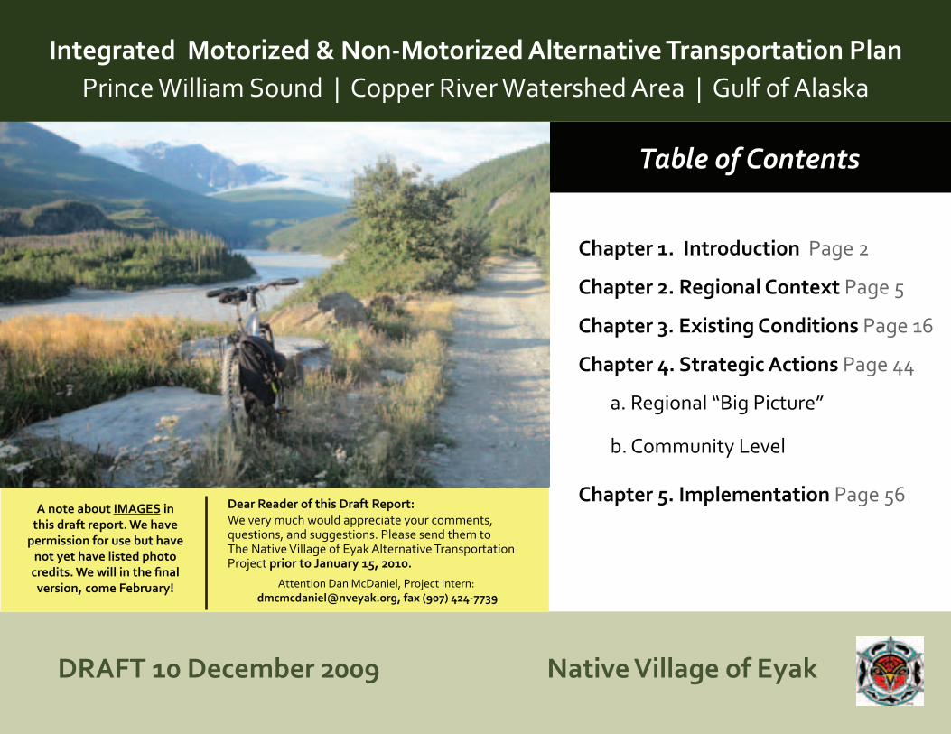
Table of Contents
Integrated Motorized & Non-Motorized Alternative Transportation Plan Prince William Sound | Copper River Watershed Area | Gulf of Alaska
Chapter 1. Introduction Page 2
Chapter 2. Regional Context Page 5
Chapter 3. Existing Conditions Page 16
Chapter 4. Strategic Actions Page 44
a. Regional “Big Picture”
b. Community Level
Chapter 5. Implementation Page 56
Native Village of EyakDRAFT 10 December 2009
Dear Reader of this Draft Report: We very much would appreciate your comments, questions, and suggestions. Please send them to The Native Village of Eyak Alternative Transportation Project prior to January 15, 2010.
Attention Dan McDaniel, Project Intern: [email protected], fax (907) 424-7739
A note about IMAGES in this draft report. We have
permission for use but have not yet have listed photo
credits. We will in the final version, come February!
Page
1
Prince William Sound | Copper River Watershed Area | Gulf of AlaskaIntegrated Motorized & Non-Motorized Alternative Transportation PlanPage
1
Copper River
Prince William Sound
Gulf of Alaska
Yakutat
Cordova
Valdez
YakatagaChenega
Whittier
Kennicott
Chitina
STUDY AREA MAP
Cooper Landing
McCarthy
Gulf of A
laska
ALA
SKA
CAN
AD
A
N
Tatitlek
To Anchorage
KennicottLegendHighwaySmall or Gravel RoadRailroad Tracks
WhittierTunnel
Page
2
Prince William Sound | Copper River Watershed Area | Gulf of Alaska
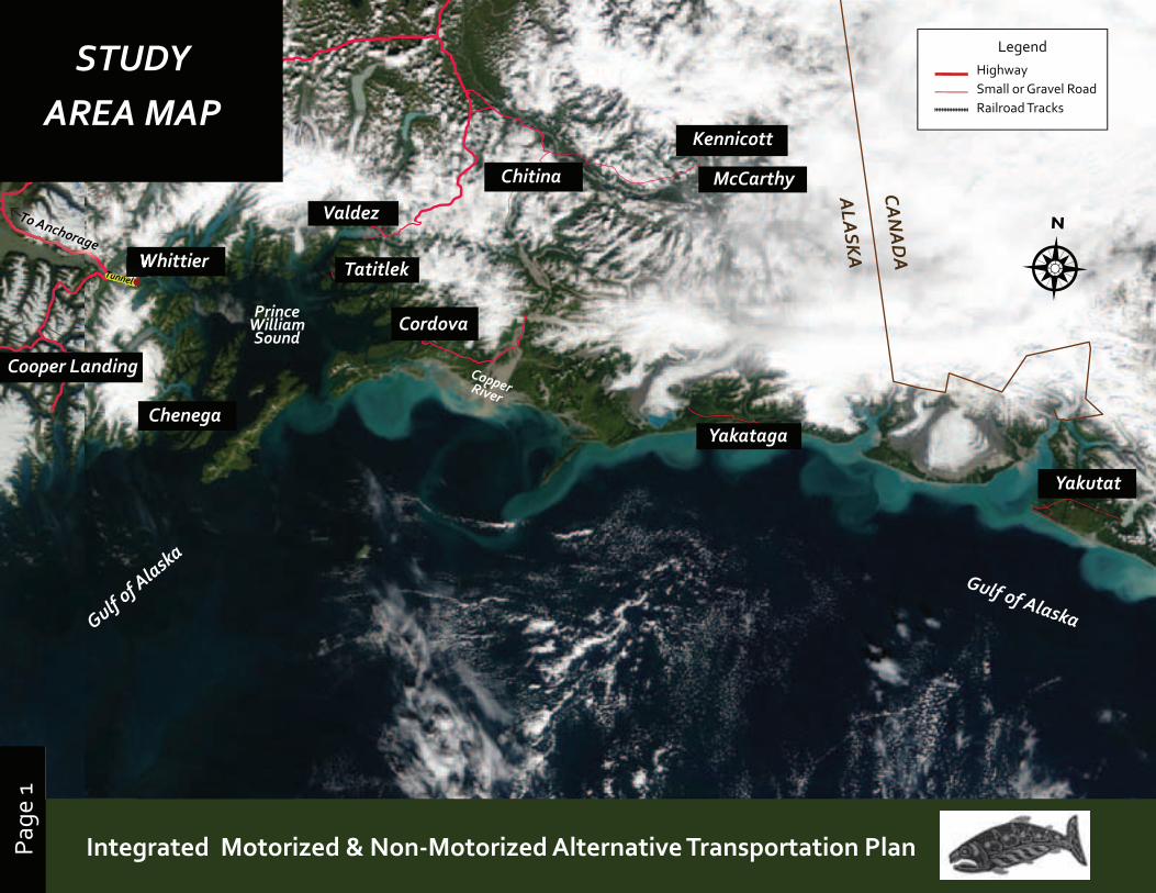
The Native Village of Eyak with headquarters in Cordova, Alaska received a grant from the Federal Transit Administration to develop a comprehensive long range plan for an integrated motorized and non-motorized transportation system. The planning are covers the Gulf of Alaska and Prince William Sound from Yakutat to the Kenai Peninsula and the lower Copper River Watershed. This extensive region includes portions of the Chugach National Forest, Wrangell St. Elias National Park, and the Chugach State Park.
This document outlines the findings of the Alternative Transportation Project, reflecting input and gathered at over a year of meetings and both community and regional levels. The document is organized to help residents, agencies, and transportation planners to picture the planning area as a cohesive region, with strong historical ties and shared needs for coordinated transportation planning. Specifically, Chapter One outlines the study area, purpose, goals and a vision for the future. Chapter Two provides an overview of the region in environmental, social, governmental, cultural and historical terms. Chapter Three describes the existing conditions and carrying capacity of current transportation systems in the region. Chapter Four presents a strategic action plan with projects at both the regional and community level, and Chapter Five outlines short and long term actions focused on strengthening and creating an integrated motorized and non-motorized transportation network for the region.
1. Introduction
“People choose to live here for the quality of life — we enjoy a “small town” feel with world class back country access. Thriving fish and wildlife populations and clean water are critical”
~ Public Comment (Cordova)
Page
3
Prince William Sound | Copper River Watershed Area | Gulf of AlaskaIntegrated Motorized & Non-Motorized Alternative Transportation PlanPage
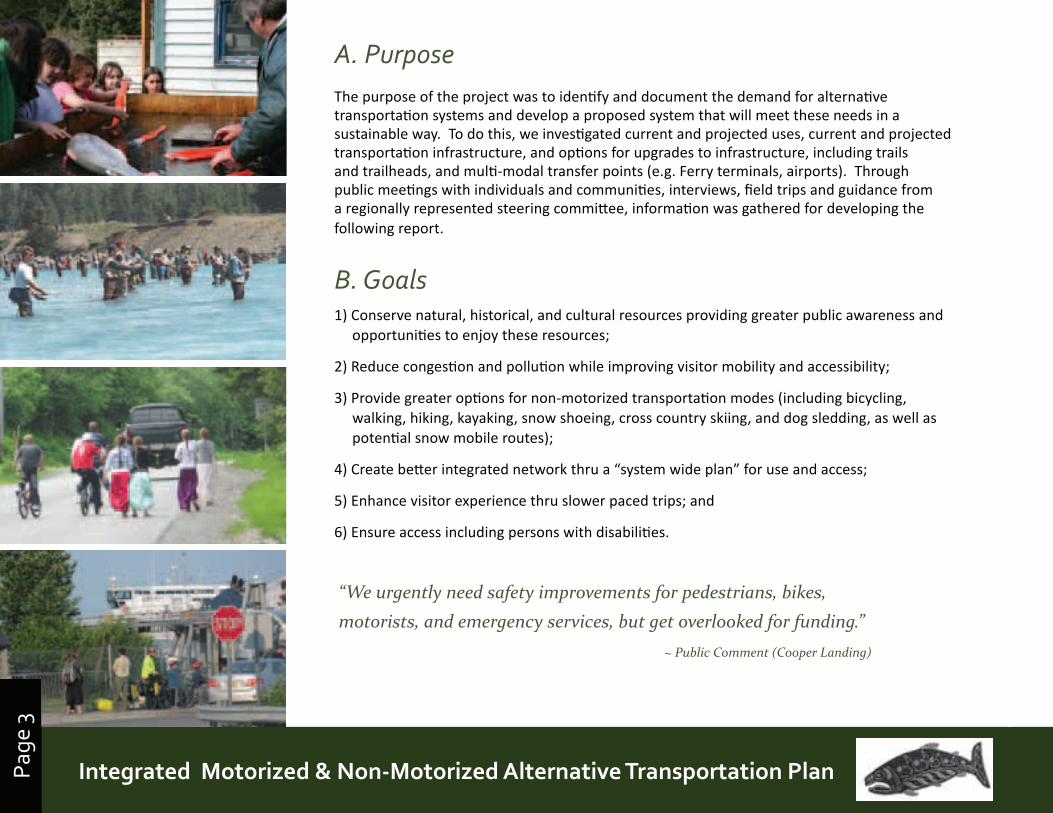
3A. PurposeThe purpose of the project was to identify and document the demand for alternative transportation systems and develop a proposed system that will meet these needs in a sustainable way. To do this, we investigated current and projected uses, current and projected transportation infrastructure, and options for upgrades to infrastructure, including trails and trailheads, and multi-modal transfer points (e.g. Ferry terminals, airports). Through public meetings with individuals and communities, interviews, field trips and guidance from a regionally represented steering committee, information was gathered for developing the following report.
B. Goals1) Conserve natural, historical, and cultural resources providing greater public awareness and
opportunities to enjoy these resources;
2) Reduce congestion and pollution while improving visitor mobility and accessibility;
3) Provide greater options for non-motorized transportation modes (including bicycling, walking, hiking, kayaking, snow shoeing, cross country skiing, and dog sledding, as well as potential snow mobile routes);
4) Create better integrated network thru a “system wide plan” for use and access;
5) Enhance visitor experience thru slower paced trips; and
6) Ensure access including persons with disabilities.
110 Nicholoff Way Cordova, Alaska 99574 • Phone: (907) 424-7738 • Fax: (907) 424-7739
Native Village of Eyak Performs it's Educational Fishery
Each year Native Village of Eyak has an Educational Fishery that is designed toeducate our Tribal youth In the ways of traditional harvest.
Our youth help process the fish. The youth enjoy the fruits of their labor.
Mark King and Pete Villa show the youth how to process fish.
Virginia Lacey enjoys the dinner. (elder)
Dolly Scott enjoys the dinner. (elder)
Thanks to Robert Henrichs, our Tribal president, for facilitating our Educational Fisheryeach year.
Select a photo below to open gallery:
Quick Directory
Archives
Home Services Programs Tribal Council EmploymentNotices
Home | About Us | Tribal Council | Current Events | Eyak Echo | Employment | Staff | Staff Login | Health CenterCultural Center | Photos | Site Map | Webmaster
close
4 of 8 by Unknown
Galleries
Welcome to the Native Village of Eyak http://www.nveyak.com/pages/stories/educationalfisheryphotos.html
1 of 1 11/28/2009 11:55 AM
“We urgently need safety improvements for pedestrians, bikes, motorists, and emergency services, but get overlooked for funding.”
~ Public Comment (Cooper Landing)
Page
4
Prince William Sound | Copper River Watershed Area | Gulf of Alaska
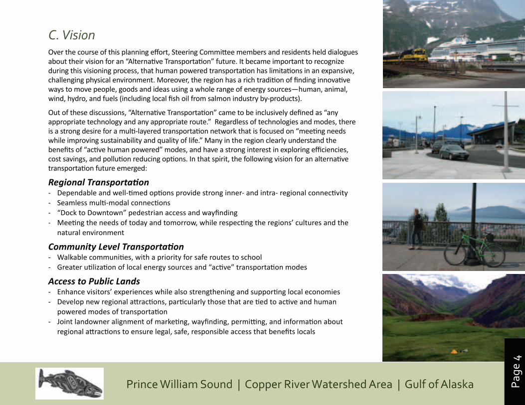
C. VisionOver the course of this planning effort, Steering Committee members and residents held dialogues about their vision for an “Alternative Transportation” future. It became important to recognize during this visioning process, that human powered transportation has limitations in an expansive, challenging physical environment. Moreover, the region has a rich tradition of finding innovative ways to move people, goods and ideas using a whole range of energy sources—human, animal, wind, hydro, and fuels (including local fish oil from salmon industry by-products).
Out of these discussions, “Alternative Transportation” came to be inclusively defined as “any appropriate technology and any appropriate route.” Regardless of technologies and modes, there is a strong desire for a multi-layered transportation network that is focused on “meeting needs while improving sustainability and quality of life.” Many in the region clearly understand the benefits of “active human powered” modes, and have a strong interest in exploring efficiencies, cost savings, and pollution reducing options. In that spirit, the following vision for an alternative transportation future emerged:
Regional Transportation- Dependable and well-timed options provide strong inner- and intra- regional connectivity- Seamless multi-modal connections- “Dock to Downtown” pedestrian access and wayfinding - Meeting the needs of today and tomorrow, while respecting the regions’ cultures and the
natural environment
Community Level Transportation - Walkable communities, with a priority for safe routes to school- Greater utilization of local energy sources and “active” transportation modes
Access to Public Lands- Enhance visitors’ experiences while also strengthening and supporting local economies- Develop new regional attractions, particularly those that are tied to active and human
powered modes of transportation- Joint landowner alignment of marketing, wayfinding, permitting, and information about
regional attractions to ensure legal, safe, responsible access that benefits locals
enhancing visitors’ experiences
Page
5
Prince William Sound | Copper River Watershed Area | Gulf of AlaskaIntegrated Motorized & Non-Motorized Alternative Transportation PlanPage
5
Copper RiverDelta
Gulf of Alaska
Yakutat
Cordova
Valdez
YakatagaChenega
Whittier
KennicottChitina
PhysicalFeatures Map
Cooper Landing
KennicottMcCarthy
Gulf of Alaska
ALA
SKA
CAN
AD
A
N
Tatitlek
To Anchorage
Kennicott
Icy Bay
Yakutat Bay
Icy Bay
Chugach Mountains
ValdezValdez
Chugach Mountains
Wrangell Mountains
St. Elias Mountains
LegendHighwaySmall or Gravel RoadRailroadSettlementTunnel
Whittier
Cooper Cooper Cooper Cooper Cooper LandingLandingLandingLandingLandingLandingCooper
LandingCooper Cooper
LandingCooper Cooper
LandingCooper Cooper
LandingCooper
Chugach Mountains
MalaspinaGlacier
BeringGlacier
Chugach MountainsBagley Ice Field
Kayak Island
Hitchinbrook Island
Montague Island
Prince William Sound
Copper River‘Atna River’
Kenai River
ColumbiaGlacier
Monti Bay (the only sheltered
deep water port in the Gulf of Alaska)
Page
6
Prince William Sound | Copper River Watershed Area | Gulf of Alaska
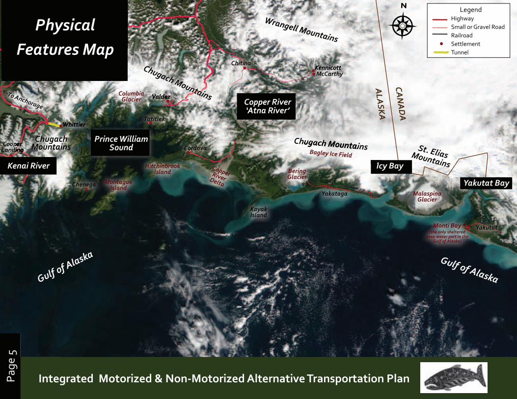
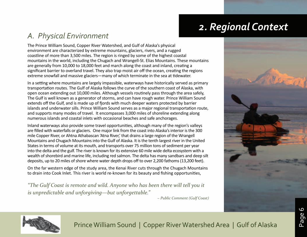
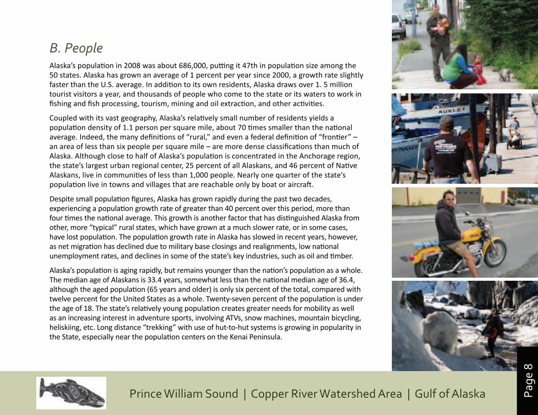
A. Physical EnvironmentThe Prince William Sound, Copper River Watershed, and Gulf of Alaska’s physical environment are characterized by extreme mountains, glaciers, rivers, and a rugged coastline of more than 3,500 miles. The region is ringed by some of the highest coastal mountains in the world, including the Chugach and Wrangell-St. Elias Mountains. These mountains are generally from 10,000 to 18,000 feet and march along the coast and inland, creating a significant barrier to overland travel. They also trap moist air off the ocean, creating the regions extreme snowfall and massive glaciers—many of which terminate in the sea at tidewater.
In a setting where mountains are largely impassible, waterways have historically served as primary transportation routes. The Gulf of Alaska follows the curve of the southern coast of Alaska, with open ocean extending out 10,000 miles. Although vessels routinely pass through the area safely, The Gulf is well known as a generator of storms, and can have rough water. Prince William Sound extends off the Gulf, and is made up of fjords with much deeper waters protected by barrier islands and underwater sills. Prince William Sound serves as a major regional transportation route, and supports many modes of travel. It encompasses 3,000 miles of shoreline extending along numerous islands and coastal inlets with occasional beaches and safe anchorages.
Inland waterways also provide some travel opportunities, although many of the region’s valleys are filled with waterfalls or glaciers. One major link from the coast into Alaska’s interior is the 300 mile Copper River, or Ahtna Athabascan ‘Atna River,’ that drains a large region of the Wrangell Mountains and Chugach Mountains into the Gulf of Alaska. It is the tenth largest river in the United States in terms of volume at its mouth, and transports over 75 million tons of sediment per year into the delta and the gulf. The river is known for its extensive 60 mile wide delta ecosystem with a wealth of shorebird and marine life, including red salmon. The delta has many sandbars and deep silt deposits, up to 20 miles of shore where water depth drops off to over 2,200 fathoms (13,200 feet).
On the far western edge of the study area, the Kenai River cuts through the Chugach Mountains to drain into Cook Inlet. This river is world re-known for its beauty and fishing opportunities,
2. Regional Context
“The Gulf Coast is remote and wild. Anyone who has been there will tell you it is unpredictable and unforgiving—but unforgettable.”
~ Public Comment (Gulf Coast)
Page
7
Prince William Sound | Copper River Watershed Area | Gulf of AlaskaIntegrated Motorized & Non-Motorized Alternative Transportation PlanPage
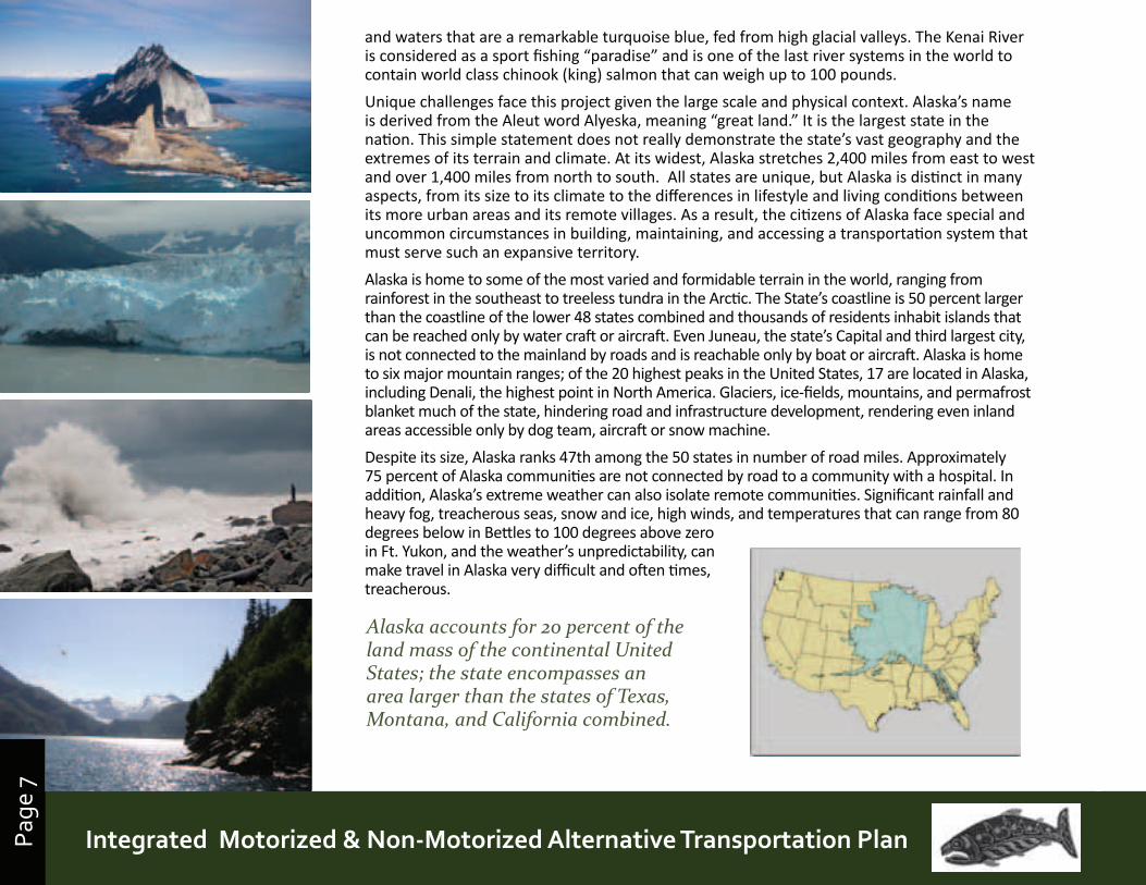
7and waters that are a remarkable turquoise blue, fed from high glacial valleys. The Kenai River is considered as a sport fishing “paradise” and is one of the last river systems in the world to contain world class chinook (king) salmon that can weigh up to 100 pounds.
Unique challenges face this project given the large scale and physical context. Alaska’s name is derived from the Aleut word Alyeska, meaning “great land.” It is the largest state in the nation. This simple statement does not really demonstrate the state’s vast geography and the extremes of its terrain and climate. At its widest, Alaska stretches 2,400 miles from east to west and over 1,400 miles from north to south. All states are unique, but Alaska is distinct in many aspects, from its size to its climate to the differences in lifestyle and living conditions between its more urban areas and its remote villages. As a result, the citizens of Alaska face special and uncommon circumstances in building, maintaining, and accessing a transportation system that must serve such an expansive territory.
Alaska is home to some of the most varied and formidable terrain in the world, ranging from rainforest in the southeast to treeless tundra in the Arctic. The State’s coastline is 50 percent larger than the coastline of the lower 48 states combined and thousands of residents inhabit islands that can be reached only by water craft or aircraft. Even Juneau, the state’s Capital and third largest city, is not connected to the mainland by roads and is reachable only by boat or aircraft. Alaska is home to six major mountain ranges; of the 20 highest peaks in the United States, 17 are located in Alaska, including Denali, the highest point in North America. Glaciers, ice-fields, mountains, and permafrost blanket much of the state, hindering road and infrastructure development, rendering even inland areas accessible only by dog team, aircraft or snow machine.
Despite its size, Alaska ranks 47th among the 50 states in number of road miles. Approximately 75 percent of Alaska communities are not connected by road to a community with a hospital. In addition, Alaska’s extreme weather can also isolate remote communities. Significant rainfall and heavy fog, treacherous seas, snow and ice, high winds, and temperatures that can range from 80 degrees below in Bettles to 100 degrees above zero in Ft. Yukon, and the weather’s unpredictability, can make travel in Alaska very difficult and often times, treacherous.
Alaska accounts for 20 percent of the land mass of the continental United States; the state encompasses an area larger than the states of Texas, Montana, and California combined.
Page
8
Prince William Sound | Copper River Watershed Area | Gulf of Alaska
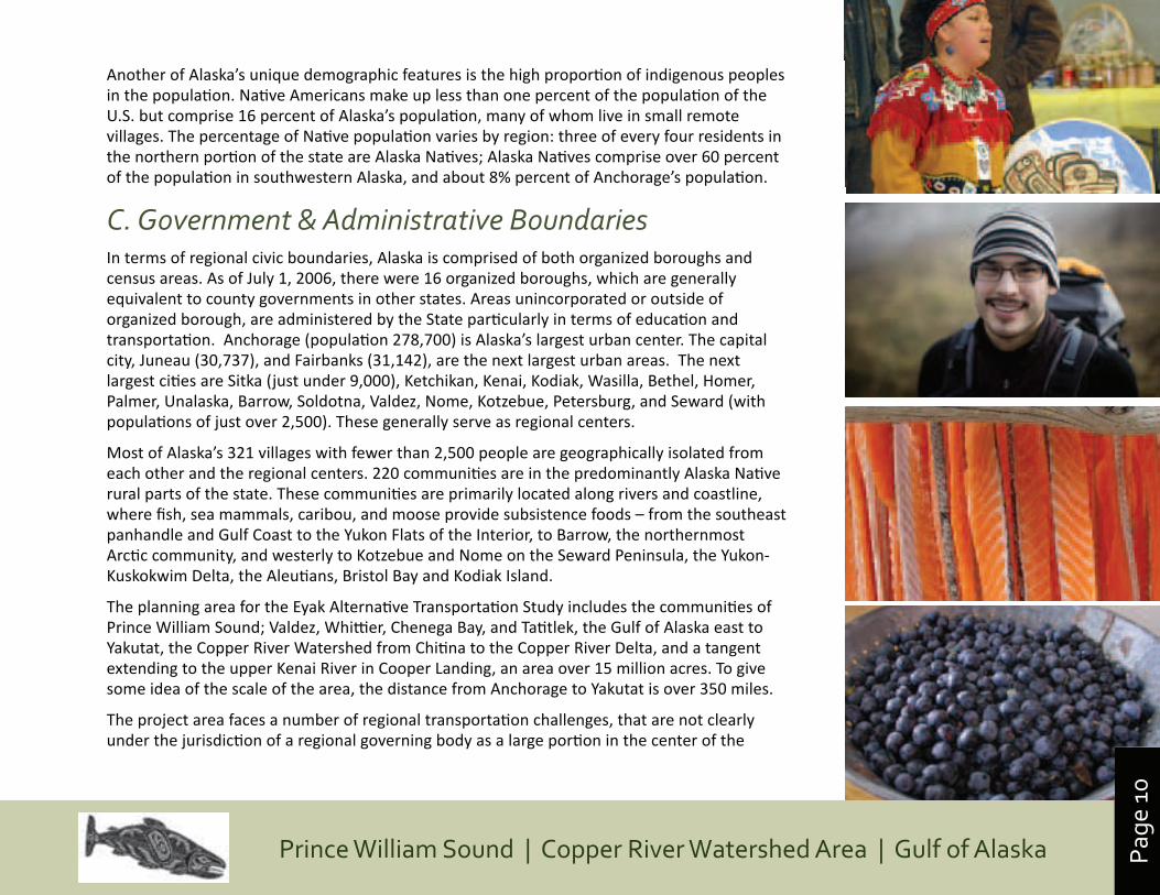
B. PeopleAlaska’s population in 2008 was about 686,000, putting it 47th in population size among the 50 states. Alaska has grown an average of 1 percent per year since 2000, a growth rate slightly faster than the U.S. average. In addition to its own residents, Alaska draws over 1. 5 million tourist visitors a year, and thousands of people who come to the state or its waters to work in fishing and fish processing, tourism, mining and oil extraction, and other activities.
Coupled with its vast geography, Alaska’s relatively small number of residents yields a population density of 1.1 person per square mile, about 70 times smaller than the national average. Indeed, the many definitions of “rural,” and even a federal definition of “frontier” – an area of less than six people per square mile – are more dense classifications than much of Alaska. Although close to half of Alaska’s population is concentrated in the Anchorage region, the state’s largest urban regional center, 25 percent of all Alaskans, and 46 percent of Native Alaskans, live in communities of less than 1,000 people. Nearly one quarter of the state’s population live in towns and villages that are reachable only by boat or aircraft.
Despite small population figures, Alaska has grown rapidly during the past two decades, experiencing a population growth rate of greater than 40 percent over this period, more than four times the national average. This growth is another factor that has distinguished Alaska from other, more “typical” rural states, which have grown at a much slower rate, or in some cases, have lost population. The population growth rate in Alaska has slowed in recent years, however, as net migration has declined due to military base closings and realignments, low national unemployment rates, and declines in some of the state’s key industries, such as oil and timber.
Alaska’s population is aging rapidly, but remains younger than the nation’s population as a whole. The median age of Alaskans is 33.4 years, somewhat less than the national median age of 36.4, although the aged population (65 years and older) is only six percent of the total, compared with twelve percent for the United States as a whole. Twenty-seven percent of the population is under the age of 18. The state’s relatively young population creates greater needs for mobility as well as an increasing interest in adventure sports, involving ATVs, snow machines, mountain bicycling, heliskiing, etc. Long distance “trekking” with use of hut-to-hut systems is growing in popularity in the State, especially near the population centers on the Kenai Peninsula.
Page
9
Prince William Sound | Copper River Watershed Area | Gulf of AlaskaIntegrated Motorized & Non-Motorized Alternative Transportation PlanPage
9
UNANGAZ (ALEUT) VALUES~ Share~ Listen~ Don’t be boastful~ Be kind to other people~ Help others~ Take care of the land~ Take care of the sea/ocean~ Do not do anything to excess~ Be happy~ Behave yourself: Do the things
you know are right~ Don’t steal~ Don’t lie~ Respect Elders (including parents,
teachers, & community members)~ Respect your peers~ Be strong
ATHABASCAN VALUES~ Self sufficiency~ Hard Work ~ Care and provision for the family~ Family relations ~ Unity~ Honor~ Honesty and Fairness~ Love for Children~ Sharing and Caring ~ Village Cooperation~ Responsibility to Village~ Respect for Elders and Others~ Respect for Knowledge~ Wisdom from Life Experiences~ Respect for the Land~ Respect for Nature~ Practice of Traditions ~ Honoring Ancestors
ALUTIIQ CULTURAL VALUES~ Our Elders~ Our heritage language~ Family and the kinship of our ancestors
and living relatives~ Ties to our homeland~ A subsistence lifestyle, respectful of and
sustained by the natural world~ Traditional arts, skills and ingenuity~ Sharing: we welcome everyone ~ Sense of humor~ Learning by doing, observing and
listening ~ Stewardship of the animals, land, sky
and waters~ Trust~ Our people: we are responsible for each
other and ourselves~ Respect for self, others and our
environment is inherent in all these values~ Responsibility to Tribe
SOUTHEAST TRADITIONAL TRIBAL VALUES~ Discipline and Obedience to the
Traditions of our Ancestors~ Respect for Self, Elders and Others~ Respect for Nature and Property ~ Patience~ Pride in Family, Clan and Traditions is
found in Love, Loyalty and Generosity~ Be Strong in Mind, Body and Spirit~ Humor~ Hold Each Other Up~ Listen Well and with Respect~ Speak with Care~ We are Stewards of the Air, Land and Sea~ Reverence for Our Creator~ Live in Peace and Harmony~ Be Strong and Have Courage
The Eyak Region historically sits at the cultural crossroads and has strong ties with Chugach-Alutiiq, Athabascan, and Tlinqit peoples.
Traditional Values of Regional Native Groups
Alaska’s Native Regions
Page
10
Prince William Sound | Copper River Watershed Area | Gulf of Alaska
Another of Alaska’s unique demographic features is the high proportion of indigenous peoples in the population. Native Americans make up less than one percent of the population of the U.S. but comprise 16 percent of Alaska’s population, many of whom live in small remote villages. The percentage of Native population varies by region: three of every four residents in the northern portion of the state are Alaska Natives; Alaska Natives comprise over 60 percent of the population in southwestern Alaska, and about 8% percent of Anchorage’s population.
C. Government & Administrative Boundaries In terms of regional civic boundaries, Alaska is comprised of both organized boroughs and census areas. As of July 1, 2006, there were 16 organized boroughs, which are generally equivalent to county governments in other states. Areas unincorporated or outside of organized borough, are administered by the State particularly in terms of education and transportation. Anchorage (population 278,700) is Alaska’s largest urban center. The capital city, Juneau (30,737), and Fairbanks (31,142), are the next largest urban areas. The next largest cities are Sitka (just under 9,000), Ketchikan, Kenai, Kodiak, Wasilla, Bethel, Homer, Palmer, Unalaska, Barrow, Soldotna, Valdez, Nome, Kotzebue, Petersburg, and Seward (with populations of just over 2,500). These generally serve as regional centers.
Most of Alaska’s 321 villages with fewer than 2,500 people are geographically isolated from each other and the regional centers. 220 communities are in the predominantly Alaska Native rural parts of the state. These communities are primarily located along rivers and coastline, where fish, sea mammals, caribou, and moose provide subsistence foods – from the southeast panhandle and Gulf Coast to the Yukon Flats of the Interior, to Barrow, the northernmost Arctic community, and westerly to Kotzebue and Nome on the Seward Peninsula, the Yukon-Kuskokwim Delta, the Aleutians, Bristol Bay and Kodiak Island.
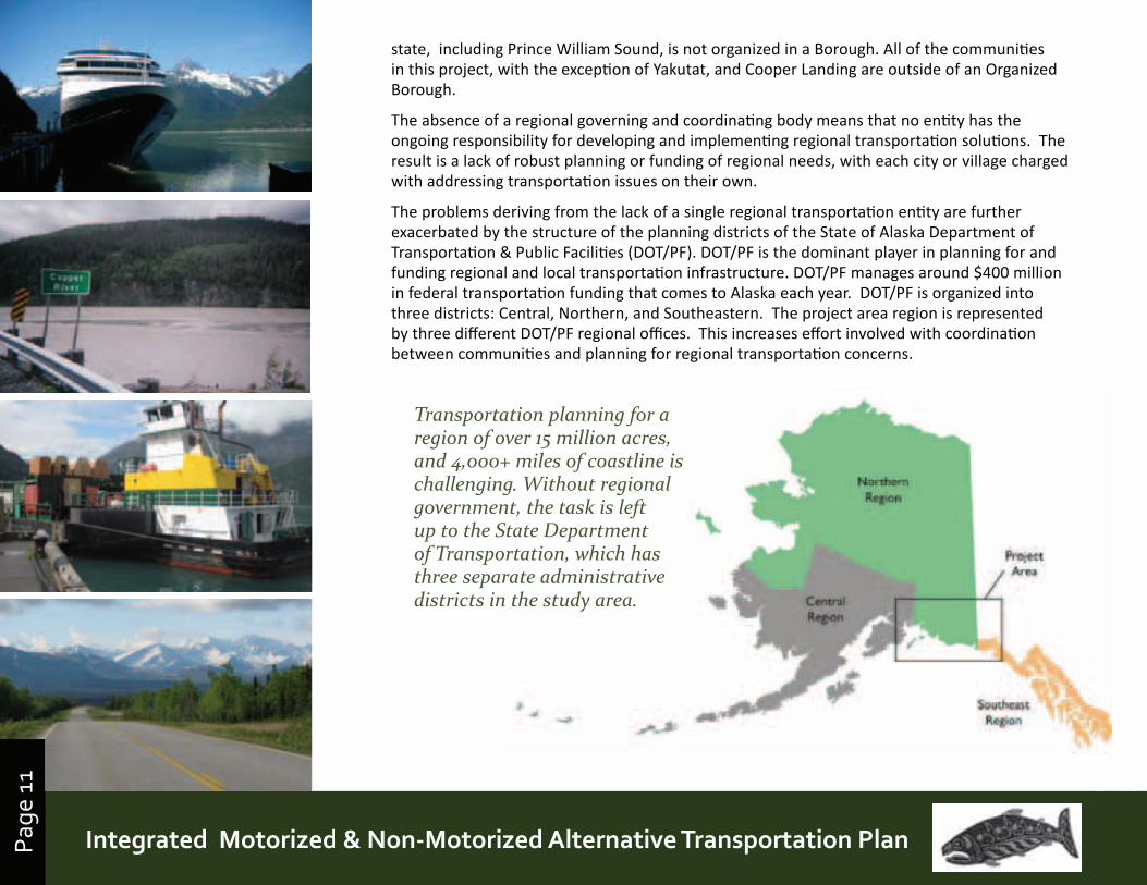
The planning area for the Eyak Alternative Transportation Study includes the communities of Prince William Sound; Valdez, Whittier, Chenega Bay, and Tatitlek, the Gulf of Alaska east to Yakutat, the Copper River Watershed from Chitina to the Copper River Delta, and a tangent extending to the upper Kenai River in Cooper Landing, an area over 15 million acres. To give some idea of the scale of the area, the distance from Anchorage to Yakutat is over 350 miles.
The project area faces a number of regional transportation challenges, that are not clearly under the jurisdiction of a regional governing body as a large portion in the center of the
Page
11
Prince William Sound | Copper River Watershed Area | Gulf of AlaskaIntegrated Motorized & Non-Motorized Alternative Transportation PlanPage
11
state, including Prince William Sound, is not organized in a Borough. All of the communities in this project, with the exception of Yakutat, and Cooper Landing are outside of an Organized Borough.
The absence of a regional governing and coordinating body means that no entity has the ongoing responsibility for developing and implementing regional transportation solutions. The result is a lack of robust planning or funding of regional needs, with each city or village charged with addressing transportation issues on their own.
The problems deriving from the lack of a single regional transportation entity are further exacerbated by the structure of the planning districts of the State of Alaska Department of Transportation & Public Facilities (DOT/PF). DOT/PF is the dominant player in planning for and funding regional and local transportation infrastructure. DOT/PF manages around $400 million in federal transportation funding that comes to Alaska each year. DOT/PF is organized into three districts: Central, Northern, and Southeastern. The project area region is represented by three different DOT/PF regional offices. This increases effort involved with coordination between communities and planning for regional transportation concerns.
Transportation planning for a region of over 15 million acres, and 4,000+ miles of coastline is challenging. Without regional government, the task is left up to the State Department of Transportation, which has three separate administrative districts in the study area.
Page
12
Prince William Sound | Copper River Watershed Area | Gulf of Alaska
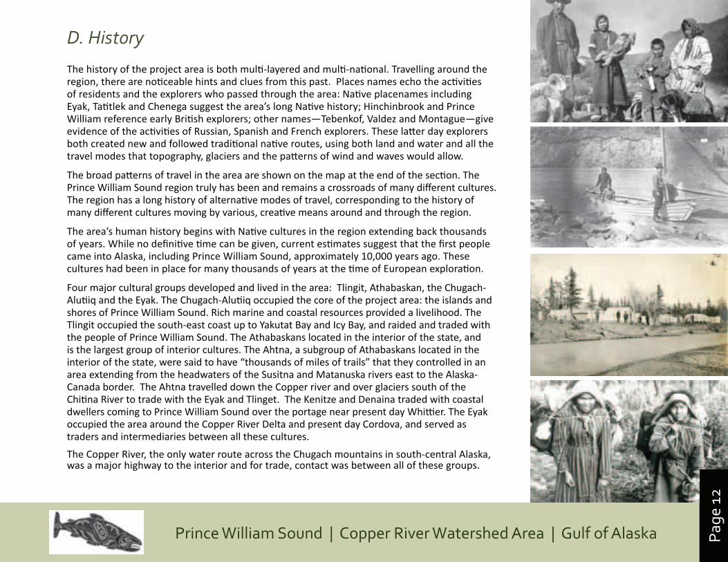
D. History
The history of the project area is both multi-layered and multi-national. Travelling around the region, there are noticeable hints and clues from this past. Places names echo the activities of residents and the explorers who passed through the area: Native placenames including Eyak, Tatitlek and Chenega suggest the area’s long Native history; Hinchinbrook and Prince William reference early British explorers; other names—Tebenkof, Valdez and Montague—give evidence of the activities of Russian, Spanish and French explorers. These latter day explorers both created new and followed traditional native routes, using both land and water and all the travel modes that topography, glaciers and the patterns of wind and waves would allow.
The broad patterns of travel in the area are shown on the map at the end of the section. The Prince William Sound region truly has been and remains a crossroads of many different cultures. The region has a long history of alternative modes of travel, corresponding to the history of many different cultures moving by various, creative means around and through the region.
The area’s human history begins with Native cultures in the region extending back thousands of years. While no definitive time can be given, current estimates suggest that the first people came into Alaska, including Prince William Sound, approximately 10,000 years ago. These cultures had been in place for many thousands of years at the time of European exploration.
Four major cultural groups developed and lived in the area: Tlingit, Athabaskan, the Chugach-Alutiiq and the Eyak. The Chugach-Alutiiq occupied the core of the project area: the islands and shores of Prince William Sound. Rich marine and coastal resources provided a livelihood. The Tlingit occupied the south-east coast up to Yakutat Bay and Icy Bay, and raided and traded with the people of Prince William Sound. The Athabaskans located in the interior of the state, and is the largest group of interior cultures. The Ahtna, a subgroup of Athabaskans located in the interior of the state, were said to have “thousands of miles of trails” that they controlled in an area extending from the headwaters of the Susitna and Matanuska rivers east to the Alaska-Canada border. The Ahtna travelled down the Copper river and over glaciers south of the Chitina River to trade with the Eyak and Tlinget. The Kenitze and Denaina traded with coastal dwellers coming to Prince William Sound over the portage near present day Whittier. The Eyak occupied the area around the Copper River Delta and present day Cordova, and served as traders and intermediaries between all these cultures.
The Copper River, the only water route across the Chugach mountains in south-central Alaska, was a major highway to the interior and for trade, contact was between all of these groups.
Page
13
Prince William Sound | Copper River Watershed Area | Gulf of AlaskaIntegrated Motorized & Non-Motorized Alternative Transportation PlanPage
13
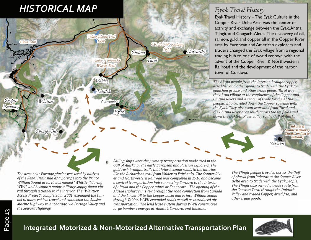
Eyak Travel HistoryEyak Travel History – The Eyak Culture in the Copper River Delta Area was the center of activity and exchange between the Eyak, Ahtna, Tlingit, and Chugach-Aleut. The discovery of oil, salmon, gold, and copper all in the Copper River area by European and American explorers and traders changed the Eyak village from a regional trading hub to one of world renown, with the advent of the Copper River & Northwestern Railroad and the development of the harbor town of Cordova.
Valdez Glacier Trail1898Glenn Trail CR & NW Railway
1911
Valdez
WhittierCooperLanding
Cordova
McCarthy
Yakutat
ChitinaValdez -Fairbanks
Wagon Trail
Valdez Glacier Trail1898Glenn Trail CR & NW Railway
1911
Valdez
WhittierCooperLanding
Cordova
McCarthy
Yakutat
ChitinaValdez -Fairbanks
Wagon Trail
Chenega BayChenega Bay
TatitlekTatitlek
EyakEyak
TaralTaral
HISTORICAL MAP
The area near Portage glacier was used by natives of the Kenai Peninsula as a portage into the Prince William Sound area. It was named “Whittier” during WWII, and became a major military supply depot via rail through a tunnel to the interior. The “Whittier Access Project”, completed in 2001, expanded the tun-nel to allow vehicle travel and connected the Alaska Marine Highway to Anchorage, via Portage Valley and the Seward Highway.
Sailing ships were the primary transportation mode used in the Gulf of Alaska by the early European and Russian explorers. The gold rush brought trails that later became roads to the interior, like the Richardson trail from Valdez to Fairbanks. The Copper Riv-er and Northwestern Railroad was completed in 1910 and became a central transportation hub connecting Cordova to the Interior of Alaska and the Copper mines at Kennecott . The opening of the Alaska Highway in 1947 brought the road connection from Canada and the Lower 48 to the Copper basin and Prince William Sound through Valdez. WWII expanded roads as well as introduced air transportation. The lend lease system during WWII constructed large bomber runways at Yakutat, Cordova, and Gulkana.
The Ahtna people from the Interior, brought copper, dried �ish and other goods to trade with the Eyak for eulachon grease and other trade goods. Taral was the Ahtna village at the con�luence of the Copper and Chitina Rivers and a center of trade for the Ahtna people, who traveled down the Copper to trade with the Eyak. They also went over land from Taral and the Chitina River area south across the ice �ields and down the Duktoth River valley to the Gulf of Alaska.
The Tlingit people traveled across the Gulf of Alaska from Yakutat to the Copper River Delta area to trade with the Eyak people. The Tlingit also owned a trade route from the Coast to Taral through the Duktoth Valley and traded Copper, dried �ish, and other trade goods.
Yakutat & Southern Railway (Situk Landing to
Yakutat)
Page
14
Prince William Sound | Copper River Watershed Area | Gulf of Alaska
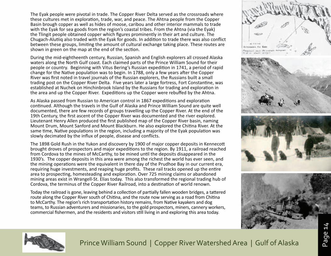
The Eyak people were pivotal in trade. The Copper River Delta served as the crossroads where these cultures met in exploration, trade, war, and peace. The Ahtna people from the Copper Basin brough copper as well as hides of moose, caribou and other interior mammals to trade with the Eyak for sea goods from the region’s coastal tribes. From the Ahtna (via the Eyak) the Tlingit people obtained copper which figures prominently in their art and culture. The Chugach-Alutiiq also traded with the Eyak for goods. In addition to trade there was also conflict between these groups, limiting the amount of cultural exchange taking place. These routes are shown in green on the map at the end of the section.
During the mid-eightheenth century, Russian, Spanish and English explorers all crossed Alaska waters along the North Gulf coast. Each claimed parts of the Prince William Sound for their people or country. Beginning with Vitus Bering’s Russian expedition in 1741, a period of rapid change for the Native population was to begin. In 1788, only a few years after the Copper River was first noted in travel journals of the Russian explorers, the Russians built a small trading post on the Copper River Delta. Five years later a large fortress, Fort Constantine, was established at Nuchek on Hinchinbrook Island by the Russians for trading and exploration in the area and up the Copper River. Expeditions up the Copper were rebuffed by the Ahtna.
As Alaska passed from Russian to American control in 1867 expeditions and exploration continued. Although the travels in the Gulf of Alaska and Prince William Sound are quite well documented, there are few records of groups travelling up the Copper River. At the end of the 19th Century, the first ascent of the Copper River was documented and the river explored. Lieutenant Henry Allen produced the first published map of the Copper River basin, naming Mount Drum, Mount Sanford and Mount Blackburn. He also explored the Chitina River. At the same time, Native populations in the region, including a majority of the Eyak population was slowly decimated by the influx of people, disease and conflicts.
The 1898 Gold Rush in the Yukon and discovery by 1900 of major copper deposits in Kennecott brought droves of prospectors and major expeditions to the region. By 1911, a railroad reached from Cordova to the mines of McCarthy, to be mined until the deposits disappeared in the 1930’s. The copper deposits in this area were among the richest the world has ever seen, and the mining operations were the equivalent in there day of the Prudhoe Bay in our current era, requiring huge investments, and reaping huge profits. These rail tracks opened up the entire area to prospecting, homesteading and exploration. Over 725 mining claims or abandoned mining areas exist in Wrangell-St. Elias today. This also transformed the regional trading hub of Cordova, the terminus of the Copper River Railroad, into a destination of world renown.
Today the railroad is gone, leaving behind a collection of partially fallen wooden bridges, a tattered route along the Copper River south of Chitina, and the route now serving as a road from Chitina to McCarthy. The region’s rich transportation history remains, from Native kayakers and dog teams, to Russian adventurers and missionaries, to the gold prospectors, miners, cannery workers, commercial fishermen, and the residents and visitors still living in and exploring this area today.
Page
15
Prince William Sound | Copper River Watershed Area | Gulf of AlaskaIntegrated Motorized & Non-Motorized Alternative Transportation PlanPage
15
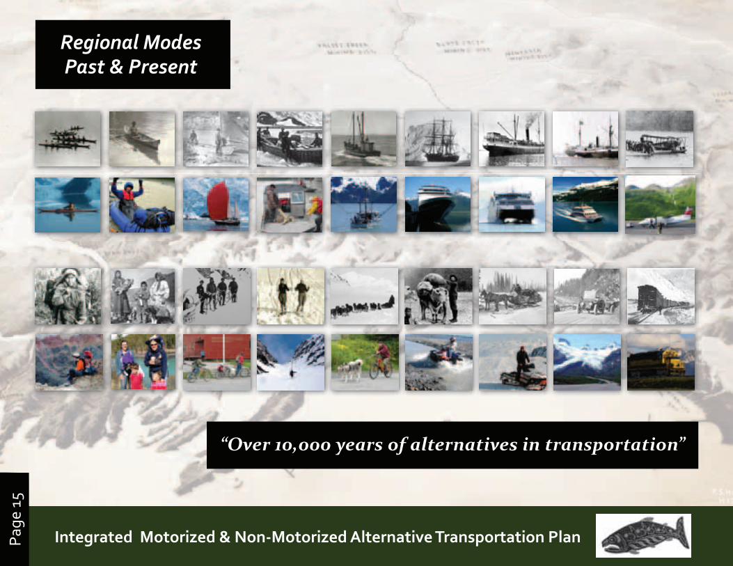
Regional Modes Past & Present
“Over 10,000 years of alternatives in transportation”
Page
16
Prince William Sound | Copper River Watershed Area | Gulf of Alaska
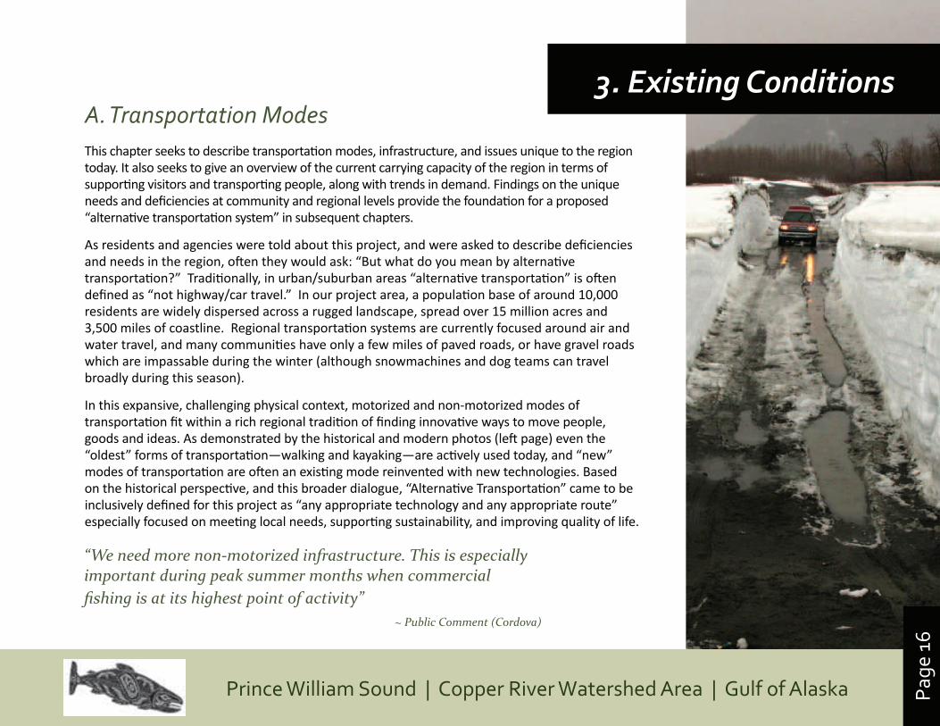
A. Transportation ModesThis chapter seeks to describe transportation modes, infrastructure, and issues unique to the region today. It also seeks to give an overview of the current carrying capacity of the region in terms of supporting visitors and transporting people, along with trends in demand. Findings on the unique needs and deficiencies at community and regional levels provide the foundation for a proposed “alternative transportation system” in subsequent chapters.
As residents and agencies were told about this project, and were asked to describe deficiencies and needs in the region, often they would ask: “But what do you mean by alternative transportation?” Traditionally, in urban/suburban areas “alternative transportation” is often defined as “not highway/car travel.” In our project area, a population base of around 10,000 residents are widely dispersed across a rugged landscape, spread over 15 million acres and 3,500 miles of coastline. Regional transportation systems are currently focused around air and water travel, and many communities have only a few miles of paved roads, or have gravel roads which are impassable during the winter (although snowmachines and dog teams can travel broadly during this season).
In this expansive, challenging physical context, motorized and non-motorized modes of transportation fit within a rich regional tradition of finding innovative ways to move people, goods and ideas. As demonstrated by the historical and modern photos (left page) even the “oldest” forms of transportation—walking and kayaking—are actively used today, and “new” modes of transportation are often an existing mode reinvented with new technologies. Based on the historical perspective, and this broader dialogue, “Alternative Transportation” came to be inclusively defined for this project as “any appropriate technology and any appropriate route” especially focused on meeting local needs, supporting sustainability, and improving quality of life.
3. Existing Conditions
“We need more non-motorized infrastructure. This is especially important during peak summer months when commercial fishing is at its highest point of activity”
~ Public Comment (Cordova)
Page
17
Prince William Sound | Copper River Watershed Area | Gulf of AlaskaIntegrated Motorized & Non-Motorized Alternative Transportation PlanPage
17
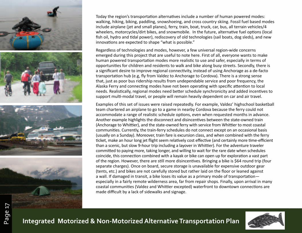
Today the region’s transportation alternatives include a number of human powered modes: walking, hiking, biking, paddling, snowshoeing, and cross country skiing. Fossil fuel based modes include airplane (jet and small planes), ferry, train, boat, truck, car, bus, all terrain vehicles/4 wheelers, motorcycles/dirt bikes, and snowmobile. In the future, alternative fuel options (local fish oil, hydro and tidal power), rediscovery of old technologies (sail boats, dog sleds), and new innovations are expected to shape “what is possible.”
Regardless of technologies and modes, however, a few universal region-wide concerns emerged during this project that are useful to note here. First of all, everyone wants to make human powered transportation modes more realistic to use and safer, especially in terms of opportunities for children and residents to walk and bike along busy streets. Secondly, there is a significant desire to improve regional connectivity, instead of using Anchorage as a de-facto transportation hub (e.g, fly from Valdez to Anchorage to Cordova). There is a strong sense that, just as poor bus ridership results from undependable service and poor frequency, the Alaska Ferry and connecting modes have not been operating with specific attention to local needs. Realistically, regional modes need better schedule synchronicity and added incentives to support multi-modal travel, or people will remain heavily dependent on car and air travel.
Examples of this set of issues were raised repeatedly. For example, Valdez’ highschool basketball team chartered an airplane to go to a game in nearby Cordova because the ferry could not accommodate a range of realistic schedule options, even when requested months in advance. Another example highlights the disconnect and disincentives between the state-owned train (Anchorage to Whittier), and the state-owned ferry with service from Whittier to most coastal communities. Currently, the train-ferry schedules do not connect except on an occasional basis (usually on a Sunday). Moreover, train fare is excursion class, and when combined with the ferry ticket, make an hour long jet flight seem relatively cost effective (and certainly more time-efficient than a scenic, but slow 9-hour trip including a layover in Whittier). For the adventure traveler committed to paying more, taking longer, and willing to wait for the rare date when schedules coincide, this connection combined with a kayak or bike can open up for exploration a vast part of the region. However, there are still more disincentives. Bringing a bike is $64 round trip (four separate charges). Once on board, secure storage is unavailable for expensive outdoor gear (tents, etc.) and bikes are not carefully stored but rather laid on the floor or leaned against a wall. If damaged in transit, a bike loses its value as a primary mode of transportation— especially in a fairly remote wilderness area, far from repair shops. Finally, upon arrival in many coastal communities (Valdez and Whittier excepted) waterfront to downtown connections are made difficult by a lack of sidewalks and signage.
Page
18
Prince William Sound | Copper River Watershed Area | Gulf of Alaska
B. Destinations & Jumping-Off PointsA map following on page 19 provides an overview of the existing transportation system and the regional modes that serve each community. Within this region is a vast expanse of millions of acres of roadless, largely wild terrain predominantly in public ownership. The public lands include world-famous parks and visitor destinations including portions of the Chugach National Forest (5.4 million acres), Wrangell St. Elias National Park & Preserve (8.3 million acres) and a sliver of the Tongass National Forest near Yakutat. Additionally, there are thirty other designated public parks, recreational sites and use areas in the region, listed to the right.
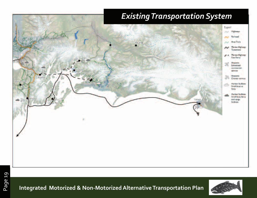
Within this large area, small communities and inholdings of Native Alaskan entitlement and other private lands are distributed in pockets. At present, significant differences exist in access and mobility within the project area’s communities. Whittier, Valdez, Chitina and Cooper Landing all have direct connections to highways. Whittier, Valdez, Yakutat and Chenega are served, to very different degrees, by the ferries of the Alaska Marine Highway System (AMHS). Valdez, Cordova and Yakutat have scheduled daily commercial air service; other communities can be reached by commercial air taxi, charter, or private planes. Whittier is linked to the Alaska Railroad. With the very rare exception of hardy backcountry adventurers, Yakutat, Cordova, Tatitlek and Chenega Bay are only accessible by air or by water, including the via the Marine Highway System, however Tatitlek has a port inadequate for Chenega, the fast ferry, and so during the heavier summer travel season is often more isolated and inaccessible.
In terms of accessing back-country, the vast coastline and most of the waterways in the region are navigable, and are fully open for public, including the beaches and river banks up to the mean high tide, or ordinary high water mark. For the Prince William Sound, Copper River, and Gulf Coast typical modes of access include use of the Ferry or air travel to communities, and coastal exploration by private boat (motorized and non), cruise ship, kayak and floatplane. Recent design improvements in packraft and folding mountain bikes have also increased the accessibility of coastal areas using these new modes, and a number of adventurers have completed exploration and circumnavigation of the entire coast and beyond.
Inland back-country areas can be explored by bush plane, snowmachine, ATV, skis, snowshoes or on foot. Major gateways, or jumping off points for visitors exploring the area include Yakutat (jet and ferry service), Valdez (jet service/road/boat/ferry), Whittier (road/train/boat/ferry), Chitina (road/boat), and Cooper Landing (road/boat).
Gulf of Alaska / “Lost Coast”- Wrangell St. Elias National Park & Preserve- Tongass National Forest- Glacier Bay National Park and Preserve- Yakataga State Game Refuge- Russel Fiord Wilderness
Prince William Sound Area:- Chugach National Forest- Chugach State Park- Bettles Bay State Marine Park- Blueberry Lake State Recreation Site- Boswell Bay State Marine Park- Canoe Passage State Marine Park- Decision Point State Marine Park- Entry Cove State Marine Park- Granite Bay State Marine Park- Horseshoe Bay State Marine Park- Jack Bay State Marine Park- Kayak Island State Marine Park- Sawmill Bay State Marine Park- Shoup Bay State Marine Park- Shoup Glacier State Marine Park- South Esther Island State Marine Park- Surprise Cove State Marine Park- Surprise Ridge State Marine Park- Worthington Glacier State Recreation Site- Zeigler Cove State Marine Park
Copper River Area- Chugach National Forest- USFS Child’s Glacier Recreation Area- State-Owned Copper River Rail Right-of Way
(unmaintained easement with some trail use, especially from Chitina to Haley Creek for Alaska resident dipnetting)
- Wrangell St. Elias National Park & Preserve - Kennicott Mines national Historic Landmark- Copper River Delta Critical Habitat Area
Eastern Kenai PeninsulaChugach National ForestKenai River Special Management Area Kenai Fjords National ParkKenai National Wildlife Refuge
Public Parks & Lands in the Study Area
Page
19
Prince William Sound | Copper River Watershed Area | Gulf of AlaskaIntegrated Motorized & Non-Motorized Alternative Transportation PlanPage
19
Existing Transportation System
Page
20
Prince William Sound | Copper River Watershed Area | Gulf of Alaska
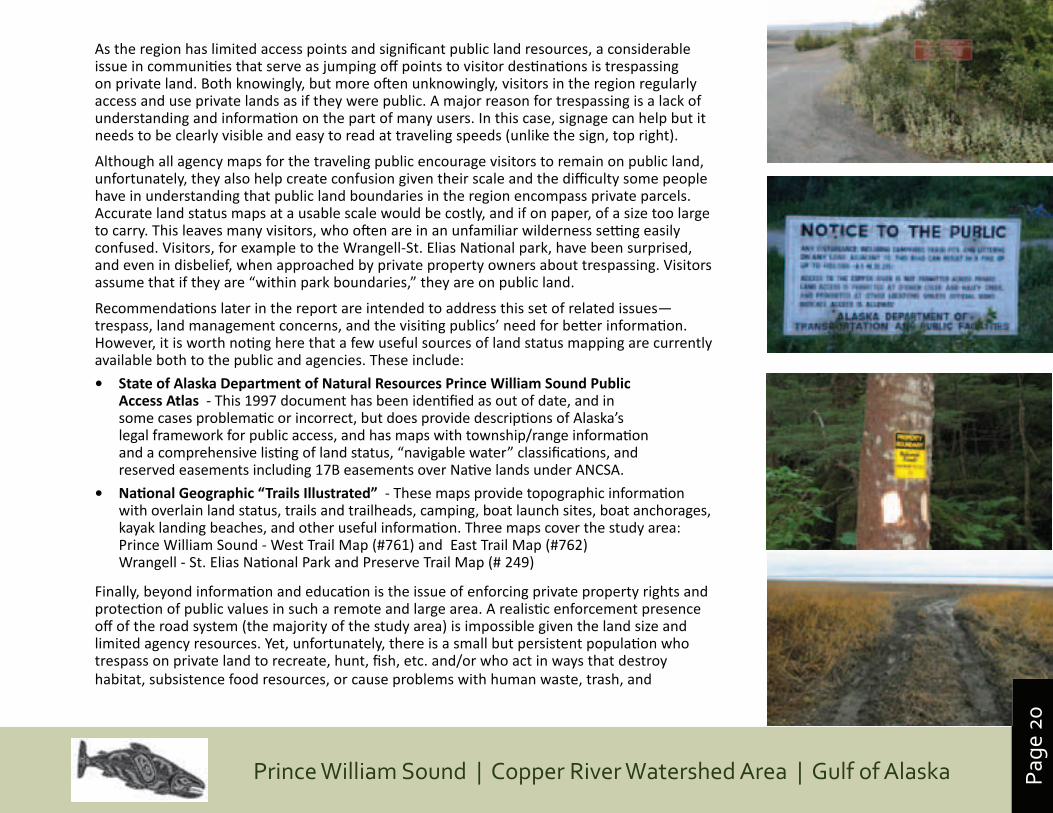
As the region has limited access points and significant public land resources, a considerable issue in communities that serve as jumping off points to visitor destinations is trespassing on private land. Both knowingly, but more often unknowingly, visitors in the region regularly access and use private lands as if they were public. A major reason for trespassing is a lack of understanding and information on the part of many users. In this case, signage can help but it needs to be clearly visible and easy to read at traveling speeds (unlike the sign, top right).
Although all agency maps for the traveling public encourage visitors to remain on public land, unfortunately, they also help create confusion given their scale and the difficulty some people have in understanding that public land boundaries in the region encompass private parcels. Accurate land status maps at a usable scale would be costly, and if on paper, of a size too large to carry. This leaves many visitors, who often are in an unfamiliar wilderness setting easily confused. Visitors, for example to the Wrangell-St. Elias National park, have been surprised, and even in disbelief, when approached by private property owners about trespassing. Visitors assume that if they are “within park boundaries,” they are on public land.
Recommendations later in the report are intended to address this set of related issues—trespass, land management concerns, and the visiting publics’ need for better information. However, it is worth noting here that a few useful sources of land status mapping are currently available both to the public and agencies. These include:
• StateofAlaskaDepartmentofNaturalResourcesPrinceWilliamSoundPublicAccessAtlas - This 1997 document has been identified as out of date, and in some cases problematic or incorrect, but does provide descriptions of Alaska’s legal framework for public access, and has maps with township/range information and a comprehensive listing of land status, “navigable water” classifications, and reserved easements including 17B easements over Native lands under ANCSA.
• NationalGeographic“TrailsIllustrated” - These maps provide topographic information with overlain land status, trails and trailheads, camping, boat launch sites, boat anchorages, kayak landing beaches, and other useful information. Three maps cover the study area:Prince William Sound - West Trail Map (#761) and East Trail Map (#762)Wrangell - St. Elias National Park and Preserve Trail Map (# 249)
Finally, beyond information and education is the issue of enforcing private property rights and protection of public values in such a remote and large area. A realistic enforcement presence off of the road system (the majority of the study area) is impossible given the land size and limited agency resources. Yet, unfortunately, there is a small but persistent population who trespass on private land to recreate, hunt, fish, etc. and/or who act in ways that destroy habitat, subsistence food resources, or cause problems with human waste, trash, and
Page
21
Prince William Sound | Copper River Watershed Area | Gulf of AlaskaIntegrated Motorized & Non-Motorized Alternative Transportation PlanPage
21
destructive acts to infrastructure and lands. One major concern heard from public input in this study is that extending motorized access in remote Alaska settings can extend and enable damage to both private and public lands.
C. Carrying CapacityThis section looks at the current carrying capacity of the region in terms of supporting visitors and transporting people, and then looks at the existing infrastructure in terms of visitor numbers, demand for specific modes of travel, and deficiencies.
Carrying capacity is a particularly useful way of looking at the region because visiting populations can exponentially dwarf the existing population—making it a challenge to provide adequate services, and protect the quality of both the experience and the natural environment. For the purposes of this study, carrying capacity is defined as the ability of an area to support demands for transportation and access to the natural environment.
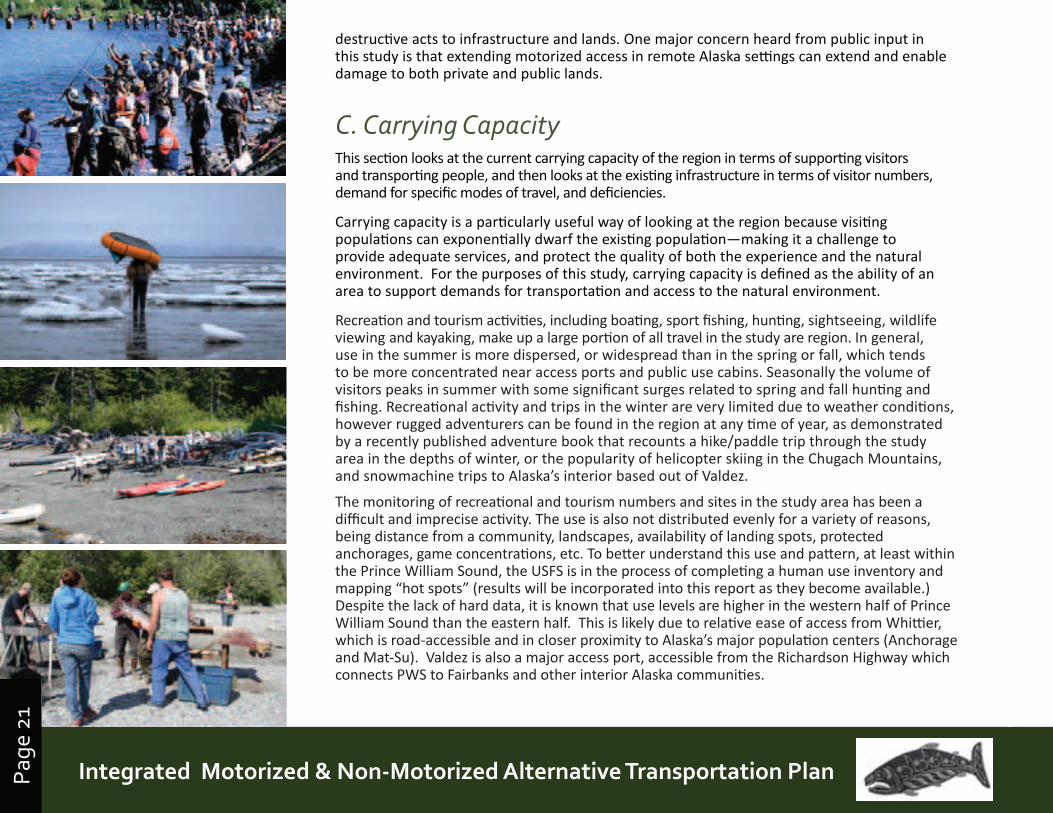
Recreation and tourism activities, including boating, sport fishing, hunting, sightseeing, wildlife viewing and kayaking, make up a large portion of all travel in the study are region. In general, use in the summer is more dispersed, or widespread than in the spring or fall, which tends to be more concentrated near access ports and public use cabins. Seasonally the volume of visitors peaks in summer with some significant surges related to spring and fall hunting and fishing. Recreational activity and trips in the winter are very limited due to weather conditions, however rugged adventurers can be found in the region at any time of year, as demonstrated by a recently published adventure book that recounts a hike/paddle trip through the study area in the depths of winter, or the popularity of helicopter skiing in the Chugach Mountains, and snowmachine trips to Alaska’s interior based out of Valdez.
The monitoring of recreational and tourism numbers and sites in the study area has been a difficult and imprecise activity. The use is also not distributed evenly for a variety of reasons, being distance from a community, landscapes, availability of landing spots, protected anchorages, game concentrations, etc. To better understand this use and pattern, at least within the Prince William Sound, the USFS is in the process of completing a human use inventory and mapping “hot spots” (results will be incorporated into this report as they become available.) Despite the lack of hard data, it is known that use levels are higher in the western half of Prince William Sound than the eastern half. This is likely due to relative ease of access from Whittier, which is road-accessible and in closer proximity to Alaska’s major population centers (Anchorage and Mat-Su). Valdez is also a major access port, accessible from the Richardson Highway which connects PWS to Fairbanks and other interior Alaska communities.
Page
22
Prince William Sound | Copper River Watershed Area | Gulf of Alaska
Within this large study area with significant public lands, human uses become surprising concentrated around a limited number jumping off points, access routes, and infrastructure like USFS and State of Alaska cabins. Designated areas and key destinations such as glaciers in small bays, wildlife areas, key fishing locations, and State Marine Parks also increase and can concentrate human use. This reality causes peak visitor season overloads and a whole number of issues and concerns for communities which will be addressed, by community, in an order that roughly corresponds to the magnitude of visitor numbers and related carrying capacity overload issues.
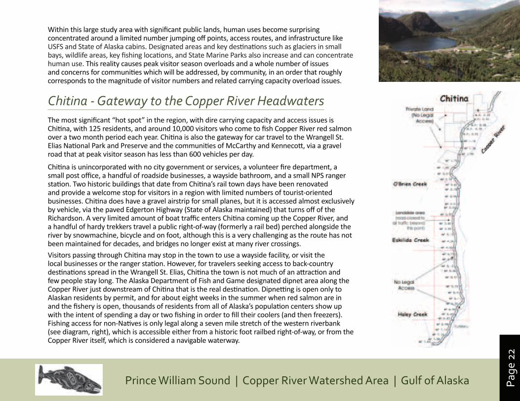
Chitina - Gateway to the Copper River HeadwatersThe most significant “hot spot” in the region, with dire carrying capacity and access issues is Chitina, with 125 residents, and around 10,000 visitors who come to fish Copper River red salmon over a two month period each year. Chitina is also the gateway for car travel to the Wrangell St. Elias National Park and Preserve and the communities of McCarthy and Kennecott, via a gravel road that at peak visitor season has less than 600 vehicles per day.
Chitina is unincorporated with no city government or services, a volunteer fire department, a small post office, a handful of roadside businesses, a wayside bathroom, and a small NPS ranger station. Two historic buildings that date from Chitina’s rail town days have been renovated and provide a welcome stop for visitors in a region with limited numbers of tourist-oriented businesses. Chitina does have a gravel airstrip for small planes, but it is accessed almost exclusively by vehicle, via the paved Edgerton Highway (State of Alaska maintained) that turns off of the Richardson. A very limited amount of boat traffic enters Chitina coming up the Copper River, and a handful of hardy trekkers travel a public right-of-way (formerly a rail bed) perched alongside the river by snowmachine, bicycle and on foot, although this is a very challenging as the route has not been maintained for decades, and bridges no longer exist at many river crossings.
Visitors passing through Chitina may stop in the town to use a wayside facility, or visit the local businesses or the ranger station. However, for travelers seeking access to back-country destinations spread in the Wrangell St. Elias, Chitina the town is not much of an attraction and few people stay long. The Alaska Department of Fish and Game designated dipnet area along the Copper River just downstream of Chitina that is the real destination. Dipnetting is open only to Alaskan residents by permit, and for about eight weeks in the summer when red salmon are in and the fishery is open, thousands of residents from all of Alaska’s population centers show up with the intent of spending a day or two fishing in order to fill their coolers (and then freezers). Fishing access for non-Natives is only legal along a seven mile stretch of the western riverbank (see diagram, right), which is accessible either from a historic foot railbed right-of-way, or from the Copper River itself, which is considered a navigable waterway.
Page
23
Prince William Sound | Copper River Watershed Area | Gulf of AlaskaIntegrated Motorized & Non-Motorized Alternative Transportation PlanPage
23
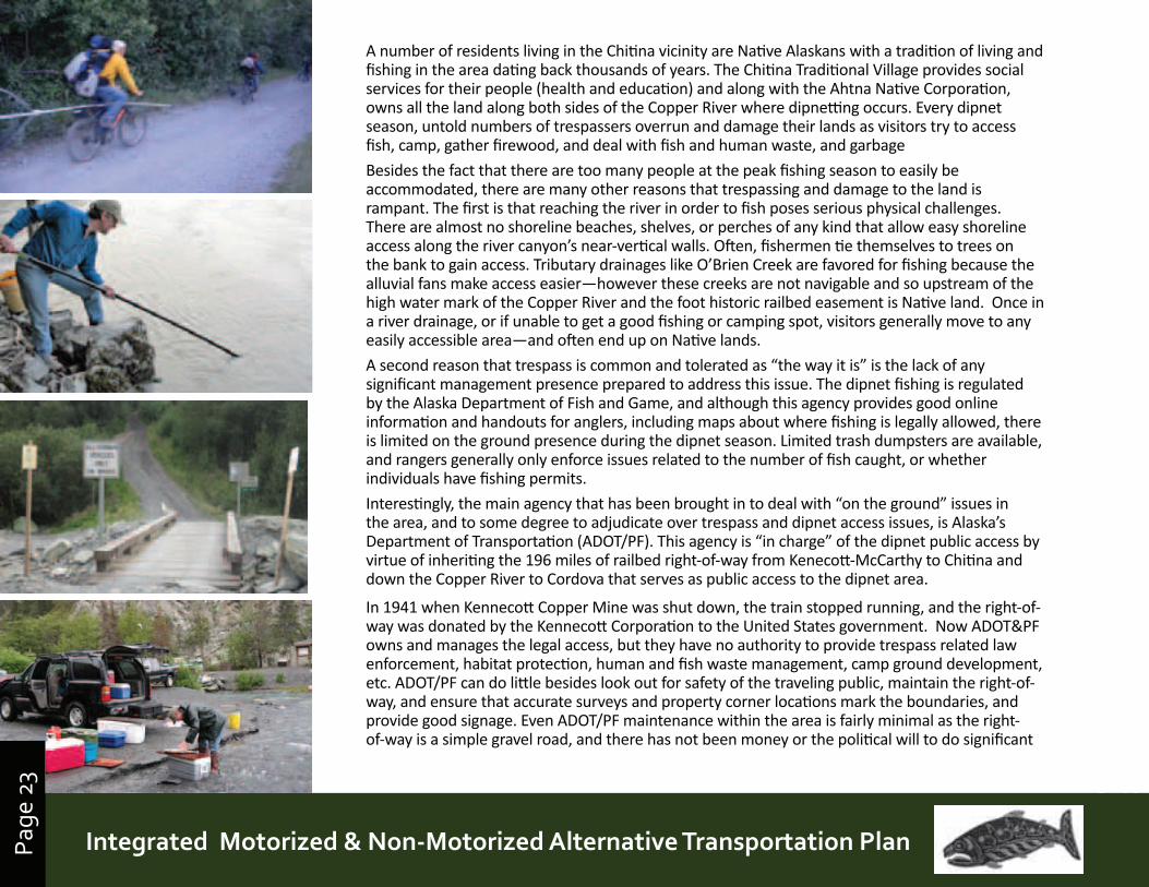
A number of residents living in the Chitina vicinity are Native Alaskans with a tradition of living and fishing in the area dating back thousands of years. The Chitina Traditional Village provides social services for their people (health and education) and along with the Ahtna Native Corporation, owns all the land along both sides of the Copper River where dipnetting occurs. Every dipnet season, untold numbers of trespassers overrun and damage their lands as visitors try to access fish, camp, gather firewood, and deal with fish and human waste, and garbage
Besides the fact that there are too many people at the peak fishing season to easily be accommodated, there are many other reasons that trespassing and damage to the land is rampant. The first is that reaching the river in order to fish poses serious physical challenges. There are almost no shoreline beaches, shelves, or perches of any kind that allow easy shoreline access along the river canyon’s near-vertical walls. Often, fishermen tie themselves to trees on the bank to gain access. Tributary drainages like O’Brien Creek are favored for fishing because the alluvial fans make access easier—however these creeks are not navigable and so upstream of the high water mark of the Copper River and the foot historic railbed easement is Native land. Once in a river drainage, or if unable to get a good fishing or camping spot, visitors generally move to any easily accessible area—and often end up on Native lands.
A second reason that trespass is common and tolerated as “the way it is” is the lack of any significant management presence prepared to address this issue. The dipnet fishing is regulated by the Alaska Department of Fish and Game, and although this agency provides good online information and handouts for anglers, including maps about where fishing is legally allowed, there is limited on the ground presence during the dipnet season. Limited trash dumpsters are available, and rangers generally only enforce issues related to the number of fish caught, or whether individuals have fishing permits.
Interestingly, the main agency that has been brought in to deal with “on the ground” issues in the area, and to some degree to adjudicate over trespass and dipnet access issues, is Alaska’s Department of Transportation (ADOT/PF). This agency is “in charge” of the dipnet public access by virtue of inheriting the 196 miles of railbed right-of-way from Kenecott-McCarthy to Chitina and down the Copper River to Cordova that serves as public access to the dipnet area.
In 1941 when Kennecott Copper Mine was shut down, the train stopped running, and the right-of-way was donated by the Kennecott Corporation to the United States government. Now ADOT&PF owns and manages the legal access, but they have no authority to provide trespass related law enforcement, habitat protection, human and fish waste management, camp ground development, etc. ADOT/PF can do little besides look out for safety of the traveling public, maintain the right-of-way, and ensure that accurate surveys and property corner locations mark the boundaries, and provide good signage. Even ADOT/PF maintenance within the area is fairly minimal as the right-of-way is a simple gravel road, and there has not been money or the political will to do significant
Page
24
Prince William Sound | Copper River Watershed Area | Gulf of Alaska
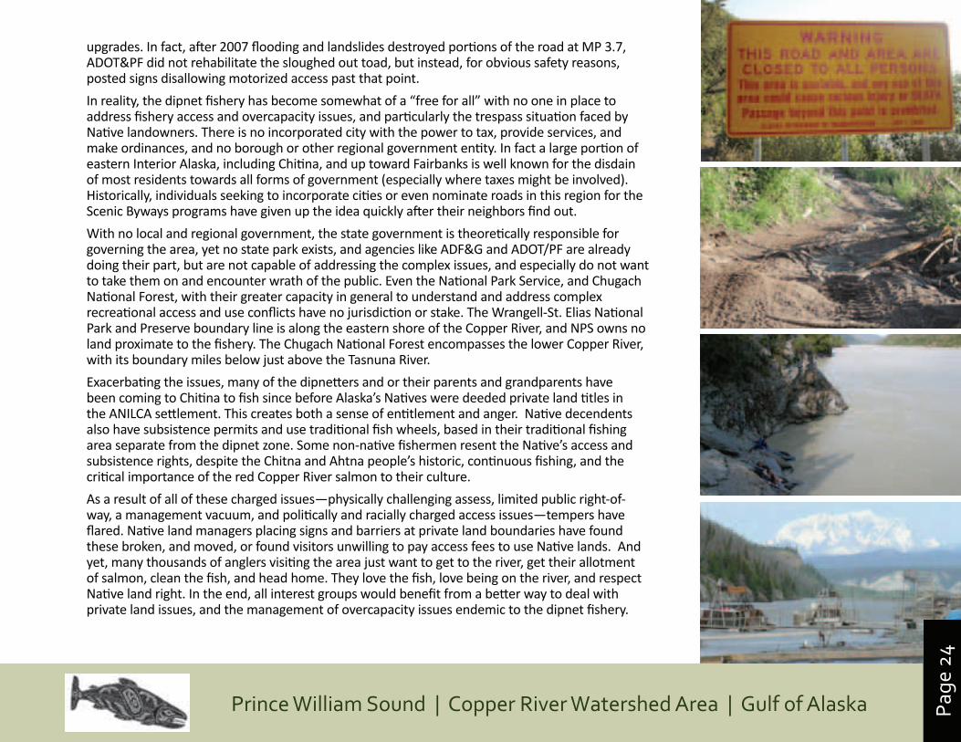
upgrades. In fact, after 2007 flooding and landslides destroyed portions of the road at MP 3.7, ADOT&PF did not rehabilitate the sloughed out toad, but instead, for obvious safety reasons, posted signs disallowing motorized access past that point.
In reality, the dipnet fishery has become somewhat of a “free for all” with no one in place to address fishery access and overcapacity issues, and particularly the trespass situation faced by Native landowners. There is no incorporated city with the power to tax, provide services, and make ordinances, and no borough or other regional government entity. In fact a large portion of eastern Interior Alaska, including Chitina, and up toward Fairbanks is well known for the disdain of most residents towards all forms of government (especially where taxes might be involved). Historically, individuals seeking to incorporate cities or even nominate roads in this region for the Scenic Byways programs have given up the idea quickly after their neighbors find out.
With no local and regional government, the state government is theoretically responsible for governing the area, yet no state park exists, and agencies like ADF&G and ADOT/PF are already doing their part, but are not capable of addressing the complex issues, and especially do not want to take them on and encounter wrath of the public. Even the National Park Service, and Chugach National Forest, with their greater capacity in general to understand and address complex recreational access and use conflicts have no jurisdiction or stake. The Wrangell-St. Elias National Park and Preserve boundary line is along the eastern shore of the Copper River, and NPS owns no land proximate to the fishery. The Chugach National Forest encompasses the lower Copper River, with its boundary miles below just above the Tasnuna River.
Exacerbating the issues, many of the dipnetters and or their parents and grandparents have been coming to Chitina to fish since before Alaska’s Natives were deeded private land titles in the ANILCA settlement. This creates both a sense of entitlement and anger. Native decendents also have subsistence permits and use traditional fish wheels, based in their traditional fishing area separate from the dipnet zone. Some non-native fishermen resent the Native’s access and subsistence rights, despite the Chitna and Ahtna people’s historic, continuous fishing, and the critical importance of the red Copper River salmon to their culture.
As a result of all of these charged issues—physically challenging assess, limited public right-of-way, a management vacuum, and politically and racially charged access issues—tempers have flared. Native land managers placing signs and barriers at private land boundaries have found these broken, and moved, or found visitors unwilling to pay access fees to use Native lands. And yet, many thousands of anglers visiting the area just want to get to the river, get their allotment of salmon, clean the fish, and head home. They love the fish, love being on the river, and respect Native land right. In the end, all interest groups would benefit from a better way to deal with private land issues, and the management of overcapacity issues endemic to the dipnet fishery.
Page
25
Prince William Sound | Copper River Watershed Area | Gulf of AlaskaIntegrated Motorized & Non-Motorized Alternative Transportation PlanPage
25
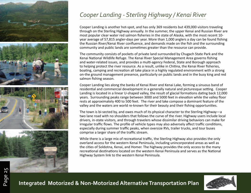
Cooper Landing - Sterling Highway / Kenai River
Cooper Landing is another hot-spot, and has only 369 residents but 439,000 visitors traveling through on the Sterling Highway annually. In the summer, the upper Kenai and Russian River are most popular clear water red salmon fisheries in the state of Alaska, with the most recent 10-year average of 57,815 angler-days per year. More than 1,000 anglers a day can be found fishing the Russian River/Kenai River confluence, and demands made on the fish and the surrounding community and public lands are sometimes greater than the resource can provide.
The community consists of pockets of private land surrounded by Chugach State Park and the Kenai National Wildlife Refuge. The Kenai River Special Management Area governs fishing and water-related issues, and provides a multi-agency Federal, State and Borough approach to helping protect the river resource. As a result, unlike in Chitina, the Kenai River fisheries, boating, camping and recreation all take place in a highly regulated environment with a strong on-the ground management presence, particularly on public lands and in the busy king and red salmon fishing season.
Cooper Landing lies along the banks of Kenai River and Kenai Lake, forming a sinuous band of residential and commercial development in a generally natural and picturesque setting. Cooper Landing is located in a linear U-shaped valley, the result of glacial formations dating back 12,000 years. Surrounding peaks range between 3000 and 5000 feet in elevation while the valley floor rests at approximately 400 to 500 feet. The river and lake compose a dominant feature of the valley and the waters are world re-known for their beauty and their fishing opportunities.
The town is bi-sected by, and owes much of its physical character to the Sterling Highway—a two lane road with no shoulders that follows the curve of the river. Highway users include local drivers, in-state visitors, and through travelers whose dissimilar driving behaviors can make for irregular traffic flows. The profile of vehicle types may also adversely affect traffic conditions, especially during summer traffic peaks, when oversize RVs, trailer trucks, and tour buses comprise a larger share of the traffic stream.
While there is a large mix of recreational traffic, the Sterling Highway also provides the only overland access for the western Kenai Peninsula, including unincorporated areas as well as the cities of Soldotna, Kenai, and Homer. The highway provides the only access to the many recreational destinations located on the western Kenai Peninsula and serves as the National Highway System link to the western Kenai Peninsula.
Page
26
Prince William Sound | Copper River Watershed Area | Gulf of Alaska
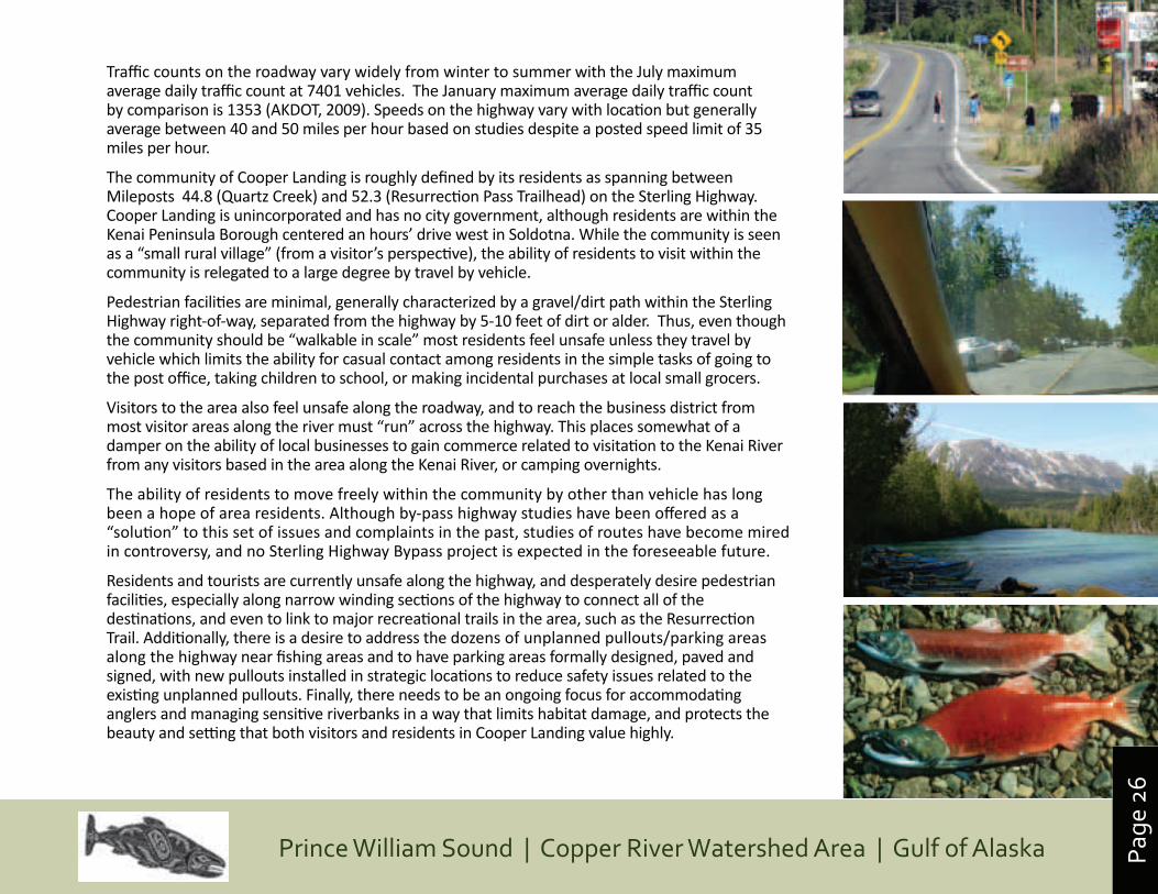
Traffic counts on the roadway vary widely from winter to summer with the July maximum average daily traffic count at 7401 vehicles. The January maximum average daily traffic count by comparison is 1353 (AKDOT, 2009). Speeds on the highway vary with location but generally average between 40 and 50 miles per hour based on studies despite a posted speed limit of 35 miles per hour.
The community of Cooper Landing is roughly defined by its residents as spanning between Mileposts 44.8 (Quartz Creek) and 52.3 (Resurrection Pass Trailhead) on the Sterling Highway. Cooper Landing is unincorporated and has no city government, although residents are within the Kenai Peninsula Borough centered an hours’ drive west in Soldotna. While the community is seen as a “small rural village” (from a visitor’s perspective), the ability of residents to visit within the community is relegated to a large degree by travel by vehicle.
Pedestrian facilities are minimal, generally characterized by a gravel/dirt path within the Sterling Highway right-of-way, separated from the highway by 5-10 feet of dirt or alder. Thus, even though the community should be “walkable in scale” most residents feel unsafe unless they travel by vehicle which limits the ability for casual contact among residents in the simple tasks of going to the post office, taking children to school, or making incidental purchases at local small grocers.
Visitors to the area also feel unsafe along the roadway, and to reach the business district from most visitor areas along the river must “run” across the highway. This places somewhat of a damper on the ability of local businesses to gain commerce related to visitation to the Kenai River from any visitors based in the area along the Kenai River, or camping overnights.
The ability of residents to move freely within the community by other than vehicle has long been a hope of area residents. Although by-pass highway studies have been offered as a “solution” to this set of issues and complaints in the past, studies of routes have become mired in controversy, and no Sterling Highway Bypass project is expected in the foreseeable future.
Residents and tourists are currently unsafe along the highway, and desperately desire pedestrian facilities, especially along narrow winding sections of the highway to connect all of the destinations, and even to link to major recreational trails in the area, such as the Resurrection Trail. Additionally, there is a desire to address the dozens of unplanned pullouts/parking areas along the highway near fishing areas and to have parking areas formally designed, paved and signed, with new pullouts installed in strategic locations to reduce safety issues related to the existing unplanned pullouts. Finally, there needs to be an ongoing focus for accommodating anglers and managing sensitive riverbanks in a way that limits habitat damage, and protects the beauty and setting that both visitors and residents in Cooper Landing value highly.
Page
27
Prince William Sound | Copper River Watershed Area | Gulf of AlaskaIntegrated Motorized & Non-Motorized Alternative Transportation PlanPage
27
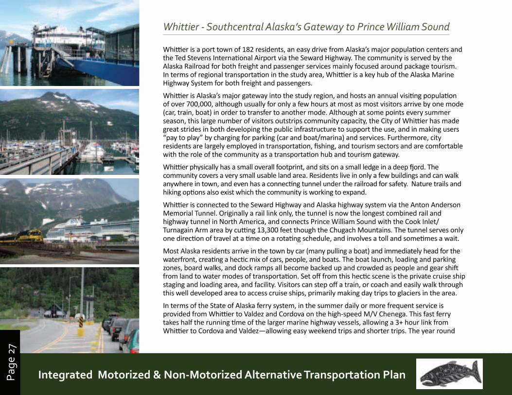
Whittier - Southcentral Alaska’s Gateway to Prince William Sound
Whittier is a port town of 182 residents, an easy drive from Alaska’s major population centers and the Ted Stevens International Airport via the Seward Highway. The community is served by the Alaska Railroad for both freight and passenger services mainly focused around package tourism. In terms of regional transportation in the study area, Whittier is a key hub of the Alaska Marine Highway System for both freight and passengers.
Whittier is Alaska’s major gateway into the study region, and hosts an annual visiting population of over 700,000, although usually for only a few hours at most as most visitors arrive by one mode (car, train, boat) in order to transfer to another mode. Although at some points every summer season, this large number of visitors outstrips community capacity, the City of Whittier has made great strides in both developing the public infrastructure to support the use, and in making users “pay to play” by charging for parking (car and boat/marina) and services. Furthermore, city residents are largely employed in transportation, fishing, and tourism sectors and are comfortable with the role of the community as a transportation hub and tourism gateway.
Whittier physically has a small overall footprint, and sits on a small ledge in a deep fjord. The community covers a very small usable land area. Residents live in only a few buildings and can walk anywhere in town, and even has a connecting tunnel under the railroad for safety. Nature trails and hiking options also exist which the community is working to expand.
Whittier is connected to the Seward Highway and Alaska highway system via the Anton Anderson Memorial Tunnel. Originally a rail link only, the tunnel is now the longest combined rail and highway tunnel in North America, and connects Prince William Sound with the Cook Inlet/Turnagain Arm area by cutting 13,300 feet though the Chugach Mountains. The tunnel serves only one direction of travel at a time on a rotating schedule, and involves a toll and sometimes a wait.
Most Alaska residents arrive in the town by car (many pulling a boat) and immediately head for the waterfront, creating a hectic mix of cars, people, and boats. The boat launch, loading and parking zones, board walks, and dock ramps all become backed up and crowded as people and gear shift from land to water modes of transportation. Set off from this hectic scene is the private cruise ship staging and loading area, and facility. Visitors can step off a train, or coach and easily walk through this well developed area to access cruise ships, primarily making day trips to glaciers in the area.
In terms of the State of Alaska ferry system, in the summer daily or more frequent service is provided from Whittier to Valdez and Cordova on the high-speed M/V Chenega. This fast ferry takes half the running time of the larger marine highway vessels, allowing a 3+ hour link from Whittier to Cordova and Valdez—allowing easy weekend trips and shorter trips. The year round
Page
28
Prince William Sound | Copper River Watershed Area | Gulf of Alaska
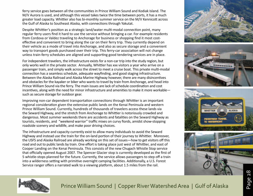
ferry service goes between all the communities in Prince William Sound and Kodiak Island. The M/V Aurora is used, and although this vessel takes twice the time between ports, it has a much greater load capacity. Whittier also has bi-monthly summer service on the M/V Kennicott across the Gulf of Alaska to Southeast Alaska, with connections through Yakutat.
Despite Whittier’s position as a strategic land/water multi-modal connection point, many regular ferry users find it hard to use the service without bringing a car. For example residents from Cordova or Valdez traveling to Anchorage for business or shopping find it most cost-effective and convenient to bring along the car on their ferry trip. They currently depend on their vehicle as a mode of travel into Anchorage, and also as secure storage and a convenient way to transport goods purchased over their trip. This ferry-car association will not change unless train-ferry schedules are aligned and supporting good tendering services are in place.
For independent travelers, the infrastructure exists for a non-car trip into the study region, but only works well in the private sector. Annually, Whittier has xxx visitors a year who arrive on a passenger train, and simply walk across the street to meet a cruise boat. This private multi-modal connection has a seamless schedule, adequate wayfinding, and good staging infrastructure. Between the Alaska Railroad and Alaska Marine Highway however, there are many disincentives and obstacles for the kayaker or biker who wants to travel by train from Anchorage, and head into Prince William Sound via the ferry. The main issues are lack of schedule coordination and cost incentives, along with the need for minor infrastructure and amenities to make it more workable—such as secure storage for outdoor gear.
Improving non-car dependent transportation connections through Whittier is an important regional consideration given the extensive public lands on the Kenai Peninsula and western Prince William Sound. Currently, hundreds of thousands of travelers access these lands via the Seward Highway, and the stretch from Anchorage to Whittier is notoriously crowded and dangerous. Most summer weekends there are accidents and fatalities on the Seward Highway as tourists, residents, and “weekend warrior” traffic mixes on curvy fiords, amidst show-stopping roadside scenery and wildlife, and make poor driving choices.
The infrastructure and capacity currently exist to allow many individuals to avoid the Seward Highway and instead use the train for the on-land portion of their journey to Whittier. Moreover, the USFS and Alaska Railroad are already working on this set of issues—how to get visitors off this road and out to public lands by train. One effort is taking place just west of Whittier, and east of Cooper Landing on the Kenai Peninsula. This consists of the new Chugach Whistle Stop service that officially opened August 2007. The Spencer Glacier stop is currently developed as the first of 5 whistle-stops planned for the future. Currently, the service allows passengers to step off a train into a wilderness setting with primitive overnight camping facilities. Additionally, a U.S. Forest Service ranger offers a narrated walk to a viewing platform, about 1.5 miles from the rail.
Page
29
Prince William Sound | Copper River Watershed Area | Gulf of AlaskaIntegrated Motorized & Non-Motorized Alternative Transportation PlanPage
29
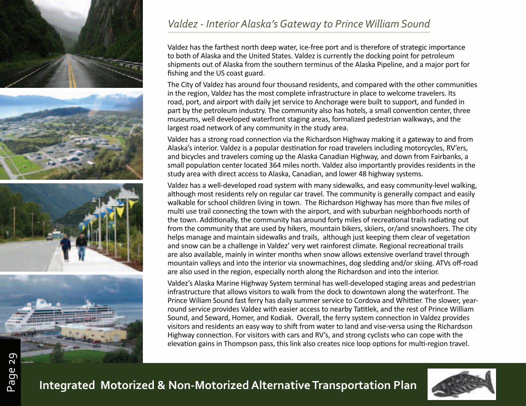
Valdez - Interior Alaska’s Gateway to Prince William Sound
Valdez has the farthest north deep water, ice-free port and is therefore of strategic importance to both of Alaska and the United States. Valdez is currently the docking point for petroleum shipments out of Alaska from the southern terminus of the Alaska Pipeline, and a major port for fishing and the US coast guard.
The City of Valdez has around four thousand residents, and compared with the other communities in the region, Valdez has the most complete infrastructure in place to welcome travelers. Its road, port, and airport with daily jet service to Anchorage were built to support, and funded in part by the petroleum industry. The community also has hotels, a small convention center, three museums, well developed waterfront staging areas, formalized pedestrian walkways, and the largest road network of any community in the study area.
Valdez has a strong road connection via the Richardson Highway making it a gateway to and from Alaska’s interior. Valdez is a popular destination for road travelers including motorcycles, RV’ers, and bicycles and travelers coming up the Alaska Canadian Highway, and down from Fairbanks, a small population center located 364 miles north. Valdez also importantly provides residents in the study area with direct access to Alaska, Canadian, and lower 48 highway systems.
Valdez has a well-developed road system with many sidewalks, and easy community-level walking, although most residents rely on regular car travel. The community is generally compact and easily walkable for school children living in town. The Richardson Highway has more than five miles of multi use trail connecting the town with the airport, and with suburban neighborhoods north of the town. Additionally, the community has around forty miles of recreational trails radiating out from the community that are used by hikers, mountain bikers, skiiers, or/and snowshoers. The city helps manage and maintain sidewalks and trails, although just keeping them clear of vegetation and snow can be a challenge in Valdez’ very wet rainforest climate. Regional recreational trails are also available, mainly in winter months when snow allows extensive overland travel through mountain valleys and into the interior via snowmachines, dog sledding and/or skiing. ATVs off-road are also used in the region, especially north along the Richardson and into the interior.
Valdez’s Alaska Marine Highway System terminal has well-developed staging areas and pedestrian infrastructure that allows visitors to walk from the dock to downtown along the waterfront. The Prince Wiliam Sound fast ferry has daily summer service to Cordova and Whittier. The slower, year-round service provides Valdez with easier access to nearby Tatitlek, and the rest of Prince William Sound, and Seward, Homer, and Kodiak. Overall, the ferry system connection in Valdez provides visitors and residents an easy way to shift from water to land and vise-versa using the Richardson Highway connection. For visitors with cars and RV’s, and strong cyclists who can cope with the elevation gains in Thompson pass, this link also creates nice loop options for multi-region travel.
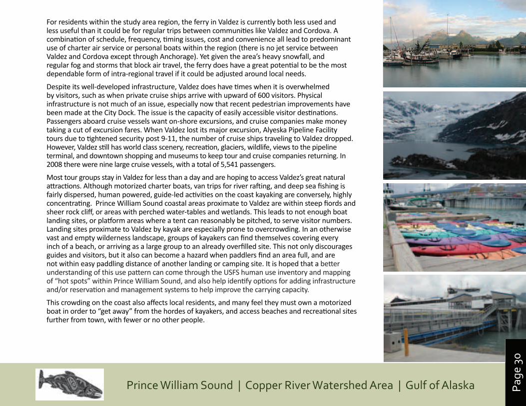
Page
30
Prince William Sound | Copper River Watershed Area | Gulf of Alaska
For residents within the study area region, the ferry in Valdez is currently both less used and less useful than it could be for regular trips between communities like Valdez and Cordova. A combination of schedule, frequency, timing issues, cost and convenience all lead to predominant use of charter air service or personal boats within the region (there is no jet service between Valdez and Cordova except through Anchorage). Yet given the area’s heavy snowfall, and regular fog and storms that block air travel, the ferry does have a great potential to be the most dependable form of intra-regional travel if it could be adjusted around local needs.
Despite its well-developed infrastructure, Valdez does have times when it is overwhelmed by visitors, such as when private cruise ships arrive with upward of 600 visitors. Physical infrastructure is not much of an issue, especially now that recent pedestrian improvements have been made at the City Dock. The issue is the capacity of easily accessible visitor destinations. Passengers aboard cruise vessels want on-shore excursions, and cruise companies make money taking a cut of excursion fares. When Valdez lost its major excursion, Alyeska Pipeline Facility tours due to tightened security post 9-11, the number of cruise ships traveling to Valdez dropped. However, Valdez still has world class scenery, recreation, glaciers, wildlife, views to the pipeline terminal, and downtown shopping and museums to keep tour and cruise companies returning. In 2008 there were nine large cruise vessels, with a total of 5,541 passengers.
Most tour groups stay in Valdez for less than a day and are hoping to access Valdez’s great natural attractions. Although motorized charter boats, van trips for river rafting, and deep sea fishing is fairly dispersed, human powered, guide-led activities on the coast kayaking are conversely, highly concentrating. Prince William Sound coastal areas proximate to Valdez are within steep fiords and sheer rock cliff, or areas with perched water-tables and wetlands. This leads to not enough boat landing sites, or platform areas where a tent can reasonably be pitched, to serve visitor numbers. Landing sites proximate to Valdez by kayak are especially prone to overcrowding. In an otherwise vast and empty wilderness landscape, groups of kayakers can find themselves covering every inch of a beach, or arriving as a large group to an already overfilled site. This not only discourages guides and visitors, but it also can become a hazard when paddlers find an area full, and are not within easy paddling distance of another landing or camping site. It is hoped that a better understanding of this use pattern can come through the USFS human use inventory and mapping of “hot spots” within Prince William Sound, and also help identify options for adding infrastructure and/or reservation and management systems to help improve the carrying capacity.
This crowding on the coast also affects local residents, and many feel they must own a motorized boat in order to “get away” from the hordes of kayakers, and access beaches and recreational sites further from town, with fewer or no other people.
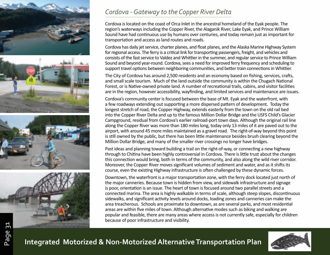
Page
31
Prince William Sound | Copper River Watershed Area | Gulf of AlaskaIntegrated Motorized & Non-Motorized Alternative Transportation PlanPage
31
Cordova - Gateway to the Copper River Delta
Cordova is located on the coast of Orca Inlet in the ancestral homeland of the Eyak people. The region’s waterways including the Copper River, the Alaganik River, Lake Eyak, and Prince William Sound have had continuous use by humans over centuries, and today remain just as important for transportation and access as land routes and roads.
Cordova has daily jet service, charter planes, and float planes, and the Alaska Marine Highway System for regional access. The ferry is a critical link for transporting passengers, freight, and vehicles and consists of the fast service to Valdez and Whittier in the summer, and regular service to Prince William Sound and beyond year-round. Cordova, sees a need for improved ferry frequency and scheduling to support travel options between neighboring communities, and better train connections in Whittier.
The City of Cordova has around 2,500 residents and an economy based on fishing, services, crafts, and small scale tourism. Much of the land outside the community is within the Chugach National Forest, or is Native-owned private land. A number of recreational trails, cabins, and visitor facilities are in the region, however accessibility, wayfinding, and limited services and maintenance are issues.
Cordova’s community center is focused between the base of Mt. Eyak and the waterfront, with a few roadways extending out supporting a more dispersed pattern of development. Today the longest stretch of road, the Copper Highway, extends easterly from the town on the old rail bed into the Copper River Delta and up to the famous Million Dollar Bridge and the USFS Child’s Glacier Campground, residual from Cordova’s earlier railroad-port town days. Although the original rail line along the Copper River was more than 180 miles long, today only 13 miles of it are paved out to the airport, with around 45 more miles maintained as a gravel road. The right-of-way beyond this point is still owned by the public, but there has been little maintenance besides brush clearing beyond the Million Dollar Bridge, and many of the smaller river crossings no longer have bridges.
Past ideas and planning toward building a trail on the right-of-way, or connecting a new highway through to Chitina have been highly controversial in Cordova. There is little trust about the changes this connection would bring, both in terms of the community, and also along the wild river corridor. Moreover, the Copper River moves significant volumes of sediment and water, and as it shifts its course, even the existing Highway infrastructure is often challenged by these dynamic forces.
Downtown, the waterfront is a major transportation zone, with the ferry dock located just north of the major canneries. Because town is hidden from view, and sidewalk infrastructure and signage is poor, orientation is an issue. The heart of town is focused around two parallel streets and a connected marina. The area is highly walkable in terms of scale, although steep slopes, discontinuous sidewalks, and significant activity levels around docks, loading zones and canneries can make the area treacherous. Schools are proximate to downtown, as are several parks, and most residential areas are within five miles of town. Although alternative modes such as biking and walking are popular and feasible, there are many areas where access is not currently safe, especially for children because of poor infrastructure and visibility.
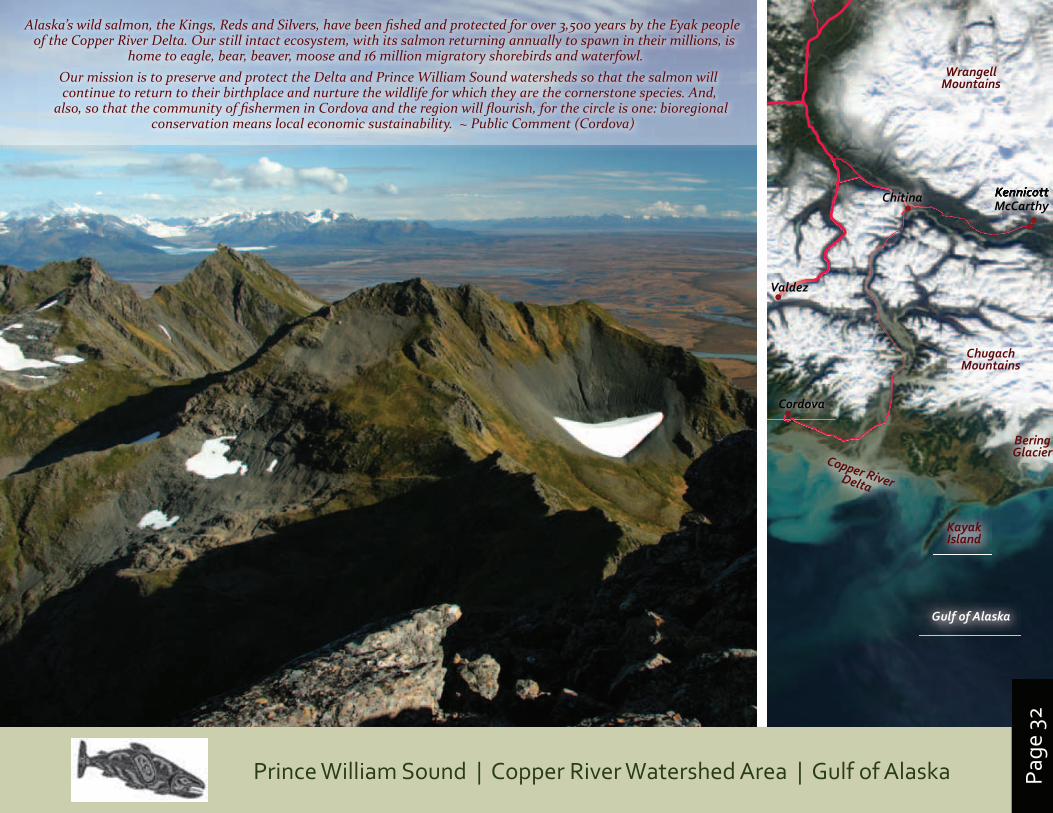
Page
32
Prince William Sound | Copper River Watershed Area | Gulf of Alaska
Copper RiverDelta
Cordova
Valdez
KennicottChitina KennicottMcCarthyKennicott
BeringGlacier
Kayak Island
Chugach Mountains
Gulf of Alaska
Wrangell Mountains
Alaska’s wild salmon, the Kings, Reds and Silvers, have been fi shed and protected for over 3,500 years by the Eyak people of the Copper River Delta. Our still intact ecosystem, with its salmon returning annually to spawn in their millions, is
home to eagle, bear, beaver, moose and 16 million migratory shorebirds and waterfowl. Our mission is to preserve and protect the Delta and Prince William Sound watersheds so that the salmon will continue to return to their birthplace and nurture the wildlife for which they are the cornerstone species. And,
also, so that the community of fi shermen in Cordova and the region will fl ourish, for the circle is one: bioregional conservation means local economic sustainability. ~ Public Comment (Cordova)

Page
33
Prince William Sound | Copper River Watershed Area | Gulf of AlaskaIntegrated Motorized & Non-Motorized Alternative Transportation PlanPage
33
Yakutat - Gulf of Alaska, Wrangell-St. Elias & Tongass Yakutat is a settlement of around 800 residents with the only sheltered deep water port in the Gulf of Alaska, at Monti Bay. The community is equidistant between Cordova and Juneau, both 200 miles along the coast in either direction. As one of the few refuges for vessels along this stretch of coast, Yakutat is a critical marine port for boats crossing the Gulf.
Regional travel options to and from Yakutat are limited and/or expensive, creating a sense of isolation for residents. The Alaska Marine Highway service rarely makes any gulf crossings, visiting only twice a month in the summer. Regular jet service to Anchorage and Juneau is the main mode of access for the community. This is supplemented by small private and charter plane services, personal boats, and hovercraft. There are no connecting roads, although beaches and tractor trails provide some extended overland access. Summer state ferry connections to the Alaska-Canadian Highway are distant but possible via Haines and Skagway.
Community level transportation is largely focused on a small road system, beaches, and trails, or along coastal waters with the use of boats and hovercraft. Walking, biking, and ATV’s have also became used more for local transport when gas prices rise. The area is at the nexus of two major NPS units, and has “in its back yard” world-famous glaciers, fjords and destinations. Recreational kayaking and trails are popular with visitors, as are beach mountain biking and surfing.
Yakutat also has a community history of using rail, although it is no longer used today. For 60 years the Yakutat and Southern Railroad provided rail service hauling fish from the Situk Landing to the cannery in Yakutat. The railcar is now covered as a historic feature in a community park.
Although removed from the community, there are also residents and economic activities within the City and Borough of Yakutat on the stretch of coast between Yakutat and the Bering Glacier/Suckling Hills area, sometimes called the “Lost Coast,.” There is transportation movement along a forty five-mile “Icy Bay Logging Road,” which relies on the 500 foot long Yakataga River Bridge. The road has been slated for closure when timber harvest operations cease, but for many, including private landowners in the area, this road (and bridges and culverts) are important for the region’s safety and economic life.
“We value connections to the outdoors and ties to nature . . . . Facilities are needed for pedestrians and bikes, and an improved ferry schedule. ”
~ Public Comment (Yakutat)
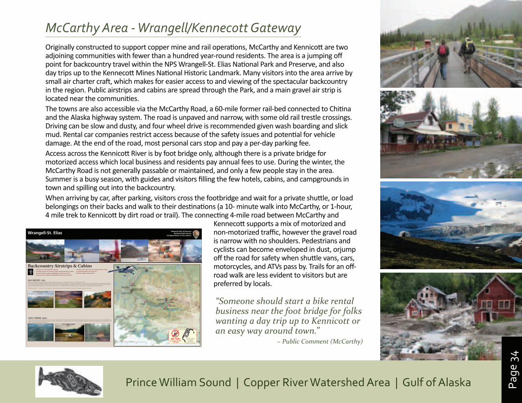
Page
34
Prince William Sound | Copper River Watershed Area | Gulf of Alaska
McCarthy Area - Wrangell/Kennecott GatewayOriginally constructed to support copper mine and rail operations, McCarthy and Kennicott are two adjoining communities with fewer than a hundred year-round residents. The area is a jumping off point for backcountry travel within the NPS Wrangell-St. Elias National Park and Preserve, and also day trips up to the Kennecott Mines National Historic Landmark. Many visitors into the area arrive by small air charter craft, which makes for easier access to and viewing of the spectacular backcountry in the region. Public airstrips and cabins are spread through the Park, and a main gravel air strip is located near the communities.The towns are also accessible via the McCarthy Road, a 60-mile former rail-bed connected to Chitina and the Alaska highway system. The road is unpaved and narrow, with some old rail trestle crossings. Driving can be slow and dusty, and four wheel drive is recommended given wash boarding and slick mud. Rental car companies restrict access because of the safety issues and potential for vehicle damage. At the end of the road, most personal cars stop and pay a per-day parking fee. Access across the Kennicott River is by foot bridge only, although there is a private bridge for motorized access which local business and residents pay annual fees to use. During the winter, the McCarthy Road is not generally passable or maintained, and only a few people stay in the area. Summer is a busy season, with guides and visitors filling the few hotels, cabins, and campgrounds in town and spilling out into the backcountry. When arriving by car, after parking, visitors cross the footbridge and wait for a private shuttle, or load belongings on their backs and walk to their destinations (a 10- minute walk into McCarthy, or 1-hour, 4 mile trek to Kennicott by dirt road or trail). The connecting 4-mile road between McCarthy and
Kennecott supports a mix of motorized and non-motorized traffic, however the gravel road is narrow with no shoulders. Pedestrians and cyclists can become enveloped in dust, orjump off the road for safety when shuttle vans, cars, motorcycles, and ATVs pass by. Trails for an off-road walk are less evident to visitors but are preferred by locals.
Wrangell-St. Elias National Park & Preserve National Park Service
US Department of the Interior
Backcountry Airstrips & Cabins
MAY CREEK (MYK) 2,700’ airstrip and rustic cabin, 14x16, sleeps up to 3 people. Approximately 11.5 miles southeast of McCarthy, this cabin is located in a mixed spruce and aspen forest in the Nizina River valley near Young Creek at an elevation of 1,650'. The cabin is located near the southeast corner of the airstrip, behind the mail cabin. Tie downs are available on the southeast end of the airstrip. Respect private property in the area.
McCarthy
May Creek
Jakes Bar
Glacier Creek
Chisana
Gulkana
Peavine
NO FUEL AVAILABLE WITHIN
THE PARK
Fuel is available At Gulkana, Northway,
Valdez, & Cordova
GLACIER CREEK (KGZ) This airstrip is situated 18 miles east of McCarthy, about 1/2 mile south of the Chitistone River. Tie downs are available. The cabin is 8 x 10 feet in size and contains a woodstove and 2 twin wooden bunks, Water is available from Glacier Creek or the Chitistone River but must be treated and allowed to settle. This is an extremely scenic area surrounded by towering cliffs and sparkling glaciers. It offers excellent opportunities for hiking up Glacier Creek, the Chitistone River, or Toby Creek. CTAF 122.9 Glacier Creek (KGZ) Elevation 2380’ N61° 27.31’ W142° 22.86’ NOT RECOMMENDED FOR TRI-CYCLE GEAR AIRCRAFT Avoid flying in valley during strong winds.
CHISANA (CZN) 1600 foot gravel airstrip and rustic cabin. Located 97 nautical miles east of the Gulkana airport. The cabin is 11 x 15 feet in size and sleeps up to two people. Cabin contains 2 standard twin-size wooden bunks and woodstove. Water is not available near the cabin, but from a seasonal spring located 1/4 mile northeast of the cabin on Chathenda Creek. The cabin is located within the historic min-ing settlement of Chisana. There are excellent opportunities for hiking and exploring along the Chisana River and historic mining lo-cations. Please respect private property in the area.
CAUTION: Two other private, but active airstrips are in the vicinity. Public tie-downs are available.
PEAVINE BAR (NO FAA IDENTIFIER) 1650’ X 25’ gravel airstrip and 2 rustic cabins. Cabin #1 is 20x24 and sleeps up to 6 people. Cabin #2 is 14x16 and sleeps up to 3 people. Cabins are located 14 miles east of McCarthy on a gravel bar of the Chitistone River surrounded by towering cliffs. Spectacular scenery, short local hikes along old mining trails on nearby hillsides. Public tie-downs are available.
CTAF 122.9 Peavine Bar Elevation ~2000 N61° 27.25’ W142° 28.00’ NOT RECOMMENDED FOR TRI-CYCLE GEAR AIRCRAFT Avoid flying in valley during strong winds.
JAKE’S BAR (AKØ) 1000’ airstrip and 2 rustic cabins. One cabin is 9 feet by 13 feet and contains a woodstove and two bunks; the second cabin is 6 feet by 9 feet in size and contains a woodstove and two bunks. These cabins are located on the north shore of the Chitina River about 15 miles south of McCarthy at about 1,000' elevation. Public tie-downs are available.
Water can be obtained by settling the glacially-silted Chitina River water. There are no developed trails at Jake's Bar, but it is possible to hike both up and down the river.
CTAF 122.9 Jakes Bar AKØ Elevation 1052 N61° 13.12’ W142° 53.39’ NOT RECOMMENDED FOR TRI-CYCLE GEAR AIRCRAFT
McCARTHY (15Z) McCarthy is located approximately 85 nautical miles south east of Gulkana. It is accessible by aircraft, or a 59-mile gravel road. There is phone, food, and lodging available in Kennecott and McCarthy during the summer. The town of McCarthy is 1 mile south of the Airport. The historic mining structures of Kenne-cott are located 3.5 miles north of the airport. During summer months, commercial shuttles are available to both of these locations. Please respect private property in the area. There are guide services available for glacier hikes, historic tours, rafting trips, etc. The National Park Service operates a visitor contact station in Kennecott during summer months. NO public tie-downs Aircraft owners are allowed to camp under the wings of the aircraft, but there are NO campfires allowed on the ramp
• Large tires are recommended for all airstrips • Over-flight inspection of all airstrips is highly recommended prior to landing • Runways should be considered unmaintained...Land at your own risk • Cell phone service available only around McCarthy, May Creek, Jakes Bar
• All cabins are first-come, first-served. Maximum stay is 14 days. • Leave NO food behind: remove ALL trash • NO FUEL is available within the park
“Someone should start a bike rental business near the foot bridge for folks wanting a day trip up to Kennicott or an easy way around town.”
~ Public Comment (McCarthy)
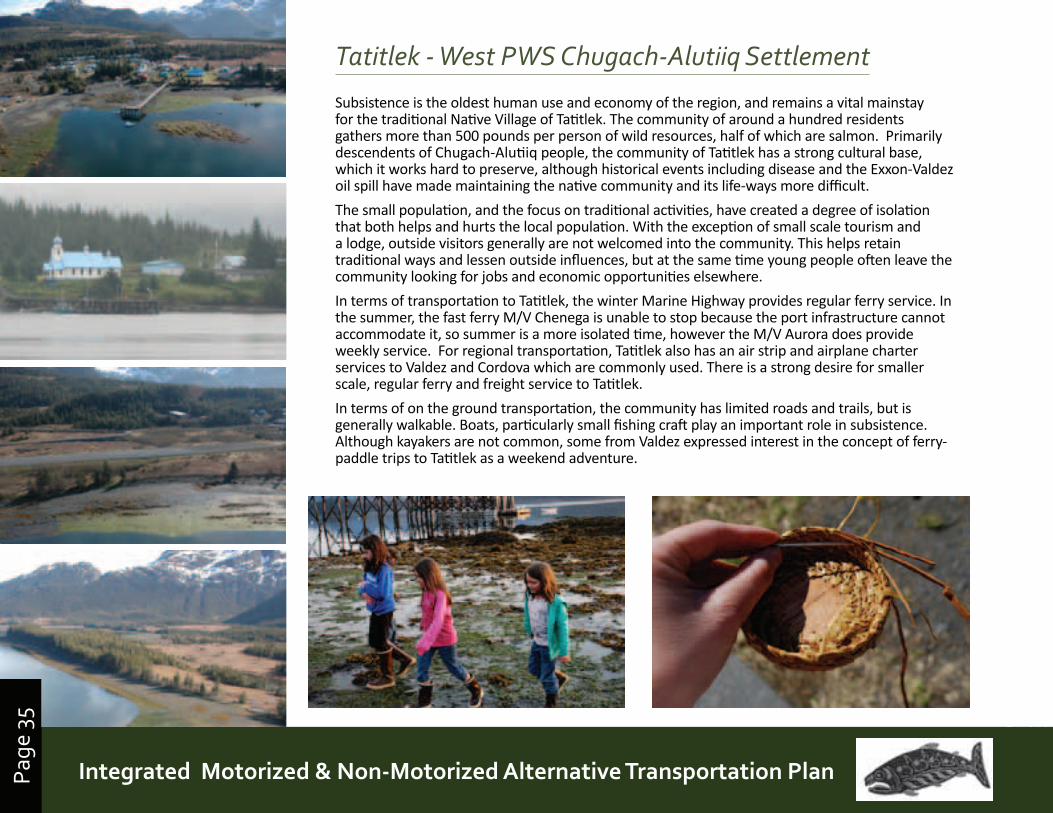
Page
35
Prince William Sound | Copper River Watershed Area | Gulf of AlaskaIntegrated Motorized & Non-Motorized Alternative Transportation PlanPage
35
Tatitlek - West PWS Chugach-Alutiiq Settlement
Subsistence is the oldest human use and economy of the region, and remains a vital mainstay for the traditional Native Village of Tatitlek. The community of around a hundred residents gathers more than 500 pounds per person of wild resources, half of which are salmon. Primarily descendents of Chugach-Alutiiq people, the community of Tatitlek has a strong cultural base, which it works hard to preserve, although historical events including disease and the Exxon-Valdez oil spill have made maintaining the native community and its life-ways more difficult.
The small population, and the focus on traditional activities, have created a degree of isolation that both helps and hurts the local population. With the exception of small scale tourism and a lodge, outside visitors generally are not welcomed into the community. This helps retain traditional ways and lessen outside influences, but at the same time young people often leave the community looking for jobs and economic opportunities elsewhere.
In terms of transportation to Tatitlek, the winter Marine Highway provides regular ferry service. In the summer, the fast ferry M/V Chenega is unable to stop because the port infrastructure cannot accommodate it, so summer is a more isolated time, however the M/V Aurora does provide weekly service. For regional transportation, Tatitlek also has an air strip and airplane charter services to Valdez and Cordova which are commonly used. There is a strong desire for smaller scale, regular ferry and freight service to Tatitlek.
In terms of on the ground transportation, the community has limited roads and trails, but is generally walkable. Boats, particularly small fishing craft play an important role in subsistence. Although kayakers are not common, some from Valdez expressed interest in the concept of ferry-paddle trips to Tatitlek as a weekend adventure.
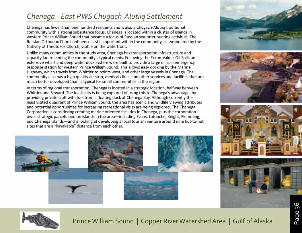
Page
36
Prince William Sound | Copper River Watershed Area | Gulf of Alaska
Chenega - East PWS Chugach-Alutiiq SettlementChenega has fewer than one hundred residents and is also a Chugach-Alutiiq traditional community with a strong subsistence focus. Chenega is located within a cluster of islands in western Prince William Sound that became a focus of Russian sea-otter hunting activities. The Russian Orthodox Church influence is still important within the community, as symbolized by the Nativity of Theotokos Church, visible on the waterfront.Unlike many communities in the study area, Chenega has transportation infrastructure and capacity far exceeding the community’s typical needs. Following the Exxon-Valdez Oil Spill, an extensive wharf and deep water dock system were built to provide a large oil spill emergency response station for western Prince William Sound. This allows easy docking by the Marine Highway, which travels from Whittier to points west, and other large vessels in Chenega. The community also has a high quality air strip, medical clinic, and other services and facilities that are much better developed than is typical for small communities in the region.In terms of regional transportation, Chenega is located in a strategic location, halfway between Whittier and Seward. The feasibility is being explored of using this to Chenega’s advantage, by providing private craft with fuel from a floating dock at Chenega Bay. Although currently the least visited quadrant of Prince William Sound, the area has scenic and wildlife viewing attributes and potential opportunities for increasing recreational visits are being explored. The Chenega Corporation is considering creating marine oriented facilities in Chenega, plus the corporation owns strategic parcels land on islands in the area—including Evans, Latouche, Knight, Flemming, and Chenega Islands—and is looking at developing a local tourism venture around nine hut-to-hut sites that are a “kayakable” distance from each other.
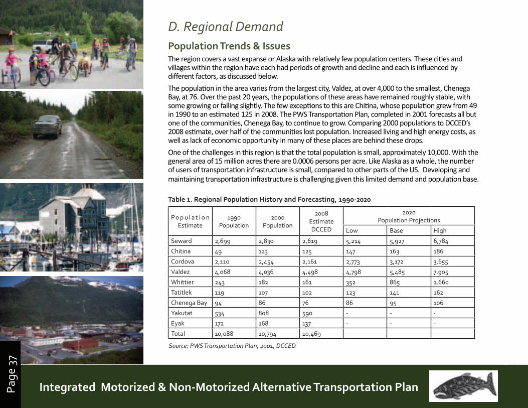
Page
37
Prince William Sound | Copper River Watershed Area | Gulf of AlaskaIntegrated Motorized & Non-Motorized Alternative Transportation PlanPage
37
D. Regional DemandPopulation Trends & IssuesThe region covers a vast expanse or Alaska with relatively few population centers. These cities and villages within the region have each had periods of growth and decline and each is influenced by different factors, as discussed below.
The population in the area varies from the largest city, Valdez, at over 4,000 to the smallest, Chenega Bay, at 76. Over the past 20 years, the populations of these areas have remained roughly stable, with some growing or falling slightly. The few exceptions to this are Chitina, whose population grew from 49 in 1990 to an estimated 125 in 2008. The PWS Transportation Plan, completed in 2001 forecasts all but one of the communities, Chenega Bay, to continue to grow. Comparing 2000 populations to DCCED’s 2008 estimate, over half of the communities lost population. Increased living and high energy costs, as well as lack of economic opportunity in many of these places are behind these drops.
One of the challenges in this region is that the total population is small, approximately 10,000. With the general area of 15 million acres there are 0.0006 persons per acre. Like Alaska as a whole, the number of users of transportation infrastructure is small, compared to other parts of the US. Developing and maintaining transportation infrastructure is challenging given this limited demand and population base.
Po p u l a t i o n Estimate
1990 Population
2000 Population
2008 Estimate DCCED
2020 Population Projections
Low Base High
Seward 2,699 2,830 2,619 5,214 5,927 6,784
Chitina 49 123 125 147 163 186
Cordova 2,110 2,454 2,161 2,773 3,172 3,655
Valdez 4,068 4,036 4,498 4,798 5,485 7.905
Whittier 243 182 161 352 865 1,660
Tatitlek 119 107 102 123 141 162
Chenega Bay 94 86 76 86 95 106
Yakutat 534 808 590 - - -
Eyak 172 168 137 - - -
Total 10,088 10,794 10,469
Table 1. Regional Population History and Forecasting, 1990-2020
Source: PWS Transportation Plan, 2001, DCCED
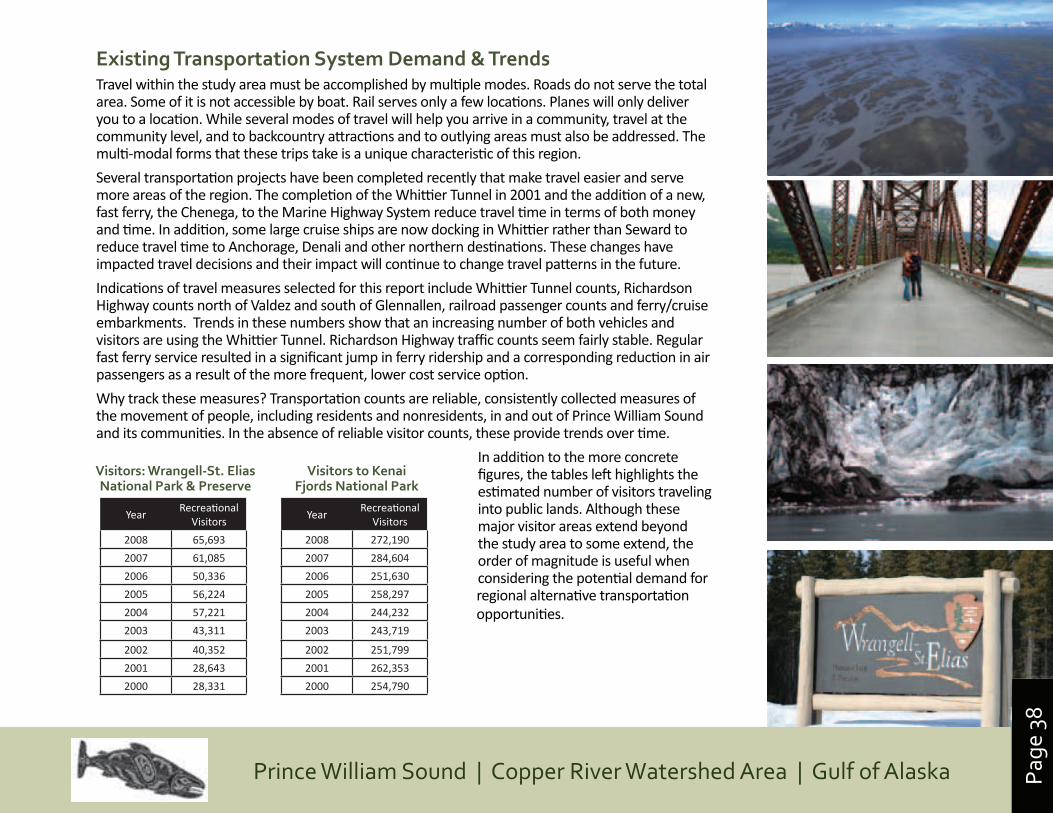
Page
38
Prince William Sound | Copper River Watershed Area | Gulf of Alaska
Existing Transportation System Demand & TrendsTravel within the study area must be accomplished by multiple modes. Roads do not serve the total area. Some of it is not accessible by boat. Rail serves only a few locations. Planes will only deliver you to a location. While several modes of travel will help you arrive in a community, travel at the community level, and to backcountry attractions and to outlying areas must also be addressed. The multi-modal forms that these trips take is a unique characteristic of this region.
Several transportation projects have been completed recently that make travel easier and serve more areas of the region. The completion of the Whittier Tunnel in 2001 and the addition of a new, fast ferry, the Chenega, to the Marine Highway System reduce travel time in terms of both money and time. In addition, some large cruise ships are now docking in Whittier rather than Seward to reduce travel time to Anchorage, Denali and other northern destinations. These changes have impacted travel decisions and their impact will continue to change travel patterns in the future.
Indications of travel measures selected for this report include Whittier Tunnel counts, Richardson Highway counts north of Valdez and south of Glennallen, railroad passenger counts and ferry/cruise embarkments. Trends in these numbers show that an increasing number of both vehicles and visitors are using the Whittier Tunnel. Richardson Highway traffic counts seem fairly stable. Regular fast ferry service resulted in a significant jump in ferry ridership and a corresponding reduction in air passengers as a result of the more frequent, lower cost service option.
Why track these measures? Transportation counts are reliable, consistently collected measures of the movement of people, including residents and nonresidents, in and out of Prince William Sound and its communities. In the absence of reliable visitor counts, these provide trends over time.
In addition to the more concrete figures, the tables left highlights the estimated number of visitors traveling into public lands. Although these major visitor areas extend beyond the study area to some extend, the order of magnitude is useful when considering the potential demand for regional alternative transportation opportunities.
YearRecreational
Visitors
2008 65,693
2007 61,085
2006 50,336
2005 56,224
2004 57,221
2003 43,311
2002 40,352
2001 28,643
2000 28,331
Visitors: Wrangell-St. Elias National Park & Preserve
YearRecreational
Visitors
2008 272,190
2007 284,604
2006 251,630
2005 258,297
2004 244,232
2003 243,719
2002 251,799
2001 262,353
2000 254,790
Visitors to Kenai Fjords National Park
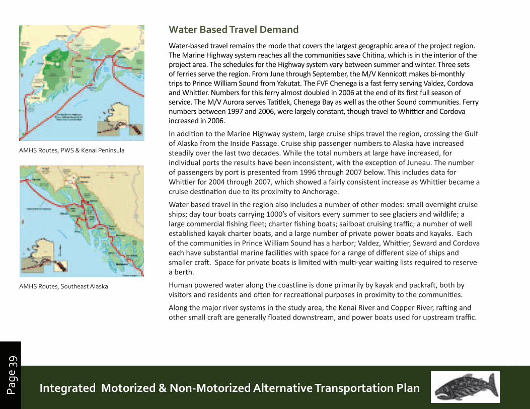
Page
39
Prince William Sound | Copper River Watershed Area | Gulf of AlaskaIntegrated Motorized & Non-Motorized Alternative Transportation PlanPage
39
Water Based Travel DemandWater-based travel remains the mode that covers the largest geographic area of the project region. The Marine Highway system reaches all the communities save Chitina, which is in the interior of the project area. The schedules for the Highway system vary between summer and winter. Three sets of ferries serve the region. From June through September, the M/V Kennicott makes bi-monthly trips to Prince William Sound from Yakutat. The FVF Chenega is a fast ferry serving Valdez, Cordova and Whittier. Numbers for this ferry almost doubled in 2006 at the end of its first full season of service. The M/V Aurora serves Tatitlek, Chenega Bay as well as the other Sound communities. Ferry numbers between 1997 and 2006, were largely constant, though travel to Whittier and Cordova increased in 2006.
In addition to the Marine Highway system, large cruise ships travel the region, crossing the Gulf of Alaska from the Inside Passage. Cruise ship passenger numbers to Alaska have increased steadily over the last two decades. While the total numbers at large have increased, for individual ports the results have been inconsistent, with the exception of Juneau. The number of passengers by port is presented from 1996 through 2007 below. This includes data for Whittier for 2004 through 2007, which showed a fairly consistent increase as Whittier became a cruise destination due to its proximity to Anchorage.
Water based travel in the region also includes a number of other modes: small overnight cruise ships; day tour boats carrying 1000’s of visitors every summer to see glaciers and wildlife; a large commercial fishing fleet; charter fishing boats; sailboat cruising traffic; a number of well established kayak charter boats, and a large number of private power boats and kayaks. Each of the communities in Prince William Sound has a harbor; Valdez, Whittier, Seward and Cordova each have substantial marine facilities with space for a range of different size of ships and smaller craft. Space for private boats is limited with multi-year waiting lists required to reserve a berth.
Human powered water along the coastline is done primarily by kayak and packraft, both by visitors and residents and often for recreational purposes in proximity to the communities.
Along the major river systems in the study area, the Kenai River and Copper River, rafting and other small craft are generally floated downstream, and power boats used for upstream traffic.
AMHS Routes, PWS & Kenai Peninsula
AMHS Routes, Southeast Alaska
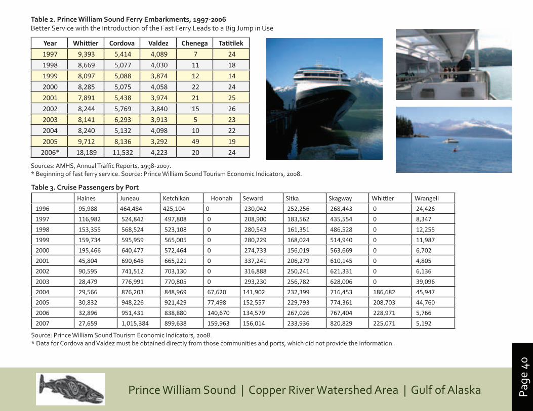
Page
40
Prince William Sound | Copper River Watershed Area | Gulf of Alaska
Year Whittier Cordova Valdez Chenega Tatitilek
1997 9,393 5,414 4,089 7 24
1998 8,669 5,077 4,030 11 18
1999 8,097 5,088 3,874 12 14
2000 8,285 5,075 4,058 22 24
2001 7,891 5,438 3,974 21 25
2002 8,244 5,769 3,840 15 26
2003 8,141 6,293 3,913 5 23
2004 8,240 5,132 4,098 10 22
2005 9,712 8,136 3,292 49 19
2006* 18,189 11,532 4,223 20 24
Table 2. Prince William Sound Ferry Embarkments, 1997-2006 Better Service with the Introduction of the Fast Ferry Leads to a Big Jump in Use
Sources: AMHS, Annual Traffic Reports, 1998-2007. * Beginning of fast ferry service. Source: Prince William Sound Tourism Economic Indicators, 2008.
Table 3. Cruise Passengers by PortHaines Juneau Ketchikan Hoonah Seward Sitka Skagway Whittier Wrangell
1996 95,988 464,484 425,104 0 230,042 252,256 268,443 0 24,426
1997 116,982 524,842 497,808 0 208,900 183,562 435,554 0 8,347
1998 153,355 568,524 523,108 0 280,543 161,351 486,528 0 12,255
1999 159,734 595,959 565,005 0 280,229 168,024 514,940 0 11,987
2000 195,466 640,477 572,464 0 274,733 156,019 563,669 0 6,702
2001 45,804 690,648 665,221 0 337,241 206,279 610,145 0 4,805
2002 90,595 741,512 703,130 0 316,888 250,241 621,331 0 6,136
2003 28,479 776,991 770,805 0 293,230 256,782 628,006 0 39,096
2004 29,566 876,203 848,969 67,620 141,902 232,399 716,453 186,682 45,947
2005 30,832 948,226 921,429 77,498 152,557 229,793 774,361 208,703 44,760
2006 32,896 951,431 838,880 140,670 134,579 267,026 767,404 228,971 5,766
2007 27,659 1,015,384 899,638 159,963 156,014 233,936 820,829 225,071 5,192
Source: Prince William Sound Tourism Economic Indicators, 2008.* Data for Cordova and Valdez must be obtained directly from those communities and ports, which did not provide the information.
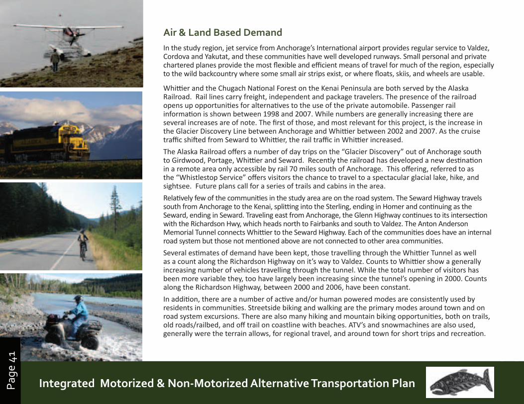
Page
41
Prince William Sound | Copper River Watershed Area | Gulf of AlaskaIntegrated Motorized & Non-Motorized Alternative Transportation PlanPage
41
Air & Land Based DemandIn the study region, jet service from Anchorage’s International airport provides regular service to Valdez, Cordova and Yakutat, and these communities have well developed runways. Small personal and private chartered planes provide the most flexible and efficient means of travel for much of the region, especially to the wild backcountry where some small air strips exist, or where floats, skiis, and wheels are usable.
Whittier and the Chugach National Forest on the Kenai Peninsula are both served by the Alaska Railroad. Rail lines carry freight, independent and package travelers. The presence of the railroad opens up opportunities for alternatives to the use of the private automobile. Passenger rail information is shown between 1998 and 2007. While numbers are generally increasing there are several increases are of note. The first of those, and most relevant for this project, is the increase in the Glacier Discovery Line between Anchorage and Whittier between 2002 and 2007. As the cruise traffic shifted from Seward to Whittier, the rail traffic in Whittier increased.
The Alaska Railroad offers a number of day trips on the “Glacier Discovery” out of Anchorage south to Girdwood, Portage, Whittier and Seward. Recently the railroad has developed a new destination in a remote area only accessible by rail 70 miles south of Anchorage. This offering, referred to as the “Whistlestop Service” offers visitors the chance to travel to a spectacular glacial lake, hike, and sightsee. Future plans call for a series of trails and cabins in the area.
Relatively few of the communities in the study area are on the road system. The Seward Highway travels south from Anchorage to the Kenai, splitting into the Sterling, ending in Homer and continuing as the Seward, ending in Seward. Traveling east from Anchorage, the Glenn Highway continues to its intersection with the Richardson Hwy, which heads north to Fairbanks and south to Valdez. The Anton Anderson Memorial Tunnel connects Whittier to the Seward Highway. Each of the communities does have an internal road system but those not mentioned above are not connected to other area communities.
Several estimates of demand have been kept, those travelling through the Whittier Tunnel as well as a count along the Richardson Highway on it’s way to Valdez. Counts to Whittier show a generally increasing number of vehicles travelling through the tunnel. While the total number of visitors has been more variable they, too have largely been increasing since the tunnel’s opening in 2000. Counts along the Richardson Highway, between 2000 and 2006, have been constant.
In addition, there are a number of active and/or human powered modes are consistently used by residents in communities. Streetside biking and walking are the primary modes around town and on road system excursions. There are also many hiking and mountain biking opportunities, both on trails, old roads/railbed, and off trail on coastline with beaches. ATV’s and snowmachines are also used, generally were the terrain allows, for regional travel, and around town for short trips and recreation.
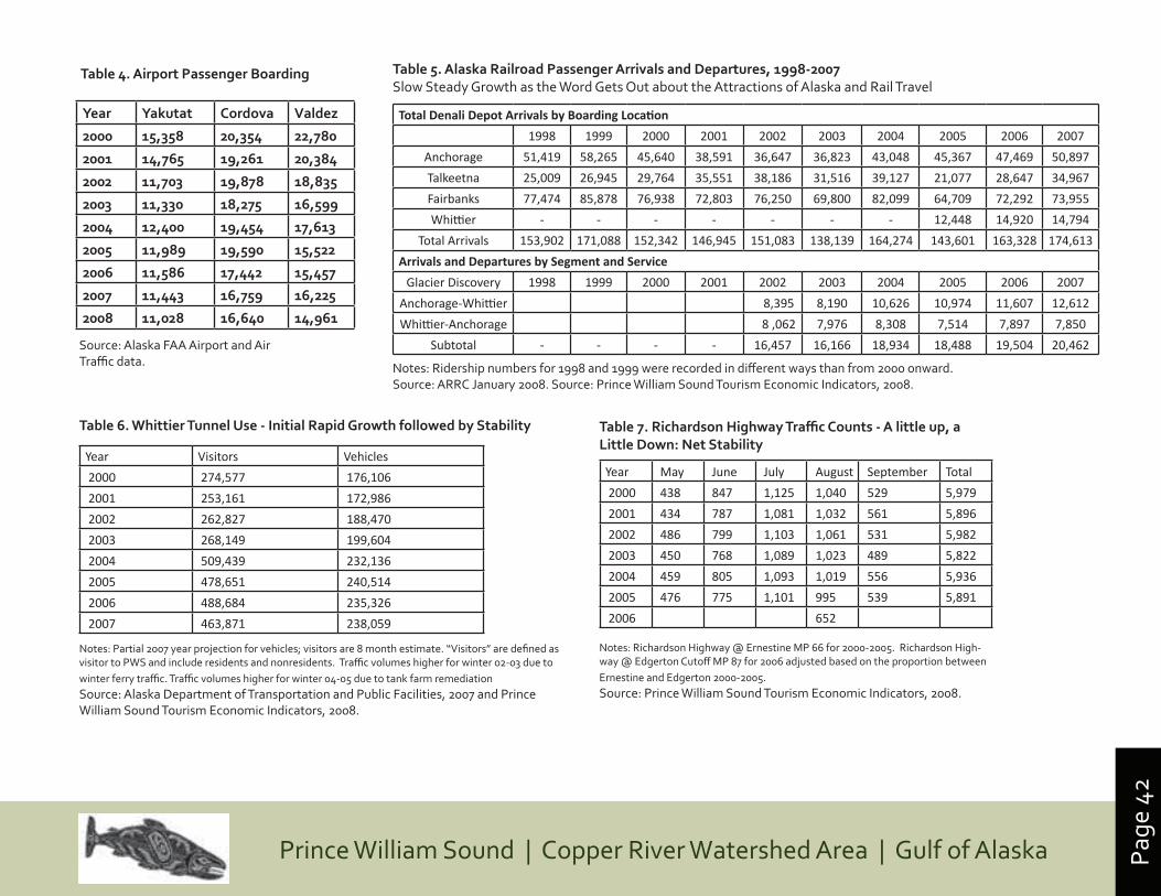
Page
42
Prince William Sound | Copper River Watershed Area | Gulf of Alaska
TotalDenaliDepotArrivalsbyBoardingLocation
1998 1999 2000 2001 2002 2003 2004 2005 2006 2007
Anchorage 51,419 58,265 45,640 38,591 36,647 36,823 43,048 45,367 47,469 50,897
Talkeetna 25,009 26,945 29,764 35,551 38,186 31,516 39,127 21,077 28,647 34,967
Fairbanks 77,474 85,878 76,938 72,803 76,250 69,800 82,099 64,709 72,292 73,955
Whittier - - - - - - - 12,448 14,920 14,794
Total Arrivals 153,902 171,088 152,342 146,945 151,083 138,139 164,274 143,601 163,328 174,613
ArrivalsandDeparturesbySegmentandService
Glacier Discovery 1998 1999 2000 2001 2002 2003 2004 2005 2006 2007
Anchorage-Whittier 8,395 8,190 10,626 10,974 11,607 12,612
Whittier-Anchorage 8 ,062 7,976 8,308 7,514 7,897 7,850
Subtotal - - - - 16,457 16,166 18,934 18,488 19,504 20,462
Table 5. Alaska Railroad Passenger Arrivals and Departures, 1998-2007Slow Steady Growth as the Word Gets Out about the Attractions of Alaska and Rail Travel
Notes: Ridership numbers for 1998 and 1999 were recorded in different ways than from 2000 onward. Source: ARRC January 2008. Source: Prince William Sound Tourism Economic Indicators, 2008.
Year Visitors Vehicles
2000 274,577 176,106
2001 253,161 172,986
2002 262,827 188,470
2003 268,149 199,604
2004 509,439 232,136
2005 478,651 240,514
2006 488,684 235,326
2007 463,871 238,059
Table 6. Whittier Tunnel Use - Initial Rapid Growth followed by Stability
Notes: Partial 2007 year projection for vehicles; visitors are 8 month estimate. “Visitors” are defined as visitor to PWS and include residents and nonresidents. Traffic volumes higher for winter 02-03 due to winter ferry traffic. Traffic volumes higher for winter 04-05 due to tank farm remediation Source: Alaska Department of Transportation and Public Facilities, 2007 and Prince William Sound Tourism Economic Indicators, 2008.
Year May June July August September Total
2000 438 847 1,125 1,040 529 5,979
2001 434 787 1,081 1,032 561 5,896
2002 486 799 1,103 1,061 531 5,982
2003 450 768 1,089 1,023 489 5,822
2004 459 805 1,093 1,019 556 5,936
2005 476 775 1,101 995 539 5,891
2006 652
Table 7. Richardson Highway Traffic Counts - A little up, a Little Down: Net Stability
Notes: Richardson Highway @ Ernestine MP 66 for 2000-2005. Richardson High-way @ Edgerton Cutoff MP 87 for 2006 adjusted based on the proportion between Ernestine and Edgerton 2000-2005. Source: Prince William Sound Tourism Economic Indicators, 2008.
Year Yakutat Cordova Valdez
2000 15,358 20,354 22,780
2001 14,765 19,261 20,384
2002 11,703 19,878 18,835
2003 11,330 18,275 16,599
2004 12,400 19,454 17,613
2005 11,989 19,590 15,522
2006 11,586 17,442 15,457
2007 11,443 16,759 16,225
2008 11,028 16,640 14,961
Source: Alaska FAA Airport and Air Traffic data.
Table 4. Airport Passenger Boarding
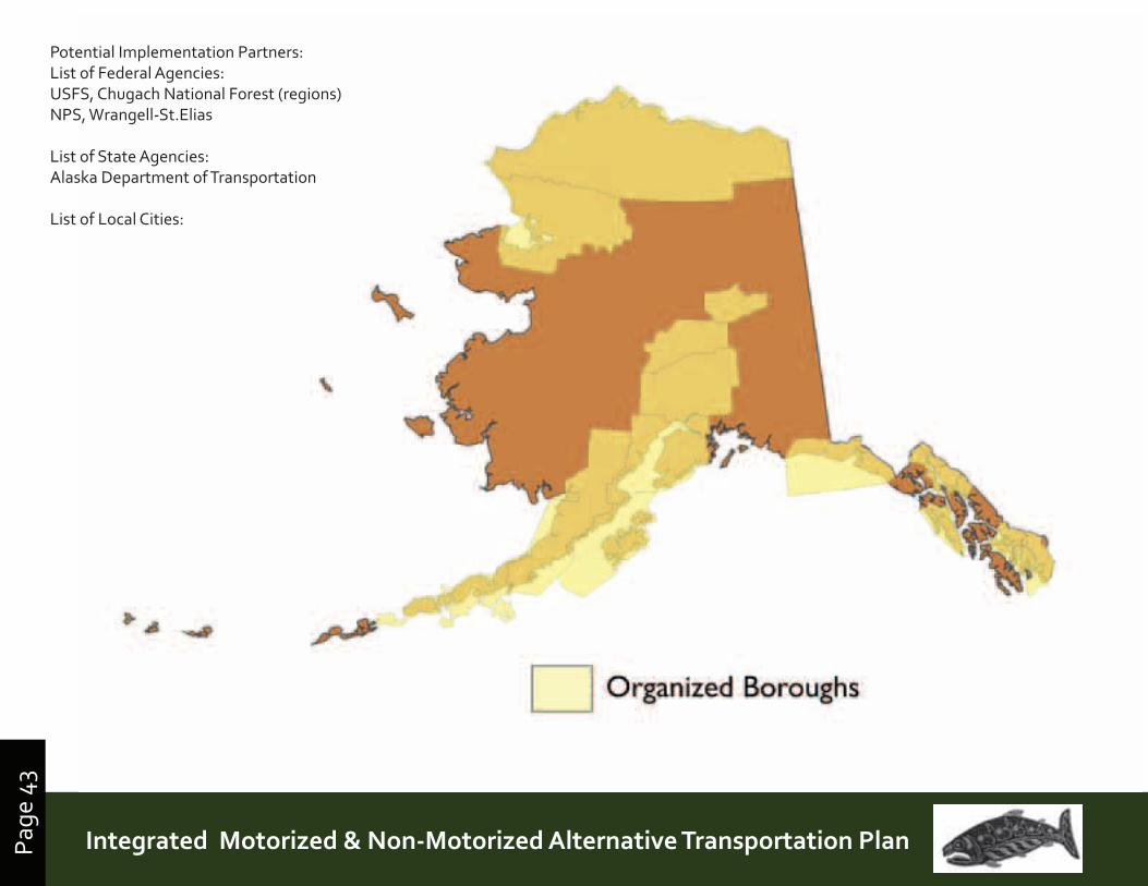
Page
43
Prince William Sound | Copper River Watershed Area | Gulf of AlaskaIntegrated Motorized & Non-Motorized Alternative Transportation PlanPage
43
Potential Implementation Partners:List of Federal Agencies:USFS, Chugach National Forest (regions)NPS, Wrangell-St.Elias
List of State Agencies:Alaska Department of Transportation
List of Local Cities:
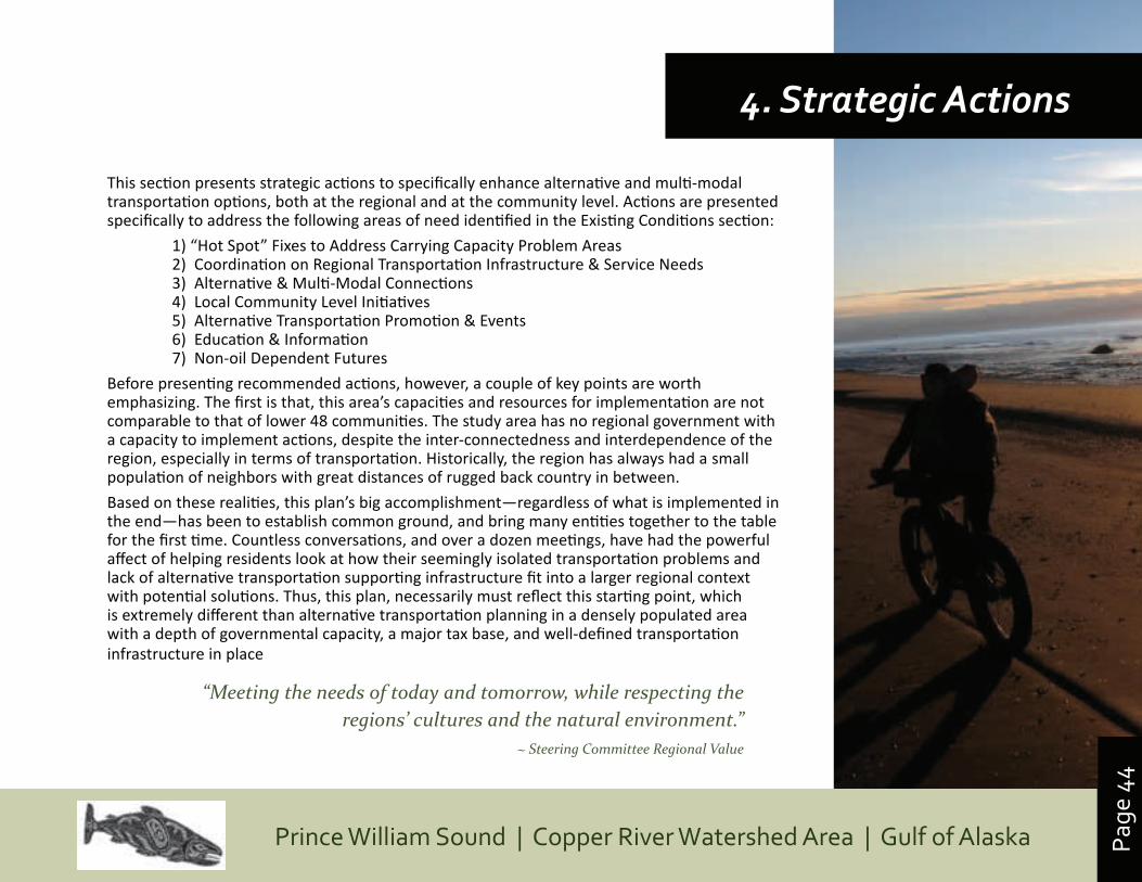
Page
44
Prince William Sound | Copper River Watershed Area | Gulf of Alaska
This section presents strategic actions to specifically enhance alternative and multi-modal transportation options, both at the regional and at the community level. Actions are presented specifically to address the following areas of need identified in the Existing Conditions section:
1) “Hot Spot” Fixes to Address Carrying Capacity Problem Areas2) Coordination on Regional Transportation Infrastructure & Service Needs3) Alternative & Multi-Modal Connections4) Local Community Level Initiatives5) Alternative Transportation Promotion & Events6) Education & Information7) Non-oil Dependent Futures
Before presenting recommended actions, however, a couple of key points are worth emphasizing. The first is that, this area’s capacities and resources for implementation are not comparable to that of lower 48 communities. The study area has no regional government with a capacity to implement actions, despite the inter-connectedness and interdependence of the region, especially in terms of transportation. Historically, the region has always had a small population of neighbors with great distances of rugged back country in between.
Based on these realities, this plan’s big accomplishment—regardless of what is implemented in the end—has been to establish common ground, and bring many entities together to the table for the first time. Countless conversations, and over a dozen meetings, have had the powerful affect of helping residents look at how their seemingly isolated transportation problems and lack of alternative transportation supporting infrastructure fit into a larger regional context with potential solutions. Thus, this plan, necessarily must reflect this starting point, which is extremely different than alternative transportation planning in a densely populated area with a depth of governmental capacity, a major tax base, and well-defined transportation infrastructure in place
4. Strategic Actions
“Meeting the needs of today and tomorrow, while respecting the regions’ cultures and the natural environment.”
~ Steering Committee Regional Value
Page
45
Prince William Sound | Copper River Watershed Area | Gulf of AlaskaIntegrated Motorized & Non-Motorized Alternative Transportation PlanPage
45
A second point is that working together on alternati ve transportati on issues is valuable, and can bring many benefi ts to the region, for both travelers seeking access to public lands, and residents. Although many residents currently bike and walk for pleasure and recreati on, and live acti ve outdoor lifestyles, there are many reasons for enhancing the infrastructure and multi -modal connecti ons in support of “non oil” dependent, or less energy intensive opti ons. Some of these reasons are already clear in the region—despite serving as a port region for Alaska’s energy exports—energy costs in the region are extremely high. The reasons below are taken from the missions of a number of organizati ons in the U.S. backing a movement to improve the health and sustainability of our communiti es by shift ing to more human powered, acti ve modes of recreati on.
• Health and physical acti vity: Alaska as a state has one of the highest percentages in the U.S. for adolescent incidence of obesity/diabetes and related diseases, especially among nati ve populati ons;
• Environmental Impacts from oil-dependent transportati on (stormwater issues, etc.).
• Costs for maintenance of present oil-dependent system (non sustainable).
• Greenhouse gas reducti on – internati onal climate change commitments and carbon sequestrati on opportuniti es
• “Fix it fi rst” funding for roads to incorporate safety and access for non-motorized users
• “Recreati onal trails initi ati ves” and “Complete streets” as part of the federal transportati on funding thru enhancements, scenic byway funds, recreati onal trails funding, local smart growth initi ati ves
• Potenti al for environmental protecti on and oil spill response (especially along Copper River – safety cabins that could also serve as oil spill deployment and monitoring
• “Think globally – Act Locally” strategy for comprehensive, long-range planning eff ort that also recognizes local projects as the necessary puzzle pieces
• It will help the region align with a nati onal trend and tap into potenti al resources
Organizations whose missions are helping shifting national transportation toward greater use of alternative modes:
FHWA
USDA
FS
EPA
NHTSA
US Fish & Wildlife Service
BIA
USDOH
USDOE
US Army Corp of Engineers
AAHSTO
Insti tute of Transportati on Engineers
Surface Transportati on Policy Project
“Rails-to-Trails” Conservancy
League of American Bicyclists
Nati onal Safe Routes to School Clearinghouse
Smart Growth America
Urban Design Insti tute
American Insti tute of Landscape Architects
American Planning Associati on
American Recreati on and Parks Assoc.
American Associati on for Health, Physical Educati on, Recreati on & Dance
American Medical Associati on
. . . . and many Alaska state agencies and local community trails groups.
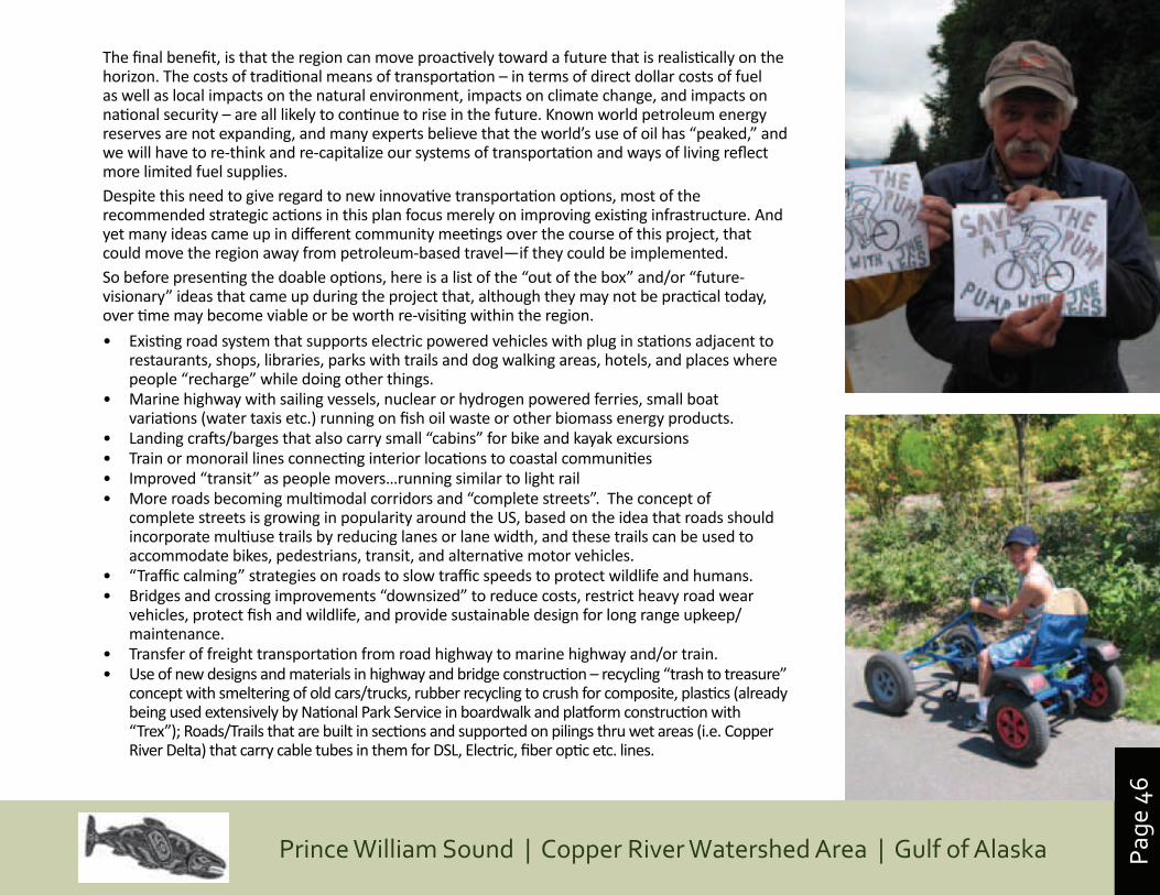
Page
46
Prince William Sound | Copper River Watershed Area | Gulf of Alaska
The final benefit, is that the region can move proactively toward a future that is realistically on the horizon. The costs of traditional means of transportation – in terms of direct dollar costs of fuel as well as local impacts on the natural environment, impacts on climate change, and impacts on national security – are all likely to continue to rise in the future. Known world petroleum energy reserves are not expanding, and many experts believe that the world’s use of oil has “peaked,” and we will have to re-think and re-capitalize our systems of transportation and ways of living reflect more limited fuel supplies. Despite this need to give regard to new innovative transportation options, most of the recommended strategic actions in this plan focus merely on improving existing infrastructure. And yet many ideas came up in different community meetings over the course of this project, that could move the region away from petroleum-based travel—if they could be implemented.So before presenting the doable options, here is a list of the “out of the box” and/or “future-visionary” ideas that came up during the project that, although they may not be practical today, over time may become viable or be worth re-visiting within the region.
• Existing road system that supports electric powered vehicles with plug in stations adjacent to restaurants, shops, libraries, parks with trails and dog walking areas, hotels, and places where people “recharge” while doing other things.
• Marine highway with sailing vessels, nuclear or hydrogen powered ferries, small boat variations (water taxis etc.) running on fish oil waste or other biomass energy products.
• Landing crafts/barges that also carry small “cabins” for bike and kayak excursions • Train or monorail lines connecting interior locations to coastal communities• Improved “transit” as people movers…running similar to light rail• More roads becoming multimodal corridors and “complete streets”. The concept of
complete streets is growing in popularity around the US, based on the idea that roads should incorporate multiuse trails by reducing lanes or lane width, and these trails can be used to accommodate bikes, pedestrians, transit, and alternative motor vehicles.
• “Traffic calming” strategies on roads to slow traffic speeds to protect wildlife and humans.• Bridges and crossing improvements “downsized” to reduce costs, restrict heavy road wear
vehicles, protect fish and wildlife, and provide sustainable design for long range upkeep/maintenance.
• Transfer of freight transportation from road highway to marine highway and/or train.• Use of new designs and materials in highway and bridge construction – recycling “trash to treasure”
concept with smeltering of old cars/trucks, rubber recycling to crush for composite, plastics (already being used extensively by National Park Service in boardwalk and platform construction with “Trex”); Roads/Trails that are built in sections and supported on pilings thru wet areas (i.e. Copper River Delta) that carry cable tubes in them for DSL, Electric, fiber optic etc. lines.
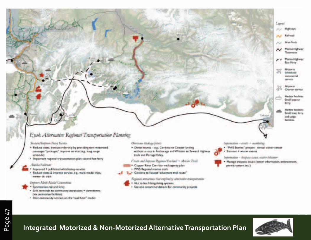
Page
47
Prince William Sound | Copper River Watershed Area | Gulf of AlaskaIntegrated Motorized & Non-Motorized Alternative Transportation PlanPage
47
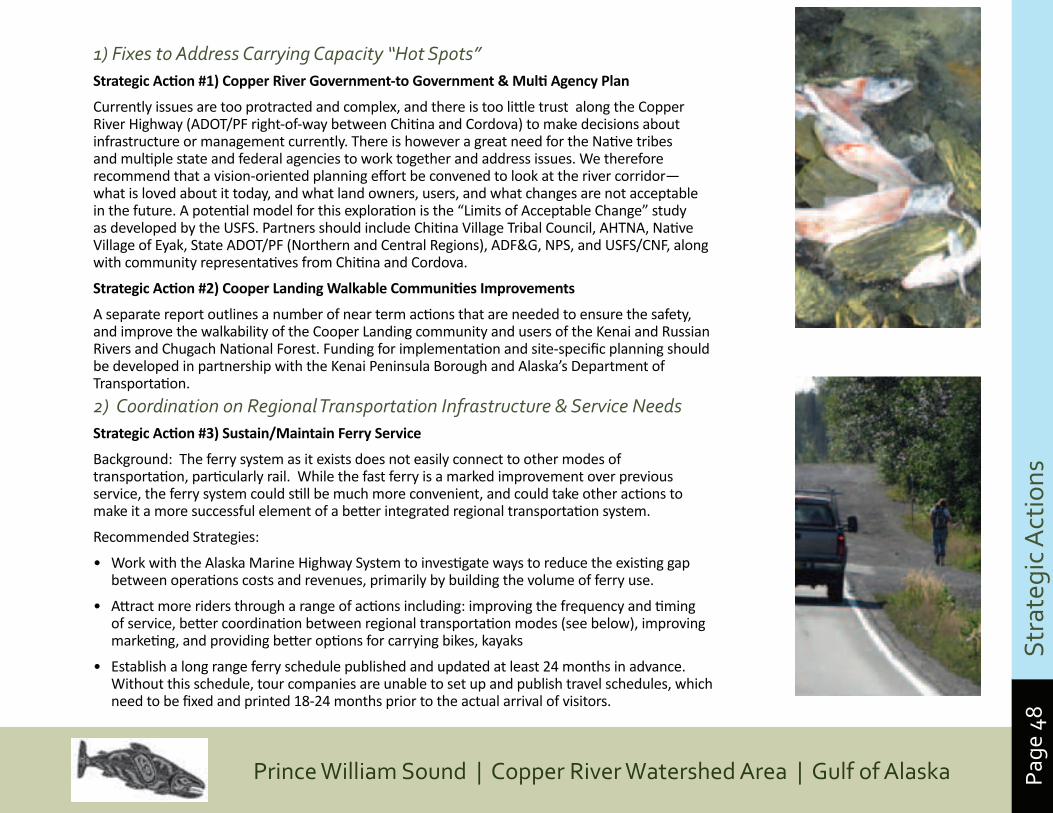
Page
48
Prince William Sound | Copper River Watershed Area | Gulf of Alaska
1) Fixes to Address Carrying Capacity “Hot Spots”StrategicAction#1)CopperRiverGovernment-toGovernment&MultiAgencyPlan
Currently issues are too protracted and complex, and there is too little trust along the Copper River Highway (ADOT/PF right-of-way between Chitina and Cordova) to make decisions about infrastructure or management currently. There is however a great need for the Native tribes and multiple state and federal agencies to work together and address issues. We therefore recommend that a vision-oriented planning effort be convened to look at the river corridor—what is loved about it today, and what land owners, users, and what changes are not acceptable in the future. A potential model for this exploration is the “Limits of Acceptable Change” study as developed by the USFS. Partners should include Chitina Village Tribal Council, AHTNA, Native Village of Eyak, State ADOT/PF (Northern and Central Regions), ADF&G, NPS, and USFS/CNF, along with community representatives from Chitina and Cordova.
StrategicAction#2)CooperLandingWalkableCommunitiesImprovements
A separate report outlines a number of near term actions that are needed to ensure the safety, and improve the walkability of the Cooper Landing community and users of the Kenai and Russian Rivers and Chugach National Forest. Funding for implementation and site-specific planning should be developed in partnership with the Kenai Peninsula Borough and Alaska’s Department of Transportation.
2) Coordination on Regional Transportation Infrastructure & Service NeedsStrategicAction#3)Sustain/MaintainFerryService
Background: The ferry system as it exists does not easily connect to other modes of transportation, particularly rail. While the fast ferry is a marked improvement over previous service, the ferry system could still be much more convenient, and could take other actions to make it a more successful element of a better integrated regional transportation system.
Recommended Strategies:
• Work with the Alaska Marine Highway System to investigate ways to reduce the existing gap between operations costs and revenues, primarily by building the volume of ferry use.
• Attract more riders through a range of actions including: improving the frequency and timing of service, better coordination between regional transportation modes (see below), improving marketing, and providing better options for carrying bikes, kayaks
• Establish a long range ferry schedule published and updated at least 24 months in advance. Without this schedule, tour companies are unable to set up and publish travel schedules, which need to be fixed and printed 18-24 months prior to the actual arrival of visitors.
S
trat
egic
Act
ions
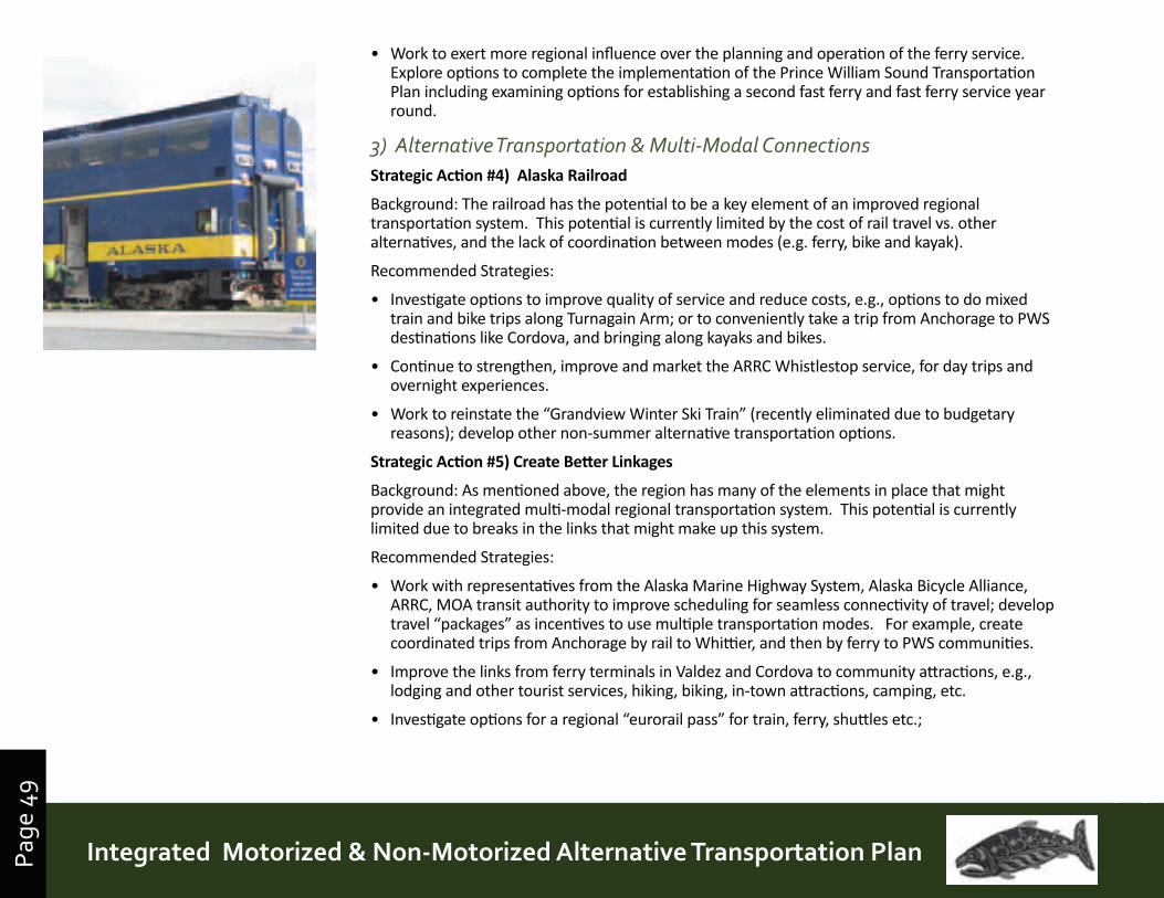
Page
49
Prince William Sound | Copper River Watershed Area | Gulf of AlaskaIntegrated Motorized & Non-Motorized Alternative Transportation PlanPage
49
• Work to exert more regional influence over the planning and operation of the ferry service. Explore options to complete the implementation of the Prince William Sound Transportation Plan including examining options for establishing a second fast ferry and fast ferry service year round.
3) Alternative Transportation & Multi-Modal Connections StrategicAction#4)AlaskaRailroad
Background: The railroad has the potential to be a key element of an improved regional transportation system. This potential is currently limited by the cost of rail travel vs. other alternatives, and the lack of coordination between modes (e.g. ferry, bike and kayak).
Recommended Strategies:
• Investigate options to improve quality of service and reduce costs, e.g., options to do mixed train and bike trips along Turnagain Arm; or to conveniently take a trip from Anchorage to PWS destinations like Cordova, and bringing along kayaks and bikes.
• Continue to strengthen, improve and market the ARRC Whistlestop service, for day trips and overnight experiences.
• Work to reinstate the “Grandview Winter Ski Train” (recently eliminated due to budgetary reasons); develop other non-summer alternative transportation options.
StrategicAction#5)CreateBetterLinkages
Background: As mentioned above, the region has many of the elements in place that might provide an integrated multi-modal regional transportation system. This potential is currently limited due to breaks in the links that might make up this system.
Recommended Strategies:
• Work with representatives from the Alaska Marine Highway System, Alaska Bicycle Alliance, ARRC, MOA transit authority to improve scheduling for seamless connectivity of travel; develop travel “packages” as incentives to use multiple transportation modes. For example, create coordinated trips from Anchorage by rail to Whittier, and then by ferry to PWS communities.
• Improve the links from ferry terminals in Valdez and Cordova to community attractions, e.g., lodging and other tourist services, hiking, biking, in-town attractions, camping, etc.
• Investigate options for a regional “eurorail pass” for train, ferry, shuttles etc.;
Page
50
Prince William Sound | Copper River Watershed Area | Gulf of Alaska
StrategicAction#6)Overcomeblockagepoints
Background: Certain segments of the transportation system prevent ease of movement between different points, despite these points being close together.
Recommended Strategies:
• Explore options to better connect Portage to Whittier for people who aren’t traveling by private vehicle or part of an organized tour. This includes those traveling by bike or foot. Options include a shuttle through the tunnel, or, more ambitiously, a boat across Portage Lake to the trail over Portage Pass.
• Explore options to reduce the requirements for travelers to take roundabout routes to reach regional destinations. For example travel from Cordova to Cooper Landing or Seward typically requires an unwanted trip to Anchorage.
StrategicAction#7)CreateandImproveRegionalOn-landAccess+MarineTrails
Background: The project area has several well used regional trails, primarily the trail systems established in the eastern Kenai Peninsula. These trails, used for hiking and biking in the summer, and skiing in the winter, include the Resurrection Pass Trail, the Russian River Trail and the Johnson Pass Trail. Other parts of the project area offer popular areas for snowmachines. The existing trails are limited, and provide access to only a small portion of the area; options for establishing new (or in some cases historic) trails should be explored.
Recommended Strategies:
• Copper River Corridor Management – develop a strategic planning task force to develop a model management plan and 1-stop permit process for the Copper River Corridor, working with Native Corporations, tribal organizations, state and federal agencies, communities, and other stakeholders. This process should identify options for creating improved recreational access while responding to concerns regarding environmental quality, trespass on Native land holdings, salmon stock protection and other issues. (See Appendix X for a description of a “Limits of Acceptable Change” approach that may work well in addressing management issues along the river.)
• Support plans to create a system of Prince William Sound “marine trails”, as well as associated on-shore support services and information promoting safe, low impact use. This project is now in progress, led by the National Wildlife Foundation and Alaska State Parks. These two partners are working with PWS communities to develop the system in a way that creates local economic benefits and incentives for environmental protection.
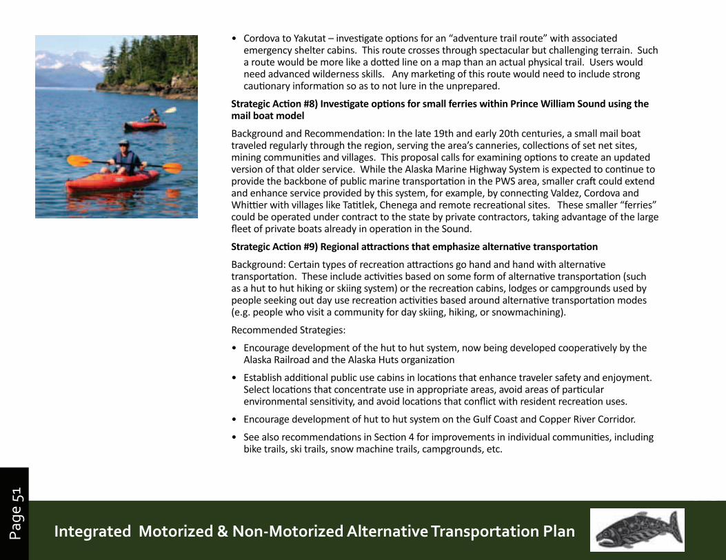
Page
51
Prince William Sound | Copper River Watershed Area | Gulf of AlaskaIntegrated Motorized & Non-Motorized Alternative Transportation PlanPage
51
• Cordova to Yakutat – investigate options for an “adventure trail route” with associated emergency shelter cabins. This route crosses through spectacular but challenging terrain. Such a route would be more like a dotted line on a map than an actual physical trail. Users would need advanced wilderness skills. Any marketing of this route would need to include strong cautionary information so as to not lure in the unprepared.
StrategicAction#8)InvestigateoptionsforsmallferrieswithinPrinceWilliamSoundusingthemailboatmodel
Background and Recommendation: In the late 19th and early 20th centuries, a small mail boat traveled regularly through the region, serving the area’s canneries, collections of set net sites, mining communities and villages. This proposal calls for examining options to create an updated version of that older service. While the Alaska Marine Highway System is expected to continue to provide the backbone of public marine transportation in the PWS area, smaller craft could extend and enhance service provided by this system, for example, by connecting Valdez, Cordova and Whittier with villages like Tatitlek, Chenega and remote recreational sites. These smaller “ferries” could be operated under contract to the state by private contractors, taking advantage of the large fleet of private boats already in operation in the Sound.
StrategicAction#9)Regionalattractionsthatemphasizealternativetransportation
Background: Certain types of recreation attractions go hand and hand with alternative transportation. These include activities based on some form of alternative transportation (such as a hut to hut hiking or skiing system) or the recreation cabins, lodges or campgrounds used by people seeking out day use recreation activities based around alternative transportation modes (e.g. people who visit a community for day skiing, hiking, or snowmachining).
Recommended Strategies:
• Encourage development of the hut to hut system, now being developed cooperatively by the Alaska Railroad and the Alaska Huts organization
• Establish additional public use cabins in locations that enhance traveler safety and enjoyment. Select locations that concentrate use in appropriate areas, avoid areas of particular environmental sensitivity, and avoid locations that conflict with resident recreation uses.
• Encourage development of hut to hut system on the Gulf Coast and Copper River Corridor.
• See also recommendations in Section 4 for improvements in individual communities, including bike trails, ski trails, snow machine trails, campgrounds, etc.
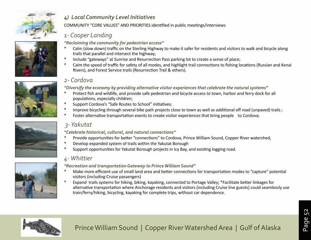
Page
52
Prince William Sound | Copper River Watershed Area | Gulf of Alaska
4) Local Community Level InitiativesCOMMUNITY “CORE VALUES” AND PRIORITIES identified in public meetings/interviews
1- Cooper Landing“Reclaiming the community for pedestrian access”* Calm (slow down) traffic on the Sterling Highway to make it safer for residents and visitors to walk and bicycle along
trails that parallel and intersect the highway;* Include “gateways” at Sunrise and Resurrection Pass parking lot to create a sense of place; * Calm the speed of traffic for safety of all modes, and highlight trail connections to fishing locations (Russian and Kenai
Rivers), and Forest Service trails (Resurrection Trail & others).
2- Cordova “Diversify the economy by providing alternative visitor experiences that celebrate the natural systems”* Protect fish and wildlife, and provide safe pedestrian and bicycle access to town, harbor and ferry dock for all
populations, especially children;* Support Cordova’s “Safe Routes to School” initiatives;* Improve bicycling through several bike path projects close to town as well as additional off road (unpaved) trails ;* Foster alternative transportation events to create visitor experiences that bring people to Cordova;
3- Yakutat“Celebrate historical, cultural, and natural connections” * Provide opportunities for better “connections” to Cordova, Prince William Sound, Copper River watershed, * Develop expanded system of trails within the Yakutat Borough* Support opportunities for Yakutat Borough projects in Icy Bay, and existing logging road.
4- Whittier“Recreation and transportation Gateway to Prince William Sound”* Make more efficient use of small land area and better connections for transportation modes to “capture” potential
visitors (including Cruise passengers)* Expand trails systems for hiking, biking, kayaking, connected to Portage Valley; *Facilitate better linkages for
alternative transportation where Anchorage residents and visitors (including Cruise line guests) could seamlessly use train/ferry/hiking, bicycling, kayaking for complete trips, without car dependence.
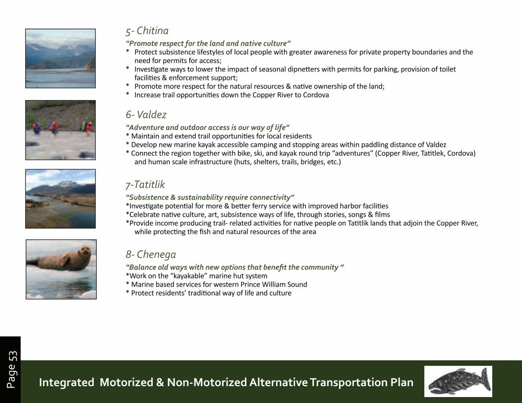
Page
53
Prince William Sound | Copper River Watershed Area | Gulf of AlaskaIntegrated Motorized & Non-Motorized Alternative Transportation PlanPage
53
5- Chitina“Promote respect for the land and native culture”* Protect subsistence lifestyles of local people with greater awareness for private property boundaries and the
need for permits for access;* Investigate ways to lower the impact of seasonal dipnetters with permits for parking, provision of toilet
facilities & enforcement support;* Promote more respect for the natural resources & native ownership of the land;* Increase trail opportunities down the Copper River to Cordova
6- Valdez“Adventure and outdoor access is our way of life”* Maintain and extend trail opportunities for local residents* Develop new marine kayak accessible camping and stopping areas within paddling distance of Valdez * Connect the region together with bike, ski, and kayak round trip “adventures” (Copper River, Tatitlek, Cordova)
and human scale infrastructure (huts, shelters, trails, bridges, etc.)
7-Tatitlik“Subsistence & sustainability require connectivity”*Investigate potential for more & better ferry service with improved harbor facilities*Celebrate native culture, art, subsistence ways of life, through stories, songs & films*Provide income producing trail- related activities for native people on Tatitlik lands that adjoin the Copper River,
while protecting the fish and natural resources of the area
8- Chenega“Balance old ways with new options that benefit the community ”*Work on the “kayakable” marine hut system* Marine based services for western Prince William Sound* Protect residents’ traditional way of life and culture
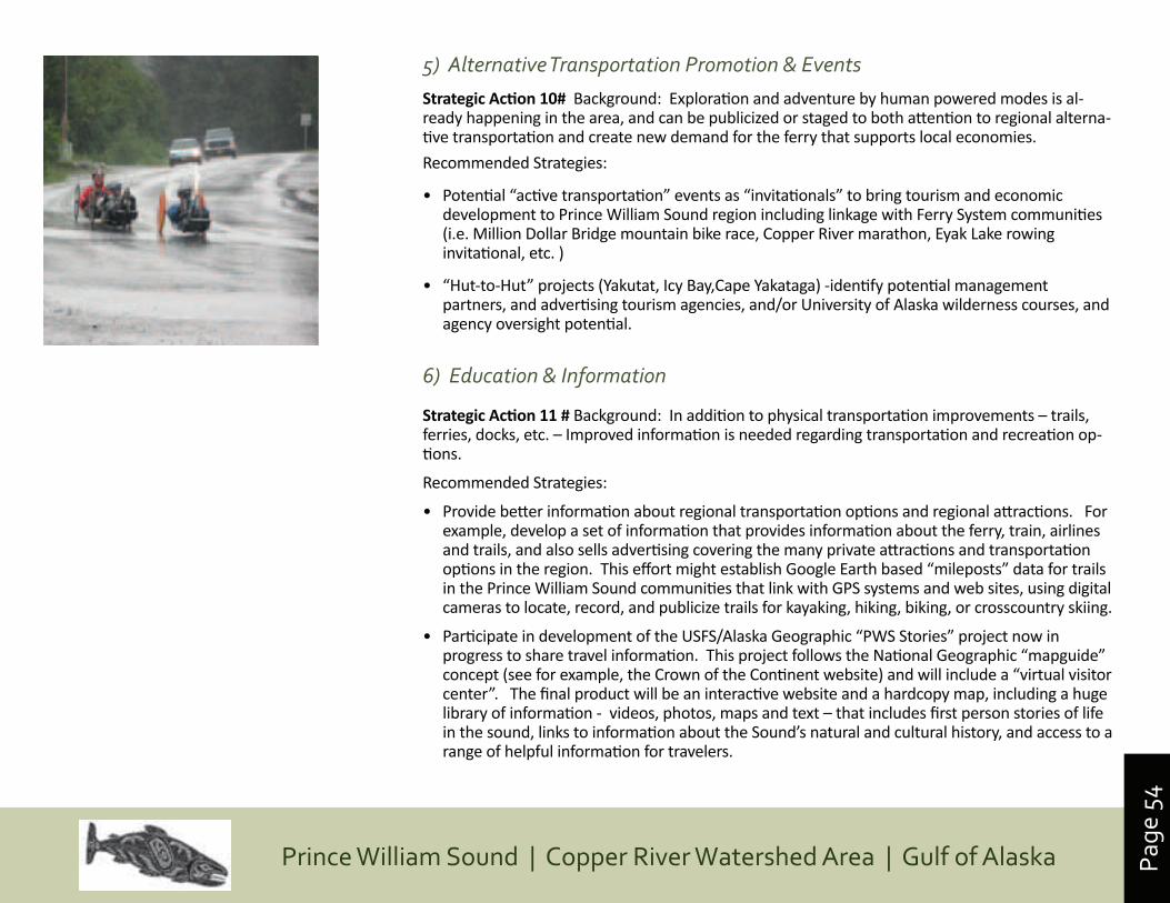
Page
54
Prince William Sound | Copper River Watershed Area | Gulf of Alaska
5) Alternative Transportation Promotion & Events StrategicAction10#Background: Exploration and adventure by human powered modes is al-ready happening in the area, and can be publicized or staged to both attention to regional alterna-tive transportation and create new demand for the ferry that supports local economies.
Recommended Strategies:
• Potential “active transportation” events as “invitationals” to bring tourism and economic development to Prince William Sound region including linkage with Ferry System communities (i.e. Million Dollar Bridge mountain bike race, Copper River marathon, Eyak Lake rowing invitational, etc. )
• “Hut-to-Hut” projects (Yakutat, Icy Bay,Cape Yakataga) -identify potential management partners, and advertising tourism agencies, and/or University of Alaska wilderness courses, and agency oversight potential.
6) Education & Information
StrategicAction11#Background: In addition to physical transportation improvements – trails, ferries, docks, etc. – Improved information is needed regarding transportation and recreation op-tions.
Recommended Strategies:
• Provide better information about regional transportation options and regional attractions. For example, develop a set of information that provides information about the ferry, train, airlines and trails, and also sells advertising covering the many private attractions and transportation options in the region. This effort might establish Google Earth based “mileposts” data for trails in the Prince William Sound communities that link with GPS systems and web sites, using digital cameras to locate, record, and publicize trails for kayaking, hiking, biking, or crosscountry skiing.
• Participate in development of the USFS/Alaska Geographic “PWS Stories” project now in progress to share travel information. This project follows the National Geographic “mapguide” concept (see for example, the Crown of the Continent website) and will include a “virtual visitor center”. The final product will be an interactive website and a hardcopy map, including a huge library of information - videos, photos, maps and text – that includes first person stories of life in the sound, links to information about the Sound’s natural and cultural history, and access to a range of helpful information for travelers.
Page
55
Prince William Sound | Copper River Watershed Area | Gulf of AlaskaIntegrated Motorized & Non-Motorized Alternative Transportation PlanPage
55
• Coordinate travel information to be offered on a regional scale with the well-developed community travel information sources already in existence (e.g., CVB’s and Chambers of Commerce in Cordova, Whittier, Valdez, Yakutat, Chitina, Glennallen and Cooper Landing)
• Consider options for events that could bring local economic benefits and promote improvement of regional trails and new regional attractions. Seek start up funds to look for partnerships/sponsorships for events that can become on-going fundraisers and community supported events while providing active adventure sport opportunities for locals and visitors. Examples include an “extreme race” from Yakutat to Cordova, winter race from Valdez to Cordova, a Million Dollar Bridge marathon, PWS triathlon)
StrategicAction12# – Trespass issues, visitor behavior
Background: Recreation and tourism can create local jobs and other benefits, but can also disrupt community life, and impact the natural environment. The information and marketing strategies presented above should also include information that helps recreation users and tourists to be low impact visitors.
StrategicAction13# –Recommended Strategies:
• Provide ready access to information about land status in the region, so recreationists/tourists can know where private lands are located. Historically, many visitors have not known about or acknowledged the fact that there are large blocks of non-public lands in the region.
• Work with large private land owners, primarily Native Corporations, to develop an information brochure, map and/or website, perhaps coupled with a permit system, so that visitors do not trespass on private lands. This system could also set up a means for Native land owners to establish systems that would allow use of their lands where appropriate, and provide a source of jobs and/or revenue.
• Provide information about ways to be a low impact, safe visitor to the region. Much of this information is already available, but scattered in dozens of different brochures. Information is needed, for example, on low impact (“leave no trace”) camping, boat safety, respect for cultural sites, and wildlife viewing.
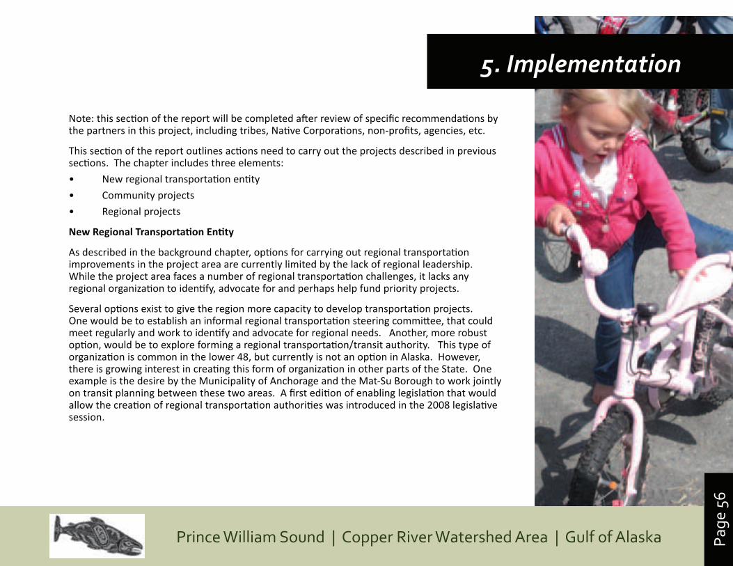
Page
56
Prince William Sound | Copper River Watershed Area | Gulf of Alaska
Note: this section of the report will be completed after review of specific recommendations by the partners in this project, including tribes, Native Corporations, non-profits, agencies, etc.
This section of the report outlines actions need to carry out the projects described in previous sections. The chapter includes three elements:
• New regional transportation entity
• Community projects
• Regional projects
NewRegionalTransportationEntity
As described in the background chapter, options for carrying out regional transportation improvements in the project area are currently limited by the lack of regional leadership. While the project area faces a number of regional transportation challenges, it lacks any regional organization to identify, advocate for and perhaps help fund priority projects.
Several options exist to give the region more capacity to develop transportation projects. One would be to establish an informal regional transportation steering committee, that could meet regularly and work to identify and advocate for regional needs. Another, more robust option, would be to explore forming a regional transportation/transit authority. This type of organization is common in the lower 48, but currently is not an option in Alaska. However, there is growing interest in creating this form of organization in other parts of the State. One example is the desire by the Municipality of Anchorage and the Mat-Su Borough to work jointly on transit planning between these two areas. A first edition of enabling legislation that would allow the creation of regional transportation authorities was introduced in the 2008 legislative session.
5. Implementation
Page
57
Prince William Sound | Copper River Watershed Area | Gulf of AlaskaIntegrated Motorized & Non-Motorized Alternative Transportation PlanPage
57
More work is needed to better understand the benefits and challenges of creating such an entity in the project area. Initial work on this topic will be done as part of this project, over the next two months. Based on a very preliminary evaluation, some of the potential benefits of creating a regional transportation authority are outlined below:
• Authority could be set up to represent the major stakeholders in transportation issues, including tribes, Native Corporations, communities, agencies, businesses and residents
• Creates, for the first time, an organization that can look broadly at regional transportation needs, and identify and plan for priority regional projects
• Creates a organization with the political clout to advocate for priority projects, with the State of Alaska and other potential funders
• Sets the stage for creative approaches to funding, for example, cooperation between Native organizations and communities
• Has the potential to generate local funds through mechanisms such as bond measures. Small amounts of matching local funding are essential to leveraging larger amounts of funds that come through the Statewide Transportation Improvement Program (STIP)
• Creates some of the benefits of a Borough, but is limited to transportation issues, and consequently does not require the taxes and bureaucratic structures that many residents and businesses do not want
This list is very preliminary. As noted above, more research into options for regional transportation organizations will be completed in the coming months.
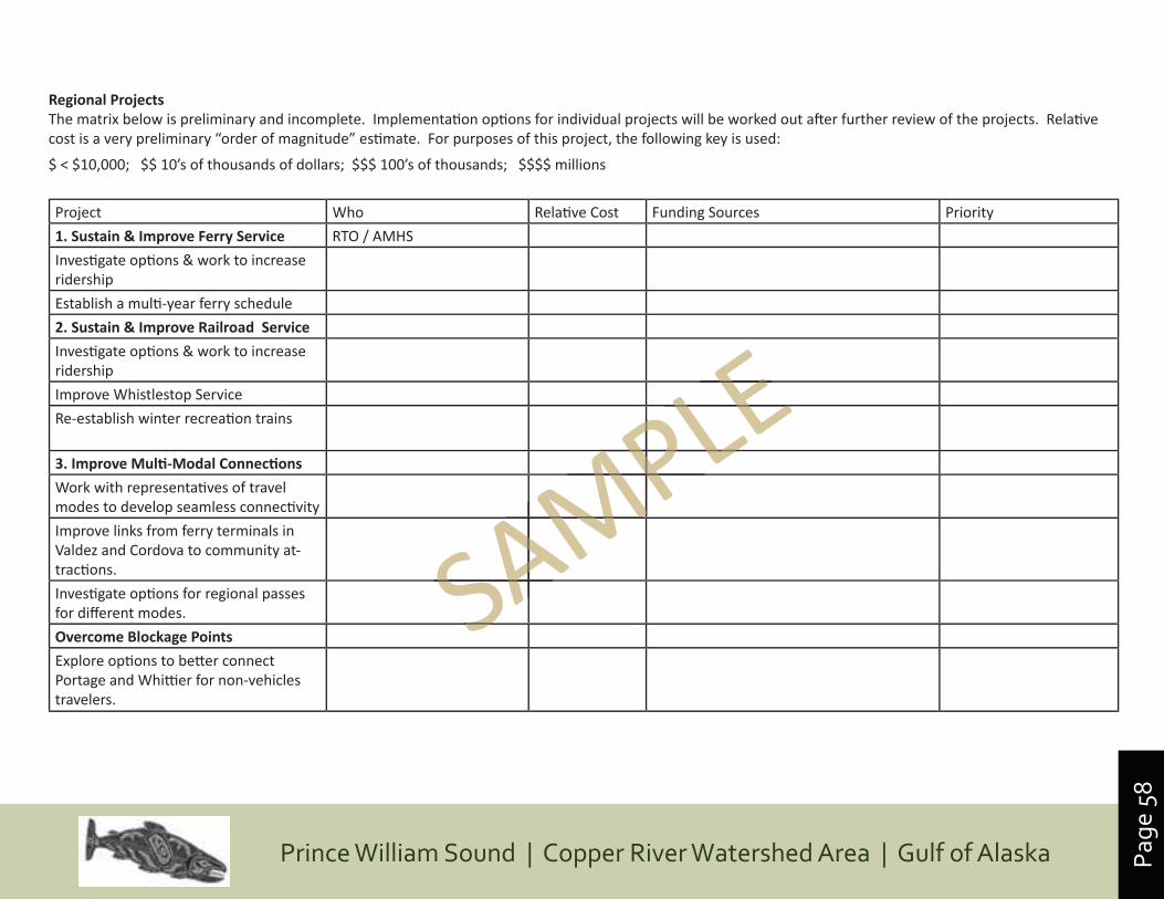
Page
58
Prince William Sound | Copper River Watershed Area | Gulf of Alaska
Project Who Relati ve Cost Funding Sources Priority
1.Sustain&ImproveFerryService RTO / AMHS
Investi gate opti ons & work to increase ridership
Establish a multi -year ferry schedule
2.Sustain&ImproveRailroadService
Investi gate opti ons & work to increase ridership
Improve Whistlestop Service
Re-establish winter recreati on trains
3.ImproveMulti-ModalConnections
Work with representati ves of travel modes to develop seamless connecti vity
Improve links from ferry terminals in Valdez and Cordova to community at-tracti ons.
Investi gate opti ons for regional passes for diff erent modes.
OvercomeBlockagePoints
Explore opti ons to bett er connect Portage and Whitti er for non-vehicles travelers.
RegionalProjectsThe matrix below is preliminary and incomplete. Implementati on opti ons for individual projects will be worked out aft er further review of the projects. Relati ve cost is a very preliminary “order of magnitude” esti mate. For purposes of this project, the following key is used:
$ < $10,000; $$ 10’s of thousands of dollars; $$$ 100’s of thousands; $$$$ millions
SAMPLE
SAMPLE
SAMPLE
SAMPLE
SAMPLE
SAMPLE
SAMPLE
SAMPLE
SAMPLE
SAMPLE
SAMPLE
SAMPLE
SAMPLE
SAMPLE
SAMPLE
SAMPLE
SAMPLE
SAMPLE