Instructor: Paul Lowrey Barb Rademacher Joan Reynolds Brina Smith David Walker.
30
Instructor: Paul Lowrey Instructor: Paul Lowrey Barb Rademacher Barb Rademacher Joan Reynolds Joan Reynolds Brina Smith Brina Smith David Walker David Walker
-
Upload
amberly-carr -
Category
Documents
-
view
219 -
download
0
Transcript of Instructor: Paul Lowrey Barb Rademacher Joan Reynolds Brina Smith David Walker.
Instructor: Paul LowreyInstructor: Paul Lowrey
Barb RademacherBarb RademacherJoan ReynoldsJoan Reynolds
Brina SmithBrina SmithDavid WalkerDavid Walker
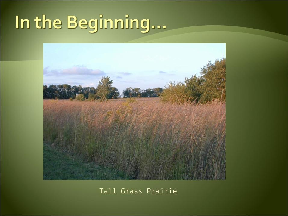
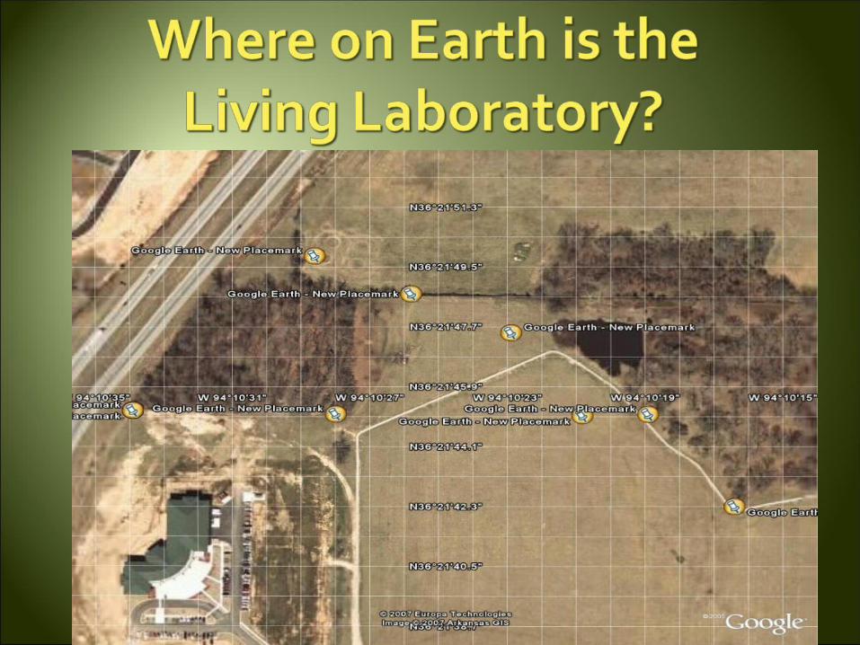
Tall Grass Prairie
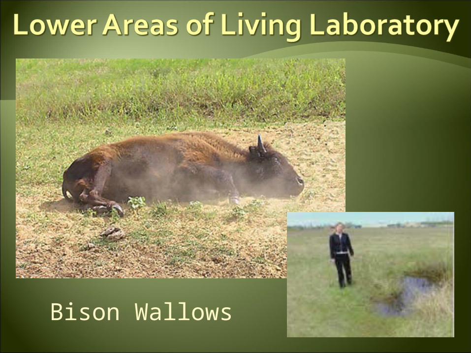
Bison Wallows
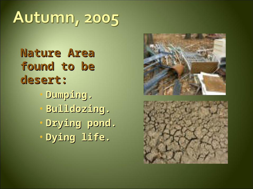
Nature Area Nature Area found to be found to be desert:desert:
• Dumping.Dumping.• Bulldozing.Bulldozing.• Drying pond.Drying pond.• Dying life.Dying life.
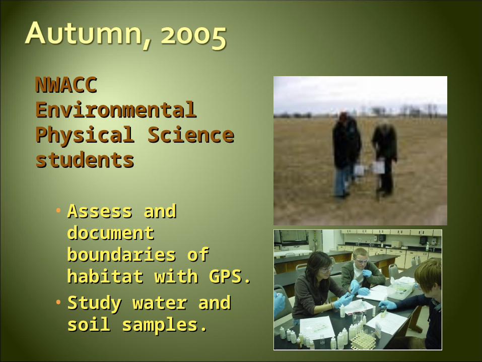
NWACC NWACC Environmental Environmental Physical Science Physical Science students students
• Assess and Assess and document document boundaries of boundaries of habitat with GPS.habitat with GPS.
• Study water and Study water and soil samples.soil samples.
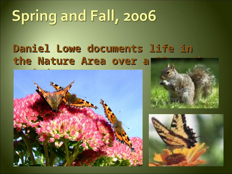
Daniel Lowe documents life in the Daniel Lowe documents life in the Nature Area over a 12-month Nature Area over a 12-month period.period.
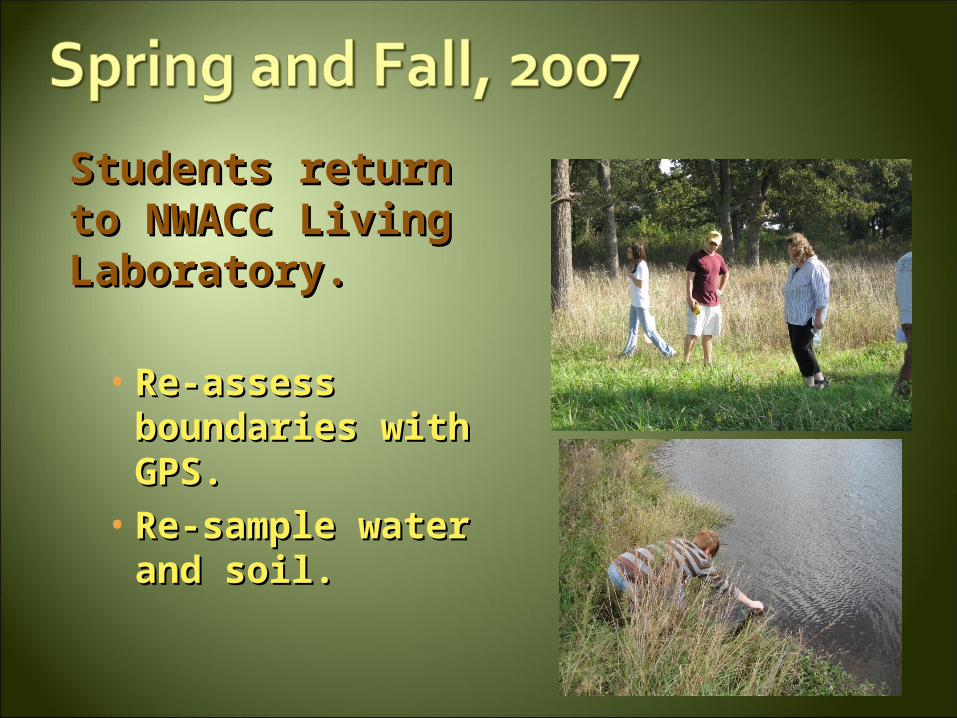
Students return Students return to NWACC Living to NWACC Living Laboratory.Laboratory.
• Re-assess Re-assess boundaries with boundaries with GPS.GPS.
• Re-sample water Re-sample water and soil.and soil.
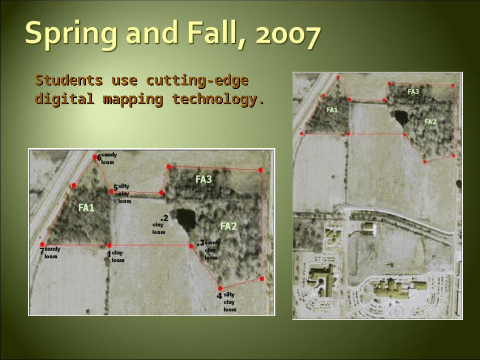
Students use cutting-edge Students use cutting-edge digital mapping technology.digital mapping technology.
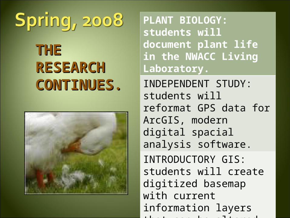
THE THE RESEARCH RESEARCH CONTINUES.CONTINUES.
PLANT BIOLOGY: students will document plant life in the NWACC Living Laboratory.
INDEPENDENT STUDY: students will reformat GPS data for ArcGIS, modern digital spacial analysis software.
INTRODUCTORY GIS: students will create digitized basemap with current information layers that can be altered and appended as necessary by future researchers
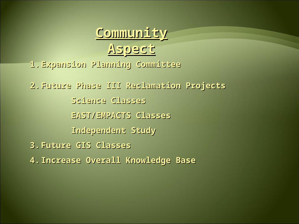
Community AspectCommunity Aspect
1.1. Expansion Planning CommitteeExpansion Planning Committee
2.2. Future Phase III Reclamation ProjectsFuture Phase III Reclamation Projects
Science ClassesScience Classes
EAST/EMPACTS ClassesEAST/EMPACTS Classes
Independent StudyIndependent Study
3.3. Future GIS ClassesFuture GIS Classes
4.4. Increase Overall Knowledge BaseIncrease Overall Knowledge Base
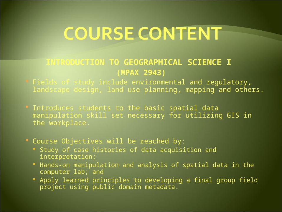
INTRODUCTION TO GEOGRAPHICAL SCIENCE I (MPAX 2943)
Fields of study include environmental and regulatory, landscape design, land use planning, mapping and others.
Introduces students to the basic spatial data manipulation skill set necessary for utilizing GIS in the workplace.
Course Objectives will be reached by: Study of case histories of data acquisition and interpretation; Hands-on manipulation and analysis of spatial data in the
computer lab; and Apply learned principles to developing a final group field
project using public domain metadata.
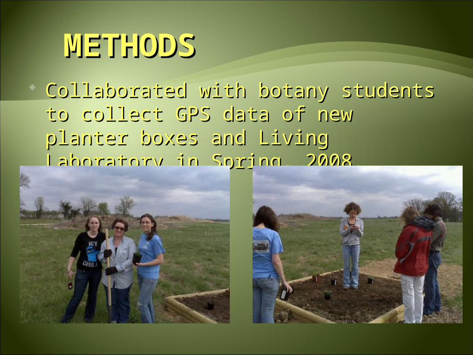
METHODSMETHODS Collaborated with botany students to Collaborated with botany students to
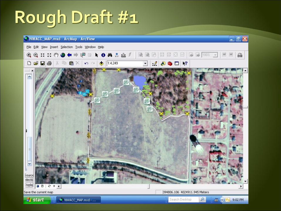
collect GPS data of new planter boxes collect GPS data of new planter boxes and Living Laboratory in Spring, 2008.and Living Laboratory in Spring, 2008.
Verify previously-collected data through Verify previously-collected data through reproduction of selected GPS points.reproduction of selected GPS points.
Convert GPS data into usable format for Convert GPS data into usable format for ArcGIS mapping.ArcGIS mapping.
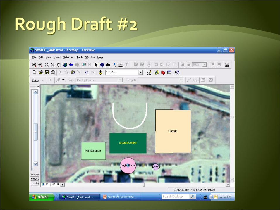
Create an ArcGIS map of the Phase III Create an ArcGIS map of the Phase III Reclamation area with various layers Reclamation area with various layers displaying data collected. displaying data collected.
COMMUNITY CONTACTSCOMMUNITY CONTACTSMARVIN GALLLOWAY, Ph.D.MARVIN GALLLOWAY, Ph.D.
Dean of Science & Mathematics, Northwest Arkansas Community CollegeDean of Science & Mathematics, Northwest Arkansas Community College
C. DIANNE PHILLIPSC. DIANNE PHILLIPS
EAST/EMPACTS Facilitator, Math & Science Faculty, Northwest Arkansas Community CollegeEAST/EMPACTS Facilitator, Math & Science Faculty, Northwest Arkansas Community College
PAUL LOWREYPAUL LOWREY
Math & Science Faculty, Northwest Arkansas Community CollegeMath & Science Faculty, Northwest Arkansas Community College
BURNETTA HINTERTHUERBURNETTA HINTERTHUER
Life & Physical Science Instructor, Northwest Arkansas Community CollegeLife & Physical Science Instructor, Northwest Arkansas Community College
DANIEL LOWEDANIEL LOWE
EAST/EMPACTS Student, Phase III Reclamation Project, Northwest Arkansas Community CollegeEAST/EMPACTS Student, Phase III Reclamation Project, Northwest Arkansas Community College
DIEGO RIOJADIEGO RIOJA
EAST/EMPACTS Student, Phase III Reclamation Project, Northwest Arkansas Community CollegeEAST/EMPACTS Student, Phase III Reclamation Project, Northwest Arkansas Community College
KEVIN EADSKEVIN EADSChief of Resource Management, Pea Ridge National Military Park, US National Park ServiceChief of Resource Management, Pea Ridge National Military Park, US National Park Service
ELIZABETH A. BOWENELIZABETH A. BOWENGIS Coordinator, Benton County Information SystemsGIS Coordinator, Benton County Information Systems
February 19thFebruary 19th: Plant Biology students will began collecting : Plant Biology students will began collecting
data from reclamation site.data from reclamation site.
March 6thMarch 6th: Plant Biology students will present the project : Plant Biology students will present the project
proposal.proposal.
April 22thApril 22th: Data collected and made available to GIS students.: Data collected and made available to GIS students.
April 29thApril 29th: GIS students projected data into ArcMap to produce : GIS students projected data into ArcMap to produce
a multi-layered map of the Reclamation area.a multi-layered map of the Reclamation area.
May 1stMay 1st: GIS Map completed and submitted for review.: GIS Map completed and submitted for review.
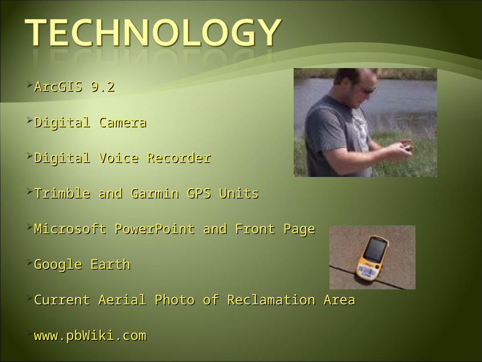
ArcGIS 9.2ArcGIS 9.2
Digital CameraDigital Camera
Digital Voice RecorderDigital Voice Recorder
Trimble and Garmin GPS UnitsTrimble and Garmin GPS Units
Microsoft PowerPoint and Front PageMicrosoft PowerPoint and Front Page
Google EarthGoogle Earth
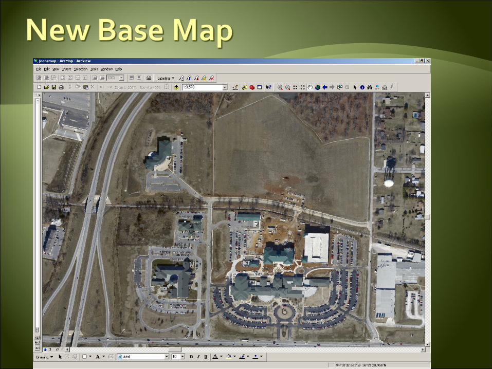
Current Aerial Photo of Reclamation AreaCurrent Aerial Photo of Reclamation Area
www.pbWiki.com www.pbWiki.com
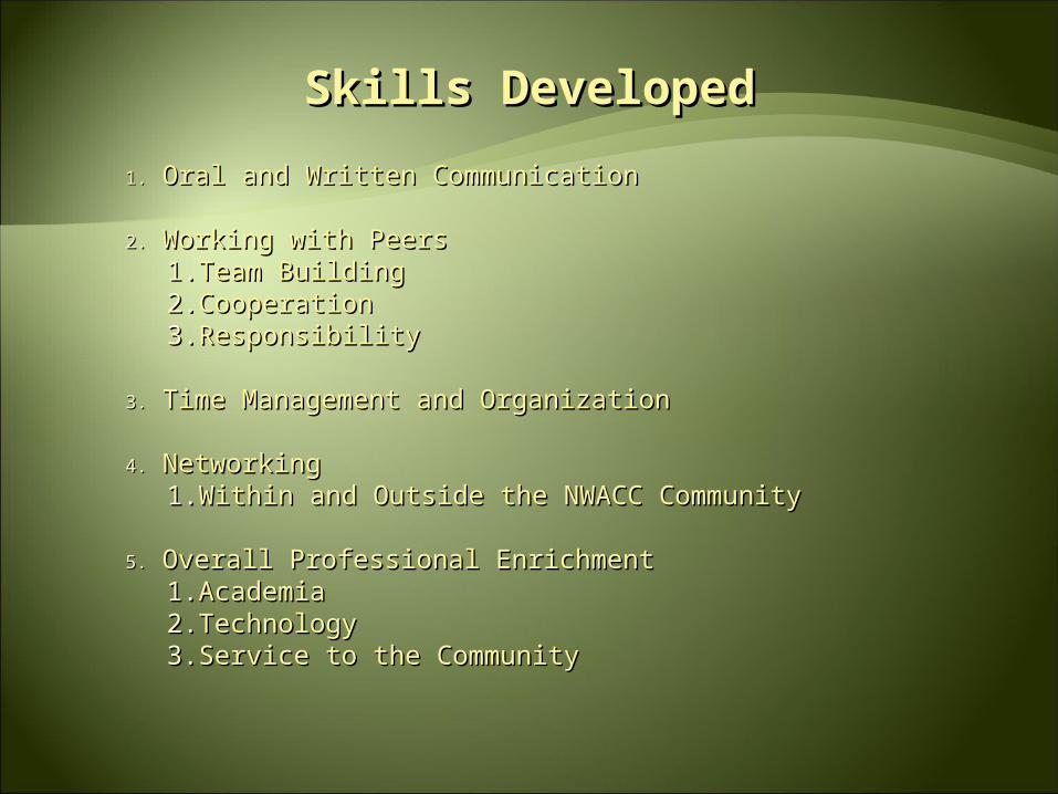
Skills DevelopedSkills Developed
1.1. Oral and Written CommunicationOral and Written Communication
2.2. Working with PeersWorking with Peers1.1. Team BuildingTeam Building2.2. CooperationCooperation3.3. ResponsibilityResponsibility
3.3. Time Management and OrganizationTime Management and Organization
4.4. NetworkingNetworking1.1. Within and Outside the NWACC CommunityWithin and Outside the NWACC Community
5.5. Overall Professional EnrichmentOverall Professional Enrichment1.1. AcademiaAcademia2.2. TechnologyTechnology3.3. Service to the CommunityService to the Community
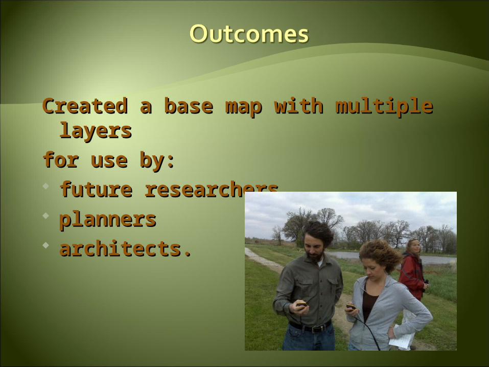
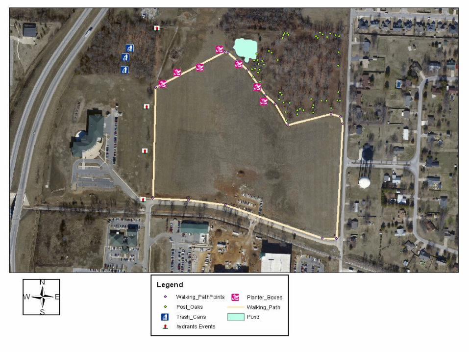
Created a base map with multiple Created a base map with multiple layerslayers
for use by: for use by: future researchersfuture researchers plannersplanners architects.architects.
Walking path.Planter boxes.Fire hydrants.Oak-Hickory Woodland Area.New Buildings (Polygons).Post Oak Savannah.And others.
From data supplied by current and previous classes.From data supplied by current and previous classes.
Using new base map: Find data and create layers showing mima
mounds. Find data and create layers showing additional
post oaks. Find data and create layers showing indigenous
and invasive fauna and flora. Create topological and hydrological map layers. Update map to correspond to new interchange
proposal.