Institute of Landscape Development, Recreation and Conservation Planning ALPTER Terraced Landscapes...
22
Institute of Landscape Development, Recreation and Conservation Planning ALPTER Terraced Landscapes in the Alpine Arc Austria Institute of Landscape Development, Recreation and Conservation Planning University of Natural Resources and Applied Sciences, Vienna Department of Landscape, Spatial and Infrastructure Sciences Christiane Brandenburg, Univ.Ass.DI Dr. Arne Arnberger, Univ.Lekt. DI Dr. Hermann Schacht, o.Prof. DI Renate Eder, DI
-
date post
21-Dec-2015 -
Category
Documents
-
view
216 -
download
1
Transcript of Institute of Landscape Development, Recreation and Conservation Planning ALPTER Terraced Landscapes...

Institute of Landscape Development, Recreation and Conservation Planning
ALPTER Terraced Landscapes in the Alpine Arc
Austria
Institute of Landscape Development, Recreation and Conservation Planning
University of Natural Resources and Applied Sciences, ViennaDepartment of Landscape, Spatial and Infrastructure Sciences
Christiane Brandenburg, Univ.Ass.DI Dr.Arne Arnberger, Univ.Lekt. DI Dr.Hermann Schacht, o.Prof. DIRenate Eder, DI
Institute of Landscape Development, Recreation and Conservation Planning
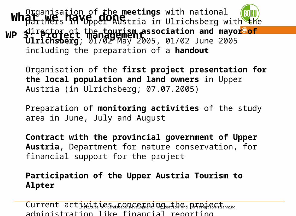
What we have done
WP 3: Project management
Organisation of the meetings with national partners in Upper Austria in Ulrichsberg with the director of the tourism association and mayor of Ulrichsberg; 01/02 May 2005, 01/02 June 2005 including the preparation of a handout
Organisation of the first project presentation for the local population and land owners in Upper Austria (in Ulrichsberg; 07.07.2005)
Preparation of monitoring activities of the study area in June, July and August
Contract with the provincial government of Upper Austria, Department for nature conservation, for financial support for the project
Participation of the Upper Austria Tourism to Alpter
Current activities concerning the project administration like financial reporting, preparation of the second activity report and financial report

Institute of Landscape Development, Recreation and Conservation Planning
WP 4: Information and publicity activities
Meeting with national partners in Upper Austria (in Linz with the Dept. for Nature Conservation, in Ulrichsberg with the director of the tourism association and mayor of Ulrichsberg), March 2005, 01/02 May 2005, 01/02 June 2005
Preparation of data for the project web site
Preparation of a handout and a PowerPoint presentation for the first presentation for the local population……

Institute of Landscape Development, Recreation and Conservation Planning
………..
Presentation of the investigation area within an excursion of the Institute of Landscape Development, Recreation and Conservation Planning in June 2005

Institute of Landscape Development, Recreation and Conservation Planning
WP 5: Land analysis and monitoring
First land analysis of the study area between 01.-02.06.2004
Data gathering and analysing about the study area (diverse trans- and interdisciplinary publications, historical maps, air photographs, ÖK, land register, and other digital data)
Detailed monitorings of the cultural landscape in Ulrichsberg (Upper Austria) between July 2005 August 2005
Data entry in GIS including topology and habitats descriptions
Data analysis: Identifying of a typology of habitats in the investigation area of Ulrichsberg

Institute of Landscape Development, Recreation and Conservation Planning
Achieved output
Digital map of study area (GIS), including air photographs and land register
Photographic documentation of habitats
Digital map of topology (GIS)
Digital map of habitats (GIS)

Institute of Landscape Development, Recreation and Conservation Planning
Investigation Area
Ulrichsberg
In Upper Austria
Investigation area -= Landscape conservation area
Institute of Landscape Development, Recreation and Conservation Planning
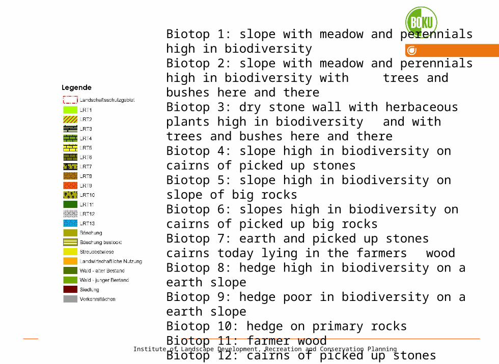
Biotop 1: slope with meadow and perennials high in biodiversityBiotop 2: slope with meadow and perennials high in biodiversity with trees and bushes here and thereBiotop 3: dry stone wall with herbaceous plants high in biodiversity and with trees and bushes here and thereBiotop 4: slope high in biodiversity on cairns of picked up stonesBiotop 5: slope high in biodiversity on slope of big rocks Biotop 6: slopes high in biodiversity on cairns of picked up big rocksBiotop 7: earth and picked up stones cairns today lying in the farmers
wood Biotop 8: hedge high in biodiversity on a earth slope Biotop 9: hedge poor in biodiversity on a earth slope Biotop 10: hedge on primary rocksBiotop 11: farmer woodBiotop 12: cairns of picked up stonesBiotop 13: vegetation on creek sides

Institute of Landscape Development, Recreation and Conservation Planning
Biotop 1: slope with meadow and perennials high in biodiversity

Institute of Landscape Development, Recreation and Conservation Planning
Biotop 2: slope with meadow and perennials high in biodiversity with trees and bushes here and there

Institute of Landscape Development, Recreation and Conservation Planning
Biotop 3: dry stone wall with herbaceous plants high in biodiversity and with trees and bushes here and there

Institute of Landscape Development, Recreation and Conservation Planning
Biotop 4: slope high in biodiversity on cairns of picked up stones

Institute of Landscape Development, Recreation and Conservation Planning
Biotop 6: slopes high in biodiversity on cairns of picked up big rocks

Institute of Landscape Development, Recreation and Conservation Planning
Biotop 8: hedge high in biodiversity on a earth slope
Institute of Landscape Development, Recreation and Conservation Planning
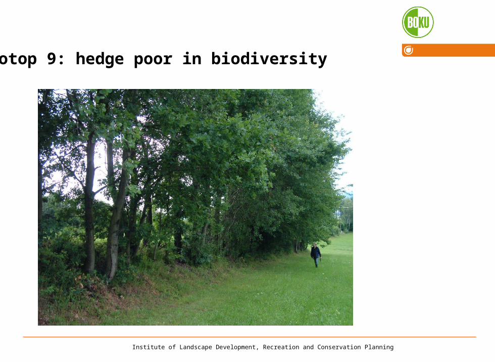
Biotop 9: hedge poor in biodiversity

Institute of Landscape Development, Recreation and Conservation Planning
Biotop 10: hedge on primary rocks

Institute of Landscape Development, Recreation and Conservation Planning
Biotop 11: farmer wood

Institute of Landscape Development, Recreation and Conservation Planning
Example for a part of the air photographie

Institute of Landscape Development, Recreation and Conservation Planning
Problems
The width of the meadows / field are very small – the field work is inefficient, sometimes the use of big machine is impossible
The preservation of the slopes and hedge means hard manual work, the wood often aren´t used.
Foundation rules

Institute of Landscape Development, Recreation and Conservation Planning
General map

Institute of Landscape Development, Recreation and Conservation Planning
Outlook – one way to preserve terraced landscapes?
Golf courseSeitelschlag

Institute of Landscape Development, Recreation and Conservation Planning
Meeting in Austria: May 2006
Thank you!