
INSIGHT Integrated Network of Scientific Information and GeoHydrologic Tools Western Governors...
12
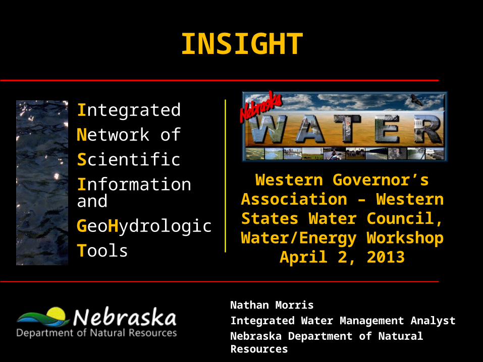
INSIGHT Integrated Network of Scientific Information and GeoHydrologic Tools Western Governor’s Association – Western States Water Council, Water/Energy Workshop April 2, 2013 Nathan Morris Integrated Water Management Analyst Nebraska Department of Natural Resources
-
Upload
triston-hern -
Category
Documents
-
view
216 -
download
0
Transcript of INSIGHT Integrated Network of Scientific Information and GeoHydrologic Tools Western Governors...
INSIGHT
Integrated
Network of
Scientific
Information and
GeoHydrologic
Tools
Western Governor’s Association – Western States Water Council,
Water/Energy WorkshopApril 2, 2013
Nathan Morris
Integrated Water Management Analyst
Nebraska Department of Natural Resources
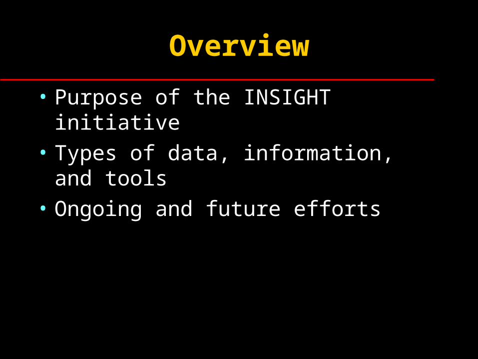
Overview
• Purpose of the INSIGHT initiative
• Types of data, information, and tools
• Ongoing and future efforts
What is INSIGHT?
• Interactive, web-based maps.• Tell the basin story.• Comprehensive source of quality-controlled
water related data for analyses and models.• Transparent data access and tools to help
evaluate and support water management options; inform water policy, administration, and planning; and for educational purposes.
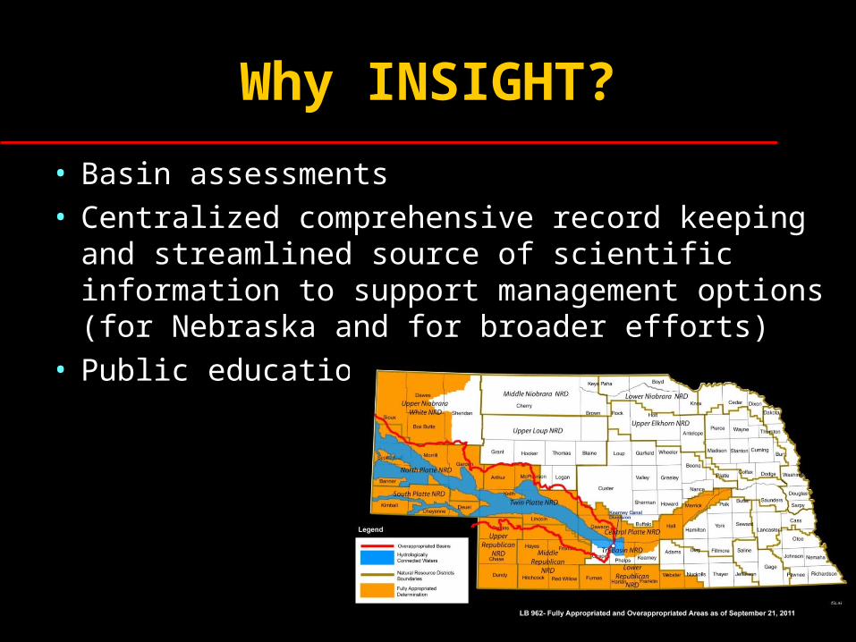
Why INSIGHT?
• Basin assessments• Centralized comprehensive record keeping and
streamlined source of scientific information to support management options (for Nebraska and for broader efforts)
• Public education
Who is developing INSIGHT and who will benefit?
• DNR with assistance from private contractors are currently developing INSIGHT
• Those that may benefit from INSIGHT include:– DNR– NRDs– UNL and other academia– Federal, state, regional, and local decision-makers and
natural resource managers– Farmers/Ranchers– Media/Reporters– General Public
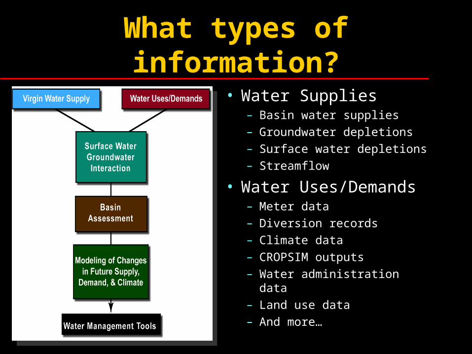
What types of information?
• Water Supplies– Basin water supplies– Groundwater depletions– Surface water depletions– Streamflow
• Water Uses/Demands– Meter data– Diversion records– Climate data– CROPSIM outputs– Water administration data– Land use data– And more…
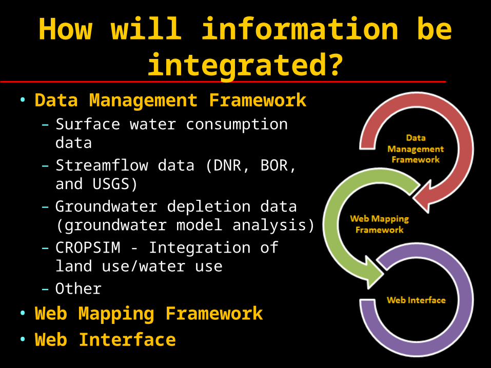
How will information be integrated?
• Data Management Framework– Surface water consumption data– Streamflow data (DNR, BOR, and
USGS)– Groundwater depletion data
(groundwater model analysis)– CROPSIM - Integration of land
use/water use– Other
• Web Mapping Framework• Web Interface
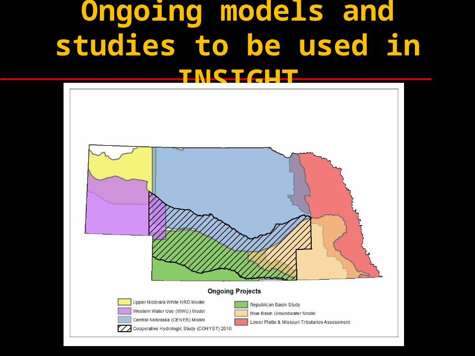
Ongoing models and studies to be used in INSIGHT
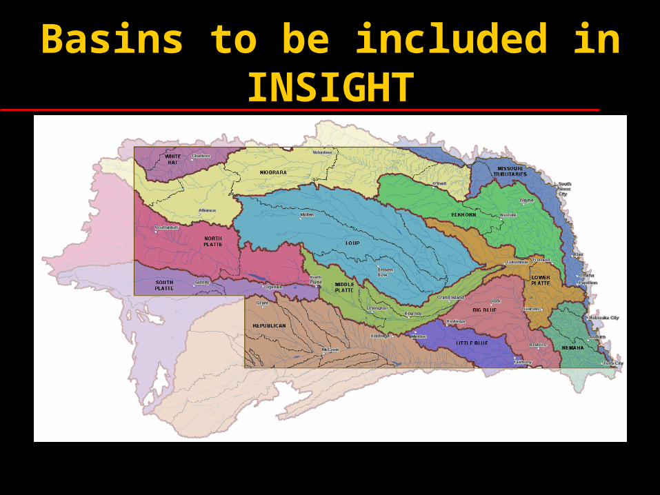
Basins to be included in INSIGHT
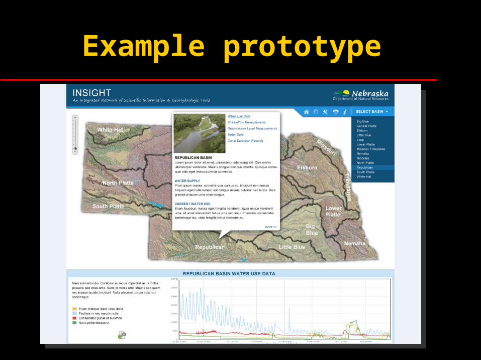
Example prototype
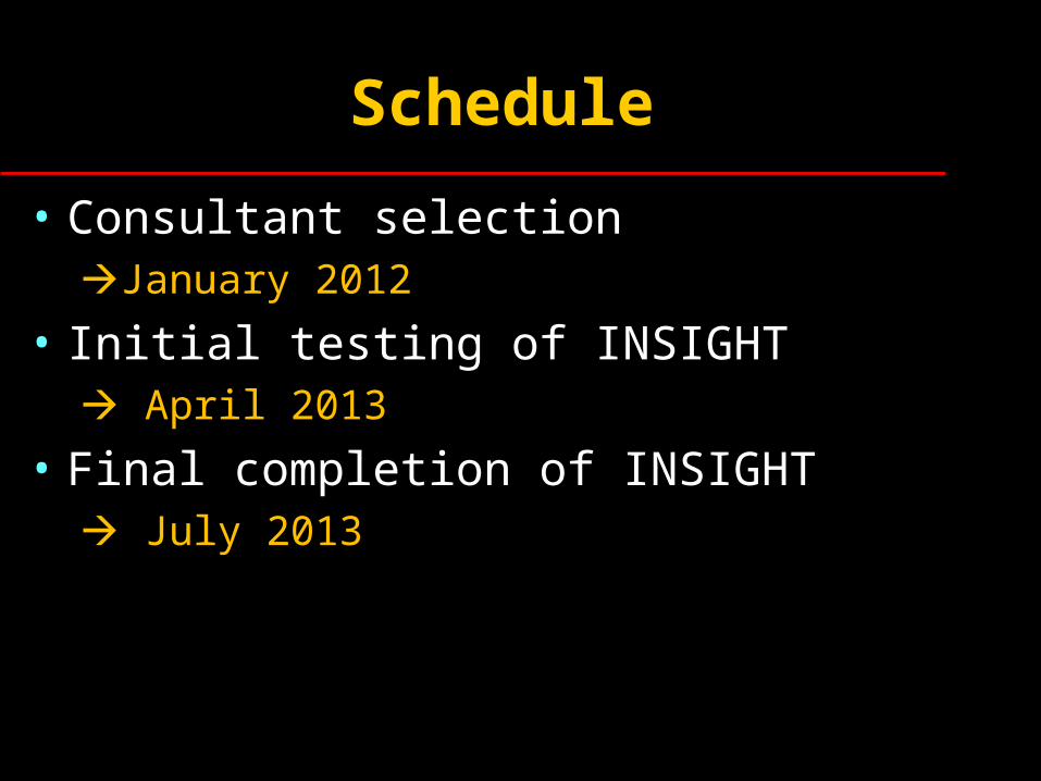
Schedule
• Consultant selection January 2012
• Initial testing of INSIGHT April 2013
• Final completion of INSIGHT July 2013