Initial Study and Proposed Negative Declaration for ...
47
Initial Study and Proposed Negative Declaration for Richvale Irrigation District 2016 Water Transfer Program Lead Agency: Richvale Irrigation District For additional information regarding this document contact: Sean Earley, Secretary/Manager, Richvale Irrigation District P.O. Box 147 Richvale, California 95974 February 2016
Transcript of Initial Study and Proposed Negative Declaration for ...
Initial Study and Proposed Negative Declaration
for Richvale Irrigation District 2016
Water Transfer Program
Lead Agency: Richvale Irrigation District
For additional information regarding this document contact:
Sean Earley, Secretary/Manager, Richvale Irrigation District
P.O. Box 147 Richvale, California 95974
February 2016

i
TABLE OF CONTENTS
SECTION 1 PROJECT DESCRIPTION
Project Introduction and Background 1 Richvale Irrigation District 1 Project Location 2 Water Availability and Transfer 2 Use of Water by Buyers 4 Figure 1 – Project Location 5 SECTION 2 INITIAL STUDY 6 SECTION 3 EVALUATION OF ENVIRONMENTAL IMPACTS 8 Aesthetics 8 Agricultural Resources 9 Air Quality 9 Biological Resources 10 Cultural Resources 15 Geology and Soils 16 Greenhouse Gas Emissions 17 Hazards and Hazardous Materials 17 Hydrology and Water Quality 18 Land Use and Planning 21 Mineral Resources 21 Noise 22 Population and Housing 23 Public Services 23 Recreation 24 Transportation/Traffic 25 Utilities and Service Systems 25 Mandatory Findings of Significance 27 SECTION 4 REFERENCES 31 SECTION 5 LIST OF PREPARERS 32

1
SECTION 1 PROJECT DESCRIPTION
1.0 PROJECT INTRODUCTION AND BACKGROUND The Richvale Irrigation District (“RID”) proposes to sell up to 21,120 acre-feet (AF) of water to the participating member districts of the State Water Project Contractors Incorporated1 or other South of Delta purchasers, including one or more Central Valley Project contractors (Buyers) during the 2016 irrigation season. Buyers are seeking up to approximately 300,000 AF of transfer water from various willing sellers in the Sacramento Valley during the 2016 irrigation season. Purchasing this water would lessen potential water supply shortages to these Buyers that may occur as a result of dry hydrologic conditions and regulatory restrictions on pumping in the Delta. As a willing seller, RID would make up to 21,120 AF of water available to Buyers by idling cropland (i.e., non-irrigation of farmland by voluntary participants). Water made available by crop idling within the boundaries of the RID would then be retained and stored by the Department of Water Resources (DWR) for delivery to Buyers. Richvale Irrigation District RID’s entitlement to Feather River water is 149,850 AF under the Joint Water Districts’ 1969 Diversion Agreement with DWR. RID proposes to not divert (i.e., forebear) a portion of its entitlement under this one-year transfer, which would allow DWR to deliver a portion of the foregone water to Buyers through the State Water Project (SWP) or Central Valley Project (CVP), as applicable, to Buyers’ service area(s). The 1969 Joint Water Districts Board (Joint Board) water rights settlement agreement (1969 Agreement) requires written approval from DWR before the districts can transfer water outside the service areas of the Joint Board. An agreement between DWR and the proposed water purchasers to store or transport the water through the SWP will also be required to implement the transfer. For the last 5 years on average, less than 1% of the acreage dedicated to rice production in RID has been fallowed for non-transfer purposes and temporarily removed from farm production so improvements such as weed abatement, land leveling, etc. can be made. In 2014, the last year a transfer occurred, approximately 20% of irrigable land was fallowed, all of which was due to the water transfer. The proposed project would idle up to 20% of the rice acreage in RID’s service area that would otherwise be irrigated in 2016. Idling would occur within approximately 32,000 acres dedicated primarily to rice production, so up to 6,400 acres of land could be idled. The accepted Evapo-Transportation Rate of
1 The State Water Contractors, Inc. is an association of 27 public agencies that purchase water under contract from the California State Water Project. Depending on the hydrologic conditions existing in the spring of 2016, all or a portion of these agencies may elect to receive all or a portion of the water purchased. Currently, 10 members of the State Water Contractors, Inc. have expressed interest in purchasing water under RID’s possible transfer. RID may also sell to other South of Delta purchasers, including one or more Central Valley Project contractors, or individual State Water Project contractors, or individual persons or entities within a CVP or SWP contractor service area with appropriate approval as necessary to accomplish such a transfer.

2
Applied Water (ETAW)2 for rice culture is 3.3 AF per acre per growing season, which is consistent with the recent ETAW rates used for water transfers in the Sacramento Valley based on crop idling of rice acreage (California Water Plan Update. Bulletin 160-05. December 2005). Thus, the water made available for transfer by reduced crop evapotranspiration for the projected idled acreage would be up to 21,120 AF (6,400 acres x 3.3 AF/acre). Under the 1969 Agreement, RID’s water entitlement is subject to curtailment under certain circumstances related to dry hydrologic conditions. If RID’s entitlement is curtailed for the 2016 irrigation season pursuant to the 1969 Agreement, RID will not participate in any transfer. Project Location The project area, from which the water for this transfer will be made available, is defined by RID’s boundaries which encompass approximately 35,000 acres in the northern Sacramento Valley in Butte County (Figure 1). Within the RID boundaries are slightly more than 32,000 irrigable acres, of which approximately 32,000 acres are currently dedicated primarily to the production of rice. Lands within RID have either primary or secondary water service. Because RID uses its full entitlement every year, only primary service lands will be eligible to participate in the project. Land idled for the purpose of this transfer will be drawn from the total irrigable acreage within RID’s boundaries. Since the program will be offered to all eligible growers and it is anticipated that there will be more interest than RID desires to offer, a wide dispersal of acreage enrolled in the program is expected. RID will require program participants to disperse idled acreage and make clear to participants that large, contiguous blocks of idled land related to this program are undesirable. Dispersing the program acres throughout RID assures that historical operational water levels will be maintained in canals throughout the district so that wildlife impacts otherwise associated with dewatering the canals will be avoided, as will impacts associated with habitat loss which might occur with large, contiguous blocks of fallowed land. Only cultivated rice land that is subject to regular, seasonal farming practices will be affected. Adjoining areas, non-rice land, other irrigated lands, drains, wetlands, and waterfowl habitat will not be affected, as those areas will receive their normal entitlement and canals and drains will operate at normal operating capacity. RID’s proposed transfer will fully comply with DWR’s Technical Information for Water Transfers in 2016, as applicable to land idling transfers.
Water Availability and Transfer No new construction or improvements by RID, Buyers, or DWR would be necessary for the production and transfer of this water. Water that would not be diverted would be available for transfer to Buyers through SWP facilities operated by DWR, including Lake Oroville, or transferred by DWR to CVP facilities. Water would accrue in storage on the basis of estimates of the amount of water that would have been consumed on the
2 ETAW is defined as the portion of the total evapotranspiration that is provided by irrigation. The portion of evapotranspiration met by precipitation occurring during the growing seasons or stored as soil moisture within the root zone before the growing season does not qualify as transferable water. ETAW values used for water transfer calculations are based upon crop water demands reflecting average rainfall and evaporative demand.

3
idled land but for the program. That is, the water that would have been consumed in the process of crop use would be available for transfer. The portion of applied water, which would have normally returned to the Feather/Sacramento River system as tailwater or groundwater discharge to surface waters, would remain available for instream use and diversion by others and would not be transferred. As the ETAW for rice culture in the Sacramento Valley is calculated at 3.3 AF per acre per growing season, each acre of idled rice production will make available for transfer 3.3 AF of water throughout the growing season. The typical growing season for rice in California is May through September. The potential ETAW demand across these months is shown in Table 1.1 with the corresponding water production expectations based on RID providing the maximum amount of transfer water from fallowing 20% of its rice acreage.
TABLE 1.1
Water Production Schedule
May June July August September Total ETAW in Percent 15 22 24 24 15 Water Production In AF
3,168 4,646.4
5,068.8
5,068.8
3,168
Total Production For Transfer in 2016 in AF
21,120
During the implementation of the proposed project, water transferred by RID would be deemed transferred at RID’s points of diversion on the Thermalito Afterbay and custody would then transfer to Buyers. As the operator of the SWP, depending on the hydrologic and regulatory conditions controlling SWP operations, DWR may be able to utilize Lake Oroville storage to facilitate the transfer during periods when Delta conditions prevent export of the transfer water. DWR would make every effort to use Lake Oroville to regulate the water in a manner which would allow for delivery of the water through the Sacramento-San Joaquin Delta, for export through the Banks or Barker Slough or Jones Delta Pumping Plants for ultimate delivery to Buyers. When exporting water from the Delta DWR must comply with all current State and federal regulatory requirements in effect at the time of the export pumping, including numerous environmental standards, laws, biological opinions, interim or final court orders, and regulations relating to Delta inflow and outflow, Delta water quality, fish protection, environmental needs, water rights, and the needs of other legal users, including legal in-basin demands. These requirements include applicable SWRCB orders, Army Corps of Engineers (Corps) permits, Biological Opinions, and other regulatory constraints including any relevant judicial orders in effect at the time of the operation. They have established water quality and flow requirements and limits on the rate of export of water that can be pumped by the state and federal pumping plants. The proposed project does not increase Delta export rates beyond permitted limits.

4
Recent regulatory restrictions have been imposed on SWP and CVP operations which significantly reduce exports from the Delta. These restrictions include the United States Fish & Wildlife Service (USFWS) Biological Opinion for delta smelt issued in December 2008. In February 2009, additional restrictions were included in the California Department of Fish and Wildlife (CDFW) Incidental Take Permit for longfin smelt and National Marine Fisheries Service (NMFS) Biological Opinion for anadromous fisheries and marine mammal species issued in June 2009. These restrictions are, in the view of the regulatory agencies, necessary to minimize the effects of pumping on fisheries populations currently and in the future in order to prevent jeopardy and protect listed fish species and habitat. The biological opinions and permits for these listed species include requirements that improve Delta aquatic habitat through export restrictions, changes in Delta flows, and land-based projects to restore fish habitat. In addition, requirements include improvements in handling of fish salvaged at the fish protection facilities and other measures to improve fish survival. Such requirements also improve the Delta ecosystem and provide benefits to other fish besides those listed under the state and federal endangered species acts. Litigation over the biological opinions resulted in federal district court decisions in 2010 and 2011 invalidating the USFWS Biological Opinion and NMFS Biological Opinion, respectively, but recent Ninth Circuit Court decisions partially reversed the district court decisions on these Biological Opinions, and upheld them. The SWP and CVP will be operated under these Biological Opinions or until any new biological opinions are completed. Operational restrictions likely will continue until long-term solutions to the problems in the Delta are implemented. These regulatory restrictions and hydrologic conditions substantially limit SWP and CVP operations during specific periods of the year. The current transfer period at Banks Pumping Plant (SWP) and Jones Pumping Plant (CVP) is typically limited to July through September. Additional restrictions could further limit either or both pumping plants’ capacity for export of transfer water. DWR estimates that approximately 20%-30% of the water transferred through the Delta would be necessary to enable the maintenance of water quality standards, which are based largely upon the total amount of water moving through the Bay-Delta system, known as “carriage water.” Therefore, this transfer may yield up to approximately 14,784 AF [6,400 ac x 3.3 AF/ac less 30%] to Buyers. At the end of the irrigation season, the amount of carriage water actually required is calculated. Depending upon the hydrologic year type and other operational constraints, the actual amount of carriage water assessed for the transfer may vary somewhat from this estimate. Use of Water by Buyers It is contemplated that the Buyers will be required to purchase the water by approximately April 22, 2016. If the water is purchased, Buyers would take delivery of this water in a manner physically identical to their typical SWP or CVP deliveries. One buyer may take 100% of the water RID makes available or a group of buyers may share on a pro-rata basis. The transfer water would provide additional resource options to Buyers to mitigate potential dry-year water shortage conditions in 2016. This water would represent backfilling of a shortfall of water normally and historically received into Buyers’ service areas. Accordingly, any water transferred under the proposed Project would not represent a dependable long-term increase in supply. As such, no adverse Project-specific impacts to Buyers’ service areas due to the proposed transfer would occur.
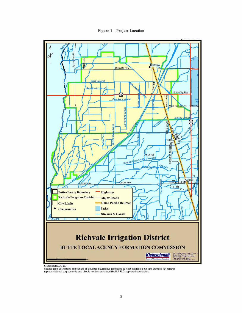
5
Figure 1 – Project Location

6
SECTION 2 INITIAL STUDY
The following Initial Study, Environmental Checklist, and evaluation of potential environmental effects (see Section 3) were completed in accordance with Section 15063(d)(3) of the State CEQA Guidelines to determine if the proposed project could have any potentially significant impact on the physical environment. An explanation is provided for all determinations, including the citation of sources as listed in Section 4. A "No Impact" or "Less-than-significant Impact" determination indicates that the proposed project will not have a significant effect on the physical environment for that specific environmental category. No environmental category was found to have a potentially significant adverse impact with implementation of the proposed project. INITIAL STUDY AND ENVIRONMENTAL CHECKLIST FORM 1. Project Title: Richvale Irrigation District 2016 Water Transfer Program 2. Lead Agency Name and Address: Richvale Irrigation District PO Box 147 Richvale, California 95974 3. Contact Person and Phone Number: Sean Earley, (530) 882-4243 4. Project Location: Refer to Section 1 (1.1) of the Negative Declaration 5. Project Sponsor's Name and Address: Richvale Irrigation District PO Box 147 Richvale, California 95974 6. Description of Project: Refer to Section 1 of the Negative Declaration. 7. Surrounding land uses and setting: Agricultural/rural setting zoned for agricultural use. 8. Other agencies whose approval is required: Buyers are all or some portion of the State Water Contractors, Inc.’s member agencies and/or San Luis and Delta Mendota Water Authority and its individual agencies or persons or entities within the CVP or SWP service area. Depending on the hydrologic conditions existing in the spring of 2016, all or a portion of these agencies may elect to receive all or a portion of water purchased. California Department of Water Resources: contract approval and CEQA compliance.


8
SECTION 3 EVALUATION OF ENVIRONMENTAL IMPACTS
I. AESTHETICS – Would the proposed Action: Less Than Significant Potentially With Less Than Significant Mitigation Significant No Issues and Determination: Impact Incorporation Impact Impact a) Have a substantial adverse effect on a scenic vista? b) Substantially damage scenic resources, including, but
not limited to, trees, rock outcroppings, and historic buildings within a state scenic highway?
c) Substantially degrade the existing visual character or
quality of the site and its surroundings? d) Create a new source of substantial light or glare which
would adversely affect day or nighttime views in the area?
Discussion: a,b,d) No Impact. As there would be no construction activities with project implementation, no potential
aesthetic resources would be impacted or altered. In addition, there would be no new sources of light and glare added to the project site. Hence, there would be no impacts to aesthetics with the proposed project.
c) Less-than-significant Impact. The pattern of cropping in the area within RID’s jurisdiction would be
altered slightly, in that somewhat more land would be idled due to the implementation of the proposed project (i.e., up to 20% of total rice acreage). Idled land is a typical feature of the agricultural landscape in RID’s jurisdiction and would not differ substantially from the existing environmental setting. As such, there would be a less-than-significant impact to the existing visual character within the farmlands occurring in RID’s jurisdiction. RID’s proposed transfer would fully comply with the terms and conditions applicable to land idling transfers as set forth in DWR’s Technical Information for Water Transfers in 2016.
9
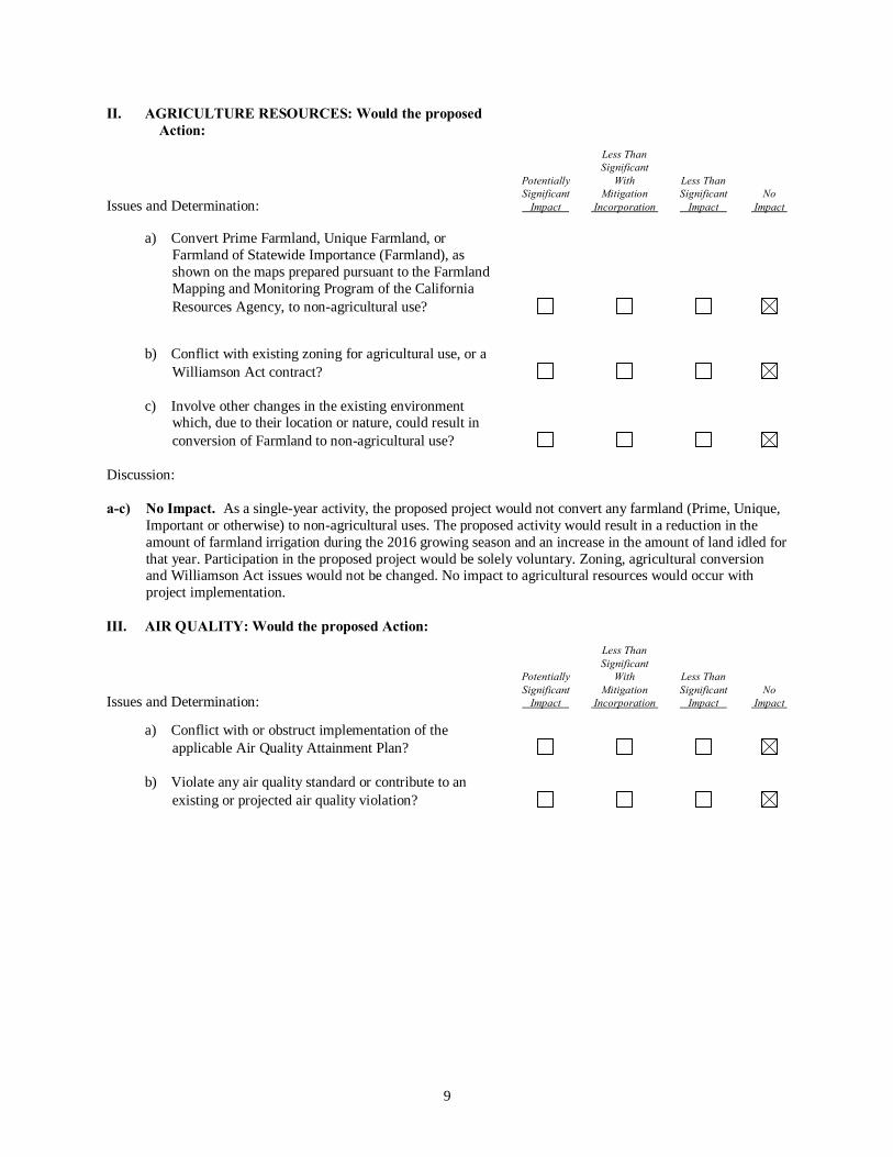
II. AGRICULTURE RESOURCES: Would the proposed Action:
Less Than Significant Potentially With Less Than Significant Mitigation Significant No Issues and Determination: Impact Incorporation Impact Impact a) Convert Prime Farmland, Unique Farmland, or
Farmland of Statewide Importance (Farmland), as shown on the maps prepared pursuant to the Farmland Mapping and Monitoring Program of the California Resources Agency, to non-agricultural use?
b) Conflict with existing zoning for agricultural use, or a
Williamson Act contract? c) Involve other changes in the existing environment
which, due to their location or nature, could result in conversion of Farmland to non-agricultural use?
Discussion: a-c) No Impact. As a single-year activity, the proposed project would not convert any farmland (Prime, Unique,
Important or otherwise) to non-agricultural uses. The proposed activity would result in a reduction in the amount of farmland irrigation during the 2016 growing season and an increase in the amount of land idled for that year. Participation in the proposed project would be solely voluntary. Zoning, agricultural conversion and Williamson Act issues would not be changed. No impact to agricultural resources would occur with project implementation.
III. AIR QUALITY: Would the proposed Action: Less Than Significant Potentially With Less Than Significant Mitigation Significant No Issues and Determination: Impact Incorporation Impact Impact a) Conflict with or obstruct implementation of the
applicable Air Quality Attainment Plan? b) Violate any air quality standard or contribute to an
existing or projected air quality violation?
10
Less Than Significant Potentially With Less Than Significant Mitigation Significant No Issues and Determination: Impact Incorporation Impact Impact
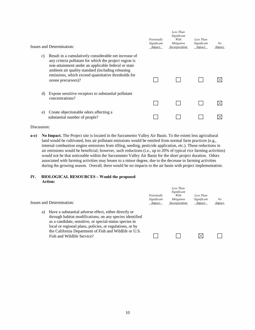
c) Result in a cumulatively considerable net increase of any criteria pollutant for which the project region is non-attainment under an applicable federal or state ambient air quality standard (including releasing emissions, which exceed quantitative thresholds for ozone precursors)?
d) Expose sensitive receptors to substantial pollutant concentrations?
e) Create objectionable odors affecting a substantial number of people? Discussion: a-e) No Impact. The Project site is located in the Sacramento Valley Air Basin. To the extent less agricultural
land would be cultivated, less air pollutant emissions would be emitted from normal farm practices (e.g., internal combustion engine emissions from tilling, seeding, pesticide application, etc.). These reductions in air emissions would be beneficial; however, such reductions (i.e., up to 20% of typical rice farming activities) would not be that noticeable within the Sacramento Valley Air Basin for the short project duration. Odors associated with farming activities may lessen to a minor degree, due to the decrease in farming activities during the growing season. Overall, there would be no impacts to the air basin with project implementation.
IV. BIOLOGICAL RESOURCES – Would the proposed
Action: Less Than Significant Potentially With Less Than Significant Mitigation Significant No Issues and Determination: Impact Incorporation Impact Impact
a) Have a substantial adverse effect, either directly or through habitat modifications, on any species identified as a candidate, sensitive, or special-status species in local or regional plans, policies, or regulations, or by the California Department of Fish and Wildlife or U.S. Fish and Wildlife Service?

11
Less Than Significant Potentially With Less Than Significant Mitigation Significant No Issues and Determination: Impact Incorporation Impact Impact
b) Have a substantial adverse effect on any riparian habitat or other sensitive natural community identified in local or regional plans, policies, regulations or by the California Department of Fish and Wildlife or U.S. Fish and Wildlife Service?
c) Have a substantial adverse effect on federally protected
wetlands as defined by Section 404 of the Clean Water Act (including, but not limited to, marsh, vernal pool, coastal, etc.) through direct removal, filling, hydrological interruption, or other means?
d) Interfere substantially with the movement of any native resident or migratory fish or wildlife corridors, or impede the use of native wildlife nursery sites?
e) Conflict with any local policies or ordinances
protecting biological resources, such as a tree preservation policy or ordinance?
f) Conflict with the provisions of an adopted Habitat
Conservation Plan, Natural Conservation Community Plan, or other approved local, regional, or state habitat conservation plan?
Discussion:
a) Less than significant Impact. Several special-status wildlife species have the potential to occur within the project area: the giant garter snake (listed as state and federally threatened), the northwestern pond turtle (listed as a state species of special concern and federal species of concern), the winter-run Chinook salmon (listed as state and federally endangered), the spring-run Chinook salmon (listed as state and federally threatened), the delta smelt (listed as state and federally threatened), the longfin smelt (listed as state threatened), the steelhead (listed as federally threatened ), and the green sturgeon (listed as federally threatened).
Giant Garter Snake (Thamnophis gigas)
The giant garter snake can be found in agricultural wetlands such as irrigation and drainage canals. These artificial waterways can be used for purposes such as ease of movement; protection from predators; warmth to aid metabolism, gestation, and digestion and as a food source. (Draft Recovery Plan for the Giant Garter Snake. 1999.) While up to 6,400 acres of land may be idled throughout the RID’s jurisdiction as a result of the project, water levels in irrigation and drainage canals would be maintained at normal operating elevations and no drying of such conveyances would occur. As such, RID’s water conveyance system would remain watered and available to the snake and other wildlife that utilize it. Flooded rice fields in the Sacramento Valley can be used by the giant garter snake for foraging, cover and dispersal purposes. The non-irrigated project fields would have little or no vegetation, retaining the open character that is currently present in fields that are between plantings or that otherwise have

12
relatively little vegetative cover. Because the maximum percentage of land idled for this project would be no more than 20% of the District’s irrigable rice acreage, at least 80% of RID’s rice acreage would remain unaffected. Lands taken out of production would be dispersed throughout the RID’s jurisdiction such that the contiguity of idled lands would be minimized allowing for a mosaic of lands that could be utilized by the snake throughout RID’s jurisdiction. The changes to agricultural fields that would occur under the proposed project could have minor and temporary effects on the giant garter snake through the decrease in potential cover and foraging areas as a result of the reduction in planted rice acreage. The one-year duration of the program minimizes any potential disruption to the giant garter snake. Crop idling conservation measures that were included in the US Bureau of Reclamation Biological Assessment for the 2014 Tehama-Colusa Canal Authority Water Transfers, and included in the 2015 draft Tehama-Colusa Canal Authority transfer as well as the Bureau’s draft 10 year EIS/EIR for transfers (both completed in March 2015), have been incorporated into the District’s proposed 2016 water transfer program. These include: The water sellers will ensure water depths in major irrigation and drainage canals are similar to years when transfers do not occur or, where information on existing water depths is limited at least two feet of water will be considered sufficient to provide movement corridors for giant garter snakes. The districts proposing water transfers made available from idled rice fields will ensure that adequate water is available for priority habitat with a high likelihood of GGS occurrence. The determination of priority habitat will be made through coordination with GGS experts, GIS analysis of proximity of historic tule marsh, and GIS analysis of suitable habitat. The priority habitats areas will be indicated on the priority habitat maps for participating water agencies, and will be maintained by the US Bureau of Reclamation (Reclamation). As new information becomes available, these maps will be updated in coordination with USFWS and CDFW. In addition, fields abutting or immediately adjacent to federal wildlife refuges will be considered priority habitat. Mapped priority habitat known to be occupied by GGS and priority habitats with a high likelihood for GGS occurrence (60% or greater probability) will not be permitted to participate in cropland idling/shifting transfers. Water sellers can request a case-by-case evaluation of whether a specific field would be precluded from participating in the proposed temporary 2016 water transfer. In accordance with the 2016 transfer white papers prepared by the Department of Water Resources and Bureau of Reclamation, the fields proposed for participating in the land idling transfer will also be reviewed and accepted by those reviewing agencies. Areas that will not be permitted to participate in a land idling transfer include lands adjacent to naturalized lands and refuges and corridors between these areas such as fields abutting or immediately adjacent to Little Butte Creek between Llano Seco and Upper Butte Basin Wildlife Area, Butte Creek between Upper Butte Basin and Gray Lodge Wildlife Areas, Colusa Basin drainage canal between Delevan and Colusa National Wildlife Refuges, Gilsizer Slough, Colusa Drainage Canal, the land side of the Toe Drain along the Sutter Bypass, Willow Slough and Willow Slough Bypass in Yolo County, Hunters and Logan Creeks between Sacramento and Delevan National Wildlife Refuges; and lands in the Natomas Basin. Water will not be purchased from a field fallowed during the immediately preceding two years; however, water may be purchased from the same parcel in successive years. Water transfer actions will be limited so that no more than 20 percent of rice fields are idled in any one County, and will be distributed across the landscape. Having the fallowed/idled rice acreage spread throughout the Sacramento Valley will help to assure that the total water conveyance system remains in its normal year wetted-up condition. The 20 percent limitation also helps alleviate potential socioeconomic effects and is based on California Water Code. California Water Code Section 1745.05 (b) states that: “The amount of water made available by land fallowing may not exceed 20 percent of the water that would have been applied or stored by the water supplier in the absence of any contract entered into pursuant to this article in any given hydrological year, unless the agency approves, following reasonable notice and a public hearing, a larger percentage.”

13
In addition, RID will agree to voluntarily perform GGS best management practices (BMPs), including educating all staff to recognize and avoid contact with GGS, dredging only one side of a conveyance channel per year, and implementing other measures to enhance habitat for GGS, such as providing rock-basking habitat in the system’s water prisms, and raising flail mower blades to at least six inches above the canal operation and maintenance road surfaces. An analysis of available research conducted by MBI (Appendix 1) on the abundance, distribution, movements, and habitat selection of giant garter snakes in the region suggests that population densities and abundance in the project study area are low due to poor habitat suitability. In addition, the dispersed pattern of fallowing may result in more functionally available edge habitat for giant garter snakes, which is preferred by snakes in rice agriculture. The giant garter snakes’ home range size and composition within rice agriculture have been reported to be smaller and less structurally diverse than in natural or constructed wetlands. As a result, it is anticipated that the available active ricelands would be adequate to support the estimated giant garter snake population in the project study area. For example, the Butte County Regional Conservation Plan (Butte RCP) reports GGS densities in rice acreage as 0.036 snakes per acre. The RID 2016 water transfer proposal states that there are approximately 32,000 acres of rice agriculture in its district, which when multiplied by the reported density in the Butte RCP, results in the estimation that there are 1,152 snakes in the RID. Assuming each snake requires 13 hectares (32.1 acres) (Valcarcel 2011), the GGS population in the RID would require approximately 36,979 acres of habitat. This acreage could then be further classified into aquatic and terrestrial habitat based on the home range compositions reported by Valcarcel (2011). Assuming each GGS home range is composed of 40% terrestrial habitat and 60% aquatic habitat (includes aquatic and emergent habitat), the GGS population in the RID would require approximately 22,187 acres of aquatic habitat and 14,792 acres of terrestrial habitat. If 20% of the approximately 32,000 acres of ricelands within the RID are fallowed, then approximately 25,600 acres would remain active. Based on these data, it is anticipated that an adequate amount of aquatic habitat would exist within the project study area to support the GGS population, due to the fact that these calculations assume no overlap in GGS home range, and do not consider available canal/agricultural waterway habitat. As a result, it is anticipated that implementation of the proposed avoidance and minimization would reduce potential giant garter snake impacts to a less-than-significant level.
Northwestern Pond Turtle (Clemmys marmorata marmorata) The northwestern pond turtle inhabits waters with little or no current. The banks of inhabited waters usually have thick vegetation, but basking sites such as logs, rocks, or open banks must also be present. Pond turtles lay their eggs in nests in upland areas, including grasslands, woodlands, and savannas. Pond turtles could be found in and along irrigation and drainage canals. The proposed project would not eliminate water from the conveyance canals within the RID’s service area. Therefore the proposed project would not impact the western pond turtle. Chinook Salmon (Oncorhynchus tshawytscha), Delta Smelt (Hypomesus transpacificus), Longfin Smelt (Spirinchus thaleichthyes), Green Sturgeon (Acipenser medirostris and Steelhead (Oncorhynchus mykiss) The Sacramento-San Joaquin Delta is a migration corridor and seasonal rearing habitat for winter-run Chinook salmon and steelhead. It provides spawning and nursery habitat for Delta Smelt. Transfer water to the buyers would be delivered through the Sacramento-San Joaquin Delta with timing identical to the Buyers’ typical SWP or CVP deliveries in conformance with all existing and pending requirements under the Endangered Species Act, including court orders, which govern SWP or CVP operations for the protection of Delta Smelt, and anadromous fishes and marine mammal species. The proposed transfer would not affect the regulatory or operational restrictions governing SWP or CVP

14
operations. As such, there would be no impact from the proposed project on listed fish species in the Sacramento-San Joaquin Delta. Western Yellow-billed Cuckoo In the western United States, yellow-billed cuckoos breed in broad, well-developed, low-elevation riparian woodlands comprised primarily of mature cottonwoods (Populus spp.) and willows (Salix spp.). Western yellow-billed cuckoo are most successful in the type of broad riparian habitat that occurs in natural river systems, where the floodplain is still hydrologically connected to the river and allows for dynamic river processes and varying woodland age-stands across the landscape (78 FR 61622-61666). This species is not associated with ricelands or the associated agricultural drainages and waterways; therefore, project-related impacts to western yellow-billed cuckoo will be less than significant. Tricolored Blackbird Tricolored blackbirds have three basic requirements for selecting their breeding colony sites: open accessible water; a protected nesting substrate including flooded or thorny /spiny vegetation; and a suitable foraging space providing adequate insect prey within a few miles of the nesting colony. Tricolored blackbirds are not known to nest in ricelands and while some agricultural drainages and waterways in the District may contain suitable nesting substrates, there are no documented occurrences in the District (California Natural Diversity Database 2015) ricelands and the proposed idling program will maintain water in major drainages; therefore, impacts to this species are anticipated to be less than significant. In sum, the proposed project would result in less-than-significant impacts to special status species because no wildlife would be directly affected by the idling activities and indirect impacts to habitat, such as a decrease in potential foraging and cover habitat for the giant garter snake, would be temporary (i.e., one year) and minimal.
b) No impact. The proposed action would have no effect on riparian or other sensitive habitats. All
canals serving such areas would be in normal operations and all normal water deliveries thereto would be continued to those lands. Such areas may not participate in transfers, and all canals and drains adjacent to those lands will be in operation at normal operating levels. Therefore there would be no impact to riparian or other sensitive habitats.
c) No Impact. No impacts to wetlands would occur from the proposed project due to continuation of
normal deliveries to such lands during the Project; such lands are ineligible to participate in land idling transfers; and all canals and drains serving or traversing such areas will be operated at normal operating elevations throughout the Project.
d) Less than significant Impact.
Waterfowl The proposed project would result in the fallowing of no more than 20% of rice acreage within RID’s jurisdiction. Rice fields in the project area serve as foraging habitat for many waterfowl species. However, implementation of the project would not interfere substantially with the foraging of native-resident or migratory waterfowl because other foraging habitat is abundant both locally and regionally. Because the proposed project would not convert any agricultural lands to non-agricultural land uses, the only change would be a one-year increase in the time between planting of rice in the project farmlands and a minor reduction in the acreage of rice lands available to waterfowl for foraging in 2016. This reduction in foraging acreage is less-than-significant based upon the regional abundance of flooded foraging habitat.

15
Fish Species The proposed project may increase flows during July through September in the Feather and Sacramento Rivers resulting from the movement of transfer water. Such flow increases may have a beneficial effect on fishes in the river during the transfer period. Because of the relatively large volume of summer flows in the Sacramento River, changes in flows resulting from the water acquisition, even on a cumulative scale, would be small and effects on fish in the Sacramento River would be negligible. Therefore, there would be no adverse impact on the movement of any native resident or migratory fish species from the proposed project.
e,f) No Impact. The proposed project would not conflict with any local, regional, or state policy,
ordinance or conservation plan in effect for the area. Hence no impact to adopted habitat conservation plans would occur with project implementation.
V. CULTURAL RESOURCES – Would the proposed Action: Less Than Less Than Significant Potentially With Less Than Significant Mitigation Significant No Issues and Determination: Impact Incorporation Impact Impact
a) Cause a substantial adverse change in the significance of a historical resource as defined in §15064.5?
b) Cause a substantial adverse change in the significance
of a unique archaeological resource pursuant to §15064.5?
c) Directly or indirectly destroy a unique paleontological
resource or site or unique geologic feature? d) Disturb any human remains, including those interred
outside of formal cemeteries? Discussion: a-d) No Impact. The proposed project does not involve any land alteration and thus no archeological or
paleontological disturbances are possible within the proposed project’s scope. In addition, with no construction activities proposed, there would be no disturbances to potential burial sites or cemeteries. Therefore, no impact to cultural resources would occur with project implementation.

16
VI. GEOLOGY AND SOILS – Would the proposed action: Less Than Less Than Significant Potentially With Less Than Significant Mitigation Significant No Issues and Determination: Impact Incorporation Impact Impact
a) Expose people or structures to potential substantial adverse effects, including the risk of loss, injury, or death involving:
Rupture of a known earthquake fault, as delineated on the most recent Alquist-Priolo Earthquake Fault Zoning Map issued by the State Geologist for the area or based on other substantial evidence of a known fault? Refer to Division of Mines and Geology Special Publication 42.
i) Strong seismic ground shaking?
ii) Seismic-related ground failure, including liquefaction?
iii) Landslides?
b) Result in substantial soil erosion or the loss of topsoil?
c) Be located on strata or soil that is unstable, or that would become unstable as a result of the project, and potentially result in on- or off-site landslide, lateral spreading, subsidence, liquefaction, or collapse?
d) Be located on expansive soil, as defined in Table 18-1-
B of the Uniform Building Code, creating substantial risks to life or property?
e) Have soils incapable of adequately supporting the use
of septic tanks or alternative wastewater disposal systems where sewers are not available for the disposal of wastewater?
Discussion: a) No Impact. No project facility falls within an Alquist-Priolo Earthquake Fault Zone, as presented in the
most recent Division of Mines and Geology Special Publication 42. Hence, no impact relating to fault rupture zones would occur with project implementation.
b) No Impact. Based upon readily available soil map information, most of the project area is underlain by
fine-textured, strongly structured soils, such as clay and silty clay. Such soils have a wind erodibility index of 86 (tons per acre per year) when in a dry, unvegetated condition (U.S Department of Agriculture 1993). Highly wind-erodible soils, such as fine sands and sands, have a wind erodibility index of 134-310. Therefore, the soils in the project area have a relatively low risk of wind erosion when left in a dry, unvegetated condition.
17
c) No Impact. Soils in the proposed project area consist of clays with a flat terrain. The proposed project would not result in instability of existing soils. The use of the soils for this short-term project is in accordance with past farming practices and no landslides, lateral spreading, subsidence, liquefaction or collapse have occurred, to date.
d) No Impact. Expansive soils are not known to occur within or on the proposed project site. Therefore, no
impacts pertaining to expansive soils would occur with project implementation.
e) No Impact. The proposed project would not involve the use of septic tanks or alternative wastewater treatment disposal systems to handle wastewater generation. Therefore, no impacts would result with implementation of the proposed project.
VII. GREENHOUSE GAS EMISSIONS – Would the
Proposed Action: Less Than Significant Potentially With Less Than Significant Mitigation Significant No Issues and Determination: Impact Incorporation Impact Impact a) Generate greenhouse gas emissions, either directly or
indirectly, that may have a significant effect on the environment?
b) Conflict with an applicable plan, policy or regulation
adopted for the purpose of reducing the emissions of greenhouse gases?
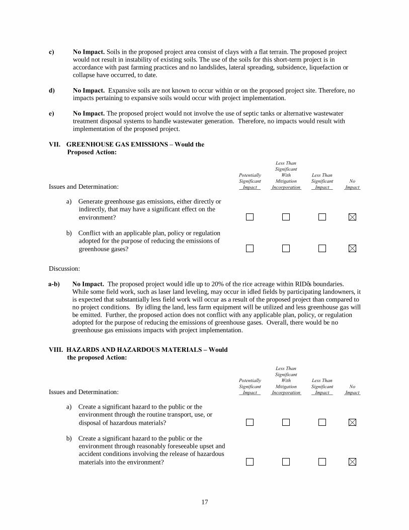
Discussion: a-b) No Impact. The proposed project would idle up to 20% of the rice acreage within RID’s boundaries.
While some field work, such as laser land leveling, may occur in idled fields by participating landowners, it is expected that substantially less field work will occur as a result of the proposed project than compared to no project conditions. By idling the land, less farm equipment will be utilized and less greenhouse gas will be emitted. Further, the proposed action does not conflict with any applicable plan, policy, or regulation adopted for the purpose of reducing the emissions of greenhouse gases. Overall, there would be no greenhouse gas emissions impacts with project implementation.
VIII. HAZARDS AND HAZARDOUS MATERIALS – Would the proposed Action:
Less Than Significant Potentially With Less Than Significant Mitigation Significant No Issues and Determination: Impact Incorporation Impact Impact a) Create a significant hazard to the public or the
environment through the routine transport, use, or disposal of hazardous materials?
b) Create a significant hazard to the public or the
environment through reasonably foreseeable upset and accident conditions involving the release of hazardous materials into the environment?

18
Less Than Significant Potentially With Less Than Significant Mitigation Significant No Issues and Determination: Impact Incorporation Impact Impact c) Emit hazardous emissions or handle hazardous or
acutely hazardous materials, substances, or waste within one-quarter mile of an existing or proposed school?
d) Be located on a site which is included on a list of
hazardous materials sites compiled pursuant to Government Code Section 65962.5 and, as a result, would it create a significant hazard to the public or the environment?
e) For a project located within an airport land use plan or,
where such a plan has not been adopted, within two miles of a public airport or public use airport, would the project result in a safety hazard for people residing or working in the project area?
f) For a project within the vicinity of a private airstrip,
would the project result in a safety hazard for people residing or working in the project area?
g) Impair implementation of or physically interfere with
an adopted emergency response plan or emergency evacuation plan?
h) Expose people or structures to a significant risk of loss,
injury or death involving wildland fires, including where wildlands are adjacent to urbanized areas or where residences are intermixed with wildlands?
Discussion: a-h) No Impact. The proposed project would not involve the transport or use of hazardous materials nor
change any public exposure to hazards or hazardous materials beyond what is currently occurring with existing farming practices within RID’s jurisdiction. Herbicide and pesticides use on ricelands would decrease by up to 20% from what is now occurring within RID’s service area due to the idling for one year. This minor decrease in the use of such chemicals may be viewed as beneficial, but would not substantially affect the overall physical environment. Overall, there would be no hazardous impacts with project implementation.
IX. HYDROLOGY AND WATER QUALITY – Would the proposed Action:
Less Than Significant Potentially With Less Than Significant Mitigation Significant No Issues and Determination: Impact Incorporation Impact Impact a) Violate any water quality standards or waste discharge
requirements?

19
Less Than Significant Potentially With Less Than Significant Mitigation Significant No Issues and Determination: Impact Incorporation Impact Impact b) Substantially deplete groundwater supplies or interfere
substantially with groundwater recharge such that there should be a net deficit in aquifer volume or a lowering
of the local groundwater table level (e.g., the production rate of pre-existing nearby wells would drop to a level which would not support existing land uses or planned uses for which permits have been granted)?
c) Substantially alter the existing drainage pattern of the
site or area, including through the alteration of the course of a stream or river, in a manner which would result in substantial erosion or siltation on- or off-site?
d) Substantially alter the existing drainage pattern of the
site or area, including through the alteration of the course of a stream or river, or substantially increase the rate or amount of surface runoff in a manner which would result in flooding on- or off-site?
e) Create or contribute runoff water which would exceed
the capacity of existing or planned storm water drainage systems?
f) Otherwise substantially degrade water quality?
g) Place housing within a 100-year flood hazard area as
mapped on a federal Flood Hazard Boundary or Flood Insurance Rate Map or other flood hazard delineation map?
h) Place housing within a 100-year flood hazard area
structures which would impede or redirect flood flows? i) Expose people or structures to a significant risk of loss,
injury or death involving flooding, including flooding as a result of the failure of a levee or dam?
j) Inundation of seiche, tsunami, or mudflow? Discussion:
a) No Impact. The proposed project does not involve any discharges and thus would not violate water quality standards or waste discharge requirements. When exporting water from the Delta, DWR must comply with all current State and federal regulatory requirements in effect at the time of the export pumping, including numerous environmental standards, laws, and regulations relating to Delta inflow and outflow, Delta water quality, fish protection, environmental needs, water rights, and the needs of other legal users, including legal in-basin demands. These requirements include applicable SWRCB orders, Corps

20
permits, Biological Opinions and other regulatory constraints including any relevant judicial orders in effect at the time of the operation. There are established water quality and flow requirements and limits on the rate of export of water that can be pumped by the state and federal pumping plants. The proposed project does not increase Delta export rates beyond permitted limits.
Recent regulatory restrictions have been imposed on SWP and CVP operations which significantly reduce exports from the Delta. These restrictions include the USFWS Biological Opinion for delta smelt issued in December 2008. In February 2009, additional restrictions were included in the CDFW Incidental Take Permit for longfin smelt and NMFS Biological Opinion for anadromous fisheries and marine mammal species issued in June 2009. Through litigation, the USFWS and NMFS Biological Opinions have been invalidated and the SWP and CVP will be operated under interim court orders until new biological opinions are completed. Operational restrictions will likely continue until new biological opinions are completed. These regulatory restrictions and hydrologic conditions substantially limit SWP and CVP operations during specific periods of the year. The current transfer period at the Jones and Banks Pumping Plants is typically limited to July through September. Additional restrictions could further limit Jones and Banks pumping capacities for export of transfer water
Hence, no impacts to water quality standards would occur with project implementation.
b) No Impact. As the proposed project would not extract groundwater supplies nor inject water into aquifers,
there would be no project impacts resulting from substantial depletion of groundwater supplies or interference with groundwater recharge resulting in a net deficit in aquifer volume or lowering of local groundwater table level.
c-d) No Impact. The proposed project would not substantially alter the existing drainage pattern of the site or
area, including the alteration of the course of a stream or river, in a manner which would result in substantial erosion, siltation on- or off-site, or increase the rate or amount of surface runoff in a manner which would result in flooding on- or off-site. The water transferred would be maintained within existing conveyance and storage systems of DWR. No drainage courses would receive transferred water from the proposed project. In addition, there are no construction activities associated with the proposed project. As such, no impacts relating to water drainage patterns would occur with project implementation.
e) No Impact. The proposed project would not create or contribute runoff water which would exceed the
capacity of existing or planned storm water drainage systems. Also refer to previous responses, (Items c-d). Hence, no impacts relating to storm water drainage systems would occur with project implementation.
f) No Impact. The proposed project would not result in degradation of water quality. Refer to previous
responses, (Items a-c). Hence, no impacts to water quality would occur with project implementation. g-i) No Impact. The proposed project would not expose people or property to water-related hazards such as
flooding or impede or redirect flood flows. The proposed project would not involve constructing any housing. All facilities which would be utilized are existing facilities constructed according to standard engineering design practices to limit the potential for exposure of people or property to water-related hazards, such as flooding. Therefore, no impact relating to flooding would occur with the project implementation.
j) No Impact. The proposed project would not be subject to tsunami or seiche wave inundation because the
project area is not situated near a large enough body of water. Also, the associated facilities are not subject to mudslides. As such, no impacts would result from project implementation with respect to tsunamis or seiches.

21
X. LAND USE AND PLANNING – Would the project: Less Than Significant Potentially With Less Than Significant Mitigation Significant No Issues and Determination: Impact Incorporation Impact Impact a) Physically divide an established community? b) Conflict with any applicable land use plan, policy, or
regulation of an agency with jurisdiction over the project (including, but not limited to the general plan, specific plan, local coastal program, or zoning ordinance) adopted for the purpose of avoiding or mitigating an environmental effect?
c) Conflict with any applicable habitat conservation plan
or natural communities’ conservation plan? Discussion: a-c) No Impact. The proposed project would not displace or divide an established community, as no new
construction activities would occur with project implementation. Only existing facilities and equipment would be employed. Also, no zoning or land use changes would be required for the participating farmer to enter into an agreement to idle a portion of his or her farmlands. Idling of agricultural land is a typical agricultural practice. Refer to Item IV.f (Biological Resources) with regard to the question on conflicts with applicable habitat conservation plans. Overall, there would be no impacts to land use or planning with project implementation.
XI. MINERAL RESOURCES – Would the proposed Action: Less Than Significant Potentially With Less Than Significant Mitigation Significant No Issues and Determination: Impact Incorporation Impact Impact a) Result in the loss of availability of a known mineral
resource that would be of value to the region and the residents of the state?
b) Result in the loss of availability of a locally-important
mineral resource recovery site delineated on a local general plan, specific plan, or other land use plan?
Discussion: a, b) No Impact. As the area is currently used for agricultural purposes only, the one-year idling of some
additional farmlands for a one-year period would not result in the loss of availability of a known mineral resource that would be of future value to the region and the residents of the State. No impacts to mineral resources would occur with the proposed water transfer.

22
XII. NOISE – Would the proposed Action result in: Less Than Significant Potentially With Less Than Significant Mitigation Significant No Issues and Determination: Impact Incorporation Impact Impact a) Exposure of persons to or generation of noise levels in
excess of standards established in the local general plan or noise ordinance, or applicable standards of other agencies?
b) Exposure of persons to or generation of excessive
groundborne vibration or groundborne noise levels? c) A substantial permanent increase in ambient noise
levels in the project vicinity above levels existing without the project?
d) A substantial temporary or periodic increase in ambient
noise levels in the project vicinity above levels existing without the project?
e) For a project located within an airport land use plan or, where such a plan has not been adopted, within two miles of a public airport of public use airport, would the project expose people residing or working in the project area to excessive noise levels? f) For a project within the vicinity of a private airstrip,
would the project expose people residing or working in the project area to excessive noise levels?
Discussion:
a-f) No Impact. The proposed project does not involve the development or enhancement of any new noise emitting devices. In addition, there would be no construction activities associated with the proposed project. Only existing facilities and equipment would be utilized with the proposed water transfer. As such, no noise impacts would result with project implementation.

23
XIII. POPULATION AND HOUSING – Would the proposed Action:
Less Than Significant Potentially With Less Than Significant Mitigation Significant No Issues and Determination: Impact Incorporation Impact Impact a) Induce substantial population growth in an area, either
directly (for example, by proposing new homes and businesses) or indirectly (for example, through extension of roads or other infrastructure)?
b) Displace substantial numbers of existing housing,
necessitating the construction of replacement housing elsewhere?
c) Displace substantial numbers of people necessitating
the construction of replacement housing elsewhere? Discussion: a-c) No Impact. The proposed project would involve the movement of water in amounts that would not exceed
existing CVP or SWP contractors’ contractual amounts specified in each long-term water supply contract for water transported through the California Aqueduct or Delta Mendota Canal nor allow for a total amount of water to be transported that would exceed levels previously delivered in non-shortage years. Therefore, there would be no net increase in water supply. No housing would be constructed, demolished, or replaced as a result of the proposed project, and no displacement of people and no substantial population growth would result. Therefore, no impacts to housing or population distribution would occur as a result of the proposed water transfer.
XIV. PUBLIC SERVICES – Would the proposed Action: Less Than Significant Potentially With Less Than Significant Mitigation Significant No Issues and Determination: Impact Incorporation Impact Impact a) Would the project result in substantial adverse physical
impacts associated with the provision of new or physically altered governmental facilities, need for new or physically altered governmental facilities, the construction of which could cause significant environmental impacts, in order to maintain acceptable service ratios, response times, or other performance objectives for any of the public services:
Fire protection?
Police protection?
Schools?
Parks?
Other public facilities?

24
Discussion: a) No Impact. The proposed project does not create any new demand for public services or alterations to existing
public facilities. The proposed water transfer would occur within existing water conveyance facilities. Hence, no impacts to public services or facilities would occur with project implementation.
XV. RECREATION – Would the proposed action: Less Than Significant Potentially With Less Than Significant Mitigation Significant No Issues and Determination: Impact Incorporation Impact Impact a) Would the project increase the use of existing
neighborhood and regional parks or other recreational facilities such that substantial physical deterioration of the facility would occur or be accelerated?
b) Does the project include recreational facilities or
require the construction or expansion of recreational facilities, which might have an adverse physical effect on the environment?
Discussion: a,b) No Impact. The proposed project would neither create nor alter demand for recreational services. The
proposed project would involve the movement of water in amounts that would not exceed existing entitlements for water transported through the California Aqueduct or Delta Mendota Canal nor allow for a total amount of water to be transported that would exceed levels previously delivered in non-shortage years. As such, there would be no net increase in recreational opportunities and no impacts to recreational facilities or activities would occur with project implementation.

25
XVI. TRANSPORTATION / TRAFFIC – Would the proposed action:
Less Than Significant Potentially With Less Than Significant Mitigation Significant No Issues and Determination: Impact Incorporation Impact Impact
a) Cause an increase in traffic, which is substantial in relation to the existing traffic load and capacity of the street system (i.e., result in a substantial increase in either the number of vehicle trips, the volume-to-capacity ratio on roads, or congestion at intersections)?
b) Exceed, either individually of cumulatively, a level of
service standard established by the county congestion management agency for designated roads or highways?
c) Result in a change in air traffic patterns, including
either an increase in traffic levels or a change in location that results in substantial safety risks?
d) Substantially increase hazards to a design feature (e.g.,
sharp curves or dangerous intersections) or incompatible uses (e.g., farm equipment)?
e) Result in inadequate emergency access? f) Result in inadequate parking capacity? g) Conflict with adopted policies supporting alternative
transportation (e.g., bus turnouts, bicycle racks)? Discussion: a-g) No Impact. The proposed project does not create any new demand for any mode of transportation services
as it would involve existing facilities and to forebear water for water supply purposes. Also, there are no construction activities associated with the proposed project (such as movement of trucks). Therefore, no transportation impacts would occur with project implementation.
XVII. UTILITIES AND SERVICE SYSTEMS – Would the
proposed action: Less Than Significant Potentially With Less Than Significant Mitigation Significant No Issues and Determination: Impact Incorporation Impact Impact a) Exceed wastewater treatment requirements of the
applicable Regional Water Quality Control Board?
b) Require or result in the construction of new water or wastewater treatment facilities or expansion of existing facilities, the construction of which could cause significant environmental effects?
26
Less Than Significant Potentially With Less Than Significant Mitigation Significant No Issues and Determination: Impact Incorporation Impact Impact
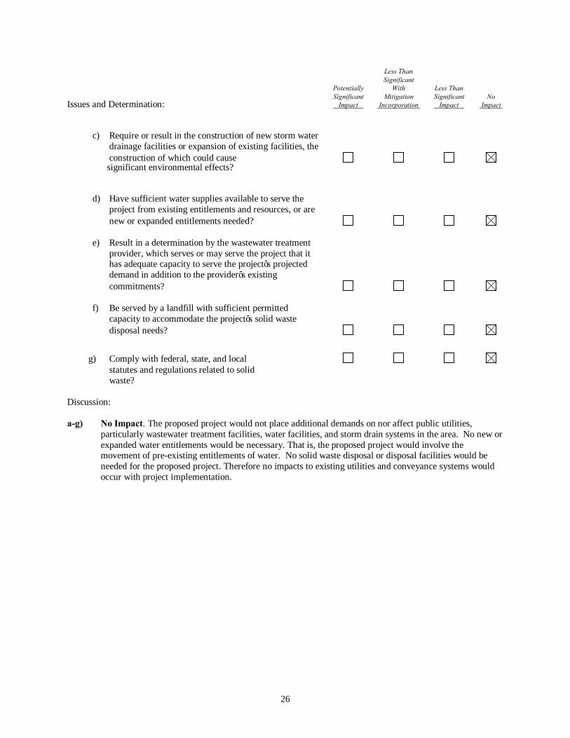
c) Require or result in the construction of new storm water
drainage facilities or expansion of existing facilities, the construction of which could cause
significant environmental effects?
d) Have sufficient water supplies available to serve the
project from existing entitlements and resources, or are new or expanded entitlements needed?
e) Result in a determination by the wastewater treatment
provider, which serves or may serve the project that it has adequate capacity to serve the project’s projected demand in addition to the provider’s existing commitments?
f) Be served by a landfill with sufficient permitted
capacity to accommodate the project’s solid waste disposal needs?
g) Comply with federal, state, and local statutes and regulations related to solid waste? Discussion: a-g) No Impact. The proposed project would not place additional demands on nor affect public utilities,
particularly wastewater treatment facilities, water facilities, and storm drain systems in the area. No new or expanded water entitlements would be necessary. That is, the proposed project would involve the movement of pre-existing entitlements of water. No solid waste disposal or disposal facilities would be needed for the proposed project. Therefore no impacts to existing utilities and conveyance systems would occur with project implementation.

27
XVIII. MANDATORY FINDINGS OF SIGNIFICANCE - Would the proposed action: Less Than Significant Potentially With Less Than Significant Mitigation Significant No Issues and Determination: Impact Incorporation Impact Impact
a) Does the project have the potential to degrade the quality of the environment, substantially reduce the habitat of a fish or wildlife species, cause a fish or wildlife population to drop below self-sustaining levels, threaten to eliminate a plant or animal community, reduce the number or restrict the range of a rare or endangered plant or animal or eliminate important examples of the major periods of California history or prehistory?
b) Does the project have impacts that are individually
limited, but cumulatively considerable? (“Cumulatively considerable” means that the incremental effects of a project are considerable when viewed in connection with the effects of past projects, the effects of other current projects, and the effects of probable future projects)
c) Does the project have environmental effects which will
cause substantial adverse effects on human beings, either directly or indirectly?
Discussion:
a-b) Less Than Significant Impact. As previously discussed, the proposed project has the potential to degrade the environment in some resource areas (biological resources and aesthetics). However, as noted above, these impacts are not significant individually or cumulatively. The proposed project would occur through existing facilities with no new construction. As such, implementation of the proposed project would have no significant impacts. As discussed below, water transfers from the Sacramento Valley through the Delta for consumptive uses and environmental purposes South of the Delta have been occurring on a large scale for over a decade. Examples include:
DWR Water Purchase Programs: The first large scale water transfer program in California was the 1991 Emergency Drought Water Bank (1991 DWB). The 1991 DWB was established in response to projected critical water supply shortages following 4 years of drought conditions. The 1991 DWB team purchased water from willing sellers in the Delta, Sacramento Valley and Feather River basin areas. Water was made available through crop idling, groundwater substitution and reservoir storage release. The 1991 DWB team executed over 300 contracts with water agencies and individuals to purchase water for critical statewide needs. Water from the 1991 DWB was allocated to 12 municipal and agricultural water users. Drought water banks were implemented again in 1992 and 1994, acquiring water primarily from groundwater substitution. DWR implemented Dry Year Purchase Programs in 2001 and 2002 in response to dry conditions and reduced SWP and CVP allocations. In 2001 DWR purchased water from willing sellers in Northern California from a combination of crop idling, groundwater substitution and reservoir storage release, for delivery to eight water agencies throughout the State to help offset water shortages. In 2002, DWR acquired water made available through
28
groundwater substitution from Yuba County Water Agency (YCWA) and its member units and provided it to four SWP contractors. DWR implemented a drought water bank in 2009 after a series of three dry years, acquiring about 76,600 acre-feet of transfer water from a combination of crop idling, groundwater substitution and reservoir storage release. An additional 200,000 acre-feet of cross-Delta transfers were executed independently by water agencies and exported through SWP and CVP facilities. Since 2009, DWR has facilitated water transfers by conveying transfer water through SWP facilities; however, it has not acted as a purchaser or broker. Federal Water Acquisition Programs: The Central Valley Project Improvement Act of 1992 (CVPIA) amended previous authorizations of the CVP to include fish and wildlife protection, restoration, and enhancement as project purposes having equal priority with agriculture, municipal and industrial, and power purposes. A major feature of CVPIA is that it requires acquisition of water for protecting, restoring, and enhancing fish and wildlife populations. To meet water acquisition needs under CVPIA, the U.S. Department of the Interior (Interior) has developed a Water Acquisition Program (WAP), a joint effort by Reclamation and the FWS. The major purposes of the WAP are acquisition of water to meet optimal refuge demands and support instream flows. Additional information on Reclamation’s water transfer programs is contained in the CVP Water Transfer Program Fact Sheet which can be accessed at http://www.usbr.gov/mp/PA/water/docs/CVP_Water_Transfer_Program_Fact_Sheet.pdf and the CVPIA Water Acquisition Program Background Information Sheet, November 2003 USDOI which can be accessed at http://www.usbr.gov/mp/cvpia/3406b3_wap/info/index.html. Environmental Water Account: The Environmental Water Account (EWA) was established in 2000. The purpose of the EWA program was to provide protection to at-risk native fish species of the Bay-Delta estuary by supporting environmentally beneficial changes in SWP and CVP operations. EWA funds were used to acquire alternative sources of water, called the “EWA assets,” which the EWA agencies used to replace the SWP and CVP water that was not exported from the Delta because of the voluntary fish actions. The EWA program ended in December 2007. Yuba River Accord Transfers: In 1989, the State Water Resources Control Board (SWRCB) received a complaint regarding fishery protection and water right issues on the Lower Yuba River. The SWRCB held hearings on the issues raised in this complaint and in 1999 issued a draft decision. At the request of YCWA and CDFW, subsequent hearings were postponed in order to provide the parties an opportunity to reach a proposed settlement regarding instream flows and further studies. The parties failed to reach agreement on a settlement and the SWRCB held additional hearings in the spring of 2000. A draft decision was issued in the fall of 2000 and was adopted as Decision 1644 on March 1, 2001. Subsequent litigation led to withdrawal of Decision 1644 and issuance of Revised Decision 1644 (RD-1644) in July, 2003. These decisions established revised instream flow requirements for the Lower Yuba River and required actions to provide suitable water temperatures and habitat for Chinook salmon and steelhead and to reduce fish losses at water diversion facilities. After the issuance of RD-1644, the parties involved in the SWRCB proceedings expressed a desire to further negotiate the instream flow, flow fluctuation, and water temperature issues on the Lower Yuba River. The parties engaged in a collaborative, interest-based negotiation with numerous stakeholders, reaching a series of agreements now known as the Lower Yuba River Accord (Accord). These negotiations resulted in the agreements outlined below and the SWRCB approval of the flow schedules and water transfer aspects of the Accord on March 18, 2008 with Water Right Order 2008-0014. Several technical revisions to the Order were adopted as part of Water Right Order 2008-0025 on May 20, 2008. Surface water releases are made available for transfer under the Accord based on the difference between a baseline release rate (the interim flow schedules defined in RD-1644 and in Water Right Order 2008-0014) and the Fisheries Agreement flow schedules. The baseline releases (interim flow schedule in RD-1644) are based on the Yuba River
29
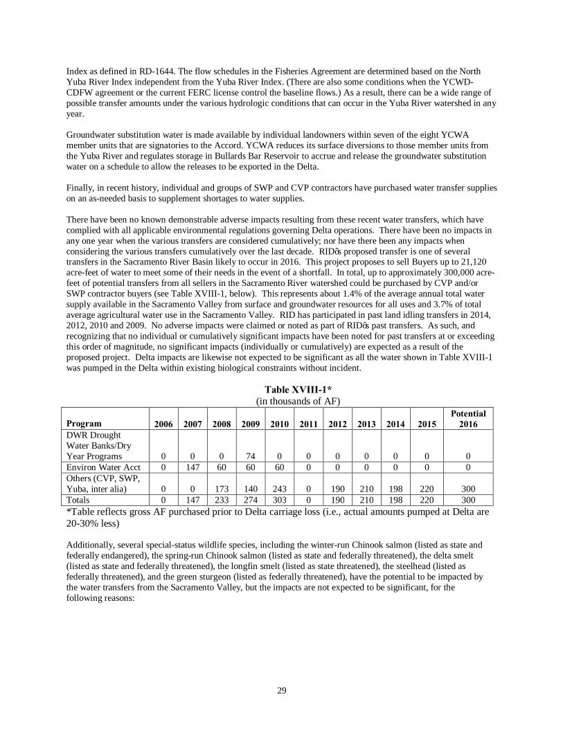
Index as defined in RD-1644. The flow schedules in the Fisheries Agreement are determined based on the North Yuba River Index independent from the Yuba River Index. (There are also some conditions when the YCWD-CDFW agreement or the current FERC license control the baseline flows.) As a result, there can be a wide range of possible transfer amounts under the various hydrologic conditions that can occur in the Yuba River watershed in any year. Groundwater substitution water is made available by individual landowners within seven of the eight YCWA member units that are signatories to the Accord. YCWA reduces its surface diversions to those member units from the Yuba River and regulates storage in Bullards Bar Reservoir to accrue and release the groundwater substitution water on a schedule to allow the releases to be exported in the Delta. Finally, in recent history, individual and groups of SWP and CVP contractors have purchased water transfer supplies on an as-needed basis to supplement shortages to water supplies. There have been no known demonstrable adverse impacts resulting from these recent water transfers, which have complied with all applicable environmental regulations governing Delta operations. There have been no impacts in any one year when the various transfers are considered cumulatively; nor have there been any impacts when considering the various transfers cumulatively over the last decade. RID’s proposed transfer is one of several transfers in the Sacramento River Basin likely to occur in 2016. This project proposes to sell Buyers up to 21,120 acre-feet of water to meet some of their needs in the event of a shortfall. In total, up to approximately 300,000 acre-feet of potential transfers from all sellers in the Sacramento River watershed could be purchased by CVP and/or SWP contractor buyers (see Table XVIII-1, below). This represents about 1.4% of the average annual total water supply available in the Sacramento Valley from surface and groundwater resources for all uses and 3.7% of total average agricultural water use in the Sacramento Valley. RID has participated in past land idling transfers in 2014, 2012, 2010 and 2009. No adverse impacts were claimed or noted as part of RID’s past transfers. As such, and recognizing that no individual or cumulatively significant impacts have been noted for past transfers at or exceeding this order of magnitude, no significant impacts (individually or cumulatively) are expected as a result of the proposed project. Delta impacts are likewise not expected to be significant as all the water shown in Table XVIII-1 was pumped in the Delta within existing biological constraints without incident.
Table XVIII-1* (in thousands of AF)
Program 2006
2007
2008
2009
2010
2011
2012
2013
2014 2015
Potential 2016
DWR Drought Water Banks/Dry Year Programs
0
0
0
74
0
0
0
0
0 0
0 Environ Water Acct 0 147 60 60 60 0 0 0 0 0 0 Others (CVP, SWP, Yuba, inter alia)
0
0
173
140
243
0
190
210
198 220
300
Totals 0 147 233 274 303 0 190 210 198 220 300 *Table reflects gross AF purchased prior to Delta carriage loss (i.e., actual amounts pumped at Delta are 20-30% less)
Additionally, several special-status wildlife species, including the winter-run Chinook salmon (listed as state and federally endangered), the spring-run Chinook salmon (listed as state and federally threatened), the delta smelt (listed as state and federally threatened), the longfin smelt (listed as state threatened), the steelhead (listed as federally threatened), and the green sturgeon (listed as federally threatened), have the potential to be impacted by the water transfers from the Sacramento Valley, but the impacts are not expected to be significant, for the following reasons:

30
Chinook Salmon (Oncorhynchus tshawytscha), Delta Smelt (Hypomesus transpacificus), Longfin Smelt (Spirinchus thaleichthyes),Green Sturgeon(Acipenser medirostris) and Steelhead (Oncorhynchus mykiss)
The Sacramento-San Joaquin Delta is a migration corridor and seasonal rearing habitat for winter-run Chinook salmon and steelhead. It provides spawning and nursery habitat for Delta Smelt. Transfer water to the buyers would be delivered through the Sacramento-San Joaquin Delta with timing identical to the Buyers’ typical SWP or CVP deliveries in conformance with all existing and pending requirements under the Endangered Species Act, including court orders, which govern SWP and CVP operations for the protection of Delta Smelt, and anadromous fishes and marine mammal species. The proposed transfer would not affect the regulatory or operational restrictions governing SWP or CVP operations. As such, there would be no impact from the proposed project on listed fish species in the Sacramento-San Joaquin Delta. Giant Garter Snake (Thamnophis gigas) The giant garter snake is endemic to the Sacramento and San Joaquin Valley floors where it inhabits an assortment of agricultural, managed, and natural wetlands. Rice cropping provides a dynamic habitat comprised of rice fields, tail water marshes, ditches and drains, delivery canals, and associated levees. These habitat components satisfy the primary requirements of giant garter snakes which include adequate water during the active summer season, basking sites, emergent vegetation for cover and foraging, as well as upland habitat for cover and refuge from flood waters during the dormant winter season. As a result, one of the biological concerns surrounding rice field idling is the potential effect on giant garter snakes. Although the proposed water transfers will reduce the overall availability of active ricelands in the BWD, available data suggests that due to (1) the relatively low suitability of habitat within the project study area, (2) the reliance on canals/agricultural waterways and rice field edges, as well as the (3) predicted abundance and habitat requirements, the proposed project will have a less-than-significant-impact on giant garter snakes with the implementation of the proposed avoidance and minimization measures.
c) No Impact. The negative declaration assesses the potential impacts of the proposed project. There would
be no construction activities associated with the proposed water transfer. Typical farming practices with the idling of land would comply with applicable health and safety requirements. Therefore, the proposed project would not cause substantial adverse effects on human beings, either directly or indirectly.

31
SECTION 4 REFERENCES
The following documents were used in the preparation of this Negative Declaration: California Department of Water Resources. California Water Plan Update. Bulletin 160-05. December 2005. State of California, 2007. California Environmental Quality Act, CEQA Guidelines. Amended July 11, 2006. U.S. Department of Agriculture, Soil Conservation Service. 1993. U.S. Department of Agriculture Soil Conservation
Service national soil survey handbook. November. Washington, DC. U.S. Fish and Wildlife Service. 1999. Draft Recovery Plan for the Giant Garter Snake (Thamnophis gigas). U.S. Fish and Wildlife Service, Portland, Oregon. ix+192 pp. http://www.dfg.ca.gov/hcpb/species/ssc/ssc.shtml
http://endangered.fws.gov/wildlife.html#Species DWR’s and the Bureau’s Draft Technical Information for Water Transfers in 2016 Reporting and monitoring results from transfers occurring within the past 10 years Draft EIS/EIR for proposed 10-year transfer by Bureau of Reclamation and San Luis & Delta Mendota Water Authority Biological assessment for proposed 2015 Tehama-Colusa Canal Authority water transfer 2014 GGS Biological Assessment Joyce Hunting, 2016. Analysis of Potential Impacts to Giant Garter Snake (Thamnophis gigas) Resulting from Riceland Fallowing for Water Transfers in the Northern Sacramento Valley of California.

32
SECTION 5 LIST OF PREPARERS
Sean Earley, General Manager, Richvale Irrigation District Dustin C. Cooper, Attorney, Minasian Law Firm Peter C. Harman, Attorney, Minasian Law Firm Joyce Hunting & Summer Pardo, Senior Biologist, Michael Baker International

Appendix 1

Page 1
Analysis of Potential Impacts to Giant Garter Snake (Thamnophis gigas) Resulting from Riceland Fallowing for Water Transfers in the Northern Sacramento Valley of California
JOYCE HUNTING
Michael Baker International 2729 Prospect Park Drive, Suite 220, Rancho Cordova, California 95670
The rice growing regions of the Sacramento Valley provide important habitat for the giant garter snake (GGS, Thamnophis gigas). Several water districts propose to take part in water transfers that will result in the idling of active rice fields in the northern portion of the Sacramento Valley. These activities could result in potentially significant impacts to GGS. A review of available research on the abundance, distribution, movements, and habitat selection of GGS in the region suggests that population densities and abundance in the project study area are low due to poor habitat suitability. GGS home range size and composition within rice agriculture have been reported to be smaller and less structurally diverse than in natural or constructed wetlands. As a result, the available remaining active ricelands would be adequate to support the estimated GGS population in the project study area. Based on these data, it is anticipated that implementation of the proposed avoidance and minimization measures would reduce potential impacts to a less than significant level.
The Western Canal Water District, Richvale Irrigation District, and Biggs-West Gridley Water District, collectively referred to as Districts in this paper, are potential sellers in water transfers associated with drought planning efforts. There are additional potential sellers in the Sacramento Valley. These are not considered in this analyses.
The Districts propose to sell water to the participating member districts of the State Water Contractors Incorporated or other South of Delta purchasers, including Central Valley Project (CVP) contractors, (Buyers) during the 2016 irrigation season. Buyers are seeking up to approximately 300,000 acre-feet (af) of transfer water from various willing sellers in the Sacramento Valley during the 2016 irrigation season. Purchasing this water would lessen potential water supply shortages to these Buyers, which may occur as a result of dry hydrologic conditions and regulatory restrictions on
pumping in the Delta. As willing sellers, the Districts would make water available to Buyers by idling cropland (i.e., non-irrigation of farmland by voluntary participants). Water made available by crop idling within the boundaries of the Districts would then be retained and stored by the Department of Water Resources (DWR) for delivery to Buyers.
The project study area, from which the water for this transfer will be made available, is defined by the boundaries of the Districts, which encompass approximately 125,000 acres in the northern Sacramento Valley (Figure 1). The majority of the project study area overlaps with southwestern Butte County; however, the Districts also overlap with portions of Glenn and Sutter counties.
Land idled for the purpose of this transfer will be drawn from the irrigable acreage within the District boundaries. Since the program will be

Page 2
offered to all eligible growers, based on prior experience, it is anticipated that there will be more interest in idling than the Districts desire. This will result in a wide dispersal of acreage enrolled in the program. The Districts will require program participants to disperse idled acreage and make clear to participants that large, contiguous blocks of idled land related to this program are undesirable. Dispersing the program acres throughout the Districts ensures that adequate water levels will be maintained in transmission canals so that wildlife impacts otherwise associated with dewatering the canals will be avoided, as will impacts associated with habitat loss that might occur with large, contiguous blocks of fallowed land. Only cultivated rice land that is subject to intense farming practices will be affected. Adjoining areas, non-rice land, other irrigated lands, drains, wetlands, and waterfowl habitat will not be affected, as those areas will receive their normal entitlement and canals and drains will operate at normal operating capacity.
One of the biological concerns surrounding rice field idling are the potential effects on GGS, a federal and California threatened species. Very little data exists on the distribution and occurrence of GGS in ricelands. This paper will summarize available data on GGS distribution, and use of ricelands within the project study area.
Species Overview
GGS are endemic to the Sacramento Valley and San Joaquin Valley floors (Fitch 1940, Hansen and Brode 1980, Rossman and Stewart 1987). Historically, GGS occurred in natural wetlands throughout the Sacramento and San Joaquin valleys, ranging from Butte County southward to Kern County (USFWS 1999). Today, GGS populations are found in the Sacramento Valley and in isolated portions of the San Joaquin Valley. More specifically, the current range is
believed to stretch from Mendota Wildlife Area in Fresno County northward to Chico in Butte County (Hansen 2008). Over 90% of the historical habitat for GGS has been lost to land development, particularly for agriculture (Wylie et al. 1997).
As a result, GGS now occupy an assortment of agricultural, managed, and natural wetlands. Rice fields, associated waterways and adjacent uplands provide the most important agricultural habitat for GGS (USFWS 1999). Rice cropping provides a dynamic habitat comprised of rice fields, tail water marshes, ditches and drains, delivery canals, and associated levees. These habitat components satisfy the primary requirements of GGS which include adequate water during the active summer season, basking sites, emergent vegetation for cover and foraging, as well as upland habitat for cover and refuge from flood waters during the dormant winter season (Hansen 1988).
The yearly rice field cycle coincides closely with seasonal GGS activity. In the spring (April and May), rice is planted and fields are flooded. Rice fields that support prey species such as mosquitofish (Gambusia affinis) and Pacific tree frog (Pseudacris regilla) will attract GGS. The active season for GGS begins around the beginning of April; however, studies suggest that GGS do not begin utilizing rice fields until June (Brode and Hansen 1992, Hansen and Brode 1993). As the rice grows, and as long as prey is present, GGS will continue to use the fields for foraging and cover. Female GGS give birth to young from late July through early September (Hansen and Hansen 1990). The shallow warm water, abundant prey, and vegetative cover may make rice fields important GGS nursery areas (Brode and Hansen 1992,

Page 3
Figure 1. Project Study Area

Page 4
Hansen and Brode 1993). In late summer and fall, the water is drained from the fields and rice is harvested. During the rice field dry-down, prey becomes concentrated in the lingering pockets of standing water, which provide an abundant prey source for GGS prior to the inactive season. It is thought that the majority of GGS move into adjacent habitats as the rice fields are drained, although some may overwinter in the fallow fields, where they find cover within burrows and soil cracks (Hansen 1998).
Historically, rice straw was burned following harvest and fields were left dry and fallow during winter. Currently, due to straw burning legislation (Connelly-Areias-Chandler Rice Straw Burning Reduction Act of 1991), many fields are flooded after harvest in an effort to decompose rice straw (Brouder and Hill 1995). As a result, many rice fields are flooded for up to eight months out of the year, eliminating them as potential refuge habitat for GGS.
Species Distribution in the Project Study Area
Recent occurrence records indicate that GGS are distributed in 13 unique population clusters coinciding with historic flood basins of the Central Valley (58 FR 54053 1993). Two of these populations, Butte Basin and Sutter Basin, overlap the study area. It is believed that GGS populations in the Sacramento Valley north of the Delta Basin are relatively stable compared to those in the San Joaquin Valley (USFWS 2012).
The abundance of ricelands may be the reason populations are more stable in the Sacramento Valley compared to the San Joaquin Valley (USFWS 2012, Halstead et al. 2010). Though GGS are able to persist in ricelands, Wylie et al.
(2010) demonstrated that riceland habitat is lower quality with lower densities of GGS than found in natural perennial wetlands. In general, GGS have been found to prefer areas with a dense network of canals, often in close proximity to rice agriculture, with a relatively low density of streams, and closer to open water and wetlands (Halstead et al. 2010).
A habitat use study was conducted by U.S. Geological Survey (USGS) biologists at Gilsizer Slough in Sutter County in 1996 to determine which habitats GGS utilized most frequently during active months (Wylie et al. 1997). Habitat use by radio-tagged snakes was documented as follows: irrigation canals (49.9%), freshwater marsh (22.9%), rice fields (20.3%), and sloughs (6.7%) (Wylie et al. 1997). In addition, approximately 50% of the radio-tagged snakes were observed using rice fields at some point during the year. One of the rice fields used by GGS in this study had been a tomato field the year prior; this demonstrates the ability of GGS to exploit newly created habitat connected to existing habitat (Wylie et al. 1997).
A query of the California Department of Fish and Wildlife’s (CDFW) California Natural Diversity Database (CNDDB, 2016) provided a list of known occurrences of GGS within a 5-mile radius of the District boundaries. The CNDDB query revealed 30 presumed extant occurrences within the boundaries of the Districts. Another 17 records occurred within 5 miles of the boundaries, resulting in a total of 33 occurrences within a 5-mile radius (Figure 2). Most of these occurrences are associated with canals and levees. Occurrences are concentrated around the Sacramento River in Glenn and Butte counties, as well as along Sutter Bypass in Sutter County.

Page 5
Figure 2. CNDDB Occurrences within 5 miles of the Project Study Area

Page 6
Recent surveys have been conducted in ricelands within the project study area. In 1996, surveys were conducted in the rice fields of Butte Basin near Butte Sink and no GGS were found (Wylie et al. 1997). Wylie et al. successfully trapped snakes in Butte County canals in 2011 (Figure 3). Population density estimates from the Wylie et al. (2011) study are lower than those of other recent studies in adjacent areas. A summary of GGS density estimates along linear transects from various sites and habitats throughout the Sacramento Valley can be found in Table 1.
Data Gaps
Very little data exists on the distribution and occurrence of GGS in ricelands. To date, most studies have focused on known populations in or near naturalized areas and refuges. Trapping studies have been conducted in agricultural
canals and waterways, but very few have directly addressed rice fields. As a result, little is known about the relationship between GGS and rice. More research is needed on how GGS use rice fields and the effects of agricultural practices and land use changes on populations of GGS. Ongoing projects are currently studying the effects of fallowing agricultural habitat on GGS.
Avoidance and Minimization Measures
In order to minimize impacts to GGS as a result of water transfers, water transfer actions will be limited so that no more than 20% of irrigable lands are idled in any one County, and will be distributed across the landscape. Having the fallowed/idled rice acreage spread throughout the project study area will help
Table 1. Some Population Estimates of Giant Garter Snakes
Location Year Trap-Days Captures (Hand &
trap)
Abundance N (95% CI)*
Author
Badger Creek 1997 18,376 103 118 (111-132) Wylie et al. 2010 Badger Creek 2002 14,973 63 216 (137-383) E. Hansen 2003a Colusa NWR 1997 12,198 53 29 (22-53) Wylie et al. 2010 Colusa NWR 2002 Not Listed 128 163 (42-186) Wylie et al. 2002c Gilsizer Slough 1996 17,136 88 177 (124-280) Wylie et al. 2010 Natomas Basin 1999 19,170 164 229 (199-276) Wylie et al. 2010 Volta WA 2003 15,900 28 45 (31-59) Dickert 2003 Volta WA 2006 5,131 7 Insufficient numbers
caught for estimate Sousa and Sloan 2007
Yolo WA 2005 13,700 41 57 (45-84) E. Hansen 2008a * CI = Confidence Interval
Source: U.S. Fish & Wildlife Service Revised Draft Recovery Plan for Giant Garter Snake 2015

Page 7
Figure 3. Wiley et al. 2011 Trap Locations

Page 8
ensure that the total water conveyance system remains in its normal year wetted-up condition. To further maximize connectivity, the water sellers will ensure water depths in major irrigation and drainage canals are similar to years when transfers do not occur or, where information on existing water depths is limited at least two feet of water will be considered sufficient. Radio-telemetry studies have shown GGS spend the majority of the active season utilizing canals and other waterways, not rice fields (Wylie et al. 1997). Additionally, approximately half of the snakes being studied did not use rice fields at all during the entire active season (Wylie et al. 1997). Maintaining the water level in the canals will preserve the most frequently utilized component of the riceland habitat.
The Districts proposing water transfers made available from idled rice fields will ensure that adequate water is available for priority habitat with a high likelihood of GGS occurrence. The determination of priority habitat will be made through coordination with GGS experts, GIS analysis of proximity of historic tule marsh, and GIS analysis of suitable habitat. The priority habitats areas will be indicated on the priority habitat maps for participating water agencies, and will be maintained by the US Bureau of Reclamation (Reclamation). In addition, fields abutting or immediately adjacent to federal wildlife refuges will be considered priority habitat.
Maintaining water in smaller drains and conveyance infrastructure supports key habitat attributes such as emergent vegetation for GGS for escape cover and foraging habitat. If crop idling/shifting occurs in priority habitat areas, Reclamation or DWR, as applicable, will work with the Districts to document that adequate water remains in drains and canals in those priority areas. Documentation may include flow records, photo documentation, or other means of
documentation agreed to by DWR and Reclamation and USFWS.
Areas with known priority GGS populations will not be permitted to participate in cropland idling/shifting transfers. Water sellers can request a case-by-case evaluation of whether a specific field would be precluded from participating in annual water transfers. These areas include lands adjacent to naturalized lands and refuges and corridors between these areas such as: fields abutting or immediately adjacent to Little Butte Creek between Llano Seco and Upper Butte Basin Wildlife Area, Butte Creek between Upper Butte Basin and Gray Lodge Wildlife Areas, Colusa Basin drainage canal between Delevan and Colusa National Wildlife Refuges, Gilsizer Slough, Colusa Drainage Canal, the land side of the Toe Drain along the Sutter Bypass, Willow Slough and Willow Slough Bypass in Yolo County, Hunters and Logan Creeks between Sacramento and Delevan National Wildlife Refuges; and lands in the Natomas Basin (USFWS 2015).
Lastly, the Districts and participating landowners will continue to voluntarily perform GGS best management practices including educating maintenance personnel to recognize and avoid contact with GGS implementing other measures to enhance habitat for GGS. These measures will be found in the Districts CEQA documents.
Conclusions
Halstead et al. (2013) determined that GGS have a higher probability of occurrence near historic marsh habitat, and that the importance of this factor may suggest dispersal limitations for GGS. The results of the Halstead et al. (2013) study may explain why density estimates in the project study area (Wylie et al. 2011) are lower than rice production areas in other regions of the Sacramento Valley (Butte County 2012). These

Page 9
data suggest that although the ricelands within the project study area may be able to support higher densities of GGS, distance to historic marsh habitat may be a limiting factor.
Radio-telemetry studies suggest that GGS move little from day to day and use rice fields ±20% of the time, marsh habitat 20-23% of the time, and canals/agricultural waterways 50-56% of the time (Wylie et al. 1997). These data suggest that removal of open water and emergent habitat found within drainage canals may be a more significant impact than temporary loss of active rice fields.
GGS home ranges within ricelands are typically composed of 43-49% terrestrial habitat, 41-42% emergent habitat, and 5% aquatic habitat; range in size from 7 to 13 hectares (17.3–32.1 acres); and have a high degree of overlap (Valcarcel 2011). Based on these data, it is anticipated that even if 20% of the ricelands within the project study area are fallowed, there would still be an adequate amount of aquatic habitat remaining to support the GGS population.
For example, the Butte County Regional Conservation Plan (Butte RCP) reports GGS densities in rice acreage as 0.036 snakes per acre. The Richvale Irrigation District (RID) 2016 water transfer proposal states that there are approximately 32,000 acres of rice agriculture in its district, which when multiplied by the reported density in the Butte RCP, results in the estimation that there are 1,152 snakes in the RID. Assuming each snake requires 13 hectares (32.1 acres) (Valcarcel 2011), the GGS population in the RID would require approximately 36,979 acres of habitat. This acreage could then be further classified into aquatic and terrestrial habitat based on the home range compositions reported by Valcarcel (2011). Assuming each GGS home range is composed of 40% terrestrial habitat and 60% aquatic habitat (includes aquatic and emergent
habitat), the GGS population in the RID would require approximately 22,187 acres of aquatic habitat and 14,792 acres of terrestrial habitat.
If 20% of the 32,000 acres of ricelands within the RID are fallowed, then approximately 25,600 acres would remain active. Based on these data, it is anticipated that an adequate amount of aquatic habitat would exist within the project study area to support the GGS population, due to the fact that these calculations assume no overlap in GGS home range, and do not consider available canal/agricultural waterway habitat.
Adult female GGS have been found to use the edges of rice fields with limited use of interior locations, which greatly decreases the amount of functionally available habitat (Valcarcel 2011). Optimal thermoregulation, cover from predators, and feeding opportunities along edges are a few of the factors thought to contribute to the greater use of edges versus interior locations (Valcarcel 2011). Water transfer actions will be implemented so that parcels idled under the water transfer program will be distributed across the landscape. This combined with maintenance of a wetted-up condition in drainage channels, and restricting emergent vegetation removal within the drainages to only one side would create a more heterogeneous habitat structure, which may provide more functionally available habitat for GGS in the project study area.
Although the proposed water transfers will reduce the overall availability of active ricelands in the project study area available data suggests that due to 1) the relatively low suitability of habitat within the project study area, 2) the reliance on canals/agricultural waterways and rice field edges, as well as the 3) predicted abundance and habitat requirements, the proposed project will have a less than significant impact on GGS with the implementation of the proposed avoidance and minimization measures.

Page 10
References
58 FR 54053. 1993. Endangered and Threatened Wildlife and Plants; Determination of Threatened Status for the Giant Garter Snake. Final Rule. Federal Register 58:54053.
Brode, J. and G. Hansen. 1992. Status and future management of the giant garter snake (Thamnophis gigas) within the southern American Basin, Sacramento and Sutter Counties, California. California Department of Fish and Game, Inland Fisheries Division.
Brouder, S.M. and J.E. Hill. 1995. Winter Flooding of Ricelands Provides Waterfowl Habitat. California Agriculture, 49, pp. 58.
Butte County. 2012. Butte Regional Conservation Plan, Covered Species Accounts – Giant Garter Snake. Preliminary Public Draft.
California Department of Fish and Wildlife. 2016. California Natural Diversity Database – January 5, 2016 update. CDFW Biogeographic Data Branch; Sacramento, CA.
California Department of Water Resources and US Bureau of Reclamation. 2015. Draft Technical Information for Preparing Water Transfer Proposals (Water Transfer White Paper). DWR and Bureau of Reclamation; Sacramento CA.
Fitch, H.S. 1940. A biogeographical study of the ordinoides artenkreis of garter snakes (genus Thamnophis). University of California. Publ. Zool. 44:1-150.
Halstead, B.J., G.D. Wylie, and M.L. Cassaza. 2010. Habitat Suitability and Conservation of the Giant Gartersnake (Thamnophis gigas) in the Sacramento Valley of California. Copiea 4: 591-599.
Halstead, B.J., G.D. Wylie, and M.L. Cassaza. 2013. Ghost of habitat past: historic habitat affects the contemporary distribution of giant garter snakes in a modified landscape. Animal Conservation, published online 22 August 2013.
Hansen, G.E. 1988. Review of the status of the giant garter snake (Thamnophis gigas) and its supporting habitat during 1986-1987. Final Report for California Department of Fish and Game, Contract C-2060. Unpublished 31 pp.
Hansen, G.E. 1998. Cherokee Canal sediment removal project post-construction giant garter snake (Thamnophis gigas) surveys. Final report for California Department of Fish and Game; Sacramento, CA.
Hansen, G.E. 2008. Implementation of priority 1, priority 2, and priority 3 recovery tasks for giant garter snake (Thamnophis gigas) – continuing surveys in Merced County, California, with an extension to northern Fresno County. Prepared for the USFWS by Eric Hansen. April 15, 2008.
Hansen, G.E. and J.M. Brode. 1980. Status of the giant garter snake Thamnophis couchii gigas (Fitch). Inland Fisheries Endangered Species Special Publication 80(5):1-14. California Department of Fish and Game; Sacramento, CA.
Hansen, G.E. and J.M. Brode. 1993. Results of Relocating Canal Habitat of the Giant Garter Snake (Thamnophis gigas) during the Widening of State Route 99/70 in Sacramento and Sutter Counties, California. California Department of Fish and Game; Sacramento, CA.
Hansen, R.W. and G.E. Hansen. 1990. Thamnophis gigas Reproduction. Herpetological Review 21(4); 93-94.

Page 11
ICF International. 2010. Biological Effectiveness for the Natomas Basin Habitat Conservation Plan Area – 2010 Annual Survey Results (Agency Version). Final report June. (ICF 00004.08.) Prepared for the Natomas Basin Conservancy; Sacramento, CA.
ICF International. 2011. Biological Effectiveness Monitoring for the Natomas Basin Habitat Conservation Plan Area 2010 Annual Survey Results (Public Version). Final report. April. (ICF 00859.09.) Sacramento, CA. Prepared for The Natomas Basin Conservancy; Sacramento, CA.
Jones & Stokes. 2005. Natomas Basin Habitat Conservation Plan Area Biological Effectiveness Monitoring Program. August. Sacramento, CA. Prepared for the Natomas Basin Conservancy; Sacramento, CA.
Rossman, D.A. and G.R. Stewart. 1987. Taxanomic reevaluation of Thamnophis couchii (Serpentes: Colubridae). Occasional Papers of the Museum of Zoology, Louisiana State University; Baton Rouge. LA. 63:1-25.
US Bureau of Reclamation. 2015. Environmental Assessment/Initial Study 2015 Tehama-Colusa Canal Authority Water Transfers. March 2015.
_____.2014a. Biological Assessment. Long-term Water Transfers. October 2014
_____. 2014b. Long-term Water Transfers Environmental Impact Statement / Environmental Impact Report.
US Fish and Wildlife Service (USFWS). 2015. Reinitiation of Programmatic Formal Consultation for Bureau of Reclamation's Proposed Central Valley Project Long Term Water Transfers (2015-2024) with Potential Effects on the Giant Garter Snake within
Sacramento Valley, California. Sacramento Fish and Wildlife Office, Sacramento, California (08ESMF00- 2015-F-0116)
US Fish and Wildlife Service (USFWS). 1999. Draft Recovery Plan for the Giant Garter Snake (Thamnophis gigas). USFWS; Sacramento, CA.
US Fish and Wildlife Service (USFWS). 2015. Draft Recovery Plan for the Giant Garter Snake (Thamnophis gigas). USFWS; Sacramento, CA.
USFWS. 2006. Giant Garter Snake (Thamnophis gigas) 5-Year Review: Summary and Evaluation. USFWS; Sacramento, CA.
USFWS. 2012. Giant Garter Snake (Thamnophis gigas) 5-Year Review: Summary and Evaluation. USFWS; Sacramento, CA.
Valcarcel, Patricia M. 2011. Giant Gartersnake Spatial Ecology in Agricultural and Constructed Wetlands. Master’s Thesis, Oregon State University.
Wylie, G.D., B.J. Halsted, M.G. Meshriy, J. M. Sweeney, V. M. Johnson and M.L. Casazza. 2011. Distribution of the Giant Garter Snake in Butte County, California: Data Summary of Field Observations May 2008-September 2010. Report R09PG20049 to the US Bureau of Reclamation Habitat Restoration program by the US Geological Survey Western Ecological Research Center, Dixon Field Station; Dixon, CA. 43 pp.
Wylie, G.D. and M. Amarello. 2008. Results of monitoring for giant garter snakes (Thamnophis gigas) for the bank protection project on the left bank of the Colusa Basin Drainage Canal in Reclamation District 108, Sacramento River Bank Protection Project, phase II. Prepared for the U.S. Army Corps of Engineers by the U.S. Geological Survey.

Page 12
Western Ecological Research Center, Dixon Field Station; Dixon, CA.
Wylie, G.D., M.L. Casazza, and J.K. Daugherty. 1997. 1996 Progress Report for the Giant Garter Snake Study. May 1, 1997. Dixon Research Station, California Science Center, USGS Biological Resource Division; Dixon, CA.
Wylie, G.D., M.L. Casazza, C.J. Gregory, and B.J. Halstead. 2010. Abundance and sexual
size dimorphism of the giant garter snake (Thamnophis gigas) in the Sacramento Valley of California. Journal of Herpetology 44(1):94-103.
Wylie, G.D., M.L. Casazza, L.L. Martin, and M. Carpenter. 2002. Monitoring Giant Garter Snakes at Colusa National Wildlife Refuge: 2002 Progress Report. USGS Western Ecological Research Center; Dixon, CA.