INAUGURAL and TECHNICAL SESSIONS - Karnataka · INAUGURAL and TECHNICAL SESSIONS ... T.V.Swetha,...
20
National Seminar on Geospatial Solutions for Resource Conservation and Management (GEOSOL 2012) 1986-2011 Silver Jubilee Year INAUGURAL and TECHNICAL SESSIONS J N Tata Auditorium, Indian Institute of Science, Bangalore 18-19 January, 2012 Organized by Karnataka State Remote Sensing Applications Centre Dept. of IT, BT and S & T, Govt. of Karnataka Sponsored by Ministry of Earth Sciences, GoI Department of Space, GoI Department of Science and Technology, GoI Indian council of Agricultural Research Council for Scientific and Industrial Research Co-sponsored by
Transcript of INAUGURAL and TECHNICAL SESSIONS - Karnataka · INAUGURAL and TECHNICAL SESSIONS ... T.V.Swetha,...

National Seminar on Geospatial Solutions for
Resource Conservation and Management (GEOSOL 2012)
1986-2011
Silver Jubilee Year
INAUGURAL
and TECHNICAL SESSIONS
J N Tata Auditorium, Indian Institute of Science, Bangalore
18-19 January, 2012
Organized by
Karnataka State Remote Sensing Applications Centre Dept. of IT, BT and S & T, Govt. of Karnataka
Sponsored by
Ministry of Earth Sciences, GoI
Department of Space, GoI Department of Science and Technology, GoI
Indian council of Agricultural Research Council for Scientific and Industrial Research
Co-sponsored by

Programme at a Glance Day 1 - 18
th January, 2012
Venue: J N Tata Auditorium
Inauguration of the National Seminar 10.30 hrs - 11.30 hrs
11.30 hrs - 12.00 hrs - Tea Break
Vision Talk
12.00 hrs - 13.30 hrs
13.30 hrs - 14.30 hrs - Lunch break
Panel Discussion
14.30 hrs - 15.30 hrs
Time Hall-A Hall-B Hall-C
15.30
to
16.30 hrs
Technical Session – I
Soil Resource Management
Technical Session – V
Earth Resources –
Water Resources
Technical Session-VIII
Forest Resources
16.30 to
16.45 hrs Tea Break
16.45
to
18.15 hrs
Technical Session - I (Cont)
Soil Resource Management
Technical Session - V (Cont)
Earth Resources –
Water Resources
Technical Session – IX
Tourism and Archaeology
Day 2 - 19th
January, 2012
09.30
to
11.00 hrs
Technical Session – II
Land Use/Land Cover
Technical Session-VI
Environment and Disaster
Management
Technical Session – X
Ocean Resource Management
11.00
to
11.15 hrs Tea Break
11.15
to
13.00 hrs
Technical Session – III
Watershed Management
Technical Session - VI (Cont)
Environment and Disaster
Management
Technical Session-XI
Urban and Country Planning
13.00 to
14.00 hrs Lunch Break
14.00
to
15.30 hrs
Technical Session – IV
Crop Acreage and Production
Estimation
Technical Session - VII (Cont)
Earth Resources –
Petroleum and Minerals
Technical Session - XI (Cont)
Urban and Country Planning
15.30 to
15.45 hrs Tea Break
15.45
to
18.00 hrs
PPLLEENNAARRYY SSEESSSSIIOONN ((J N Tata Auditorium))
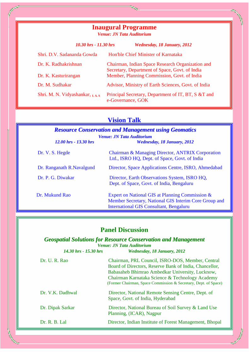
Inaugural Programme
Venue: JN Tata Auditorium
10.30 hrs - 11.30 hrs Wednesday, 18 January, 2012
Shri. D.V. Sadananda Gowda Hon'ble Chief Minister of Karnataka
Dr. K. Radhakrishnan Chairman, Indian Space Research Organization and
Secretary, Department of Space, Govt. of India
Dr. K. Kasturirangan Member, Planning Commission, Govt. of India
Dr. M. Sudhakar Advisor, Ministry of Earth Sciences, Govt. of India
Shri. M. N. Vidyashankar, I. A. S Principal Secretary, Department of IT, BT, S &T and
e-Governance, GOK
Vision Talk
RReessoouurrccee CCoonnsseerrvvaattiioonn aanndd MMaannaaggeemmeenntt uussiinngg GGeeoommaattiiccss
Venue: JN Tata Auditorium
12.00 hrs - 13.30 hrs Wednesday, 18 January, 2012
Dr. V. S. Hegde Chairman & Managing Director, ANTRIX Corporation
Ltd., ISRO HQ, Dept. of Space, Govt. of India
Dr. Ranganath R.Navalgund Director, Space Applications Centre, ISRO, Ahmedabad
Dr. P. G. Diwakar Director, Earth Observations System, ISRO HQ,
Dept. of Space, Govt. of India, Bengaluru
Dr. Mukund Rao Expert on National GIS at Planning Commission &
Member Secretary, National GIS Interim Core Group and
International GIS Consultant, Bengaluru
Panel Discussion
GGeeoossppaattiiaall SSoolluuttiioonnss ffoorr RReessoouurrccee CCoonnsseerrvvaattiioonn aanndd MMaannaaggeemmeenntt Venue: JN Tata Auditorium
14.30 hrs - 15.30 hrs Wednesday, 18 January, 2012
Dr. U. R. Rao Chairman, PRL Council, ISRO-DOS, Member, Central
Board of Directors, Reserve Bank of India, Chancellor,
Babasaheb Bhimrao Ambedkar University, Lucknow,
Chairman Karnataka Science & Technology Academy (Former Chairman, Space Commission & Secretary, Dept. of Space)
Dr. V.K. Dadhwal Director, National Remote Sensing Centre, Dept. of
Space, Govt. of India, Hyderabad
Dr. Dipak Sarkar Director, National Bureau of Soil Survey & Land Use
Planning, (ICAR), Nagpur
Dr. R. B. Lal Director, Indian Institute of Forest Management, Bhopal

Oral Presentation
Technical Session- I
Agriculture-Soil Resources
Date: 18-01-2012 Time:15.30 to 18.15 hrs Venue: Hall - A
Chairman Dr. D. Sarkar
Director, NBSS & LUP , Nagpur
Rapporteur
V. Rengan
Research Scholar, Department of Geography
Madurai Kamaraj University, Madurai
Time Authors Paper
15.30
to
16.30 hrs
Dr. D.Sarkar
NBSS & LUP , Nagpur
Soil Resource Management
Lead Paper
A. Natarajan, R.S.Meena, S.Thayalan,
R.Hegde,
K.V.Niranjana, B.A.Dhanorkar,
L.G.K.Naidu and Dipak Sarkar
Soil Resource Mapping for Command Area Development
– A Case Study in Chikkarsinakere Hobli, Maddur Taluk,
Mandya District, Karnataka
Rajendra Hegde, K.V.Niranjana,
A.Natrajan, S.Thayalan, L.G.K. Naidu
and Dipak Sarkar
Efficient techniques for detailed land resources
inventorization using RS and conventional tools: a case
study of Tirumale sub-watershed in Magadi Taluk,
Karnataka
D.K.Prabhuraj, B.L.Joythi,
C.S.Harindranath, C.R.Shivaprasad and
K.T.Guruswamy
Soil and Land Resources Information System – A Case
study of Chikkanya Village, Mysore Taluk and district
16.30
to
16.45 hrs
T E A B R E A K
16.45
to
18.15 hrs
T. Bhattacharyya, P. Chandran, S. K.
Ray, P. Tiwary, D. K. Pal, C. Mandal,
A. S. Deshmukh, A. M. Nimje, R. R.
Deshmukh, D. Das Gupta, D. V.
Balbuddhe, and B. A. Telpande
Predicting changes in soil organic carbon and crop yield
due to climate change in two important food growing
zones of India
Champa Mandal, D.K. Mandal, Jagdish
Prasad, Dipak Sarkar, P. Chandran, P.
Tiwary, N.G. Patil, G.P. Obi Reddy,
M.A. Lokhande, K.N. Wadhai, V.T.
Dongare, G.S. Sidhu, A.K. Sahoo, K.M.
Nair, R.S. Singh, D. K. Pal, S.K. Ray
and T. Bhattacharyya
Revision of Black Soil Map of India for Sustainable Crop
Production
P.Chandran, C. Mandal,
T. Bhattacharyya, D. Sarkar,
D.K. Pal, S.K. Ray, Jagdish Prasad, P.
Tiwary, R. Srivastava, M. Lokhande, K.
Wadhai V. Dongre and J.A. Dijkshoorn,
N.H. Batjes and P.S. Brindaban
Soil and terrain information system for resource planning
of the Indo-Gangetic plains, India
S.C.Ramesh Kumar, L.G. K. Naidu,
K.V. Niranjana and Dipak Sarkar
Assessment of the economic value of soil resources
information
Inder Jeet Singh Bardhan and Simran
Kaur
Creation of Database and Mapping of Natural Resources
for Planning Using Remote Sensing and GIS : A Study of
Ropar Block, District – Rupanagar (Punjab)
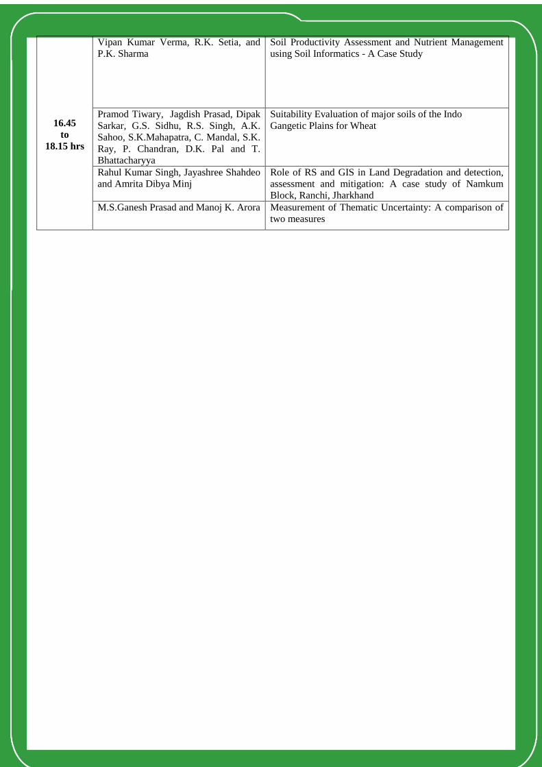
16.45
to
18.15 hrs
Vipan Kumar Verma, R.K. Setia, and
P.K. Sharma
Soil Productivity Assessment and Nutrient Management
using Soil Informatics - A Case Study
Pramod Tiwary, Jagdish Prasad, Dipak
Sarkar, G.S. Sidhu, R.S. Singh, A.K.
Sahoo, S.K.Mahapatra, C. Mandal, S.K.
Ray, P. Chandran, D.K. Pal and T.
Bhattacharyya
Suitability Evaluation of major soils of the Indo
Gangetic Plains for Wheat
Rahul Kumar Singh, Jayashree Shahdeo
and Amrita Dibya Minj
Role of RS and GIS in Land Degradation and detection,
assessment and mitigation: A case study of Namkum
Block, Ranchi, Jharkhand
M.S.Ganesh Prasad and Manoj K. Arora Measurement of Thematic Uncertainty: A comparison of
two measures

Technical Session - II
Agriculture-Land Use/Land Cover
Date: 19-01-2012 Time: 9.30 to 11.00 hrs Venue: Hall - A
Chairman Dr. P.P. Nageswara Rao
Project Director, IGBP, ISRO
Rapporteur Dr. S. C. Ramesh Kumar
Principal Scientist, NBSS & LUP, Bengaluru
Time Authors Paper
9.30
to
11.00 hrs
Prof. Manoj K. Arora
Dept. of Civil Engineering,
IIT, Roorkee
Advances in Land Cover Extraction from Remote Sensing
Data
Lead Paper
S.Sundaraj Thayalan, Arun
Chaturvedi and Dipak Sarkar
Assessment of Land Use / Land Cover dynamics in
Chandrapur District of Maharashtra using Remote Sensing
for Planning Sustainable Agricultural Development
T.Vani, G. Kumaraswami, G.Mehar
Baba and K. Mruthyunjaya Reddy,
Application of Geomatics for Land Use and Land Cover
Mapping of Nellore District, Andhra Pradesh
U.K.Shanwad , V.C.Patil, H.Honne
Gowda, K. Ashoka Reddy and
D.K.Prabhuraj
Application of Remote Sensing Techniques for Land Use/
Land Cover Change Analysis of Katangidda Nala
Watershed in Gulbarga District of North Karnataka
M. Kirithiga and V. Thangamani Geographical Analysis of Land Use Classification in
Kayalkudar Sub Watershed of Vaippar basin, Tamil Nadu
using GIS
G.S.Chandan and T.J.Renuka Prasad
Change Detection Studies of Landuse and Land cover in
YMSK Kere Watershed, Bangalore North Taluk using
Remote Sensing & GIS
P. K. Srimani and Nanditha Prasad Land Use / Land Cover Classification through Decision
Tree Classifiers
11.00
to
11.15 hrs
T E A B R E A K

Technical Session-III
Agriculture-Watershed Management
Date: 19-01-2012 Time: 11.15 to 13.00 hrs Venue: Hall - A
Chairman Dr. B. K. Ranganath,
Project Director, M & E, Antrix Corporation, ISRO
Rapporteur Dr. Rajendra Hegde,
Principal Scientist, NBSS & LUP, Bengaluru
Time Authors Paper
11.15
to
13.00 hrs
Dr. B.K. Ranganath
Project Director, ISRO
Watershed Management
Lead Paper
Rama Subramonium,
Vipul Sharma, Manoj Joseph and J.R.
Sharma
Watershed characterization and prioritization in semi-
arid region of Rajasthan using Geomatics Technologies
Adil Mushtaq and A.Q.Dar
Watershed prioritization of inaccessible micro-
watersheds of Dal lake catchment (J&K) using GIS
H.B.Balakrishna and D.Shivaprasad Watershed Prioritization for soil conservation using RS
and GIS
K.N.Chandrashekarappa, Ahmed S.A,
Govindaraju, Shruthi, Monohar and
Devarajaiah.
Erosion Prone Analysis of Kattehole Sub-Watershed,
Tarikere Taluk, Chikmagalur District, Karnataka, India
Girish Gopinath, M.Manasa,
T.V.Swetha, M.K.Ashitha and Ajith
G. Nair
Watershed Prioritization Using Morphometric Analysis
in Kuttiyadi River Basin: A Geospatial Approach
Ms.Sharvari Shridharan Estimating water balance and crop water productivity
of Osman Sagar Catchment area of Musi river basin
using Remote Sensing and secondary datasets
V. Rengan and G. R. Parthasarathy Land Evaluation for Land use Planning in Theniar Sub
Watershed Using Geoinformation Technology
K.N.Chandrashekarappa,
Ahmed S.A., Govindaraju, Shruthi,
Monohar and Devarajaiah
Quantitative Geomorphic Study of Hirehalla Sub-
watershed, Honnali Taluk, Davangere district of
Karnataka State
S. Edison and Nizamudeen. A. Micro-watershed Level Land use Planning
for Sustainable Natural Resource Conservation
B.P.Lakshmikantha and Rashmi Raj Web Based Watershed Information System for
Karnataka State
13.00
to
14.00 hrs
L U N C H B R E A K

Technical Session-IV
Agriculture-Crop Acreage and Production Estimation
Date: 19-01-2012 Time: 14.00 to 15.30 hrs Venue: Hall - A
Chairman Dr. Udayaraj
General Manager, RRSC-South, Bengaluru
Rapporteur Dr. P. Chandran
Principal Scientist, NBSS & LUP, Nagpur
Time Authors Paper
14.00
to
15.30 hrs
Dr.Udayaraj,
General Manager, RRSSC
Crop Acreage and Production Forecasting using RS
and GIS
Lead Paper
J.S.Nagaraj ,K.S.Ramesh, H.M.
Ravishankar, M.V.D’Souza,
S.M.Prasanna and
Jayarama,
Utility of Remote Sensing Techniques for Estimation
of Coffee Area and Production in India
M.Kavitha Hemanth, K.V.V. Ramesh,
G.Mehar Baba and K.Mruthyunjaya
Reddy
Cotton Acreage and Production forecast using RS data
and Agro meteorological yield models – A case study
of Karimnagar District, Andhra Pradesh
K.Ashoka Reddy, B.P.Lakshmikantha,
G.N.Naveenkumar, D.K.Prabhuraj
D.R.Rajak, G.N.Patel, Hitendra,
N.K.Patel, Sushma Panigrahy and
J.S.Parihar
Remote Sensing Applications for Rabi Sorghum Crop
Acreage Estimation using Multi-date AwiFS Data for
Northern Districts of Karnataka
Govindaraju, S.Govindaiah,
K.C.Chandrashekarappa,
D.C.Lingadevaru, P.D.Jayakumar, and
K.S.Leela
RS and GIS Applications in Wetland Change Detection
Analysis – A Case Study in Bhadravathi Taluk,
Shimoga District
Aniruddha Ghosh and
P.K.Joshi
Potential of Very High Resolution Satellite Images to
Create Agricultural Land Record in India
Mahantesh B Patil, U.K.Shanwad,
H.Veeresh, N.L.Rajesh, Pandit Rathod
and B.G.Mastan Reddy
Precision Farming in Karnataka – A New Initiative
towards strengthening farming community
15.30
to
15.45 hrs T E A B R E A K
15.45
to
18.00 hrs P L E N A R Y S E S S I O N (J N Tata Auditorium)

Technical Session-V
Earth Resources-Water Resources
Date: 18-01-2012 Time: 15.30 to 18.15 hrs Venue: Hall - B
Chairman Prof. G. Venkatraman
CSRE, IIT, Mumbai
Rapporteur Dr. Parag Phukon
Department of Geological Sciences, Gawahati University, Gawahati
Time Authors Paper
15.30
to
16.30 hrs
Prof. G.Venkataraman
CSRE, IIT Powai, Mumbai
Synthetic Aperture RADAR applications for Snow
Studies
Lead Paper
Atanu Bhattacharya, Manoj K. Arora
and Mukat L. Sharma
A Study on Surface Displacement Estimataion using
Differential SAR Interferometry in the Himalayan
Region
G.Balamurugan, V.Thirukumaran and
K.Santhanam.
Synergistic Use of Multispectral EO-1 ALI, Landsat-
ETM+ and Hyperspectral Hyperion Data and GIS for
Regolith Land form Mapping in Arid Region:
Implication for Groundwater Exploration
A.Nageswara Rao, G.Gautham, and
K.Mruthyunjaya Reddy
Mapping of Ground Water Prospect zones in
Bazarhatnoor watershed, Adilabad Didtrict, Andhra
Pradesh using RS & GIS
G.Gautham, S.Swetha, A.Nageswara
Rao and K.Mruthyunjaya Reddy
Identification of Ground Water Potential Zones Using
High Resolution Satellite Data in the Desert Prone
Area - A Case Study on Gorantla Watershed,
Ananthapur District, Andhra Pradesh
16.30
to
16.45 hrs T E A B R E A K
16.45
to
18.15 hrs
A.G.Rajanna, S.M.Kalagidi and
S.C.Puranik
Mapping of Groundwater Prospect Zones using
Remote Sensing and Geographical Information System
for Bagalkot Taluk, Karnataka
Rajesh Raghunath and R.Rakhi Gopal Multi Criteria Approach for the Management of
Ground Water Resources in problematic Areas: WPR
Based Ground Water Potential Zones in Parasala
Block, South Kerala, India
Gigo Pulikkottil, P.Babu,
M.K.Ashitha and Girish Gopinath
Assessment of drainage network derived from ASTER
and SRTM digital elevation datasets in a tropical river
basin, Kerala
Parag Phukon and Ratamali
Machahary
River Variability Analysis in the parts Northern
Brahmaputra Plain, Assam: A Remote Sensing and GIS
Approach
Surabhi Bhatt,
Ahmed. S. A., S.Kiran Raj and
Nischitha V
Evaluation of Morphometric Parameters of Yerla River
catchment in Maharashtra from Aster Dem
S. Arya and T.Subramani Ground water potential mapping in a Rock Terrain
Using Remote Sensing and GIS Techniques
Nagraj,S. Patil and A.K. Gosain Web based Geospatial Technology for Water
Resources Management

Technical Session-VI
Environment and Disaster Management
Date: 19-01-2012 Time: 9.30 to 13.00 hrs Venue: Hall - B
Chairman
Prof. Manoj K. Arora
Professor and Associate Dean (Academics) Geomatics Engg.
IIT, Roorkee
Rapporteur Dr. M. S. Ganesh Prasad
Professor, Department of Civil Engineering, NIE, Mysore
Time Authors Paper
9.30
to
11.00 hrs
Dr. V.S. Prakash,
Director, KSNDMC, Bangalore
Environment and Disaster Management
Lead Paper
Dr. K. Ganesh Raj
Dy. Director, RESPOND, ISRO
RS & GIS in
Environment & Disaster Management
Lead Paper
Reshma Raskar (Phule)
Geospatial Solutions for Disaster Management –
(Tsunami Disaster Damage Detection – A Case Study
in SriLanka)
Farjana Birajdar
S. Birajdar, G. Venkataraman
Remote Sensing and GIS Applications in monitoring
Himalayan Glaciers
Mahendra R.S, Prakash. C., Mohanty,
Hrusikesh Bisoyi, Sumisha Velloth
and T. Srinivasa Kumar
Assessment of Spatial Changes in Coral Reef and
Mangrove Environs of the Andaman Islands due to
December 26, 2004 Sumatra Earthquake
Arshad Amin Assessment of Anthropogenic Pressure on Dal Lake in
Srinagar City
Anil Kumar, Sengar S.S. Ghosh S. K.
and Wason H. R.
Soft Computing approach for liquefaction
identification using Temporal Indices from IRS-1D
data
Saran M.S, D Robinson and Arun
Anat
Air pollution monitoring in Central Business District
(CBD) of Ernakulam City using GIS
Ashwini S.Rao, B.R.Raghavan,
T.Deepthi and M. Kumaraswami
Spatial Distribution and Season Variation of Total
Suspended Matter off Honnavar, Eastern Arabian Sea,
India
11.00
to
11.15 hrs T E A B R E A K
11.15
to
13.00 hrs
R.K.Mrinalinee Devi and P.K. Bora
Morphotectonics and Paleoseismicity on the Frontal
Alluvial Region of the Eastern Limb of the eastern
Syntaxial Bend, Arunachal Himalaya: A Case Study of
the Kundil River Section, Sadiya
Hina Pande, R.D., Garg and A.K.Sen Environmental Impact Assessment in Open Cast
Mining Areas Using Multidate Remote Sensing
T. Subramani, S.P.Kasiviswanathan
and U.Sathya
Land Slide Hazard Study using Remote Sensing and
GIS in Kattary Watershed, Nilgiris, Tamil Nadu, India
G.K.Girijesh, A.S.Kumara swamy,
M. Dinesh Kumar and
K.S.Rajashekarappa
Carbon sequestration through improved agronomic
practices and conservation of Natural Resources in the
context of Global Warming
Vignesh Rajkumar L, K.Shimola and
M.Krishnaveninna
Climate Change Vulnerability study using GIS for
developing farmers adaptation strategy
Pratima Pandey and G.Venkataraman Application of Remote Sensing Data for Glacial
Studies – An Overview

Technical Session-VII
Earth Resources- Petroleum and Minerals
Date: 19-01-2012 Time: 14.00 to 15.30 hrs Venue: Hall - B
Chairman Dr. D.S.Mitra
Dy.Director General, DDS, KDMIPE, Dehradun
Rapporteur Dr. Aneesh Kumar
GSI, Bengaluru
Time Authors Paper
14.00
to
15.30 hrs
Dr.D.S. Mitra,
Dy.Director General,
KDMIPE, ONGC, Dehradun
Geospatial Technology for Petroleum Exploration
Lead Paper
Prawaal Kumar, D.S.Mitra and
M.J.Rao
Remote Sensing Based Analysis of Geomorphology
and Morphotectonics of Krishna Sub-Basin: A
Preliminary Probe for Petroleum Systems
Nageswara Rao,C.S.K.Jain,
O.P.Yadav and L.K.Nanda
Potential of High Resolution Satellite Data
(RESOURCESAT-1) in / delineation of Paleochannels
of Luni River in Didwana – Sipka – Moulasar area,
Western Rajasthan
Prabaharan and T. Subramani
Remote Sensing Studies to locate the Hydrocarbon
prospects in Nagapattinam Sub – Basin of Cauvery
Basin
S.Mazumder, H.D.Dave,
K.K.S.Pangtey, J.K.Samal and
D.S.Mitra
Tectonic Significance of Drainage based
Geomorphologic Analysis and its impact on
Hydrocarbon Exploration – A case study from Tripura
Dept. of Remote Sensing & Geomatics, Dehradun
Poonam Tiwari, R.D.Garg and
A.K.Sen
Spectral Transformation of ASTER data and the
discrimination of hydrothermal alteration minerals in
Khetri Copper belt
Aneesh Kumar
Interpretation and Integration of Geological, Remote
Sensing and Aero-Geophysical Data in Parts of
Bangalore-Penukonda Area for Delineation of Target
Blocks for Different Kinds of Mineralisation
H.D. Dave S.Mazumder and
D.S.Mitra
Detection of Natural Hydrocarbon seepages using SAR
Technology and associated Subsurface studies in
Offshore Cauvery Basin
A.M.Raju, G.Arun Kumar,
B.Sunanda, A.N Rao C.V.S. Sandilya
and K.M.Reddy
Geomorphological mapping of Eastern parts of
Chittoor District AP, using RS and GIS techniques
Parag Phukon and Ajanta Sarma
Application of RS and GIS in large scale Lithological
Mapping and Limestone Resource Assessment in
Jaintia Hills District, Meghalaya, NE, India
15.30
to
15.45 hrs T E A B R E A K
15.45
to
18.00 hrs P L E N A R Y S E S S I O N (J N Tata Auditorium)

Technical Session-VIII Forest Resources
Date: 18-01-2012 Time: 15.30 to 16.30 hrs Venue: Hall - C
Chairman Dr. R.B. Lal
Director, Indian Institute of Forest Management, Bhopal
Rapporteur Ms.Deepthi Thimmaiah
Dept. of Marine Geology, Mangalore University, Mangalore
Time Authors Paper
15.30
to
16.30hrs
Dr.R.B. Lal
Director,
Indian Institute of Forest
Management, Bhopal,
Madhya Pradesh
Perspectives in Forest Resource Conservation and
Management: A Geospatial Approach
Lead Paper
S.C.Ramesh Kumar, L.G.K. Naidu,
S.Srinivas and Dipak Sarkar Use of Soil and Climate Information for
Delineation of potential Areas for Forest
Development in Karnataka GIS and RS tools
Sreekumar V.B, R.Suganthasakthivel
and C.Renuka
Geographical Modeling for the Conservation and
Management of Rattan Resources in Western Ghats
B.P.Lakshmikantha, K.S.Palakshaiah,
N.Vijay kumar, D.K. Prabhuraj,
K.Ashoka Reddy and C.R.Harsha
Geo-spatial database of Forest Information System for
Karnataka State
B.P.Lakshmikantha, K.S.Palakshaiah,
N.Vijay kumar and C.R.Harsha
Forest Fire Risk Zonation and Warning System using
Satellite Remote Sensing and Geographic Information
System,
D Chutia, C. Goswami, P.Rocky,
J.Goswami, P.S.Singh, R.Das and
S.Sudhakar
Preparation of action plan inputs for
developmental activities: A case study for
Afforestation planning using Geospatial approach
16.30
to
16.45 hrs
T E A B R E A K

Technical Session-IX Tourism and Archaeology
Date: 18-01-2012 Time: 16.45 to 18.15 hrs Venue: Hall - C
Chairman Prof. Onkar Dikshit
Centre of Archaeological Studies, IIT, Kanpur
Rapporteur Dr. Sreekumar V.B
Peechi, Thrissur
Time Authors Paper
16.45
to
18.15 hrs
Prof. Onkar Dikshit,
Head, Centre for Archeological
Sciences and Technology (CAST),
IIT, Kanpur
Geomatics in Archeological Exploration
Lead Paper
Shashi Kartikey Tiwari and M.
Sajnani
Assessment of Eco-tourism potential in Chilla and
Ghori Ranges of Rajaji National Park using Geospatial
tools and techniques
Shivanna and Aziz Musthafa
Towards a better tour experience using mobile GIS and
other wireless technologies
K.K.Asra, B.P.Lakshmikantha and
N.L.Rajesh
Web based GIS for Tourism in Mysore and Contiguous
Mandya District
K.S.Rana, Shilpa Raturi and M.P.
Sujith
The Significance of Automatic Weather Stations at
Historic monuments and approach to append
Archaeological Conservation
N.S.Nalini and M.B.Rajani
Mapping the Ancient Fort of Chitradurga using GIS

Technical Session-X
Ocean Resource Management
Date: 19-01-2012 Time: 9.30 to 11.00 hrs Venue: Hall - C
Chairman
Prof Kotha Mahender
Dept. of Earth Sciences,
Goa University
Rapporteur Dr. T.N.Prakash
Marine Sciences, CESS, Trivandrum
Time
Authors Paper
9.30
to
11.00 hrs
Dr.Srinivasa Kumar T,
Scientist ‘E’ and Head ASG,
INCOIS, Hyderabad
Ocean Resource Management Lead Paper
Kotha Mahender, Samanta.S and
P.D.Kunte
Coastal Geomorphology and Land Use Changes along
Coastal parts of Goa: An RS–GIS Approach
Kumara Swami, Shailesh Nayak. R,
Srinivasa Kumar.T, Aneesh Lotliker.
A, Deepthi.T, Ashwini.S,
Sreedharamurthy.T.R. and
B.R.Raghavan
Spatial Variation of Chlorophyll-a off Betul to
Coondapoor, West Coast of India: A Satellite
Oceanographic Approach
K.V.Thomas K.O. Badarees, K.C.
Vimal, T. Neelima, Abhi R Aravind,
K. Sreekanth and C.Rafeeque
Generation of large scale Coastal Regulation Zone’
maps for field Applications Using Remote Sensing
Data
Deepthi Thimmaiah, Raghavan.B. R.,
Nayak.S.R, Prakash Chauhan, Mini
Raman, Kumaraswami.M, Ashwini.S
and Shreedharamurthy.T.R.
Spatial Distribution of Chlorophyll – off Betul –
Karwar, West Coast of India during the Inter Monsoon
Season
M.C.Jayaprakash, T.Sadananda Singh,
V.Sreeshara and T.V.R. Murthy
Wetland Inventory Assessment Study Using Remote
Sensing and GIS technique of Dakshina Kannada
district: Karnataka State, Southern India
T.N.Prakash, K.V.Thomas and
K.O.Badarees
Application of GIS and Remote Sensing for the
preparation of Integrated Coastal Zone Management
Plan (ICZMP) for the Lakshadweep Archipelago
Shivanna, D.Natashekar,
Channabasappa, Aziz Musthafa and
M.C. Jayaprakasha
Remote Sensing and GIS approach to Ground Water
Quality Analysis of Mangalore Coast
Jayaprakash M.C., Sunil Kumar,
B.C.Raghavan, B.R., Rajshekar and
Sreedhara Murthy T.R
Spatial distribution of surface chlorophyll-a and Total
Suspended Matters (TSM) in the Eastern Arabian Sea
shallow marine water, India
11.00
to
11.15 hrs T E A B R E A K
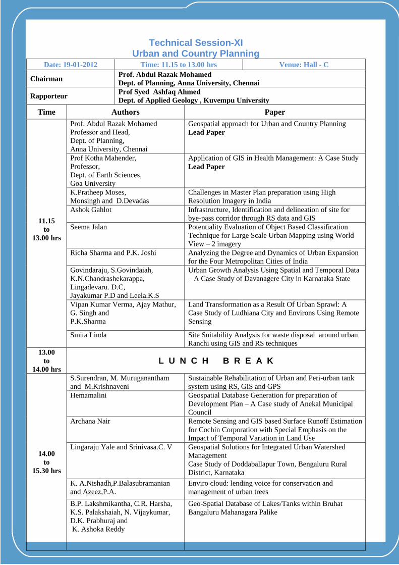
Technical Session-XI
Urban and Country Planning Date: 19-01-2012 Time: 11.15 to 13.00 hrs Venue: Hall - C
Chairman Prof. Abdul Razak Mohamed
Dept. of Planning, Anna University, Chennai
Rapporteur Prof Syed Ashfaq Ahmed
Dept. of Applied Geology , Kuvempu University
Time Authors Paper
11.15
to
13.00 hrs
Prof. Abdul Razak Mohamed
Professor and Head,
Dept. of Planning,
Anna University, Chennai
Geospatial approach for Urban and Country Planning
Lead Paper
Prof Kotha Mahender,
Professor,
Dept. of Earth Sciences,
Goa University
Application of GIS in Health Management: A Case Study
Lead Paper
K.Pratheep Moses,
Monsingh and D.Devadas
Challenges in Master Plan preparation using High
Resolution Imagery in India
Ashok Gahlot
Infrastructure, Identification and delineation of site for
bye-pass corridor through RS data and GIS
Seema Jalan
Potentiality Evaluation of Object Based Classification
Technique for Large Scale Urban Mapping using World
View – 2 imagery
Richa Sharma and P.K. Joshi Analyzing the Degree and Dynamics of Urban Expansion
for the Four Metropolitan Cities of India
Govindaraju, S.Govindaiah,
K.N.Chandrashekarappa,
Lingadevaru. D.C,
Jayakumar P.D and Leela.K.S
Urban Growth Analysis Using Spatial and Temporal Data
– A Case Study of Davanagere City in Karnataka State
Vipan Kumar Verma, Ajay Mathur,
G. Singh and
P.K.Sharma
Land Transformation as a Result Of Urban Sprawl: A
Case Study of Ludhiana City and Environs Using Remote
Sensing
Smita Linda
Site Suitability Analysis for waste disposal around urban
Ranchi using GIS and RS techniques
13.00
to
14.00 hrs L U N C H B R E A K
14.00
to
15.30 hrs
S.Surendran, M. Muruganantham
and M.Krishnaveni
Sustainable Rehabilitation of Urban and Peri-urban tank
system using RS, GIS and GPS
Hemamalini
Geospatial Database Generation for preparation of
Development Plan – A Case study of Anekal Municipal
Council
Archana Nair
Remote Sensing and GIS based Surface Runoff Estimation
for Cochin Corporation with Special Emphasis on the
Impact of Temporal Variation in Land Use
Lingaraju Yale and Srinivasa.C. V Geospatial Solutions for Integrated Urban Watershed
Management
Case Study of Doddaballapur Town, Bengaluru Rural
District, Karnataka
K. A.Nishadh,P.Balasubramanian
and Azeez,P.A.
Enviro cloud: lending voice for conservation and
management of urban trees
B.P. Lakshmikantha, C.R. Harsha,
K.S. Palakshaiah, N. Vijaykumar,
D.K. Prabhuraj and
K. Ashoka Reddy
Geo-Spatial Database of Lakes/Tanks within Bruhat
Bangaluru Mahanagara Palike

B.P. Lakshmikantha, Vinaykumar,
A., Sanjay Sahay and Suresh, P.
GIS Based Desktop Application for Crime Analysis and
Reporting Engine
Ravikumar, B. Choodegowda and
Gilbert Malinga
Assessing the Impact of Rezoning and Urbanization on
Surface Watershed Hydrology
15.30
to
15.45 hrs
T E A B R E A K

PPP LLL EEE NNN AAA RRR YYY SSS EEE SSS SSS III OOO NNN
Date: 19-01-2012
Time: 15.45 To 18.00 hrs Venue: JN Tata
Auditorium
Chairman Dr. Dr.K.R.Sridhara Murthi,
Senior Expert, Office Advisor to PM on Public Information
Infrastructure and Innovation, Bengaluru
Members All Chairmen and Rapporteurs of Technical Sessions
H I G H T E A
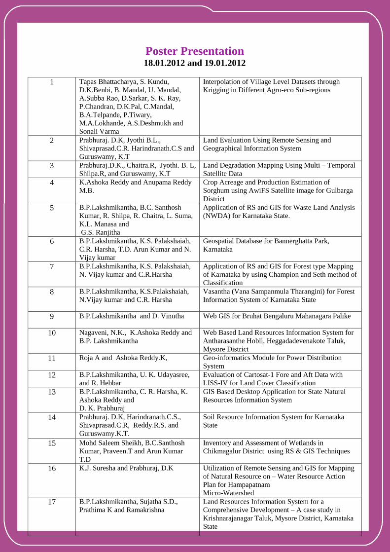
Poster Presentation 18.01.2012 and 19.01.2012
1
Tapas Bhattacharya, S. Kundu,
D.K.Benbi, B. Mandal, U. Mandal,
A.Subba Rao, D.Sarkar, S. K. Ray,
P.Chandran, D.K.Pal, C.Mandal,
B.A.Telpande, P.Tiwary,
M.A.Lokhande, A.S.Deshmukh and
Sonali Varma
Interpolation of Village Level Datasets through
Krigging in Different Agro-eco Sub-regions
2 Prabhuraj. D.K, Jyothi B.L.,
Shivaprasad.C.R. Harindranath.C.S and
Guruswamy, K.T
Land Evaluation Using Remote Sensing and
Geographical Information System
3 Prabhuraj.D.K., Chaitra.R, Jyothi. B. L,
Shilpa.R, and Guruswamy, K.T Land Degradation Mapping Using Multi – Temporal
Satellite Data
4 K.Ashoka Reddy and Anupama Reddy
M.B.
Crop Acreage and Production Estimation of
Sorghum using AwiFS Satellite image for Gulbarga
District
5 B.P.Lakshmikantha, B.C. Santhosh
Kumar, R. Shilpa, R. Chaitra, L. Suma,
K.L. Manasa and
G.S. Ranjitha
Application of RS and GIS for Waste Land Analysis
(NWDA) for Karnataka State.
6 B.P.Lakshmikantha, K.S. Palakshaiah,
C.R. Harsha, T.D. Arun Kumar and N.
Vijay kumar
Geospatial Database for Bannerghatta Park,
Karnataka
7 B.P.Lakshmikantha, K.S. Palakshaiah,
N. Vijay kumar and C.R.Harsha
Application of RS and GIS for Forest type Mapping
of Karnataka by using Champion and Seth method of
Classification
8 B.P.Lakshmikantha, K.S.Palakshaiah,
N.Vijay kumar and C.R. Harsha
Vasantha (Vana Sampanmula Tharangini) for Forest
Information System of Karnataka State
9 B.P.Lakshmikantha and D. Vinutha Web GIS for Bruhat Bengaluru Mahanagara Palike
10 Nagaveni, N.K., K.Ashoka Reddy and
B.P. Lakshmikantha
Web Based Land Resources Information System for
Antharasanthe Hobli, Heggadadevenakote Taluk,
Mysore District
11 Roja A and Ashoka Reddy.K, Geo-informatics Module for Power Distribution
System
12 B.P.Lakshmikantha, U. K. Udayasree,
and R. Hebbar
Evaluation of Cartosat-1 Fore and Aft Data with
LISS-IV for Land Cover Classification
13 B.P.Lakshmikantha, C. R. Harsha, K.
Ashoka Reddy and
D. K. Prabhuraj
GIS Based Desktop Application for State Natural
Resources Information System
14 Prabhuraj. D.K, Harindranath.C.S.,
Shivaprasad.C.R, Reddy.R.S. and
Guruswamy.K.T.
Soil Resource Information System for Karnataka
State
15 Mohd Saleem Sheikh, B.C.Santhosh
Kumar, Praveen.T and Arun Kumar
T.D
Inventory and Assessment of Wetlands in Chikmagalur District using RS & GIS Techniques
16 K.J. Suresha and Prabhuraj, D.K
Utilization of Remote Sensing and GIS for Mapping
of Natural Resource on – Water Resource Action
Plan for Hampapatnam
Micro-Watershed
17 B.P.Lakshmikantha, Sujatha S.D.,
Prathima K and Ramakrishna
Land Resources Information System for a
Comprehensive Development – A case study in
Krishnarajanagar Taluk, Mysore District, Karnataka
State

18 B.K.Bhavya, K.Ashoka Reddy,
B.P.Lakshmikantha and
C.S.Harindranath
Identification and Area Estimation of Horticultural
Plantation using Remote Sensing and GIS
Techniques
19 Bhavani and K. Ashoka Reddy Identification and Acreage Estimation of Coffee
Plantation in Part of Sakleshpura Taluk, Hassan
District using Satellite Remote Sensing Technique
20 Nandeesh, K.L. Narahari Rao, Lubna
Kousar and Raghavendra, H.U.
Land Use and Land Cover Studies Using Remote
Sensing Data by Digital Image Processing Technique
– A Case study of Siddaganaga Institute of
Technology Campus, Tumkur City, Karnataka
21 C.J.Jagadeesha, Madhukar Shastry and
Prabhuraj, D.K
Application of Image Resampling Methods in
Satellite Remote Sensing
22 Haji Rahamathulla Sheriff,
B.Chandrasheakar and
D.K.Prabhuraj
Vehicle Tracking System Using OPENGTS
23 Praburaj D.K, Ashoka Reddy.A,
Shilpa.R and Chaithra R
Applications of Remote Sensing & GIS in
Sericulture Development