In-Trail Procedure (ITP) Algorithm Design
38
NASA/CR-2007-214863 NIA Report No. 2007-06 In-Trail Procedure (ITP) Algorithm Design Cesar A. Munoz and Radu I. Siminiceanu National Institute of Aerospace (NIA), Hampton, Virginia August 2007
Transcript of In-Trail Procedure (ITP) Algorithm Design

NASA/CR-2007-214863NIA Report No. 2007-06
In-Trail Procedure (ITP) Algorithm Design
Cesar A. Munoz and Radu I. Siminiceanu National Institute of Aerospace (NIA), Hampton, Virginia
August 2007

The NASA STI Program Office . . . in Profile
Since its founding, NASA has been dedicated to the advancement of aeronautics and space science. The NASA Scientific and Technical Information (STI) Program Office plays a key part in helping NASA maintain this important role.
The NASA STI Program Office is operated by Langley Research Center, the lead center for NASA’s scientific and technical information. The NASA STI Program Office provides access to the NASA STI Database, the largest collection of aeronautical and space science STI in the world. The Program Office is also NASA’s institutional mechanism for disseminating the results of its research and development activities. These results are published by NASA in the NASA STI Report Series, which includes the following report types:
TECHNICAL PUBLICATION. Reports of completed research or a major significant phase of research that present the results of NASA programs and include extensive data or theoretical analysis. Includes compilations of significant scientific and technical data and information deemed to be of continuing reference value. NASA counterpart of peer-reviewed formal professional papers, but having less stringent limitations on manuscript length and extent of graphic presentations.
TECHNICAL MEMORANDUM. Scientific and technical findings that are preliminary or of specialized interest, e.g., quick release reports, working papers, and bibliographies that contain minimal annotation. Does not contain extensive analysis.
CONTRACTOR REPORT. Scientific and technical findings by NASA-sponsored contractors and grantees.
CONFERENCE PUBLICATION. Collected papers from scientific and technical conferences, symposia, seminars, or other meetings sponsored or co-sponsored by NASA.
SPECIAL PUBLICATION. Scientific, technical, or historical information from NASA programs, projects, and missions, often concerned with subjects having substantial public interest.
TECHNICAL TRANSLATION. English-language translations of foreign scientific and technical material pertinent to NASA’s mission.
Specialized services that complement the STI Program Office’s diverse offerings include creating custom thesauri, building customized databases, organizing and publishing research results ... even providing videos.
For more information about the NASA STI Program Office, see the following:
Access the NASA STI Program Home Page at http://www.sti.nasa.gov
E-mail your question via the Internet to [email protected]
Fax your question to the NASA STI Help Desk at (301) 621-0134
Phone the NASA STI Help Desk at (301) 621-0390
Write to: NASA STI Help Desk NASA Center for AeroSpace Information 7115 Standard Drive Hanover, MD 21076-1320

NASA/CR-2007-214863NIA Report No. 2007-06
In-Trail Procedure (ITP) Algorithm Design
Cesar A. Munoz and Radu I. Siminiceanu National Institute of Aerospace (NIA), Hampton, Virginia
National Aeronautics and Space Administration
Langley Research Center Prepared for Langley Research Center Hampton, Virginia 23681-2199 under Cooperative Agreement NCC1-02043
August 2007

Available from:
NASA Center for AeroSpace Information (CASI) National Technical Information Service (NTIS) 7115 Standard Drive 5285 Port Royal Road Hanover, MD 21076-1320 Springfield, VA 22161-2171 (301) 621-0390 (703) 605-6000

IN-TRAIL PROCEDURE (ITP) ALGORITHM DESIGN∗
Cesar A. Munoz and Radu I. Siminiceanu †
ABSTRACT
The primary objective of this document is to provide a detailed description of theIn-Trail Procedure (ITP) algorithm, which is part of the Airborne Traffic SituationalAwareness – In-Trail Procedure (ATSA-ITP) application. To this end, the documentpresents a high level description of the ITP Algorithm and a prototype implementationof this algorithm in the programming language C.
AcronymsADS-B Automatic Dependent Surveillance-BroadcastAPI Application Programming InterfaceATSA Airborne Traffic Situational AwarenessITP In-Trail ProcedureFIR Flight Information RegionNATOTS North Atlantic Organized Track SystemRVSM Reduced Vertical Separation MinimumTCAS Traffic Collision Avoidance System
1 INTRODUCTION
The In-Trail Procedure (ITP) algorithm is an airborne software module of the AirborneTraffic Situational Awareness – In-Trail Procedure (ATSA-ITP) application in non-radarairspace. This software module is responsible for computing the flight deck informationneeded by the crew to determine whether the criteria required for an ITP procedure are metor not. This information is processed by a host application that decides how and when it isdisplayed to the crew.
This document is organized as follows. Section 2 presents a list of definitions that arerelevant to the ITP algorithm. Section 3 gives a high level description of the algorithmthat includes assumptions, configurable parameters, input and output data, and functionalbehavior. Finally, a prototype implementation of the algorithm is described in Section 4.Appendix A lists the complete code of the prototype implementation. Appendix B includesauxiliary functions from Williams’ Aviation Formulary [3].
2 DEFINITIONS
The following is a list of definitions, based on the list provided in [2], that are relevant tothe description of the ITP algorithm.
• Altitude. “The vertical distance of a level, a point or an object considered as a point,measured from mean sea level (Doc 4444 - PANS-ATM chapter 1).” [2].
∗This work was supported in part by the National Aeronautics and Space Administration under thecooperative agreement NCC-1-02043.
†National Institute of Aerospace, 100 Exploration Way, Hampton VA, 23666. E-mail: {munoz,radu}@nianet.org. Authors are in alphabetical order.
1

• Flight Level. “A surface of constant atmospheric pressure which is related to aspecific pressure datum, and is separated from other such surfaces by specific pressureintervals (Doc 4444 - PANS-ATM chapter 1).” [2]. On a day with standard atmosphericpressure (defined in the 1976 US Standard Atmosphere as 29.92 inches of mercury), aflight level of 310 would correspond to an altitude of 31,000 feet mean sea level. Flightlevels are always in increments of 1,000 feet.
• Flight Level Dead Band. Maximum altitude deviation beyond which an aircraft isnot considered to be in a flight level.
• Ground Speed Differential. “The speed difference over the ground between theITP Aircraft and the Potentially Blocking Aircraft along each aircraft’s track. Thismeasurement would use a technique similar to the Doc 4444 - PANS-ATM longitudinalseparation procedure using DME (Doc 4444 - PANS-ATM section 5.4.2.3) to determinethe Ground Speed Differential. A Positive Ground Speed Differential signifies that theITP Aircraft and the Reference Aircraft are closing on each other (the separation isbeing reduced).” [2].
• Initial Flight Level. “The flight level of the ITP Aircraft when it determines a climbor descent is desired and before it begins the climb or descent.” [2].
• In Trail Procedure. “A procedure employed by an aircraft that desires to change itsflight level to a new flight level by climbing or descending in front or behind one, or be-tween two Same Track, Potentially Blocking Aircraft which are at an Intervening FlightLevel and which are at less than the standard longitudinal separation minimum.” [2].
• ITP Aircraft. “An aircraft that is fully qualified (from an equipment, operator,and flight crew qualification standpoint) to conduct an ITP and whose flight crew isconsidering a change of flight level.” [2]. For the ITP algorithm, the ITP Aircraft isassumed not to be maneuvering.
• ITP Maximum Range. Maximum horizontal range relative to ownship for anyaircraft to be included in the traffic list.
• Maneuvering Aircraft. Nearby Aircraft whose altitude is between the ITP Aircraft’sinitial flight level and the Requested Flight Level, but off the altitude dead bands.
• Nearby Aircraft. Aircraft within ITP Maximum Range that are flying in the SameVicinity, in the Same or Opposite Direction (only aircraft flying in a Cross Directionare excluded).
• Nearest Aircraft. At most two Potentially Blocking Aircraft that are closest to theITP Aircraft. For the ITP algorithm, if the two nearest aircraft are flying in the samedirection and at the same flight level, only the closest aircraft is considered to be anearest aircraft.
• Opposite Direction. Aircraft are flying in Opposite Direction if their relative bearingis between 135 degrees and 225 degrees.
2

• Positive Mach Difference. “The difference in Mach between the ITP Aircraft andthe Reference Aircraft that would result in the aircraft closing on each other (theseparation is being reduced).” [2].
• Potentially Blocking Aircraft. “Aircraft flying in the Same Direction at an Inter-vening Flight Level whose ADS-B report data are available to the ITP Aircraft.” [2].For the ITP algorithm, aircraft data of a Potentially Blocking Aircraft may not bequalified.
• Qualified ADS-B. “Automatic Dependent Surveillance-Broadcast (ADS-B) that meetsthe accuracy and integrity requirements determined to be required for the ITP.” [2].
• Reference Aircraft. “One or two Potentially Blocking Aircraft that meet the ITPcriteria and that will be identified to ATC by the ITP Aircraft as part of the ITPclearance request.” [2]. For the ITP algorithm, the data quality of a Reference Aircraftmust be qualified for ITP. Furthermore, a Reference Aircraft is not maneuvering andis either the closest ahead or the closest behind Potentially Blocking Aircraft.
• Requested Flight Level. “One same direction flight level above (for a climb) orbelow (for a descent) the Intervening Flight Level, appropriate for the operationalregion. A requested flight level may be:
a. 2,000 feet above or below the initial flight level in RVSM airspace with single-direction tracks.
b. 4,000 feet above or below the initial flight level in non-RVSM airspace with single-direction tracks.
c. 4,000 feet above or below the initial flight level in RVSM airspace with bi-directionaltracks with opposite direction traffic at alternating flight levels.” [2].
• Same Direction. Aircraft are flying in the Same Direction if their relative bearing iswithin ±45 degrees.
• Same Vicinity. Aircraft are located in the Same Vicinity, if their lateral offset is lessthan a Maximum Lateral Offset.
• Same Track. “Same direction tracks and intersecting tracks or portions thereof, theangular difference of which is less than 45 degrees or more than 315 degrees, andwhose protection areas overlap (i.e., without lateral separation). (Doc 4444 - PANS-ATM section 5.4.2.1.5). These tracks may be a portion of a user preferred route ormay be published routes, either fixed or flexible.” [2]. Since the information necessaryto compute the same track criterion is not available to the aircraft, the ITP algorithmuses instead the more general concept of Same Direction, Same Vicinity.
• Track. “The position on the earth’s surface of the path of an aircraft, the directionof which path at any point is usually expressed as degrees from North (Doc 4444 -PANS-ATM Chapter 1).” [2].
3

• Vertical Speed Dead Band. Maximum vertical speed deviation beyond which anaircraft is considered to be maneuvering.
3 HIGH LEVEL DESCRIPTION
The main function of the ITP algorithm is called itpAlgorithm. This function is ex-pected to run at a higher frequency than the traffic aircraft information is received. Hence,itpAlgorithm assumes that the input data have been coasted and that error-checking hasbeen performed prior to its execution. More precisely, we assume:
• The position of each aircraft is projected to current time from the last state vector andelapsed time. The error between the real position and the projected one is boundedby the maximum cruise speed multiplied by the frequency of the algorithm.
• Traffic input data have an indication of their quality. The value itpQualified in-dicates that the aircraft is equipped with an ADS-B that meets the accuracy andintegrity required to perform an ITP. In any other case, including the case of aircraftonly equipped with TCAS, this value is set to itpNonQualified. Aircraft data that isitpQualified may be used for the computation of potentially blocking and referenceaircraft. Aircraft data that is itpNonQualified may only be used for the computationof potentially blocking aircraft. In any case, for the purpose of the calculations, thedata is supposed to be correct.
• The ADS-B reception range is much larger than the separation standards.
3.1 Run-time Configurable Parameters
The run-time configurable parameters of itpAlgorithm are depicted in Figure 1. A datastructure itpGlobalParamaters includes the following parameters:
itpGlobalParameters
MaxRange
MaxTraffic
FlDeadBand
MaxReference
MaxLateralOffset
Range1
GsDiff1
Range2
GsDiff2
VsDeadBand
Figure 1: Run-time configurable parameters of ITP algorithm
• FlDeadband. Value of Flight Level Dead Band in hundreds of feet. The default valueis 1.
4
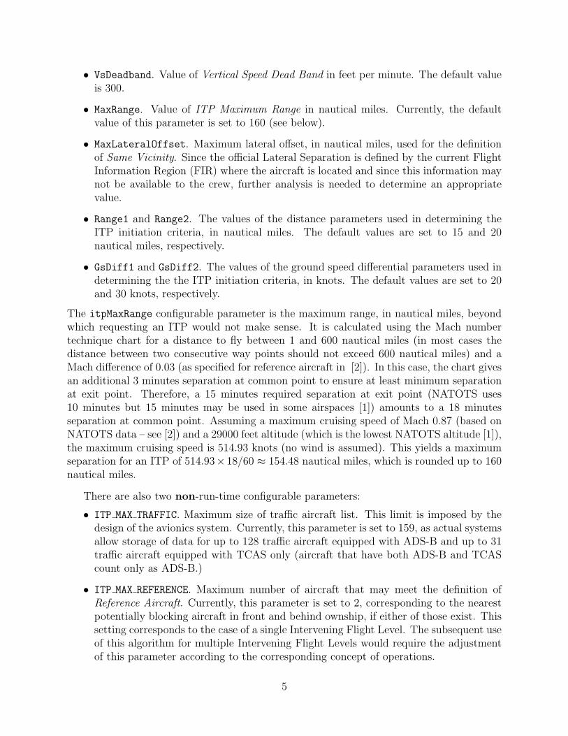
• VsDeadband. Value of Vertical Speed Dead Band in feet per minute. The default valueis 300.
• MaxRange. Value of ITP Maximum Range in nautical miles. Currently, the defaultvalue of this parameter is set to 160 (see below).
• MaxLateralOffset. Maximum lateral offset, in nautical miles, used for the definitionof Same Vicinity. Since the official Lateral Separation is defined by the current FlightInformation Region (FIR) where the aircraft is located and since this information maynot be available to the crew, further analysis is needed to determine an appropriatevalue.
• Range1 and Range2. The values of the distance parameters used in determining theITP initiation criteria, in nautical miles. The default values are set to 15 and 20nautical miles, respectively.
• GsDiff1 and GsDiff2. The values of the ground speed differential parameters used indetermining the the ITP initiation criteria, in knots. The default values are set to 20and 30 knots, respectively.
The itpMaxRange configurable parameter is the maximum range, in nautical miles, beyondwhich requesting an ITP would not make sense. It is calculated using the Mach numbertechnique chart for a distance to fly between 1 and 600 nautical miles (in most cases thedistance between two consecutive way points should not exceed 600 nautical miles) and aMach difference of 0.03 (as specified for reference aircraft in [2]). In this case, the chart givesan additional 3 minutes separation at common point to ensure at least minimum separationat exit point. Therefore, a 15 minutes required separation at exit point (NATOTS uses10 minutes but 15 minutes may be used in some airspaces [1]) amounts to a 18 minutesseparation at common point. Assuming a maximum cruising speed of Mach 0.87 (based onNATOTS data – see [2]) and a 29000 feet altitude (which is the lowest NATOTS altitude [1]),the maximum cruising speed is 514.93 knots (no wind is assumed). This yields a maximumseparation for an ITP of 514.93× 18/60 ≈ 154.48 nautical miles, which is rounded up to 160nautical miles.
There are also two non-run-time configurable parameters:
• ITP MAX TRAFFIC. Maximum size of traffic aircraft list. This limit is imposed by thedesign of the avionics system. Currently, this parameter is set to 159, as actual systemsallow storage of data for up to 128 traffic aircraft equipped with ADS-B and up to 31traffic aircraft equipped with TCAS only (aircraft that have both ADS-B and TCAScount only as ADS-B.)
• ITP MAX REFERENCE. Maximum number of aircraft that may meet the definition ofReference Aircraft. Currently, this parameter is set to 2, corresponding to the nearestpotentially blocking aircraft in front and behind ownship, if either of those exist. Thissetting corresponds to the case of a single Intervening Flight Level. The subsequent useof this algorithm for multiple Intervening Flight Levels would require the adjustmentof this parameter according to the corresponding concept of operations.
5

requested_fl
itpGetNearby
itpGetReference
nearby
pblocking
reference
itpAlgorithm
maneuver
itpGlobalParameters
traffic
ownship
itpGetNearest
itpInputs
itpOutputs
itpGetManeuver
nearest
itpGetPotentiallyBlocking
Figure 2: Data flow chart of ITP algorithm
3.2 Data Flow
Figure 2 presents a data flow chart of itpAlgorithm.
3.2.1 Inputs
The function itpAlgorithm gets as inputs a structure itpInputs consisting of:
• ownship. Data of ownship aircraft, of type itpAircraft. This aircraft should meetthe definition of ITP Aircraft.
• traffic. A list of coasted and error-checked traffic aircraft data. The maximum lengthof this list is given by the non-configurable parameter ITP MAX TRAFFIC. The elementsof this list are also of type itpAircraft.
• requested fl. The requested cruise flight level (in hundreds of feet).
The itpAircraft data structure consists of
• a unique flight identifier (id), of type itpIdentifier (strings of up to 255 characters),
• latitude (lat), in degrees, in the interval [−90o, 90o],
• longitude (lon), in degrees, in the interval [−180o, 180o) – excluding 180o; by conventionEast longitudes are positive,
6

• altitude (alt) at standard barometric pressure, in hundreds of feet,
• ground speed (gs), in knots,
• vertical speed (vs), in feet per minute,
• ground track (trk), in degrees from true north, in the interval [0, 360) – excluding 360o,and
• data quality flag (qlty), which is either itpQualified or itpNonQualified.
3.2.2 Outputs
The function itpAlgorithm outputs a data structure itpOutput that consists of a numberof lists of itpTraffic elements:
• traffic: a list of all aircraft that are within the itpMaxRange.
• nearby: a list of indices to traffic of all aircraft that meet the definition of NearbyAircraft.
• pblocking: a list of indices to traffic of all aircraft that meet the definition ofPotentially Blocking Aircraft. The maximum length of this list is given by the non-configurable parameter ITP MAX TRAFFIC.
• nearest: a list of indices to traffic of all aircraft that meet the definition of NearestAircraft.
• reference: a list of indices to traffic of aircraft that meet the definition of ReferenceAircraft. The maximum length of this list is also ITP MAX REFERENCE.
• maneuver: the type of In-Trail Procedure that is available, one of : {itpNone,itpFollowingClimb, itpFollowingDescent, itpLeadingClimb, itpLeadingDescent,
itpCombinedLeadingFollowingClimb, itpCombinedLeadingFollowingDescent}.The data structure itpTraffic consists of the following fields, which are computed by
itpAlgorithm:
• ITP range (range), in nautical miles: the relative distance to ITP aircraft with respectto a common point. A negative value means that the aircraft is behind the ITP aircraft.Conversely, a positive value means that the aircraft is ahead of the ITP aircraft.
• ground speed differential (gsdiff), in knots: the relative ground speed differential toITP aircraft. A negative value means that the aircraft is slower than the ITP aircraft.Conversely, a positive value means that the aircraft is faster than the ITP aircraft.
• lateral offset (offset): traffic relative lateral offset to ownship, in nautical miles.
7

• relative position (relpos): traffic relative position to ownship, from the enumeratedtype itpRelPos: {itpOwnBehindTraffic, itpOwnAheadTraffic, itpNoRelPos},where itpOwnBehindTraffic is assigned to traffic leading ownship, itpOwnAheadTrafficto traffic following ownship, and itpNoRelPos to traffic that is flying in a cross direc-tion, i.e., traffic that is neither same direction nor opposite direction.
• direction of flight (dir), from the enumerated type itpDirection: {itpSameDirection,itpOppositeDirection, itpCrossDirection}.
• traffic type (actype), a numeric value that encodes the role of the traffic aircraft inthe ITP and, when necessary, an ITP error code corresponding to this aircraft. Thisnumerical code is computed by binary addition on the following constants (in hexadec-imal):
– ITP TRAFFIC 0x0
– ITP NEARBY 0x1
– ITP POTENTIALLY BLOCKING 0x2
– ITP NEAREST 0x4
– ITP REFERENCE 0x8
– ITP BLOCKING 0x10
– ITP MANEUVERING 0x20
– ITP TOO FAST 0x40
– ITP TOO CLOSE 0x80
– ITP UNQUALIFIED DATA 0x100
For example, a nearby aircraft that is maneuvering has the associated actype value of0x1 + 0x20 = 0x21 hexadecimal (that is 33 decimal value).
3.3 Control Flow
As illustrated in Figure 3, the function itpAlgorithm calls, in sequence, the following func-tions.
• itpGetNearby. This function computes the list nearby. If the list is empty the exe-cution of itpAlgorithm ends.
• itpGetPotentially Blocking. This function computes the list potentially blocking.If the list is empty, the execution of itpAlgorithm ends.
• itpGetReference. This function computes the list reference.
• itpGetManeuver. Given the list reference, this function computes the ITP maneuverthat is available to the ITP aircraft (or itpNone).
8

setInputsitpGetNearby
itpGetPotentiallyBlocking
itpGetReference
getOutputs
yes
yes
no
no
itpAlgorithm
nearby > 0 ?
itpGetManeuver
potentially_blocking > 0 ?
Figure 3: Control flow chart of ITP algorithm
4 PROTOTYPE IMPLEMENTATION
A prototype implementation of the ITP Algorithm, written in the programming languageC, is electronically available at http://research.nianet.org/~munoz/ITP_Module. Theimplementation consists of the following files:
• ITP Defs.h, included in Appendix A.1, contains constant and type declarations.
• ITP Parameters.c, included in Appendix A.2, contains the definition of configurableparameters and utility functions to read and modify their values.
• ITP Algorithm.h, included in Appendix A.3, contains the program interface.
• ITP Algorithm.c, included in Appendix A.4, contains the definition of the main func-tions.
• ITP Aviation.h and ITP Aviation.c, included in Appendix B, contain the imple-mentation of auxiliary functions from Williams’ Aviation Formulary [3].
In the implementation, we use the following naming convention:
• Constants are written in uppercase letters and start with the prefix ITP .
• Global variables, types, and function names start with the prefix itp.
The actual In-Trail Procedure is implemented by the function itpAlgorithm, which hasthe following interface:
9

void itpAlgorithm(itpInputs, itpOutputs*);
The function itpAlgorithm has two parameters: an input parameter of type itpInputs,which is passed by value, and an output parameter of type itpOutputs, which is passed byreference. The exact definition of these types is found in the file ITP Defs.h.
The configurable parameters of the algorithm are defined as global variables in the fileITP Parameters.c. These variables are not intended to be directly read or modified by theuser. For that reason, the following functions are provided in the interface:
itpAltitude itpGetGlobalFlDeadband();
double itpGetGlobalVsDeadband();
double itpGetGlobalMaxRange();
double itpGetGlobalMaxLateralOffset();
double itpGetGlobalRange1();
double itpGetGlobalGsDiff1();
double itpGetGlobalRange2();
double itpGetGlobalGsDiff2();
void itpSetGlobalFlDeadband(itpAltitude);
void itpSetGlobalVsDeadband(double);
void itpSetGlobalMaxRange(double);
void itpSetGlobalMaxLateralOffset(double);
void itpSetGlobalRange1(double);
void itpSetGlobalGsDiff1(double);
void itpSetGlobalRange2(double);
void itpSetGlobalGsDiff2(double);
void itpResetGlobalParameters();
As expected, functions with the prefix itpGetGlobal read the variables and functions withthe prefix itpSetGlobal write them. The function itpResetGlobalParameters resets allthe configurable global parameters to their default value.
Finally, the following functions are provided to check and decode the information returnedby the ITP algorithm:
itpBool itpIsClosing(itpTraffic trf);
itpBool itpIsNearby(itpTraffic trf);
itpBool itpIsPotentiallyBlocking(itpTraffic trf);
itpBool itpIsNearest(itpTraffic trf);
itpBool itpIsReference(itpTraffic trf);
itpBool itpIsBlocking(itpTraffic trf);
itpBool itpIsManeuvering(itpTraffic trf);
itpBool itpIsUnqualifiedData(itpTraffic trf);
itpBool itpIsTooClose(itpTraffic trf);
itpBool itpIsTooFast(itpTraffic trf);
10

void itpBlckCode2String(itpIdentifier s,itpTraffic trf);
ACKNOWLEDGMENTS
The groundwork for the ITP module design was laid by the NASA Enhanced Oceanic Oper-ations research group. Special credit goes to Mike Palmer, Frank Bussink, Ryan Chartrand,James Chamberlain, and Jeffrey Maddalon for design ideas, discussions, and suggestionsthat shaped up this ITP software module. The authors are also thankful to Ed Williams forhis technical help with some of the formulas in his Aviation Formulary.
REFERENCES
[1] ICAO PANS-ATM. Doc. 4444, 2001.
[2] RTCA/EUROCAE Requirements Focus Group, Application Definition Sub-group.OSED In-Trail Procedure in Non-Radar Oceanic Airspace, version 5.0, 2006. Workingdraft.
[3] E. Williams. Aviation formulary v1.42. http://williams.best.vwh.net/avform.htm.
A IMPLEMENTATION OF THE ITP ALGORITHM
A.1 Constant and Type Declaration
/*======================================================
ITP algorithm constants and types
Author: Cesar A. Munoz (NIA)
Radu I. Siminiceanu (NIA)
File : ITP_Defs.h
Release: ITP_Module-6.d (10/11/06)
======================================================*/
#ifndef ITP_DEFS
#define ITP_DEFS
/* General constants */
#define ITP_STR_LEN 255
#define ITP_VER "ITP_Module-6.d (10/11/06)"
#define ITP_INVALID_VALUE -999999
#define ITP_MAX_TRAFFIC 159
#define ITP_MAX_REFERENCE 2
/* Default parameter values */
#define ITP_FL_DEADBAND 1 /* 100ft */
#define ITP_VS_DEADBAND 300.0 /* ft/min */
11

#define ITP_MAX_RANGE 160.0 /* nmi */
#define ITP_MAX_LATERAL_OFFSET 15.0 /* nmi */
/* ITP initiation criteria constants */
#define ITP_RANGE_1 15.0 /* nmi */
#define ITP_GS_DIFF_1 20.0 /* knots */
#define ITP_RANGE_2 20.0 /* nmi */
#define ITP_GS_DIFF_2 30.0 /* knots */
/*-------------------------------------
Enumerated types
-------------------------------------*/
typedef enum {itpQualified, itpNonQualified} itpDataQuality;
typedef enum {itpNone,
itpFollowingClimb, itpFollowingDescent,
itpLeadingClimb, itpLeadingDescent,
itpCombinedLeadingFollowingClimb,
itpCombinedLeadingFollowingDescent
} itpManeuver;
typedef enum {itpOwnBehindTraffic, itpOwnAheadTraffic,
itpNoRelPos} itpRelPos;
typedef enum {itpSameDirection, itpOppositeDirection,
itpCrossDirection} itpDirection;
/*-------------------------------------
Type of traffic aircraft
-------------------------------------*/
typedef unsigned int itpAcType;
/*-------------------------------------
Substitute types
-------------------------------------*/
typedef char itpIdentifier[ITP_STR_LEN];
typedef int itpAltitude; /* hundreds of feet */
typedef int itpBool;
#define ITP_FALSE 0
#define ITP_TRUE 1
/*-------------------------------------
Traffic/aircraft record
12

-------------------------------------*/
typedef struct {
itpIdentifier id; /* flight identifier */
double lat; /* latitude, in degrees: -90 ≤ lat ≤ 90 */
double lon; /* longitude, in degrees: -180 ≤ lon < 180 */
/* (west is negative) */
itpAltitude alt; /* altitude, in 100s ft: alt > 0 */
double gs; /* ground speed, in knots: gs > 0 */
double vs; /* vertical speed, in ft/min */
double trk; /* ground true track, in degrees 0 ≤ trk < 360 */
itpDataQuality qlty; /* data quality */
} itpAircraft;
/*----------------------------------------
Input lists
----------------------------------------*/
typedef struct {
itpAircraft ac[ITP_MAX_TRAFFIC];
int len;
} itpAircraftList;
/*---------------------------------------
Record-type to bundle inputs together
---------------------------------------*/
typedef struct {
itpAircraft ownship;
itpAircraftList traffic;
itpAltitude requested_fl;
} itpInputs;
/*----------------------------------------
Output lists
----------------------------------------*/
typedef struct {
itpIdentifier id;
double range; /* ITP range to ownship */
double gsdiff; /* Ground speed differential */
double offset; /* Lateral offset */
itpRelPos relpos; /* Traffic relative position to ownship */
itpDirection dir; /* Direction: same, opposite, cross */
itpAcType actype; /* Type of aircraft. This is a bitmask that */
/* must be decoded through the functions: */
/* itpIsNearby,itpIsPotentiallyBlocking, */
/* itpIsNearest,itpIsReference */
13

/* itpIsBlocking, itpIsManeuvering, */
/* itpIsTooClose, itpIsTooFast */
/* itpIsUnqualifiedData */
} itpTraffic;
typedef struct {
itpTraffic trf[ITP_MAX_TRAFFIC];
int len;
} itpTrafficList;
typedef int itpTrafficIdx; /* Index of aircraft */
typedef struct {
itpTrafficIdx nrbyx[ITP_MAX_TRAFFIC];
int len;
} itpNearbyList;
typedef struct {
itpTrafficIdx blckx[ITP_MAX_TRAFFIC];
int len;
} itpBlockingList;
typedef struct {
itpTrafficIdx nrstx[ITP_MAX_REFERENCE];
int len;
} itpNearestList;
typedef struct {
itpTrafficIdx refx[ITP_MAX_REFERENCE];
int len;
} itpReferenceList;
/*----------------------------------------
Record-type to bundle outputs together
----------------------------------------*/
typedef struct {
itpTrafficList traffic;
itpNearbyList nearby;
itpBlockingList pblocking;
itpNearestList nearest;
itpReferenceList reference;
itpManeuver maneuver;
} itpOutputs;
14
void itpEmptyOutputs(itpOutputs *outputs);
/*----------------------------------------------
Function to reset the global parameters
----------------------------------------------*/
void itpResetGlobalParameters();
/*------------------------------
Get current parameter values
------------------------------*/
itpAltitude itpGetGlobalFlDeadband();
double itpGetGlobalVsDeadband();
double itpGetGlobalMaxRange();
double itpGetGlobalMaxLateralOffset();
double itpGetGlobalRange1();
double itpGetGlobalGsDiff1();
double itpGetGlobalRange2();
double itpGetGlobalGsDiff2();
/*----------------------------------------------
Functions to set parameters to custom values
----------------------------------------------*/
void itpSetGlobalFlDeadband(itpAltitude);
void itpSetGlobalVsDeadband(double);
void itpSetGlobalMaxRange(double);
void itpSetGlobalMaxLateralOffset(double);
void itpSetGlobalRange1(double);
void itpSetGlobalGsDiff1(double);
void itpSetGlobalRange2(double);
void itpSetGlobalGsDiff2(double);
#endif
A.2 Global Parameters
/*======================================================
ITP algorithm global parameters
Author: Cesar A. Munoz (NIA)
Radu I. Siminiceanu (NIA)
15

File : ITP_Parameters.c
Release: ITP_Module-6.d (10/11/06)
======================================================*/
#include "ITP_Defs.h"
struct {
itpAltitude FlDeadband; /* flight level deadband (100s ft) */
double VsDeadband; /* vertical speed deadband (ft/min) */
double MaxRange; /* maximum range (nmi) */
double MaxLateralOffset; /* maximum lateral offset for same vicinity (nmi) */
/* ITP initiation criteria */
double Range1;
double GsDiff1;
double Range2;
double GsDiff2;
} itpGlobalParameters = {
ITP_FL_DEADBAND,
ITP_VS_DEADBAND,
ITP_MAX_RANGE,
ITP_MAX_LATERAL_OFFSET,
ITP_RANGE_1,
ITP_GS_DIFF_1,
ITP_RANGE_2,
ITP_GS_DIFF_2
};
/*----------------------------------------------
function to reset the global parameters
----------------------------------------------*/
void itpResetGlobalParameters() {
itpGlobalParameters.FlDeadband = ITP_FL_DEADBAND;
itpGlobalParameters.VsDeadband = ITP_VS_DEADBAND;
itpGlobalParameters.MaxRange = ITP_MAX_RANGE;
itpGlobalParameters.MaxLateralOffset = ITP_MAX_LATERAL_OFFSET;
itpGlobalParameters.Range1 = ITP_RANGE_1;
itpGlobalParameters.GsDiff1 = ITP_GS_DIFF_1;
itpGlobalParameters.Range2 = ITP_RANGE_2;
itpGlobalParameters.GsDiff2 = ITP_GS_DIFF_2;
}
/*------------------------------------------------
Functions to set global parameters
16

-------------------------------------------------*/
void itpSetGlobalFlDeadband(itpAltitude fdb) {
itpGlobalParameters.FlDeadband = fdb;
}
void itpSetGlobalVsDeadband(double vdb) {
itpGlobalParameters.VsDeadband = vdb;
}
void itpSetGlobalMaxRange(double maxr) {
itpGlobalParameters.MaxRange = maxr;
}
void itpSetGlobalMaxLateralOffset(double latoff) {
itpGlobalParameters.MaxLateralOffset = latoff;
}
void itpSetGlobalRange1(double range1) {
itpGlobalParameters.Range1 = range1;
}
void itpSetGlobalGsDiff1(double gs1) {
itpGlobalParameters.GsDiff1 = gs1;
}
void itpSetGlobalRange2(double range2) {
itpGlobalParameters.Range2 = range2;
}
void itpSetGlobalGsDiff2(double gs2) {
itpGlobalParameters.GsDiff2 = gs2;
}
/*------------------------------
Get current parameter values
------------------------------*/
itpAltitude itpGetGlobalFlDeadband() {
return itpGlobalParameters.FlDeadband;
}
double itpGetGlobalVsDeadband() {
return itpGlobalParameters.VsDeadband;
17

}
double itpGetGlobalMaxRange() {
return itpGlobalParameters.MaxRange;
}
double itpGetGlobalMaxLateralOffset() {
return itpGlobalParameters.MaxLateralOffset;
}
double itpGetGlobalRange1() {
return itpGlobalParameters.Range1;
}
double itpGetGlobalGsDiff1() {
return itpGlobalParameters.GsDiff1;
}
double itpGetGlobalRange2() {
return itpGlobalParameters.Range2;
}
double itpGetGlobalGsDiff2() {
return itpGlobalParameters.GsDiff2;
}
A.3 Program Interface
/*======================================================
ITP algorithm main file
Author: Cesar A. Munoz (NIA)
Radu I. Siminiceanu (NIA)
File : ITP_Algorithm.h
Release: ITP_Module-6.d (10/11/06)
======================================================*/
#ifndef ITP_ALG
#define ITP_ALG
#include "ITP_Defs.h"
/* Is traffic closing with respect to ownship ?*/
itpBool itpIsClosing(itpTraffic trf);
18

/* Blocking type recognizers */
itpBool itpIsNearby(itpTraffic trf);
itpBool itpIsPotentiallyBlocking(itpTraffic trf);
itpBool itpIsNearest(itpTraffic trf);
itpBool itpIsReference(itpTraffic trf);
itpBool itpIsBlocking(itpTraffic trf);
itpBool itpIsManeuvering(itpTraffic trf);
itpBool itpIsUnqualifiedData(itpTraffic trf);
itpBool itpIsTooClose(itpTraffic trf);
itpBool itpIsTooFast(itpTraffic trf);
/* Decodes actype */
void itpBlckCode2String(itpIdentifier s,itpTraffic trf);
/* ITP main function */
void itpAlgorithm(itpInputs, itpOutputs*);
#endif
A.4 Code
/*======================================================
ITP algorithm main file
Author: Cesar A. Munoz (NIA)
Radu I. Siminiceanu (NIA)
File : ITP_Algorithm.c
Release: ITP_Module-6.d (10/11/06)
======================================================*/
#include "ITP_Aviation.h"
#include "ITP_Algorithm.h"
#include <string.h>
/*======================================================
Internal constants: Type of traffic aircraft
======================================================*/
#define ITP_TRAFFIC 0x0
#define ITP_NEARBY 0x1
#define ITP_POTENTIALLY_BLOCKING 0x2
#define ITP_NEAREST 0x4
#define ITP_REFERENCE 0x8
19

#define ITP_BLOCKING 0x10
#define ITP_MANEUVERING 0x20
#define ITP_TOO_FAST 0x40
#define ITP_TOO_CLOSE 0x80
#define ITP_UNQUALIFIED_DATA 0x100
/*======================================================
Auxiliary functions
======================================================*/
double itpGeoRange(itpAircraft ac1,itpAircraft ac2) {
double lt1, ln1, lt2, ln2;
lt1 = ac1.lat*ITP_RAD_PER_DEG;
ln1 = ac1.lon*ITP_RAD_PER_DEG;
lt2 = ac2.lat*ITP_RAD_PER_DEG;
ln2 = ac2.lon*ITP_RAD_PER_DEG;
return ITP_ABS(itpDistance(lt1,ln1,lt2,ln2))*ITP_NMI_PER_RAD;
}
itpDirection itpGetDirection(double trk1, double trk2, double upto) {
double delta;
trk1 = itpTo360(trk1);
trk2 = itpTo360(trk2);
delta= ITP_MAX(trk1,trk2) - ITP_MIN(trk1,trk2);
if (delta ≤ upto || delta ≥ 360-upto)
return itpSameDirection;
if (180-upto ≤ delta && delta ≤ 180+upto)
return itpOppositeDirection;
return itpCrossDirection;
}
void itpGetTrafficData(itpInputs inputs, itpOutputs *outputs, int i) {
itpAircraft own,ac;
double lta, lna, lto, lno, crsa, crso, lti, lni, trkoa;
double dai,doi;
int eps;
int inter;
own = inputs.ownship;
ac = inputs.traffic.ac[i];
lto = own.lat*ITP_RAD_PER_DEG;
lno = own.lon*ITP_RAD_PER_DEG;
crso = own.trk*ITP_RAD_PER_DEG;
lta = ac.lat*ITP_RAD_PER_DEG;
20

lna = ac.lon*ITP_RAD_PER_DEG;
crsa = ac.trk*ITP_RAD_PER_DEG;
inter = itpIntersection(lta,lna,crsa,lto,lno,crso,<i,&lni);
/* printf("inter: %d (%6.2f,%6.2f)\n",inter,
lti*ITP_DEG_PER_RAD,lni*ITP_DEG_PER_RAD); */
if (inter < 0) {
/* No intersection */
trkoa = itpCourse(lto,lno,lta,lna)*ITP_DEG_PER_RAD;
eps = (itpGetDirection(own.trk,trkoa,90) == itpSameDirection? 1: -1);
outputs->traffic.trf[i].range =
eps*ITP_ABS(itpDistance(lta,lna,lto,lno))*ITP_NMI_PER_RAD;
outputs->traffic.trf[i].offset = 0;
} else {
doi = itpDistance(lto,lno,lti,lni);
dai = itpDistance(lta,lna,lti,lni);
outputs->traffic.trf[i].offset =
itpCrossTrackError(lto,lno,lta,lna,lti,lni)*ITP_NMI_PER_RAD;
/* Intersection behind of traffic */
if (inter == 1 || inter == 3)
dai *= -1;
/* Intersection behind of ownship */
if (inter == 2 || inter == 3)
doi *= -1;
if (outputs->traffic.trf[i].dir == itpSameDirection)
outputs->traffic.trf[i].range = (doi - dai)*ITP_NMI_PER_RAD;
else
outputs->traffic.trf[i].range = (doi + dai)*ITP_NMI_PER_RAD;
}
outputs->traffic.trf[i].relpos = outputs->traffic.trf[i].range < 0 ?
itpOwnAheadTraffic : itpOwnBehindTraffic;
if (outputs->traffic.trf[i].dir == itpSameDirection)
outputs->traffic.trf[i].gsdiff = ITP_SIGN(outputs->traffic.trf[i].range)*
(inputs.ownship.gs - inputs.traffic.ac[i].gs);
else
outputs->traffic.trf[i].gsdiff = ITP_SIGN(outputs->traffic.trf[i].range)*
(inputs.ownship.gs + inputs.traffic.ac[i].gs);
}
itpAltitude itpGetFlightLevel(itpAircraft ac) {
int err = ac.alt % 10;
int fl = ac.alt / 10;
if (err ≤ itpGetGlobalFlDeadband())
return 10*fl;
if (err ≥ 10-itpGetGlobalFlDeadband())
21

return 10*(fl+1);
return ITP_INVALID_VALUE;
}
itpBool itpIsManeuveringAircraft(itpAircraft ac) {
return
itpGetFlightLevel(ac) == ITP_INVALID_VALUE ||
ITP_ABS(ac.vs) > itpGetGlobalVsDeadband();
}
itpBool itpIsAtInterveningFlightLevels(itpInputs inputs, itpAircraft ac) {
int eps;
itpAltitude flown;
flown = itpGetFlightLevel(inputs.ownship);
eps = ITP_SIGN(inputs.requested_fl - flown);
return
flown != ITP_INVALID_VALUE &&
eps*flown < eps*ac.alt &&
eps*ac.alt < eps*inputs.requested_fl;
}
void itpGetNearby(itpInputs inputs,
itpOutputs *outputs) {
int i;
outputs->traffic.len = 0;
outputs->nearby.len = 0;
for (i=0; i < inputs.traffic.len; i++) {
outputs->traffic.trf[i].actype = ITP_TRAFFIC;
strcpy(outputs->traffic.trf[i].id,inputs.traffic.ac[i].id);
outputs->traffic.trf[i].dir = itpGetDirection(inputs.traffic.ac[i].trk,
inputs.ownship.trk,45);
if (outputs->traffic.trf[i].dir == itpSameDirection ||
outputs->traffic.trf[i].dir == itpOppositeDirection) {
itpGetTrafficData(inputs,outputs,i);
/* if same vicinity */
if (itpGeoRange(inputs.traffic.ac[i],inputs.ownship) <=
itpGetGlobalMaxRange() &&
outputs->traffic.trf[i].offset ≤ itpGetGlobalMaxLateralOffset()) {
outputs->traffic.trf[i].actype |= ITP_NEARBY;
outputs->nearby.nrbyx[outputs->nearby.len] = i;
outputs->nearby.len++;
}
22
} else {
outputs->traffic.trf[i].offset = ITP_INVALID_VALUE;
outputs->traffic.trf[i].range = ITP_INVALID_VALUE;
outputs->traffic.trf[i].gsdiff = ITP_INVALID_VALUE;
outputs->traffic.trf[i].relpos = itpNoRelPos;
}
outputs->traffic.len++;
}
}
itpBool itpIsClosing(itpTraffic trf) {
return trf.gsdiff > 0;
}
itpAcType itpGetBlockingType(itpInputs inputs,
itpTrafficList traffic,
itpTrafficIdx idx) {
itpAircraft ac;
itpTraffic trf;
itpAcType actype;
actype = 0x0;
ac = inputs.traffic.ac[idx];
trf = traffic.trf[idx];
if (itpIsManeuveringAircraft(ac))
actype |= ITP_MANEUVERING;
if (ac.qlty != itpQualified)
actype |= ITP_UNQUALIFIED_DATA;
if (ITP_ABS(trf.range) < itpGetGlobalRange1())
actype |= ITP_TOO_CLOSE;
if (itpIsClosing(trf)) {
if (trf.gsdiff > itpGetGlobalGsDiff2() ||
ITP_ABS(trf.range) ≥ itpGetGlobalRange1() &&
ITP_ABS(trf.range) < itpGetGlobalRange2() &&
trf.gsdiff > itpGetGlobalGsDiff1())
actype |= ITP_TOO_FAST;
if (trf.gsdiff > itpGetGlobalGsDiff1() &&
trf.gsdiff ≤ itpGetGlobalGsDiff2() &&
ITP_ABS(trf.range) < itpGetGlobalRange2())
actype |= ITP_TOO_CLOSE;
}
if (!actype)
actype = ITP_BLOCKING;
23

return ITP_POTENTIALLY_BLOCKING | actype ;
}
void itpBlckCode2String(itpIdentifier s,itpTraffic trf) {
strcpy(s,"");
if (itpIsBlocking(trf))
strcat(s,"B");
if (itpIsManeuvering(trf))
strcat(s,"M");
if (itpIsUnqualifiedData(trf))
strcat(s,"U");
if (itpIsTooClose(trf))
strcat(s,"C");
if (itpIsTooFast(trf))
strcat(s,"F");
}
itpBool itpIsNearby(itpTraffic trf) {
return trf.actype & ITP_NEARBY;
}
itpBool itpIsPotentiallyBlocking(itpTraffic trf) {
return trf.actype & ITP_POTENTIALLY_BLOCKING;
}
itpBool itpIsNearest(itpTraffic trf) {
return trf.actype & ITP_NEAREST;
}
itpBool itpIsReference(itpTraffic trf) {
return trf.actype & ITP_REFERENCE;
}
itpBool itpIsBlocking(itpTraffic trf) {
return trf.actype & ITP_BLOCKING;
}
itpBool itpIsManeuvering(itpTraffic trf) {
return trf.actype & ITP_MANEUVERING;
}
itpBool itpIsTooClose(itpTraffic trf) {
return trf.actype & ITP_TOO_CLOSE;
}
24

itpBool itpIsTooFast(itpTraffic trf) {
return trf.actype & ITP_TOO_FAST;
}
itpBool itpIsUnqualifiedData(itpTraffic trf) {
return trf.actype & ITP_UNQUALIFIED_DATA;
}
void itpGetPotentiallyBlocking(itpInputs inputs,
itpOutputs *outputs) {
int i,idx;
outputs->pblocking.len = 0;
for (i=0; i < outputs->nearby.len; i++) {
idx = outputs->nearby.nrbyx[i];
if (outputs->traffic.trf[idx].dir == itpSameDirection &&
itpIsAtInterveningFlightLevels(inputs,inputs.traffic.ac[idx])) {
outputs->traffic.trf[idx].actype |=
itpGetBlockingType(inputs,outputs->traffic,idx);
outputs->pblocking.blckx[outputs->pblocking.len] = idx;
outputs->pblocking.len++;
}
}
}
void itpGetNearest(itpInputs inputs,
itpOutputs *outputs) {
int i,j,k,idx,jdx;
outputs->nearest.len = 0;
/* Find nearest ITP_MAX_REFERENCE aircraft */
for (i=0; i < outputs->pblocking.len; i++) {
idx = outputs->pblocking.blckx[i];
for (j=0; j < outputs->nearest.len; j++) {
jdx = outputs->nearest.nrstx[j];
if (ITP_ABS(outputs->traffic.trf[idx].range) <
ITP_ABS(outputs->traffic.trf[jdx].range))
break;
}
if (j < ITP_MAX_REFERENCE) {
for(k=ITP_MIN(outputs->nearest.len,ITP_MAX_REFERENCE-1); k > j; k--)
outputs->nearest.nrstx[k] = outputs->nearest.nrstx[k-1];
outputs->nearest.nrstx[j]=idx;
25

if (outputs->nearest.len < ITP_MAX_REFERENCE)
outputs->nearest.len++;
}
}
/* Remove nearest at the same fligh level same direction */
idx=outputs->nearest.nrstx[0];
for (i=0,j=1,idx=outputs->nearest.nrstx[0]; j < outputs->nearest.len; j++) {
jdx = outputs->nearest.nrstx[j];
if (itpGetFlightLevel(inputs.traffic.ac[idx]) !=
itpGetFlightLevel(inputs.traffic.ac[jdx]) ||
ITP_SIGN(outputs->traffic.trf[idx].range) !=
ITP_SIGN(outputs->traffic.trf[jdx].range)) {
outputs->traffic.trf[idx].actype |= ITP_NEAREST;
idx = jdx;
i++;
}
}
if (i < outputs->nearest.len) {
outputs->traffic.trf[idx].actype |= ITP_NEAREST;
i++;
}
outputs->nearest.len = i;
}
void itpGetReference(itpInputs inputs,
itpOutputs *outputs) {
int i,idx;
itpGetNearest(inputs,outputs);
outputs->reference.len = 0;
for (i=0; i < outputs->nearest.len; i++) {
idx = outputs->nearest.nrstx[i];
if (!itpIsBlocking(outputs->traffic.trf[idx])) {
outputs->reference.len = 0;
break;
} else {
outputs->traffic.trf[idx].actype |= ITP_REFERENCE;
outputs->reference.refx[outputs->reference.len] = idx;
outputs->reference.len++;
}
}
}
void itpGetManeuver(itpInputs inputs,
26

itpOutputs *outputs) {
itpBool climb,lead,follow;
int i;
outputs->maneuver = itpNone;
lead = 0;
follow = 0;
climb = (inputs.requested_fl > inputs.ownship.alt);
for (i=0; i<outputs->reference.len; i++) {
if (outputs->traffic.trf[outputs->reference.refx[i]].relpos ==
itpOwnAheadTraffic)
lead = 1;
else
follow = 1;
}
if (lead && follow)
outputs->maneuver = (climb? itpCombinedLeadingFollowingClimb :
itpCombinedLeadingFollowingDescent);
else if (lead)
outputs->maneuver = (climb? itpLeadingClimb : itpLeadingDescent);
else
outputs->maneuver = (climb? itpFollowingClimb : itpFollowingDescent);
}
/*-----------------------------------------------
ITP main function.
CAVEAT: itpGLobalParameters should be set before
calling itpAlgorithm
-----------------------------------------------*/
void itpSetOutputs(itpOutputs *outputs) {
outputs->traffic.len = 0;
outputs->nearby.len = 0;
outputs->pblocking.len = 0;
outputs->nearest.len = 0;
outputs->reference.len = 0;
outputs->maneuver = itpNone;
}
void itpAlgorithm(itpInputs inputs, itpOutputs *outputs) {
itpSetOutputs(outputs);
itpGetNearby(inputs,outputs);
if (!itpIsManeuveringAircraft(inputs.ownship) &&
outputs->nearby.len > 0) {
27

itpGetPotentiallyBlocking(inputs,outputs);
if (outputs->pblocking.len > 0) {
itpGetReference(inputs,outputs);
if (outputs->reference.len > 0)
itpGetManeuver(inputs,outputs);
}
}
}
B AVIATION FORMULARY
Except for the function ITP intersection, which was developed by R. Siminiceanu, all theother functions were taken from William’s Aviation Formulary [3].
B.1 Program Interface
/*======================================================
Aviation Formulary
Author: Cesar A. Munoz (NIA)
Radu I. Siminiceanu (NIA)
File : ITP_Aviation.h
Release: ITP_Module-6.d (10/11/06)
======================================================*/
#ifndef ITP_AVI
#define ITP_AVI
#include <math.h>
#define ITP_MAX(a,b) ((a) > (b) ? (a) : (b))
#define ITP_MIN(a,b) ((a) < (b) ? (a) : (b))
#define ITP_ABS(x) ((x) < 0 ? -(x) : x)
#define ITP_SQ(x) (x*x)
#define ITP_SIGN(x) ((x) < 0 ? -1 : 1)
#define ITP_PI 3.14159265358979323846
#define ITP_RAD_PER_DEG (ITP_PI/180.0)
#define ITP_DEG_PER_RAD (180.0/ITP_PI)
#define ITP_FT_PER_NMI 6076.11548556431
#define ITP_EARTH_RADIUS_FT 20898908.0
#define ITP_NMI_PER_RAD (ITP_EARTH_RADIUS_FT/ITP_FT_PER_NMI)
#define ITP_ALMOST_ZERO 0.00001
int itpIsAlmostZero(double x);
double itpSqrtSafe(double x);
28

double itpAsinSafe(double x);
double itpAcosSafe(double x);
double itpAtanyxSafe(double y, double x);
double itpTo2pi(double x);
double itpTo360(double x);
double itpDistance(double lat1, double lon1, double lat2, double lon2);
double itpCourse(double lat1, double lon1, double lat2, double lon2);
int itpIntersection(double lat1,double lon1,double crs13,
double lat2,double lon2,double crs23,
double *lati, double *loni);
double itpCrossTrackError(double lat1, double lon1,
double lat2, double lon2,
double lat3, double lon3);
#endif
B.2 Code
/*======================================================
These formulas are taken from Aviation Formulary v1.42:
http://williams.best.vwh.net
- all units are in radians
- modified to convention "east is positive"
Author: Cesar A. Munoz (NIA)
Radu I. Siminiceanu (NIA)
File : ITP_Aviation.c
Release: ITP_Module-6.d (10/11/06)
======================================================*/
#include <stdio.h>
#include <stdlib.h>
#include "ITP_Aviation.h"
int itpIsAlmostZero(double x) {
return ITP_ABS(x) < ITP_ALMOST_ZERO;
}
double itpSqrtSafe(double x) {
return sqrt(ITP_MAX(x,0.0));
}
double itpAsinSafe(double x) {
29

return asin(ITP_MAX(-1.0,ITP_MIN(x,1.0)));
}
double itpAcosSafe(double x) {
return acos(ITP_MAX(-1.0,ITP_MIN(x,1.0)));
}
double itpAtanyxSafe(double y, double x) {
if (itpIsAlmostZero(x) && itpIsAlmostZero(y))
return 0.0;
return atan2(y,x);
}
double itpTo2pi(double x) {
double mod = x - 2*ITP_PI*((int) (x/(2*ITP_PI)));
if (mod < 0) mod += 2*ITP_PI;
return mod;
}
double itpTo360(double x) {
double mod = x - 360.0*((int) (x/360.0));
if (mod < 0) mod += 360.0;
return mod;
}
double itpDistance(double lat1, double lon1, double lat2, double lon2) {
return 2*itpAsinSafe(itpSqrtSafe(ITP_SQ(sin((lat1-lat2)/2)) +
cos(lat1)*cos(lat2)*sin((lon2-lon1)/2)*
sin((lon2-lon1)/2)));
}
double itpCourse(double lat1, double lon1, double lat2, double lon2) {
if (itpIsAlmostZero(cos(lat1)))
return (lat1>0 ? ITP_PI : 0.0);
return itpTo2pi(itpAtanyxSafe(sin(lon2-lon1)*cos(lat2),
cos(lat1)*sin(lat2)-
sin(lat1)*cos(lat2)*cos(lon2-lon1)));
}
/* This function returns:
-1 : no intersection,
0 : ahead of both,
1 : behind of 1, ahead of 2
2 : behind of 2, ahead of 1
30

3 : behind of both
If positive (*ilat,*ilon) is the intersection point */
int itpIntersection(double lat1, double lon1, double crs13,
double lat2, double lon2, double crs23,
double *ilat, double *ilon) {
double crs12, crs21, ang1, ang2, ang3, dst12, dst13, lat3, lon3;
double modcrs13, modcrs23, delta;
int flipped1, flipped2;
crs13 = itpTo2pi(crs13);
crs23 = itpTo2pi(crs23);
dst12 = itpDistance(lat1, lon1, lat2, lon2);
crs12 = itpCourse(lat1, lon1, lat2, lon2);
crs21 = itpCourse(lat2, lon2, lat1, lon1);
ang1=crs13-crs12;
ang2=crs21-crs23;
if (ITP_ABS(sin(ang1)) < 0.1 &&
ITP_ABS(sin(ang2)) < 0.1)
/* if (itpIsAlmostZero(sin(ang1)) && itpIsAlmostZero(sin(ang2))) */
return -1;
flipped1 = 0;
flipped2 = 0;
modcrs13 = crs13;
modcrs23 = crs23;
if (0<=crs13 && crs13<=ITP_PI) { /* ownship going east */
if (crs13 ≤ crs21 && crs21 ≤ crs13+ITP_PI) { /* target on left side */
if (crs23 > crs13+ITP_PI || crs23 < crs13) {
modcrs23 = itpTo2pi(crs23 + ITP_PI);
flipped2 = 1;
}
flipped1 = (crs21 < modcrs23 && modcrs23 < crs13+ITP_PI);
}
else { /* target on the right side */
if (crs23 > crs13 && crs23 < crs13+ITP_PI) {
modcrs23 = itpTo2pi(crs23 + ITP_PI);
flipped2 = 1;
}
if (itpIsAlmostZero(ITP_ABS(crs21))) crs21 = crs21 + 2*ITP_PI;
flipped1 = ((crs21 > crs13+ITP_PI &&
crs13+ITP_PI < modcrs23 && modcrs23 < crs21) ||
31

(crs21 < crs13 && (modcrs23 > crs13+ITP_PI ||
modcrs23 < crs21)));
}
}
else { /* ownship going west */
if (crs21 ≥ crs13 || crs21 ≤ crs13-ITP_PI) {/* target on the left side */
if (crs13-ITP_PI < crs23 && crs23 < crs13) {
modcrs23 = itpTo2pi(crs23 + ITP_PI);
flipped2 = 1;
}
flipped1 = ((crs21 > crs13 && (modcrs23 > crs21 ||
modcrs23 < crs13-ITP_PI)) ||
(crs21 < crs13-ITP_PI && modcrs23 > crs21 &&
modcrs23 < crs13-ITP_PI));
}
else { /* target on the right side */
if (crs23 > crs13 || crs23 < crs13-ITP_PI) {
modcrs23 = itpTo2pi(crs23 + ITP_PI);
flipped2 = 1;
}
if (itpIsAlmostZero(ITP_ABS(crs21))) crs21 = crs21 + 2*ITP_PI;
flipped1 = (modcrs23 > crs13-ITP_PI && modcrs23 < crs21);
}
}
ang1 = itpTo2pi(crs13-crs12+ITP_PI) - ITP_PI;
ang2 = itpTo2pi(crs21-modcrs23+ITP_PI) - ITP_PI;
ang1 = ITP_ABS(ang1);
ang2 = ITP_ABS(ang2);
if (flipped1) {
ang1 = itpTo2pi(ITP_PI - ang1);
modcrs13 = itpTo2pi(crs13 + ITP_PI);
}
ang3 = itpAcosSafe(-cos(ang1)*cos(ang2) + sin(ang1)*sin(ang2)*cos(dst12));
if (itpIsAlmostZero(sin(ang3))) {
*ilat = 0.0;
*ilon = 0.0;
return -1;
}
dst13 = itpAsinSafe(sin(ITP_ABS(ang2))*sin(dst12)/sin(ang3));
lat3 = itpAsinSafe(sin(lat1)*cos(dst13)+cos(lat1)*sin(dst13)*cos(modcrs13));
32
delta = itpAsinSafe(sin(crs13)*sin(dst13)/cos(lat3));
if (flipped1==0)
lon3 = itpTo2pi(lon1 + delta + ITP_PI) - ITP_PI;
else
lon3 = itpTo2pi(lon1 - delta + ITP_PI) - ITP_PI;
*ilat = lat3;
*ilon = lon3;
return 2*flipped2 + flipped1;
}
/* Track error to common point (lat3,lon3), wrt (lat2,lon2) */
double itpCrossTrackError(double lat1, double lon1,
double lat2, double lon2,
double lat3, double lon3) {
double crs31, crs32,dst32;
dst32 = itpDistance(lat3, lon3, lat2, lon2);
if (itpIsAlmostZero(cos(lat3))) {
/* (lat3,lon3) is a Pole */
crs31 = lon1;
crs32 = lon2;
} else {
crs31 = itpCourse(lat3, lon3, lat1, lon1);
crs32 = itpCourse(lat3, lon3, lat2, lon2);
}
return ITP_ABS(itpAsinSafe(sin(dst32)*sin(crs32-crs31)));
}
33

REPORT DOCUMENTATION PAGE Form Approved
OMB No. 0704-0188 The public reporting burden for this collection of information is estimated to average 1 hour per response, including the time for reviewing instructions, searching existingdata sources, gathering and maintaining the data needed, and completing and reviewing the collection of information. Send comments regarding this burden estimate or any other aspect of this collection of information, including suggestions for reducing this burden, to Department of Defense, Washington Headquarters Services, Directoratefor Information Operations and Reports (0704-0188), 1215 Jefferson Davis Highway, Suite 1204, Arlington, VA 22202-4302. Respondents should be aware thatnotwithstanding any other provision of law, no person shall be subject to any penalty for failing to comply with a collection of information if it does not display a currentlyvalid OMB control number. PLEASE DO NOT RETURN YOUR FORM TO THE ABOVE ADDRESS.
1. REPORT DATE (DD-MM-YYYY) 2. REPORT TYPE 3. DATES COVERED (From - To)
4. TITLE AND SUBTITLE 5a. CONTRACT NUMBER
5b. GRANT NUMBER
5c. PROGRAM ELEMENT NUMBER
6. AUTHOR(S) 5d. PROJECT NUMBER
5e. TASK NUMBER
5f. WORK UNIT NUMBER
7. PERFORMING ORGANIZATION NAME(S) AND ADDRESS(ES) 8. PERFORMING ORGANIZATIONREPORT NUMBER
9. SPONSORING/MONITORING AGENCY NAME(S) AND ADDRESS(ES) 10. SPONSORING/MONITOR'S ACRONYM(S)
11. SPONSORING/MONITORINGREPORT NUMBER
12. DISTRIBUTION/AVAILABILITY STATEMENT
13. SUPPLEMENTARY NOTES
14. ABSTRACT
15. SUBJECT TERMS
16. SECURITY CLASSIFICATION OF: 17. LIMITATION OF
ABSTRACT18. NUMBER
OFPAGES
19b. NAME OF RESPONSIBLE PERSON
a. REPORT b. ABSTRACT c. THIS PAGE19b. TELEPHONE NUMBER (Include area code)
Standard Form 298 (Rev. 8-98)Prescribed by ANSI Std. Z39-18
01/08/2007 Contractor Report
In-Trail Procedure (ITP) Algorithm Design
NCC1-02043
2204
411931.02.07.07
Cesar A. MunozRadu I. Siminiceanu
NASA Langley Research Center National Institute of Aerospace (NIA)Hampton, VA 23681-2199 100 Exploration Way Hampton, VA 23666
NIA Report No. 2007-06
National Aeronautics and Space AdministrationWashington, DC 20546-0001
NASA
NASA/CR-2007-214863
Unclassified - UnlimitedSubject Category 61Availability: NASA CASI (301) 621-0390
Langley Technical Monitor: Ricky Butler
The primary objective of this document is to provide a detailed description of the In-Trail Procedure (ITP) algorithm, which is partof the Airborne Traffic Situational Awareness – In-Trail Procedure (ATSA-ITP) application. To this end, the document presents ahigh level description of the ITP Algorithm and a prototype implementation of this algorithm in the programming language C.
In-Trail Procedure; Algorithm Design
U U UUU
38
STI Help Desk (email: [email protected])
(301) 621-0390