Improving Groundwater Monitoring and Management with GPS Data Collection and Field Updates
6
IMPROVING GROUNDWATER MONITORING AND MANAGEMENT WITH GPS DATA COLLECTION AND FIELD UPDATES Shawn Davis Field Technician Prairilands Groundwater Conservation District David Pritchard Principal Texian Geospatial & Asset Solutions Co.
-
Upload
txtagd -
Category
Technology
-
view
16 -
download
1
Transcript of Improving Groundwater Monitoring and Management with GPS Data Collection and Field Updates

IMPROVING GROUNDWATER MONITORING AND MANAGEMENT WITH
GPS DATA COLLECTION AND FIELD UPDATES
Shawn Davis
Field Technician
Prairilands Groundwater Conservation District
David Pritchard
Principal
Texian Geospatial & Asset Solutions Co.

FIELD DATA COLLECTION AND UPDATE SOLUTIONS
• Compact and High Accuracy GPS
• Easy to use and familiar interface (IOS/DROID Phone or
Tablet)
• Update existing and legacy field data
• Integrate data into existing workflow
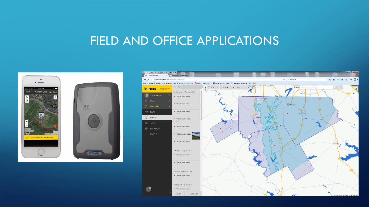
FIELD AND OFFICE APPLICATIONS

Field to Cloud
Custom forms for integration
into existing database
Data uploads to Cloud-based software
Variable base-maps and backgrounds
Integrate high accuracy field data with
Groundwater Management Software
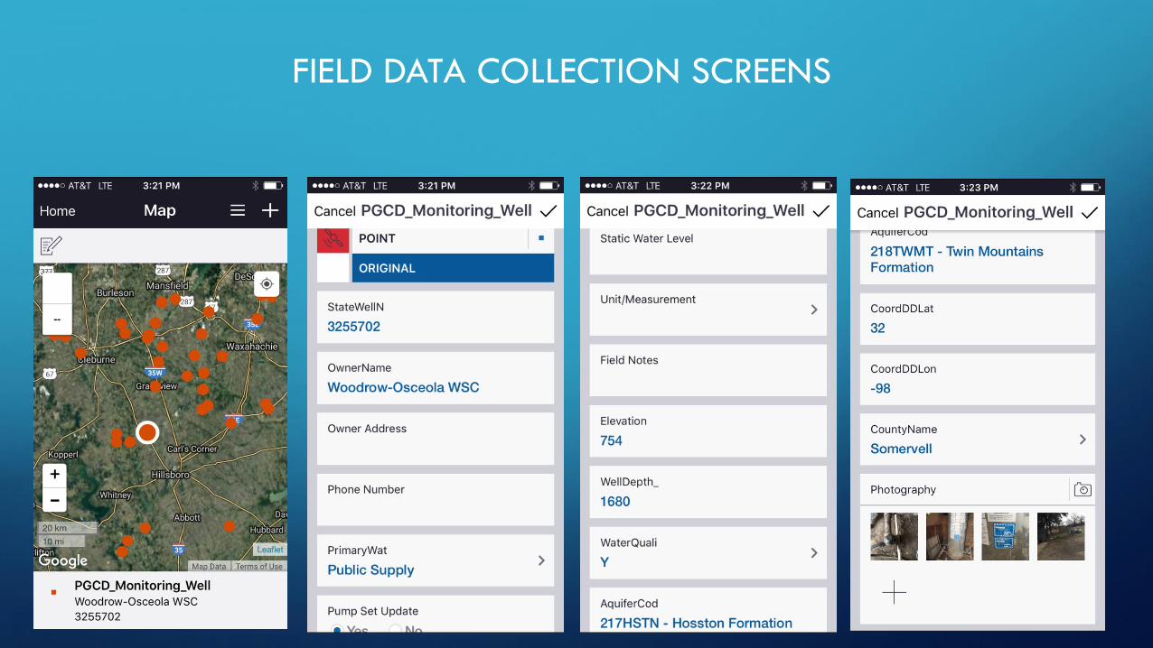
FIELD DATA COLLECTION SCREENS

CONCLUSION
• This solution provides GCD’s and other entities an inexpensive way to improve
workflow in the field.
• Accurate data results in better modelling and management of resources
• Reduces time and increases accuracy of field monitoring