Improving AODV route discovery through GPS coordinates
37
VASIL HNATYSHIN * and HRISTO ASENOV + Improving AODV route discovery through GPS coordinates * Department of Computer Science Rowan University Glassboro, NJ 08028 E-mail: [email protected] + Department of Computer and Information Science University of Delaware Newark, DE 19716 E-mail: [email protected]
Transcript of Improving AODV route discovery through GPS coordinates

VASIL HNATYSHIN*
and HRISTO ASENOV +
Improving AODV route discovery through GPS coordinates
*Department of Computer Science Rowan University
Glassboro, NJ 08028E-mail: [email protected]
+Department of Computer and
Information ScienceUniversity of Delaware
Newark, DE 19716E-mail: [email protected]

Outline
Problem Statement
Ad-hoc On Demand Distance Vector (AODV)Routing
Location Aided Routing (LAR)
Geographical AODV (GeoAODV)
OPNET Modeler
Implementation of GeoAODV
Simulation study
Summary and Conclusions
Related Work: AODV
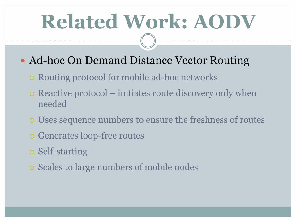
Ad-hoc On Demand Distance Vector Routing
Routing protocol for mobile ad-hoc networks
Reactive protocol – initiates route discovery only when needed
Uses sequence numbers to ensure the freshness of routes
Generates loop-free routes
Self-starting
Scales to large numbers of mobile nodes

AODV Path Discovery
AODV Path Discovery
Initiated only when the route to destination is needed
Uses request/reply cycle to discover route to destination
Uses request (RREQ) flooding (broadcast) to discover the route to destination
Reply (RREP) is unicast back to the source through reverse path
Source transmits data once the route is found

AODV Path Discovery
Source broadcasts RREQ if route to destination is unknown
RREQ message
Source Address
Source Sequence Number – freshness of the reverse route to source
Broadcast ID – unique ID for RREQ from this source node
Destination Address
Destination Sequence Number – freshness of the route to destination
required by the source
Hop count – number of hops visited, i.e., path cost

RREQ arrivals
Determine if RREQ is a duplicate (i.e., source address
and broadcast id have been seen before)
If yes then discard RREQ
Check if have path to destination or is destination itself
If no, then
Record reverse path information: source IP address, destination
IP addresses, broadcast ID, source sequence number, and
expiration time for reverse path, IP address of the neighboring
node from which RREQ arrived
Re-broadcast RREQ
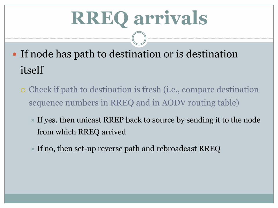
RREQ arrivals
If node has path to destination or is destination
itself
Check if path to destination is fresh (i.e., compare destination
sequence numbers in RREQ and in AODV routing table)
If yes, then unicast RREP back to source by sending it to the node
from which RREQ arrived
If no, then set-up reverse path and rebroadcast RREQ
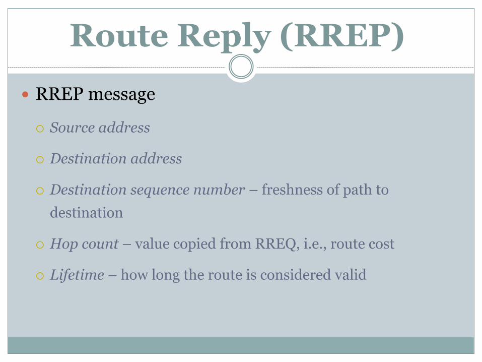
Route Reply (RREP)
RREP message
Source address
Destination address
Destination sequence number – freshness of path to
destination
Hop count – value copied from RREQ, i.e., route cost
Lifetime – how long the route is considered valid

RREP Arrivals
First RREP arrives at intermediate node
Set-up forward path
Record the IP address from which RREP arrived
Update source and destination timeout values
Updated destination sequence number
Send RREP to neighboring node on the path to the source
(i.e., via reverse path)

RREP Arrivals
Duplicate RREP arrives at intermediate node
If destination sequence number of RREP is greater than that
or the recorded route or
If destination sequence number of RREP is the same but the
hop count (i.e., cost) is smaller
Then update forward route routing table entry and send
RREP
Otherwise, discard RREP

RREP Arrival at Source
RREP arrives at source
Update its routing table
Start sending application data
Update routing table if RREP with a better route arrives at
later time
If a node does not receive RREP then its reverse
path entry expires and is discarded after certain
time
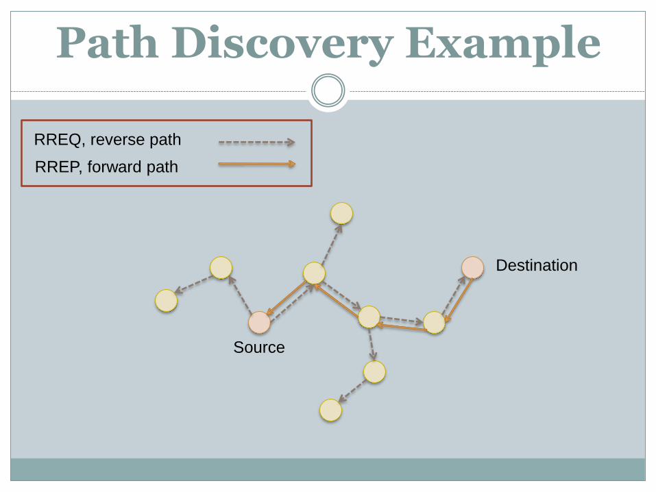
Path Discovery Example
Source
Destination
RREQ, reverse path
RREP, forward path
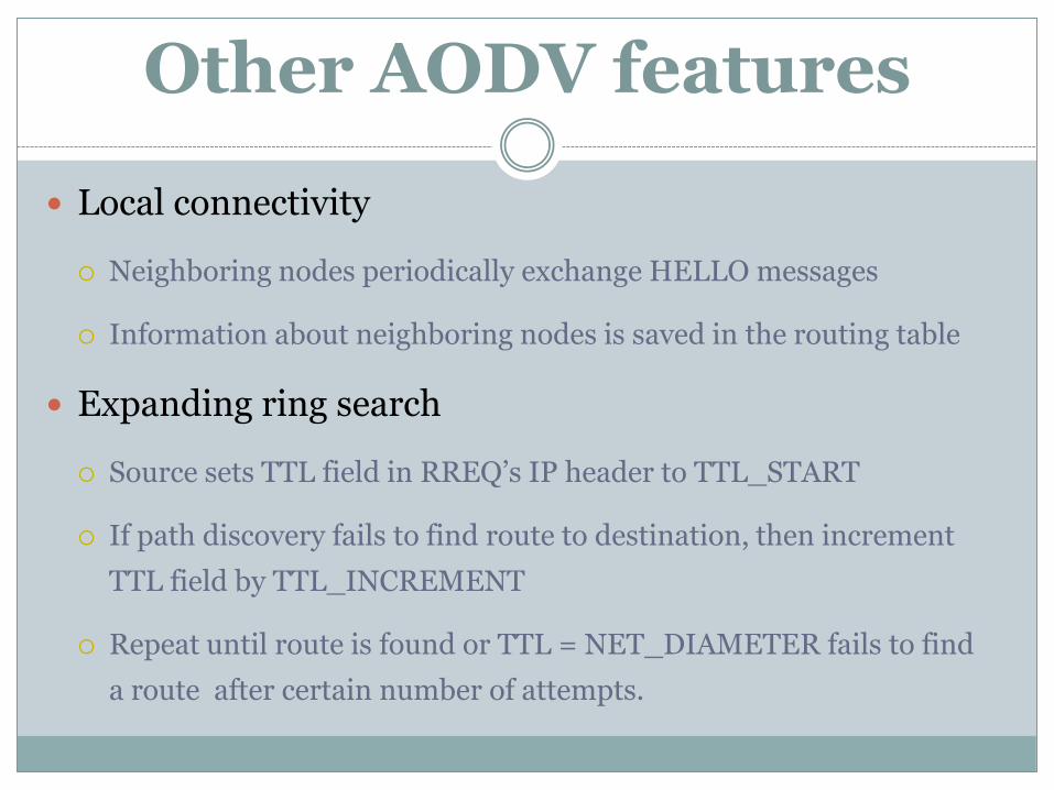
Other AODV features
Local connectivity
Neighboring nodes periodically exchange HELLO messages
Information about neighboring nodes is saved in the routing table
Expanding ring search
Source sets TTL field in RREQ’s IP header to TTL_START
If path discovery fails to find route to destination, then increment
TTL field by TTL_INCREMENT
Repeat until route is found or TTL = NET_DIAMETER fails to find
a route after certain number of attempts.

Location Aided Routing
AODV route discovery problem
Too many control messages traveling through the network
Solution idea:
Use location information to limit the number of nodes
participating in route discovery
Perform “limited” flooding within the area that is likely to
contain the route to destination
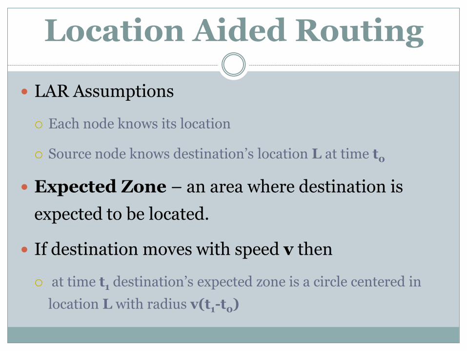
Location Aided Routing
LAR Assumptions
Each node knows its location
Source node knows destination’s location L at time t0
Expected Zone – an area where destination is
expected to be located.
If destination moves with speed v then
at time t1 destination’s expected zone is a circle centered in
location L with radius v(t1-t0)
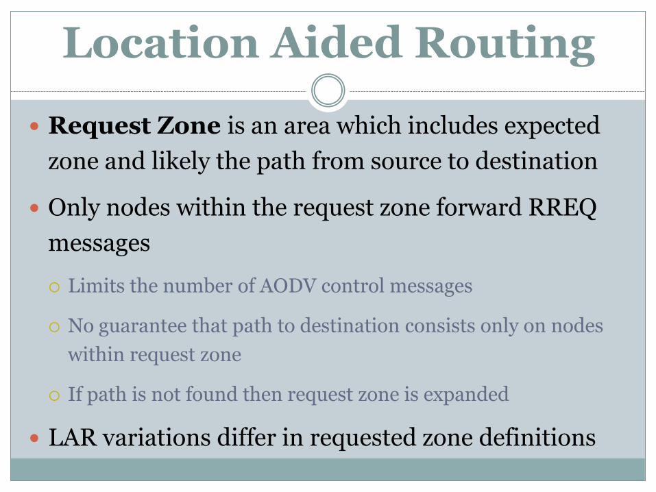
Location Aided Routing
Request Zone is an area which includes expected
zone and likely the path from source to destination
Only nodes within the request zone forward RREQ
messages
Limits the number of AODV control messages
No guarantee that path to destination consists only on nodes
within request zone
If path is not found then request zone is expanded
LAR variations differ in requested zone definitions

Location Aided Routing
LAR version #1

Location Aided Routing
LAR version #2 S does not need to know D’s velocity
S knows the location (Xd, Yd) of node D
S calculates distance DISTs between S
and D and includes its value in RREQ
RREQ arrives at I:
o I computes DISTi, distance
between I and D
o For some parameter δ,
If (DISTs + δ ≥ DISTi)
Then I replaces DISTs with DISTi
in RREQ and re-broadcasts RREQ
Otherwise, I discards RREQ

Geographical Routing
Request zone is defined as a cone shaped area
The size of request zone is controlled via flooding angle
Source
N1
N2
Destination
N3
A1
A2
Flooding angle is
increased if previous
round of route discovery
fails to find path to
destination
Eventually, GeoAODV
may morph into AODV

Geographical Routing
RREQ arrives at Intermediate node N
o N computes angle θ
If 2θ < α then rebroadcast RREQ
Else discard RREQ
SD – source and destination vector
SN – source and neighbor vector
θ – angle between vectors SD and SN
α – flooding angle
SNSD
SNSD1cos
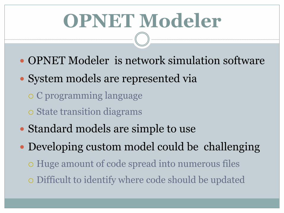
OPNET Modeler
OPNET Modeler is network simulation software
System models are represented via
C programming language
State transition diagrams
Standard models are simple to use
Developing custom model could be challenging
Huge amount of code spread into numerous files
Difficult to identify where code should be updated

OPNET Architecture
Network Domain
Describes a complete simulated system
Node Domain
Represents a single system device
Process Domain
models a single protocol or technology
Process models
State Transition Diagram
C code
External code files
AODV Implementation
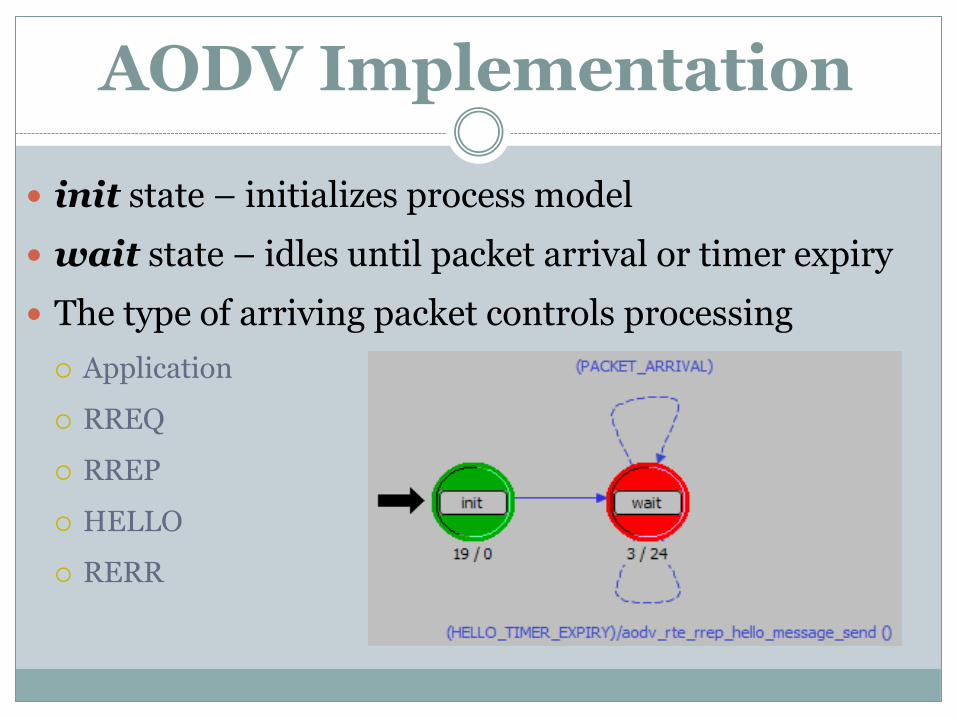
init state – initializes process model
wait state – idles until packet arrival or timer expiry
The type of arriving packet controls processing
Application
RREQ
RREP
HELLO
RERR

All data structures are implemented as C structs
AodvT_Packet_Option
Packet Type
Pointer to packet’s header (i.e. AodvT_Rreq or AodvT_Rrep)
AodvT_Route_Table – table of active routes to destinations
Implemented as hash table
Indexed by destination’s IP address
Populated via RREQ and RREP messages
AodvT_Route_Entry – a routing table entry
Contains destination address, next-hop address, sequence number, etc.
Key AODV data structures

AodvT_Request_Table – maintains data about RREQ messages that travel through the node
RREQ created by the node (AodvT_Orig_Request_Entry)
Keeps track of active route discovery processes
Determines if route discovery succeeded
Implements expanding ring search
RREQ sent to the node
Avoids duplicate processing of arriving RREQs
AodvT_Conn_Info – maintains information about neighboring nodes
Populated via HELLO messages
Key AODV data structures

Modeling GeoAODV
Add new protocol configuration parameters Changes are implemented in manet_mgr process model
Specify GeoAODV model attributes
Parse attributes in attributes_parse_buffers_create function
Modified AODV control packet headers AodvT_Rreq
AodvT_Rrep
Modified AODV control packet managing routines aodv_rte_rreq_pkt_arrival_handle
aodv_rte_rrep_pkt_arrival_handle
Modified AODV route request and connectivity tables
Added geo-table to store GPS coordinates of the nodes

Modeling GeoAODV
Geo-table is updated via RREQ and RREP packets
Update route discovery process
Algorithm for determining if a node rebroadcasts RREQ is changed
Perform regular AODV verification procedures
Compute search region at each node
Check if the node belongs to search region
Implement algorithm for computing initial value of flooding angle
Implement algorithm for increasing flooding angle if previous round of route discovery failed
GeoAODV implementation is placed into external files

GeoAODV Implementation
Start of GeoAODV route discovery process:
Retrieve current node’s location coordinates
If the destination’s coordinates are available in geo-table then {
Retrieve destination coordinates from geo-table
Compute the initial value of the flooding angle
}
Otherwise (destination coordinates are unknown) {
Set the flooding angle to 360 (e.g. regular AODV)
Set destination coordinates to (-1, -1) (e.g. unavailable)
}
Generate RREQ message using obtained flooding angle and source
and destination coordinates
Send generated RREQ message
Update Request Table (i.e. record RREQ message information )

Computing the initial value of flooding angle:
If destination coordinates are unknown then return 360
Set the value of the flooding angle to 90
Repeat while flooding angle < 360 {
If there is at least one neighboring node within the
search area defined by the current value of flooding
angle
then return the current value of flooding angle
Else increment the value of flooding angle by 90
}
Return current value of flooding angle
GeoAODV Implementation

Processing of RREQ at intermediate node:
Update geo-table with originator node coordinates and destination
node coordinates if fresher coordinates have been received
If the node is destination or the node knows route to destination then {
Generate RREP
Return
}
If AODV determines that RREQ message is to be rebroadcast and if
the node is within the search area then {
Rebroadcast RREQ
Update Request Table
Return
}
Drop RREQ message
GeoAODV Implementation
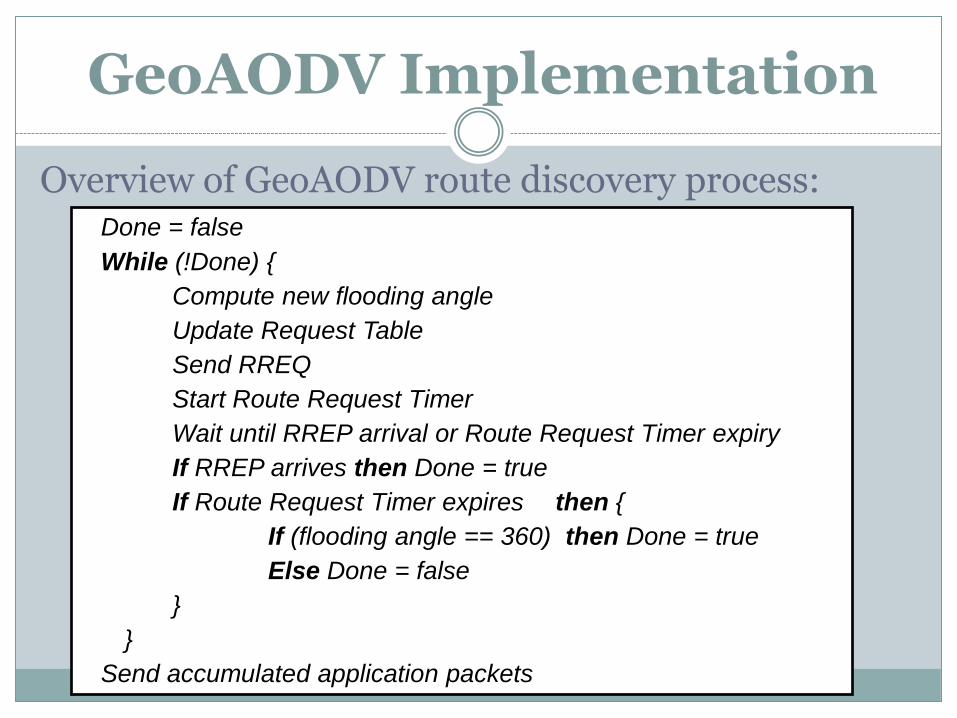
Overview of GeoAODV route discovery process:Done = false
While (!Done) {
Compute new flooding angle
Update Request Table
Send RREQ
Start Route Request Timer
Wait until RREP arrival or Route Request Timer expiry
If RREP arrives then Done = true
If Route Request Timer expires then {
If (flooding angle == 360) then Done = true
Else Done = false
}
}
Send accumulated application packets
GeoAODV Implementation
Simulation study
Simulated area is 1000 meters x 1000 meters
Randomly placed 50 MANET nodes
Nodes move using random waypoint model
Average node speed was uniformly distributed
between 1 and 10 meters/second
The number of communicating nodes range
between 5 and 30

Simulation study
Configuration Parameter Value
Channel Data Rate 11 Mbps
Transmit Power 0.005 Watts
Packet Reception Power Threshold -95 dBm
Start of data transmission* normal (100, 5) seconds
End of data transmission End of simulation
Packet inter-arrival time* exponential (1) second
Packet size* exponential (1024) bytes
Duration of Simulation 300 seconds

Simulation study
0
500
1000
1500
2000
2500
3000
3500
4000
4500
5000
5500
5 10 20 30
Nu
mb
er
of
RR
EQ
me
ss
ag
es
Number of Communicating Nodes
GeoAODV Stationary
AODV Stationary
GeoAODV Mobile
AODV Mobile

Summary and Conclusion
o GeoAODV outperforms AODV
The whole network is not searched
Fewer RREQ and RREP packets travel through
the network
o Improvement is lower in mobile scenarios
Node coordinates are not as accurate
More rounds of route discovery may be needed

Future Work
• Compare GeoAODV to LAR and other related protocols
• Modify the processing at the intermediate node so that it
computes the search area formed in respect to previous
node – destination node line, instead of sourse–
destination line.
• Add provisions to ensure that the route discovery does
not extend too far beyond the location of the destination
node.

Future Work
• Dynamically increase flooding angle at the
intermediate nodes if there are no immediate neighbors
within the search area defined by the flooding angle of
arriving RREQ message.
• Combine multiple ideas presented above to maximize
the overall improvement.
• One such hybrid approach could be to use only two values of
flooding angle, 180 and 360, and always compute the search area
based on the location of the previous node.