Image Analysis in ArcGIS Pro - Esri Eastern Africa Analysis in ArcGIS Pro.pdf · Imagery Workflow...
16
Image Analysis in ArcGIS Pro Douglas Ronoh Remmy Kesis
Transcript of Image Analysis in ArcGIS Pro - Esri Eastern Africa Analysis in ArcGIS Pro.pdf · Imagery Workflow...

Image Analysis in ArcGIS
Pro
Douglas Ronoh
Remmy Kesis

Overview
• The ArcGIS Platform
• Why Use Imagery?
• Imagery Workflow
• What is Image Classification?
• Demo 1
• Image Analysis: NDVI
• Mosaic Datasets
• Raster Functions
• Demo 2
• Resources


Why use Imagery?
• To Enrich our Maps
• To Understand the World
• To Extract GIS Feature Data

Imagery Workflow
CollectionRasterTypes
ArcGIS ServerImage Service
ArcGIS DesktopMosaic Dataset
Harvests Metadata
ImageryNative Form
Raster Functions Raster Products
Points to the
original Imagery
What is Image Classification?

Types of image classification
Type of
classification
How class is
identified
What is
classified
Spatial resolution
of raster
UnsupervisedUser input after
processing
Land
use/land
cover
Coarse
Supervised
Training
samples of
spectrally pure
surfaces
Land
use/land
cover
Coarse or fine
Object-oriented
Training
samples of
specific
features
Features Fine
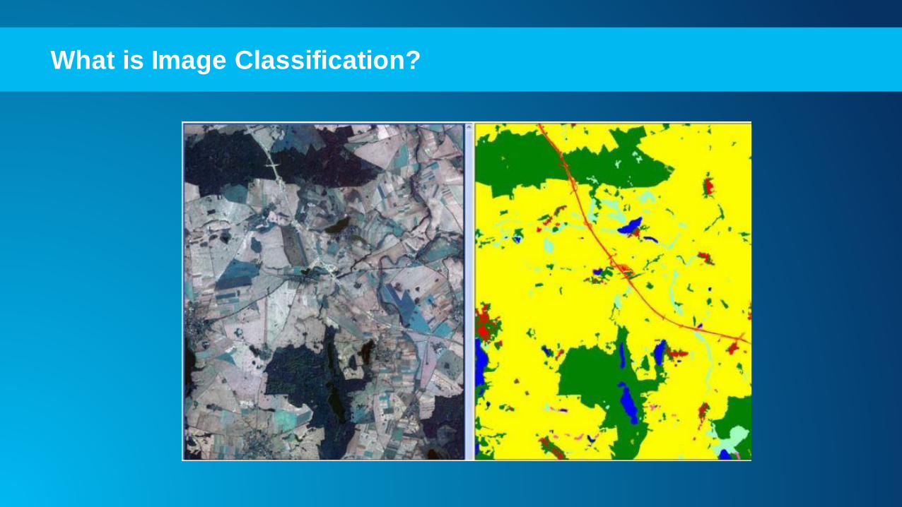
Supervised classification
Training
samples of surfaces
Supervised
classification
User identifies classes through spectrally pure training
samples before classification
Results are generalized and combined through reclassification
Coarse or fine resolutions

Douglas Ronoh
Demo 1
Performing
Supervised Image
Classification

Image AnalysisNormalized Difference Vegetation Index (NDVI)
• NDVI is a simple graphical indicator that can be used to analyze remote
sensing measurements.
• Goal is to assess whether the target being observed contains live green
vegetation or not.

Mosaic Datasets
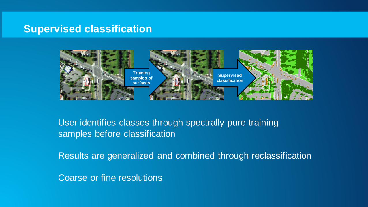
Raster Functions
• Apply algorithm on-the-fly to a raster/image
layer
• Can be applied to a pixel or block of pixels
• Raster functions can be chained
• Used by developers to extend ArcGIS
image processing
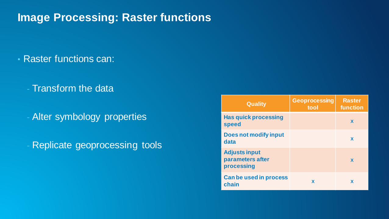
Image Processing: Raster functions
• Raster functions can:
- Transform the data
- Alter symbology properties
- Replicate geoprocessing tools
QualityGeoprocessing
tool
Raster
function
Has quick processing
speedX
Does not modify input
dataX
Adjusts input
parameters after processing
X
Can be used in process
chainX X
Douglas Ronoh
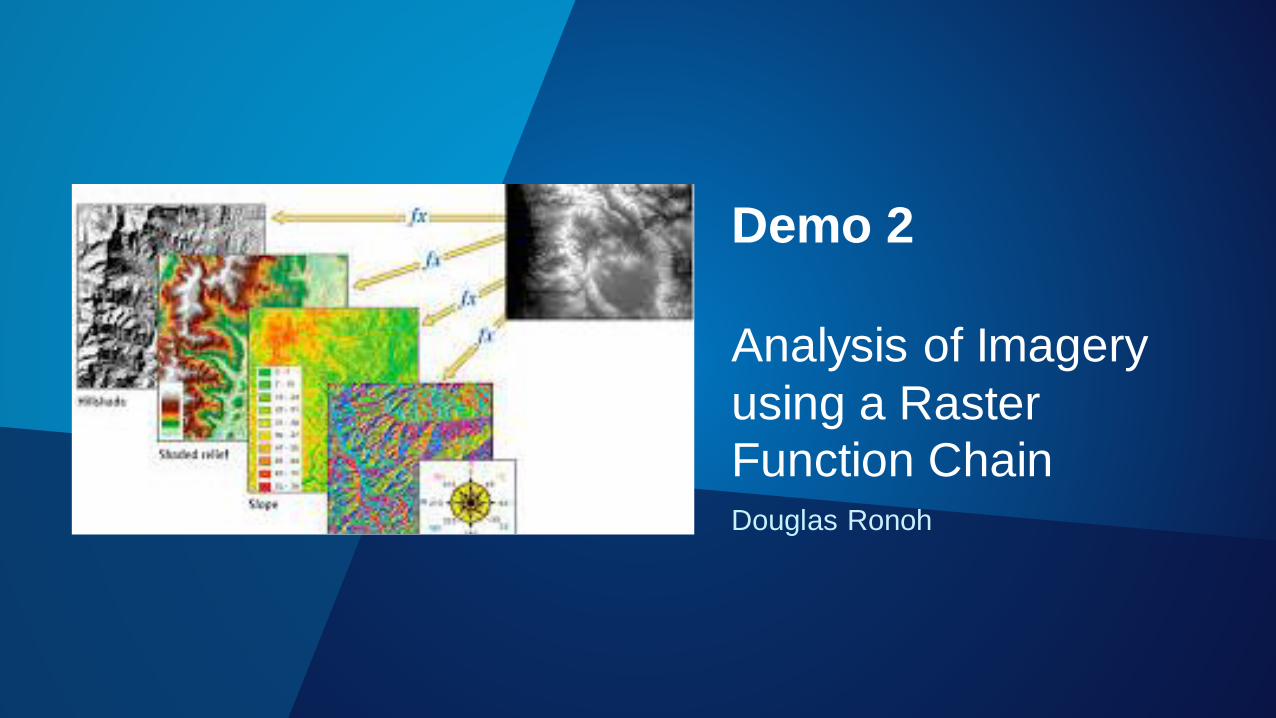
Demo 2
Analysis of Imagery
using a Raster
Function Chain
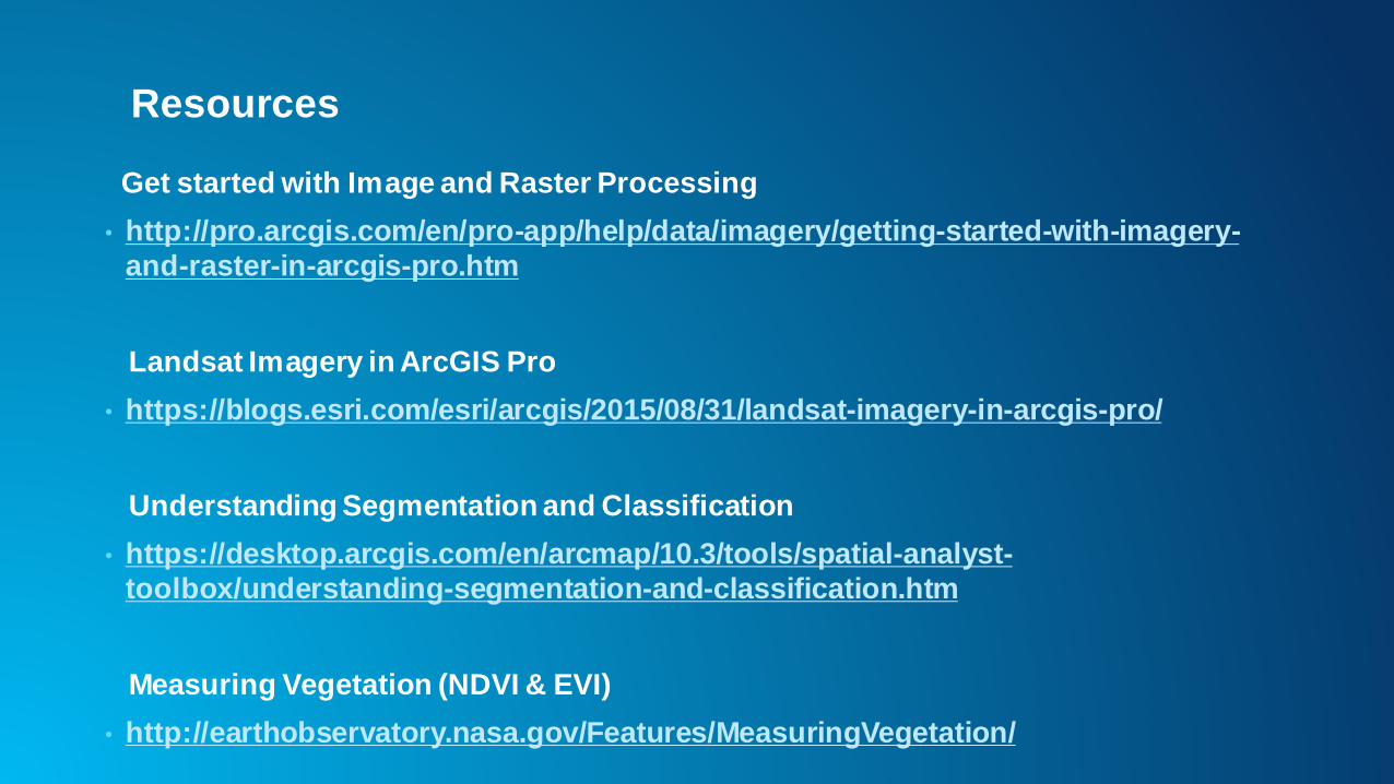
Resources
Get started with Image and Raster Processing
• http://pro.arcgis.com/en/pro-app/help/data/imagery/getting-started-with-imagery-
and-raster-in-arcgis-pro.htm
Landsat Imagery in ArcGIS Pro
• https://blogs.esri.com/esri/arcgis/2015/08/31/landsat-imagery-in-arcgis-pro/
Understanding Segmentation and Classification
• https://desktop.arcgis.com/en/arcmap/10.3/tools/spatial-analyst-
toolbox/understanding-segmentation-and-classification.htm
Measuring Vegetation (NDVI & EVI)
• http://earthobservatory.nasa.gov/Features/MeasuringVegetation/