Hurricane Katrina
23
Hurricane Katrina Geog. 585 Term Project Wansoo Kim
description
Hurricane Katrina. Geog. 585 Term Project Wansoo Kim. Introduction. Hurricane Katrina struck the Gulf coast area from Aug. 23 to Aug. 30, 2005. Especially, Alabama, Louisiana, and Mississippi states. - PowerPoint PPT Presentation
Transcript of Hurricane Katrina

Hurricane Katrina
Geog. 585Term ProjectWansoo Kim

Introduction
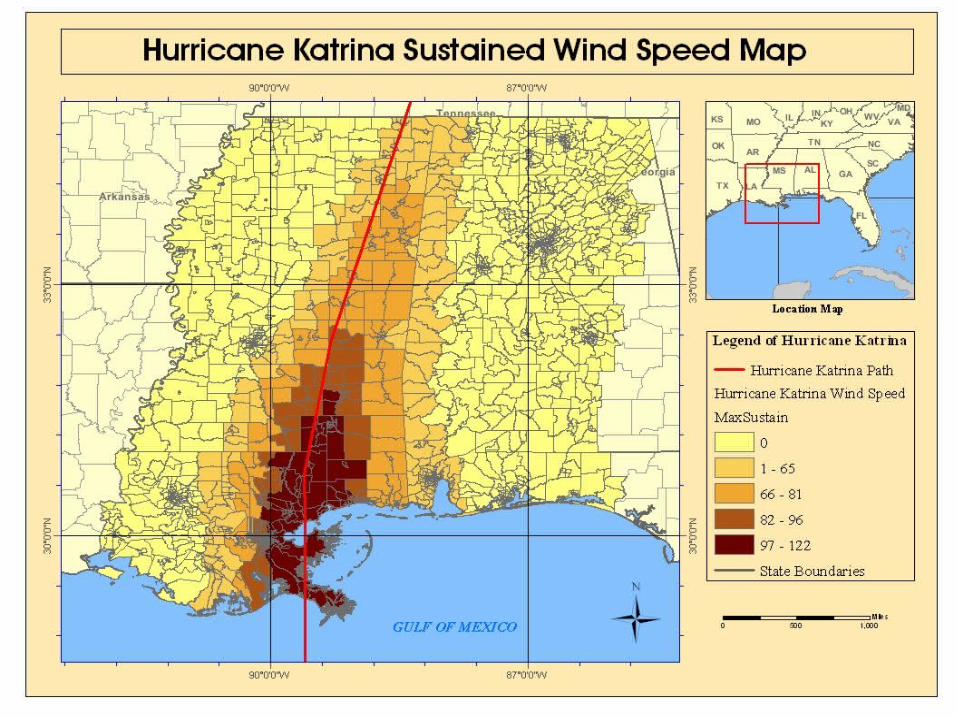
• Hurricane Katrina struck the Gulf coast area from Aug. 23 to Aug. 30, 2005. Especially, Alabama, Louisiana, and Mississippi states.
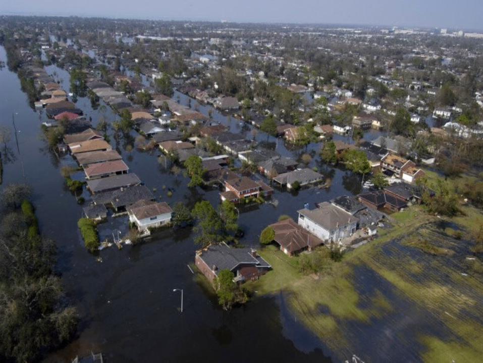
• Millions of people have been displaced and thousands people were killed by Hurricane Katrina. Estimated cost is more than 200 million dollars.

Purpose
• Making Hurricane Katrina Pathway and Damage maps.
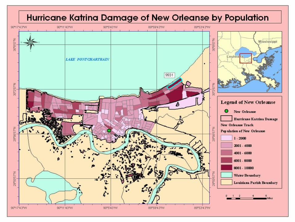
• Which area was the most impacted by Hurricane Katrina?
- by Census Population Data
- by Census Housing Unit Data

Method
Katrina Pathway Data Add X,Y Location Katrina Pathway Buffer Katrina Pathway Buffer
Census Track
Join New Orleanse Population
Clip OutputCensus Population Data
Katrina Damage Area
Census Track
Join New Orleanse Housing
Clip OutputCensus Housing Data
Katrina Damage Area
Hurricane Katrina Track Map
Hurricane Katrina Damage by Population
Hurricane Katrina Damage by Housing Unit


Reference
• http://www.noaa.gov/
• http://www.nws.noaa.gov/ndfd/
• http://hurricanes.noaa.gov/
• http://www.noaa.gov/coasts
• http://www.fema.gov/
• http://www.esri.com/
• http://www.census.gov/
• http://factfinder.census.gov/
• http://www.globalsecurity.org/