
How to display the BLM’s Public Land Survey System (PLSS ... · PDF fileHow to display...
3
How to display the BLM’s Public Land Survey System (PLSS) data in Google Earth Point your web browser to: https://gis.blm.gov/arcgis/rest/services/ For PLSS data, Click on “Cadastral”, and in the resulting window, click on “Cadastral/BLM_Natl_PLSS_CadNSDI”
Transcript of How to display the BLM’s Public Land Survey System (PLSS ... · PDF fileHow to display...

HowtodisplaytheBLM’sPublicLandSurveySystem(PLSS)datainGoogleEarth
Pointyourwebbrowserto:
https://gis.blm.gov/arcgis/rest/services/
ForPLSSdata,Clickon“Cadastral”,andintheresultingwindow,clickon“Cadastral/BLM_Natl_PLSS_CadNSDI”
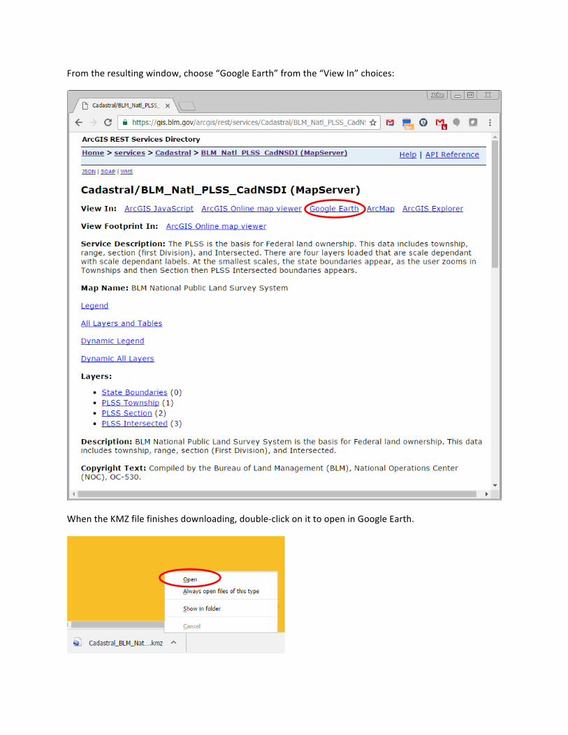
Fromtheresultingwindow,choose“GoogleEarth”fromthe“ViewIn”choices:
WhentheKMZfilefinishesdownloading,double-clickonittoopeninGoogleEarth.

ZoomintoanareaofinteresttohavethePLSSgriddisplayed.Sectionsandquarter-quarterswilldisplayasyouzoominfurther.ThePLSSdatawillnotdisplayifzoomedoutbeyondanaltitudeof450miles.
ThesymbologyofstreamingKMZdatacannotbemodified.


