How Every Library Can Use Web GIS -...
85
How Every Library Can Use Web GIS Eva Dodsworth Geospatial Data Services Librarian University of Waterloo Library Courtney Lundrigan Librarian Intern/MLIS Candidate Ryerson University Library/University of Western Ontario
Transcript of How Every Library Can Use Web GIS -...

How Every Library Can Use Web GIS
Eva Dodsworth
Geospatial Data Services Librarian
University of Waterloo Library
Courtney LundriganLibrarian Intern/MLIS Candidate
Ryerson University Library/University of Western
Ontario

Why are we here today?
Upgrading Skills to Include Web Mapping 2.0 Technology
• GIS technology is all around us. Library users are using it. It’s time for library staff to use it too
• An introduction to Web GIS Resources• Introduction to Visual/Spatial Literacy• How are Library Staff using GIS?• The importance of GIS training for library staff

Web 2.0 and Social Networking Technology
• Libraries are using social networking technology to connect with students
•Curtis Rogers (2009) conducted a survey of American library staff members to determine the variety of Web 2.0 and social networking sites utilized to promote library services and programs.
• Among the highest ranked were Facebook (71.4%), Flickr (49.6%), and Blogs (47.4%), followed by Twitter and Meebo (36.1%) and YouTube (35.3%). The survey did not include mapping based Web 2.0 applications, which was found to be a common omission among surveys studied.
Facebook : 400 million usersFlicker : 27 million usersTwitter : 105 million usersYouTube : 258 million users
Google Earth : Over 600 million usersGoogle Maps : Even more!

Are Libraries Using Mapping Products?
Eva Dodsworth and Andrew Nicholson, 2011, “Google Earth Usage in Academic Libraries” survey, (January, 2011, unpublished). -Over 80 responses, US and Canada
- 45% use Google Mapping Products on a weekly bases (27% use them more than 3 times a week)
- 82% (58) used these products to answer research questions- 61% (43) used these products for creating or accessing a finding aid
tool- 56% (40) for instruction purposes- 27% for promotion/marketing- 20% (14) have used them for project work such as georeferencing
imagery, for use in webpages and for training purposes

Concepts to think about throughout this session
• How can these tools be used in your library?
•Are there opportunities to embed this technology into the coursecurriculum?
• Can you utilize this technology to outreach to library users?
•Can you utilize this technology to promote or deliver library services and resources?

Objective Number One: Geographical Awareness
GIS is Everywhere!

Everyday information is becoming widely presented in map form
Traffic Flowshttp://toronto.ibegin.com/traffic/

Flight Tracker
fboweb.com


http://maps.tctrail.ca/index.jsp# Trans Canada Trail
http://www.gmap-pedometer.com/


www.dudewheresmyusedcar.com

•You don’t need to be a professional cartographer to create a map
•You don’t need to be a programmer to create a mapping application
Neogeography : Essentially, Neogeography is about people using and creating their own maps, on their own terms and by combining elements of an existing toolset. Andrew Turner, 2007.
Also known as Citizen Mapping
Web 2.0 and the Neogeographer

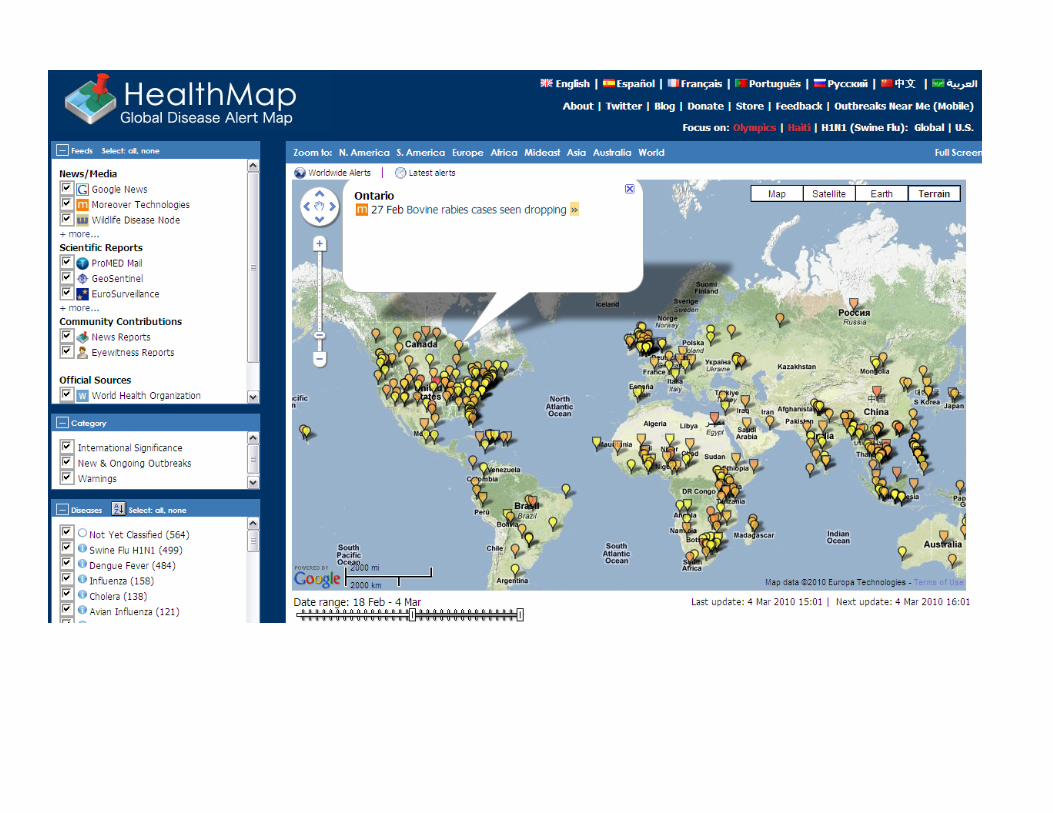
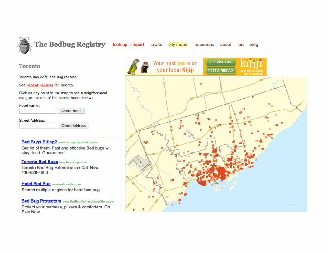
Citizen Mapping Projects
• Urban Forest Map : http://www.urbanforestmap.org/map/
• Open Street Map : openstreetmap.org


www.openstreetmap.org


OpenStreetMap vs Google Maps
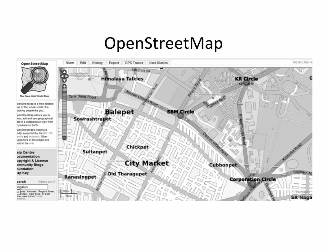
OpenStreetMap
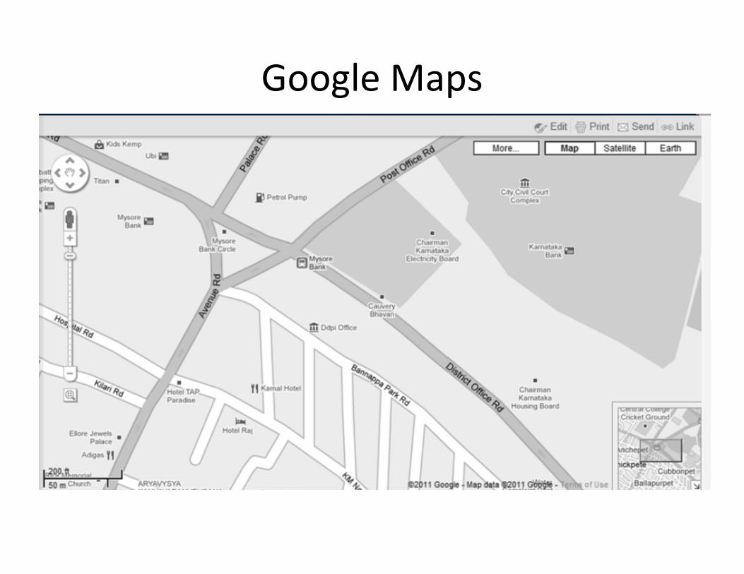
Google Maps

Search for photos spatially

Google Earth 360 photos

Our interest in locations is providing much more than a spot on the map :
-It has increased our awareness of the world outside our doorstep-It has validated the benefits and ease of sharing information-It has brought communities with same interests together

We are interested in locations!
• Our whereabouts – GPS chips• Geographical settings of novels, location of news events
• Location stamping (geo‐tagging) vacations (Flikr) and events (blogs, Facebook)

Visual Literacy
Map reading and map writing are lifelong literacy skills.
-Know how to communicate with maps-Know that maps exist and where

•We are expected to have map literacy skills. •Read a map•Create a map
•Society is communicating information in a map format•To tell a story•To find patterns•To find solutions•To make information clearer
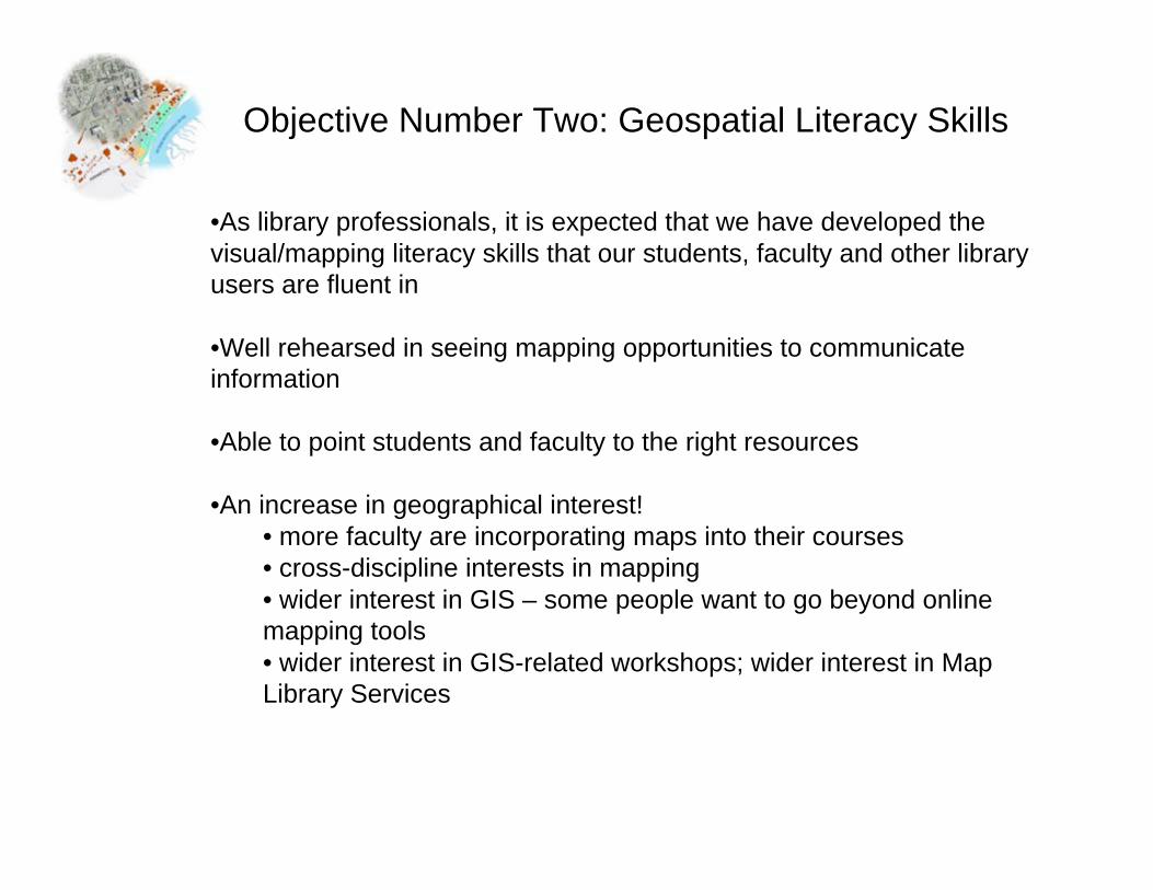
Objective Number Two: Geospatial Literacy Skills
•As library professionals, it is expected that we have developed the visual/mapping literacy skills that our students, faculty and other library users are fluent in
•Well rehearsed in seeing mapping opportunities to communicate information
•Able to point students and faculty to the right resources
•An increase in geographical interest!• more faculty are incorporating maps into their courses• cross-discipline interests in mapping• wider interest in GIS – some people want to go beyond online mapping tools• wider interest in GIS-related workshops; wider interest in Map Library Services

Map Literacy on Campus
• How are students and faculty using maps and online mapping resources?

Google Earth
• Source for information on land and people– Archaeological information
– Social and cultural information
– Urban and commercial development
– Geographical information
– Natural disasters and restoration
– Mapping! Simple and advanced
– Georeferencing photos and maps – higher resolution or historical
– 3‐D Model building – Sketchup

Mapping Tabular Information
• People are interested in mapping addresses, survey results, and points of interests
• Quite popular with the social sciences – mapping the location of respondents
• Excellent product Google Fusion allows you to paste your Excel table with address information into the online program and it instantly creates latitude and longitude coordinates for each address in your table.
• You can then view your address ‘points’ in Google Earth, Google Maps, or import your updated Excel table into a GIS program for further analysis

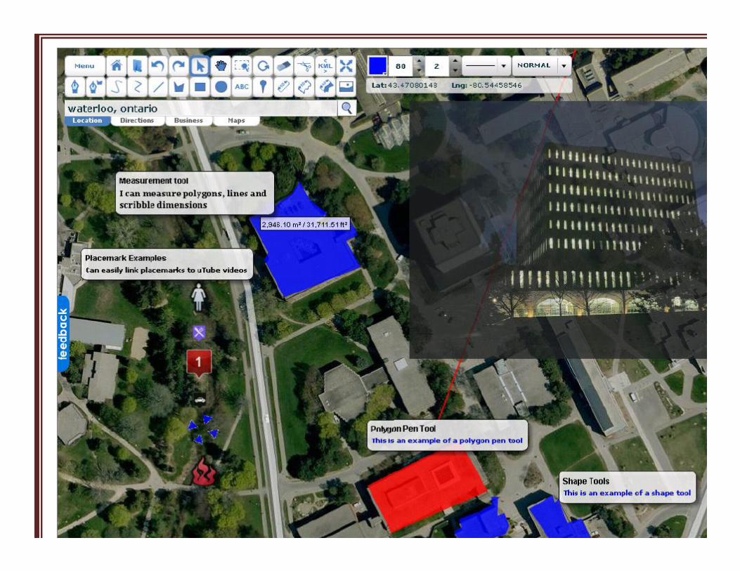
Creating mashups
• We often use other people’s mashups, but we can all easily create our own!
• Scribblemaps.com– Can scribble, add markers, paths (streets, trails, etc), add tables, add
images, add GIS files, add KML! Imbed map into other applications using widgets
• Google Maps, Bing Maps


http://www.lib.uwaterloo.ca/locations/umd/digital/Toronto_2009_vector.html

Interactive Mapping
• Government resources available freely online‐ Municipal information (neighbourhood level)
• Provincial/State level projects (Parks, Soil Surveys, Topography)
• National Level projects (Census)
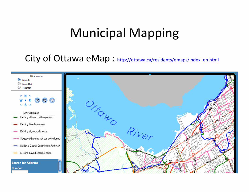
Municipal Mapping
City of Ottawa eMap : http://ottawa.ca/residents/emaps/index_en.html

City of Ottawa Interactive Traffic Map

Land Information Ontario (LIO)


Historical Mapping
• People across several disciplines are interested in studying historical facts about our land
– Egyptian and Roman design of streets
– Bends and sizes of rivers and lakes
– Changes in political boundaries, and in names
– Rural and Urban Development – parcel divisions
– Historical settings read in books and texts
– Many online sites offer historical maps for viewing and downloading
– http://www.davidrumsey.com/
– http://www.lib.utexas.edu/maps/map_sites/hist_sites.html#europe

Accessing static maps
• A wide variety of scanned maps are available for download
• http://www.geogratis.ca/ ‐ Toporama prototype

Geological Survey of Canada : http://gsc.nrcan.gc.ca/map/1860a/index_e.php
Accessing static maps

• Online maps don’t meet the needs of all users
• Advanced mapping and analysis is often done in desktop GIS programs – ArcGIS, MapInfo, Manifold, or several open source programs
• Data for these programs are often available from the Map Library, as well as from online resources
Spatial Data Providers

Geographynetwork.ca


Open Access to Data
City of Toronto Open Datahttp://www.toronto.ca/open/catalogue.htm#g
City of Vancouver Open Datahttp://data.vancouver.ca/
City of London Open Datahttp://www.london.ca/d.aspx?s=/Open_Data/default.htm


If library users are utilizing all of these web mapping resources, shouldn’t library staff do the same?

How are Library Staff Using Web GIS?
•Creating maps! •Digitizing Library Collections•Promoting and Delivering Library Collections•Teaching and training students, faculty and other library users•Reference services•Course liaison responsibilities•Administration•As a communication and information tool
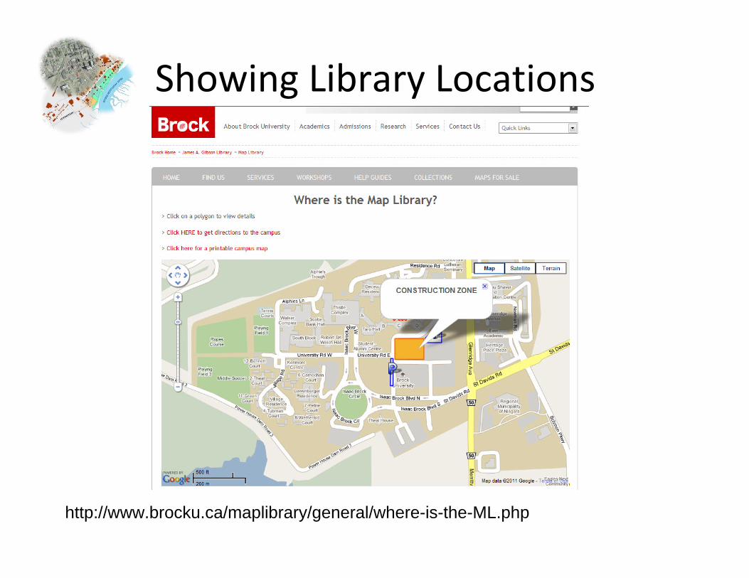
Showing Library Locations
http://www.brocku.ca/maplibrary/general/where-is-the-ML.php

University of North Carolina
http://www.lib.unc.edu/libraries_collections.html

San Diego Public Library
http://www.sandiego.gov/public-library/locations/

St. Paul Public Library
http://www.sppl.org/locations/bookmobile.html#map
BookMobile Locations & Schedule

Resource SharingUniversity of Vermont Library
http://cdi.uvm.edu/collections/browseCollection.xql?pid=longtrail&title=Long%20Trail%20Photographs
Digitized Photo Collection, Geotagged and make available online
Slide 1/2

University of Vermont Photograph Collection

University of North CarolinaAir Photo Collection
Slide 1/3

Slide 2/3

Slide 3/3

Digitizing and Georeferencing Fire Insurance Plans

University of Waterloo Historical Air Photo Project
http://www.lib.uwaterloo.ca/locations/umd/project/

Slide 1/3

http://www.clevelandmemory.org/hlneo/ Slide 2/3


http://trialgmaps.wikidot.com/Slide 1/2


http://magic.lib.uconn.edu/otl/neighborhood_change.html

McMillan Memorial Library, Wisconsin – Cemetery Locations
http://www.mcmillanlibrary.org/history/cemeteries.html

McMillan Memorial Library : Postcard Collection
http://www.mcmillanlibrary.org/history/postcards.html

http://www.lorensbergs.com/public-library-solutions/netloan-public/libraryguide-access.aspx

Breaking down the silos
GIS is not a subject, but a multi-disciplinary technology
Although many libraries still have a GIS librarian or a GIS technician, we should conceptualize GIS as a companion to current library services
Virtually every subject area will find use for GIS – English, History, Psychology, Health Sciences, etc.
GIS has evolved from a subject area to an integral part of research and library activity

For Reference Services
Many of the enquiries made of libraries and their on-line systems have a geographical question at their core e.g. ‘where is….’; where can I find…. ‘are there any…. in’, ‘who lives at…’. Street and land maps, voters’ lists, weather maps, satellite images and environmental information are part of the resource which may be used to answer these enquiries. As more and more geographic and cartographic data goes over to a primarily digital form librarians will have to grasp the nettle of providing GIS and its supporting hardware to the public
- workshops, help create maps, insert into reports….

The Importance of GIS Training for Library Staff
Why learn about GIS?

WHY NOT?

Population Decline, % (1996‐2001)Courtney Lundrigan, August 2010

Information to take back to the office
• Multidisciplinary uses for mapping – how can it be used in your disciplines?
• Familiarity with features of online mapping programs (what can they do?) – Google Earth, Google mashups, other online programs
• An understanding that any information with a geographical component can be mapped (displaying database files) – e.g. Survey results, census data
• Consider working with the GIS librarian to imbed mapping resources into the classrooms/course curriculum

Rogers, Curtis. Social Media, Libraries, and Web 2.0 : How American Libraries are Using New Tools for Public Relations and to Attract new Users. Slideshare. http://www.slideshare.net/crr29061/social-media-libraries-and-web-20-how-american-libraries-are-using-new-tools-for-public-relations-and-to-attract-new-users (accessed 18 April, 2010.).
Scribd. Social Media 2008 Statistics. http://www.scribd.com/doc/11481779/Social-Media-2008-Statistics. (accessed 21 April, 2010).
Statsaholic. Website Traffic Graphs for Flikr. http://www.statsaholic.com/flickr.com (accessed 21 April, 2010).
Yahoo News. “Twitter has over 105 million registered users : co-founder”, Yahoo News, April 14, 2010. http://news.yahoo.com/s/afp/20100414/tc_afp/usitcompanysoftwareinternettwitter (accessed 16 April, 2010).
References


![การบันทึกพิกัด GISforprod.forest.go.th/forprod/research_officesite/GIS.pdfระบบการบ นท กพ ก ด GIS [bis55b002_7] จากเมนูหลักของระบบ](https://static.fdocuments.in/doc/165x107/61299718d5015813070f7994/aaaaaaaaaaaaaa-aaaaaaaa-aa-aa.jpg)