How can we improve urban resilience with open data? · How can we improve urban resilience with...
56
Sponsored by Jean-Noé Landry Keira Webster Bianca Wylie Pamela Robinson How can we improve urban resilience with open data?
Transcript of How can we improve urban resilience with open data? · How can we improve urban resilience with...
Sponsored by
Jean-Noé Landry Keira Webster
Bianca Wylie Pamela Robinson
How can we improve urban resilience with open data?


How can we improve urban resilience with open data?

AuthorsJean-Noé Landry (Open North)
Keira Webster (Open North, Geothink.ca student) Bianca Wylie (Open North)
Pamela Robinson MCIP RPP (Urban Planning Ryerson University, Geothink.ca Researcher)
AcknowledgementsWith thanks to:
Jeni Tennison (ODI)Peter Wells (ODI)Fiona Smith (ODI)
Dawn Dunhaney (ODI)GeoThink.ca
Special thanks to our interviewees
Coordinated by: Jessica Weereratne (ODI)
Editing:Anna Scott (ODI)
Production and Design:Claudio Mendonca (CCMDesign)

5
What is open data?
CLOSED DATA
SHARED DATA
What is urban resilience?
Data anyone can access, use and share. It must:
� be accessible, which usually means published on the web
� be available in a machine-readable format
� have a licence that permits anyone to access, use and share it
Closed data is data that only its owners or people within an organisation can access, for reasons like privacy, commercial sensitivity and security.
Shared data is data that is shared with specific people and or-ganisations for a specific purpose: to provide services, connect information, and contribute to research.
Find out more at theodi.org/what-is-open-data
“The capacity of individuals, communities, institutions,
businesses, and systems within a city to survive,
adapt, and grow no matter what kinds of chronic
stresses and acute shocks they experience.”
Rockefeller Foundation, 2016
Resilience relates to diverse shocks and stresses, ranging from terrorist activities to natural disasters to crime (Capu-to, 2015). These stresses and shocks include instant, short-term crises that require innovative reaction and coopera-tion, and embedded, systemic issues that require long-term mitigation and adaptation strategies (Mehmood, 2016).
Urban resilience is often place-based. The shocks and stress-es experienced by a city can vary depending on its social, economic and environmental circumstances (Mehmood, 2016). Understanding the various degrees of vulnerability within cities – population groups that have differing skills, housing and socioeconomic statuses – plays an important role in making a city more resilient.
Determining the specific threats to resilience in a given con-text and therefore what it would mean to make it resilient helps in managing the issues and enabling collective under-standing and collaborative action.

How can we improve urban resilience with open data?

7
TABLE OF CONTENTS
Executive summary. . . . . . . . . . . . . . . . . . . . . . . . . . . . . . . . . . . . . . . . . . . . . . . . . . . . . . . . . . . . . . . . . . 9
Introduction . . . . . . . . . . . . . . . . . . . . . . . . . . . . . . . . . . . . . . . . . . . . . . . . . . . . . . . . . . . . . . . . . . . . . . . 11
How can we improve urban resilience with open data? . . . . . . . . . . . . . . . . . . . . . . . . . . . . . . . . . 13
Couple open data and urban resilience efforts to build a culture of openness . . . . . . . . . . . . . 13
Assess and address similarities and differences in urban resilience work between low- and high-income countries globally . . . . . . . . . . . . . . . . . . . . . . . . . . . . . . . . . . . . . . 19
Close the open data capacity gap . . . . . . . . . . . . . . . . . . . . . . . . . . . . . . . . . . . . . . . . . . . . . . . . . . . . . 22
Develop an agile approach to managing urban resilience . . . . . . . . . . . . . . . . . . . . . . . . . . . . . . . . 27
Cultivate business opportunities that address urban resilience issues . . . . . . . . . . . . . . . . . . . . 29
Realising the full potential of open data: next steps . . . . . . . . . . . . . . . . . . . . . . . . . . . . . . . . . . . 35
Bibliography . . . . . . . . . . . . . . . . . . . . . . . . . . . . . . . . . . . . . . . . . . . . . . . . . . . . . . . . . . . . . . . . . . . . . . . 39
Appendices . . . . . . . . . . . . . . . . . . . . . . . . . . . . . . . . . . . . . . . . . . . . . . . . . . . . . . . . . . . . . . . . . . . . . . . . 41
Appendix A: Cases studies . . . . . . . . . . . . . . . . . . . . . . . . . . . . . . . . . . . . . . . . . . . . . . . . . . . . . . . . . . . . 41
Appendix B: List of interviewees . . . . . . . . . . . . . . . . . . . . . . . . . . . . . . . . . . . . . . . . . . . . . . . . . . . . . . 49
Appendix C: Methodology . . . . . . . . . . . . . . . . . . . . . . . . . . . . . . . . . . . . . . . . . . . . . . . . . . . . . . . . . . . . 51

How can we improve urban resilience with open data?

9
Executive summary
The Rockefeller Foundation defines urban resilience as: “The capacity of individuals, communities, institutions, businesses, and systems within a city to survive, adapt, and grow no matter what kinds of chronic stresses and acute shocks they experience” (Rockefeller Foundation, 2016).
Urban resilience is a complex topic, and one that is inherently dynamic. A large part of the work in urban resilience is focused around issues that are constantly changing and evolving, such as migration patterns, employment trends, natural disasters, demographics, climate change, industrial developments and disease.
The time is right to bring the open data community and the urban resilience sector together to work on these complex problems, to support improved outcomes for cities, and to explore the question at the heart of this paper: ‘How can urban resilience be improved with open data?’
This paper suggests five recommendations and implementation approaches for policymakers working to improve urban resilience with open data:
� Couple open data and urban resilience efforts to build a culture of openness
� Assess and address similarities and differences in urban resilience work between low- and high-in-come countries globally
� Close the open data capacity gap
� Develop an agile approach to managing urban resilience
� Cultivate business opportunities that address urban resilience issues
One key message from our research stands out as a call to action: if we want to support increased collaboration between open data and resilience efforts, we must create and build robust local and global data infrastructure (Open Data Institute, 2016). Data infrastructure includes datasets; the technology, training and processes that makes them useable; policies and regulation, such as those for data sharing and protection; and the organisations and people that collect, maintain and use data. When we fail to maintain robust infrastructure, we reduce our ability to innovate.
As members of the open data and urban resilience community, we present these recommendations for policy professionals, practitioners and other interested parties active in these spaces to respond, revise, refine and expand our shared thinking. Ultimately, we look forward to co-developing a road-map for action on open data and resilience infrastructure.
Do you have an idea for a solution-focused open data initiative for urban resilience? Submit it at: [email protected]

How can we improve urban resilience with open data?

11
Introduction
According to the United Nations, over 50% of the world’s population currently lives in cities. By 2050, that number is expected to rise to 66% (United Nations, 2015). Cities are complicated en-tities, where a vast number of ever-changing factors affect and define the quality of life of their residents. Two of the most challenging factors to manage in addressing urban resilience issues (the things that make cities healthy and sustainable), are the sheer number of variables that impact a city’s overall health, and the speed at which any number of those variables may change. Climate change, for example, is one of the most persistent and unpredictable factors.
“Cities are particularly vulnerable in that they are immobile. Such infrastructure as bridges, subway systems, buildings, and roads, the historic sense of place, and rootedness of residents are critical attributes of cites. These strengths of place can, however, become liabilities if the local ecosystems that they are based on are unable to adapt to the climate-induced changes. Climate change poses serious threats to urban infrastructure, quality of life, and entire urban systems. Not only poor countries, but also rich ones will increasingly be affected by anomalous climate events and trends”
World Bank, 2010
As well as climate change, a range of other factors affect urban resilience, including migration pat-terns, employment trends, natural disasters, changing demographics, industrial developments and disease. Given this context, having access to timely, open and accessible data and networks as part of an open culture is extremely advantageous for urban planning and managing these issues.
However, this concept of an open culture is still relatively new for many urban resilience stakehold-ers, whether city or national governments, academic institutions, the third sector, social enterprises.
Broadly speaking, an open culture means open collaborative spaces, where access to timely and high-quality data and networks is valued and maintained. The projects within the space are works in progress where research is available for comment and revision by anyone who has a stake in it. Data and research are easy to access and share, and not limited to any competitive, protective, or siloed space where answers or ideas are owned and contained.

How can we improve urban resilience with open data?
“Making data open [...] creates an environment in which people can browse, explore and learn to pursue issues of unique or common concerns. This [...] approach could be very helpful to the resiliency community [in that we could] create platforms and infrastructure that [allowed] for sharing, exchange, and perhaps even co-production of resiliency efforts.
Pamela Robinson, Ryerson University and GeoThink Researcher
The five recommendations set out in this paper are designed to be implemented concurrently. Each recommendation relies on and feeds into the next, but are not listed in order of priority, which may vary depending on the context. As such, they do not have a linear flow of short-, medium-, and long-term timelines.
We look forward to discussions with policy professionals and practitioners about the experiences of each unique city, and how they will inform the prioritisation of immediate efforts and long-term goals in managing resilience. We expect the approaches taken to vary from city to city, and for nat-ural alliances to emerge within and between cities facing similar urban resilience issues.
All the actors and stakeholders in every city around the world have a role to play in supporting and expanding our shared data infrastructure, both locally and globally, to build an open culture and to use open data to improve urban resilience.

13
How can we improve urban resilience with open data?
Couple open data and urban resilience efforts to build a culture of openness
There is much potential in increasing collaboration between organisations working in urban resil-ience and open data. To realise this, we must enable network-thinking that cuts across sectors and organisational silos to support the exchange of related theory and practice.
Consider the agricultural sector, which is embracing this type of cross-collaboration and making impressive strides in developing an open approach to innovation. Strong leadership for this collabo-ration is provided by the Global Open Data for Agriculture and Nutrition (GODAN) initiative.1 By investing in the creation of a global data ecosystem to improve agriculture and nutrition with open data, a range of actors – from farmers to researchers, private companies to nonprofits – are reaping the benefits of shared data and agricultural methods and approaches. These are all vital in the global effort to support food security (Open Data Institute, 2015).
One challenge to address in supporting collaboration is sector-specific jargon. The open data community needs help in understanding the issues and challenges that resilience communities are working to address. Housing, physical and social infrastructure, the environment and climate change, and economic develop-ment can all be categorised as subjects within ‘urban resiliency’. The term itself is not intuitive.
“Once we have the problem definition clearly stated, it becomes much easier to understand data cycles around addressing urban resilience, to identify priority datasets, define standards that can facilitate their interoperability, and to support relevant use cases.”
Ania Calderón Mariscal, General Director of Open Data, National Digital Strategy, Office of the President of Mexico
Likewise, those working to improve urban resilience need help in understanding the technical and cultural challenges faced by those working in open data, from standard-setting to licensing to getting data released.
Encouragingly, both sectors possess a baseline of shared data literacy that will help address this issue of language. Urban resilience groups work frequently with data (albeit not always open data) so the
1. Global Open Data for Agriculture and Nutrition (GODAN), http://www.godan.info

How can we improve urban resilience with open data?
value and need for high-quality data is understood. This shared understanding creates opportunities for discussions on issues related to openness, and how openness supports quality and interoperability.
As resilience experts continue their work to define problems, communicate local issues and test solutions, the open data community can offer advice on how to develop a culture of openness to help make urban resilience efforts more collaborative. In addition, the open data community can advise on the technical aspects of making data more usable (such as standards, interoperability and licensing), which are all crucial in creating the robust data infrastructure vital to widespread and sustainable collaboration.
Opening up data is one step in applying it to solutions for urban resilience. Building urban resilience is a people-centred practice. Its most progressive approaches convene a range of actors. Consider the issue of housing and what people-centred practice for building housing solutions looks like:
“First, it means trusting people themselves to make choices, rather than handing those choices over to professionals (architects and engineers). Second, it means ensuring that everyone is included: house-owners, but also tenants and squatters. It allows people to get involved in different ways according to their needs. Third, it means thinking about livelihoods as part of the reconstruction process. That includes the income-earning opportunities from construction, but also how housing (its location and design) is part of how people make a living. People should emerge more resilient – not long-term dependent. Finally, it means leaving people and communities (as well as their housing and infrastructure) more resilient against all kinds of future risks.”
NGO Practical Action on people-centred reconstruction (2016)
Implementation approach Convene and organise stakeholders to address the silos that prevent network-thinking and collaboration on resiliency efforts
The urban resilience community is not well connected to the open data community, nor is it very aware of open data’s potential in tackling urban resilience issues. It is also unfamiliar with the core ingredients for strong data infrastructure, such as open data and open standards for data pub-

15
lishing. Using network-thinking and organisation, it becomes possible to recognise the opportu-nity and desire amongst both the urban resilience and open data communities to organise around a shared set of challenges. This approach (also known as field building) has been used by a range of organisations, including Robert Wood Johnson Foundation, New Economics Foundation, Finance Innovation Lab, and Escuela Nueva.
Existing trusted networks, that span both these communities, can be an avenue where greater collab-oration can take place. It is important to build on what already works and help it scale. Where this is not the case, and new connections need to be made, neutral bodies can be used to connect groups, run events, commission joint ventures and research, and help guide the discussions.
Implementation approach Use collaborative problem-definition exercises
The following is a suggested set of questions to support collaborative problem definition between the open data and urban resilience communities:
� Who is defining the problem?
� What is the known background to this problem?
� What are the problem’s symptoms or root causes?
� Are those affected by this problem able to define its root causes?
� How big is the problem? How is it measured? What is its unit of analysis?
� What data is accessible to help us understand the problem?
� What data is not accessible that we would like to have?
� What are the barriers to making that data available and useable?
� Who are the data users that can add value to resolving resiliency issues?
� What solutions to this problem have been attempted in the past?
� Why did they fail or succeed?
� How is feedback collected on the users of data that have tried to resolve this problem?

How can we improve urban resilience with open data?
Implementation approach Leverage community events and encourage collaboration through citizen engagement
Data challenges and hackathons are events where a technical community of software developers, data analysts, mappers and others are invited to use data to work on social or business challenges. This is often in a volunteer capacity and in collaboration with government, the private sector and the non-profit and charitable sectors. These events can take place over various timescales, from a weekend to several months.
An increasing number of data challenge series and hackathons are focusing on water, energy, social and physical infrastructure, and climate change issues. Ecuador’s Ciudades Resilientes hackathon on managing natural disasters is illustrative of the convening power of these events.2 The Canadian de Gaspé Beaubien Foundation recently held Aqua Hack, a policy and innovation event that led to the development of a interprovincial and interjurisdictional agreement and cooperation mechanism.3 FloodHack in Jakarta aims to reduce the impact of yearly floods on the livelihood of residents.4
These events are important citizen-centred mechanisms that take small steps in resilience-related policy development. They focus attention on a set of issues and convene multiple actors to partic-ipate in addressing or resolving them, expanding network-thinking and citizen engagement, and supporting the development of an open culture.
CASE STUDY 1 HACKINGHEALTH – GLOBAL INNOVATION IN HEALTHCARE SYSTEMS
Good city planning for resilience includes a range of approaches to support healthcare for citizens, before, during and after any shocks to an urban system. As the types of health-re-lated issues evolve with urban development and growth, the need to innovate in response to these challenges continues. HackingHealth is a forum where exactly this type of work can occur.5 HackingHealth is a series of global events that focus on innovation in healthcare systems. The event began in 2012, and is now active in over 40 cities worldwide. It started as an event to bring healthcare professionals together with the IT community to work on health-related issues. The core concept is to develop prototypes and applications that can be tested in clinics and hospitals to support improved health outcomes for patients.
2. Ciudades Resilientes: http://ciudades-resilientes.org3. Aqua Hack: http://aquahacking.com/en4. Flood Hack, Jakarta: http://floodhack.org5. Hacking Health: http://hackinghealth.ca

17
“The problem is that people in health know what problems they face, but they don’t have access to [the technical] people who can create these solutions. The people with the solutions can’t even get into the health-care system. Here, we’re putting them in the same room.”
Jeeshan Chowdhury, HackingHealth organiser (The Globe and Mail, 2012)
The events draw 200-300 people per city, on average, and have produced several award-winning apps and innovations that are currently in use in the healthcare sector. Iamsick.ca is a Canadian project that emerged from HackingHealth, and is used today to support Syrian refugees recently arrived in Canada who are in need of healthcare.6 The functionality of the app, which connects users to local healthcare providers, is comple-mented by Arabic language support.
Events are one type of civic advocacy and engagement. There are also persistent citizen-led openness movements in many countries around the world. These movements advocate for the release of open data to provide increased transparency and accountability in both the public and private sectors. This advocacy approach has been particularly effective in Latin America, where civic mobilisation has created a strong foundation for the resilience community to seek access to data assets. The ben-efits of this data advocacy are twofold: increased accountability for citizens and a better understand-ing of the way a city is or is not working, in terms of urban resilience.
“Water shortages in Sao Paulo are a big issue, and we worked with the state of Sao Paulo to try to solve the problem. The open data community played a very important role during times of water shortages, they were critical of the state for not releasing proper data on the issue. There were even parts of the Sao Paulo civil service that didn’t know how low the water level was. Now the data is open because of civic pressure – the pressure that the open data community put on the state government made society as a whole realise the importance of the data.”
Gustavo Cavalcanti, Deputy Secretary of International affairs of the City Hall, Sao Paulo Town Hall
6. Iamsick.ca: http://www.iamsick.ca/ar
How can we improve urban resilience with open data?
Implementation approach Create and sustain spaces for collaboration
Cities are able to convene stakeholders, work together on a city-to-city basis, and sustain a net-worked ecosystem. But city networks can be precarious due to changes in political leadership and limited resources. This reinforces the need to institutionalise innovative partnerships to cre-ate a global network of city data labs.
A model to consider is the Open Data Leaders Network run by the Open Data Institute.7 This type of a model would link cutting-edge urban innovation spaces that convene participants from different sectors (including private companies, research institutions, and government agencies ) to exchange data to help solve public problems: a few examples include GovLab’s data collaborative, Forum Vir-ium Helsinki, Guelph Civic Incubator and Kathmandu Living Labs project.8
A formal global network of city labs would maximise the impact of different aspects of the labs, which provide a range of venues for innovation, hacking, experimenting, learning and prototyping. Emerging forms of collaborative approaches, such as the city data collaboratives, can be applied to help prioritise city data assets, foster city policy recommendations, coordinate urban initiatives on resiliency data standards, and rally the efforts of data users and producers.
Implementation approach Address urban resilience through a global open data framework
The creation of global open data frameworks such as sector-based data packages is evidence that open data’s maturity is increasing. Multi-stakeholder efforts, such as The International Open Data Charter or the Open Definition initiative, make it easier to communicate the objectives, standards and desired results of the global open data movement.9 Designing a sector package specifically on urban data for resilience would apply this benefit to ongoing work in the sector.
A promising example of coordinated efforts to define common language in resilience is the Sendai Frame-work for Disaster Risk Reduction, adopted at the Third UN World Conference on Disaster Risk Reduc-tion in Sendai, Japan, in March 2015.10 The framework outlines seven targets and four priorities for
7. Open Data Leaders Network: https://theodi.org/open-data-leaders-network 8. On GovLab: http://thegovlab.org/datacollaboratives; Forum Virium Helsinki: https://forumvirium.fi/en; Guelph Civic Incubator: http://guelph.ca/2016/06/city-guelph-launches-civic-solutions-accelerator; Kathmandu Living Labs: http://www.kathmandulivinglabs.org9. On the International Open Data Charter: http://opendatacharter.net; Open Definition: http://opendefinition.org/od/2.1/en 10. Sendai Framework for Disaster Risk Reduction: http://www.unisdr.org/we/inform/publications/43291

19
action in order to prevent new disaster risks and to reduce existing ones. The Sendai Framework was developed by many cities around the world. It puts a strong emphasis on transparency, accountabil-ity, and the promotion of data collection, analysis, management and use by relevant users. These are all traits shared with the ‘open by default’ culture championed by many open data advocates.
Assess and address similarities and differences in urban resilience work between low- and high-income countries globallyAcross the low- to high-income spectrum, countries share many of the same challenges in their work on urban resilience, including a lack of collaboration between communities, government, academics and the third sector, and the absence of standardised data.
Significant differences exist as well. As the World Economic Forum highlighted in its 2014 Global Information Technology Report, several countries in low-income regions such as Sub-Saharan Africa suffer from relatively poor IT infrastructure and data availability (World Economic Forum, 2014).
Moreover, in the low-income countries, the general focus of citizens and openness advocates has been for open data to support government transparency. This has directly influenced the types of open data made available, as well as the jurisdiction of the data. Much of the data and data standards being used by low- to middle-income countries are for global monitoring at the national level and not necessarily for city resilience at the local level.
“When it comes to quality of data, availability of data, and access to open data, these are completely different factors that you’re looking at in [high-income countries] versus [low-income countries].”
Beata Lisowska, Data Scientist, Joined Up Data Standards project (jointly run by Publish What you Fund and Development Initiatives)
The impact of gaps in data and data infrastructure is well-illustrated through examples related to flood-ing and health epidemics. In well-resourced contexts it is common to use data-driven prevention and management systems to mitigate risks and address problems, but these tools are not available to many governments. But change is slowly afoot – in Tanzania, for example, flood mitigation efforts are beginning to make use of data, as seen in Dar Es Salaam, with the Dar Ramani Huria flood mapping project.11
11. Dar Ramani Huria: http://ramanihuria.org

How can we improve urban resilience with open data?
In some countries, planning and risk mitigation strategies can be hindered significantly by a lack of data about informal urban settlements. The City of Quito, in Ecuador, offers an example of the impact of this kind of problem. The eruption of a nearby volcano is believed to be imminent, but the lack of data on the population and place of informal settlements inhibits accurate predictive model-ing about a catastrophe that could kill 60,000 inhabitants.12
Differences in physical and organisational infrastructure also have an impact on the availability and utility of data. In many low-income countries and cities, most of the transport is informal, which hinders the supply and usability of open data about transportation. The Digital Matatus Project in Nairobi, Kenya is one project tackling this challenge.13
Implementation approach Crowdsource data for resilience issues
Civic tech applications – such as Open311, SeeClickFix and youpin.city in Bangkok – continue to demonstrate the power of open data and crowdsourcing methods to enable local residents to geo-locate areas they are concerned with.14 They offer good examples of open-source tools that engage citizens in improving data quality.
“The ability to ingest crowd sourced data, and turn data into actionable information is a trait of engaged administrations and data programmes that leverage platforms to harness new data and feedback on local issues. This includes the ability to allow partners to stream sensor based data to a city’s open portal.”
Sifa Mawiyoo, Open Data Geospatial Technologist, ICT Authority, Kenya
Crowdsourced data can be applied to resilience issues in various ways, as demonstrated in the fol-lowing examples.
12. Survey response, Antonio Moneo Lain, Learning and Management Senior Associate, Inter-American Development Bank. 13. Digital Matatus Project: http://www.digitalmatatus.com/about.html14. On Open311: http://www.open311.org; SeeClickFix: http://en.seeclickfix.com; youpin.city: https://youpin.city

21
ADDRESSING LOCAL NEEDS WITH AIR-QUALITY SENSORS
London hosts some of the most polluted areas in the world. Breathe Heathrow uses air-quality sensors to help residents understand how the airport affects their area, bringing more data into the hands of communities to address local needs.15 The project, which was supported by the ODI Show-case, exemplifies the opportunity to democratise data sources, encouraging more community-driven sensor networks to be set up to complement those deployed by institutions.
DISASTER-MAPPING IN HAITI
Humanitarian OpenStreetMap organises volunteer mappers to support emergency responders with maps. Humanitarian OpenStreetMap is now being used to respond to Hurricane Matthew, six years after its initial use in Haiti following the 2010 earthquake. Past projects have included earthquake mapping in Nepal, Ecuador, and Eastern Afghanistan, mapping the Ebola epidemic in West Africa, and drought and famine in Somalia.16
REPORTING ON RADIATION LEVELS IN FUKUSHIMA
After the nuclear disaster in 2011, hundreds of citizens collected and reported on radiation levels in their neighbourhoods using Safecast devices, contributing to a system for notification and mon-itoring.17 Safecast is now a global project, and maintains the largest open dataset of background radiation measurements ever collected, with over 50 million readings to date (Safecast, 2016).
MAPPING REPORTS OF VIOLENCE IN KENYA
Ushahidi, headquartered in Nairobi, is a crowdsourcing platform that supports active community data collection for civic impact. Ushahidi, which translates to “testimony” in Swahili, was developed to map reports of violence in Kenya after the post-election unrest in 2008.18 Today, thousands use this tool for a range of different mapping projects.
As shown by these examples, active citizen participation can occur in areas of diverse levels of tech-nology infrastructure. In cases where relevant data is not collected or shared by government, crowd-sourced data can help make the case for the need to address urban resilience challenges.
15. Breathe Heathrow: http://theodi.org/summer-showcase-breathe-heathrow16. Humanitarian OpenStreetMap: https://hotosm.org/projects/disaster-mapping17. Safecast: http://blog.safecast.org18. Ushahidi: https://www.ushahidi.com/about

How can we improve urban resilience with open data?
CASE STUDY 2 TRACKING HOUSING DISPLACEMENT IN SAN FRANCISCO AND MADRID
The Anti-Eviction Mapping Project documents the dispossession of San Francisco Bay Area Residents.19 Using a simple online survey, it gathers resident-specific stories about being forced out of housing, through a variety of mechanisms (rent increases, evictions, etc). It also provides several maps to help tell the story of multiple urban variables that are contributing to the dispossession of residents, such as tech and displacement, afford-ability, public space, evictions and new developments.
This project inspired similar initiatives in Madrid in the post-economic depression of 2008. These types of data projects can be immensely powerful because the people that collect and use the data are motivated to address a specific problem that impacts them directly.
Similarly, in Buenos Aires, citizens were key partners in using sensors and open data to iden-tify the sources of pollution in rivers. In many well-resourced cities, local government would be required to implement infrastructure to collect this data, but in this case an engaged com-munity bridged the data gap.20
Close the open data capacity gapIncreasing capacity for open data will support better collaboration between the open data and re-siliency communities. This includes supporting people to release datasets, provide the technology, training and processes that makes them useable, create policies and regulation – such as those for data sharing and protection – and collect, maintain and use data.
Implementation approach Conduct data audits and open more data related to urban resilience issues
Open data can provide a “gateway to collaboration” between multiple actors, as one participant commented for this report.21 Open data advocates – including those who work within city govern-ments – put emphasis on the need to create inventories of data assets, conducting needs assessment for high-value data, and prioritising data for publication.
19. Anti-Eviction Mapping Project: http://www.antievictionmap.com20. Survey response, Fernando Perini, Programme Officer, International Development Research Centre.21. Survey response, Daniel Carranza, Co-Founder, DATA Uruguay.

23
Data audits present an opportunity to develop a life-cycle understanding of datasets, including the roles and responsibilities of those involved in different stages of the data lifecycle, from data collection to data publication. This approach reinforces the creation of network relationships between government officials working in the urban resilience space and government data publishers. It also highlights the need for data infrastructure to support interdependence amongst data users.
Another approach to strengthening data infrastructure is through training. The United Nations Department of Economic and Social Affairs (UNDESA) holds workshops on “strengthening developing countries’ ca-pacity to provide access to information for sustainable development through open government data”.22 These are particularly relevant in the context of supporting network-thinking, as they are designed to build capacity for public servants and civil society simultaneously. Open Government Partnership National Ac-tion Plans like Ghana’s increasingly include technology and innovation capacity building commitments tied to social and physical infrastructure challenges (Open Government Partnership Initiative, 2016).
Implementation approach Improve data quality and consistency, and apply data standards
“Data is published to different data standards and each data standard has its own rules, rules that may serve the needs of the data publisher more than the data user. Household surveys, for example, are very similar nation to nation, as they gather data on similar indicators and ask similar questions. But they are coded in completely different ways, making any comparative studies of the data laborious, time-consuming, and ultimately less reliable than they would be if the data was coded using consistent standards. Data publishers should either use existing technologies to link the data or make data dictionaries to enable connections between different data standards.”
Beata Lisowska, Data Scientist, Joined Up Data Standards project (jointly run by Publish What you Fund and Development Initiatives)
Inconsistent data, missing data and data that is difficult to disaggregate are a few of the challenges inherent in working in urban resilience. A lack of data standards is a general challenge within the open data sector. It is also difficult to align people around standards, as it requires widespread col-laboration on the complex task of defining and structuring them.
22. United Nations Economic and Social Development Agency workshops: https://publicadministration.un.org/en/ogd

How can we improve urban resilience with open data?
The ISO 37120 city indicator standard offers an opportunity to delve deeper into cooperative in-teractions between city indicators and open data.23 Lessons learned from other open data standards, such as the Popolo Project, also serve as valuable models to consider in developing collaborative approaches to standards development and governance.24
National statistical offices should develop city resilience data taxonomies and standards across levels of jurisdictions, such as the National Statistical MetaData Dictionary by the Uganda Bureau of Statistics.25 Data publishers should be at the forefront of standardisation efforts to promote machine-readable links between data standards. Working towards standardised data will also strengthen networks between cities with uneven socio-economic situations, enabling increased collaboration and cooperation.
Implementation approach Define the role of open data in smart city strategies
“Is the smart city focus on efficiency at odds with the need for resilient cities to be open, democratic and inclusive, processes which are time and labour intensive?”
Pamela Robinson, Ryerson University and GeoThink Researcher
New smart city data collection and management systems are not always consistent with open approaches. Data collected by smart city programmes is often closed and not always owned by the city. This is prob-lematic, as data relevant for smart city programmes – such as those focused on urban mobility, warning systems, and infrastructure – are extremely useful for those working to improve urban resilience.
There is an urgent need to develop open, smart cities that support the development of data-driven solutions to resilience issues. And this may be the right time in the conversation to shift away from thinking about smartness or resilience as separate issues for cities, and to begin incorporating both topics into policy. City resilience and open data expertise should be part of smart city planning. Thus far, urban planners are more engaged in resilient city work and are less engaged than their engineering colleagues in the smart city approach.
23. ISO 37120 city indicator standard: http://www.iso.org/iso/catalogue_detail?csnumber=6243624. Popolo Project: http://www.popoloproject.com25. National Statistical MetaData Dictionary: http://www.ubos.org/onlinefiles/uploads/ubos/pnsd/NSS_MetaDataDic.pdf
25
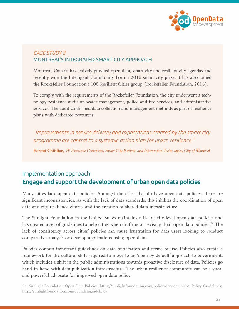
CASE STUDY 3 MONTREAL’S INTEGRATED SMART CITY APPROACH
Montreal, Canada has actively pursued open data, smart city and resilient city agendas and recently won the Intelligent Community Forum 2016 smart city prize. It has also joined the Rockefeller Foundation’s 100 Resilient Cities group (Rockefeller Foundation, 2016).
To comply with the requirements of the Rockefeller Foundation, the city underwent a tech-nology resilience audit on water management, police and fire services, and administrative services. The audit confirmed data collection and management methods as part of resilience plans with dedicated resources.
“Improvements in service delivery and expectations created by the smart city programme are central to a systemic action plan for urban resilience.”
Harout Chitilian, VP Executive Committee, Smart City Portfolio and Information Technologies, City of Montreal
Implementation approach Engage and support the development of urban open data policies
Many cities lack open data policies. Amongst the cities that do have open data policies, there are significant inconsistencies. As with the lack of data standards, this inhibits the coordination of open data and city resilience efforts, and the creation of shared data infrastructure.
The Sunlight Foundation in the United States maintains a list of city-level open data policies and has created a set of guidelines to help cities when drafting or revising their open data policies.26 The lack of consistency across cities’ policies can cause frustration for data users looking to conduct comparative analysis or develop applications using open data.
Policies contain important guidelines on data publication and terms of use. Policies also create a framework for the cultural shift required to move to an ‘open by default’ approach to government, which includes a shift in the public administrations towards proactive disclosure of data. Policies go hand-in-hand with data publication infrastructure. The urban resilience community can be a vocal and powerful advocate for improved open data policy.
26. Sunlight Foundation Open Data Policies: https://sunlightfoundation.com/policy/opendatamap/; Policy Guidelines: http://sunlightfoundation.com/opendataguidelines

How can we improve urban resilience with open data?
Implementation approach Commit to best practices in open data portal design
City data portals are evolving. Many now provide residents, public-sector employees, and pri-vate-sector companies with real-time information, time-series indicator data, and interactive maps about all aspects of a city. Single city (e.g. Dublin City Dashboard, NYC OpenData, City of Rome Open Data portal, Buenos Aires Data) or multi-stakeholder portals (e.g. Data Mill North) publish detailed, up-to-date information to help everyday decision-making and support evidence-informed analysis on resilience issues.27
Portals can distribute and make open data discoverable, and provide tools that allow people to make sense of the data and engage on various issues. The data journalism community is particularly im-portant in this regard as it plays a vital role in activating open data, by taking it and transforming it into news stories to help inform public discussion and debate.
“We must always be mindful, however, of political geography and how systems are organised administratively with different authorities, priorities, systems, and technologies, which have a direct impact on data accessibility and quality.”
Rob Kitchin, Professor, Maynooth University
Portals also enable an integrated systems view of a city-region on specific topics. The water, sani-tation and hygiene (WASH) sector portal prototype developed by resilience.io is the “world’s first open-source, integrated human-ecology-economics systems platform that enables resilient disaster risk sensitive planning, policymaking, investment and procurement for city-regions globally.”28 Resilience issue-specific portals and data repositories – like the World Bank Climate Change Portal – are designed as central hubs of information, data and reports on climate change around the world.29 They make it possible to query, map, compare, chart and summarise key climate and climate-related information.
27. Dublin City Dashboard: http://www.dublindashboard.ie/pages/index; NYC Open Data: https://nycopendata.socra-ta.com; City of Rome Open Data Portal: http://dati.comune.roma.it; Buenos Aires data: http://data.buenosaires.gob.ar; Data Mill North: http://datamillnorth.org/platform28. Resilience.io: http://resilience.io29. World Bank Climate Change Portal: http://sdwebx.worldbank.org/climateportal

27
Develop an agile approach to managing resilienceThere are multiple examples of data – on mobility, transit, urban sustainability, for example – for resilience applications. Increased implementation of open data and related data policies within pub-lic administrations indicate that systemic changes are underway.
Systemic change includes data-driven policymaking, predictive analysis and releasing open data to encourage open innovation regarding the performance of city services and infrastructure. These steps support an agile approach to managing a range of urban resilience shocks, such as health cri-ses or environmental disasters. Frameworks like the What Works Cities Standard create a strong foundation for data and evidence to be used effectively within a city.30
Implementation approach Increase the use of open data in crisis situations
For open data to serve urban resilience efforts, we need it to help advance our adaptive and responsive insti-tutional capacity. Necessary institutional capacity takes the form of pre-identified teams with clear mandates to act in response to disasters, and established legal frameworks to act quickly with available resources.
While few cities have this institutional capacity, local governments are leveraging their open data, smart city and digital governance teams to collaborate with local civic tech communities in crisis situations. Coordina-tion efforts between these groups can take various forms, as demonstrated in the following examples.
OPENING DATA FOR CRISIS COORDINATION IN NEW YORK
By making data freely available in a usable format for civic-minded developers and technology plat-forms, the New York’s crisis coordination team exponentially scaled its communications and service delivery to respond to residents’ needs after Hurricane Sandy.31
MAPPING REAL-TIME FLOODING IN JAKARTA
In Jakarta, the smart city team created PetaJakarta.org, a “geosocial intelligence framework” that “harnesses the power of social media to gather, sort and display information about flooding in real time.” The platform, which was supported by the ODI Showcase, uses an open source software called, CogniCity. Data is gathered and distributed by residents for residents using mobile phones to facil-itate real-time mapping of problems related to flooding and other water infrastructure.
30. What Works Cities Standard: http://www.bbhub.io/dotorg/sites/8/2015/04/What-Works-Cities-Standard.pdf31. Hurricane Sandy crisis response: http://blog.okfn.org/2012/11/01/hurricane-sandy-and-open-data

How can we improve urban resilience with open data?
ENABLING TOOLS TO TARGET EARTHQUAKE RESPONSE IN NEW ZEALAND
In February 2011 Christchurch, New Zealand, was struck by a severe earthquake. As documented in Gov-Lab’s impact profile, volunteers and practitioners from response and recovery organizations utilized open data, open source tools, trusted data sharing, and crowdsourcing to create various products and services needed to account for continuously changing circumstances (GovLab and Omidyar Network, 2016).
CASE STUDY 4 MEXICO’S COMMITMENT TO TRANSPARENCY IN EMERGENCY MANAGEMENT FUNDS
In 2014, Mexico made an Open Government Partnership commitment to opening its national emergency funds, Fonden (World Bank, 2012). These funds are used to respond to crises on the ground during all the stages of crisis management.
The focus of this open commitment is to support transparency for both emergency re-sponse and recovery approaches, including rebuilding bridges, roads and housing. Of par-ticular interest in the data publication cycle is the ability to see and track where financial resources are being applied at the rebuilding stage. Publishing open data made it possible to map and track the geographic process of recovery. Citizens were able to assess whether money from the fund was being prioritised for the populations most at risk. Citizens were part of this open data publishing and reporting process by contributing their photos of the rebuilding effort, which were fed into the Open Fonden Platform for anyone to access.32 Everyone was able to follow the money and stay informed of how funds were being applied.
In addition to transparency, the process yielded operational improvements and revisions to how the fund should operate.33 For example, one of the requirements of the initial process was to ensure that whatever infrastructure had to be rebuilt was done so in the same loca-tion, using the same construction methods. This requirement was developed to ensure that the rebuild matched the previous infrastructure. But through the newfound ability to analyse the infrastructure data with the disaster risk areas map, it became evident that some of the infrastructure was located in places where the risk of recurrent damage was likely, given the frequency of natural hazards common to Mexico. This type of infrastructure location reas-sessment and improvement was made possible through the use of open data – data that was initially intended to support transparency on the delivery of the disaster management fund.
32. Open Fonden Platform: fonden.datos.gob.mx33. Survey response, Ania Calderón Mariscal, General Director of Open Data, National Digital Strategy–Office of the President of Mexico.

29
Implementation approach Document and assess impacts of cases studies and celebrate success stories
Creating case studies helps us to learn from each other. Those included in Appendix A are cate-gorised as follows: Housing, Physical Infrastructure, Social Infrastructure, Climate/Environment, Health/Aging Populations, Networks/Community, and Economic Development.
Initiatives such as GovLab’s Impact Map and the ODI Showcase illustrate the value that these resources can provide.34 Beyond keeping track of case studies, it is also beneficial to track impact, so we know what works well and what does not. Capturing failure is just as important to learning as capturing success.
Conferences and showcases also give opportunities to highlight ideas and designs that are working, celebrate success and support momentum for collaboration.
Cultivate business opportunities that address resiliency issuesThere is significant opportunity for the private sector to help address urban resilience challenges. Open data on local resilience issues can serve to invigorate local economic development and job cre-ation, provide government with solutions, and create new products and services. Important issues of economic development and equality must be considered as part of this work to build resilient cities.
Open data supports general economic development by helping entrepreneurs and companies gain a better understanding of local contexts and the factors that may influence their business decisions. The World Bank’s report ‘A world that counts: mobilising the data revolution for sustainable development’ clearly situates open data as a driver of both sustainable development and economic development (World Bank, 2014). With open data tools, both the public and private sectors are able to monitor and track economic development indicators in their communities according to resilient norms and regulations.
Consider the following examples of complementary open data platforms.
� NYC Business Atlas is a tool that enables you to explore business conditions in different neighbor-hoods, including population data, demographic data and business conditions data.35
� BuildingEye in San Francisco is a citizen platform that provides an “easy to use interface for citizens to access building permits, planning applications, code enforcement, capital projects, public events, business licenses and other civic activities”.36
34. GovLab Impact Map: http://odimpact.org; ODI Showcase: http://theodi.org/summer-showcase35. NYC Business Atlas: https://maps.nyc.gov/businessatlas36. BuildingEye, San Fransico: https://buildingeye.com

How can we improve urban resilience with open data?
� The Open Data for Resilience Initiative helps governments to share, collect, and use data col-laboratively with communities (e.g. the Open Cities Project) to address rapidly evolving urban and rural environments using free and open source data-sharing platforms.37
Implementation approach Promote open business environments to support resiliency efforts
Open data helps communicate regulations that strengthen resilience to the private sector, to support compliance with norms and standards. An example of this approach for climate change data is the CDP data portal (formerly the Carbon Disclosure Project), which helps cities gather and understand the data needed to take action on climate change.38 This creates a business environment where the issues to consider when supporting resilient outcomes in the context of climate change are open and accessible. As such, they can be incorporated into new products and services that are developed.
Disclosing environmental data through the CDP portal has a number of other advantages, from improving engagement to centralising data and tracking progress. CDP provides cities with pub-licly available data, benchmarks their performance against peers, and finds areas of opportunity for improvements. Furthermore, opening up resiliency data to frame procurement processes can drive more resilient behaviour by companies competing for government tenders.
In the Greater Amman Municipality in Jordan, the United Nations Development Programme used re-siliency research and analysis to propose changes to governance policy and procedures. It set basic con-struction requirements to mitigate potential risks and prevent shocks to cities caused by flash flooding, earthquakes and other hazards. While the overall objective was to come up with a risk assessment plan for the entire country, it also created an opportunity to strengthen the resiliency of construction programmes.
By openly publishing the results of the comprehensive risk assessment, the private sector and con-tractors in the construction industry could include proposed risk mitigation measures as part of their contract bids. The risk assessment can also build resilient government institutions by training capacity, updating emergency and technical professionals databases, and establishing emergency teams.39
37. Open Data for Resilience Initiative: https://opendri.org/about; Open Cities Project: http://www.opencitiesproject.org38. Carbon Disclosure Project: https://data.cdp.net/browse39. Survey response, Diya Elfadel, Governance and Disaster Risk Reduction Associate, UNDP–Jordan Office.

31
Implementation approach Enable businesses to use open data in addressing resilience issues
Open data is increasingly being used to build new products, services and tools to address a wide range of city resilience issues. Private companies that seek to develop business models with open government data are helping increase the demand for more open data.
“The technology sector is stepping up to respond to the pressing issues identified by the resilience community and the open data community’s calls for increased use of government open data in civic tech.”
Robert Bell, Co-Founder, Intelligent Community Forum
Technology firms increasingly provide solutions to respond to urban resilience issues, as demon-strated in the following examples.
VIZONOMY: PREPARING COMMUNITIES FOR NATURAL HAZARDS
Based in Washington DC, Vizonomy uses data and algorithms to increase urban resilience. Its mission is to “change the way communities prepare for and react to natural hazards using data solutions”40, from protect-ing new housing from rising sea levels to predicting how a floodplain will alter in the future.
MASTADON C: MODELLING TOOLS AND DATA MANAGEMENT FOR URBAN PLANNING
Through the use of open data and real-time sensor data, Mastodon C coordinates with and assists built environment and infrastructure clients to understand and track their assets, and to anticipate any issues that may impact them.41 In partnership with the Greater London Authority, Mastodon C recently developed Witan, a platform to provide modelling tools and data management processes to help tackle urban planning issues.42
40. http://vizonomy.com/about.html41. Mastodon C: http://www.mastodonc.com42. Witan: http://www.mastodonc.com/products/witan

How can we improve urban resilience with open data?
SUN ENERGIA: DISTRIBUTING TARGETED SOLAR PANELS
Using government open data, Sun Energia determines the amount of sunlight and shade that homes receives during any given hour of the year.43 The data supports product users and manufacturers to determine the number of solar panels that a client needs and where exactly to put them, to save energy and money.
In addition to opening up and prioritising data related to urban resilience issues, cities should work to evolve their procurement models to support increased participation from the private sector on pressing resilience issues related to urban planning. This evolution of procurement to a more open model can include require-ments from the private sector to publish and use open data as part of their work (Open Data Institute, 2016b). This builds open data infrastructure through one of the most powerful tools that cities have at their disposal for resilience issue management: purchasing.
In countries where governments have been relatively slow to embrace the open data movement there are incentives to publish data to support business development through public-private partnerships.
“Economic development that serves to increase equality is a key component of resilient cities.”
Jayne Engle, Programme Director and Lead, Cities for People, J.W. McConnell Family Foundation
CASE STUDY 5 SUPPORTING COMMUNITY TOURISM IN JAMAICA USING OPEN DATA
The tourism sector in the Caribbean faces a number of systemic challenges, including the dominance of the sector by large properties. Small operators have an inherent disadvantage due to a lack of financial resources, organisational capabilities and visibility.
The Caribbean Open Institute (COI) conducted an assessment in Jamaica that revealed a high level of demand for government data from established businesses (Caribbean Open Institute, 2016). The business register, demographic data (Census), and economic statistics were the most frequently requested types of government data. Critical barriers to effective private sec-tor use of government data included an inability to find relevant data, lack of disaggregated data, and lack of current data. These challenges are being alleviated with the recent launch of
43. Sun Energia: http://sunenergia.com/en/service

33
the Jamaican Open Data Portal in July 2016.44 More targeted demand-side studies conducted by the COI in key sectors such as agriculture and tourism led to an innovative and scalable partnership model to improve the performance of the Caribbean Community Based Tourism sector – the Interactive Community Mapping project. The model is noteworthy for its scal-able, partnership-based, innovative and empowering step-by-step model, which leveraged citi-zen-generated open geospatial data and promoted knowledge exchange and capacity building.
“An interactive community mapping pilot project conducted in the August Town community in Kingston, Jamaica became a catalyst for active partnering between community residents, community-based organisations, government agencies, businesses and academia to produce local interactive community maps and open geoData that provides a platform for community tourism initiatives and new tourism products and services. These open digital assets enabled the development of a community tour product, supported by an innovative mobile app that demonstrated how tourism activity at the local level can be enhanced through tourist interaction with the community supported by interactive community maps. Active discussions are now underway with various government agencies to replicate this partnership model, enabled by interactive community mapping and open geoData, through other inner-city and rural communities in Jamaica”
Interactive Community Mapping website (2016)45
“Community-based tourism” offers a specific opportunity for a “bottom-up, demand-driven open data initiative”. In this sense, the open data initiate would incorporate participation from local stakeholders in developing and releasing crowdsourced open data and indigenous infor-mation to stimulate “participatory economic development”.
Local business development initiatives help demonstrate the use and reuse of government open data to strengthen partnerships between government agencies, businesses and civil society organisations. A tour-ism sector that thrives strengthens city resilience by providing jobs and opportunities. Framing data acces-sibility in terms of economic growth rather than according to strict accountability and transparency goals can resonate particularly well in situations where democratic institutions are not as free and open.
44. See http://data.gov.jm45. http://caribbeanopeninstitute.org/?q=civicrm/profile/view&reset=1&id=1228&gid=14


35
Realising the full potential of open data: next steps
There is strong willingness within the urban resilience and open data communities to challenge one another and ask questions in a constructive manner, speak openly about experiences and lessons, experiment with new practices, and request support from each other in order to develop a new shared culture of openness.
The urban resilience and open data communities should come together to explore and define the following issues.
� What value do members of the open data and urban resilience communities receive from collaboration? What do they give? Is the exchange clear?
� Is there ample trust and reciprocity? Are some groups more heavily engaged than oth-ers? Who is not participating but ought to be?
� How big does the network and ecosystem need to be?
� How is responsibility shared across the network?
� What kind of infrastructure, both data infrastructure and other, is needed to maintain and strengthen connections?
� How open or closed should the spaces for network connection be?
� How quickly does information about network assets flow through the network?
� What is the network’s ideal form one year from now? Three years? Five years?
� How does the network know if it’s working or not, and how does it make needed adjustments?
� How does the network listen to its participants?
The next five years present an exciting opportunity to take the promise of applying open data in resilience work and collaborate to test, develop and build it into networks and systems. Policymakers and practitioners need to work closely together to jointly develop a shared roadmap. The roadmap’s principles should underpin cities’ individual plans for short-, medium-, and long-term approaches to using open data infrastructure to support urban resilience efforts.

How can we improve urban resilience with open data?
A final note on improved collaboration between communities: while this paper can help establish the usefulness of open data for city resilience, the ultimate decision to prioritise open data as a core initiative is a decision for the urban resilience community to make.
“The danger here is to say: ‘yes, open data can help’. Say we determine that it does help – that it can be net positive – that is nice, but it may be 80th on the list of things that you should do. So it isn’t enough to say this is helpful, we also need to learn where open data sits within the resiliency debate, is it something that should be prioritized and/or what should we be investing above or below it.”
David Eaves, Lecturer, Harvard University
This paper is intended to provide a catalyst for ongoing discussion within communities around the recommendations identified here, as well as others.

37
Suggested next steps: use community events to continue the discussionMembers of both the urban resilience and open data communities should look to continue this discussion in conference agendas, workshops, papers and other pre-existing collaborative spaces. A few of the upcoming opportunities to continue this discussion include the Open Government Part-nership Summit in Paris in December 2016, urban resilience summits and conferences, smart cities forums, and the International Open Data Conference 2018 in Buenos Aires, Argentina. There are hundreds of events around the world where the topic can be raised and pursued.
The message and focus on increased collaboration between the urban resilience and open data com-munities will be best received when shared by champions of each sector. This means identifying and supporting open data champions in the urban resilience sector and urban resilience champions in the open data space. Appendix B of this paper contains the full list of interviewees that we spoke to, which constitutes a good starting list of individuals. These organisational stakeholders can be approached to use existing mechanisms (calls for papers, speakers, etc) to highlight the collaboration opportunity and support ongoing discussion of the topic.
Implementing and managing an ongoing online space for focused discussion about open data in urban resilience efforts can complement in-person discussions and enable discussions to be documented.

How can we improve urban resilience with open data?
Suggested next steps: organise and focus discussion around consistent questionsWe’d like to hear your thoughts on where we should go from here. We are keen to hear ideas for possible workshops, a potential International Open Data Charter sector package for urban resil-ience, mailing lists, working groups, or other focus points.
Some questions below help focus this discussion. We look forward to your comments and feedback. If you create a blogpost to respond to these questions, or any topics from the paper, we, the authors, will amplify it through our channels to keep the discussion going.
Question 1: Does the problem statement’s core research question used in this discussion paper res-onate, is it the right one to use? If not, how can or should it be revised/updated?
“How can open data help build knowledge, capacity and outcomes that strengthen urban resilience?”
For the problem statement, we used the definition of resilience provided by the Rockefeller Foun-dation, which defines urban resiliency as: “The capacity of individuals, communities, institutions, businesses and systems within a city to survive, adapt and grow no matter what kinds of chronic stresses and acute shocks they experience.”
Question 2: How can the communities of practice be convened to keep the conversation going?
Question 3: Which of these recommendations should be prioritised, and why? What challenges would you face in working to implement these recommendations in your City? What could you do to address them?

39
Bibliography
Caputo,S., Caserio, M., Coles, R., Jankovic, L., Gaterell, M (2015). Urban resilience: two diverging inter-pretations, Journal of Urbanism: International Research on Placemaking and Urban Sustainability, 8(3), 222-240. [online] Available at: http://dx.doi.org/10.1080/17549175.2014.990913 [Accessed 8/16/16].
Caribbean Open Institute (2016), ‘Open Data for Business Tool; Jamaica Initial Findings Draft Report’ [online]. Available in pdf at: http://data.gov.jm/sites/default/files/Jamaica_Open_Data_for_Business_Initial_Findings_May_2016.pdf [Accessed 9/11/16].
The Globe and Mail, ‘Solutions: Bridging the gap between doctors and hackers to upgrade health care’, 20 February 2012. Available at the Globe and Mail website: http://www.theglobeandmail.com/life/health-and-fitness/bridging-the-gap-between-doctors-and-hackers-to-upgrade-health-care/arti-cle547503 [Accessed 9/11/16].
GovLab and Omidyar Network, ‘Open Data’s Impact; Open Data’s Uses after Christchurch Earth-quakes’, January 2016 [online]. Available in pdf at: http://odimpact.org/static/files/case-studies-new-zealand.pdf [Accessed 9/11/16].
Mehmood, A (2015). Of resilient places: planning for urban resilience, European Planning Studies, 24(2), 407-419. [online] Available at: http://dx.doi.org/10.1080/09654313.2015.1082980 [Accessed 8/16/16].
Open Data Institute (2015), ‘Improving agriculture and nutrition with open data’, [online]. Avail-able at: https://theodi.org/how-improve-agriculture-food-nutrition-open-data [Accessed 9/11/16].
Open Data Institute (2016), ‘Principles for strengthening our data infrastructure’ [online]. Available at: http://theodi.org/guides/principles-for-strengthening-our-data-infrastructure [Accessed 8/11/16].
Open Data Institute (2016b), ‘Procurement Policy’ [online]. Available at: https://theodi.org/pro-curement [Accessed 9/11/16].
Open Government Partnership Initiative and the Office of the President, Republic of Ghana, ‘Na-tional Action Plan for the Republic of Ghana’, Accra.
Practical Action (2016), ‘People Centred Reconstruction’ [online]. Available at: http://practicalac-tion.org/people-centred-reconstruction [Accessed 9/11/16].
Rockefeller Foundation (2016), ‘City Resilience’ [online]. Avaliable at: http://www.100resilientci-ties.org/resilience [Accessed 8/11/16].

How can we improve urban resilience with open data?
Safecast (2016), ‘Open environmental data for everyone’ [online]. Available at: http://blog.safecast.org [Accessed 9/11/16].
United Nations (2015), ‘World Urbanization Prospects; 2014 Revision’, New York.
World Bank (2010), ‘Cities and Climate Change: An Urgent Agenda’, Washington DC.
World Bank (2012), ‘Fonden, Mexico’s Natural Disaster Fund; A Review’, Washington DC.
World Bank (2014), ‘A World That Counts; Mobilising the Data Revolution for Sustainable Devel-opment’, Washington DC.
World Economic Forum (2014), ‘The Global Information Technology Report 2014; Rewards and Risks of Big Data’, Geneva.

41
AppendicesAPPENDIX A: USE CASES
HousingNational housing collaboratives (Canada): Multi-sectoral collaboration leading to housing policy strategies. Interview with Jayne Engle.
Collaboration with Google Innovation Lab (Los Angeles, USA): Utilising housing RFP/Q to provide housing for homeless populations.
Easy-access real estate information (India): Using open data to optimise real estate market, help people choose a place to live, proximity, build-ing part of governmental assets not known in var-ious cities in India.
Greater Toronto Area Housing Action Lab (Greater Toronto Area, Canada): Collab-orative working group supporting affordable housing to ensure residents of all incomes have the best chance to live in a suitable home and have a choice in their housing.
Canadian Homelessness Data Sharing Ini-tiative (Calgary, Canada): Inter-city sharing of homelessness data to drive smarter policies.
Living Lots NYC by 596acres (New York City, USA): Using open data, Living Lots NYC is a clearinghouse of information that New York-ers can use to find, unlock and protect shared resources. See: list of cities with similar projects.
Open United Nations Habitat (Various Loca-tions): Promoting sustainable urbanisation and ad-
vocacy for adequate shelter for all through sharing data on work towards sustainable towns and cities.
Municipal Urban Planning open dataset (Rio de Janeiro, Brasil): List of licensing units and works supervision of the Municipal Urban Plan-ning department, including construction permits and licences issued.
Physical InfrastructureInteractive WebMAPs (Lethbridge, Cana-da): GIS map provides access to Lethbridge’s most current geographic information (e.g. in-frastructure, ongoing projects, sewer, water data) through maps that you can search, cus-tomis, and/or print.
Betaville (Various Cities): An open-source multiplayer environment for real cities, in which ideas for new works of public art, ar-chitecture, urban design, and development can be shared, discussed, tweaked and brought to maturity in context, and with the kind of broad participation people take for granted in open source software development.
Mapping informal cities (Barranquilla, Co-lombia): Researchers from the University of Mi-ami are mapping informal communities in Co-lombia to better understand risks posed to them by climate change.
DigitalGlobe post-disaster infrastructure mapping (Ecuador): mapping and releasing images of physical infrastructure after earth-quake to support emergency relief efforts.

How can we improve urban resilience with open data?
Real-time monitoring and predictive an-alytics of rail system (London, England): An online dashboard allows for remote mon-itoring of equipment vibration, video cameras, HVAC equipment, temperature, humidity, sys-tem alerts and fault warnings in an effort to streamline day-to-day operations and predict problems.
Dublin City Dashboard (Dublin, Ireland): Providing residents with real-time information, time-series indicator data, and interactive maps about all aspects of the city, enabling users to gain detailed, up to date intelligence about the city that aids everyday decision making and fostering evi-dence-informed analysis.
Digital Matatus (Nairobi, Kenya): This proj-ect captured transit data for Nairobi, designed mobile-routing applications, and designed a new transit map for the city.
District 2030 (Toronto, Canada): A multi-sec-toral, scalable, partnership model to build high performance and sustainable neighbourhoods.
National Statistical MetaData Dictionary (Uganda): The MetaData Dictionary seeks to ensure data collected, compiled and disseminat-ed by different government offices are consis-tent, coherent and can be used with confidence.
Interoperability Solutions for European Public Administrations (European Union): The programme supports the development of digital solutions that enable public adminis-trations, businesses and citizens in Europe to benefit from interoperable cross-border and cross-sector public services.
Civic Accelerator Programme (Guelph, Canada): The Civic Accelerator is a pilot proj-ect that enables the City of Guelph to engage in open innovation with entrepreneurs, startups, students and companies to create solutions for complex municipal problems.
The Kilimani Project (Kilimani, Kenya): A neighbourhood association that engages with county and citizens on topics such as traffic, roads, security.
LocateIT (Kenya): provide highly sophisticat-ed yet simple location-based ICT products and services that positively impact society. Inter-view with Sifa Mawiyoo. See also: article.
@whatisaroad (Nairobi, Kenya): Utilising pothole location information retrieved via Twitter, @whatisaroad generates a map for fol-low-up by city officials.
Hot Spots Analysis System (New Taipei City, Taiwan): Drawing on posts to the city’s Web portals, logs of the emergency response centre, and traffic on social networks, the Hot Spots Analysis system identifies issues raised by citizens that are not being properly addressed.
Missing Maps project (Various Locations): This project maps the most vulnerable places in the developing world in order for international and local NGOs and individuals to better re-spond to crises affecting the areas, and supports the Humanitarian OpenStreetMap Team.
Participatory risk mapping (Philippines): Dutch Company Cordaid released the docu-ment ‘Risk analysis in the Philippines’.
43
Ushahidi: mapping flood management and wider urban planning issues in Semarang (Indonesia).
Fonden – National Emergency Funds (Mex-ico): Opening up the emergency funds through Mexico’s National Action Plan. Interview with Ania Calderon Mariscal.
Data Mill North (Leeds, UK): Open data portal bringing datasets from multiple sectors across the city, helping people use data cre-atively to gain new service solutions and in-crease understanding of how the city works.
Greater Manchester Combined Authori-ty Infrastructure Map (Manchester, UK): Online service providing comprehensive over-view of Greater Manchester’s infrastructure by using open data to pinpoint details includ-ing planned transport works, communications links, streetlight locations, designated nature reserves, amongst others.
Global Facility for Disaster Reduction and Recovery Open Cities Project (Batticaloa, Sri Lanka): The World Bank launched the GFDRR Open Cities Project to create open data ecosystems that will facilitate innova-tive, data-driven urban planning and disaster risk management.
Social InfrastructureCarioca Digital (Rio de Janeiro, Brasil): On-line data portal where online services offered by the city can be accessed, including informa-tion on public schools and medical records.
City of Helsinki Open311 API (Helsinki, Greece): The Open311 API is used for ser-vice requests and reporting issues to the Public Works Department of the City of Helsinki.
Ontario Open211 standard (Ontario, Cana-da): By integrating 2-1-1 directories and oth-er local data, information that is valuable to community planners, policy creators and deci-sion-makers can be easily visualised.
atuServicio.uy (Uruguay): Clearly high-lights performance indicators for all health providers in Uruguay.
Mejora Tu Escuela (Mexico): Combining 230+ independent datasets, Mejora Tu Escuela allows citizens to compare schools.
Dereschos Del Estudiante (Uruguay): This tool allows students, parents and educational actors to consult with current and complete re-cords on student rights information.
Aplicación Elefantes Blancos (Colombia): This application allows citizens to report on construction, maintenance or installation work that has a negative impact on the community.
myColumbus (Columbus, USA): The app puts numerous city services at the fingertips of residents and visitors, highlighting mayoral ini-tiatives that improve the quality of life of the Columbus residents.
PorMiBarrio (Montevideo, Uruguay): Citi-zens can easily report problems and damages to city officials.

How can we improve urban resilience with open data?
Youpin.city (Bangkok, Thailand): A map of street problems in generated through us-er-friendly crowdsourcing.
Answers Project (Various Cities): First im-plemented in Honolulu, the Answers Project allows residents to search for answers for ques-tions they have about city services.
Arlington County Yellow button (Arling-ton County, USA): The Yellow Button app is a community reporting and information sharing tool for people living and working in Arlington County.
Policewatch.com (Nigeria): This online plat-form provides citizens of Nigeria with infor-mation on police activity to help them get the best out of the police in their neighborhoods and live a more secure life.
Tracka.ng (Nigeria): Tracka is a network of active citizens, and enables people to collabo-rate and track capital projects in their commu-nity and give feedback to government and their communities.
Climate/EnvironmentRespira (Buenos Aires, Argentina; Mon-tevideo, Uruguay; Mexico City, Mexico): Website publishing current air quality condi-tions in relation to World Health Organisation standards.
Open data for Hurricane Patricia manage-ment (Mexico): In preparation for Hurricane Patricia, critical information including loca-
tions of healthcare facilities, demographics, and road infrastructure were published to an online portal to guide response efforts.
Climate KIC Climathon (Various Loca-tions): European network Climate KIC hosts an annual climate change hackathon for creat-ing innovative ways to increase city resiliency to climate change.
Prepdata (Global): The Partnership for Resil-ience and Preparedness (PREP) is a public-pri-vate collaboration to empower a data-driven approach to building climate resilience. It seeks to reduce the barriers to accessing, contribut-ing and using data for climate resilience.
¿Qué Pasa Riachuelo (Argentina): By inte-grating reports from local stakeholders with public information, the ‘Social Monitoring Matanza-Riachuelo Basin’ project generates an interactive map showing sources of impact on the Matanza-Riachuelo watershed.
Adopt-a-river Initiative (Kenya): Schools and community groups undertake regular mon-itoring of rivers using benthic invertebrates and upload their findings into a map platform called MiniSASS, which provides immediate evaluation of the river’s health.
Resilience.io (Gloabl Initiative): The world’s first open-source, integrated human-ecolo-gy-economics systems platform that enables resilient disaster risk sensitive planning, pol-icymaking, investment and procurement for city-regions globally. See also: role of data in sustainable development goals, the ecological sequestration trust.

45
Project NOAH (Philippines): NOAH provides high-resolution flood maps that are necessary for localised emergency response, identification of evacuation and access routes, road closures during disaster events, siting of key rescue facili-ties and comprehensive land use planning.
CleanSpace (London, UK): A personal pollu-tion monitor records local air pollution levels and pools this data to create a high-resolution, dy-namic map of pollution hotspots and areas where the air is cleaner.
Ciudades Resilientes (Ecuador): This Hack-aton asks participants to develop innovative means to improve natural disaster management.
Climate Change Knowledge Portal (Various Locations): Operated by the World Bank, the CCKP is designed as a central hub of infor-mation, data and reports about climate change. Possible to query, map, compare, chart and summarise key climate and climate-related in-formation.
Open data and Stormwater Infrastructure (Raleigh, USA): Stormwater infrastructure/stormwater utility is a focus of Raleigh’s open data effort.
CDP Open Data Portal (London, UK): CDP holds the largest and most comprehensive col-lection of primary corporate climate change, wa-ter and forest-risk information driving sustain-able economies.
Earthquake Emergency Response (Christ-church, New Zealand): recovery agencies used open data, open source tools, trusted data
sharing and crowdsourcing to develop a range of products and services required to respond successfully to emerging conditions.
Kathmandu Living Labs (Kathmandu, Ne-pal): KLL is a civic-tech group that strives to co-create digital tools and information infra-structure so that government, nonprofits and businesses can provide citizens the best ser-vices.
Ushahidi Open Street Map (Semarang, In-donesia): Citizen-assisted city mapping to pinpoint flood-prone areas and unused public spaces.
Disaster Management in Jordan (Amman, Jordan): This project supports building na-tional capacities for earthquake risk reduction.
ecoHack (Montreal, Canada): ecoHack is a sustainable urban development hacking com-munity that leverages technology and data to strategically engage with urban environmental impacts.
Predictive analysis of rising sea levels (Van-couver, Canada): A toolkit developed by BTA-works explores the effects and costs of rising sea levels on housing in Vancouver.
Global Biodiversity Information Facility (Various Locations): (GBIF) is an interna-tional open data infrastructure, funded by gov-ernments.It allows anyone, anywhere to access data about all types of life on earth, shared across national boundaries via the Internet.

How can we improve urban resilience with open data?
Climate Change Adaptation and ICT Project (Uganda): Application that provides 120,000 farmers with weather forecasts, agricultural advisories, and market information via mobile phones and interactive radio.
Caribbean Open Data Scoping Study (Various Locations): Open data on fisheries and marine protected areas is compiled from five Caribbean nations to inform policy, legislative and manage-rial decisions.
Adopt-a-river programme (Kenya): The initiative is a national ‘people-driven’ wetlands monitoring and restoration project where groups are expected to adopt a nearby river, monitor water pollution levels at designated points and undertake its restoration and con-servation.
HydroBid (Latin America and Caribbean countries): This system simulates hydrology and water resources management under sce-narios of change (e.g. climate, land use, pop-ulation) which allows for the design of strate-gies and adaptive projects in response to these changes.
Global Metropolitan Index on Air Quality (Global Initiative): Air quality data from each countries’ respective Environmental Agencies is compiled on one map to show real-time air pollution levels.
MiniSASS (Various Locations): This simple online program allows anyone to collect and input data to determine the health of their rivers and streams.
Health/Aging populationsCare Circles (Eindhoven, Netherlands): Homecare workers are dispatched through a centralised call centre, which matches patients with the care-takers closest to them.
MyAidin (Various Locations): MyAidin is a referral marketplace where post-acute provid-ers compete for patients based quality and sat-isfaction feedback provided by patients.
Ebola Fund Watch (West Africa): In an ef-fort to increase accountability in disaster relief funding, follows up with aid donors and recip-ients to transparently follow funds regarding the deadly Ebola Virus Disease.
Impact of ‘Flushgate’ on St. Lawrence River (Montreal, Canada): Example of how open data was utilised to address concerns over the sewage dump into the St-Lawrence River.
Purple Binder (Chicago, USA): This software matches people with the necessary community services with consideration to social determi-nants of health.
Hacking Health (Various Locations): Hack-ing Health connects healthcare. providers with designers, developers, innovators and entre-preneurs to create innovative solutions for healthcare problems.
Peg (Winnepeg, Canada): A variety of data is aggregated annually to evaluate community
health and guide policymakers.

47
Networks/CommunityOpen Data Party (Nigeria): OpenDataPar-ty is an initiative of Connected Development to make and spread open data. People from all around Nigeria will gather together in per-son to make things with and around open data while in a party mode.
CODE Open Data Impact Map (Various Lo-cations): The Open Data Impact Map and its accompanying report are a public database of open data use cases from around the world, and makes it possible to filter, compare, analyse, and study the wide range of use cases for open data.
Kathmandu Living Labs (Katmandu, Nepal): KLL is a civic-tech group that strives to co-cre-ate digital tools and information infrastructure so that government, nonprofits and businesses can provide citizens the best services.
What Works Cities (Various Cities, USA): A network of cities that is designed to acceler-ate cities’ use of data and evidence to improve people’s lives.
Crime Tracking (Montreal, Canada): Po-lice open data is used by citizens to see crime trends of importance to them.
Premium Times Center for Investigative Journalism (Nigeria): The PTCIJ has numer-ous initiatives with the goal of advancing good governance and promoting public participation through journalism, open data, civic technology and media training.
46. See http://blogs.iadb.org/abierto-al-publico/2016/08/04/how-open-data-can-improve-tourism-in-the-caribbean
Economic developmentBudeshi (Nigeria): The Budeshi website links budget and procurement data to various public services, and allows the public to interact with the data and make their own comparisons.
Public Procurement by PPDC (Nigeria): PPDC uses open contracting data standard to engage the public in procurement process in Nigeria.
NYC Business Atlas (New York City, USA): The NYC Business Atlas compiles population, demographic, and business data to unveil eco-nomic trends across the city.
BuildingEye (San Francisco, USA): City data is compiled in an easy to visualise map that allows citizens to interact with data.
Solar panels map (Finland): Open data is used to determine which roofs are best suited for solar panels.
Vizonomy Climate Risk Platform (USA): Vizonomy provides over seventy layers of gov-ernment data that can create dynamic hazard risk assessment for communities.
Open data and the Caribbean gateway: to-wards improved governance and decision-mak-ing of the Caribbean’s protected areas.
Open data for the business sector in the Ca-ribbean.
Open data and Caribbean tourism: see also IADB’s blog post.46


49
Anderica Caffarena, Victoria Head of Transparency Project of the City of Madrid, Madrid City Hall
Ariss, Audrey Director of Research and Design, Centre for Open Data Enterprise (CODE)
Bennett, Francine Director, Mastodon C
Bell, Robert Co-Founder, Intelligent Community Forum
Calderón Mariscal, Ania General Director of Open Data, National Digital Strategy, Office of the President of Mexico
Calvacanti, Gustavo Deputy Secretary of International affairs of the City Hall, Sao Paulo Town Hall
Carranza, Daniel Co-founder, DATA Uruguay
Chitilian, Harout VP Executive Committee, Smart City Portfolio, City of Montreal
Donkor, Wisdom Technical Lead for Ghana Open Data Initiative, National Information Technology Agency
Eaves, David Lecturer, Harvard University
Elfadel, Diya Governance and Disaster Risk Reduction Associate, UNDP (Jordan Office)
Engle, Jayne Programme Director and Lead, Cities for People, J.W. McConnell Family Foundation
Gevers, Richard Director, Open Data Durban, South Africa
Harvey, Mark Founder/CEO, Resurgence
Janvier ,Gaelle Project Manager in Urban Agriculture, Alternatives and EcoHack
Kitchin, Rob Professor, Maynooth University
Lahti, Tanja Project Manager, City of Helsinki, Urban Facts department
Larrick, Stephen Open Data Project Lead, Sunlight Foundation
Lauriault, Tracey Carleton University, Critical Media and Big Data Communication and Media Studies
Lisowska, Beata Data Scientist, Joined Up Data Standards project (jointly run by Publish What you Fund and Development Initiatives)
Manley, Laura Co-Founder and Director of Programme, Centre for Open Data Enterprise (CODE)
Mawiyoo, Sifa Open Data Geospatial Technologist, ICT Authority, Kenya
APPENDIX B: LIST OF INTERVIEWEES (In alphabetical order)

How can we improve urban resilience with open data?
McNaughton, Maurice The University of the West Indies, at Mona, Jamaica
Moneo Lain, Antonio Learning and Management Senior Associate, Inter-American Development Bank
Morgan, Derek Director, Urban Earth
Niemi-Hugaerts, Hanna Development Manager, Forum Virium Helsinki, Finland
Olufemi, Joshua Programme Manager, Premium Times Centre for Investigative Journalism, Nigeria
Perini, Fernando Programme Officer, International Development Research Centre (IDRC)
Prada, Juan Asesor Depto. Desarrollo Sostenible e Inteligente, Intendencia de Montevideo
Rea, Hugo Coordinador del proyecto de Resilicia Urbana, Intendencia de Montevideo
Saavedra, Ricardo Founder and CEO, Vizonomy
Scrollini, Fabrizio Lead Researcher, Latin American Open Data Initiative
Smith, Amanda Manager, Urban Infrastructure Programme, Canadian Urban Institute
Swinney, Paul Principal Economist, Center for Cities
Tuer, Kevin Managing Director, Canada’s Open Data Exchange (ODX)
Vaidhayakarn, Klaikong Director, Social Technology Institute, Thailand
Young, Andrew Associate Director of Research, The Governance Lab

51
APPENDIX C: METHODOLOGY
In order to select and approach cities for the report, we compared different city resilience indices to identify people from within or outside government who would be able to speak about current resilience or open data initiatives in their city.
Once we approached the interviewees, we shared the problem statement and sought confirmation of their interest in participating in the study. We then shared the online questionnaire with them, which we asked to be completed in advance of a telephone interview. Overall, 36 interviewees participated in the interviews or completed the questionnaires.
The paper is more heavily informed by the open data community than the resilience community, in terms of number of sources, but we have worked to centre and work outward from core themes central to discussions of urban resilience.
412.1%
1
721.7%
2
618.2%
3
39.1%
4
824.2%
5
13%
6
13%
7
26.1%
8
0
9
13%
10
On a spectrum of open data and city resilience expertise, where would you position yourself in terms of your own skills and knowledge (33 responses)
Asked to position themselves on a scale of 1–10, 1 being an open data expert and 10 being a city resilience expert, we can see a clear tilt towards open data expertise.
How can we improve urban resilience with open data?
Problem statementFor the problem statement, we used the definition of resilience provided by the Rockefeller Founda-tion, which defines urban resiliency as:
“The capacity of individuals, communities, institutions, businesses, and systems within a city to sur-vive, adapt, and grow no matter what kinds of chronic stresses and acute shocks they experience.”
We chose this particular definition because it focuses on several issues simultaneously, including housing, physical and social infrastructure, aging populations and climate change.
We heard several things from the interviewees in terms of feedback with regards to the problem statement, in which the core research question reads: how can open data help build knowledge, capacity, and outcomes that strengthen urban resilience?
Firstly, many felt that the problem statement resonated with them and accurately captured several themes relevant to this broad topic. Some participants, however, felt the statement was too con-straining, while others felt it was not precise enough (more on that in the following section). That being said, it is important to view the problem statement and this discussion paper as part of a larger and ongoing engagement process.
It is also noteworthy that certain topics kept coming up in response to our research question, but they fell outside the scope of this report. For example, several participants from the low-income countries mentioned agriculture as a pressing subject. As one of the main job creating sectors in these countries, it is important to develop this industry in a way that prevents rural communities from migrating to urban centres.
Another frequently raised topic was the ethics of open data, and the importance of biases (gender, socioeconomic demographic group, etc) in the collection of data and its impact on the development and administration of services.
Lastly, the topic of inequality was discussed several times. It is becoming clear that the level of inequality in a society is inherently tied to the success of a city. One respondent suggested that mea-sures of equality rather than resiliency may be better indicators for improving social and econom-ic outcomes. Generally, the communities most negatively affected by economic or environmental shocks are low-income households and those with low social mobility. Further, these are often issues that can be addressed at the city level.
This brings us to three additional topics that were not covered in the definition, but that we felt compelled to capture in this paper: economic growth, disaster management and response, and urban planning.

53
The initial problem statement did not include sufficient emphasis on economic growth and job creation, two issues that are equally relevant in low- and high-income countries. A city is not going to be very resilient if it does not have a growing economy providing its citizens with good quality employment. The subject of disaster management is another critical topic. Although represented in many ways within the climate change lens, it does not necessarily highlight, for example, the issue of air pollution, a communi-ty’s vulnerability to natural resource overuse, food security risks, nor the issue of financial resilience for private property/assets and critical public infrastructure through risk transfer/underwriting.
Lastly, the importance of open data for urban planning was a topic that came forth repeatedly. The experts interviewed view open data as valuable not only for citizens, but for the very institutions and companies that have to execute city projects. Bogged down by various levels of bureaucracy and access to information requests from multiple agencies, these institutions can use open data internally in order to design better programmes and policies that are informed by evidence and resilience objectives.


HOW CAN WE IMPROVE URBAN RESILIENCE WITH OPEN DATA?