Hornsea Project Four: Preliminary Environmental ...
29
Prepared AOC Archaeology, June, 2019 Checked Royal HaskoningDHV, June, 2019 Accepted Tom Watts, Ørsted, 25 June 2019 Approved Julian Carolan, Ørsted, 26 June 2019 A6.5.4 Version A Hornsea Project Four: Preliminary Environmental Information Report (PEIR) Volume 6, Annex 5.4: Geoarchaeological Desk-Based Assessment
Transcript of Hornsea Project Four: Preliminary Environmental ...

Prepared AOC Archaeology, June, 2019
Checked Royal HaskoningDHV, June, 2019
Accepted Tom Watts, Ørsted, 25 June 2019
Approved Julian Carolan, Ørsted, 26 June 2019
A6.5.4
Version A
Hornsea Project Four: Preliminary Environmental Information Report (PEIR) Volume 6, Annex 5.4: Geoarchaeological Desk-Based Assessment

Page 1/28 A6.5.4
Version A
Table of Contents
1 Introduction ............................................................................................................................ 4
1.1 Project background ............................................................................................... 4
1.2 Site Description ....................................................................................................... 4
1.2.2 Aims and objectives ............................................................................................... 4
2 Methodology .......................................................................................................................... 5
2.1 Study area ................................................................................................................ 5
3 Desktop Review ..................................................................................................................... 6
3.1 Geology .................................................................................................................... 6
3.1.2 Geological Overview of the Study Area .......................................................... 6
3.1.3 Geology of Section 1 - Fraisthorpe to North Pasture Farm ......................... 7
3.1.4 Geology of Section 2 - North pasture Farm to Rotsea ................................ 8
3.1.5 Geology of Section 3 - Rotsea to Scorborough ............................................ 8
3.1.6 Geology of Section 4 - Scorborough to Killingwoldgraves ......................... 9
3.1.7 Geology of Section 5 - Killingwoldgraves to Cottingham .......................... 9
3.2 Soils ............................................................................................................................ 9
3.3 Review of Borehole Records ............................................................................. 11
3.3.1 Introduction ........................................................................................................... 11
3.3.2 Section 1: Fraisthorpe to North Pasture Farm .............................................. 11
3.3.3 Section 2: North pasture Farm to Rotsea ...................................................... 12
3.3.4 Section 3: Rotsea to Scorborough ................................................................... 13
3.3.5 Section 4: Scorborough to Killingwold graves ............................................. 14
3.3.6 Section 5: Killingwoldgraves to Cottingham ................................................ 14
3.4 Palaeoenvironmental overview ....................................................................... 21
4 Discussion and Conclusion ................................................................................................ 24
5 References ............................................................................................................................ 26

Page 2/28 A6.5.4
Version A
List of Tables Table 1: Summary of geoarchaeological and palaeoenvironmental potential. ..................................... 24
List of Figures Figure 1: Location Plan (Not to Scale). ................................................................................................................ 15 Figure 2: Section 1 Fraisthorpe to North Pasture Farm (Not to Scale). ....................................................... 16 Figure 3: Section 2 North Pasture Farm to Rotsea (Not to Scale). ............................................................... 17 Figure 4: Section 3 Rotsea to Scorborough (Not to Scale). ............................................................................ 18 Figure 5: Section 4 Scorborough to Killingwoldgraves (Not to Scale). ....................................................... 19 Figure 6: Section 5 Killingwoldgraves to Cottingham (Not to Scale). ......................................................... 20
Glossary
Term Definition
Effect Term used to express the consequence of an impact. The significance of an
effect is determined by correlating the magnitude of the impact with the
importance, or sensitivity, of the receptor or resource in accordance with
defined significance criteria.
Environmental Impact
Assessment (EIA)
A statutory process by which certain planned projects must be assessed
before a formal decision to proceed can be made. It involves the collection
and consideration of environmental information, which fulfils the assessment
requirements of the EIA Directive and EIA Regulations, including the
publication of an Environmental Statement.
EIA Regulations The Infrastructure Planning (Environmental Impact Assessment) Regulations
2017
Export cable corridor (ECC) The specific corridor of seabed (seaward of Mean High Water Springs (MHWS))
and land (landward of MHWS) from the Hornsea Project Four array area to the
Creyke Beck National Grid substation, within which the export cables will be
located.
Hornsea Four The proposed Hornsea Four offshore wind farm project; the term covers all
elements within the Development Consent Order (i.e. both the offshore and
onshore components).
National Grid Electricity
Transmission (NGET)
substation
The grid connection location for Hornsea Four at Creyke Beck.
Onshore substation / OnSS Located as close as practical to the NGET substation at Creyke Beck and will
include all necessary electrical plant to meet the requirements of the
National Grid.
Ørsted Hornsea Project Four
Ltd.
The proposed Ørsted Hornsea Project Four Ltd. offshore wind farm project;
the term covers all elements within the Development Consent Order (i.e. both
the offshore and onshore components). Hereafter referred to as Hornsea Four.

Page 3/28 A6.5.4
Version A
Acronyms
Acronym Definition
AOD Above Ordnance Datum
BC Before Christ (used to indicate that a date is before the Christian era).
BGL Below Ground Level
BGS British Geological Survey
BP Before Present
DMV Deserted Medieval Village
DTM Digital Terrain Model
ESRI Environmental Systems Research Institute
GI Ground Investigation
GPS Global Positioning System
HER Historic Environment Record
KA Thousand years ago
LGM Last Glacial Maximum
MYA Million Years Ago
NGR National Grid Reference
NHLE National Heritage List for England
NMP National Mapping Programme
OD Ordnance Datum
OS Ordnance Survey
SOBI Single Onshore Boreholes Index
SSEAW Soil Survey of England And Wales
Units
Unit Definition
GW Gigawatt (power)
ka Thousand years
kV Kilovolt (electrical potential)
kW Kilowatt (power)

Page 4/28 A6.5.4
Version A
1 Introduction
1.1 Project background
1.1.1.1 Ørsted Hornsea Project Four Limited (hereafter the ‘Applicant’) is proposing to develop
Hornsea Project Four Wind Farm (hereafter Hornsea Four). Hornsea Four will be located
approximately 65 km offshore the East Riding of Yorkshire in the Southern North Sea and
will be the fourth project to be developed in the former Hornsea Zone. Hornsea Four will
include both offshore and onshore infrastructure including an offshore generating station
(wind farm), export cables to landfall and on to an onshore substation with electrical
balancing infrastructure, and connection to the electricity transmission network. The
location of Hornsea Four is illustrated on Figure 1. The Preliminary Environmental
Information Report (PEIR) boundary combines the search areas for the onshore and offshore
infrastructure.
1.1.1.2 AOC Archaeology Group was commissioned to undertake a Geoarchaeological Desk-Based
Assessment for Hornsea Four, comprising the landfall, onshore Export Cable Corridor (ECC),
onshore Substation (OnSS) and 400 kV ECC.
1.2 Site Description
1.2.1.1 The onshore works consist of a refined landfall location at Fraisthorpe Sands (south of
Bridlington), a 40 km long, 80 m wide onshore ECC easement with eight logistics compounds,
heading south-westwards and crossing the River Hull before curving southwards to the west
of Beverley and terminating at the OnSS, 4 km south of Beverley and 10 km north-west of
Hull (Figure 1). The onshore ECC route passes through 15 parishes within East Riding
(Barmston, Ulrome, Beeford, Foston, Hutton Cranswick, Watton, Beswick, Lockington,
Leconfield, Cherry Burton, Molescroft, Bishop Burton, Walkington, Rowley and Skidby). The
vast majority of current land-use around Hornsea Four is arable farmland and the landscape
contains numerous small villages, with larger urban centres located to the north (Bridlington)
and east (Beverley).
1.2.2 Aims and objectives
1.2.2.1 The aims of this study are to:
• further understand geological changes across the proposed Hornsea Four onshore
footprint;
• better understand the varying depths of deposits likely to be present;
• establish a better understanding of the archaeological and geoarchaeological
landscape; and
• highlight areas of potential geoarchaeological interest which will inform the
assessment presented in Volume 3, Chapter 5: Historic Environment.
Page 5/28 A6.5.4
Version A
1.2.2.2 The aims of this report are to:
• review available existing/historic geotechnical and geoarchaeological sources of
information to establish the geoarchaeological and palaeoenvironmental potential;
and
• prepare a fully illustrated report on the results of the geoarchaeological desk-based
review that is compliant with all relevant policy, guidance and good practice and
which is proportionate to the results, making recommendations for suitable (justified
and proportionate) further work, if required.
2 Methodology
2.1 Study area
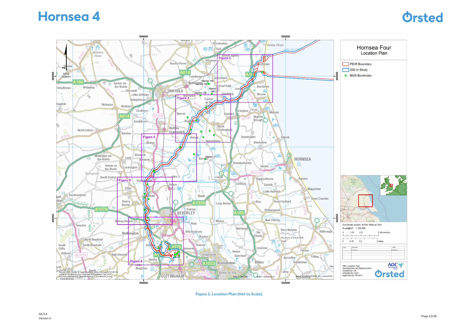
2.1.1.1 For ease of discussion and for the purposes of this background geoarchaeological and
palaeoenvironmental review, Hornsea Four has been divided into five sections (Figure 1),
comprising:
• Section 1: Landfall and the northern element of the onshore ECC (Fraisthorpe to
North Pasture Farm, Figure 2);
• Section 2: Onshore ECC from North pasture Farm to Rotsea (Figure 3);
• Section 3: Onshore ECC from Rotsea to Scorborough (Figure 4);
• Section 4: Onshore ECC from Scorborough to Killingwoldgraves (Figure 5); and
• Section 5: Onshore ECC from Killingwoldgraves to Cottingham, OnSS (permanent and
temporary works areas) and 400Kv ECC (shown in Figure 6).
2.1.1.2 The following data sources were consulted during preparation of this desk-based
assessment:
• British Geological Survey (BGS) Single Onshore Boreholes Index (SOBI); for records of
boreholes, shafts and wells from all forms of drilling and site investigation work within
the 200 m study area;
• Ordnance Survey (OS); for OS Terrain® 50 Mapping for contour and spot height data
for the study area;
• Environment Agency; for LIDAR Composite Digital Terrain Model (DTM) at 2 m spatial
resolution;
• Soil Survey of England and Wales; for soil mapping of the study area;
• Environmental Systems Research Institute (ESRI) Digital Globe, GeoEye, Earthstar
Geographics; for satellite imagery showing the study area;
• Britain from Above; for online aerial photographs showing the study area;
• The Humber Wetlands Project; for records relating to investigations within the study
area; and
• Publications and grey literature reports concerning previous archaeological and
palaeoenvironmental investigations within the 10 km study area as listed in the
References in Section 5.

Page 6/28 A6.5.4
Version A
2.1.1.3 An initial review of SOBI records within a 100 m buffer of the Hornsea Four boundary (within
which it is considered deposits would reflect those likely to be found within the landfall,
onshore ECC, OnSS and 400 kV ECC) revealed insufficient records to characterise deposits
and as such a wider 200 m study area around the Hornsea Four boundary was selected.
Many of the borehole records used in this study have only a very brief description of the
lithologies. For example, a unit described as “Clay” could be alluvium, tidal flat deposits,
head, till or glaciolacustrine. In interpreting this, judgement has been used, based on the
likely stratigraphy at that location and depth.
2.1.1.4 Palaeoenvironment records and literature have been reviewed for relevant sites surrounding
each section within a 10 km study area either side of the Hornsea Four boundary.
Paleoenvironmental studies frequently focus on palynological data which includes pollen
from a wide ‘pollen catchment’ frequently extending several kilometres from the site of
study and contributing to regional pollen diagrams. Therefore, it was considered relevant to
include known palaeoenvironmental studies within 10 km and occasionally, such as in the
case of Star Carr and Roos Bog, to consider sites beyond this where useful regional pollen
diagrams have been established.
3 Desktop Review
3.1 Geology
3.1.1.1 The 200 m study area is located within the Hull Valley and Holderness on low lying terrain
at elevations of less than 20 m above Ordnance Datum (AOD) along its length. The 200 m
study area is underlain by solid geological deposits of chalk belonging to the White Chalk
Subgroup. The BGS geology maps show the bedrock within the Hornsea Four boundary to
comprise the following formations (from oldest to youngest bedrock age):
• Burnham Chalk Formation (Section 1 and Section 2);
• Flamborough Chalk Formation (Sections 3-5); and
• Rowe Chalk Formation (Sections 2-5).
3.1.2 Geological Overview of the Study Area
3.1.2.1 The BGS geology maps show that various superficial deposits underlie the 200 m study area.
These deposits include (from oldest to youngest deposit age):
• Basement Till (diamicton);
• Skipsea Till (diamicton);
• Glacifluvial Sand and Gravel Deposits;
• River Terrace Sand and Gravel Deposits; and
• Alluvial Clay Silt and Sand Deposits.
3.1.2.2 The oldest glacial deposit underlying the 200 m study area is the Basement Till, which is
dated to the Wolstonian (Catt, 2007). This is overlain by the Skipsea till which is of Devensian
age. Radiocarbon dates of 18,500 ± 400 14 calendar years (C yrs.) Before Present (BP) and

Page 7/28 A6.5.4
Version A
18,240 ± 250 14C yrs. BP obtained by Penny et al. (1969) on plant remains between the
Basement and Skipsea Tills provide a maximum age for the onset of the Dimlington Stadial
in the region (Rose, 1985). An additional date for the onset of the Stadial of 17,500 ± 1,600C
yrs. BP was obtained by thermoluminescence techniques from beneath the Skipsea Till on
the Wolds dip slope (Wintle and Catt, 1985).
3.1.2.3 The western limit of the Basement till lies within Section 3 of the 200 m study area along
the OS 510000 m line, although some outcrops extend towards the OS 505000 m line
around Leconfield and Cottingham in Sections 4 and 5 respectively. The overlying Skipsea
till largely mirrors this distribution and demarcates the former limit of the Dimlington Stadial
(22,000 to 13,000 year ago) North Sea glacier lobe (Bateman et al., 2015).
3.1.2.4 An extensive buried cliff in the chalk bedrock runs roughly from north to south in Sections 3
and 4 of the 200 m study area. The onshore ECC crosses the cliff north of Leconfield in the
vicinity of Scorborough. This palaeocliff formed during the Ipswichian (128,000 to 117,000
years ago), an interglacial period prior to the Devensian glaciation, and provides evidence
that the pre-Devensian landscape was a marine erosion surface or ‘wave-cut platform’ in the
chalk, which represents the shoreline during a period when the inferred relative sea level was
approximately 2 m above present Ordnance Datum (OD) (Catt, 2007).
3.1.2.5 The diamicton glacial till is the main deposit from the last (Devensian) cold stage and
underlies the majority of 200 m study area. Till is deposited by glacial ice, either at the
glacier base or derived from material within and on the ice. It comprises gravelly sandy silty
clay with boulders and contains numerous lenses of sand and gravel. The till is also likely to
contain interdigitating units of glaciolacustrine clay, plus sand and gravel formed during ice
advance and retreat (Burke et al., 2015, 30).
3.1.2.6 The 200 m study area features upper deposits of clays, silts and peat that formed a fining-
upwards tidal-flat sequence following the deglaciation and sea-level rise during the
Holocene. As the sea rose to its present level, alluvium and the lower-level peat initially
filled the channels. Later, the deposits were spread thinly over the adjacent low ground, with
expanses of peat followed by the silts and clays. Some of the fine-grained sediments include
‘warp’, an artificially deposited silt and clay sequence formed in the last two or three
centuries by controlled flooding to raise the land level and improve the quality of
agricultural land. There is thus potential along the onshore ECC, particularly within Section
2 of the 200m study area in the vicinity of Corpslanding and Rotsea, to encounter deposits
that represent both Quaternary and Holocene environments of the River Hull valley and are
of interest for understanding the evolution and exploitation of the landscape throughout
prehistory.
3.1.3 Geology of Section 1 - Fraisthorpe to North Pasture Farm
3.1.3.1 Section 1 of the 200 m study area from Fraisthorpe to North Pasture Farm is underlain by a
bedrock of Rowe Chalk Formation formed approximately 66 to 84 million years ago (mya)
in the Cretaceous Period, under a shallow warm sea environment. Superficial geological
deposits in Section 1 of the 200 m study area are variable. Storm beach deposits are mapped

Page 8/28 A6.5.4
Version A
by the BGS on the coastline. Further inland, alluvial deposits associated with Earls’ Dyke and
the Barmston Main Drain may be encountered.
3.1.3.2 LIDAR data held by the Environment Agency shows that the onshore ECC crosses a possible
palaeochannel tributary at National Grid Reference (NGR) 514516 458858. A wider
probable palaeochannel is visible in the vicinity of tributaries to the Barmston Main Drain.
The possible channel runs north to south and is crossed by the onshore ECC for a distance of
approximately 420 m from NGR 514686 459009 to 514563 458688 (Figure 2). A further
probable palaeochannel is visible north of Beeford Grange near Lissett Bridge from NGR
513284 456893 to 512270 456550 for a distance of 1.08 km (Figure 2).
3.1.3.3 The remainder of Section 1 of the 200m study area is likely underlain by a range of
till/diamicton deposits of the last glacial maximum (LGM) which in places are overlain by
glacial outwash deposits. The BGS map glacial outwash deposits of sand and gravel where
the onshore ECC crosses Gransmoor Road at Lissett.
3.1.4 Geology of Section 2 - North pasture Farm to Rotsea
3.1.4.1 The chalk bedrock in Section 2 of the 200 m study area rises from +30 m below ground level
(bgl) at Fraisthorpe to c. 20 m bgl where the onshore ECC crosses the Barmston Main Drain
just east of North Pasture Farm and where the underlying bedrock changes to Flamborough
Chalk. The Flamborough Chalk formed 72 to 86 mya in the Cretaceous Period in a local
environment previously dominated by warm chalk seas. Mapped superficial deposits within
Section 2 of the 200 m study area are largely dominated by till relating to the LGM with
areas of mapped alluvial deposits north-west of Brigham where the onshore ECC crosses the
Driffield Canal and the River Hull/Nafferton Drain east of Corpslanding. A deposit model
prepared by the BGS (Burke et al., 2015) shows an extensive area of glaciofluvial sand and
gravel in the vicinity of Gembling and Foston on the Wolds. These deposits are associated
with the till but generally have a lower clay content and correspondingly greater
proportions of sand and gravel.
3.1.4.2 Review of LIDAR data indicates the probable alluvial floodplain from NGR 508709 455348
south of Carr House Farm for a distance of c. 700 m to the junction with B1249 at NGR
508102 454915 with further low lying land notable from NGR 507711 454407 to 507234
454132 for 735 m (Figure 3) where the onshore ECC crosses the Driffield Canal and
Nafferton Drain in an area where preserved paleoenvironmental deposits within former
palaeochannels are known (Lillie and Geary, 2000, 40-41). Any such fluvial deposits have
the potential to record finer grained clays, silts and sands of the Late Quaternary/Holocene
as well as preserved land surfaces.
3.1.5 Geology of Section 3 - Rotsea to Scorborough
3.1.5.1 Section 3 of the 200 m study area is underlain by a solid geology of Flamborough Chalk until
a point just west of Acres Farm where the solid geology changes to the older Burnham Chalk
Formation which formed approximately 84 to 94 million years ago in the Cretaceous Period.
The majority of the section is underlain by superficial diamicton Till deposits with small

Page 9/28 A6.5.4
Version A
patches of glacial sand and gravel mapped by the BGS where the onshore ECC passes
Throstle Nest Farm, Kilnwick Arm Drain and Bryan Mills Farm. An area of alluvium is mapped
between the sands and gravels at Kilnwick Arm Drain and Beswick New Cut and also where
the onshore ECC crosses Bryan Mills Beck.
3.1.6 Geology of Section 4 - Scorborough to Killingwoldgraves
3.1.6.1 Section 4 of the 200 m study area is underlain by solid deposits of Burnham Chalk until it
reaches a point parallel with the settlement of Cherry Burton where the onshore ECC is
underlain again by Flamborough Chalk. Superficial deposits are dominated by diamicton Till
although patches of glacial sand and gravels are mapped by the BGS where the onshore
ECC passes west of Leconfield. The onshore ECC also crosses channel deposits of glacial
sand and gravels and glacial head deposits south-west of Leconfield where the onshore ECC
crosses two offshoots of the Catchwater Drain.
3.1.7 Geology of Section 5 - Killingwoldgraves to Cottingham
3.1.7.1 Section 5 of the 200 m study area is underlain by Flamborough Chalk until west of Bentley
where deposits of Burnham Chalk are mapped before returning again to Flamborough Chalk
at the southern end of the onshore ECC and at the OnSS. Alluvial and head deposits north-
west of Bentley mark a former palaeochannel. The majority of superficial deposits mapped
by the BGS are diamicton Till.
3.2 Soils
3.2.1.1 A review of soil survey data held by the Soil Survey of England and Wales (SSEAW) and
readily available online satellite imagery and aerial photography has been undertaken to
inform a review of soils and land use. The soils in the 200 m study area are mainly influenced
by the geology and superficial till deposits, where glacial clays are inter-bedded with sands
and gravels.
3.2.1.2 The flanks of the chalk Wolds at the south-western extremity of the onshore ECC, including
the OnSS, have well drained loamy soils. In contrast the flat, poorly drained valley areas in
the north-east of the onshore ECC are mainly characterised by gley soils, with some areas
of freely drained brown earths. The varied depositional history means that the character of
the overlying deposits changes across the 200 m study area. The LIDAR data shows changes
in topography hinting at subtle depressions in landscape which appear to mark the route of
various palaeochannels.
3.2.1.3 Soils in the vicinity of Barmston which underlie the Logistics Compounds and Landfall
Connection Works as well as the onshore ECC as far as Lissett are mapped by the SSEAW
(1984) as part of the Wick 1 Association which comprise deep, well drained coarse loamy
brown earth soils usually overlying glaciofluvial and terrace drift. The remainder of the
onshore ECC in Section 1 of the 200 m study area is underlain by fine loamy and moderately
permeable coarse loamy soils of the Holderness series underlain by glacial clay till. Stones
are common in these soils and reflect the glacial origin of the underlying till with igneous

Page 10/28 A6.5.4
Version A
erratics from Scotland and Scandinavia present alongside Carboniferous stones from the
north of England.
3.2.1.4 Soils underlying Section 2 of the 200 m study area are part of the Holderness series with the
exception of where the onshore ECC crosses the Driffield Canal and River Hull where soils
are mapped as part of the Frome association. The Frome association includes alluvial soils
of streams draining the chalk Wolds and comprises grey and mottled silty clay loams
affected by groundwater with calcareous chalky and flinty gravel at relatively shallow
depth. Evidence of periodic or prolonged waterlogging is present in the form of grey and
ocherous mottling. The distribution of Frome soils largely correlates with the distribution of
superficial alluvial deposits mapped by the BGS and discussed in Section 3.1.4.
3.2.1.5 Soils underlying Section 3 of the 200 m study area are largely part of the Downholland 3
association. These are stoneless marine clays with peaty or humose upper horizons which
give rise to humic alluvial gley soils. The soils are severely waterlogged in their natural state
but are permeable and thus very responsive to drainage measures (Jarvis et al., 1984).
3.2.1.6 The northern part of Section 4 of the 200 m study area from Scorborough to Leconfield is
underlain by the aforementioned fine loamy soils of the Holderness Series. Soils south of
Leconfield including those in Section 5 of the 200 m study area are mapped (SSEAW) as part
of the Burlingham 2 association. This association is dominated by stagnogleyic fine loamy
soils with a slowly permeable subsoil, formed in chalky till. Stones of Scandinavian origin are
common within these soils alongside locally derived chalk which increases with depth (Jarvis
et al., 1984).
3.2.1.7 Soils in the 200 m study area are thus frequently mapped as semi-waterlogged. However,
continued drainage within the Hull valley from the medieval period onwards has reduced
the once extensive salt marsh and wetland carr areas (Sheppard, 1976). These drainage
measures combined with rich soils of glacial till and alluvium have meant the modern
landscape is dominated by intensive agriculture, primarily arable cultivation. Post-medieval
narrow ridge and furrow was largely located in the lower lying areas adjacent to the River
Hull, benefiting from the fertile alluvial deposits found on the floodplain. The resulting field
patterns are of note with irregular field boundaries visible on areas that were subject to pre-
parliamentary enclosure largely located on the higher ground. The field systems lying in the
former carrs were some of the last areas of the Hull valley to be enclosed and as such are
notably more regular in plan (Chapman, 2000).
3.2.1.8 Grassland pasture is evident on the poorly drained areas or on poorer clay soils. Field
boundaries on the lower-lying areas are usually ditched for increased drainage, while on the
higher ground hedged boundaries are more common. Woodland is very sparse across the
200 m study area and is present only in small copses or beside water courses. The modern
settlement pattern was broadly established by the medieval period and reflects limited
availability of dry areas prior to the effective drainage schemes of the 18th and 19th
centuries.

Page 11/28 A6.5.4
Version A
3.2.1.9 Shrinkage of former peat land along with smaller scale 20th century drainage measures to
facilitate agriculture have resulted in the canalised River Hull and Barmston Main Drain
having water levels several metres higher than the surrounding land (Van de Noort and Ette,
2000). Water transport was once of vital importance to the lowland areas and the River Hull
played a central part in the transport network. Many of the earliest 'drains' crossed by the
onshore ECC were intended primarily for water transport (Middleton, 2000).
3.2.1.10 Topographically, evidence for settlement and land division within the study area can be
seen ranging from elevations of up to 40 m OD on the Wold edge at Risby down to
approximately 2 m in the Hull Valley itself, although most sites are above 3 m OD. Known
archaeological settlement sites are commonly located on slightly higher ground which
presumably would have ensured that they remained relatively dry, a trend that continued
for settlements into the medieval period and beyond.
3.3 Review of Borehole Records
3.3.1 Introduction
3.3.1.1 Boreholes falling within a 200 m corridor either side of the Hornsea Four boundary and held
within the BGS Single Onshore Boreholes Index have been reviewed. The locations of these
boreholes are shown on Figure 2 to Figure 6. Where relevant, boreholes sunk as part of the
Humber Wetlands Survey (Van de Noort and Ellis, 1995; 2000) have also been reviewed.
3.3.2 Section 1: Fraisthorpe to North Pasture Farm
3.3.2.1 The BGS record only a single borehole (TA16SE29) within the 200 m study area for Section
1 of the onshore ECC south-west of Landfall (Figure 2). This borehole recorded glacial drift
deposits (with no further description) to a depth of 23.8 m bgl overlying chalk bedrock.
3.3.2.2 The Landfall Logistics Compounds are located in an area which crosses the Earl’s Dike and
associated narrow valley floor. The Earl’s Dike valley was investigated as part of the
Humber Wetlands Project. The survey found the valley to be less than 30 m across and
infilled with approximately 2 m of inorganic alluvium which was likely deposited since c.
1260 cal BC, when water courses in the areas would have been aggrading in response to sea
level reaching OD and/or following forest clearance. The peaty topsoil encountered in this
valley indicated that prior to modern land drainage the valley bottom was waterlogged and
thus may retain paleoenvironmental potential. A fieldwalking survey of the flat sandy
ground adjacent to the valley in the vicinity of the proposed Landfall Logistics Compound
revealed concentrations of worked flint material (Head et al., 1995 229-239).
3.3.2.3 Coring undertaken at Barmston Low Ground as part of the Humber Wetlands Project
revealed a complex stratigraphic sequence which documented periods of lacustrine alluvial
deposition following the formation of Barmston Mere followed by wind-blow sand
deposition. Drainage and ploughing have probably destroyed many of the Holocene organic
sediments which would have accumulated at the shallower margins of the mere (Dinnin and
Lillie, 1995). A coring transect was undertaken by Humber Archaeology in 2013 through

Page 12/28 A6.5.4
Version A
Barmston Mere south of the proposed Landfall Connection Works. A plan of the mere drawn
from ground survey during an earlier phase of works was also amended using LIDAR and
aerial photographic images and showed it to extend further north than previously thought
(Brigham and Jobling, 2015). The coring allowed for the creation of a new profile of
Barmston Mere, revealing a sequence of post-glacial lacustrine deposition. The boreholes
passed through a sequence of lacustrine alluvial silts at least 7 m bgl (–2.74 m AOD). A
perched water table was encountered close to the ground level. Several boreholes closest
to both edges of the mere (BH1–2 and BH6–10) reached an indurated gravel surface which
in several instances was impenetrable. The sequence above this included sand and gravel
which in some instances formed discrete layers, in others it formed bands within the lower
alluvium. Previous excavations at Barmston by Varley (1968) and Humber Wetlands Project
(Fletcher & Van de Noort, 2007) had revealed peat deposits and traces of Bronze Age
settlement, but these were not encountered within the 2013 boreholes (Brigham and
Jobling, 2015).
3.3.2.4 Deposits in the north-east of Section 1 within the 200 m study area and in the vicinity of
Barmston have the potential to preserve complex geoarchaeological deposits and
paleoenvironmental remains associated with Earls’ Dike valley and the former Barmston
Mere. As far as is possible from the limited records available, it appears that deposits in the
remainder of Section 1 of the 200 m study area largely comprise glacial till overlying chalk
bedrock as indicated by BGS mapping.
3.3.3 Section 2: North pasture Farm to Rotsea
3.3.3.1 The BGS record three borehole records (TA05NE25, TA05SE40) and TA05SE33) within the
200 m study area for Section 2 (Figure 3). In addition, a borehole transect (Brigham Transect
2: Corpslanding) undertaken as part of the Hull Valley archaeological survey (Van de Noort
and Ellis 2000) also falls within this section of the study area.
3.3.3.2 The northernmost borehole at Foston Beck (TA05NE25) recorded deposits of clay to a depth
of 6.4 m bgl overlying a thin lens of sand 0.6 m thick which in turn overlay clay deposits to
a depth of 16.2 m before chalk bedrock was encountered. The Brigham borehole
(TA05SE40) similarly recorded clay to a depth of 2.9 m overlying a deposit of sand 2 m thick
which in turn overlay clay to 11 m before encountering chalk bedrock.
3.3.3.3 The borehole sunk at Rotsea (TA05SE33) noted soil/made ground to a depth of 2.4 m
overlying a deposit of sand to 5 m depth which in tun overlay boulder clay to a depth of 9.3
m. Gravels were encountered to a depth of 12.9 m bgl at which point the chalk bedrock had
been reached. Review of this borehole alongside deposit modelling by BGS (Burke et al.,
2015) indicates the existence of intra-till glacio-lacustrine deposits in the form of laminated
clay between till units. Glaciolacustrine deposits such as those encountered at Rotsea
represent temporary glacial lakes that form in topographic lows on the till surface. The
laminated clay became incorporated into the till deposits when they were overridden during
a later ice advance (Burke et al 2015, 37).

Page 13/28 A6.5.4
Version A
3.3.3.4 The Brigham Transect 2: Corpslanding comprised eight boreholes excavated in a north-
south direction across the Nafferton Drain and the onshore ECC (Figure 3). The boreholes
reached a maximum depth of 3 m bgl. Boreholes on the southern side of the floodplain
encountered plough soil to 0.35 m depth on to glaciofluvial sands and clays to 0.88 m depth
overlying a weathered chalk horizon to 0.95 m depth. The weathered chalk overlay a
second horizon of glaciofluvial material comprising silt and fine sands with angular chalk
gravels to 1.5 m where a compact till was encountered. Similar deposits, with the
appearance of having been reworked were encountered 50 m to the north with the
sequence being bottomed on to solid gravels at 2.4 m depth. The fluvial deposits were noted
to be more sand dominated as the transect moved northwards. A borehole taken
immediately south of the River Hull encountered a sequence with an upper partially oxidised
clay-silt and fine sand alluvial unit comprising silts with occasional clays and molluscs to
1.72 m depth overlying a natural silt peat horizon with frequent fibrous material, rhizomes
and molluscs to 1.97 m depth overlying fluvial coarse sands and gravels. On the northern
side of the Nafferton Drain the uppermost sediments were found to comprise warp-like silts
and fine sands to 1.3 m depth over oxidised silt-clay alluvium to 1.36 m depth onto a lower
organic alluvial unit. This comprised peaty silts with fine sands and frequent wood (alder and
birch) twigs and fibrous material through to 2.37 m depth on to chalk. A borehole 40 m
further north encountered silt and fine sand to 0.7 m over intercalated alluvium and clayey
floodplain with peats between 0.7 and 1.63 m. The alluvial horizons comprise silt-clays with
fine sands and the clayey peats have poorly preserved plant macrofossil remains in the form
of wood and fibrous material. At 1.63 m depth glaciofluvial deposits in the form of coarse
sands and flint, chalks and quartzite gravels were found to underlie the floodplain deposits.
The depositional sequence encountered in the northernmost boreholes exhibited evidence
for colluviation from the adjacent hillslope which resulted in an overburden of 0.7 m depth
on to alluvium 1.26 m in depth. The lower deposits in this sequence comprise glaciofluvial
sands and gravels to 2.10 m bgl.
3.3.3.5 The Brigham Transect 2: Corpslanding indicates the existence of a palaeochannel feature
south of the Nafferton Drain whereas on the north side of the drain the depositional
sequence reflected low energy sedimentation comprising a silty biogenic rich deposit
overlain with fine grained alluvium and warp like deposits (Lillie and Geary, 2000, 41-43)
3.3.4 Section 3: Rotsea to Scorborough
3.3.4.1 Section 3 of the 200 m study area has four boreholes of note (Figure 4). Boreholes TA05SE7
and TA05SE34 are located adjacent to Throstle Nest Farm and were sunk to 24.69 m bgl
and 26.5 m bgl, respectively. The sequence encountered in both boreholes revealed a sandy
soil to a depth of over 1 m overlying clay deposits to just over 10 m where chalk was
encountered. Borehole TA05SE7 encountered a more complex sequence noting the
presence of laminated clays between 8.74 m and 10.36 m which may be indicative of former
lakeland environments such as those at Gembling (Thomson and Evans, 2001) and
hypothesised at Rotsea (Burke et al., 2015).
3.3.4.2 Boreholes TA04NW24 and TA04NW6 were sunk north of Bryan Mills Farm. Both boreholes
encountered soil to a depth of 0.3 m overlying gravels to 3.9 and 4.3 m, respectively. Clay
Page 14/28 A6.5.4
Version A
overlying chalk at a depth of 11.3 m bgl was encountered within TA04NW24 whereas a
second gravel deposit underlying the clay was encountered at 8 m before the chalk was
encountered at 12.9 m bgl.
3.3.5 Section 4: Scorborough to Killingwold graves
3.3.5.1 Section 4 of the 200 m study area records two previous borehole records within the study
area (Figure 5). However neither borehole (TA04SW48B and TA04SW59) record
stratigraphy in sufficient detail to characterise deposits with both being described as ‘Drift
on Burnham Chalk’.
3.3.5.2 A review of boreholes adjacent to the study area revealed a depth of soils/made ground to
depths of between 0.4 m -1.5 m bgl overlying boulder clay or till to 5 m (TA04SW198 and
TA04SW199) and ‘Drift on Flamborough Chalk (TA04SW47 and TA04SW145). Deposit
Modelling undertaken by the BGS indicates an area of glaciofluvial sands and gravels at
Leconfield. Glaciofluvial sands and gravels are generally indicative of high energy
depositional events possibly associated with cooler conditions during the last ice age.
Information about deposits in Section 4 is relatively scarce and as such little is known about
the potential for this part of the onshore ECC to contribute to the paleoenvironmental
record and wider understanding of the Quaternary Holocene transition in the Hull Valley.
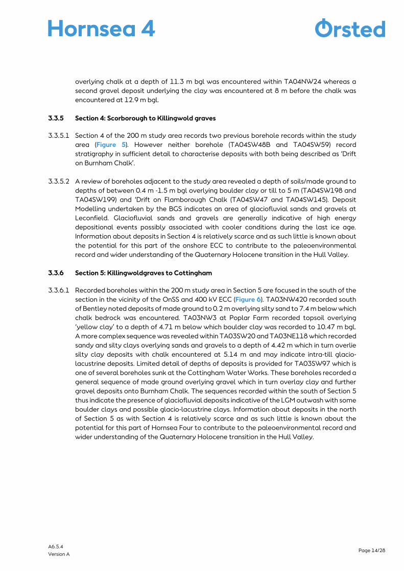
3.3.6 Section 5: Killingwoldgraves to Cottingham
3.3.6.1 Recorded boreholes within the 200 m study area in Section 5 are focused in the south of the
section in the vicinity of the OnSS and 400 kV ECC (Figure 6). TA03NW420 recorded south
of Bentley noted deposits of made ground to 0.2 m overlying silty sand to 7.4 m below which
chalk bedrock was encountered. TA03NW3 at Poplar Farm recorded topsoil overlying
‘yellow clay’ to a depth of 4.71 m below which boulder clay was recorded to 10.47 m bgl.
A more complex sequence was revealed within TA03SW20 and TA03NE118 which recorded
sandy and silty clays overlying sands and gravels to a depth of 4.42 m which in turn overlie
silty clay deposits with chalk encountered at 5.14 m and may indicate intra-till glacio-
lacustrine deposits. Limited detail of depths of deposits is provided for TA03SW97 which is
one of several boreholes sunk at the Cottingham Water Works. These boreholes recorded a
general sequence of made ground overlying gravel which in turn overlay clay and further
gravel deposits onto Burnham Chalk. The sequences recorded within the south of Section 5
thus indicate the presence of glaciofluvial deposits indicative of the LGM outwash with some
boulder clays and possible glacio-lacustrine clays. Information about deposits in the north
of Section 5 as with Section 4 is relatively scarce and as such little is known about the
potential for this part of Hornsea Four to contribute to the paleoenvironmental record and
wider understanding of the Quaternary Holocene transition in the Hull Valley.
Page 15/28 A6.5.4
Version A
Figure 1: Location Plan (Not to Scale).

Page 16/28 A6.5.4
Version A
Figure 2: Section 1 Fraisthorpe to North Pasture Farm (Not to Scale).

Page 17/28 A6.5.4
Version A
Figure 3: Section 2 North Pasture Farm to Rotsea (Not to Scale).

Page 18/28 A6.5.4
Version A
Figure 4: Section 3 Rotsea to Scorborough (Not to Scale).

Page 19/28 A6.5.4
Version A
Figure 5: Section 4 Scorborough to Killingwoldgraves (Not to Scale).

Page 20/28 A6.5.4
Version A
Figure 6: Section 5 Killingwoldgraves to Cottingham (Not to Scale).

Page 21/28 A6.5.4
Version A
3.4 Palaeoenvironmental overview
3.4.1.1 During the latter stages of the last (Devensian) Ice Age, the Hull Valley and Holderness were
covered by an ice lobe (North Sea Lobe) extending down the eastern margins of the North
Sea Basin as far as North Norfolk, depositing extensive till and glaciofluvial sands and
gravels across the region. During the colder Pleistocene periods, global sea levels were
substantially lower than today and the study area occupied part of an important location
on the western margins of ‘Doggerland’ now submerged beneath the southern North Sea
but which formerly linked the Humber to Denmark (Gaffney et al., 2007). Following the final
retreat of the ice sheet (<13 ka BC), there was a rapid incision of the river valleys down to
contemporary sea-level, creating steep sided valleys up to 9 m deep (Van de Noort, 2000)
now largely infilled with Holocene sediment. Large numbers of lakes formed in depressions
left in the till (kettle-holes and pingos), where a significant number contain Late Glacial
deposits of palaeoenvironmental importance. Palaeoenvironmental records within the 10
km study area are discussed below followed by a review of the implications of these records
for an understanding of past environment of Hornsea Four.
3.4.1.2 Skipsea Withow Gap within the 10 km study area, located approximately 2 km south of the
Landfall Connection Works has been the subject of several paleoenvironmental
investigations (Gilbertson 1984a, Flenley 1987). Deposits from within the former mere have
been dated to 10,710±70 BP to c. 4,500 ± BP at the top of the peat sequence. The peat
sequence is overlain by clay silts and sandy silts thought to be of colluvial origin.
Thermophilious plants and molluscs characterised the early part of the pollen record being
replaced by a sedge-grass tundra with strands of birch. By 7,000 BP the landscape was
dominated by alder, elm, oak and lime with the mere becoming increasingly infilled with
sediment enabling fen and fen carr to encroach on the peat surface by 5,000 BP. The
paleoenvironmental record at Gransmoor (Figure 2) to the west of the onshore ECC in
Section 1 provides a record spanning the LGM and Holocene and is comparable to the record
at Skipsea Withow Gap. A juniper phase existed c. 12,400-12,500 BP followed by the arrival
of birch as temperatures warmed (Walker et al., 1993). The Gransmoor sequence expresses
a greater importance of lime-dominated wildland in the mid-Holocene in contrast to other
sites (Beckett, 1975) reflecting both localised variations in conditions as well as wider
regional trends such as the elm decline which was dated to 4,030-3,783 cal BC and thus
comparable to other sites in northern Britain.
3.4.1.3 Peat deposits at Barmston within the 10 km study area south of the onshore ECC in Section
1 (Figure 2) have been preserved beneath c. 1 m of colluvium. The deposits developed in a
small basin and have been dated to 2,960±150 BP and 2,890±150 BP. The pollen diagram
at Barmston is sparser than at other nearby sites but suggests a local fen carr landscape
with human exploitation and deforestation in the Middle Bronze Age and Iron Age (Fletcher
and Van de Noort, 2007). Further work undertaken at Barmston by Humber Archaeology
(Brigham and Jobling, 2015) has revealed birch pollen in cores extracted below 3.1 m bgl;
although the sequence as a whole could not be dated.
3.4.1.4 Research in the River Hull floodplain has identified basal peats within a palaeochannel
sequence at Copper Hall, Skerne (Figure 3) within the 10 km study area approximately 1 km
Page 22/28 A6.5.4
Version A
west of the onshore ECC in Section 2. Analysis of two samples from the base of these
deposits revealed a pollen taxa characteristic of the late glacial and indicative of Holocene
biogenic sedimentation in the channel between 12,000-9,000 BP. South of Copper Hall,
within the Nafferton drainage sequences at Corsplanding (Figure 3), the pollen taxa is
indicative of a later date of the onset of sedimentation between 9,000 and 7,000 BP (Lillie
and Geary, 2000).
3.4.1.5 Palynological investigations at Brandesburton within the east of the 10 km study area in
Section 3 were undertaken following finds of a Maglemosian harpoon (Van de Noort and
Ellis, 1995). The pollen diagram from this site is low resolution and focuses on organic
material within the sequence. It is interpreted as representative of the Late Glacial, Post
Glacial, Atlantic, Sub-boreal and modern periods. During the Late Glacial, birch is the
dominant tree taxa accompanied by abundant herbaceous plants such as grasses and
sedges. The Post Glacial begins with a dominance of birch, giving way to an expansion of
pine and hazel in low frequencies. The Atlantic period is characterised by a sharp rise in alder.
Higher up the sequence is a mixed oak forest taxa followed by pollen types associated with
deforestation and animal husbandry with modern taxa represented in the final 20 cm of the
record (Clark and Godwin, 1957). Although the palynological sequence remains undated,
this study indicates the potential for recovery of palynological sequences within the 10 km
study area and thus indicates the potential for waterlogged deposits within Section 3 to
preserve palaeoenvironmental deposits of interest.
3.4.1.6 Routh Quarry falls within the 10 km study area to the east of the onshore ECC in Section 4.
Extensive gravel and sand deposits underlying the organic sequence at Routh indicate
glacio-fluvial activity at the end of the Devensian glaciation (Geary, 2008). The site at Routh
is therefore thought to represent a kettle hole similar to the site at Gransmoor (Figure 2).
The pollen record indicates vegetation typical of late glacial Interstadial sequences from
this area, with an initial phase of birch-willow scrub with open grassland including herbs
typical of disturbed soils (e.g. Beckett, 1981; Day, 1996). A radiocarbon date of 12,595±80
BP from 2.58 m depth indicates that initial organic sedimentation occurred around the time
of the thermal maximum. Birch percentage at Routh are lower than those recorded at
Gransmoor (Walker et al., 1993) and further north at Star Carr (Day, 1996) but are
considered sufficient to reflect a local presence of birch. This was followed by a subsequent
rise and decline in Juniper followed by an increase in birch characteristic of the late glacial.
The transition to the Holocene is not clearly resolved in the pollen record from Routh but
appears to be defined by an increase in birch and pine. The vegetational sequence continues
throughout the Holocene with a notable elm decline at 3,465±50 BP (Griffiths and Geary,
2017).
3.4.1.7 Palaeoecological studies carried out at Skipsea Withow Mere, (Gilbertson et al., 1984),
Barmston Mere (Dinnin and Lillie, 1995; Brigham and Jobling, 2015) and Brandesburton (Van
de Noort and Ellis., 1995) in Holderness and at Routh Quarry (Geary, 2008) and Gransmoor
Quarry (Walker et al., 1993) in the Hull valley have provided key information about late
glacial environments across the 10 km study area. Studies from Roos Bog Holderness
(Beckett, 1981), Starr Carr in the Vale of Pickering (Day, 1996; Dark, 1998; Taylor et al.,
2018; Taylor and Allison, 2018); Cove Farm Quarry in the Humberhead levels (Bateman et

Page 23/28 A6.5.4
Version A
al., 2001) lie beyond the 10 km study area but do provide important data for the
understanding of past environments of Hornsea Four and in particular in providing dated
continuous sequences which are largely absent from the Hull valley palynological record
(Van de Noort et al., 2000). These pollen records have allowed the development of the post-
glacial environment in the area to be reconstructed as a series of ‘Regional Pollen
Assemblage Zones’ (Beckett, 1981) and tentatively dated (Flenley, 1991; Lillie and Geary,
2000).
3.4.1.8 The earliest late glacial pollen records date from c. 13,000-12,400 BP and indicate an open
landscape with few trees of birch, willow and juniper. Between 12,000 and 11,000 BP an
expansion of birch woodland is evident although discrepancies between the records from
Gransmoor (Walker et al., 1993) and Roos Bog (Beckett, 1981) indicate local climatic
variations. Between 11,000 and 10,200 BP the pollen records form Roos Bog, Gransmoor
and Star Carr all indicate deterioration in climate evidenced by a decrease in tree species
and an increase in open ground conditions with herbs suggestive of unleached and calcium-
rich soils (e.g. Helianthemum), and woody taxa limited to isolated patches of birch or hazel
scrub (Lillie and Geary, 2000).
3.4.1.9 Birch and Scots Pine dominated the area as the tundra-like conditions of the Loch Lomond
Interstadial gave way to the early Holocene, with probably smaller areas of juniper and
willow between 10,200-9,500 BP. As the climate ameliorated further, hazel and elm began
to dominate around 9,500-9,000 BP, with alder also increasing, and ash, lime and oak also
appearing, beginning to shade out hazel and some of the other ’pioneer’ species (Lillie and
Geary, 2000).
3.4.1.10 Large-scale clearance of woodlands on the dry ground did not happen until the later Bronze
Age and Iron Age by which time much of the Hull valley was dominated by eutrophic
wetlands with transgression and encroachment of intertidal events. Alder dominated the
marginal wetlands forming carr woodland, while pine and lime were more prevalent on free-
draining soils. Following the elm decline (c. 3,800 cal BC), oak, hazel and lime dominated
within woodlands until large-scale clearance from 1,000 cal BC (Van de Noort and Ellis.,
1995). Although the earliest evidence for woodland clearance dates to c. 4,000 cal BC,
these are typically small-scale and impermanent and are reflected in the archaeological
record by evidence of temporary seasonal activity in the form of Mesolithic and Neolithic
flint scatters. Investigations at Routh Quarry have shown that Mesolithic groups were
exploiting the rich riparian environments of the region in a landscape that exhibited a mixed
range of vegetation types (Lillie and Geary, 2000).
3.4.1.11 Records of late Holocene environmental change within the palynological record are
constrained due to the effects of post-medieval drainage, arable exploitation and urban and
industrial development. Sea-level rise continued until c. 500 BC, followed by drier conditions
and a phase of marine regression during the late Iron Age and Romano-British period.
Palynological data are sparse for the Iron Age and Romano-British periods.
3.4.1.12 The landscape of Hornsea Four onshore project footprint went through a transformation
over the course of the post-medieval period, largely as a result of extensive drainage

Page 24/28 A6.5.4
Version A
schemes (Shephard, 1976) gradually reducing the impact and frequency of flooding in the
lower lying carrs. Where previously these carrs had been underwater for much of the year,
by the mid-19th century they were largely dry (Shephard, 1976). The move to enclosure also
effected a substantial change in the Hull Valley. It signified a shift away from the communal,
open field methods of the medieval period and reflects an intensification of agriculture
during this period.
4 Discussion and Conclusion
4.1.1.1 Review of geological and palaeoenvironmental data have revealed Hornsea Four onshore
project elements to be located within an area rich in evidence for landscape evolution from
the Quaternary and Holocene periods.
4.1.1.2 Abundant wetlands and lakes existed in the 200 m study area from post-Devensian to
medieval times and were likely formed in the original depressions in the till (Gilbertson et al.,
1984). Subsequent sediment accretion in the late glacial and Holocene has likely masked
many earlier archaeological sites. Drainage of the wetlands in the 18th and 19th centuries
has resulted in desiccation and deterioration of many shallower former peat deposits
although deeper sequences in former paleochannels and deeper kettle holes have been
shown to retain higher palaeoenvironmental potential. Sediment accretion caused by
warping (controlled flooding of land to increase fertility) may also have preserved earlier
deposits along some areas of the onshore ECC as demonstrated by fine grained warp
deposits identified at Corpslanding. It is possible that further such deposits exist and mask
earlier sequences in other sections of the onshore ECC and OnSS. Table 1 summarises the
geoarchaeological and paleoenvironmental potential of Hornsea Four based on this
desktop review.
Table 1: Summary of geoarchaeological and palaeoenvironmental potential.
Section Description of Potential Potential
1 The north-east of the onshore ECC is located within an area
known to contain preserved alluvial deposits associated with
the Earl’s Dike and also lies close to the northern margin of
the infilled Barmston Mere.
Possible palaeochannel at Lissett Bridge.
High
2 Sand and gravel deposits in the vicinity of Foston-on-the
Wolds are indicative of better drained areas within Watton
Carrs which may have been attractive for past settlement.
Intra till glaciofluvial deposits identified at Rotsea.
Alluvial deposits, palaeochannels and warp deposits known
at Nafferton Drain and in the valley of River Hull near Skerne.
High
3 Laminated clays identified in a borehole at Throstle Nest
potentially represent lake deposits.
Possible alluvial deposits associated with Bryan Mills Beck.
Moderate
4 Superficial deposits in boreholes of dominantly clay and
glaciofluvial and gravels overlying bedrock. No known
Moderate

Page 25/28 A6.5.4
Version A
Section Description of Potential Potential
palaeoenvironmental data. Glaciofluvial sands from possible
river terrace deposits associated with River Hull and fluvial
deposition.
5 Superficial deposits in boreholes of dominantly clay and
glaciofluvial and gravels overlying bedrock. No known
palaeoenvironmental data. Glaciofluvial sands from possible
river terrace deposits associated with River Hull and fluvial
deposition
Moderate
4.1.1.3 The quality and preservation of the waterlogged and paleoenvironmental resource along
Hornsea Four reflects recent changes in landscape with only pockets of well-preserved
sediments where once extensive carr land would have preserved prehistoric landscapes.
4.1.1.4 Analysis of cropmarks with reference to soils and geology is beyond the scope of this
assessment and is reviewed by Chapman (2000, 180), and specifically for Hornsea Four (see
Volume 6, Annex 5.2). However, there is unsurprisingly often a correlation between
cropmarks and areas of better drained sands and gravels. This leads inevitably to bias in the
archaeological record with areas of deeper alluvium being less well represented in the
archaeological record as they are less conducive to the formation of crop marks. Similarly,
a review of links between material culture and changing landscapes is beyond the scope of
this study but a recent review undertaken by Halkon and Innes (2017) highlights the
importance of understanding changing landscapes when interpreting the archaeological
record. These points are considered within Volume 3, Chapter 5: Historic Environment.
4.1.1.5 Monitoring or review of geotechnical test pit records for Hornsea Four will provide further
details regarding the nature of deposits and allow for targeted mitigation proposals. This
work is anticipated to be undertaken alongside an engineering-led programme of Ground
Investigation (GI) works which are to be undertaken post-consent. Paleoenvironmental
sampling and investigation where preservation of deposits allows will provide a more
detailed account of the context in which any archaeological material was deposited and
within which human activity took place along Hornsea Four. Of particular relevance to the
palaeoenvironmental record is establishing a more secure Holocene sequence.
4.1.1.6 It is clear from the evidence reviewed that the environments forming along Hornsea Four
changed throughout the time that people inhabited this landscape. An integration of the
geoarchaeological and paleoenvironmental data is key to understanding the pattern of
archaeological survival and informing the likely significant effects of Hornsea Four (see
Volume 3, Chapter 5: Historic Environment).

Page 26/28 A6.5.4
Version A
5 References
Bateman, M. D. and Evans, D. J. A. and Buckland, P. C. and Connell, E. R. and Friend, R. J. and
Hartmann, D. and Moxon, H. and Fairburn, W. A. and Panagiotakopulu, E. and Ashurst, R. A. (2015)
Last glacial dynamics of the Vale of York and North Sea lobes of the British and Irish Ice Sheet.,
Proceedings of the Geologists' Association., 126 (6). p. 712-730.
Beckett, S.C., (1981) Pollen diagrams from Holderness, North Humberside, J. Biogeography 8, p. 177–
198
Brigham, T. and Jobling, D. (2015) Rapid Coastal Zone Assessment Yorkshire And Lincolnshire Site
Investigation and Assessment Selected Palaeoenvironmental and Archaeological Sites East Riding of
Yorkshire, North-East Lincolnshire. Research Report Series no. 99-2015 Historic England.
Britain from Above, https://www.britainfromabove.org.uk/ Accessed 20 May 2019
British Geological Survey, Geology of Britain Viewer, http://www.bgs.ac.uk/data/mapViewers/home
Accessed 20 May 2019
Burke, H.F Morgan D. J. Kessler H. and Cooper A. H. (2015) A 3D geological model of the superficial
deposits of the Holderness area. Geology And Landscape Programme Commissioned Report
Cr/09/132. British Geological Survey.
Catt, J.A. (2007) The Pleistocene glaciations of eastern Yorkshire: a review. Proceedings of the
Yorkshire Geological Society. Vol. 56, p. 177-207.
Chapman, H. (2000) The Hull valley from the air: a landscape in context In: Van de Noort, R. and Ellis,
S. (eds) Wetland Heritage of the Hull Valley: An Archaeological Survey. Hull: University of Hull
Clark, J. and Godwin, H. (1957) A Maglemosian site at Brandesburton Holderness, Yorkshire In
Proceedings of the Prehistoric Society Cambridge University Press, Vol 22, p. 6-22
Day, S. P. (1996). Dogs, Deer and Diet at Star Carr: a Reconsideration of C-isotope Evidence from Early
Mesolithic Dog Remains from the Vale of Pickering, Yorkshire, England. Journal of Archaeological
Science, 23(5), p. 783–787
Day, S. P., and Mellars, P. A. (1994). Absolute dating of Mesolithic human activity at Star Carr,
Yorkshire: new palaeoecological studies and identification of the 9600 bp radiocarbon ‘plateau’.
Proceedings of the Prehistoric Society, 60, p. 417-422.
Dinnin, M., and Lillie, M., (1995) The palaeoenvironmental survey of the meres of Holderness. In: Van
de Noort & Ellis (eds) Wetland Heritage of Holderness: An Archaeological Survey, Humber Wetlands
Project, University of Hull, p. 49–85
Ellis, S. (2000) 'Physical background to the Hull Valley' in Van de Noort, R and Ellis, S (eds) 2000
Wetland Heritage of the Hull Valley: An Archaeological Survey. Hull: University of Hull, p. 7-12

Page 27/28 A6.5.4
Version A
Evans, D. (2000) Archaeology in the modern city of Kingston upon Hull, and recent research at
Kingswood. In: Van de Noort, R. and Ellis, S. (eds) Wetland Heritage of the Hull Valley: An
Archaeological Survey. Hull: University of Hull, p. 193-216
Fenwick, H. (2000) Medieval sites in the Hull Valley: distribution and modelling. In: Van de Noort, R.
and Ellis, S. (eds) Wetland Heritage of the Hull Valley: An Archaeological Survey. Hull: University of
Hull, p. 183-191
Fenwick, H., Thomas, G. and Van de Noort, R. (2000) Introduction to the Archaeological Survey. In
Van de Noort, R. and Ellis, S. (eds) Wetland Heritage of the Hull Valley: An Archaeological Survey.
Hull: University of Hull, p. 87-104
Flenley J.R. (1987) The meres of Holderness East Yorkshire Field Guide Quaternary Research
Association Cambridge p. 73-81
Flenley J.R. (1990) Vegetational history. In Ellis, S. and Crowther, D.R. (eds) Humber Perspectives: A
Region Through the Ages. Hull: Hull University Press, p. 43- 53
Fletcher, W., and Van de Noort, R., (2007) The lake-dwellings in Holderness, East Yorkshire, revisited:
a journey into antiquarian and contemporary wetland archaeology. In: Scottish Wetlands
Archaeology Programme (eds), Archaeology from the Wetlands: Recent Perspectives, Proceedings
of the Eleventh WARP Conference, Edinburgh 2005, WARP Occ. Paper 18, p. 313–21
Gaffney, V., Thomson, K. and Fitch, S. (2007) Mapping Doggerland: The Mesolithic Landscapes of the
Southern North Sea. English Heritage.
Geary, B. R. (2008) Lateglacial vegetation change in East Yorkshire: a radiocarbon dated pollen
sequence form Routh Quarry, Beverley Proceeding of the Yorkshire Geological Society Vol 57, p. 113-
122
Gilbertson, D.D., Briggs, D.J. and Blackham, A. (1984) Late Quaternary environments and man in
Holderness (vol 134) British Archaeological Reports Ltd
Halkon, P. and Innes J. (2017) Settlement and economy in a changing prehistoric lowland landscape:
as East Yorkshire (UK) case study European Journal of Archaeology Volume 8 Issue 3, p. 225-259.
Head, R., Fenwick, H., Van de Noort, R., Dinnin, M., & Lillie, M. (1995) The meres and coastal survey. In
Van de Noort & Ellis (eds) Wetland Heritage of Holderness: An Archaeological Survey, Humber
Wetlands Project, University of Hull
Jarvis, R.A., Bendelow, V.C., Bradley, R.I., Carroll, D.M., Furness, R.R., Kilgour, I.N.L. and King, S.J. (1984)
Soils and their Use in Northern England. Soil Survey of England And Wales.
Lillie, M.C. and Geary B.R. (2000) The palaeoenvironmental survey of the Hull valley and research at
Routh Quarry. In Van de Noort, R. and Ellis, S. (eds) Wetland Heritage of the Hull Valley, Humber
Wetlands Projects, University of Hull p. 31-87

Page 28/28 A6.5.4
Version A
Middleton, R. (2000) Landuse in the Hull Valley. In: Van de Noort, R. and Ellis, S. (eds) Wetland Heritage
of the Hull Valley: An Archaeological Survey. Hull: University of Hull, p. 13-20
Penny, L.F., Coope, G.R., & Catt, J.A., (1969) Age and insect fauna of the Dimlington silts, East
Yorkshire, Nature 224, p. 65–7
Rose, J. (1985) The Dimlington Stadial/Dimlington Chronozone: a proposal for naming the main
glacial episode of the Late Devensian in Britain, Boreas 14, 225–230
Sheppard, J.A. (1976) The draining of the Hull Valley. East Yorkshire Local History Series 8.
Taylor, B. and Allison, E. (2018) Palaeoenvironmental Investigations. In: Milner, N., Conneller, C. and
Taylor, B. (eds.) Star Carr Volume 2: Studies in Technology, Subsistence and Environment, pp. 123–
149. York: White Rose University Press. DOI: https://doi.org/10.22599/book2.e. Licence: CC BY-NC
4.0
Taylor, B., Blockley, S., Candy, I., Langdon, P., Matthews, I., Palmer, A., Bayliss, A. and Milner, N. (2018)
Climate, Environment and Lake Flixton. In: Milner, N., Conneller, C. and Taylor, B. (eds.) Star Carr
Volume 1: A Persistent Place in a Changing World, pp. 41–53. York: White Rose University Press. DOI:
https://doi.org/10.22599/book1.d. Licence: CC BY-NC 4.0
Usai, M.R. (2005) Geoarchaeology in Northern England I: the Landscape and Geography of Northern
England. English Heritage
Van de Noort, R., and Ellis, S. (eds) (1995) Wetland Heritage of Holderness: An Archaeological Survey,
Humber Wetlands Project, University of Hull
Van de Noort, R. and Ellis, S. (eds) (2000) Wetland Heritage of the Hull Valley: An Archaeological
Survey. Hull: University of Hull
Van de Noort, R. and Ette, J. (2000) Introducing the survey of the Hull valley. In: Van de Noort, R. and
Ellis, S. (eds) Wetland Heritage of the Hull Valley: An Archaeological Survey. Hull: University of Hull
Varley, W.J., 1968 ‘Barmston and the Holderness Crannogs’, East Riding Archaeol 1, 11–26
Walker, M.J.C., Cooper, G.R. and Lowe, J.J. (1993) The Devensian (Weichselian) Lateglacial
palaeoenvironmental record from Gransmoor East Yorkshire, England Quaternary Science Reviews
12, p. 659-680.
Wintle, A.G. and Catt, J.A. (1985) Thermoluminescence dating of Dimlington stadial deposits in
eastern England. Boreas. 14 (3), p. 231-234.