History and GeoGrapHy The Age of - Core Knowledge … and GeoGrapHy The Age of Exploration Spice...
108
HISTORY AND GEOGRAPHY The Age of Exploration Spice trade Native American Enslaved workers John Cabot Crossing the Ocean Reader
Transcript of History and GeoGrapHy The Age of - Core Knowledge … and GeoGrapHy The Age of Exploration Spice...

History and GeoGrapHy
The Age of Exploration
Spice trade
Native American
Enslaved workers
John Cabot
Crossing the Ocean
Reader

THIS BOOK IS THE PROPERTY OF:STATE
PROVINCE
COUNTY
PARISH
SCHOOL DISTRICT
OTHER
Book No.
Enter information in spaces to the left as instructed.
CONDITION
ISSUED RETURNEDISSUED TOYear Used
PUPILS to whom this textbook is issued must not write on any page or mark any part of it in any way, consumable textbooks excepted.
1. Teachers should see that the pupil’s name is clearly written in ink in the spaces above in every book issued.
2. The following terms should be used in recording the condition of the book: New; Good; Fair; Poor; Bad.

The Age of Exploration
Reader

ISBN
: 978
-1-6
8380
-064
-4
Creative Commons LicensingThis work is licensed under a Creative Commons Attribution-NonCommercial-ShareAlike 4.0 International License.
You are free:to Share—to copy, distribute, and transmit the work to Remix—to adapt the work
Under the following conditions:Attribution—You must attribute the work in the following manner:
This work is based on an original work of the Core Knowledge® Foundation made available through licensing under a Creative Commons Attribution-NonCommercial-ShareAlike 4.0 International License. This does not in any way imply that the Core Knowledge Foundation endorses this work.
Noncommercial—You may not use this work for commercial purposes.
Share Alike—If you alter, transform, or build upon this work, you may distribute the resulting work only under the same or similar license to this one.
With the understanding that: For any reuse or distribution, you must make clear to others the license terms of this work. The best way to do this is with a link to this web page:
https://creativecommons.org/licenses/by-nc-sa/4.0/
Copyright © 2016 Core Knowledge Foundation www.coreknowledge.org
All Rights Reserved.
Core Knowledge®, Core Knowledge Curriculum Series™, Core Knowledge History and Geography™ and CKHG™ are trademarks of the Core Knowledge Foundation.
Trademarks and trade names are shown in this book strictly for illustrative and educational purposes and are the property of their respective owners. References herein should not be regarded as affecting the validity of said trademarks and trade names.

The Age of Exploration
Table of Contents
Chapter 1 The Spice Islands . . . . . . . . . . . . . . . . . . . . . . . . . . . . . . . . . 2
Chapter 2 Motives and Means . . . . . . . . . . . . . . . . . . . . . . . . . . . . . 10
Chapter 3 Portuguese Exploration . . . . . . . . . . . . . . . . . . . . . . . 18
Chapter 4 Christopher Columbus . . . . . . . . . . . . . . . . . . . . . . . . . 30
Chapter 5 A Spanish Empire and Its Critics . . . . . . . . . . . . . . 42
Chapter 6 Magellan’s Voyage . . . . . . . . . . . . . . . . . . . . . . . . . . . . . . 48
Chapter 7 England Explores and Colonizes . . . . . . . . . . . . . 54
Chapter 8 France and the Fur Trade . . . . . . . . . . . . . . . . . . . . . . 66
Chapter 9 Dutch Trade . . . . . . . . . . . . . . . . . . . . . . . . . . . . . . . . . . . . . . 74
Chapter 10 Slavery . . . . . . . . . . . . . . . . . . . . . . . . . . . . . . . . . . . . . . . . . . . . 82
Glossary . . . . . . . . . . . . . . . . . . . . . . . . . . . . . . . . . . . . . . . . . . . . . . . . . . . . . 96

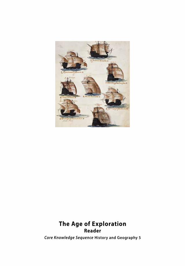
The Age of ExplorationReader
Core Knowledge Sequence History and Geography 5

Chapter 1The Spice IslandsThe Spice of Life History can be changed by many things. A battle, an election, an earthquake, or even a rainstorm can alter the course of events. But would you ever have thought that peppercorns and cinnamon sticks could lead to one of history’s great developments? Because it can easily be argued that the United States exists today because medieval Europeans liked spicy food.
Supermarkets today stock all sorts of spices
that can be used to season or add flavor to
different foods. In medieval Europe, however,
people relied on spices not only to flavor their
food, but also as a way to preserve it. Without
refrigerators or other cold storage, medieval
Europeans used spices to extend the time
period during which meats and other foods could be stored and then
safely eaten before turning rotten.
2
The Big Question
According to the author, how did the search for the Spice Islands change history?
Vocabulary
medieval, adj. relating to the Middle Ages in Europe
spice, n. a plant used to add flavor to food

Spices such as cinnamon sticks and peppercorns were very valuable in medieval Europe.
3

4
In the Middle Ages, spices were hard to get. Pepper, cinnamon,
ginger, cloves, and other seasonings were grown in faraway
Asia. Getting the spices to Europe took a lot of time and effort.
Distances were great, and travel back and forth was dangerous.
As a result, spices were very expensive. Europe’s desire for cheaper
spices sparked the Age of European Exploration and its settlement
of the Americas.
The Spice Islands
Different spices come from different places. Many of the most
desirable spices come from the islands of present-day Indonesia.
Indonesia is an archipelago, or chain
of islands. It stretches from Southeast
Asia’s Malay Peninsula to the continent
of Australia. This group, known as the
Malay Archipelago, contains more than thirteen thousand islands.
Some, like Sumatra and Java, are large. Others, like the Maluku
Islands located south of the Philippines, are smaller. Of all the
spice-bearing islands, the Maluku Islands are probably the most
famous. Indeed, for many years, Europeans referred to them as
the Spice Islands.
The islands of the Malay Archipelago are special. They mark a
boundary between two sections of Earth’s crust. The ridge formed
by those sections is noted for its volcanoes and earthquake
activity. It is part of the Ring of Fire, an arc of volcanoes that
surrounds the rim of the Pacific Ocean.
Vocabulary
archipelago, n. a chain of islands

5
Today, the Spice Islands are part of the nation of Indonesia.
The equator runs through the Malay
Archipelago, just south of the Malay
Peninsula. Daytime temperatures are
between 70° and 90°F year-round. Rainfall
can be as much as 320 inches a year on
the forested mountain slopes. On the
rain shadow sides, it can be less than twenty inches a year.
Overall, the annual average is eighty inches. Heat, heavy rainfall,
and rich soil result in exceptional spice crops.
Vocabulary
rain shadow, n. an area that gets less rain because it is on the protected side of a mountain
South China
Sea
N
S
EW
India
AUSTRALIA
Philippines
China
The Spice Islands
Spice Islands (Maluku Islands)
0
140°E130°E120°E110°E100°E90°E80°E70°E 150°E 160°E
40°S
30°S
20°S
10°S
10°N
20°N
30°N
0°
PACIFICOCEAN
INDIANOCEAN
1,000 miles
AFRICAEquator
Java
Sumatra
Malay
Peninsula
East Indies(Indonesia)

6
The Quest for Spices
You might wonder why the Europeans didn’t just sail over to the
Spice Islands and buy their spices. It wasn’t that simple. They did
not yet know that the Atlantic Ocean went as far as the southern
tip of Africa. Nor were their ships and navigational skills suited to
such long voyages. And at the time, the exact location of the Spice
Islands was a closely guarded secret.
During the Middle Ages, the spice trade
was controlled by Arab traders. They
controlled the market not only for nutmeg
and cloves from the Spice Islands, but also
for ginger from China and cinnamon from
India. For hundreds of years, from around
1100 until 1400, the Arabs managed to
keep the location of the Spice Islands a
secret. They even made up stories about
how dangerous it was to sail to these
islands. If you had been alive then you
might have heard tales told by Arab
traders of the fantastic monsters and
hideous flesh-eating birds that guarded
the Spice Islands. Stories like these were
designed to help the Arab traders preserve
their monopoly of the spice trade.
How did the spice trade work? Arab traders sailed east to trading
centers in India, Ceylon (now Sri Lanka), and the Spice Islands.
After loading up their ships, they sailed west again. A typical trip
Vocabulary
navigational, adj. related to controlling the movement of a ship
trader, n. a person who buys and sells goods
monopoly, n. a situation in which one person, country, or company has complete control of the supply of a good or service
trading center, n. a place where people buy and sell goods

7
took them around the Arabian
Peninsula, into the Red Sea, and
north to Egypt. There they sold
the spices to merchants from
Venice and other parts of Italy.
The Arab traders made huge
profits from this exchange.
The Venetians did well, too.
They negotiated with Arab
traders to distribute spices throughout
Europe. Europeans wanting to purchase
spices had to deal with Venice. Once they
had acquired the spices, the Venetian
merchants could set whatever prices and
taxes they pleased. This arrangement made
Venice a very wealthy city. It also made the
Venetians unpopular.
Wealthy Europeans had become used to exotic goods from the
Venetian marketplace. At the same time, they resented the high
cost of doing business with Venetian merchants. Similarly, the
Venetian merchants dreamed of a time when they would not have
to deal with the Arab traders, but instead be able to deal directly
with merchants in the Spice Islands.
The Travels of Marco Polo
Maffeo and Niccolo Polo were brothers who lived in Venice in
the second half of the thirteenth century. The Polos were great
Vocabulary
merchant, n. a person who buys and sells goods to earn money
negotiate, v. to discuss the terms of an agreement
Traders crossed the Indian Ocean to reach the Spice Islands.

8
traders and travelers. When the overland trade routes that had
existed in Roman times opened up again, they set out to find
the legendary markets of the East. At the time, the Mongols
controlled much of Asia and part of
Europe. The Mongols made the roads safe
for travelers, and many adventurers were
anxious to seek their fortunes. Some went
to trade for silk, gems, porcelain, and
tea. Others hoped to find sources of the
world’s most exotic spices.
When the Polo brothers started their
second journey east in 1271, they decided
to take Niccolo’s young son, Marco, with
them. The expedition ended up taking
them twenty-four years to complete. The
three spent time in the service of the Mongol ruler Kublai Khan
and traveled throughout Asia by land and by sea.
Marco’s father and uncle served as military advisers to the
Great Khan. Kublai Khan took a liking to Marco. He sent Marco
to distant parts of
his kingdom on
diplomatic missions.
Wherever he went,
Marco observed,
asked questions, and
remembered what he
had seen.
Vocabulary
Mongol, n. a native of the Asian nation of Mongolia
porcelain, n. a type of fine pottery
“diplomatic mission,” (phrase) a group of people who serve as representatives of their government in another country
During his travels, Marco Polo served the Emperor Kublai Khan. Khan ruled a vast Mongol empire that included China.

9
In 1295, Marco Polo returned to Venice. Soon after, he was
captured during a war with a neighboring city. Polo was sent to
jail. His cellmate was a writer from the city of Pisa. During his days
in prison, Polo talked about his travels, and the writer wrote down
what Marco said. Together, the two cellmates produced a book
that helped change the world. The Travels of Marco Polo was read
by people all over Europe, first in handwritten copies and later in
printed editions. Polo was the first European to write about China,
Thailand, the Malay Archipelago, and other Asian lands. His book
inspired European mapmakers to update their maps. Almost two
hundred years after it was written, this book inspired an Italian sea
captain named Christopher Columbus.
For centuries, the search for the Spice Islands attracted explorers,
adventurers, and dreamers like a magnet. While searching for the
Spice Islands, these
explorers found
lands, oceans, and
peoples that they
never knew existed.
It is perhaps not
an exaggeration to
say that the desire
to reach the Spice
Islands led to the
European exploration
of the entire planet.
This illustration from Marco Polo’s book shows the port of Venice, which held a near-monopoly on the spice trade in Europe.

Chapter 2Motives and Means The Value of Spices By the mid-1400s, Europeans had several motives for exploration. For one thing, they wanted direct access to the spice-growing areas of the world described by Marco Polo.
Because of the monopoly held by Arab
traders and Venetian merchants, spices
were very valuable throughout Europe. In
some places, spices were so valuable that
peppercorns were used in place of coins.
Payments were even counted out peppercorn by peppercorn. Spices
by the pound were used to pay fees, tariffs, taxes, rents, and ransoms.
10
The Big Question
What developments enabled Europeans to travel farther?
Vocabulary
motive, n. the reason for taking a specific action

11
Pepper was valuable as a spice. This painting from the 1400s shows peppercorns being grown (left) and offered to the king (right).

12
Europeans were so enthusiastic about spices because their food
was not very tasty. At this time Europeans did not yet have any
of the fruits and vegetables native to North and South America.
Potatoes, tomatoes, corn, bananas, chocolate, peanuts, strawberries,
blueberries, and pineapples were all unheard of. Europeans did not
have sugar until the late Middle Ages. They also had no coffee or tea.
Europeans typically butchered livestock in the fall. They used salt
to cure the meat for long-term storage.
After a few months, much of this meat was
not very appetizing. A pinch of pepper,
cloves, or ginger could make bad tasting or
even spoiled meat much easier to eat.
Vocabulary
cure, v. to preserve meat, fish, or other food by smoking, drying, or salting it
The Silk Road: For many centuries this was an overland trade route of nearly 4,000 miles that crossed mountains and deserts between Asia and the Arab and European cities near the Mediterranean Sea.

13
It’s hardly surprising, then, that Europeans developed a taste for
the intense flavors of spices that come from plants grown on tiny
islands in faraway places. As you have discovered, getting those
spices wasn’t at all easy. Because of this, Arab traders and Venetian
merchants charged very high prices. Then, in the fifteenth century,
the quest for spices became even more problematic. The Turks
shut down the Silk Road, an important land route, which had
previously been used to transport spices from the East.
The Europeans needed a sea route to Asia. Nobody was sure that
such a route existed. Everybody hoped one would be discovered. The
great kings of Europe began looking for brave explorers, shipbuilders,
mapmakers, and others who could help them with this quest.
The Crusades
Exploration was also fueled by another series of events. In the
Middle Ages, generations of European knights and soldiers went
on Crusades to the Middle East to capture the Holy Land from
Muslims. When Europeans reached the Middle East, they saw
that Islamic civilization was much more advanced than they had
been led to believe. Crusaders returned home and described the
goods and cultures they had encountered. This added to European
curiosity about the world outside their borders.
New Ships
Arab traders had been sailing across the Indian Ocean for
centuries. Therefore, they had learned a great deal about

14
navigation and shipbuilding. By
comparison, Europeans generally made
shorter voyages within European waters.
European sailors navigated mostly by
staying near the coastline and watching for
known landmarks. Their navigational skills
were not as advanced as their competitors’.
Their ships were not well-suited to long
voyages across uncharted waters.
Generally, ships built in the Mediterranean shipyards of southern
Europe had large triangular sails, called lateen sails. These
sails provided easy handling in the winds that blew along the
Mediterranean coast. Northern ships had square sails, which were
more effective on the open
ocean. They also had hulls
built with thick, overlapping
planks. These hulls were built
to withstand the rougher
waters of the Baltic Sea and
the Atlantic Ocean.
Both of these ship designs
had advantages, but neither
was ideal for long voyages
on uncharted waters. Then,
in the 1400s, Portuguese
shipbuilders combined
features from these two
Vocabulary
navigation, n. the act of planning and directing the movement of a ship, plane, or other vehicle
uncharted, adj. never mapped
hull, n. the sides and bottom of a boat
The caravel was developed for sailing on long voyages under various conditions.

15
different kinds of ships. By doing this,
they created new, more seaworthy vessels
called caravels (/kar*uh*velz/). Caravels
had the sturdiness of the northern ships
and the easy handling of the southern
ships. Their masts were rigged with lateen
sails so that the ships were easy to handle,
but the caravels also had square sails to
take advantage of strong winds that could
send the ships across the open ocean. The
ships had hulls sturdy enough to sail on
rough seas. They were also large enough
to carry men, supplies, and trade goods
farther than ever before.
Finding Their Way
Sailors needed ways to keep track of their location and direction
when they were out of sight of land. To do this, they relied on the sky.
During the day, sailors could plot their direction in relation to the
sun’s apparent movement across the sky from east to west. For
example, the sun setting on the right side of the ship would mean
that the ship was heading south. The sun setting on the left would
mean that the ship was heading north.
Ship pilots also had a variety of navigational tools to help keep their
ships on course. Pilots used instruments such as the astrolabe and
later the sextant to determine the ship’s latitude. By measuring
the height and varying positions of the sun, moon, and stars in the
Vocabulary
rig, v. to prepare for sailing
astrolabe, n. a navigational tool used to determine the position of the sun, a star, or other object in the sky
sextant, n. a navigational instrument that uses a telescope and scale to determine latitude and longitude

16
sky with these instruments, pilots were able to obtain information
about the time of day and the ship’s location. As you might imagine,
though, taking exact measurements on a bobbing ship was difficult.
Speed was measured using a log attached to a rope. The rope had
knots tied along it at regular spaces. A sailor counted the knots
as they slipped through his hands. The number of knots let out
during a certain amount of time was used to calculate the speed.
Today, ship speed is still measured in knots.
The magnetic compass, a Chinese
invention, had been in use in other parts
of the world for centuries. Europeans
also relied on it to determine direction.
Imagine sailing across an ocean, especially an unknown ocean, just using instruments such as an astrolabe, shown here.
Vocabulary
magnetic compass, n. a device that uses a magnetized pointer to show direction

17
However, many captains and navigators did not really understand
how or why it worked.
To measure the passage of time, sailors
used a sand hourglass. The ship’s cabin
boy turned the glass every half hour.
The time calculated was checked against
sunrise and sunset just in case the sand ran
too fast or too slowly.
Navigators also made use of observations made by the crew.
Information about the clouds, birds, waves, and anything floating
in the water all helped to track a ship’s position on the sea.
Europeans were building new ships, learning more about
navigation, and updating their maps. Soon, they might really be
able to sail to far-flung parts of the world.
Vocabulary
hourglass, n. a glass device that measures time using the flow of sand

Chapter 3Portuguese ExplorationPioneers of the Sea The most powerful European governments in the 1400s were the Spanish states of Castile and Aragon, France, England, and some of the city-states in Italy, such as Venice. But none of these countries led the search for a sea route to the East. It was Portugal—a small, relatively poor country— that became the seagoing pioneer.
Portuguese leadership in exploration was largely due to one
person. Prince Henry, often called the Navigator, had a strong
desire to explore the oceans. Although Henry never went on any
expeditions himself, he supported the design of ships. He encouraged
developments in mapmaking, shipbuilding, and instrument
making. He also encouraged the sharing of information, therefore
enabling would-be explorers to benefit from these new ideas. Most
importantly, he helped to convince his father, King John I, to pay for
expensive expeditions in the name of Portugal. Like other Europeans,
the Portuguese had a strong desire to set up trade routes, spread
Christianity, and gain knowledge.
18
The Big Question
Why do you think Portugal is described as a seagoing pioneer?

19
This statue of Prince Henry is part of a monument in Lisbon, the capital of Portugal. The monument honors Portugal’s role in the Age of Exploration. Prince Henry is shown holding a ship and a map.

20
Prince Henry sent dozens of expeditions
down the west coast of Africa. On these
expeditions, Portugal’s seafarers faced
many challenges. Prior to this, no European
had sailed very far from Europe. Just as
the Arab traders did, European sailors told
hair-raising stories about sea monsters and boiling waves. Really,
they were encountering extremely rough waters and sea creatures
that they had never seen before. Such tales made it difficult
for Portuguese captains to find crew members willing to sail
farther south. Therefore, reaching Cape Bojador (/boh*juh*dor/)
off the Western Sahara on the Atlantic coast was indeed a great
achievement for the Portuguese.
Portuguese sailors told stories of sea monsters they encountered on their expeditions.
Vocabulary
expedition, n. a special journey taken by a group that has a clear purpose or goal

21
Over the years, Prince Henry’s explorers
pushed farther south along the African
coast. They brought back gold, ivory,
spices, and people, to be sold into
slavery. The first Africans to be sold
arrived in Portugal in 1441. They became
servants and laborers. Africans were
also taken along on expeditions to serve
as interpreters and help set up trade
agreements in new ports. Portuguese
traders set up trading posts and challenged
the Moors for leadership in West Africa.
Bartolomeu Dias
As expeditions made their way down the west coast of Africa,
Portuguese horizons expanded. Their knowledge grew, and their
maps became more complete. The more they learned, the less
superstitious they became.
In 1487, Bartolomeu Dias (/bar*tuh*luh*mae*uh/dee*us/) set sail
with a fleet of three ships. The fleet traveled far beyond where
any European had ever sailed before. The ships stopped at various
ports along the coast before stormy seas forced the fleet offshore.
They did not see land for several days. When the seas calmed, the
ships turned back to make landfall. They looked for the land that
had been to the east of them as they journeyed southward. They
could not find it. Then, when the ships turned north, land was
sighted. But it was on the west side of the ship, not the east. This
could only mean one thing: The fleet was traveling north up the
Vocabulary
interpreter, n. a person who translates from one language to another
Moor, n. a North African follower of Islam during the Middle Ages
fleet, n. a group of ships sailing together with the same purpose and under the control of the same leader
landfall, n. the reaching of land, after a trip by sea
22
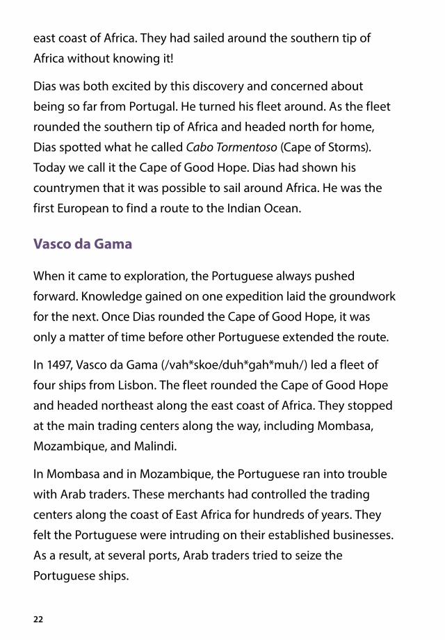
east coast of Africa. They had sailed around the southern tip of
Africa without knowing it!
Dias was both excited by this discovery and concerned about
being so far from Portugal. He turned his fleet around. As the fleet
rounded the southern tip of Africa and headed north for home,
Dias spotted what he called Cabo Tormentoso (Cape of Storms).
Today we call it the Cape of Good Hope. Dias had shown his
countrymen that it was possible to sail around Africa. He was the
first European to find a route to the Indian Ocean.
Vasco da Gama
When it came to exploration, the Portuguese always pushed
forward. Knowledge gained on one expedition laid the groundwork
for the next. Once Dias rounded the Cape of Good Hope, it was
only a matter of time before other Portuguese extended the route.
In 1497, Vasco da Gama (/vah*skoe/duh*gah*muh/) led a fleet of
four ships from Lisbon. The fleet rounded the Cape of Good Hope
and headed northeast along the east coast of Africa. They stopped
at the main trading centers along the way, including Mombasa,
Mozambique, and Malindi.
In Mombasa and in Mozambique, the Portuguese ran into trouble
with Arab traders. These merchants had controlled the trading
centers along the coast of East Africa for hundreds of years. They
felt the Portuguese were intruding on their established businesses.
As a result, at several ports, Arab traders tried to seize the
Portuguese ships.

23
Mediterranean Sea
S A H A R A D E S E R T
Cape Bojador
Cape of Good Hope
Mozambique
Mombasa
Lisbon
Malindi
Iberian
Peninsula
20°W 40°E
AFRICA
Portugal
INDIANOCEAN
ATLANTICOCEAN
Beira
Maputo Bay
Mad
agas
car
Early Portuguese Exploration
0° 20°E
40°S
20°N
40°N
0°
20°S
Dias (1487–1488)Key
da Gama (1497–1499)
Gulf of Guinea
N
S
EW
0 1,000 miles
Equator
Most of what Europeans of this time knew about Africa was restricted to the coasts of the continent.

24
Farther north at Malindi, however, the
reception was friendly. The Portuguese
were given a ship’s pilot to help them. The
fleet crossed the Indian Ocean in twenty-
three days. They made landfall at Calicut,
India, known today as Kozhikode, India.
The knowledge of the experienced pilot
and the strong west winds known as the
trade winds had enabled them to arrive safely.
Calicut was a major trading city and seaport on the southwest
coast of India. The main trade items were spices, gems, and pearls.
Vasco da Gama was anxious to set up trade relations. The Zamorin
(/zah*mor*ihn/), as the Hindu ruler was called, had other ideas. The
Zamorin was not impressed with the ordinary items that da Gama
had brought to exchange. He also did not want to make the Arab
merchants angry. The Zamorin demanded bright red fabric, coral,
silver, and gold. Only if da Gama could supply these items would
they be able to do business.
The Portuguese fleet remained at Calicut for several months. When
it came time to leave, the Zamorin tried to seize the Portuguese
goods. Vasco da Gama and his crew managed to escape—taking
with them their goods and five hostages, too.
The return trip across the Indian Ocean took three terrible months.
Many of the men died of scurvy during their journey. They were
forced to set fire to one ship because they did not have enough
crew members to sail it home. The fleet finally reached Lisbon
in 1499. In spite of the terrible losses on his trip, Vasco da Gama’s
Vocabulary
trade wind, n. a wind that almost always blows in a particular direction
scurvy, n. a disease caused by a lack of vitamin C
25
return was cause for celebration, and he
was called a hero by the king.
The Portuguese in East Africa
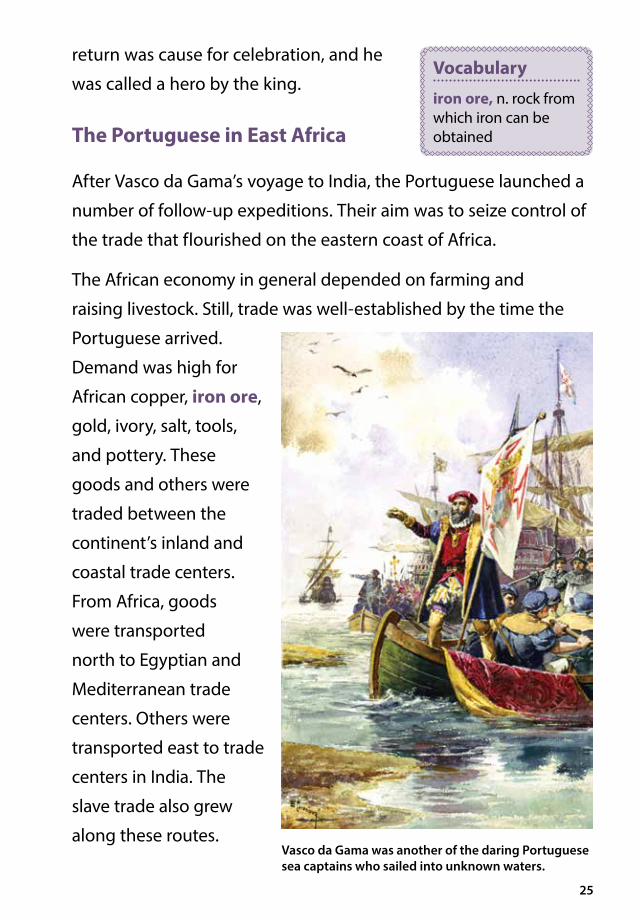
After Vasco da Gama’s voyage to India, the Portuguese launched a
number of follow-up expeditions. Their aim was to seize control of
the trade that flourished on the eastern coast of Africa.
The African economy in general depended on farming and
raising livestock. Still, trade was well-established by the time the
Portuguese arrived.
Demand was high for
African copper, iron ore,
gold, ivory, salt, tools,
and pottery. These
goods and others were
traded between the
continent’s inland and
coastal trade centers.
From Africa, goods
were transported
north to Egyptian and
Mediterranean trade
centers. Others were
transported east to trade
centers in India. The
slave trade also grew
along these routes.
Vocabulary
iron ore, n. rock from which iron can be obtained
Vasco da Gama was another of the daring Portuguese sea captains who sailed into unknown waters.

26
Historians sometimes call the East African coast the Swahili
(/swah*hee*lee/) Coast, because the African language Swahili
was spoken by many of the people in this area. The population of
the Swahili Coast was a mixture of Africans, Arabs, and Persians.
Most people in the region were Muslim.
The Portuguese set up trading posts along the Swahili Coast in
places like Beira and Maputo Bay. Today, both are found in the
country of Mozambique. Beira was an especially valuable trade
center. Gold that was mined inland was shipped down the Save
River to Beira. From there it was shipped to Portugal.
Once the Portuguese were established along the Swahili Coast,
they were anxious to learn more about the inland areas. For
decades, the Portuguese tried to gain control of the rich resources
of the interior of Africa. However, despite their efforts, they were
AFRICA
India
China
AUSTRALIA
INDIANOCEAN
N
S
EW
Portuguese in�uence and trade
Portugal
ATLANTIC OCEAN East Indies
(Indonesia)
Portugal’s Trade Empire
0 1,000 miles
The Spice Islands(Maluku Islands)
Mediterranean Sea
Arabian
Peninsula
Swahili Coast
Portugal set up a trade network that stretched from Africa across the Indian Ocean to India and the Spice Islands.

27
met with strong resistance. Portugal was never able to gain full
control of the African interior and their expansion was limited to
a number of small colonies.
The Portuguese did manage to break the long-standing Arab
traders’ monopoly along the coast. They set up a network of
trading posts, not only along the Swahili Coast but also in India,
the East Indies, and the Spice Islands.
Pedro Alvares Cabral and Brazil
A fleet of thirteen ships set sail from Portugal in March 1500, bound
for India under the command of Pedro Alvares Cabral (/kuh*brahl/).
Cabral was supposed to follow the route taken by Vasco da Gama.
His goal was to make contact with trade centers in the East and to
see what else he could find. Before leaving Lisbon, Cabral met with
da Gama, who shared maps and information about sailing to India.
Cabral sailed out of Lisbon harbor and turned south. He followed
the coast of Africa until he had passed the Cape Verde Islands (off
present-day Senegal). Da Gama had told Cabral not to get stuck
in the Gulf of Guinea. The ocean there was frequently calm, with
little or no wind to move a ship. He told Cabral to head southwest
and sail out into the Atlantic Ocean instead. Cabral did so, and in
April 1500, he sighted land. The expedition had reached the coast
of Brazil.
We tend to think of the western and eastern hemispheres as being
very far apart. However, Brazil juts out into the Atlantic Ocean
toward the western coast of Africa. All it took was a southwestward

28
swing by Cabral and some strong winds to close the distance. The
Portuguese explorer came upon land he did not know existed. He
immediately claimed the territory for his king.
Cabral sent a ship home to tell the king of this land, which
he named Vera Cruz (/vair*uh/krooz/), the Island of the True
Cross. He made contact with the people living in the area and
stayed for ten days. Then he set out to complete his expedition.
Four ships were lost as the fleet approached the Cape of Good
Hope. Among the men who drowned was Bartolomeu Dias,
the explorer who had been the first European to spot the cape
twelve years earlier.
The distance between the east coast of Brazil and the west coast of Africa is not that great.
PACIFIC OCEAN
Gulf of Guinea
INDIANOCEAN
ATLANTIC OCEAN
AFRICA
Portugal
CanaryIslands
Cape VerdeIslands
Cape of Good Hope
N
S
EW
Cabral’s Expedition
Cabral’s route
20°E20°W40°W60°W80°W
Brazil
100°W120°W 0° 40°E 60°E
40°S
40°S
20°S
20°S
0°
NORTH AMERICA
SOUTH AMERICA

29
Cabral continued on with what remained of his fleet. He traded
at a number of ports along the Indian Ocean and loaded his ships
with precious spices. On the return journey, more ships were lost.
Only four ships sailed back into Lisbon harbor.
For a time, this land now called the Island of the True Cross was
spared the impact of European settlement. The Portuguese were
busy gaining power in the rich ports of Africa, India, the East
Indies, and the Spice Islands. They did not want to bother with this
new territory—at least not yet.

Chapter 4Christopher ColumbusSailing West to the East Indies On August 3, 1492, three ships left Palos, Spain, and headed for the Canary Islands, off the African coast. In those days, European ships often sailed to the Canary Islands to trade or rest before continuing south along the coast of Africa.
These three ships did something different. After their stop in the
Canary Islands, they sailed due west.
The ships were under the command of an Italian named Christopher
Columbus. Columbus had read Marco Polo’s account of the East
Indies and was eager to find the sources of the spices Polo had
described. His approach was a new one, however. He believed that it
was unnecessary to sail all the way around Africa, as Dias had done.
Like most educated people of his day, Columbus knew that the world
was round. He believed he could reach the East by sailing west. He
also believed that the world was smaller than people imagined.
Therefore he thought that the East Indies could not be very far west
of the Canary Islands.
30
The Big Question
Why do you think Columbus kept a secret log?

31
Columbus searched for many years for support of his plan to find a new route to Asia.

32
Columbus had spent seven years trying to convince the rulers of
Europe to sponsor, or pay for, a westward expedition to the Indies.
The king of Portugal told him no. The king of France kept putting him
off. At first, King Ferdinand and Queen Isabella of Spain declined as
well. However, in 1492, they agreed to pay for an expedition. They
instructed Columbus to claim any new lands he discovered for Spain.
Columbus was given three ships, the Niña, the Pinta, and the Santa
Maria. That September, they left the Canary Islands and headed
west into waters quite unfamiliar to Europeans. According to some
who sailed with Columbus, many sailors wept. They were fearful
The captains and crews of the three ships led by Columbus faced a hazardous voyage into unknown waters.
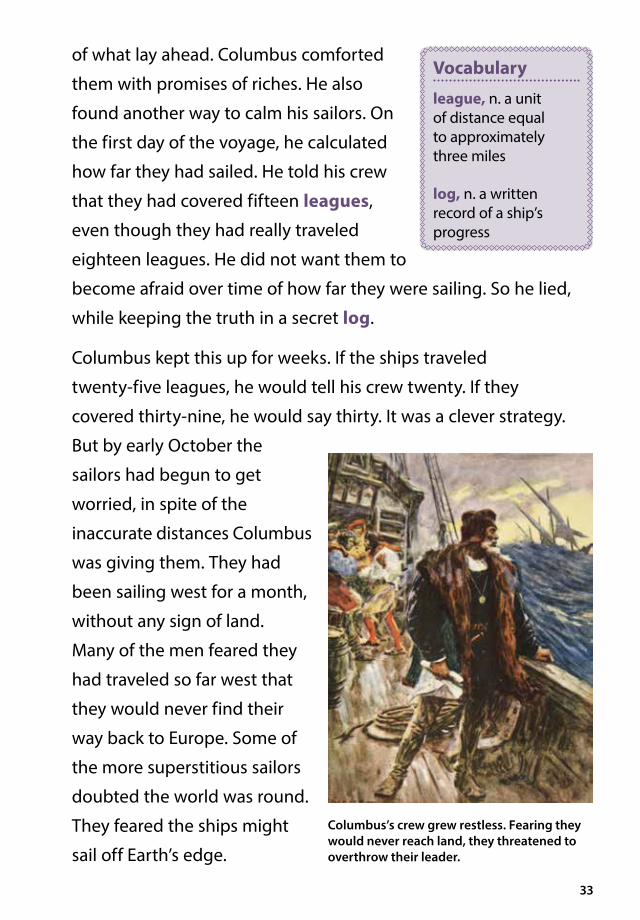
33
of what lay ahead. Columbus comforted
them with promises of riches. He also
found another way to calm his sailors. On
the first day of the voyage, he calculated
how far they had sailed. He told his crew
that they had covered fifteen leagues,
even though they had really traveled
eighteen leagues. He did not want them to
become afraid over time of how far they were sailing. So he lied,
while keeping the truth in a secret log.
Columbus kept this up for weeks. If the ships traveled
twenty-five leagues, he would tell his crew twenty. If they
covered thirty-nine, he would say thirty. It was a clever strategy.
But by early October the
sailors had begun to get
worried, in spite of the
inaccurate distances Columbus
was giving them. They had
been sailing west for a month,
without any sign of land.
Many of the men feared they
had traveled so far west that
they would never find their
way back to Europe. Some of
the more superstitious sailors
doubted the world was round.
They feared the ships might
sail off Earth’s edge.
Vocabulary
league, n. a unit of distance equal to approximately three miles
log, n. a written record of a ship’s progress
Columbus’s crew grew restless. Fearing they would never reach land, they threatened to overthrow their leader.
34
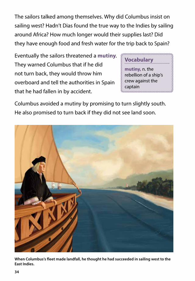
The sailors talked among themselves. Why did Columbus insist on
sailing west? Hadn’t Dias found the true way to the Indies by sailing
around Africa? How much longer would their supplies last? Did
they have enough food and fresh water for the trip back to Spain?
Eventually the sailors threatened a mutiny.
They warned Columbus that if he did
not turn back, they would throw him
overboard and tell the authorities in Spain
that he had fallen in by accident.
Columbus avoided a mutiny by promising to turn slightly south.
He also promised to turn back if they did not see land soon.
When Columbus’s fleet made landfall, he thought he had succeeded in sailing west to the East Indies.
Vocabulary
mutiny, n. the rebellion of a ship’s crew against the captain

35
This was a risky promise to make, but it paid off. A few days later,
sailors began to see encouraging signs. They spotted birds that
were known to live on land. They saw a bush floating in the ocean,
with berries still clinging to the branches.
Finally, in the early morning hours of October 12, 1492, an excited
shout rippled across the water. “Tierra! Tierra!” called the Spanish
lookout on the Pinta. “Land! Land!”
The First Encounter
When the sun rose on that day, Columbus took a landing party
ashore to meet the inhabitants of what he thought was Asia. He
was actually in the Bahamas, a group of islands just east of what
is now Florida. Columbus decided to
name the island he was on San Salvador
(Holy Savior). He personally carried the
royal standard ashore to claim the land
for Spain.
The lush green land did not look much like the Asia described by
Marco Polo. There were no silks or spices to be seen. Columbus
nevertheless was convinced that he had reached the East Indies.
He called the native people Indians. The name stuck, even
after later explorers proved that Columbus had not found the
East Indies but rather islands near two new continents located
between Europe and Asia.
The inhabitants of the island were not “Indians,” but members of
the Taino (/tye*noh/) tribe. They were peaceful people who fished
in the waters around their island.
Vocabulary
royal standard, n. a flag that represents a king or queen

36
The Tainos came down to the shore to look at Columbus and his
men. Columbus had brought along a translator who spoke Hebrew
and Arabic. He felt sure that the “Indians” would understand one
of these two Eastern languages. To his frustration, they did not.
The Spanish and the Tainos ended up using sign language to
communicate.
In order to locate what he believed would be China, Columbus
soon sailed on. He took six Tainos with him. Before long he landed
on what are now the islands of Cuba and Hispaniola. Today the
island of Hispaniola is divided between the countries of Haiti and
the Dominican Republic.
By January 1493, supplies were getting low. Columbus set sail
for Spain. Columbus traveled until he reached the latitude of
40°N. Then he turned the ships east, putting them on course
for Spain.
The Triumphant Return
When Columbus returned to the court of King Ferdinand and
Queen Isabella, he told them everything he had seen in the lands
that he had claimed for their country. He described his meetings
with an Indian chieftain, whom he called the “great khan.” He told
of his visit to Cuba, which he thought was Japan. He described the
contacts he had made.
King Ferdinand and Queen Isabella rewarded Columbus by
giving him money and land. They also named him “Admiral of
the Ocean Sea. “

37
News of Columbus’s success quickly spread across Europe.
However, not everyone was convinced that Columbus had found
a westward route to Asia. Among the biggest doubters were the
Portuguese. They thought that Columbus had explored part of
the African coast or an unknown group of islands in the Atlantic.
The Spanish themselves did not really know what to think. They
eventually came to believe that Columbus had found some
faraway place. Many also decided that whatever place that was,
they wanted to go there too.
The Spanish monarchs Ferdinand and Isabella were pleased with Columbus’s account of his voyage.

38
The Treaty of Tordesillas
It was inevitable that Spain and Portugal would become trading
rivals. Various disputes broke out between the two countries. The
pope tried but failed to settle the disagreements. Finally, diplomats
from the two countries worked out an
agreement. In 1494, they drew an imaginary
line from the North Pole to the South Pole,
370 leagues (1,185 miles or 1,907 kilometers)
west of the Cape Verde Islands. The Treaty
of Tordesillas (/tor*dae*seel*yus/) said
that all land to the west of this line could
be claimed by Spain. All land to the east
could be claimed by Portugal. Neither
country could occupy any territory already
in the hands of a Christian ruler. The agreement disregarded
the indigenous peoples of the Americas, who had maintained
sophisticated cultures for hundreds, if not thousands, of years.
The treaty placed all of North and South America west of the
treaty line under Spanish control. What is modern day Brazil was
given to the Portuguese. In terms of landmass, Spain had the
advantage. Over the next hundred years or so, millions of people
in North and South America would learn to speak Spanish, while
the Brazilians learned Portuguese.
However, in 1494, when the treaty was signed, nobody was quite
sure yet what had been divided or who had rights to what. Cabral
had not yet discovered Brazil (that would happen in 1500), and
no one yet knew exactly what Columbus had discovered in 1492.
Vocabulary
diplomat, n. someone who represents the government of one country in another country
indigenous, adj. native to a particular region or environment

39
Queen Isabella of Spain sent a letter to Columbus, urging him to
determine where the treaty line was and which lands lay on the
Spanish side.
The Later Voyages of Columbus
Columbus made three more voyages to the Americas. On his
second voyage, he mapped most of the islands of the Caribbean
Sea and established the permanent colony of Santo Domingo on
Hispaniola. He left his brothers Bartholomew and Diego in charge
while he searched the Caribbean Sea for gold. His search was
unsuccessful.
The third voyage (1498–1500) was even worse. While Columbus
explored the north coast of South America, Bartholomew and
The Treaty of Tordesillas divided newly explored territories between Spain and Portugal.

40
Diego angered both the indigenous peoples and the Spanish
settlers of Hispaniola. The Columbus brothers forced the
indigenous people to work in gold mines, and favored some
Spanish settlers over others. Eventually complaints reached the
Spanish court. Columbus lost his position as governor of the
colony, and his brothers were sent back to Spain.
The fourth voyage (1502–1504) was the worst of all. Columbus
and his men were shipwrecked on the island of Jamaica for a year.
By the time Columbus returned to Spain, he was in bad health,
and his reputation had been damaged. When Columbus died in
1506, almost nobody noticed. In 1537 his bones were sent back to
Hispaniola and buried in the Cathedral of Santo Domingo.
None of Columbus’s later voyages were as successful as his first.

41
The Final Blow
The Americas were actually named after another explorer,
Amerigo Vespucci (/ves*poo*chee/). Vespucci had explored the
coast of South America for Portugal in 1501. He wrote letters
about his voyage that were published. In his letters he described a
densely populated continent. He also used the term “New World”
to describe this place. A German mapmaker was so impressed with
Amerigo’s revelations he labeled the new continent America on
the map he was working on.

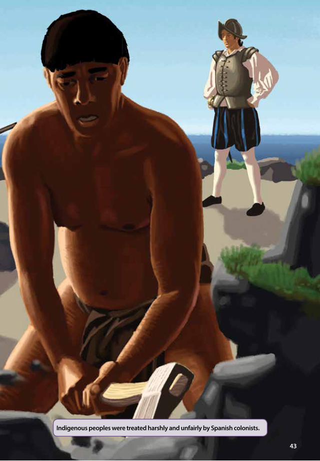
Chapter 5A Spanish Empire and Its Critics After Columbus The Spanish continued to expand their lands in the Americas after Columbus died. As the Spanish grew stronger, the situation of the indigenous peoples grew worse. Many of the Spaniards were ruthless colonists.
Indigenous people died in large numbers
in gold mines controlled by the Spanish.
Thousands more died from European diseases
against which they had no immunities. The
effects were devastating. When the Spanish
first arrived in Hispaniola, it had hundreds
of thousands of inhabitants. By 1507, the indigenous population
had decreased to sixty thousand. By 1531, there were only about
six hundred native inhabitants left on the island.
42
The Big Question
How did European explorers and colonists treat the indigenous people of the Americas?
Vocabulary
immunity, n. a body’s ability to remain free of illness even after being exposed to the cause of the illness
43
Indigenous peoples were treated harshly and unfairly by Spanish colonists.

44
When the gold mines became less profitable, the Spanish
introduced cattle ranches and sugar plantations. Sugar was
a cash crop. This meant that the plantation owners could earn
a lot of money growing and selling sugar. But the rapid decline
of the indigenous population created a
labor shortage. By the sixteenth century,
that shortage was being filled by the
importation of enslaved people from Africa.
The Conquistadors
Between 1495 and 1535, Spanish
conquistadors (/kon*kees*tuh*dorz/)
gained control of much of South and
Central America. You have learned about
Hernán Cortés, the conquistador who
destroyed the mighty Aztec Empire in
modern-day Mexico. You have also learned
about Francisco Pizarro, who invaded the
Inca civilization in Peru.
Pizarro spent many years working for another famous conquistador,
Vasco Nùñez de Balboa (/vah*skoe/noo*nyath/de/bal*boe*uh/).
Balboa and Pizarro explored the Isthmus of Panama together.
During their explorations, they learned about a great sea to the
west. In 1513, Balboa organized an expedition to find this sea. He
chose one hundred ninety of his toughest men, including Pizarro,
as well as men to carry equipment and supplies. The party crossed
swamps by stripping off their clothing and carrying it on their
Vocabulary
plantation, n. a large farm where one or more crops were grown by a large number of laborers; these crops were sold for a profit by the plantation owner
cash crop, n. a crop that is grown to be sold
conquistador, n. the Spanish word for conqueror
isthmus, n. a narrow piece of land that connects two larger land masses

45
heads as they splashed along. They fought off snakes, crocodiles,
and mosquitoes. They hacked their way through thick jungles.
They climbed over mountains.
Balboa and his men were rewarded for their struggles. On
September 25, 1513, they stood atop a mountain and looked out over
a body of water Balboa called “the South Sea.” Today, we call it the
Pacific Ocean. Balboa marched down to the ocean and tasted the salt
water, just to be sure. Then, as Europeans so often did, he claimed all
the lands washed by this sea in the name of his homeland, Spain.
Encomiendas
Of course, building an empire in the
Americas required settlers. To encourage
migration to these new lands, the
Spanish set up a system of encomiendas
Balboa and Pizarro made a difficult journey across the Isthmus of Panama looking for a great sea.
Vocabulary
empire, n. a group of countries or territories under the control of one government or ruler
46
(/en*koe*me*yen*dus). This system meant that a Spanish settler
was given a large plot of land and a number of enslaved workers.
Encomiendas clearly benefited Spain and the Spanish settlers. They
also led to the further enslavement of indigenous peoples.
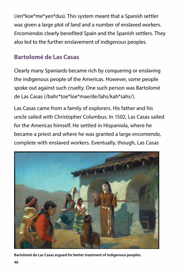
Bartolomé de Las Casas
Clearly many Spaniards became rich by conquering or enslaving
the indigenous people of the Americas. However, some people
spoke out against such cruelty. One such person was Bartolomé
de Las Casas (/bahr*toe*loe*mae/de/lahs/kah*sahs/).
Las Casas came from a family of explorers. His father and his
uncle sailed with Christopher Columbus. In 1502, Las Casas sailed
for the Americas himself. He settled in Hispaniola, where he
became a priest and where he was granted a large encomienda,
complete with enslaved workers. Eventually, though, Las Casas
Bartolomé de Las Casas argued for better treatment of indigenous peoples.

47
came to the conclusion that
the encomienda system was
wrong. He began to preach
against the enslavement of
people.
Las Casas returned to Spain to
seek the support of the king.
He also wrote a book telling
people in Spain what was
happening in the Americas.
Las Casas’s The Devastation
of the Indies: A Brief Account
helped turn the king against
the encomienda system. In
the book, Las Casas explained
that greed was the cause of
such exploitation.
Eventually the king changed the laws regarding the treatment
of indigenous peoples. But it was difficult to enforce these laws
from across the ocean. The indigenous peoples continued to
suffer. Las Casas later wrote a history of the Spanish conquest of
the Americas. His work is the source for much of what we know of
conquered peoples such as the Aztec in
Mexico and Inca in Peru. Today Bartolomé
de Las Casas is widely admired for his
stand against the exploitation of the
indigenous people of the Americas.
Much of what we know today about the effect of the Spanish conquest on the indigenous peoples of the Americas comes from Bartolomé de Las Casas’s book.
Vocabulary
exploitation, n. the practice of taking unfair advantage of a person or group

Chapter 6Magellan’s Voyage Ferdinand Magellan While conquistadors conquered new lands for Spain, sea captains continued to explore the oceans. One of the most famous of these captains was Ferdinand Magellan.
Magellan was born in Portugal during the great age of Portuguese
exploration. As a boy, he served as a page in the Portuguese court.
He dreamed of life at sea. Magellan was thirteen when Columbus
sailed back to Spain with tales of his westward travels. Inspired by
Columbus, Magellan went to sea.
Magellan was a hot-tempered fellow, and he was usually in one kind
of trouble or another. His first expeditions took him to trading centers
in the East, first as a crew member and later as a fleet commander
in the Portuguese navy. But Magellan’s temper eventually cost him
the support of the Portuguese crown. The time came when the king
refused to send him on any more expeditions.
In 1517, John of Lisbon, a friend of Magellan’s, persuaded him to
ask Spain for support. A famous navigator, John of Lisbon had just
48
The Big Question
How important was it for explorers to have finally circumnavigated the globe?

49
Portuguese sea captain Ferdinand Magellan was inspired by the voyages of Christopher Columbus.

50
returned from a Portuguese expedition
to explore the coastline of Brazil. He said
he had come upon a strait. He thought
this new information might lead to the
discovery of a water route through the
middle of the South American continent.
If there was such a route, this would make trade and the
accumulation of wealth easier for the European explorers, traders,
and merchants, and of course for the kings of Europe. John of
Lisbon fired up Magellan’s imagination. When another friend
helped him gain command of a Spanish expedition to explore this
strait, Magellan turned his back on Portugal forever.
In September 1519, five ships carrying 277 men left port for the
three-month voyage to Brazil. Right away, the boats started
leaking. A week into the
voyage, Magellan faced a
mutiny. But he held onto his
command. In January 1520, the
ships reached the waters that
John of Lisbon had described.
Magellan was soon
disappointed. The crew sent
to explore the strait returned
with news that the strait did
not provide a route through the
continent to the Pacific Ocean.
Instead it flowed into a bay. Frustrated by the lack of progress in their search for a strait, Magellan’s crew mutinied.
Vocabulary
strait, n. a narrow body of water that connects two larger bodies of water

51
Magellan met with his officers to discuss their next steps. Some
wanted to sail to Africa and on to the Spice Islands, following
known routes. Others wanted to go back up the coast for the
winter. Magellan decided to keep sailing south.
High winds and rough seas slowed and battered the fleet. In
March, heavy snow finally stopped progress altogether. Magellan
led his angry crew into a harbor on the coast of what is now
Argentina. There in early April, Magellan faced his second mutiny.
Once again, he was able to regain control of the crew.
Finding the Strait
Magellan resumed his search in October. He lost one ship in rough
seas. Near the southern tip of South America, a storm blew his
remaining ships into a narrow strait. This strait turned out to be
the strait Magellan had been seeking all along. Unfortunately, it
was very difficult to navigate. Tall cliffs loomed up on both sides,
and violent tides threatened to smash the ships against the rocks.
Many of Magellan’s men felt that discovering the strait was
enough. They were afraid to sail through the strait. They urged
Magellan to turn back. Magellan refused. The crew of one ship
mutinied and did turn back. The other three ships pressed on. It
took more than a month for the fleet to pass through what would
eventually be called the Straits of Magellan.
Finally, the fleet emerged into a vast and calm ocean. Magellan
and his crew knelt down and recited a prayer of thanksgiving.
Magellan also pointed out to his crew that they were now sailing

52
upon unknown waters. Because the waters were so pleasantly
peaceful, he named the body of water the Pacific Ocean.
Magellan’s fleet turned north. The ships followed the west coast
of South America until they could pick up the currents that would
carry them west, across the ocean. Magellan did not know the
size of the Pacific Ocean. He figured his ships would reach Asia in
a matter of days. The ships made landfall at some of the Pacific
Islands, but the ocean was so large that supplies ran out quickly.
Finally, on March 16, Magellan and his crew spotted the
easternmost island of the Philippine archipelago. The men who
had survived the ordeal were able to gather their strength.
It was now a year and a half since they had left Spain. The men
were anxious to head for the Spice Islands and then make their way
In 1520, Magellan and his crew discovered the South American strait that connected the Atlantic and Pacific Oceans.
53
home. Magellan, however, wanted to explore the Philippine Islands.
This decision proved to be Magellan’s final command to his weary
men. Magellan was killed in a confrontation with island chieftains.
The crew sailed homeward under the command of Juan Sebastián
del Cano. They finally reached Spain in September 1522, nearly
three years after they had begun the journey. Only one ship of
the original five remained. Only eighteen of the original crew of
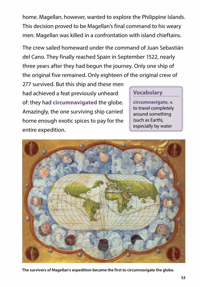
277 survived. But this ship and these men
had achieved a feat previously unheard
of: they had circumnavigated the globe.
Amazingly, the one surviving ship carried
home enough exotic spices to pay for the
entire expedition.
Vocabulary
circumnavigate, v. to travel completely around something (such as Earth), especially by water
The survivors of Magellan’s expedition became the first to circumnavigate the globe.

Chapter 7England Explores and Colonizes John Cabot In 1490, Giovanni Caboto (/joh*vah*nee/kah*boh* toh/) moved his family from Venice to Spain. Years of experience as a Venetian spice trader had made Caboto an expert seaman. Now he was caught up in the spirit of exploration.
Caboto wanted to form an expedition to search for a northwesterly
route to the Spice Islands. Unfortunately, the monarchs of both
Portugal and Spain had other plans.
The Portuguese had established their own route to the East
around the Cape of Good Hope at the southern tip of Africa. When
Christopher Columbus returned from his voyage, the Spanish
believed that they had found another route. No one wanted to hear
Caboto’s proposal for still another route.
Caboto moved with his family to the port city of Bristol, England.
There, Giovanni Caboto changed his name to John Cabot. The English
54
The Big Question
How did European exploration of the Americas lead to settlement and colonization?

55
John Cabot sought support for an expedition to find a passage to the Spice Islands through North America.

56
monarch, Henry VII, and the merchants of Bristol were happy to
give the explorer their support. They hoped he would bring them
great wealth.
After a failed first attempt in 1496, John Cabot set sail again in
1497. He sailed under an English flag with only one ship and a crew
of eighteen. The ship crossed the North Atlantic. After five weeks
of travel, the crew spotted what they called “new found land.” You
may have learned about this area when you studied the Vikings
and the colony they called Vineland. Cabot believed that he had
found an island off the coast of Asia. He returned to England to
report his findings.
The sailors did not have any spices or silks to show for their
journey, but they were able to describe scooping fish out of the
Cabot’s crew described waters so rich in fish they could be scooped out in baskets.
57
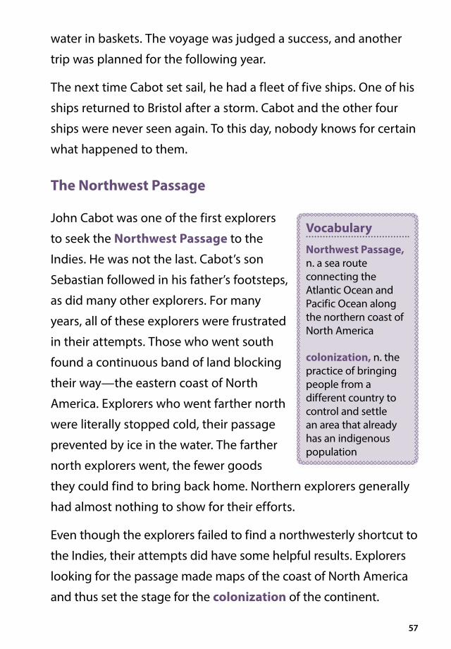
water in baskets. The voyage was judged a success, and another
trip was planned for the following year.
The next time Cabot set sail, he had a fleet of five ships. One of his
ships returned to Bristol after a storm. Cabot and the other four
ships were never seen again. To this day, nobody knows for certain
what happened to them.
The Northwest Passage
John Cabot was one of the first explorers
to seek the Northwest Passage to the
Indies. He was not the last. Cabot’s son
Sebastian followed in his father’s footsteps,
as did many other explorers. For many
years, all of these explorers were frustrated
in their attempts. Those who went south
found a continuous band of land blocking
their way—the eastern coast of North
America. Explorers who went farther north
were literally stopped cold, their passage
prevented by ice in the water. The farther
north explorers went, the fewer goods
they could find to bring back home. Northern explorers generally
had almost nothing to show for their efforts.
Even though the explorers failed to find a northwesterly shortcut to
the Indies, their attempts did have some helpful results. Explorers
looking for the passage made maps of the coast of North America
and thus set the stage for the colonization of the continent.
Vocabulary
Northwest Passage, n. a sea route connecting the Atlantic Ocean and Pacific Ocean along the northern coast of North America
colonization, n. the practice of bringing people from a different country to control and settle an area that already has an indigenous population

58
Sir Francis Drake
Once the Age of Exploration was underway, the seas were crowded
with European ships carrying valuable materials. Adventurous men
could make a lot of money as pirates. Indeed, one of the greatest
English explorers made his name as a pirate, robbing the Spanish
and Portuguese ships and presenting that treasure to Queen
Elizabeth. His name was Francis Drake, and he became one of the
greatest sea captains in history.
During his early years on the ocean, Drake’s ship was attacked
and robbed by a Spanish ship. Drake never forgot these attacks.
He spent much of his adult life seeking
revenge on the Spaniards. As Drake
crisscrossed the Atlantic, he took every
opportunity to loot Spanish trade ships
Sir Francis Drake used his pirate skills to serve Queen Elizabeth I of England.
Vocabulary
loot, v. to steal or take something by force

59
loaded with spices and silver. He also led raids on Spanish ports in
the Americas.
In 1577, Drake convinced a group of people to invest in one of his
voyages. He set out with a fleet of five ships with 164 crewmen. At
first, the voyage seemed to be nothing more than one of Drake’s
usual raiding parties. Instead, Drake followed Magellan’s example
by embarking on a journey around the world. Drake surprised his
crew by plundering a Portuguese ship and taking not only several
sacks of silver but also an experienced Portuguese pilot. This
hostage guided Drake’s fleet on the journey across the Atlantic.
Drake’s fleet crossed from the Atlantic Ocean to the Pacific Ocean
through the Straits of Magellan. Drake observed the southerly area
that Magellan had called Tierra del Fuego, or “land of fire.” Magellan
named it for the campfires burning in native villages along the
shore. Drake noted that this area was an archipelago rather
than a part of the continent. This observation would lead future
navigators to the open sea around Cape Horn at the southern tip
of South America.
By the time the expedition reached the west coast of South
America, Drake had only fifty-eight men and one ship left. That
ship was the Golden Hind. As the Golden Hind moved up the
coast of what are now Chile and Peru, Drake captured ships and
raided ports.
In Peru, Drake sailed into a harbor crowded with Spanish ships and
proceeded to rob each ship of its treasure. He learned that a ship
loaded with gold and silver had just left port a few days earlier.
The ship also had many powerful guns.

60
Drake and his Golden Hind raced up
the coast after the heavy and slow-
moving Spanish treasure ship. When
he saw it, he hung water barrels off
the back of his ship to make Golden
Hind look like a merchant ship. When
he got close, he cut loose the barrels
and pulled up next to the Spanish
ship. Drake’s trained sailors jumped
aboard the treasure ship and cut down
the Spanish crew, throwing many of
them overboard. They then looted the
ship of its treasure and set it on fire.
The Spanish Armada
Not surprisingly, Spain was very angry about Sir Francis Drake’s
actions. Drake might have been a hero in England, but to the
Spanish he was nothing but a pirate. The Spanish ambassador is
said to have called him “the master-thief of the unknown world.”
The Spaniards demanded that Queen Elizabeth return the stolen
treasure and have Drake hanged. The queen refused.
Spain considered itself the strongest naval power in the
world. Its rulers resented the attacks by English pirates and
England’s involvement in other Spanish affairs. It put together
an armada of ships loaded with heavy
cannons and soldiers. In 1588, the armada
set sail to invade England and overthrow
Queen Elizabeth.
Sir Francis Drake’s Golden Hind laid a trap for a Spanish treasure ship.
Vocabulary
armada, n. a large fleet of ships

61
The English knew that they could not fight the huge Spanish fleet
as a unit. So Drake and other English sea captains used imaginative
battle tactics. They set small ships on fire and sent them into the
Spanish battle formations. The Spanish, afraid that the small ships
were loaded with gunpowder, broke formation. The English had
smaller, more mobile ships. They used these ships to gang up on
the lumbering Spanish battleships, sinking many. As the Spanish
ships retreated, a storm sank still more of the armada. In the end,
In 1588, the English defeated the mighty Spanish Armada, shifting the balance of naval power from Spain to England.

62
only about half of the armada’s more than 130 ships returned
safely to Spain.
England had won a great victory. The defeat of the Spanish
Armada also marked a change in the balance of sea power. The
1500s had belonged to Spain. Over the next two centuries, English
ships would come to rule the seas.
Building Colonies
In the 1500s, Spain conquered Mexico and Central and South
America. The Spanish accumulated a great fortune in gold and
silver from their American colonies. Indeed, the main purpose of
many Spanish colonies was to find gold and silver and send these
precious metals back to Spain.
The English were also interested in acquiring wealth, but preferred
to do so by setting up permanent settlements. They wanted
colonies where people would farm, fish, cut timber, and harvest
the other resources of the region.
Building colonial settlements was
expensive. The English kings and queens
did not want to spend the money. Instead,
they gave grants of land to well-to-do
people or businesses, called joint-stock
companies, to build the colonies.
In 1585, Sir Walter Raleigh established the first English colony in
North America. Raleigh sent a group of men to Roanoke Island, off
the coast of modern-day North Carolina. Unfortunately, Raleigh’s
colonists grew discouraged and they returned to England.
Vocabulary
joint-stock company, n. a company that raises money by selling shares, or interest in the company, in the form of stock
63
In 1587, Raleigh sent a second group to the island. This time,
women and children traveled with the men. He hoped that a
community of families would stay there.
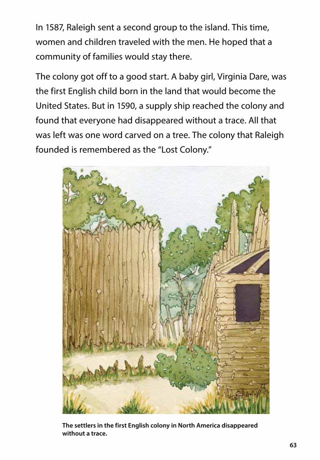
The colony got off to a good start. A baby girl, Virginia Dare, was
the first English child born in the land that would become the
United States. But in 1590, a supply ship reached the colony and
found that everyone had disappeared without a trace. All that
was left was one word carved on a tree. The colony that Raleigh
founded is remembered as the “Lost Colony.”
The settlers in the first English colony in North America disappeared without a trace.

64
In 1607, a joint-stock company called the London Company started a
colony at Jamestown, Virginia. Jamestown was the first permanent
English settlement in North America. At first, the colony struggled.
Then the Powhatan Confederacy, Native Americans indigenous
to the area, came to the colony’s rescue. The Confederacy was
made up of about thirty Native American groups that shared the
same language, called Algonquian. It was named for the chief who
governed it. Members of the Powhatan Confederacy taught the
colonists how to grow tobacco, a crop that was native to North
America and unknown in Europe. Growing tobacco was a big
success. Tobacco quickly became a cash crop for the colonists.
Then in 1620, the Pilgrims settled at Plymouth. These colonists
wanted religious freedom. Ten years later, the Puritans formed the
Massachusetts Bay Company and settled in Boston.
During the 1600s, the English settled on land along most of the
Atlantic coast. This land belonged to various Native American
groups, who were often forced to find new places to live. The
English also built colonies on islands in the West Indies in the
Caribbean Sea.
These English colonies survived and
prospered. By 1700, English colonies
stretched from the fisheries of
Newfoundland to the sugar plantations
of the Caribbean.
These colonies were built on strong trade connections.
They became home to people who were looking for wealth,
Vocabulary
fishery, n. an area of water where fish or other sea creatures are raised and caught

65
religious freedom, and unlimited opportunities for themselves
and their children.
Pursuing the Spice Trade
England successfully built colonies in North America, but it did not
forget about the rest of the world. It also competed for a share of
the spice trade in Asia.
England’s East India Company decided that traveling all the way
to the Spice Islands from England was too dangerous and too
expensive. The company directors chose to base their operations
in India. Before long, the East India Company had settlements
in the Indian cities of Surat, Madras, Bombay, and Calcutta. The
Company was also given the authority to raise an army. It was only
a matter of time before the English expanded their holdings in
India and started permanent trading posts there.
Chapter 8France and the Fur Trade France Joins In In the early 1500s, Spain was mining gold and silver in Mexico and Peru. Portugal ruled the spice trade in the Indian Ocean. England had sent John Cabot to look for the Northwest Passage. The king of France, Francis I, did not want to be left behind.
In 1524, the king hired an Italian explorer
named Giovanni da Verrazano (/joh*vah*nee
/da/ver*rah*zah*noe/) to explore North
America and look for the Northwest Passage.
Verrazano’s brother, a cartographer, sailed with him. North America
was new to the Europeans and had not been mapped. One of the
goals of Verrazano’s expedition was to create accurate maps of the
Atlantic coast.
66
The Big Question
The French and the English had different approaches to settlement in North America. In what ways were they different?
Vocabulary
cartographer, n. a mapmaker

67
New York’s Verrazano Bridge honors explorer Giovanni da Verrazano, who explored the Atlantic coast for France.

68
Verrazano was the first European to sail up the Atlantic coast of the
present-day United States, from North Carolina to Newfoundland.
When he sailed into New York Bay, he noted that it was a deep-
water harbor. Today the entrance to New York Harbor is spanned
by the Verrazano-Narrows Bridge, named in his honor. Verrazano
did not make it back to Europe. He was killed on an island in the
Caribbean. The French king was sad to learn about his fate, but he
was determined that France benefit from the riches found in the
Americas. The king was also determined to find the Northwest
Passage. But who could help him to achieve this goal?
Jacques Cartier
In 1534 France’s king asked Jacques Cartier, a French sea
captain, to explore the coast of North America. Cartier sailed to
Newfoundland, where he encountered English and Spanish fishing
fleets. This area of water off the coast of Newfoundland was a rich
fishing ground.
Cartier continued his voyage, exploring the coast of Labrador and
the Gulf of St. Lawrence. At the time, Cartier did not realize that
the Gulf of St. Lawrence was in fact the mouth of a mighty river.
Instead of exploring further, he claimed the land around the gulf
for France and returned to Europe.
One year later, Cartier returned to North America. This time he
sailed up the St. Lawrence River. In his log, Cartier recorded his
thoughts on the land he saw, describing the tree-covered territory
as beautiful.

69
Cartier visited a Native American village on an island in the
St. Lawrence. He climbed a hill and named it Mount Royal. This
site eventually became part of the Canadian city of Montreal.
During the winter, Cartier’s men became sick with scurvy. The
snow was four-feet deep. Many of Cartier’s men died from
the cold and sickness. Cartier gave up hope of ever returning
to France.
The friendship between Cartier and the Native Americans saved
him and his men. The Native Americans taught the French
how to brew a drink made from evergreen trees. (Today we
know that such a brew is rich in vitamin C.) It cured the French
explorers of their scurvy. In the spring, Cartier and his men
returned to France.
Cartographers were important participants in the voyages of early explorers.

70
Cartier returned on a third voyage to what is now Canada. The
French king wanted a colony in North America. But French people
could not be easily persuaded to become settlers in this cold,
distant land. Instead, the king released prisoners from jail and sent
them to settle in North America.
That colony was doomed from the start. The prisoners were happy
to get out of jail but not eager to work in such difficult conditions.
Supply ships were late in arriving. Jacques Cartier was forced to
give up and return to France.
Over the next sixty years, France was racked by political troubles
and wars. Little attention was paid to the land Cartier claimed
for France.
Champlain and New France
During the 1500s, French ships did venture to the waters off
Newfoundland to fish. As a result, trade relationships slowly
developed between the French fishermen and the local Native
Americans. The Native Americans were eager to have tools and
other metal goods. The French wanted to trade furs, particularly
beaver skins, which were in great demand in Europe for making
men’s hats.
The development of a fur trade in North America led to a renewed
effort by the French to establish colonies in the land they called
New France. The key figure in the settlement of New France was
an explorer named Samuel de Champlain.

71
In 1603, Champlain sailed to New France for the first time. He
explored the coast of Maine and Nova Scotia. He founded his
first settlement in Nova Scotia. In 1608, Champlain moved
the settlement to the site of Quebec City, on the banks of the
St. Lawrence River. At a point where the river narrows, Champlain
built a town on the heights with a view of the river.
New France grew differently than the
English colonies. At first very few settlers
came to New France. The winters were
long and hard. Farming was difficult
because the growing season was
so short.
Samuel de Champlain explored the coast of Maine and Nova Scotia. He eventually established a settlement that became Quebec City.
Vocabulary
growing season, n. the days available in a year to plant and harvest crops

72
Those who did settle in New France were mostly rugged
adventurers. For a while that suited the French government. The
colony made a profit, and for the most part the colony’s few
settlers did not need a great deal of supervision.
It is probably true to say that the settlers in New France also dealt
with the Native Americans living nearby somewhat differently
than the English did in the colonies to the south. English colonists
forcefully pushed Native Americans off land they had lived on
for generations. In New France, the relationship between the fur
traders and the Native American tribes was more peaceful. The
French had not tried to conquer the Native Americans, but instead
had focused on trade.
The fur trade also resulted in further
exploration. Fur traders canoed and
portaged farther and farther into the
North American wilderness. In 1673, an
expedition led by Jacques Marquette
(/mahr*ket/) and Louis Jolliet (/joe*lee*ae/) became the first
European expedition to reach the Mississippi River.
The Mississippi River
In 1682, a French explorer with the imposing name of René-
Robert Cavelier, Sieur de La Salle (/reh*nae/roh*bayr/kah*vel*yae/
syer/duh/lah/sal/) sailed down the Mississippi River to the Gulf of
Mexico. La Salle claimed all the land drained by the Mississippi for
the king of France.
Vocabulary
portage, v. to carry boats and supplies overland from one waterway to another

73
By 1700, New France was a sizable empire with hardly any settlers.
There were only about ten thousand Europeans in the entire area.
The fur trade was profitable, true. But if a competitor appeared,
France would have a hard time defending its lands. And that
competitor was right next door. England and France were rivals
in Europe. They would soon become rivals in North America
as well.

Chapter 9Dutch Trade Control of the Spice Trade For many years, the Portuguese controlled the spice trade from the Cape of Good Hope to the most distant shores of the Indian Ocean. They had settlements up and down the African coast and a main trade center at Goa, on the west coast of India.
Spain was growing wealthy by mining the gold that had been
discovered in the Americas. It did not become especially interested in
the spice trade until the death of a particular king.
In 1580, King Henry of Portugal died. His death changed the history
of the spice trade. A king’s death could create political unrest when
it was unclear who should succeed him. That’s what happened in
Portugal. Henry had no adult son to take over the throne. Seven
different people presented themselves as having the right to be
the next king of Portugal. One of them was King Philip II of Spain.
Philip was related to Henry on his mother’s side. After some conflict,
Portugal and Spain were brought together under the rule of the
Spanish King Philip II.
74
The Big Question
How did the death of a king affect the Spice Trade?
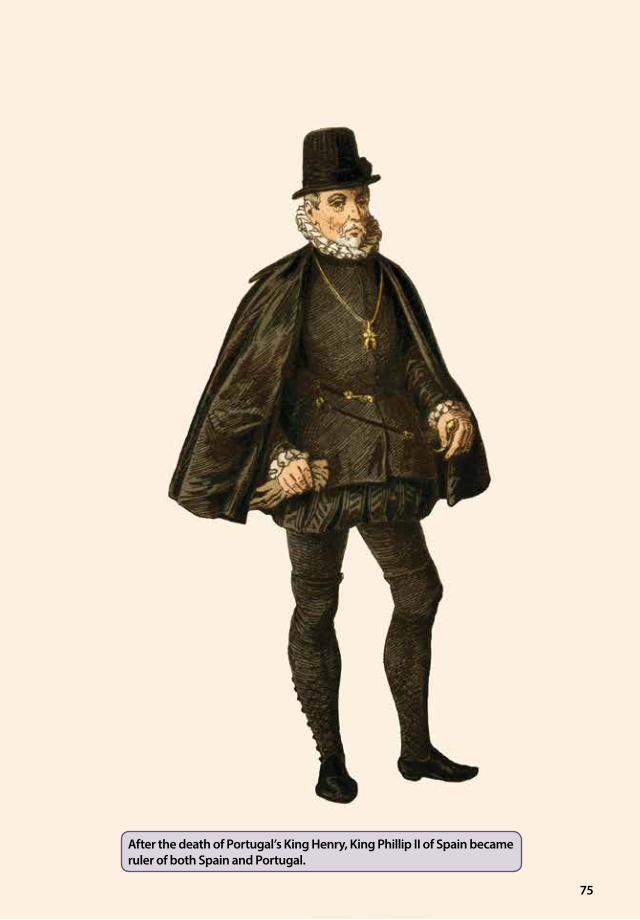
75
After the death of Portugal’s King Henry, King Phillip II of Spain became ruler of both Spain and Portugal.

76
At first there was little effect on the spice trade. The Spanish navy
was the most powerful in the world. It could protect Portuguese
ships sailing to Asia. Only now a good part of the profits went to
the king of Spain.
In 1588, the defeat of the Spanish Armada tipped the balance of
sea power in the world. The defeat crippled Spain as a sea power.
At the time, Spain was at war with the Dutch. As Spanish power
declined, the Dutch saw an opportunity for their country, the
Netherlands, to take control of the spice trade.
The Dutch were excellent sailors and merchants, and they had a
developing interest in the spice trade. A Dutch seaman named Jan
van Linschoten (/yahn/vahn/lihn*skoe*tun/) played an important
role. As a sailor, Linschoten spent his life looking for a northeastern
route to the Spice Islands, a route that did not exist. When he
stopped exploring, Linschoten worked in India, keeping long and
detailed notes about the Eastern traders he worked with. The
information he gathered was a great help to the Dutch as they
entered the spice trade.
The Dutch set up their main trade center on the island of Java
in present-day Indonesia. They named the community Batavia.
(Today it is called Jakarta and is the capital city of Indonesia.) It
was far away from the Portuguese on the African coast but close
to the nutmeg, mace, and cloves found in the Spice Islands.
In the early 1600s, Dutch merchants
formed a joint-stock company called the
Dutch East India Company. The company
received a charter from the government
Vocabulary
charter, n. a document issued by an authority giving a group certain rights

77
giving it a monopoly on all trade stretching east from the Cape of
Good Hope in Africa to the Straits of Magellan in South America.
Dutch power and control of the spice trade grew.
Because the Netherlands is a very small country without many
resources of its own, the Dutch did not have many goods to trade
from their home ports. Instead, they traveled throughout the East
gathering up goods to trade. Dutch ships called at ports all over
Africa, India, and other Asian countries. They voyaged into the Persian
Gulf and all the way to Japan. They traded silver from one place for
cloth or tea from another. The trades were set up so that, in the end,
spices ended up in the hands of the Dutch for transport to Europe.
The Dutch worked hard to control the amount of spices available
in Europe. For example, if there was too much of one spice
available, they would destroy supplies of it to prevent the price
of that spice from falling. Since the trading center at Java was so
The Dutch developed a trade empire that stretched from Europe across Asia to Japan.
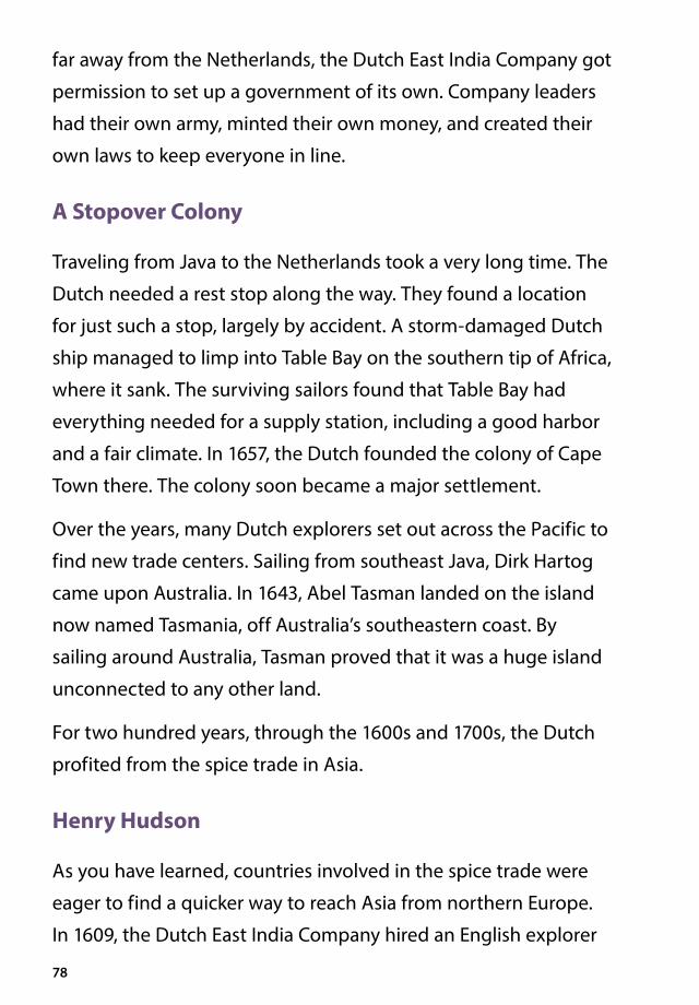
78
far away from the Netherlands, the Dutch East India Company got
permission to set up a government of its own. Company leaders
had their own army, minted their own money, and created their
own laws to keep everyone in line.
A Stopover Colony
Traveling from Java to the Netherlands took a very long time. The
Dutch needed a rest stop along the way. They found a location
for just such a stop, largely by accident. A storm-damaged Dutch
ship managed to limp into Table Bay on the southern tip of Africa,
where it sank. The surviving sailors found that Table Bay had
everything needed for a supply station, including a good harbor
and a fair climate. In 1657, the Dutch founded the colony of Cape
Town there. The colony soon became a major settlement.
Over the years, many Dutch explorers set out across the Pacific to
find new trade centers. Sailing from southeast Java, Dirk Hartog
came upon Australia. In 1643, Abel Tasman landed on the island
now named Tasmania, off Australia’s southeastern coast. By
sailing around Australia, Tasman proved that it was a huge island
unconnected to any other land.
For two hundred years, through the 1600s and 1700s, the Dutch
profited from the spice trade in Asia.
Henry Hudson
As you have learned, countries involved in the spice trade were
eager to find a quicker way to reach Asia from northern Europe.
In 1609, the Dutch East India Company hired an English explorer

79
named Henry Hudson. Hudson wanted to be the explorer who
found the Northwest Passage that everyone was seeking.
Hudson took a small crew on a small ship called the Half Moon. He
sailed north, following the coast of Norway. The farther north the
Half Moon traveled, the colder and icier it got. The crew began to
grumble. Conditions on the ship went from bad to worse. Hudson
had planned to find a passage that would take him over the North
Pole and down to the Malay Archipelago. Instead, he changed his
mind and headed west.
Hudson charted the Half Moon’s course down the Atlantic coast
of North America to find the Northwest Passage. At the mouth of
what is now the Hudson River, he claimed land for the Netherlands.
For the first few days that the Half Moon sailed up the Hudson
River, Hudson must have felt great excitement. The river was wide
and deep, with steep sides and a strong current. Surely this was
the passage through the continent. Hudson sailed up the river
to the site of present-day Albany, New York. But when the river
grew shallow, it became clear that it would not lead to the Pacific
Ocean. Hudson returned to Europe.
The next year, Hudson returned to North America, this time on an
English ship, the Discovery. Hudson was sure he would have to sail
north to find the Northwest Passage. He discovered a huge inland
sea, which he mistook for the Pacific Ocean. Today that Canadian
body of water is called Hudson Bay.
Hudson and his men quickly realized they were in an inland sea.
Winter came rapidly. The ship got stuck in the ice, and food ran

80
low. The crew grew angry and mutinied. Hudson, his son, and
some loyal sailors were forced off the ship and into a small boat.
They were never heard from again. Sailors on the Discovery made
it back to England. They were never punished for the mutiny.
New Netherland
Dutch merchants were eager to make money from the land
claimed by Hudson. In 1614, a group of these merchants formed a
joint-stock company called the New Netherland Company.
The company’s first activity was fur trading. A trading post was built
at Fort Orange (today, Albany, New York) far up the river explored by
Hudson. The fur trading went well, and merchants prospered. But the
company was unsuccessful in getting colonists to this new land. Most
Mutinous crew members forced Henry Hudson off his ship to face certain death in the cold and barren area.

81
people in the Netherlands, a small country, were reluctant to leave
their homeland to live in a distant wilderness.
Eventually a new company called the Dutch West India Company
took over. In 1626, Peter Minuit (/mihn*yoo*iht/), the head of the
Dutch West India Company, came to the island of Manhattan and
acquired the island from the Native Americans. Today, the island
of Manhattan is the heart of New York City. On the southern tip of
Manhattan, the Dutch built a town they called New Amsterdam.
The town grew, but slowly.
The Dutch government didn’t think New Amsterdam was worth
the high cost of defending it. In 1664 an English warship sailed
into New York Harbor and took over the colony. The English
renamed the colony New York in honor of the duke of York. The
Dutch efforts to colonize North America were over.
The English easily captured the Dutch colony of New Amsterdam. They renamed the colony New York.
Chapter 10Slavery Age-Old Practice There had been enslaved people for many years prior to the Age of Exploration. For centuries people throughout the world had enslaved those they had conquered. But Europeans used their power and wealth to spread the practice of slavery on a vast scale. In doing so, they dramatically changed the lives of millions of people.
Slavery was part of African life long before Europeans arrived.
Muslim states in North Africa marched Africans across the Sahara to
markets in the Middle East. Traders also shipped people from East
Africa across the Indian Ocean to sell them into slavery. Many African
cultures also practiced slavery among themselves. But among some
groups, enslaved people had rights. For example, in the Ashanti
kingdom of West Africa, enslaved people could own property and
marry, and they got their freedom after working for a set amount of
time. Most importantly, children born to Ashanti-enslaved people
were not automatically also enslaved.
82
The Big Question
How did the Age of Exploration lead to the development of the slave trade?

83
Enslaved people were forced to work extremely hard in challenging conditions.

84
European involvement in the African slave trade began to grow
after the year 1415 when the Portuguese seized the city of Ceuta
(/she*yoo*tuh/) on the North African coast. During the next
hundred years, nearly two hundred thousand Africans were taken
to become enslaved workers in parts of Europe, and to islands in
the Atlantic.
In the 1400s, Portuguese and Spanish explorers discovered
several groups of islands in the Atlantic Ocean. Colonists quickly
settled on these islands. Portugal built colonies on Madeira
(/muh*deer*uh/), Sāo Tomé (/sou/tuh*meh/), and the Azores
(/ae*zorz/). Spain colonized the Canary Islands.
Spanish and Portuguese colonists realized that the land and
climate in these islands would be good for growing the cash crop
sugar, which was in high demand in Europe. In order for growing
sugar to be a profitable business, though, huge fields of sugarcane
had to be planted and harvested. This required lots of workers.
For Spanish and Portuguese plantation owners, large numbers of
enslaved people provided the needed labor. As sugar plantations
sprang up, the demand for enslaved workers grew.
Slavery in the Americas
After Columbus came upon the islands of the Caribbean Sea, the
Spanish quickly colonized the region. Spanish colonies throughout
the Americas were established to benefit Spain. In Mexico and
Peru, the Spanish gathered vast amounts of gold and silver. They
used indigenous people to work in the mines.

85
The islands of the Caribbean were not rich in mineral wealth. The
land and climate, however, were well-suited for growing sugar and
other crops. Experts from the Canary Islands came to Hispaniola
and other islands to help the Spanish set up sugar plantations.
These plantations needed an inexpensive labor force. At first,
plantation owners planned to use local people to work on the
plantations. But disease and war, which had largely been brought
to the islands by the Europeans, killed many indigenous people.
As had been the case in the Azores and
the Canary Islands, enslaved people from
Africa provided a cost-effective answer.
However, this practice was incredibly
inhumane, and caused much suffering.
The Spanish were not the only Europeans
who thought of this solution. Portuguese
colonists found that sugar was well-suited to the coastal regions
of Brazil. They imported people to use as enslaved labor to grow
sugarcane there. In the 1600s, England colonized several islands
in the Caribbean, including Jamaica and St. Kitts. British planters,
too, turned to enslaved people from Africa to work on their sugar
plantations. Sugar made the planters rich. But the sugar growers
created another business that could make people rich—trading
human beings across the Atlantic.
The Slave Trade
The Portuguese were the first Europeans involved in the Atlantic
slave trade. Their explorations of the African coast had opened
Vocabulary
cost-effective, adj. providing benefits without costing a great deal of money
inhumane, adj. cruel, unacceptable

86
up new sources for people they could enslave. When Portugal’s
power collapsed and the Dutch took over the spice trade, they
took over much of the Atlantic slave trade as well.
In 1619, a Dutch ship sailed into the mouth of the James River in the
English colony of Virginia in North America and dropped anchor.
On board were Dutch pirates who had been attacking other
ships on the high seas. They had captured a shipload of enslaved
Africans from a Spanish vessel heading for the Caribbean. Now the
Dutch sailors were traveling north and needed supplies. The pirates
traded these people for food. This was the first arrival of Africans
in the English North American colonies. Whether these Africans
became indentured servants or enslaved workers remains unclear.
One of the trade centers the Dutch had taken from the Portuguese
was Elmina on the west coast of Africa (in present-day Ghana). For
years, Elmina had been a Portuguese trade center where ivory
Captured Africans were held in Elmina Castle on the West African coast before being transported to Europe or the Americas.

87
and gold were exchanged. As the slave trade increased, Elmina
became one of the forts where captured Africans were imprisoned
before being transported to Europe or to the Americas. Before
long, Elmina was the center of the Dutch slave trade.
By 1655, the Dutch were transporting 2,500 enslaved people
across the Atlantic each year. When England seized control of New
Netherland, there were five hundred Dutch-speaking Africans in
the colony.
The slave trade was one side of a trading triangle. One segment
of the triangle carried goods from Europe to Africa. Ships carried
items such as iron, guns, gunpowder, knives, cloth, and beads.
Another segment transported people from Africa to the Caribbean
islands and later to the English colonies in North America.
The slave trade was an important leg of the triangular trade that developed among Europe, Africa, and the Americas.

88
And another segment of the triangle made a return trip to Europe.
These ships carried timber, tobacco, grain, sugar, and rice from the
plantations of the Americas.
Middle Passage
Africans typically passed through several stages in their journey
into slavery. First, they were captured, sometimes by European
slavers but usually during wars among African tribes. Next they
were marched to a seaport such as Elmina. There they were
packed into ships for the journey across the Atlantic. Those who
survived the journey were sold at the slave market in a seaport in
the Americas and transported to plantations.
The trip across the Atlantic Ocean was known as the Middle
Passage. It was a terrible, dehumanizing experience. Slave
The Middle Passage was a harsh experience that many did not survive.

89
ships usually carried between 150 and
six hundred Africans. Enslaved people
were treated like cargo, not people. They
were chained on platforms. Each person
had a space about six feet long and
sixteen inches wide. Because they were chained in place, they
could not even turn over.
As the ships passed through tropical latitudes, temperatures in the
hold would rise to over one hundred degrees. Enslaved people
were fed small amounts of rice and water twice a day.
The trip across the ocean took between two and four months
depending on the weather and the destination. Illness and
death were common occurrences. With people packed in close
quarters, disease spread easily. Historians estimate that about
fifteen percent of enslaved people did not survive the journey. The
Atlantic slave trade lasted nearly three hundred years. In that time,
European slave traders made approximately fifty-four thousand
voyages across the Atlantic.
The Growth of Slavery in the Colonies
In the colonies of North America, the demand for enslaved
people came later in the slave trade. The Pilgrims and Puritans
settled the colonies in the Northeast where the soil was not
very good and the winters were cold. These conditions were not
ideal for growing cash crops, so there was no need for a large
labor force. Even so, slavery did exist on a small scale in these
northern colonies.
Vocabulary
cargo, n. goods transported by a ship, plane, or truck
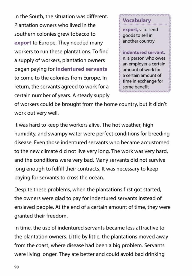
90
In the South, the situation was different.
Plantation owners who lived in the
southern colonies grew tobacco to
export to Europe. They needed many
workers to run these plantations. To find
a supply of workers, plantation owners
began paying for indentured servants
to come to the colonies from Europe. In
return, the servants agreed to work for a
certain number of years. A steady supply
of workers could be brought from the home country, but it didn’t
work out very well.
It was hard to keep the workers alive. The hot weather, high
humidity, and swampy water were perfect conditions for breeding
disease. Even those indentured servants who became accustomed
to the new climate did not live very long. The work was very hard,
and the conditions were very bad. Many servants did not survive
long enough to fulfill their contracts. It was necessary to keep
paying for servants to cross the ocean.
Despite these problems, when the plantations first got started,
the owners were glad to pay for indentured servants instead of
enslaved people. At the end of a certain amount of time, they were
granted their freedom.
In time, the use of indentured servants became less attractive to
the plantation owners. Little by little, the plantations moved away
from the coast, where disease had been a big problem. Servants
were living longer. They ate better and could avoid bad drinking
Vocabulary
export, v. to send goods to sell in another country
indentured servant, n. a person who owes an employer a certain amount of work for a certain amount of time in exchange for some benefit

91
water. Healthy servants started living long enough to fulfill their
contracts. Plantation owners started having to pay out more in
“freedom dues.”
Freedom dues were what a servant received for completing his or
her contract. According to the contract, an indentured servant was
given food, clothing, money, and some livestock. Those who were
given land could finish their contracts and start farming next door.
Before long, buying an enslaved workforce from Africa became
more profitable and efficient than hiring indentured servants.
Slavery spread in the 1700s. Millions of acres were planted with
tobacco. Planters also introduced a new cash crop, rice, which
needed lots of labor to plant and harvest.
In the late 1700s and 1800s, cotton
became a third cash crop grown in the
American South. Indigo and cotton
cultivation also relied on the labor of
enslaved people.
Plantation Life
The life of an enslaved person was very hard. People were sold
as slaves at a market where owners bid against each other.
Slaveholders bought the people they thought would work best for
them. Families were frequently broken up; children were separated
from their parents, and husbands from wives.
On the plantation, enslaved people had no freedom. They had
to do what their masters told them to do and could not travel
Vocabulary
cultivation, n. the planting, growing, and harvesting of crops

92
anywhere without permission. They could not testify in court, so
an owner could mistreat an enslaved person and get away with it.
Many colonies also had laws that made it illegal to teach enslaved
people to read or write.
Slaveholders sometimes separated children from their parents.

93
Enslaved people worked from dawn to nightfall, with an hour off
midday in the heat. The work was hard. They worked in the cotton,
rice, indigo, and tobacco fields. They chopped wood, built fences,
cleared roads, and dug wells. All the while,
they were watched by a person called an
overseer. Other enslaved people worked
in the master’s house, performing tasks
such as cooking and cleaning.
Not all Africans in the colonies were enslaved. Some managed to
gain their freedom. A few slaveholders even gave freedom to their
enslaved workers. Free Africans in the colonies made their living as
farmers and crafts workers. After the American Revolution, slavery
was abolished in most of the northern states. But slavery spread
in the American South, where it survived until the end of the Civil
War in the mid-nineteenth century.
Summing Up the Age of Exploration
The Age of Exploration brought tremendous changes to the world.
The United States and Canada had their first beginnings in this era.
They might not exist if the explorers you have learned about had
stayed at home.
To have a full and well-balanced understanding of the Age of
Exploration, we have to recognize that this age, like most ages,
was better for some people than for others. Some people made
their fortunes; others did not survive perilous journeys.
But for many people, the Age of Exploration was a time of great
hardship. Contact with Europeans devastated the indigenous
Vocabulary
overseer, n. someone who supervises workers to make sure a job is done properly

94
peoples of the Americas. Many died in battle, and disease killed
millions more. For millions of Africans, contact with Europeans
meant a lifetime of slavery. The image of a ship sailing proudly
across the Atlantic becomes much less inspiring when we
remember that many of these ships carried human cargo in
inhumane conditions. An understanding of the age must include
both the heroism of the explorers and the tragedies that resulted
from exploration.
Port
ugal
Spai
nEn
glan
d
Terr
itor
ies
and
Voy
ages
Fran
ceN
ethe
rland
s
PACI
FIC
OCE
AN
NO
RTH
AM
ERIC
A
Da Gam
a
N
SE
W
Engl
and
Nor
th P
ole
Sout
h Po
le
Spa
in
Port
ugal
Fran
ce
Net
herl
ands
EURO
PEA
SIA
AFR
ICA
AU
STRA
LIA
SOU
THA
MER
ICA
Expl
orat
ion
and
Empi
res
(ca.
170
0)
Vespucc
i
John
Cab
ot
Verr
azan
o
Hud
son
Hud
son
Rale
igh
Cart
ier
Mag
ella
n/de
l Can
o
PizarroBalb
oa
Drake
Tasm
an
03,
000
mile
s
IND
IAN
OCE
AN20
°S
0°20°N
40°S
40°N
60°S
60°N
80°N 80
°S160°
W12
0°W
120°
E16
0°E
40°W
40°E
0°80
°W80
°E
Diaz
Mag
ella
n/de
l Can
o
Colu
mbu
s
Spic
e Is
land
s

95
Port
ugal
Spai
nEn
glan
d
Terr
itor
ies
and
Voy
ages
Fran
ceN
ethe
rland
s
PACI
FIC
OCE
AN
NO
RTH
AM
ERIC
A
Da Gam
a
N
SE
W
Engl
and
Nor
th P
ole
Sout
h Po
le
Spa
in
Port
ugal
Fran
ce
Net
herl
ands
EURO
PEA
SIA
AFR
ICA
AU
STRA
LIA
SOU
THA
MER
ICA
Expl
orat
ion
and
Empi
res
(ca.
170
0)
Vespucc
i
John
Cab
ot
Verr
azan
o
Hud
son
Hud
son
Rale
igh
Cart
ier
Mag
ella
n/de
l Can
o
PizarroBalb
oa
Drake
Tasm
an
03,
000
mile
s
IND
IAN
OCE
AN20
°S
0°20°N
40°S
40°N
60°S
60°N
80°N 80
°S160°
W12
0°W
120°
E16
0°E
40°W
40°E
0°80
°W80
°E
Diaz
Mag
ella
n/de
l Can
o
Colu
mbu
s
Spic
e Is
land
s

Aarchipelago, n. a chain of islands (4)
armada, n. a large fleet of ships (60)
astrolabe, n. a navigational tool used to determine the position of the sun, a star, or other object in the sky (15)
Ccargo, n. goods transported by a ship, plane,
or truck (89)
cartographer, n. a mapmaker (66)
cash crop, n. a crop that is grown to be sold (44)
charter, n. a document issued by an authority giving a group certain rights (76)
circumnavigate, v. to travel completely around something (such as Earth), especially by water (53)
colonization, n. the practice of bringing people from a different country to control and settle an area that already has an indigenous population (57)
conquistador, n. the Spanish word for conqueror (44)
cost-effective, adj. providing benefits without costing a great deal of money (85)
cultivation, n. the planting, growing, and harvesting of crops (91)
cure, v. to preserve meat, fish, or other food by smoking, drying, or salting it (12)
Ddiplomat, n. someone who represents the
government of one country in another country (38)
“diplomatic mission,” (phrase) a group of people who serve as representatives of their government in another country (8)
Eempire, n. a group of countries or territories under
the control of one government or ruler (45)
expedition, n. a special journey taken by a group that has a clear purpose or goal (20)
exploitation, n. the practice of taking unfair advantage of a person or group (47)
export, v. to send goods to sell in another country (90)
Ffishery, n. an area of water where fish or other
sea creatures are raised and caught (64)
fleet, n. a group of ships sailing together with the same purpose and under the control of the same leader (21)
Ggrowing season, n. the days available in a
year to plant and harvest crops (71)
Hhourglass, n. a glass device that measures
time using the flow of sand (17)
hull, n. the sides and bottom of a boat (14)
Iimmunity, n. a body’s ability to remain free
of illness even after being exposed to the cause of the illness (42)
indentured servant, n. a person who owes an employer a certain amount of work for a certain amount of time in exchange for some benefit (90)
indigenous, adj. native to a particular region or environment (38)
inhumane, adj. cruel, unacceptable (85)
interpreter, n. a person who translates from one language to another (21)
iron ore, n. rock from which iron can be obtained (25)
isthmus, n. a narrow piece of land that connects two larger land masses (44)
Glossary
96

Jjoint-stock company, n. a company that
raises money by selling shares, or interest in the company, in the form of stock (62)
Llandfall, n. the reaching of land, after a trip
by sea (21)
league, n. a unit of distance equal to approximately three miles (33)
log, n. a written record of a ship’s progress (33)
loot, v. to steal or take something by force (58)
Mmagnetic compass, n. a device that uses
a magnetized pointer to show direction (16)
medieval, adj. relating to the Middle Ages in Europe (2)
merchant, n. a person who buys and sells goods to earn money (7)
Mongol, n. a native of the Asian nation of Mongolia (8)
monopoly, n. a situation in which one person, country, or company has complete control of the supply of a good or service (6)
Moor, n. a North African follower of Islam during the Middle Ages (21)
motive, n. the reason for taking a specific action (10)
mutiny, n. the rebellion of a ship’s crew against the captain (34)
Nnavigation, n. the act of planning and
directing the movement of a ship, plane, or other vehicle (14)
navigational, adj. related to controlling the movement of a ship (6)
negotiate, v. to discuss the terms of an agreement (7)
Northwest Passage, n. a sea route connecting the Atlantic Ocean and Pacific Ocean along the northern coast of North America (57)
Ooverseer, n. someone who supervises workers
to make sure a job is done properly (93)
Pplantation, n. a large farm where one or more
crops were grown by a large number of laborers; these crops were sold for a profit by the plantation owner (44)
porcelain, n. a type of fine pottery (8)
portage, v. to carry boats and supplies overland from one waterway to another (72)
Rrain shadow, n. an area that gets less rain
because it is on the protected side of a mountain (5)
rig, v. to prepare for sailing (15)
royal standard, n. a flag that represents a king or queen (35)
Sscurvy, n. a disease caused by a lack of
vitamin C (24)
sextant, n. a navigational instrument that uses a telescope and scale to determine latitude and longitude (15)
spice, n. a plant used to add flavor to food (2)
strait, n. a narrow body of water that connects two larger bodies of water (50)
Ttrade wind, n. a wind that almost always
blows in a particular direction (24)
trader, n. a person who buys and sells goods (6)
trading center, n. a place where people buy and sell goods (6)
Uuncharted, adj. never mapped (14)
97


CKHG™
Core Knowledge HISTORY AND GEOGRAPHY™
Series Editor-In-ChiefE. D. Hirsch, Jr.

Subject Matter ExpertJ. Chris Arndt
Illustration and Photo CreditsAge Fotostock/SuperStock: i, iii, 19Album/Oronoz/SuperStock: 9Angela Padron: Cover D, 54–55Brittany Tingey: 40Christopher Columbus’s Santa Maria/Private Collection/© Look and Learn/Bridgeman Images: Cover E, 32Classic Vision/Age Fotostock/SuperStock: 67Cover of “Short Account of the Destruction of the Indies” 1552 by Friar Bartolome de las Casas (1474–1566)/Photo © Tarker/Bridgeman Images: 47Daniel Hughes: 58Durga Bernhard: Cover C, 83, 88, 92Dustin Mackay: 30–31, 34, 37, 42–43Erika Baird: 71Ferdinand Magellan (1480–1521)/Pictures from History/Bridgeman Images: 49Galleon in full sail en route to Portugal, illustrated by the Coler (or Keller) family of Nuremburg (vellum), German School, (16th century)/British Library, London, UK/© British Library Board. All Rights Reserved/Bridgeman Images: 20Jacques Cartier (1491–1557) Discovering the St. Lawrence River in 1535, 1847 (oil on canvas) by Jean Antoine Theodore Gudin (1802–80)/Château de Versailles, France/Bridgeman Images: 69James Johnson: 46Japan: Dejima Island, with Dutch flag flying. Chromolithograph of a painting by Johan Maurits (1807–1874)./Pictures from History/Bridgeman Images: 77John Cardasis/SuperStock: 67King Philip II of Spain by Albert Kretschmer (1825–91)/Private Collection/© Look and Learn/Bridgeman Images: 75Map tracing Magellan’s world voyage, once owned by Charles V, 1545 (vellum) by Battista Agnese (1514–64)/John Carter Brown Library, Brown University, RI, USA/Bridgeman Images: 53Marco Polo at the court of Kublai Khan by Angus McBride (1931–2007)/Private Collection/© Look and Learn/Bridgeman Images: 8Marti Major: 16, 56Michael Parker: Cover A
Mutiny on board the fleet of Magellan by Tancredi Scarpelli (1866–1937)/Private Collection/© Look and Learn/Bridgeman Images: 50Navigators using an astrolabe in the Indian Ocean, from the ‘Livre des Merveilles du Monde’, c.1410–12 (tempera on vellum) Ms Fr 2810 f.188, by the workshop of The Boucicaut Master, (fl.1390–1430)/Bibliotheque Nationale, Paris, France/Bridgeman Images: 7Pepper harvest and offering the fruits to a king, from the ‘Livre des Merveilles du Monde’, c.1410–12 (tempera on vellum) Ms Fr 2810 f.186, by the workshop of The Boucicaut Master, (fl.1390–1430)/Bibliotheque Nationale, Paris, France/Archives Charmet/Bridgeman Images: 10–11Photononstop/SuperStock: 12Portuguese caravels, illustration from Memory of Armadas that from Portugal passed to India, Ms 1551, 16th century/Academia das Ciencias de Lisboa, Lisbon, Portugal/De Agostini Picture Library/G. Dagli Orti/Bridgeman Images: 1, 14Scott Hammond: 80Sharae Peterson: 63, 81Shari Darley Griffiths: 45Signing of Treaty of Tordesillas between Spain and Portugal, June 7, 1494/De Agostini Picture Library/G. Dagli Orti/Bridgeman Images: 39Sir Francis Drake (1540–96) (gouache on paper) by Peter Jackson (1922–2003)/Private Collection/© Look and Learn/Bridgeman Images: 60Sir Francis Drake’s The Golden Hind/Private Collection/© Look and Learn/Bridgeman Images: 61The Discovery of the Strait of Magellan (coloured engraving) by Oswald Walters Brierly (1817–94)/Private Collection/Index/Bridgeman Images: 52The Voyage of Columbus, illustration after Arthur Michael (d. 1945) from ‘This Country of Ours, The Story of the United States’ by H.E. Marshall, 1917/Private Collection/The Stapleton Collection/Bridgeman Images: 33Vasco da Gama lands at Kozhikode (Calicut, India), May 20, 1498/Pictures from History/Bridgeman Images: 25Wolfgang Kaehler/SuperStock: 86Yadid Levy/Robertharding/SuperStock: Cover B, 2–3

CKHG™
Core Knowledge History and GeoGrapHy
The Age of ExplorationCore Knowledge Sequence History and Geography 5
What is the Core Knowledge Sequence? The Core Knowledge Sequence is a detailed guide to specific content and skills to be taught in grades K-8 in language arts, history, geography, mathematics, science, and the fine arts. In the domains of world and American history and geography, the Core Knowledge Sequence outlines topics that build chronologically or thematically grade by grade.
For which grade levels is this book intended? In general, the content and presentation are appropriate for readers from the upper elementary grades through middle school. For teachers and schools following the Core Knowledge Sequence, this book is intended for Grade 5 and is part of a series of Core Knowledge HISTORY AND GEOGRAPHY units of study.
For a complete listing of resources in the Core Knowledge HISTORY AND GEOGRAPHY series,
visit www.coreknowledge.org.
Core Knowledge Curriculum Series™Series Editor-in-Chief
E. D. Hirsch, Jr.
History and GeoGrapHy
The Age of Exploration
The Spice Trade
Christopher Columbus
Enslaved workers
John Cabot
Crossing the Ocean
Reader
G5_U3_The Age of Exploration_FrontCover_SR.indd 1 10/4/16 3:59 PM

ISBN: 978-1-68380-064-4 930L
Core Knowledge History and GeoGrapHy units at this level include:
World LakesMaya, Aztec, and Inca Civilizations
The Age of ExplorationThe RenaissanceThe Reformation
England in the Golden AgeEarly Russia
Feudal JapanThe Geography of the United States
Westward Expansion Before the Civil WarThe Civil War
Westward Expansion After the Civil WarNative Americans: Cultures and Conflicts
www.coreknowledge.org
Core Knowledge Curriculum Series™Series Editor-in-Chief
E. D. Hirsch, Jr.
CKHG™
Core Knowledge History and GeoGrapHy
A comprehensive program in world and American history and geography, integrating topics in civics and the arts,
exploring civilizations, cultures, and concepts specified in the Core Knowledge Sequence (content and skill guidelines for grades K-8).
![FOR TEACHERS ONLY VOLUME - Regents Examinations · (2) When actual rating ... Aug. ’17 [3] Vol. 2 Global History and Geography Part A Specific Rubric ... enslaved Africans were](https://static.fdocuments.in/doc/165x107/5b16a9d67f8b9a546d8d301c/for-teachers-only-volume-regents-2-when-actual-rating-aug-17-3.jpg)