Historical Overview of Vegetation Management on...
40
1 Historical Overview of Vegetation Management on Fort Huachuca AZ Section SRM meeting Ft Huachuca, 14 Jan 2009 Sheridan Stone Wildlife Biologist
Transcript of Historical Overview of Vegetation Management on...

1
Historical Overview of Vegetation Management on Fort Huachuca
AZ Section SRM meeting Ft Huachuca, 14 Jan 2009
Sheridan StoneWildlife Biologist
2
Fort Huachuca Vegetation
3
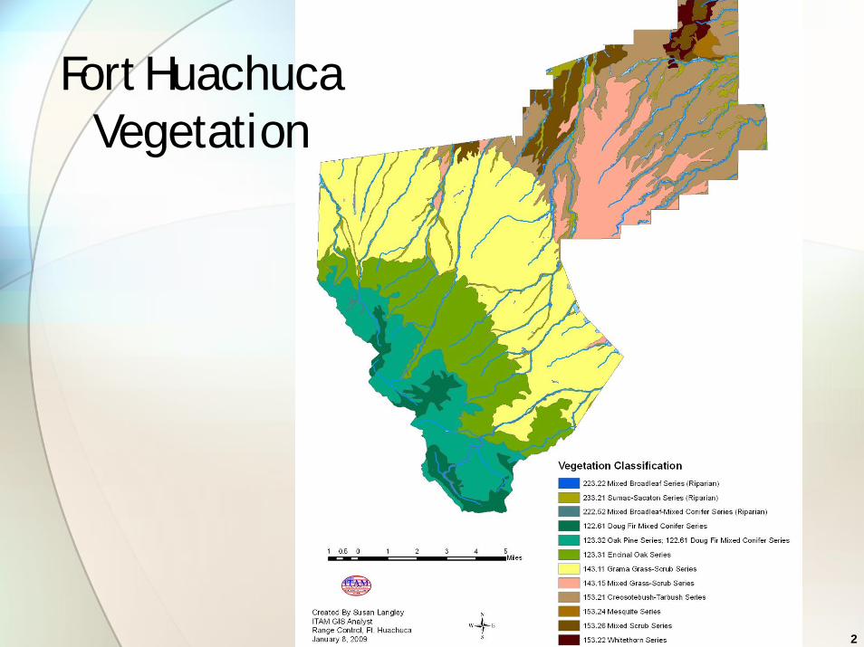
Fort Huachuca Soils
4
Fort Huachuca Military Reservation
• 73,142 ac• East Reservation 28,544 ac• West Reservation 44,598 ac
• 5,720 ac in housing, offices, training & ops facilities, airfield
Domain use: Agency is land owner & land user

5
Establishment & frontier period
• 1877~1883: Military Reservation withdrawal & boundary changing• 1881 & 1883 Exec Orders
• Strategically located in area of basin & range topography, but
• Site selected for natural resources: grass, water, wood
6
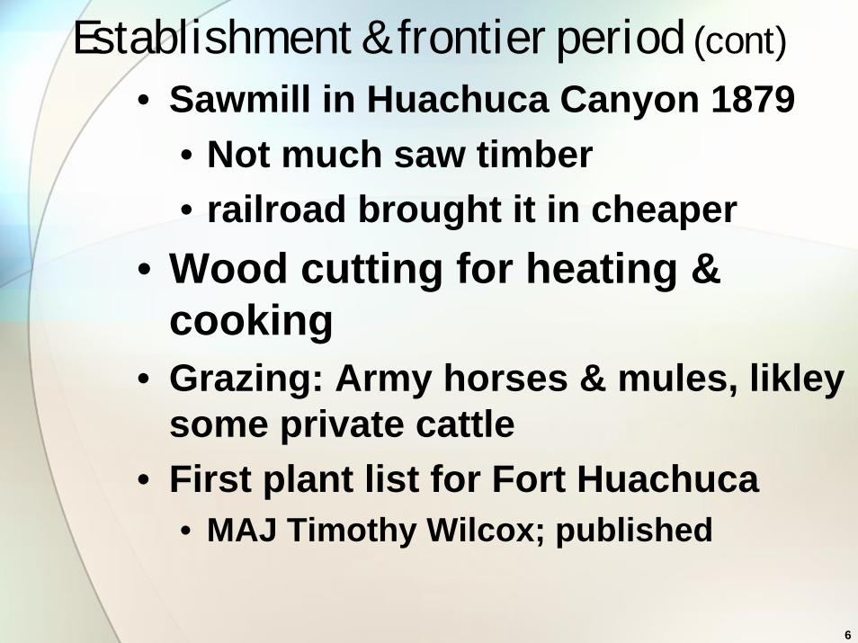
Establishment & frontier period (cont)
• Sawmill in Huachuca Canyon 1879• Not much saw timber • railroad brought it in cheaper
• Wood cutting for heating & cooking
• Grazing: Army horses & mules, likleysome private cattle
• First plant list for Fort Huachuca • MAJ Timothy Wilcox; published

7
Establishment & frontier period (cont)
• 1879 photo

8
1880 – Huachuca Canyon

9
1893 – Huachuca Canyon
10
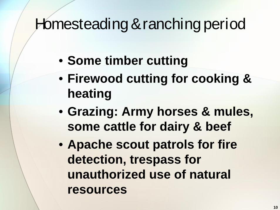
Homesteading & ranching period
• Some timber cutting• Firewood cutting for cooking &
heating• Grazing: Army horses & mules,
some cattle for dairy & beef• Apache scout patrols for fire
detection, trespass for unauthorized use of natural resources

11
1918 - Cavalry era & World Wars
12
Cavalry era & World Wars (cont)
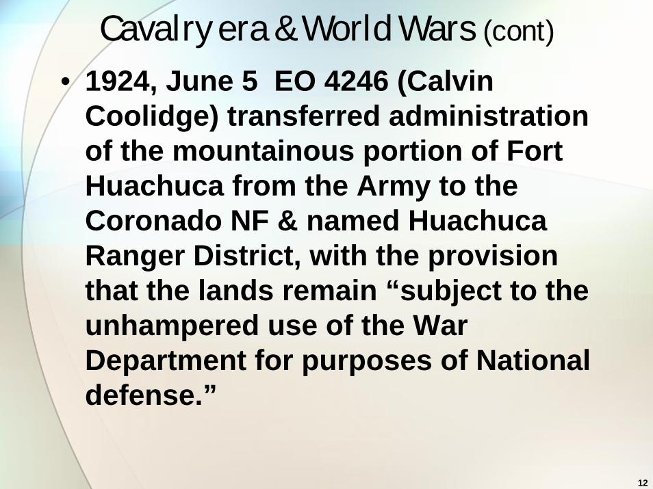
• 1924, June 5 EO 4246 (Calvin Coolidge) transferred administration of the mountainous portion of Fort Huachuca from the Army to the Coronado NF & named Huachuca Ranger District, with the provision that the lands remain “subject to the unhampered use of the War Department for purposes of National defense.”
13
Cavalry era & World Wars (cont)
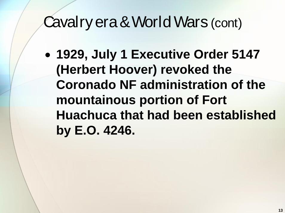
• 1929, July 1 Executive Order 5147 (Herbert Hoover) revoked the Coronado NF administration of the mountainous portion of Fort Huachuca that had been established by E.O. 4246.

14
1929 - Cavalry era & World Wars

15
1940 - Cavalry era & World Wars

16
1940 - Cavalry era & World Wars
17
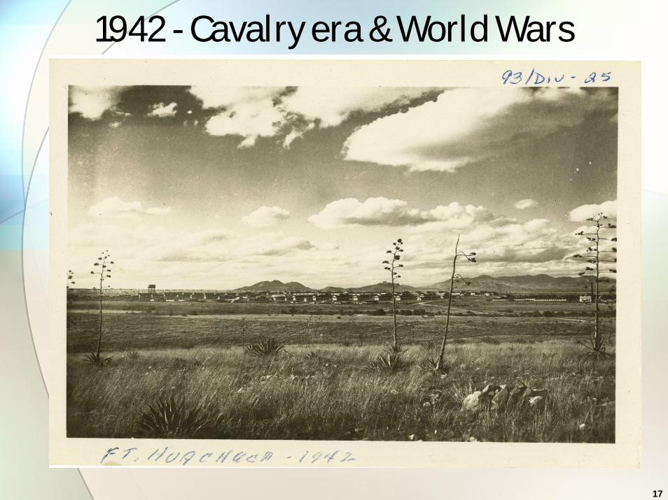
1942 - Cavalry era & World Wars
18
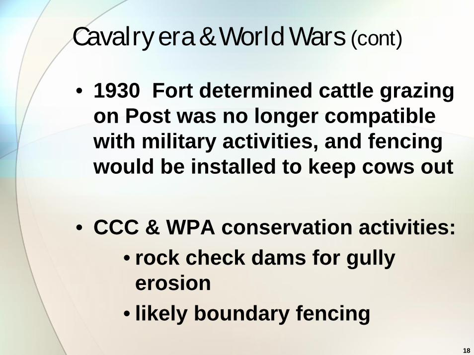
Cavalry era & World Wars (cont)
• 1930 Fort determined cattle grazing on Post was no longer compatible with military activities, and fencing would be installed to keep cows out
• CCC & WPA conservation activities:• rock check dams for gully
erosion• likely boundary fencing

19
AGFD Wildlife Area 1949-1951
• PL 537 5/19/1948 authorized transfer of real property for wildlife & other purposes
• 1/26/1949 14 Fed Reg 355 Wildlife Order 2 • Transfer of Portion of Fort Huachuca to
the State of AZ Game & Fish Comm
• 1st Vegetation map developed – Wallmo
• Plant surveys – Goodding
• Bison introduction: inc to 400 in 2 yrs
• Army reclaimed in 1952
20
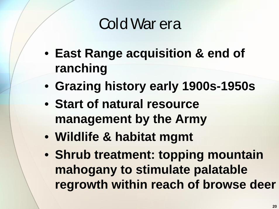
Cold War era
• East Range acquisition & end of ranching
• Grazing history early 1900s-1950s• Start of natural resource
management by the Army• Wildlife & habitat mgmt• Shrub treatment: topping mountain
mahogany to stimulate palatable regrowth within reach of browse deer
21
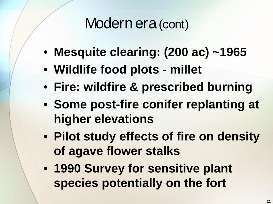
Modern era (cont)
• Mesquite clearing: (200 ac) ~1965• Wildlife food plots - millet• Fire: wildfire & prescribed burning• Some post-fire conifer replanting at
higher elevations• Pilot study effects of fire on density
of agave flower stalks • 1990 Survey for sensitive plant
species potentially on the fort
22
Integrated natural resource managementVegetation management for: • wildlife habitat • fire risk and fuel reduction • watershed and vegetation cover
rehab, &/or • military training land management
23
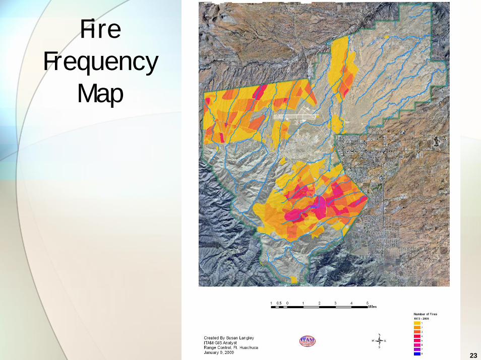
Fire Frequency
Map
24
Integrated natural resource management, cont.
• East Range • Land rehabilitation: contour
rootplowing lanes & reseeding through 1989
• Watershed rehab to decrease erosion and off-post sedimentation
• Prescribed burning to reduce woody plants (e.g. mesquite, desert broom) not effective: fire doesn’t carry well & heat release/ fire intensity insufficient to kill shrubs

25
Burning in light fuels
26
Integrated natural resource management, cont.
• Vegetation/habitat protection• Agave Management Areas in
grasslands (for Lesser long-nosed bat) & Agave Mgmt Plan
• burning allowable once per decade • no tactical vehicles off the dirt
roads• no pyrotechnics or firing blanks
w/in 0.25 mi of AMA
27
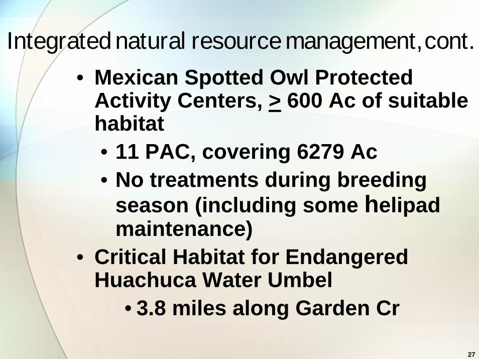
Integrated natural resource management, cont.
• Mexican Spotted Owl Protected Activity Centers, > 600 Ac of suitable habitat• 11 PAC, covering 6279 Ac• No treatments during breeding
season (including some helipad maintenance)
• Critical Habitat for Endangered Huachuca Water Umbel
• 3.8 miles along Garden Cr
28
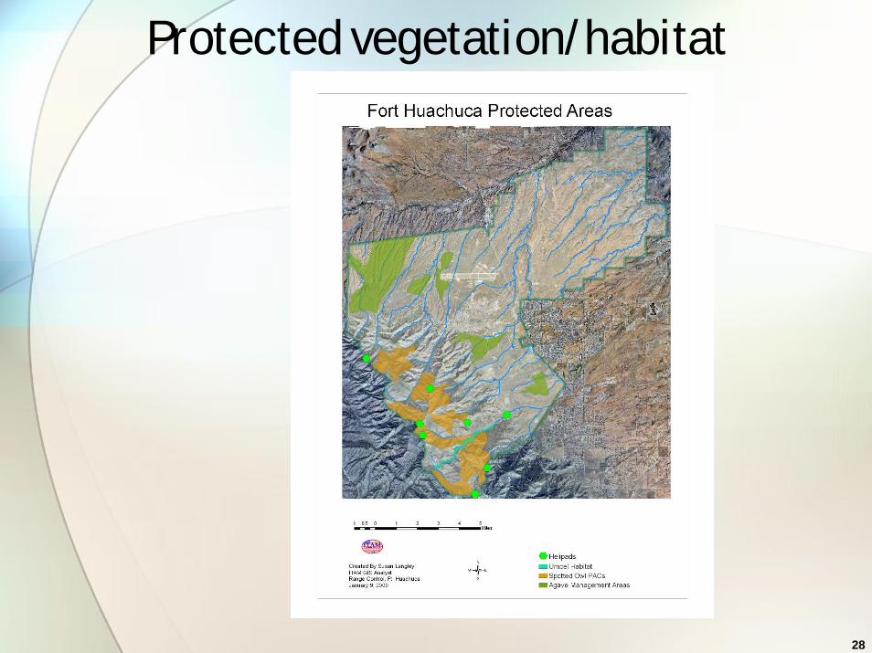
Protected vegetation/habitat

29
Liliumparryi
LemonLily

30
Erigeronlemmonii
Lemmon fleabane
31
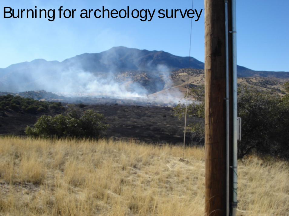
Burning for archeology survey

32
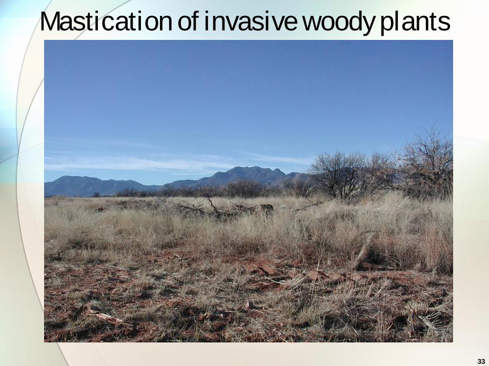
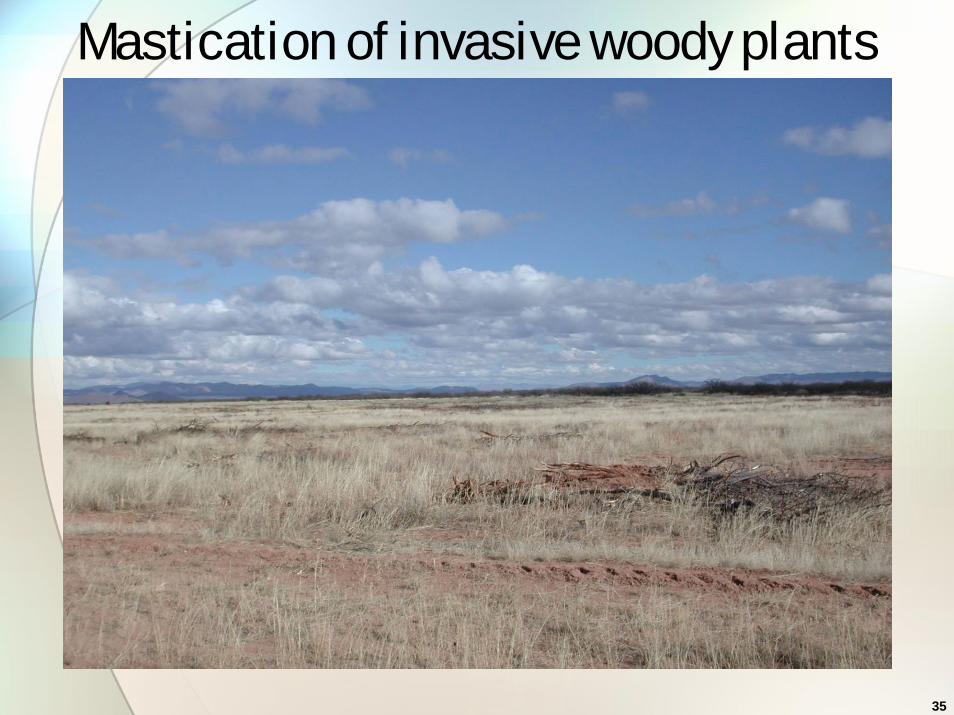
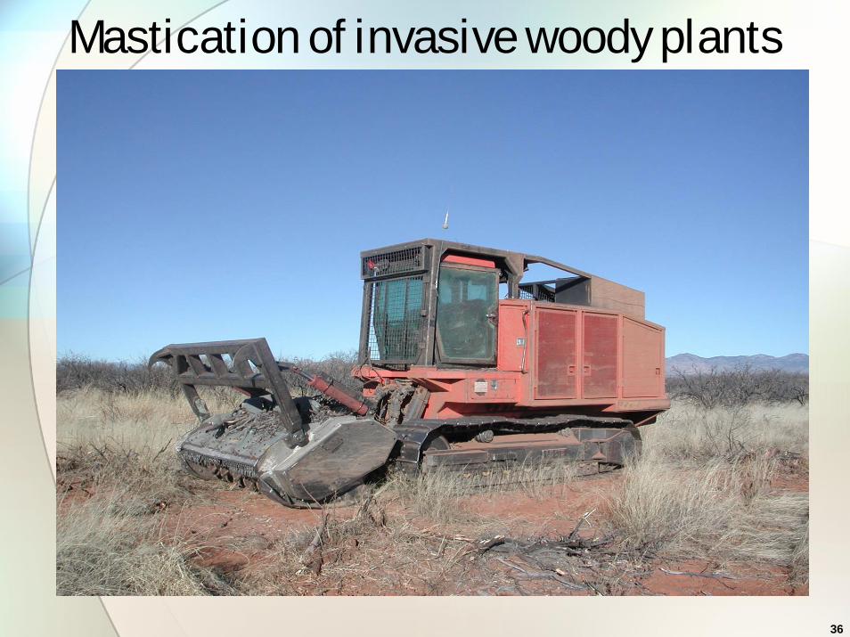
2008 - Masticating invasive woody plants
33
Mastication of invasive woody plants

34
Mastication of invasive woody plants
35
Mastication of invasive woody plants
36
Mastication of invasive woody plants
37
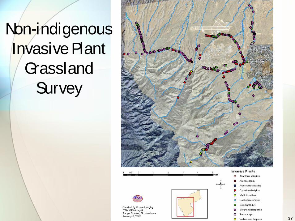
Non-indigenous Invasive Plant
GrasslandSurvey

38
Integrated Training Area Management
• Range Training Land Assessment• Monitoring soil, vegetation &
other natural resources that might be affected by military missions
39
Land Rehabilitation & Management
• road closures in training areas, signage, ripping roadbed, reseeding
• road improvement for tactical and test operations
• identifying prescribed burns for:• risk reduction for training activities• clearance for unexploded
ordinance or cultural resources
40
Land Rehabilitation & Management (cont’d)
Fire prevention:• no pyrotechnic use or firing blanks
w/in 0.25 agave areas


![[Vegetation and Remote Sensing] Vegetation](https://static.fdocuments.in/doc/165x107/577cdfd71a28ab9e78b21a32/vegetation-and-remote-sensing-vegetation.jpg)