
Hike and Bike Trails - Dallas and Bike Trails Emergency Locator System Quality of Life Committee...
30
Transcript of Hike and Bike Trails - Dallas and Bike Trails Emergency Locator System Quality of Life Committee...

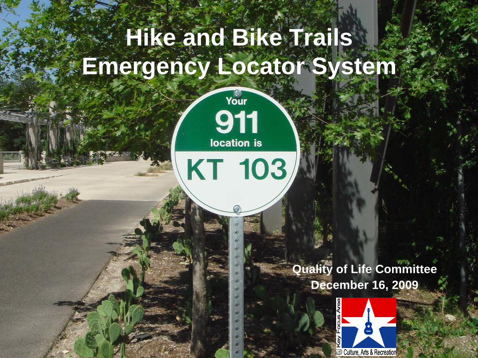
Hike and Bike Trails Emergency Locator System
Quality of Life CommitteeDecember 16, 2009
2
Purpose of Briefing
• Provide background on the Trail Network Master Plan
• Discuss the need for an emergency locator system on the trails
• Review the alternative processes for addressing trails
• Discuss next steps
3
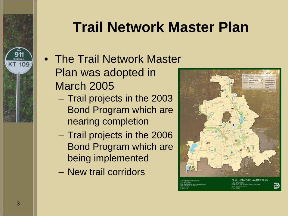
Trail Network Master Plan
• The Trail Network Master Plan was adopted in March 2005– Trail projects in the 2003
Bond Program which are nearing completion
– Trail projects in the 2006 Bond Program which are being implemented
– New trail corridors
4
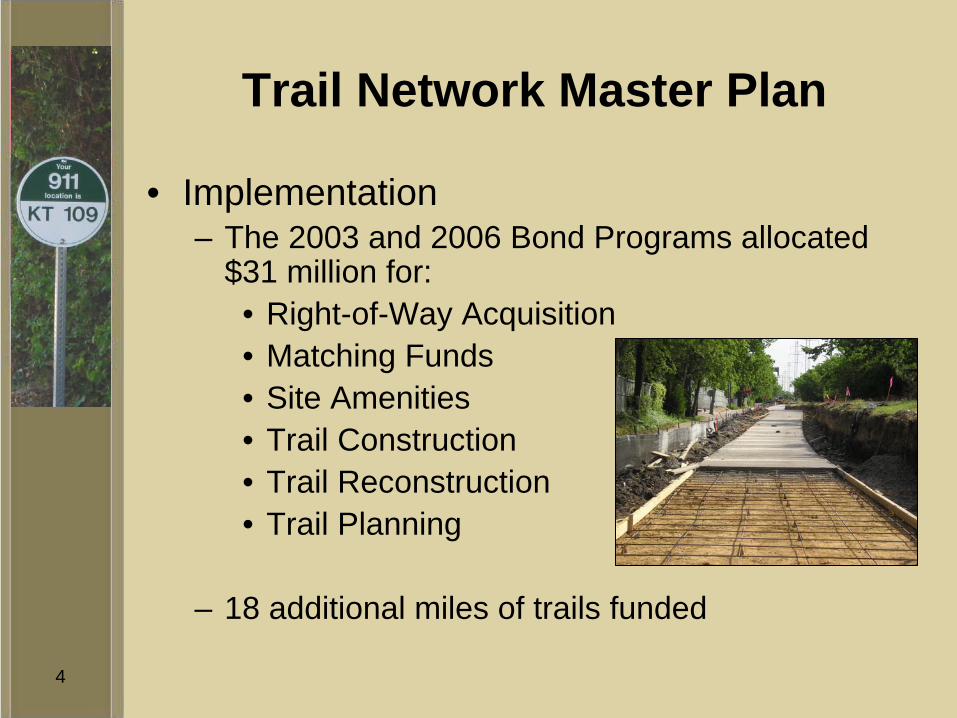
Trail Network Master Plan
• Implementation– The 2003 and 2006 Bond Programs allocated
$31 million for:• Right-of-Way Acquisition• Matching Funds• Site Amenities• Trail Construction• Trail Reconstruction• Trail Planning
– 18 additional miles of trails funded
5
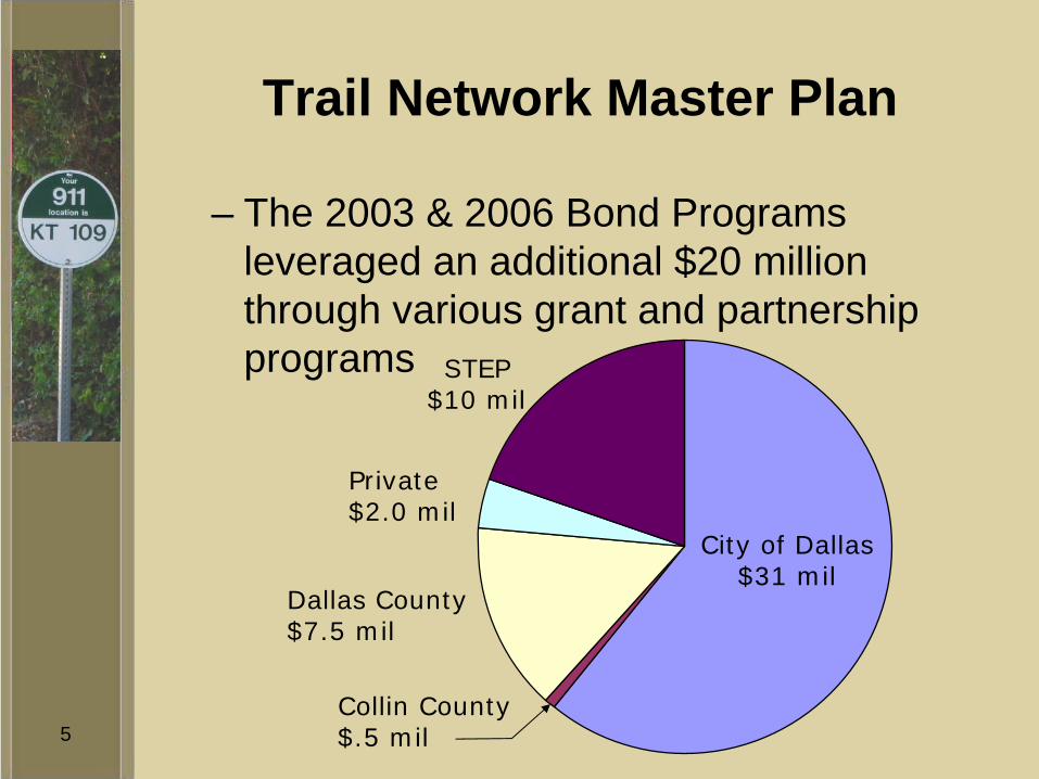
Trail Network Master Plan
– The 2003 & 2006 Bond Programs leveraged an additional $20 million through various grant and partnership programs
Dallas County$7.5 mil
Collin County$.5 mil
City of Dallas$31 mil
STEP$10 mil
Private$2.0 mil
6
Trail Network Master Plan
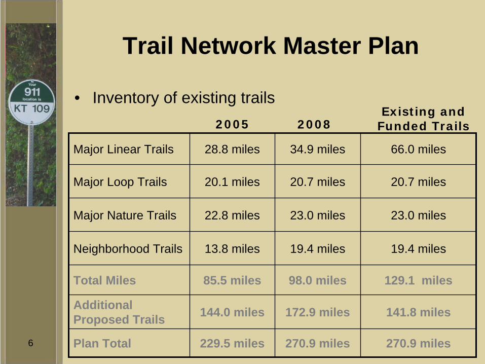
• Inventory of existing trails
Major Linear Trails 28.8 miles 34.9 miles 66.0 miles
Major Loop Trails 20.1 miles 20.7 miles 20.7 miles
Major Nature Trails 22.8 miles 23.0 miles 23.0 miles
Neighborhood Trails 13.8 miles 19.4 miles 19.4 miles
Total Miles 85.5 miles 98.0 miles 129.1 miles
Additional Proposed Trails 144.0 miles 172.9 miles 141.8 miles
Plan Total 229.5 miles 270.9 miles 270.9 miles
2005 2008Existing and
Funded Trails
7
Emergency Locator System
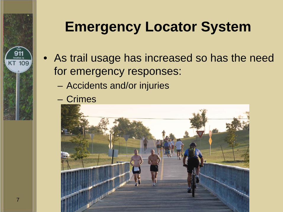
• As trail usage has increased so has the need for emergency responses:– Accidents and/or injuries– Crimes

8
Emergency Locator System
• Most of the major linear trails are in railway and utility easements with limited street access

9
Emergency Locator System
• The Friends of the Katy Trail wanted to increase safety on the Katy Trail by placing Call Boxes along the trail– Call Boxes require a street address
• Katy Trail does not front on streets, but is located behind residential and commercial properties
• Most street crossings are grade-separated

10
Emergency Locator System
• Issues:– How can trails fit into the 911 system?– Can trails have addresses similar to streets?
• To fit in the 911 system, trails would have to be designated “pedestrian ways”
• There are numerous streets in Dallas that are called trails

11
Emergency Locator System
• What solutions are out there?– Staff was unable to find where any trail
management agency was addressing this issue• It was determined that Dallas would need to
create its own solution to this issue.
12
Emergency Locator System
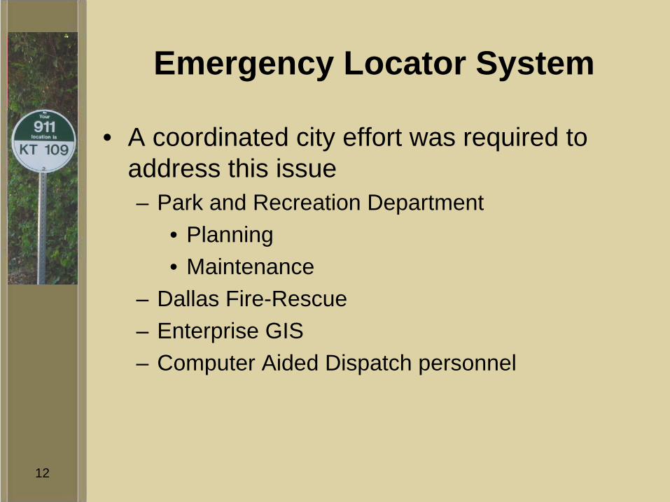
• A coordinated city effort was required to address this issue– Park and Recreation Department
• Planning• Maintenance
– Dallas Fire-Rescue– Enterprise GIS– Computer Aided Dispatch personnel

13
Emergency Locator System
• After reviewing several options the team determined that a unique “911” pole marker system was the best way to proceed.
• It was determined that it is imperative that the 911 pole markers:– Could be seen from any location on the trail– Would have a similar appearance on every trail
throughout the City’s trail network– Could be purchased within current budget
allocations
14
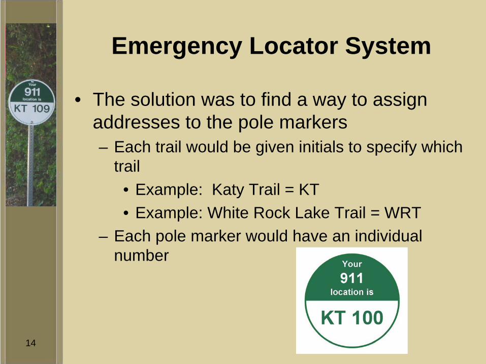
Emergency Locator System
• The solution was to find a way to assign addresses to the pole markers– Each trail would be given initials to specify which
trail • Example: Katy Trail = KT• Example: White Rock Lake Trail = WRT
– Each pole marker would have an individual number
15
Katy Trail
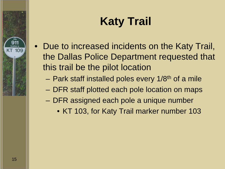
• Due to increased incidents on the Katy Trail, the Dallas Police Department requested that this trail be the pilot location– Park staff installed poles every 1/8th of a mile– DFR staff plotted each pole location on maps– DFR assigned each pole a unique number
• KT 103, for Katy Trail marker number 103
16
Katy Trail
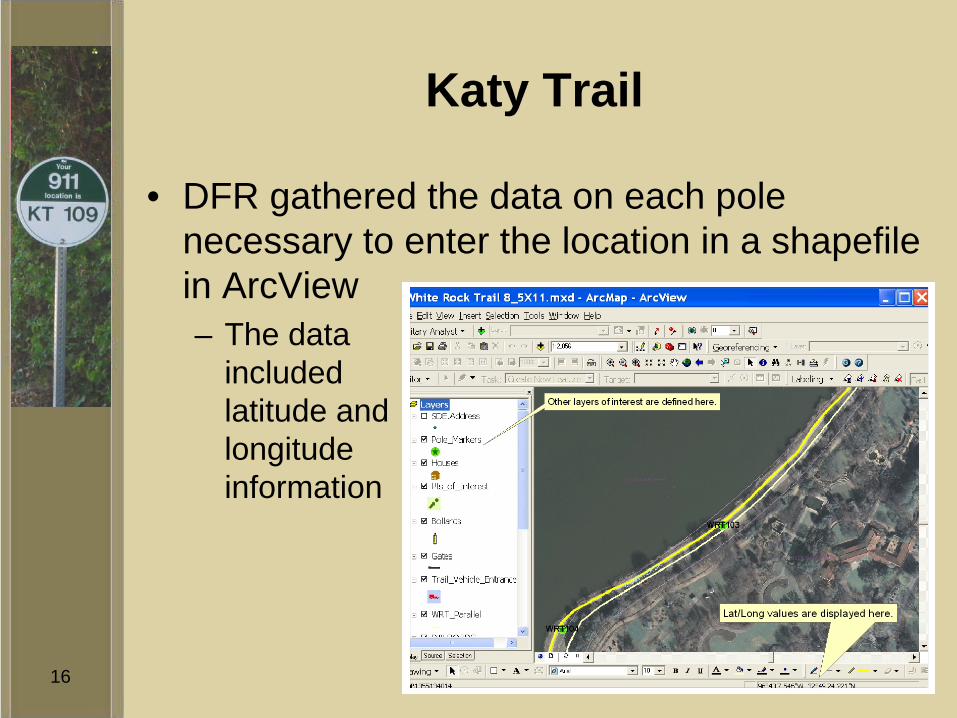
• DFR gathered the data on each pole necessary to enter the location in a shapefile in ArcView– The data
included latitude and longitude information
17
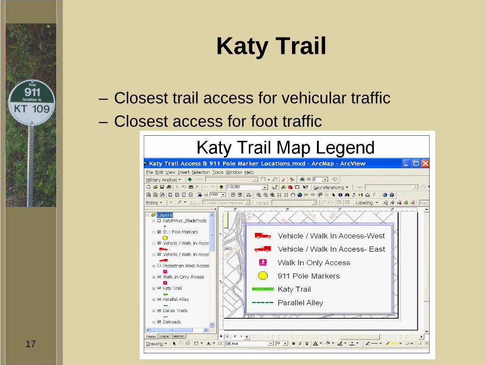
Katy Trail
– Closest trail access for vehicular traffic– Closest access for foot traffic
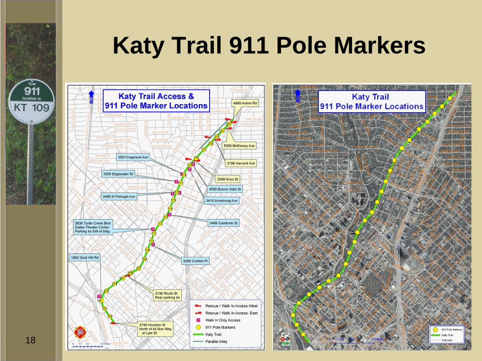
18
Katy Trail 911 Pole Markers

19
Katy Trail
• By assigning addresses to each pole, CAD was able to dispatch to the coinciding address when the pole number was entered
• Caution Notes were then added to each of these linked dispatching coordinates– The Caution Notes would be transmitted to the
Mobile Data Computers (MDC) on the emergency vehicles
– The Caution Notes would supply directions along the trail to enable emergency crews to locate the pole and thus locate the emergency
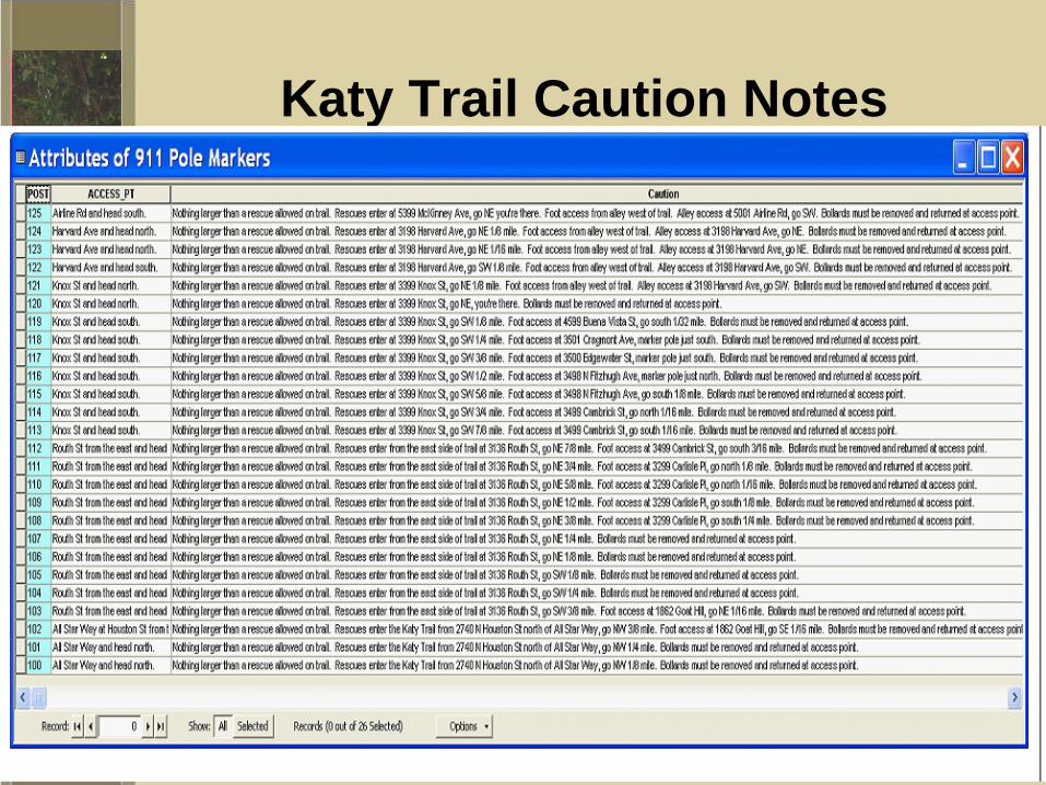
20
Katy Trail Caution Notes
21
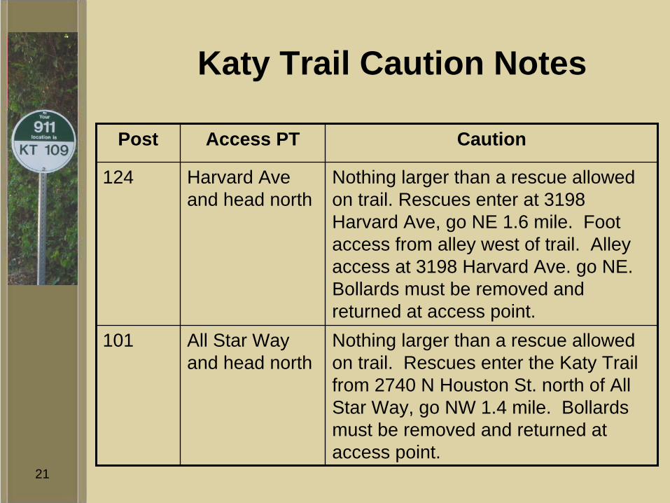
Katy Trail Caution Notes
Post Access PT Caution
124 Harvard Ave and head north
Nothing larger than a rescue allowed on trail. Rescues enter at 3198 Harvard Ave, go NE 1.6 mile. Foot access from alley west of trail. Alley access at 3198 Harvard Ave. go NE. Bollards must be removed and returned at access point.
101 All Star Way and head north
Nothing larger than a rescue allowed on trail. Rescues enter the Katy Trail from 2740 N Houston St. north of All Star Way, go NW 1.4 mile. Bollards must be removed and returned at access point.
22
Katy Trail
• The markers have been in use for just over a year– DFR and DPD have responded to several calls
and have not had any issues in finding locations
23
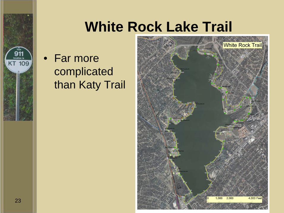
White Rock Lake Trail
• Far more complicated than Katy Trail

24
White Rock Lake Trail
• Tried a different approach– DFR used ArcView to plot the points along the
trail– Using ArcView’s geo-referencing capabilities,
DFR added lat/long coordinates to the attribute table
– DFR wrote preliminary caution notes to go with the points, to be verified once the poles were in the ground

25

26
White Rock Lake Trail
• Using the map created by DFR, Park staff installed poles
27
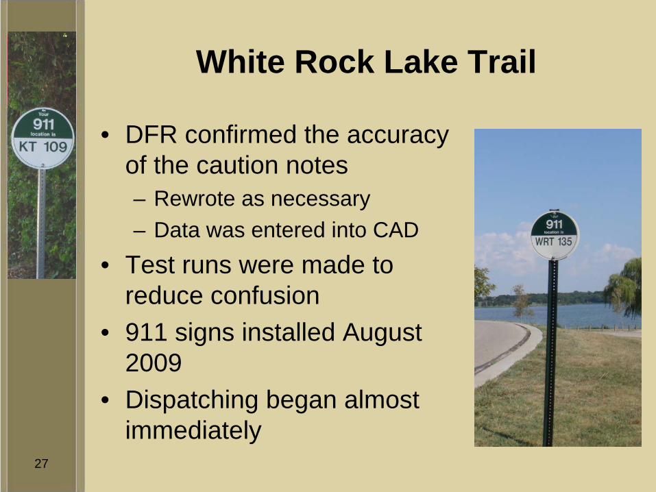
White Rock Lake Trail
• DFR confirmed the accuracy of the caution notes– Rewrote as necessary– Data was entered into CAD
• Test runs were made to reduce confusion
• 911 signs installed August 2009
• Dispatching began almost immediately

28
White Rock Lake Trail
• Within the first two weeks there was a medical emergency on the trail near Big Thicket– Emergency responders were able to access the
individual without delay
29
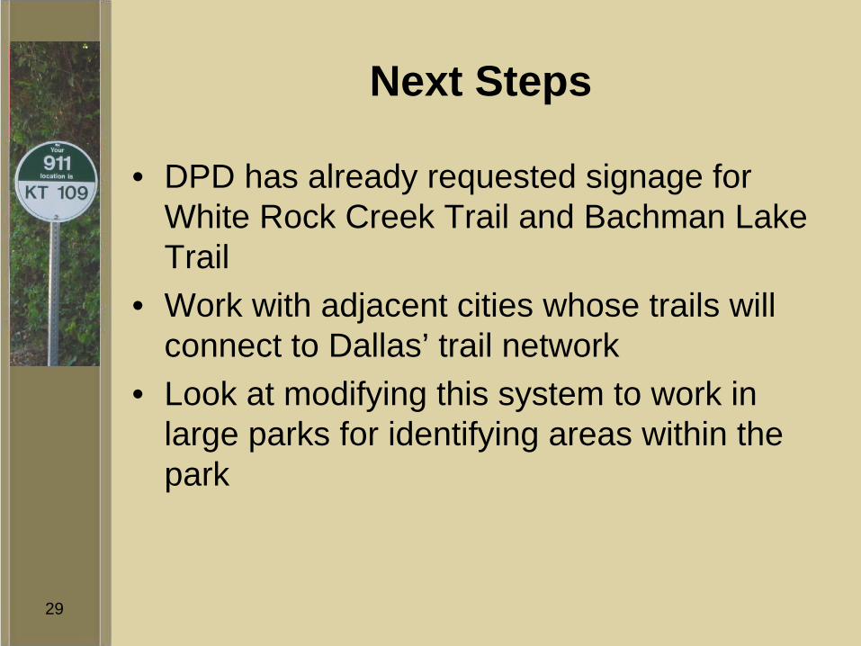
Next Steps
• DPD has already requested signage for White Rock Creek Trail and Bachman Lake Trail
• Work with adjacent cities whose trails will connect to Dallas’ trail network
• Look at modifying this system to work in large parks for identifying areas within the park