MURDER ON THE HIGH SPEED RAIL HIGH SPEED RAIL TO ORLANDO, FL.
Upload
luis-salazarCategory
view
42download
0
The Impact of California’s High Speed Rail System on Sylmar
By:Mariaelena Fuentes, Luis Salazar, Daisy Benicia, Daniel
Banuelos
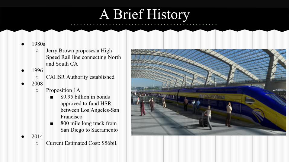
A Brief History
● 1980s○ Jerry Brown proposes a High
Speed Rail line connecting North and South CA
● 1996○ CAHSR Authority established
● 2008 ○ Proposition 1A
■ $9.95 billion in bonds approved to fund HSR between Los Angeles-San Francisco
■ 800 mile long track from San Diego to Sacramento
● 2014○ Current Estimated Cost: $56bil.
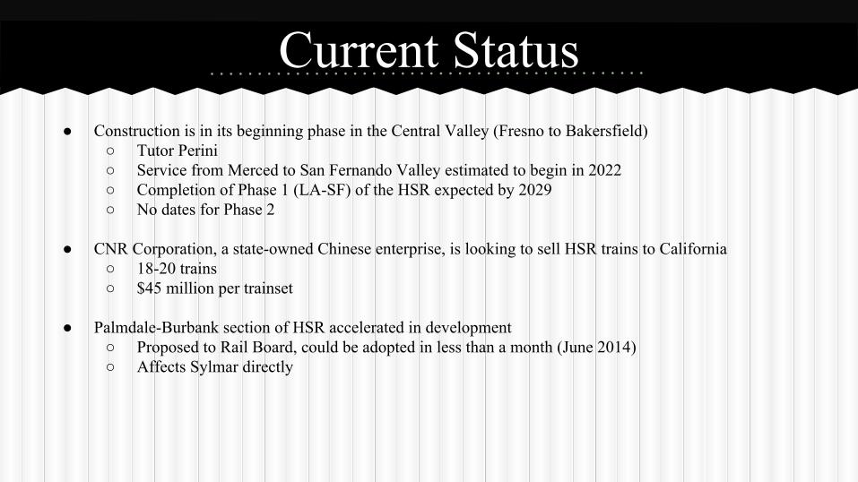
Current Status● Construction is in its beginning phase in the Central Valley (Fresno to Bakersfield)
○ Tutor Perini○ Service from Merced to San Fernando Valley estimated to begin in 2022○ Completion of Phase 1 (LA-SF) of the HSR expected by 2029○ No dates for Phase 2
● CNR Corporation, a state-owned Chinese enterprise, is looking to sell HSR trains to California○ 18-20 trains○ $45 million per trainset
● Palmdale-Burbank section of HSR accelerated in development○ Proposed to Rail Board, could be adopted in less than a month (June 2014)○ Affects Sylmar directly
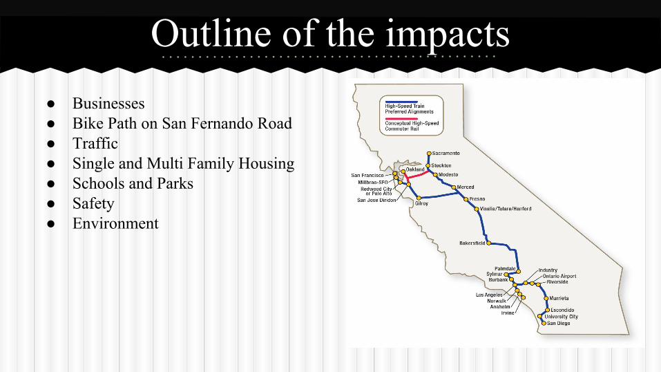
Outline of the impacts● Businesses● Bike Path on San Fernando Road● Traffic● Single and Multi Family Housing● Schools and Parks● Safety● Environment
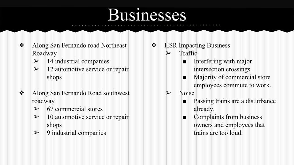
Businesses❖ Along San Fernando road Northeast
Roadway➢ 14 industrial companies ➢ 12 automotive service or repair
shops
❖ Along San Fernando Road southwest roadway➢ 67 commercial stores➢ 10 automotive service or repair
shops➢ 9 industrial companies
❖ HSR Impacting Business➢ Traffic
■ Interfering with major intersection crossings.
■ Majority of commercial store employees commute to work.
➢ Noise■ Passing trains are a disturbance
already.■ Complaints from business
owners and employees that trains are too loud.
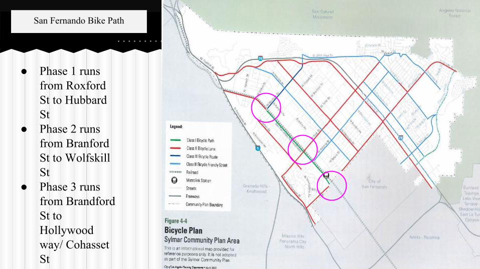
● Phase 1 runs from Roxford St to Hubbard St
● Phase 2 runs from Branford St to Wolfskill St
● Phase 3 runs from Brandford St to Hollywood way/ Cohasset St
San Fernando Bike Path
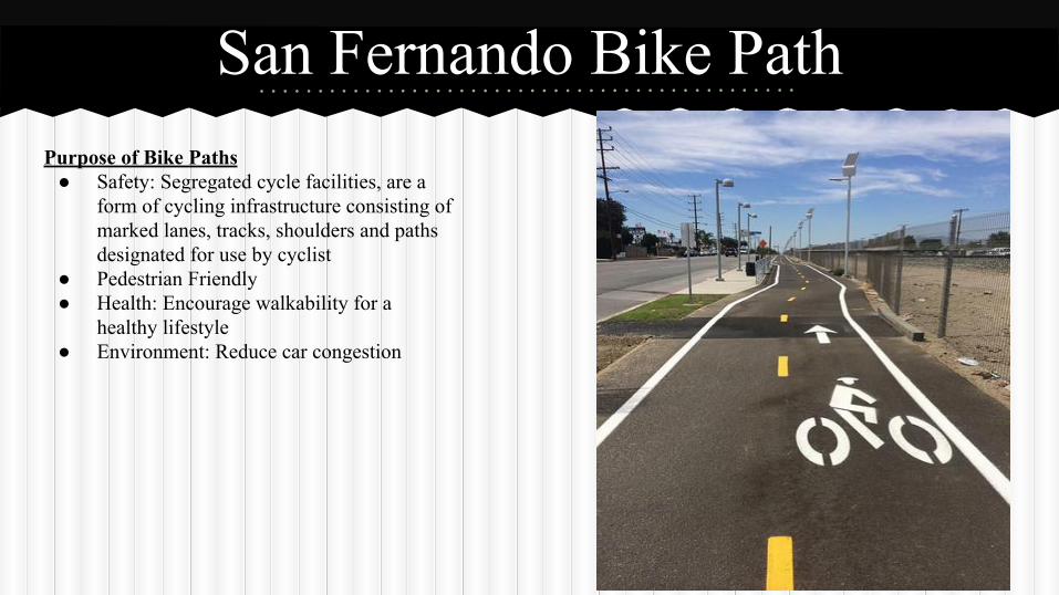
San Fernando Bike PathPurpose of Bike Paths
● Safety: Segregated cycle facilities, are a form of cycling infrastructure consisting of marked lanes, tracks, shoulders and paths designated for use by cyclist
● Pedestrian Friendly● Health: Encourage walkability for a
healthy lifestyle● Environment: Reduce car congestion
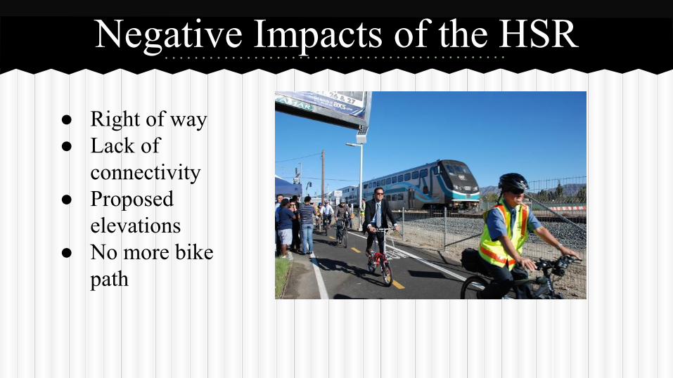
Negative Impacts of the HSR
● Right of way● Lack of
connectivity● Proposed
elevations● No more bike
path
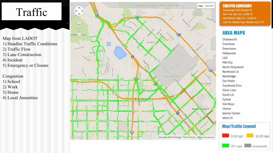
Map from LADOT 1) Handles Traffic Conditions2) Traffic Flow 3) Lane Construction4) Incident5) Emergency or Closure
Congestion1) School2) Work3) Home4) Local Amenities
Traffic
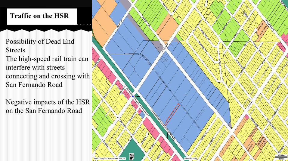
Possibility of Dead End StreetsThe high-speed rail train can interfere with streets connecting and crossing with San Fernando Road
Negative impacts of the HSR on the San Fernando Road
Traffic on the HSR
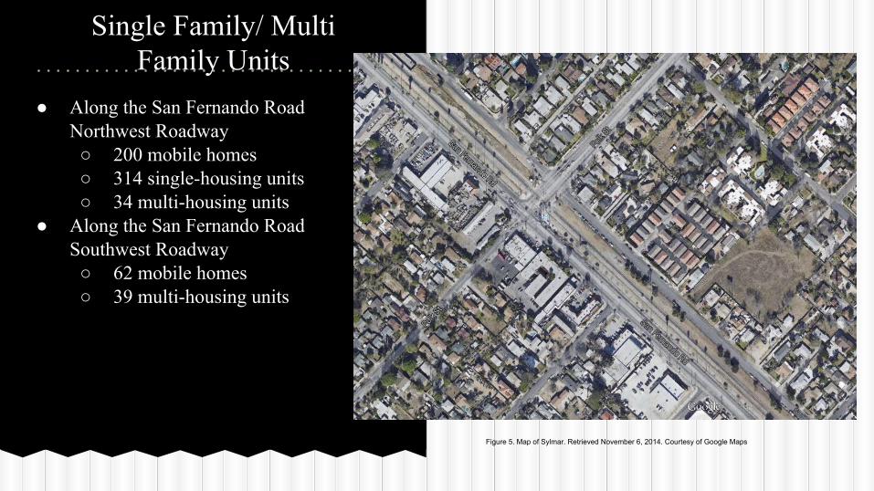
Single Family/ Multi Family Units
● Along the San Fernando Road Northwest Roadway○ 200 mobile homes○ 314 single-housing units○ 34 multi-housing units
● Along the San Fernando Road Southwest Roadway ○ 62 mobile homes ○ 39 multi-housing units
Figure 5. Map of Sylmar. Retrieved November 6, 2014. Courtesy of Google Maps
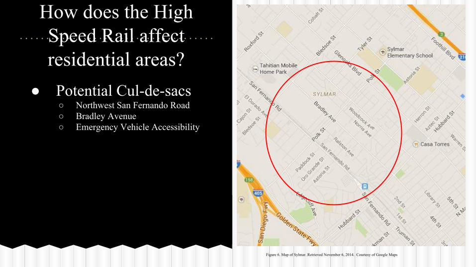
How does the High Speed Rail affect residential areas?
● Potential Cul-de-sacs○ Northwest San Fernando Road ○ Bradley Avenue○ Emergency Vehicle Accessibility
Figure 6. Map of Sylmar. Retrieved November 6, 2014. Courtesy of Google Maps
● Effect on property value○ There are two arguments regarding public transit systems and property values:
■ Properties close to rails may increase due to the fact that there is a stop in that area (Wardripp, 2011).
■ Property value may decrease because of the noise, traffic and pollution associated with transit systems (Wardripp, 2011).
How does the High Speed Rail affect residential areas?
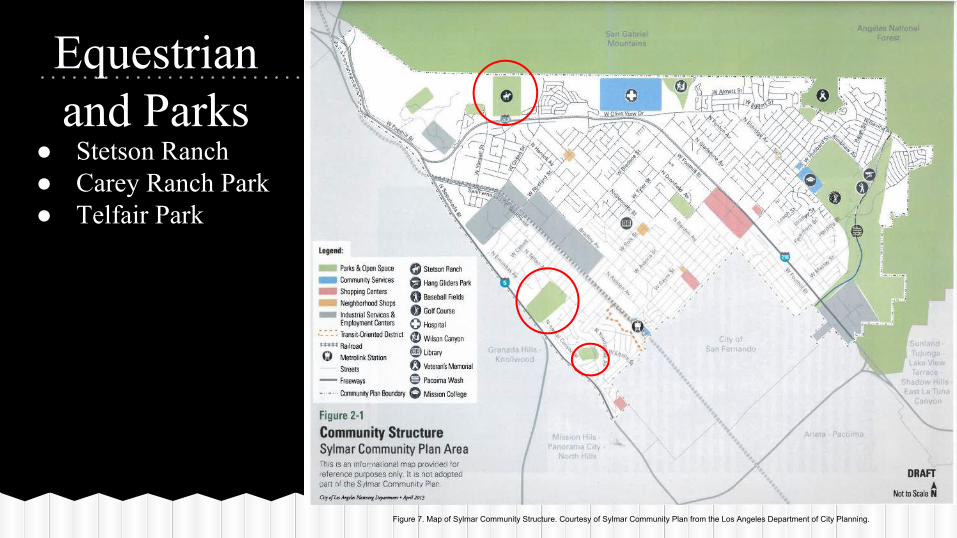
Equestrianand Parks
● Stetson Ranch● Carey Ranch Park ● Telfair Park
Figure 7. Map of Sylmar Community Structure. Courtesy of Sylmar Community Plan from the Los Angeles Department of City Planning.
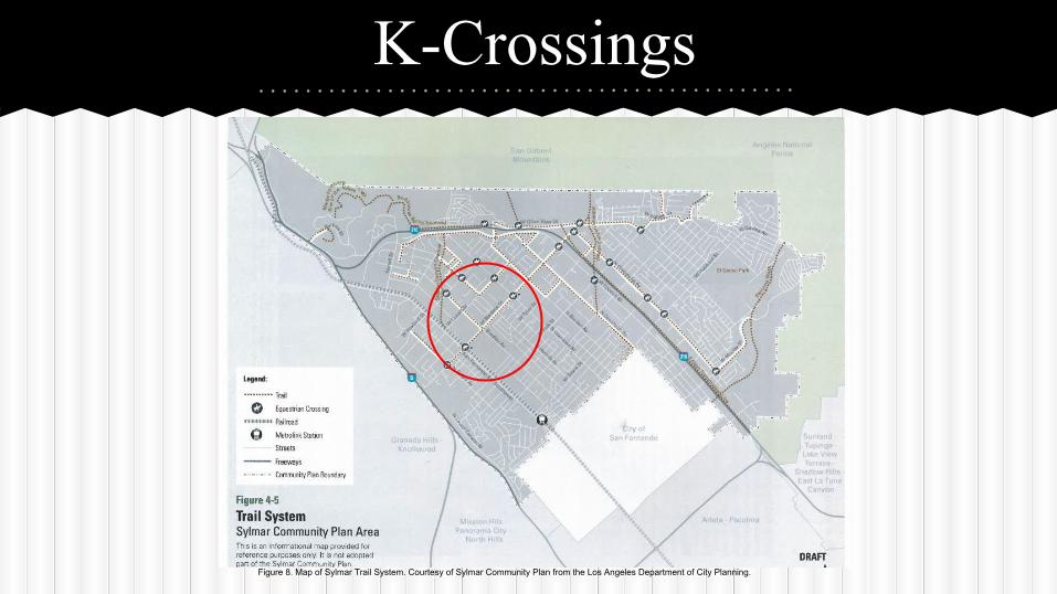
K-Crossings
Figure 8. Map of Sylmar Trail System. Courtesy of Sylmar Community Plan from the Los Angeles Department of City Planning.
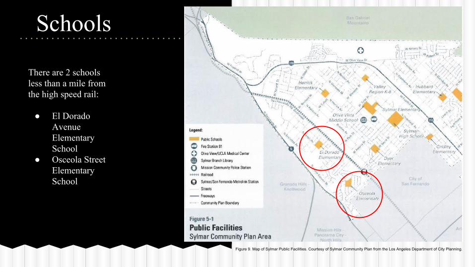
Schools
There are 2 schools less than a mile from the high speed rail:
● El Dorado Avenue Elementary School
● Osceola Street Elementary School
Figure 9. Map of Sylmar Public Facilities. Courtesy of Sylmar Community Plan from the Los Angeles Department of City Planning.
Environmental Impacts● Air Quality
○ Positive impact○ Freight trucks absent from
environmental impact■ Large Diesel Trucks
are a major source of Pollution, congestion, and Accidents
■
● Sound○ Less Noise than
conventional freight trains■ 80-90 Decibels (dB)
at 100 ft.○ 4 sec. travel time through
a point vs. 60 sec. freight trains
○ No planned operations from Midnight - 5am
○ Sound Wall
SafetyEmergency Response
● LAPD - Mission Hills● LAFD - Foothill● Holy Cross Medical Center
○ No Planned ResponseEarthquake Procedures
● No emergency plans for CAHSR yet○ Follow Procedures and incidents with HSR in earthquake prone areas (Japan)
● California Earthquake Prone○ Sylmar Earthquake, February 1971○ Northridge Earthquake, January 1994
● Only one HSR train derailed due to earthquakes○ Japan, 2004
● UrEDAS○ Early response system
● France○ Custom Built Trains
Community Survey
● Background● Equestrian ● Parks● Schools ● Transportation● High Speed Rail
Methods
● 47 participants● Locations
○ Businesses○ Churches○ Schools○ Apartment Complexes
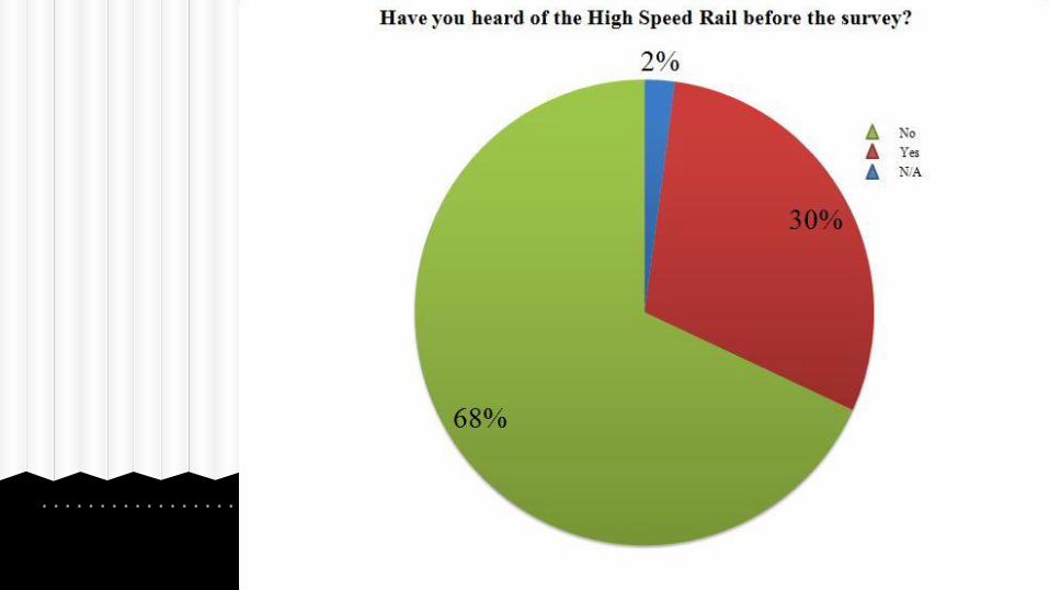
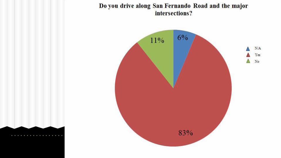
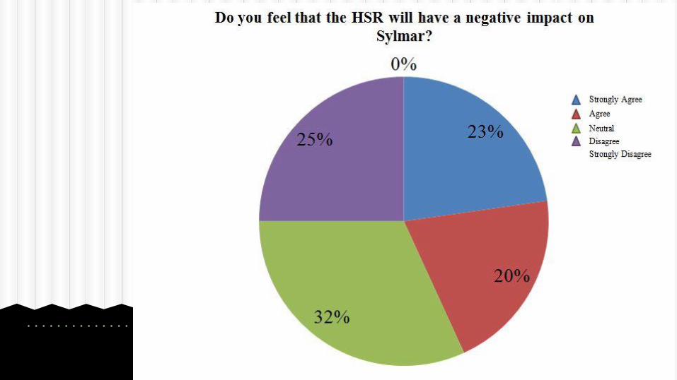
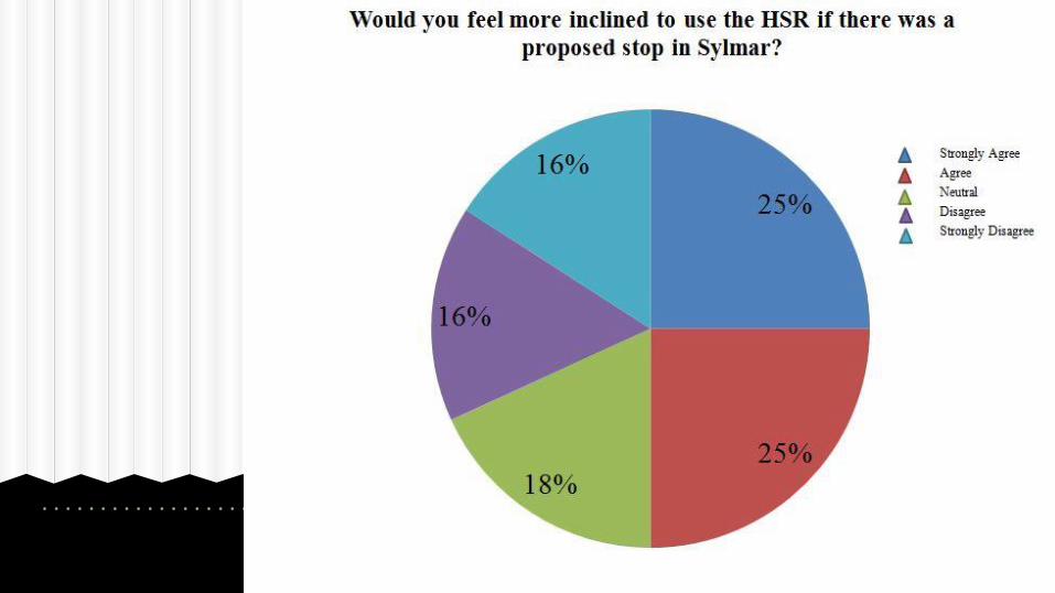
● Noise Level● Traffic● Safety
● Do not want HSR to pass through Sylmar○ Do not want major intersections to be impacted
Community’s Response
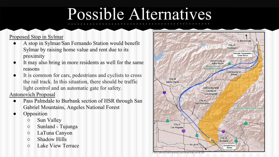
Possible AlternativesProposed Stop in Sylmar
● A stop in Sylmar/San Fernando Station would benefit Sylmar by raising home value and rent due to its proximity
● It may also bring in more residents as well for the same reasons
● It is common for cars, pedestrians and cyclists to cross the rail track. In this situation, there should be traffic light control and an automatic gate for safety.
Antonovich Proposal● Pass Palmdale to Burbank section of HSR through San
Gabriel Mountains, Angeles National Forest● Opposition
○ Sun Valley○ Sunland - Tujunga○ LaTuna Canyon○ Shadow Hills○ Lake View Terrace
Antonovich Proposal
● Prevents disruption of Bike Paths● Prevents Interference with Traffic● No decrease in Property Values
Official Recommendation
Works Cited“California High Speed Rail.” Hatch Mott MacDonald. n.p. , n.d. Web. 29 Oct 2014.“California Proposition 1A, High Speed Rail Act (2008).” Ballotpedia. n.p., n.d. Web. 29 Oct 2014.“Central Valley: ‘Backbone’ of the High Speed Rail.” California High Speed Rail Authority. California High Speed Rail Authority.
May 2013. Web. 29 Oct 2014.Goh, Brenda. “China Wants to Sell High-Speed Trains to California.” Business Insider. Business Insider. 21 Oct 2014. Web. 29 Oct
2014."High-Speed Rail Environmental Benefits." Environmental Benefits. California High Speed Rail Authority, 2017. Web. 29 Oct.
2014.Lipkin, Boris and Ben Tripousis. “What’s Happening with California’s High Speed Rail System.” Spur. Spur. 20 May 2014. Web.
29 Oct 2014."Significant Earthquakes and Faults." Southern California Earthquake Data Center at Caltech. CalTech, 31 Jan. 2013. Web. 12 Nov. 2014.Vartabedian, Ralph. "Burbank-Palmdale Segment Added to Bullet Train Timetable." Los Angeles Times. Los Angeles Times, 30 June 2014. Web. 29 Oct. 2014.Wardrip, Keith. “Public Transit’s Impact on Housing Costs: A Review of the Literature” Insights from Housing Policy Research. Web. 29 Oct. 2014Sylmar Community Plan. Los Angeles Department of City Planning. April 2013.