HIGH-DEFINITION SURVEY AND BIM PRESENTATION FOR BIM-MEP · HIGH-DEFINITION SURVEY AND BIM...
17
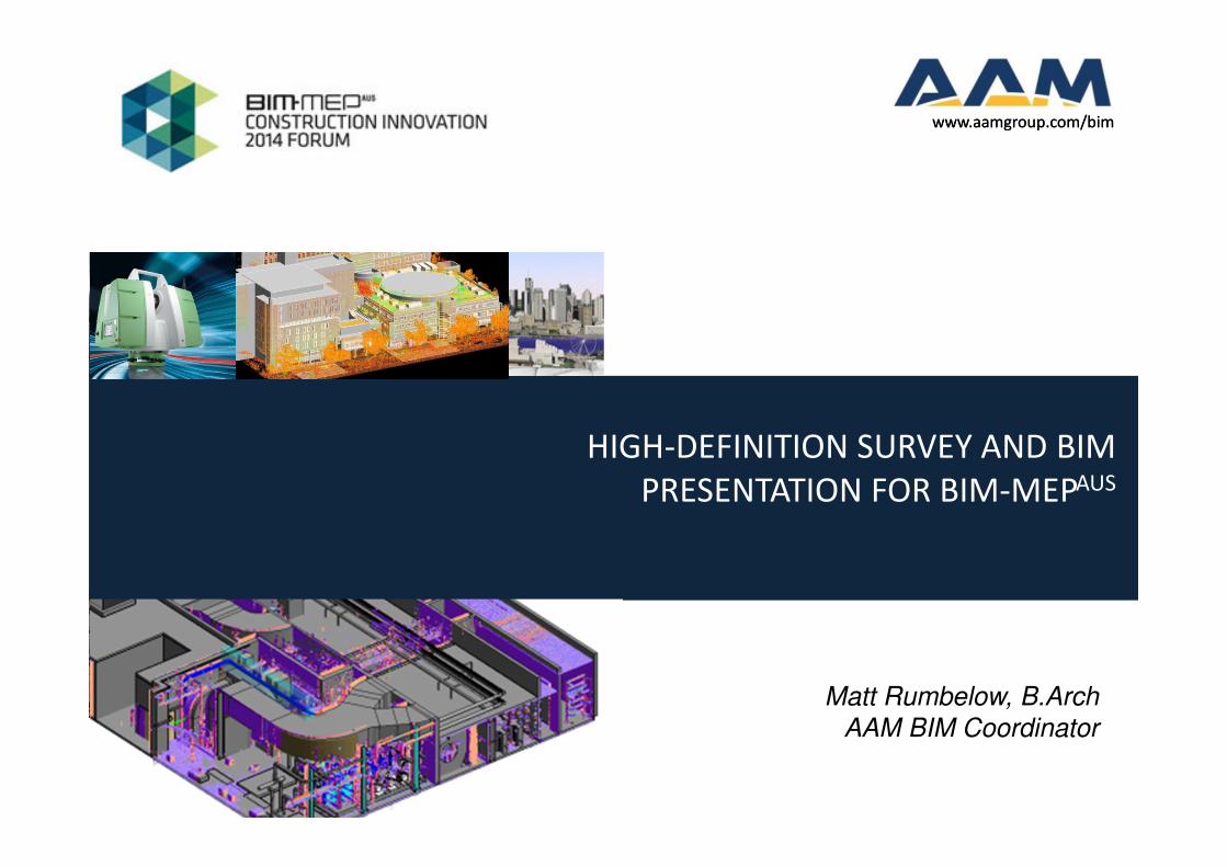
www.aamgroup.com/bim HIGH-DEFINITION SURVEY AND BIM PRESENTATION FOR BIM-MEP AUS Matt Rumbelow, B.Arch AAM BIM Coordinator www.aamgroup.com/bim
Transcript of HIGH-DEFINITION SURVEY AND BIM PRESENTATION FOR BIM-MEP · HIGH-DEFINITION SURVEY AND BIM...
www.aamgroup.com/bim
HIGH-DEFINITION SURVEY AND BIM
PRESENTATION FOR BIM-MEPAUS
Matt Rumbelow, B.Arch
AAM BIM Coordinator
www.aamgroup.com/bim
Copyright © 2014 AAM Pty Ltd
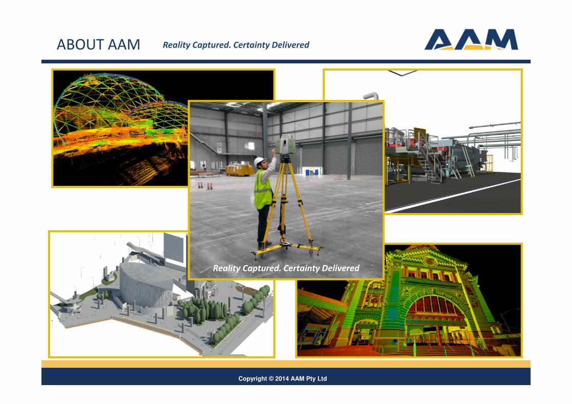
ABOUT AAM
Reality Captured. Certainty Delivered
Reality Captured. Certainty Delivered
Copyright © 2014 AAM Pty Ltd3
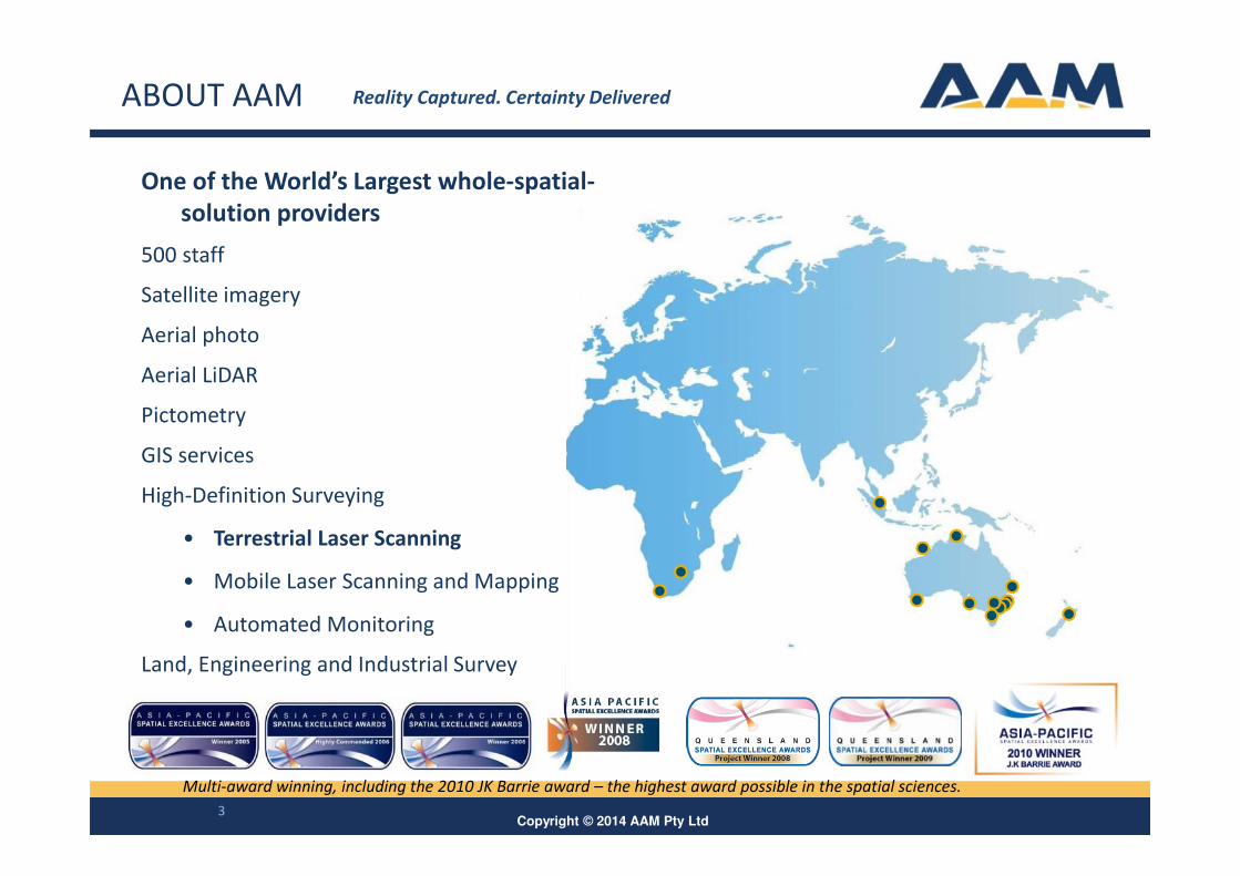
One of the World’s Largest whole-spatial-
solution providers
500 staff
Satellite imagery
Aerial photo
Aerial LiDAR
Pictometry
GIS services
High-Definition Surveying
• Terrestrial Laser Scanning
• Mobile Laser Scanning and Mapping
• Automated Monitoring
Land, Engineering and Industrial Survey
Multi-award winning, including the 2010 JK Barrie award – the highest award possible in the spatial sciences.
ABOUT AAM Reality Captured. Certainty Delivered
Copyright © 2014 AAM Pty Ltd4
HIGH-DEFINITION SURVEYING
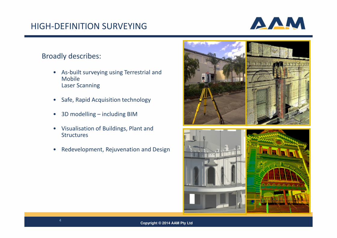
Broadly describes:
• As-built surveying using Terrestrial and Mobile Laser Scanning
• Safe, Rapid Acquisition technology
• 3D modelling – including BIM
• Visualisation of Buildings, Plant and Structures
• Redevelopment, Rejuvenation and Design
Copyright © 2014 AAM Pty Ltd5
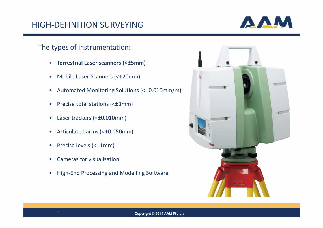
The types of instrumentation:
• Terrestrial Laser scanners (<±5mm)
• Mobile Laser Scanners (<±20mm)
• Automated Monitoring Solutions (<±0.010mm/m)
• Precise total stations (<±3mm)
• Laser trackers (<±0.010mm)
• Articulated arms (<±0.050mm)
• Precise levels (<±1mm)
• Cameras for visualisation
• High-End Processing and Modelling Software
HIGH-DEFINITION SURVEYING
Copyright © 2014 AAM Pty Ltd
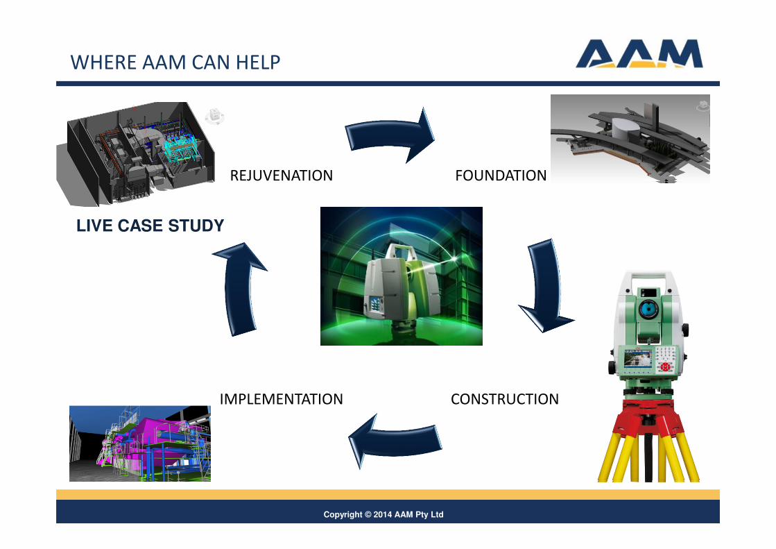
FOUNDATION
CONSTRUCTIONIMPLEMENTATION
REJUVENATION
WHERE AAM CAN HELP
LIVE CASE STUDY
Copyright © 2014 AAM Pty Ltd
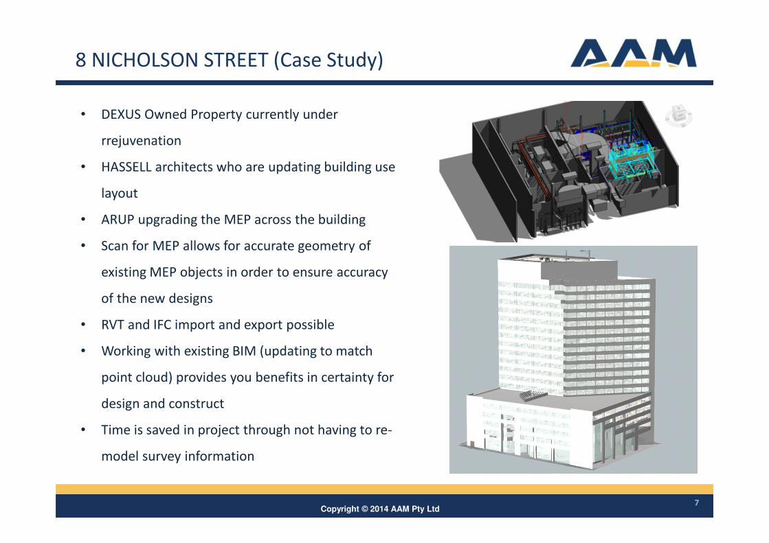
8 NICHOLSON STREET (Case Study)
7
• DEXUS Owned Property currently under
rrejuvenation
• HASSELL architects who are updating building use
layout
• ARUP upgrading the MEP across the building
• Scan for MEP allows for accurate geometry of
existing MEP objects in order to ensure accuracy
of the new designs
• RVT and IFC import and export possible
• Working with existing BIM (updating to match
point cloud) provides you benefits in certainty for
design and construct
• Time is saved in project through not having to re-
model survey information
Copyright © 2014 AAM Pty Ltd
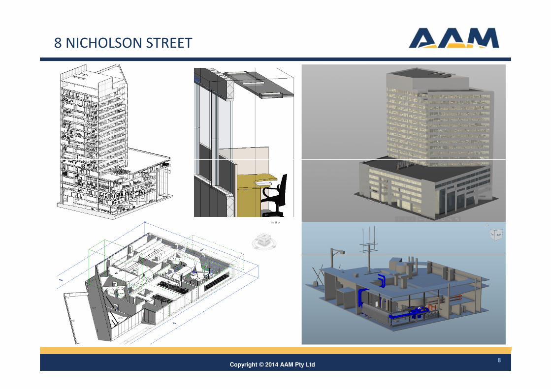
8 NICHOLSON STREET
8
Copyright © 2014 AAM Pty Ltd9
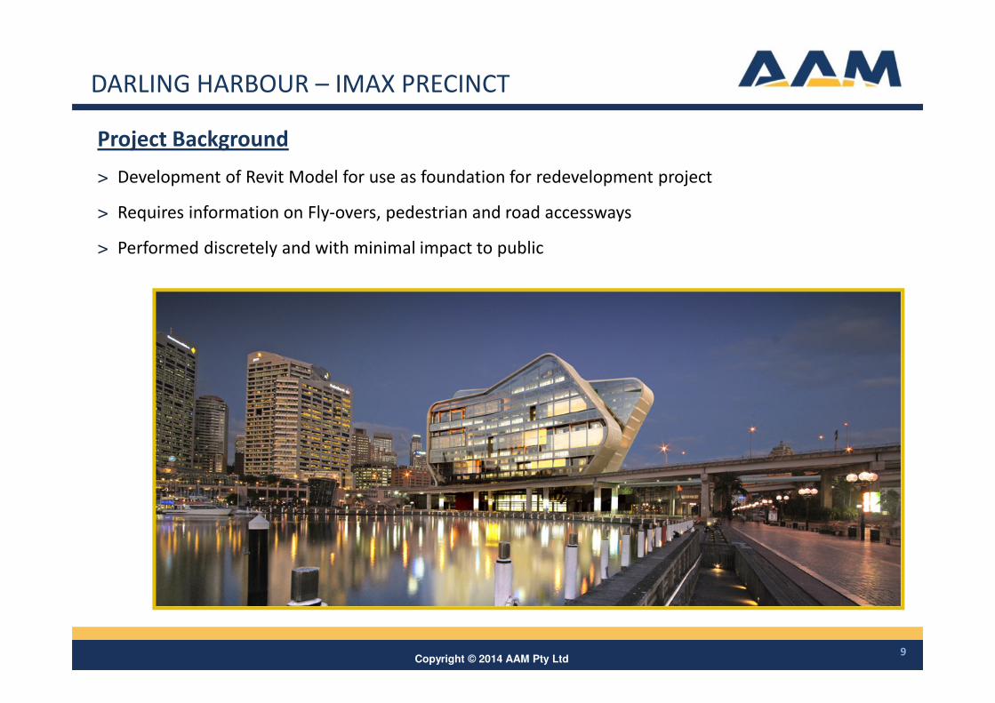
DARLING HARBOUR – IMAX PRECINCT
Project Background
> Development of Revit Model for use as foundation for redevelopment project
> Requires information on Fly-overs, pedestrian and road accessways
> Performed discretely and with minimal impact to public
Copyright © 2014 AAM Pty Ltd10
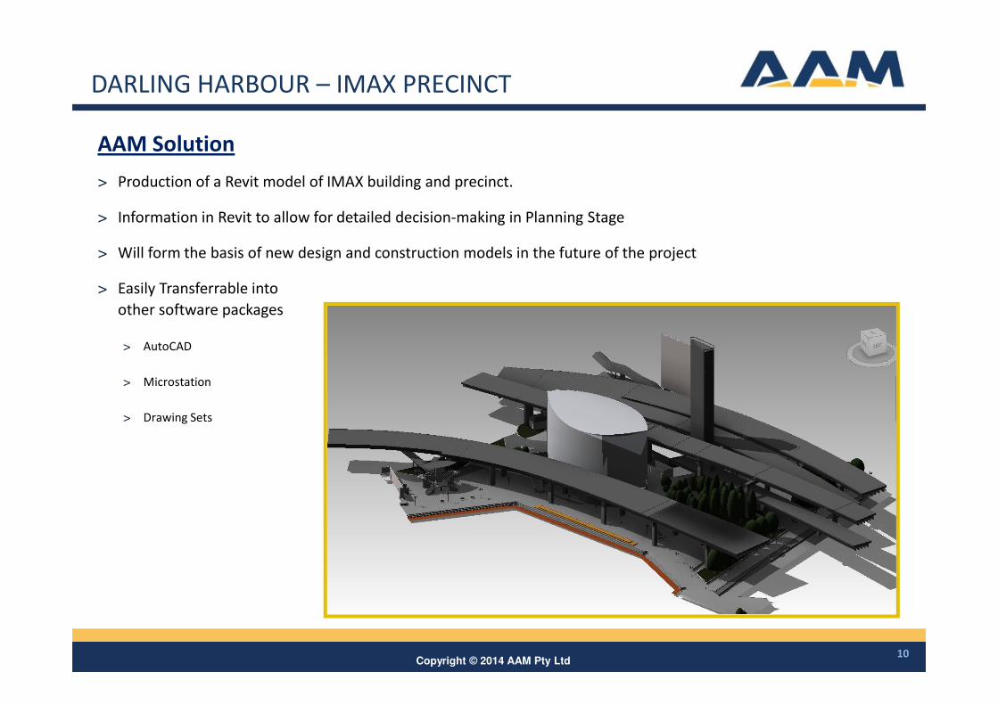
AAM Solution
> Production of a Revit model of IMAX building and precinct.
> Information in Revit to allow for detailed decision-making in Planning Stage
> Will form the basis of new design and construction models in the future of the project
> Easily Transferrable into
other software packages
> AutoCAD
> Microstation
> Drawing Sets
DARLING HARBOUR – IMAX PRECINCT
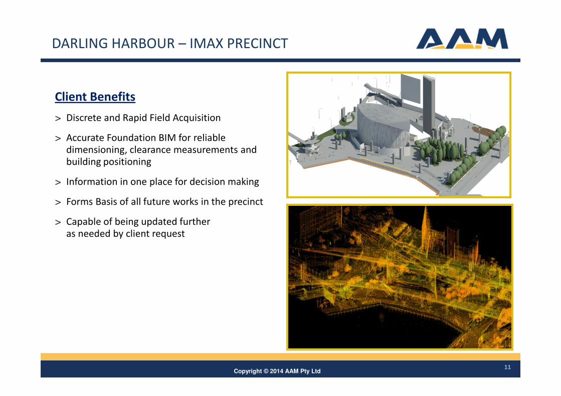
Copyright © 2014 AAM Pty Ltd11
Client Benefits
> Discrete and Rapid Field Acquisition
> Accurate Foundation BIM for reliable
dimensioning, clearance measurements and
building positioning
> Information in one place for decision making
> Forms Basis of all future works in the precinct
> Capable of being updated further
as needed by client request
DARLING HARBOUR – IMAX PRECINCT
Copyright © 2014 AAM Pty Ltd
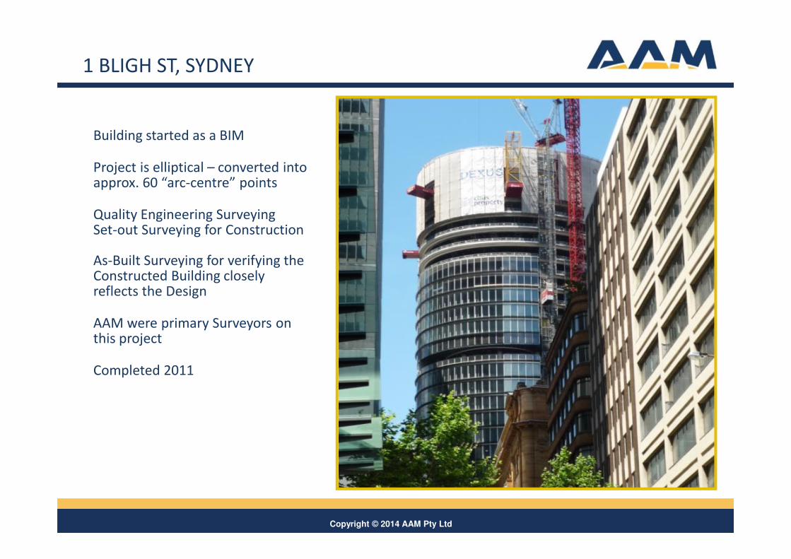
Building started as a BIM
Project is elliptical – converted into approx. 60 “arc-centre” points
Quality Engineering SurveyingSet-out Surveying for Construction
As-Built Surveying for verifying the Constructed Building closely reflects the Design
AAM were primary Surveyors on this project
Completed 2011
1 BLIGH ST, SYDNEY
Copyright © 2014 AAM Pty Ltd
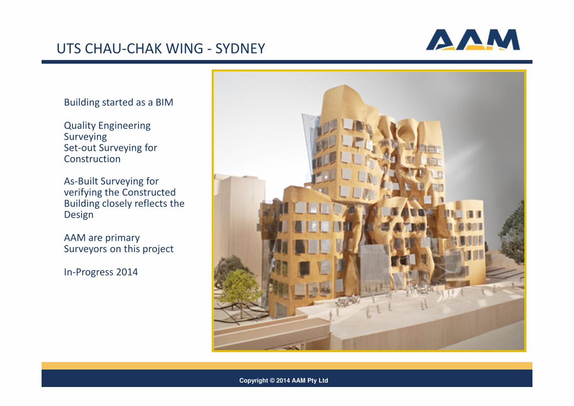
Building started as a BIM
Quality Engineering SurveyingSet-out Surveying for Construction
As-Built Surveying for verifying the Constructed Building closely reflects the Design
AAM are primary Surveyors on this project
In-Progress 2014
UTS CHAU-CHAK WING - SYDNEY
Copyright © 2014 AAM Pty Ltd
K2VI INTRODUCTION
14
• AAM’s K2Vi platform can be used as a platform to manage external links to BIM’s
• The Brisbane City Council Planning team use 3D modeling for master planning,
concept planning, consultation and site analysis including shadow, view-shed and
visibility.
• This can be used effectively by Councils, Universities and Developers/Property
Management to give tiered detail for BIM in context of the surrounding environment
Copyright © 2014 AAM Pty Ltd
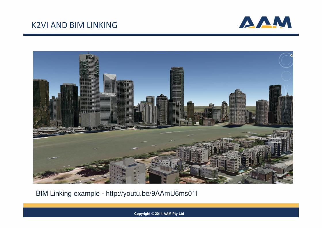
K2VI AND BIM LINKING
BIM Linking example - http://youtu.be/9AAmU6ms01I
Copyright © 2014 AAM Pty Ltd
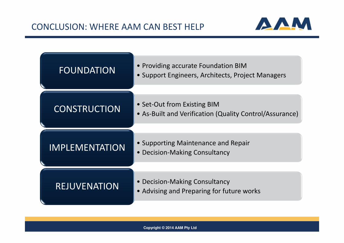
CONCLUSION: WHERE AAM CAN BEST HELP
• Providing accurate Foundation BIM
• Support Engineers, Architects, Project ManagersFOUNDATION
• Set-Out from Existing BIM
• As-Built and Verification (Quality Control/Assurance)CONSTRUCTION
• Supporting Maintenance and Repair
• Decision-Making ConsultancyIMPLEMENTATION
• Decision-Making Consultancy
• Advising and Preparing for future worksREJUVENATION
Copyright © 2014 AAM Pty Ltd17
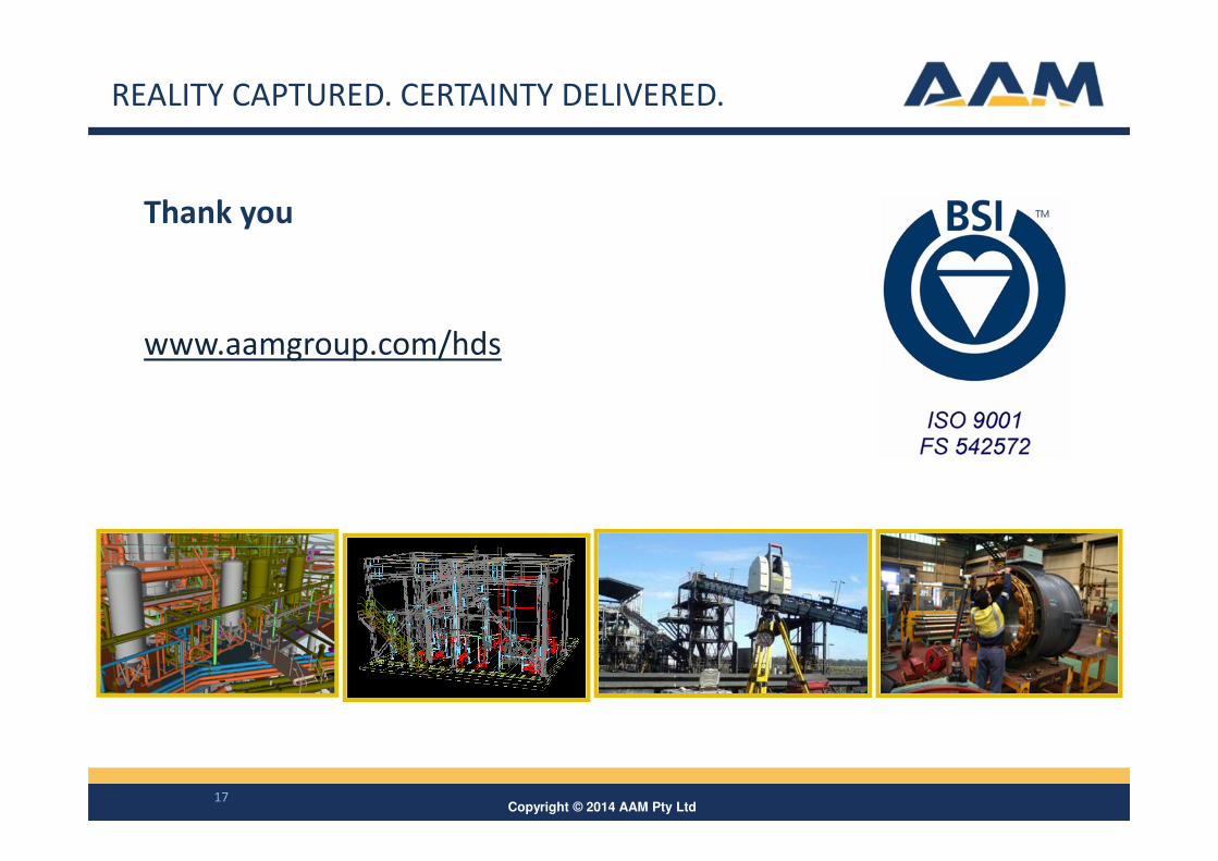
Thank you
www.aamgroup.com/hds
REALITY CAPTURED. CERTAINTY DELIVERED.