HANDOUT A - TCI
5
© Teachers’ Curriculum Institute Increasing Trade and Competition 1 HANDOUT A When early explorers set sail, they didn’t have tools to help them sail in open water. Instead, they had to follow the coastline in order to not get lost. To get to other places faster, they needed a better system of navigation. e Chinese were the first people to invent the compass. ese compasses allowed explorers to calculate their position and the direction that they were heading. ese early compasses had magnetized pointers. Some of these early compasses consisted of a metal spoon in a bowl of water. By the early 12th century, the compass was being used on ships to help sailors navigate the seas even when they couldn’t see the land. By the 13th century, Christian and Islamic nations also began using the compass. Naval Technologies The Compass
Transcript of HANDOUT A - TCI

© Teachers’ Curriculum Institute Increasing Trade and Competition 1
H A N D O U T A
When early explorers set sail, they didn’t have tools to help them sail in open water. Instead, they had to follow the coastline in order to not get lost. To get to other places faster, they needed a better system of navigation.
The Chinese were the first people to invent the compass. These compasses allowed explorers to calculate their position and the direction that they were heading. These early compasses had magnetized pointers. Some of these early compasses consisted of a metal spoon in a bowl of water.
By the early 12th century, the compass was being used on ships to help sailors navigate the seas even when they couldn’t see the land. By the 13th century, Christian and Islamic nations also began using the compass.
Naval Technologies
The Compass

© Teachers’ Curriculum Institute Increasing Trade and Competition 2
H A N D O U T A
Portolan charts were basic drawings of sea and landforms. These navigational charts had detailed and precise drawings of the coastline. They also often included the names of ports and other land features. Because of the accuracy of the charts, sailors and shippers used them to find their way around.
The charts included crisscrossed lines, called rhumblines, so that navigators could use the charts with a compass. Portolan charts also were often written in the vernacular languages of the people who used them.
The oldest surviving Portolan chart was called the Carta Pisana and was made in present-day Morocco in the late 13th century. Other Portolan charts from countries throughout Europe also still exist today.
The Portolan Charts
© Teachers’ Curriculum Institute Increasing Trade and Competition 3
H A N D O U T A
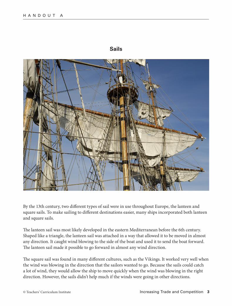
By the 13th century, two different types of sail were in use throughout Europe, the lanteen and square sails. To make sailing to different destinations easier, many ships incorporated both lanteen and square sails.
The lanteen sail was most likely developed in the eastern Mediterranean before the 6th century. Shaped like a triangle, the lanteen sail was attached in a way that allowed it to be moved in almost any direction. It caught wind blowing to the side of the boat and used it to send the boat forward. The lanteen sail made it possible to go forward in almost any wind direction.
The square sail was found in many different cultures, such as the Vikings. It worked very well when the wind was blowing in the direction that the sailors wanted to go. Because the sails could catch a lot of wind, they would allow the ship to move quickly when the wind was blowing in the right direction. However, the sails didn’t help much if the winds were going in other directions.
Sails

© Teachers’ Curriculum Institute Increasing Trade and Competition 4
H A N D O U T A
The astrolabe was a common tool in the Islamic world. Sailors would use the astrolabe in order to determine their latitude. To do this, a sailor would line up the bar with the sun, moon, or a star. Then, by determining the angle between the bar and the horizon, sailors could understand how far north or south they were.
Early astrolabes were effective for determining latitude in calm seas or on land, but they were not reliable during storms. By the 15th century, explorers had developed a mariners astrolabe that allowed sailors to find out where they were even in rough seas.
Astrolabes allowed sailor to sail out of the sight of land and still know where they were and in what direction they should go. Without it, sailors would not have been able to travel into open waters away from the shore.
The Astrolabe
© Teachers’ Curriculum Institute Increasing Trade and Competition 5
H A N D O U T A
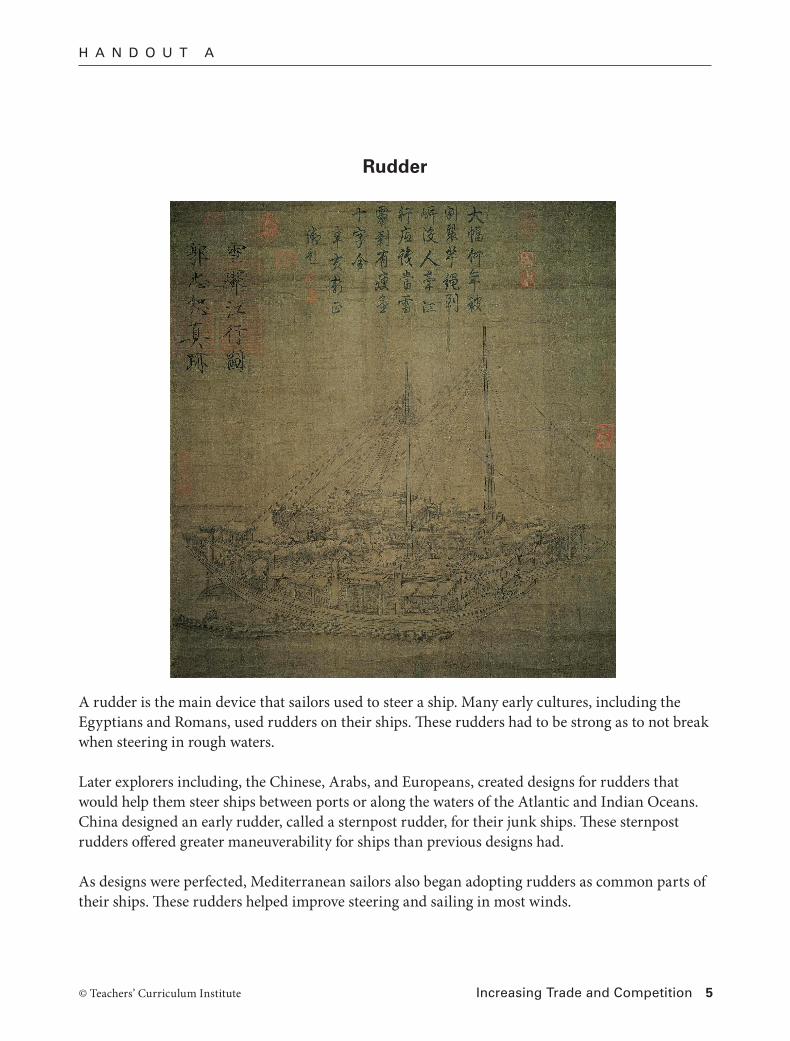
A rudder is the main device that sailors used to steer a ship. Many early cultures, including the Egyptians and Romans, used rudders on their ships. These rudders had to be strong as to not break when steering in rough waters.
Later explorers including, the Chinese, Arabs, and Europeans, created designs for rudders that would help them steer ships between ports or along the waters of the Atlantic and Indian Oceans. China designed an early rudder, called a sternpost rudder, for their junk ships. These sternpost rudders offered greater maneuverability for ships than previous designs had.
As designs were perfected, Mediterranean sailors also began adopting rudders as common parts of their ships. These rudders helped improve steering and sailing in most winds.
Rudder