Groundwater Availability Modeling (GAM) for the Queen City ...
61
Groundwater Availability Groundwater Availability Modeling (GAM) for the Modeling (GAM) for the Queen City and Sparta Aquifers Queen City and Sparta Aquifers Stakeholder Advisory Forum (SAF#1) Stakeholder Advisory Forum (SAF#1) The Bureau of Economic Geology The Bureau of Economic Geology Austin, Texas Austin, Texas February 28 February 28 th th , 2003 , 2003
Transcript of Groundwater Availability Modeling (GAM) for the Queen City ...
Groundwater Availability Groundwater Availability Modeling (GAM) for theModeling (GAM) for the
Queen City and Sparta AquifersQueen City and Sparta AquifersStakeholder Advisory Forum (SAF#1)Stakeholder Advisory Forum (SAF#1)
The Bureau of Economic GeologyThe Bureau of Economic GeologyAustin, Texas Austin, Texas
February 28February 28thth, 2003, 2003
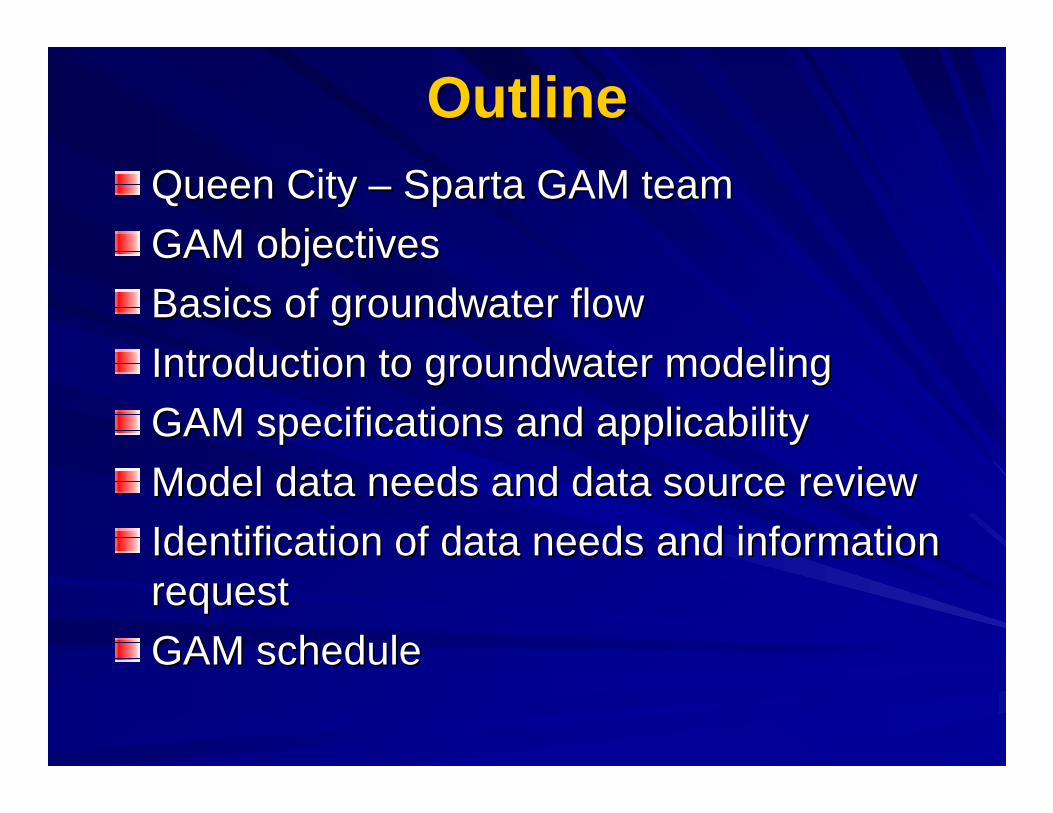
OutlineOutlineQueen City Queen City –– Sparta GAM teamSparta GAM team
GAM objectivesGAM objectives
Basics of groundwater flowBasics of groundwater flow
Introduction to groundwater modelingIntroduction to groundwater modeling
GAM specifications and applicabilityGAM specifications and applicability
Model data needs and data source reviewModel data needs and data source review
Identification of data needs and information Identification of data needs and information requestrequest
GAM scheduleGAM schedule
Team ResponsibilitiesTeam Responsibilities
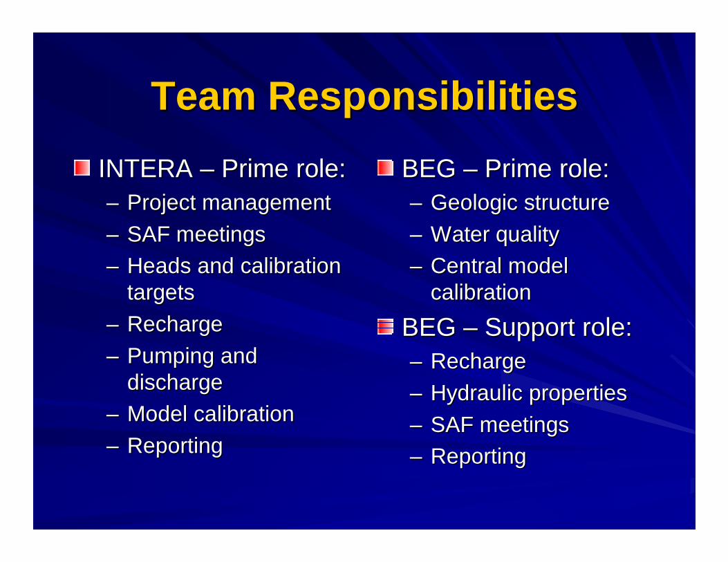
INTERA INTERA –– Prime role:Prime role:–– Project managementProject management
–– SAF meetingsSAF meetings
–– Heads and calibration Heads and calibration targetstargets
–– RechargeRecharge
–– Pumping and Pumping and dischargedischarge
–– Model calibrationModel calibration
–– ReportingReporting
BEG BEG –– Prime role:Prime role:–– Geologic structureGeologic structure
–– Water qualityWater quality
–– Central model Central model calibrationcalibration
BEG BEG –– Support role:Support role:–– RechargeRecharge
–– Hydraulic propertiesHydraulic properties
–– SAF meetingsSAF meetings
–– ReportingReporting
Team ResponsibilitiesTeam Responsibilities
R. J. Brandes R. J. Brandes Company Company –––– Support development Support development
of surface water of surface water calibration metriccalibration metric
TWDB:TWDB:–– Contract Manager Contract Manager ––
Dr. Shirley WadeDr. Shirley Wade
Expert Review:Expert Review:–– Dr. Graham Dr. Graham FoggFogg
–– Dr. Steve GorelickDr. Steve Gorelick
–– Dr. Bill Dr. Bill EspeyEspey
GAM ObjectivesGAM Objectives
Develop realistic and scientifically Develop realistic and scientifically accurate GW flow models representing accurate GW flow models representing the physical characteristics of the the physical characteristics of the aquifer and incorporating the relevant aquifer and incorporating the relevant processesprocesses
Promote stakeholder participation which Promote stakeholder participation which is critical to the success of the GAM is critical to the success of the GAM programprogram

GAM Objectives (cont’d)GAM Objectives (cont’d)
Provide a thoroughly documented data Provide a thoroughly documented data base and model, available to the publicbase and model, available to the public
The models are designed as tools to The models are designed as tools to help GCDs, RWPGs, and other help GCDs, RWPGs, and other interested parties assess groundwater interested parties assess groundwater availabilityavailability

SAFsSAFsHeld on 4 month scheduleHeld on 4 month schedule
First SAF to introduce basic information and First SAF to introduce basic information and request data for the modelrequest data for the model
Future meetingsFuture meetings–– provide updates on progressprovide updates on progress
–– opportunity to obtain feedbackopportunity to obtain feedback
SAF presentations and questions & SAF presentations and questions & responses from meetings will be posted at responses from meetings will be posted at http://http://www.twdb.state.tx.us/gam/qc_sp/qc_sp.htmwww.twdb.state.tx.us/gam/qc_sp/qc_sp.htm
Groundwater Flow Groundwater Flow -- DefinitionsDefinitions
Aquifer Aquifer –– Water saturated permeable geologic Water saturated permeable geologic unit that can transmit significant quantities of unit that can transmit significant quantities of waterwater–– Unconfined Unconfined –– water table forms the upper boundarywater table forms the upper boundary–– Confined Confined –– water level usually rises above top of aquiferwater level usually rises above top of aquifer
Water table Water table –– The level at which water stands in The level at which water stands in a shallow wella shallow well–– Subdued replica of topographySubdued replica of topography
Hydraulic head Hydraulic head -- The elevation that water stands The elevation that water stands in a wellin a well–– Primary observable measure describing groundwater flowPrimary observable measure describing groundwater flow

Groundwater Flow Groundwater Flow –– Definitions Definitions (cont’d)(cont’d)
Hydraulic conductivity Hydraulic conductivity –– A physical A physical property of an aquifer representing its property of an aquifer representing its ability to transmit waterability to transmit waterStorage Storage –– A measure of the volume of A measure of the volume of water stored in pore spaces in an aquiferwater stored in pore spaces in an aquifer
Groundwater Flow Groundwater Flow –– Definitions Definitions (cont’d)(cont’d)
Stream losses or gains Stream losses or gains –– The water that is The water that is either lost or gained through the base of a either lost or gained through the base of a streamstream
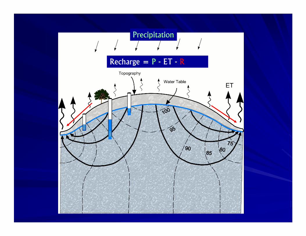
Recharge Recharge –– The addition of water to the The addition of water to the water table. Recharge equals water inputs water table. Recharge equals water inputs at ground surface (precipitation + irrigation at ground surface (precipitation + irrigation + stream loss) minus water losses (runoff + stream loss) minus water losses (runoff + + evapotranspirationevapotranspiration))
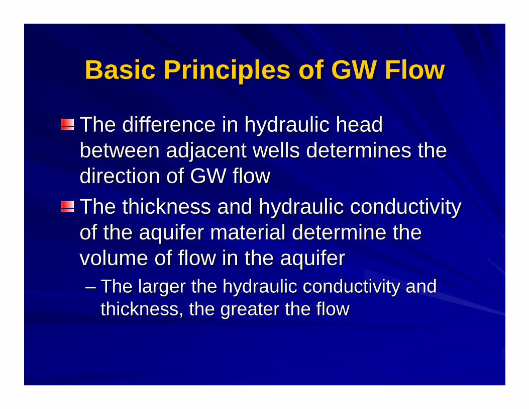
Basic Principles of GW FlowBasic Principles of GW Flow
The difference in hydraulic head The difference in hydraulic head between adjacent wells determines the between adjacent wells determines the direction of GW flowdirection of GW flow
The thickness and hydraulic conductivity The thickness and hydraulic conductivity of the aquifer material determine the of the aquifer material determine the volume of flow in the aquifervolume of flow in the aquifer–– The larger the hydraulic conductivity and The larger the hydraulic conductivity and
thickness, the greater the flowthickness, the greater the flow

Schematic Cross Section of Schematic Cross Section of Groundwater FlowGroundwater Flow
���������� � � �� �
������������
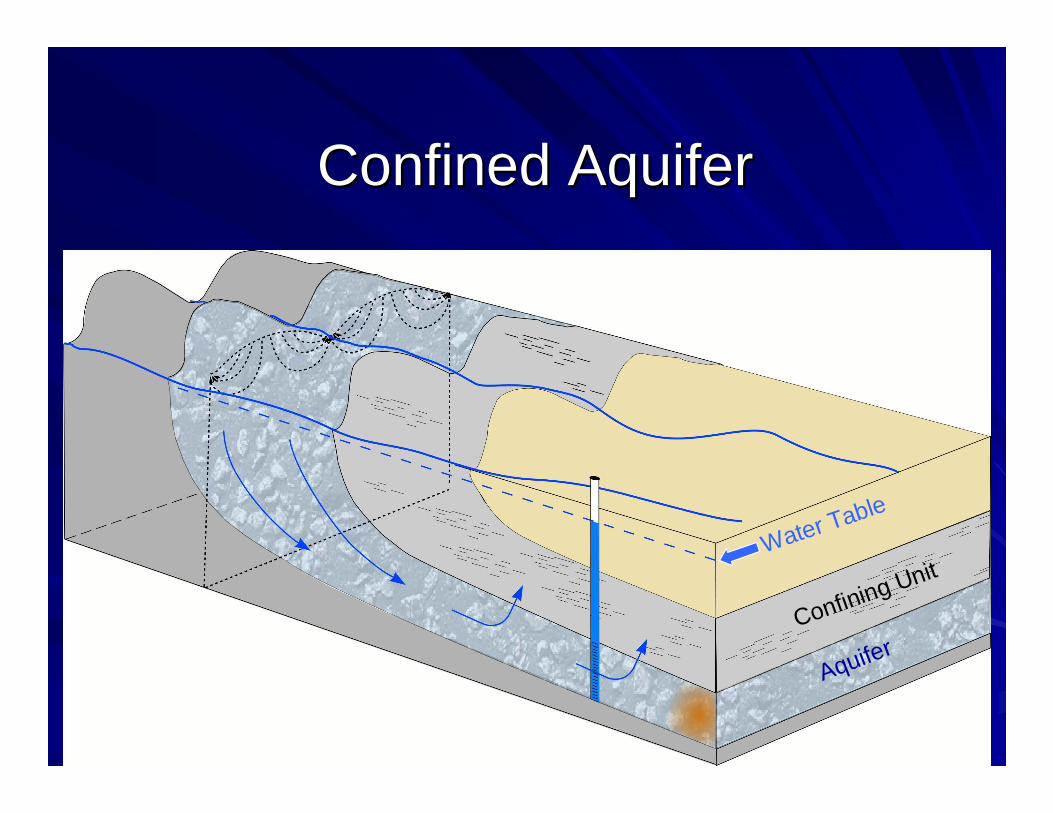
Confined AquiferConfined Aquifer
AquiferConfining Unit
Water Table

Definition of a ModelDefinition of a Model
DomenicoDomenico (1972)(1972) defined a model as a defined a model as a representation of reality that attempts to representation of reality that attempts to explain the behavior of some aspect of explain the behavior of some aspect of reality and is always reality and is always less complexless complex than the than the real system it represents real system it represents
Wang & Anderson (1982)Wang & Anderson (1982) defined a model defined a model as a tool designed to represent a as a tool designed to represent a simplifiedsimplified version of reality version of reality
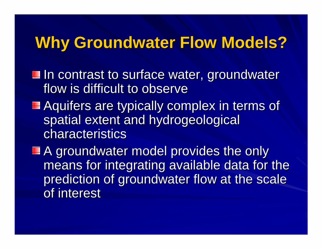
Why Groundwater Flow Models?Why Groundwater Flow Models?
In contrast to surface water, groundwater In contrast to surface water, groundwater flow is difficult to observeflow is difficult to observeAquifers are typically complex in terms of Aquifers are typically complex in terms of spatial extent and spatial extent and hydrogeologicalhydrogeologicalcharacteristics characteristics A groundwater model provides the only A groundwater model provides the only means for integrating available data for the means for integrating available data for the prediction of groundwater flow at the scale prediction of groundwater flow at the scale of interestof interest
Numerical Flow ModelNumerical Flow Model
A numerical groundwater flow model is the A numerical groundwater flow model is the mathematical representation of an aquifermathematical representation of an aquifer
It uses basic laws of physics that govern It uses basic laws of physics that govern groundwater flow groundwater flow
In the model domain, the numerical model In the model domain, the numerical model calculates the hydraulic head at discrete calculates the hydraulic head at discrete locations (determined by the grid)locations (determined by the grid)
The calculated model heads can be compared The calculated model heads can be compared to hydraulic heads measured in wellsto hydraulic heads measured in wells
� ������� ���������������
� ������� ����������
������������
� ����������� ����
� ����������
���������
� �����������
������! ����
"���������
���������
� �� �������� �� �������� �� �������� �� �������
# ���# ���# ���# ���
����������������������������������������
$ �����������
��������� ��������� ��������� ���������
��������� ��������� ��������� ���������
%&��������
������������
��������
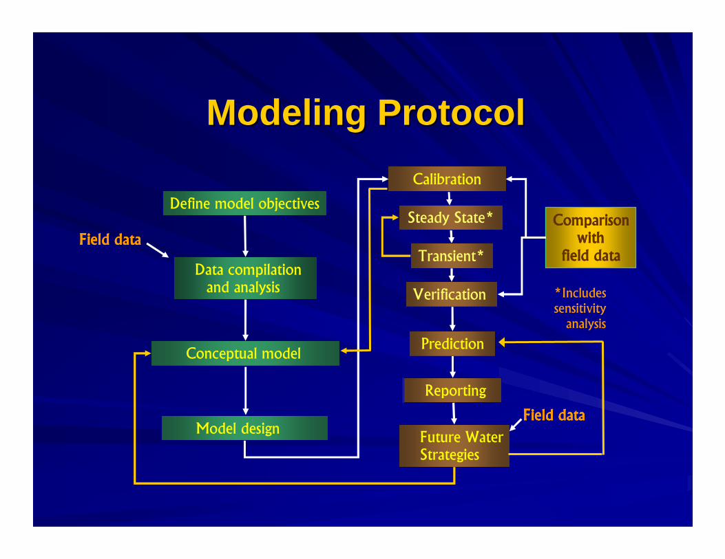
Modeling ProtocolModeling Protocol
��������%
"������"����%
GAM Model SpecificationsGAM Model Specifications
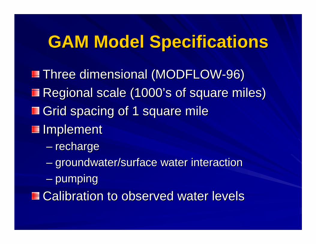
Three dimensional (MODFLOWThree dimensional (MODFLOW--96)96)
Regional scale (1000’s of square miles)Regional scale (1000’s of square miles)
Grid spacing of 1 square mileGrid spacing of 1 square mile
ImplementImplement–– rechargerecharge
–– groundwater/surface water interactiongroundwater/surface water interaction
–– pumpingpumping
Calibration to observed water levelsCalibration to observed water levels
Queen CityQueen City--Sparta GAMSparta GAMSpecificationsSpecifications
The Queen City and Sparta aquifer The Queen City and Sparta aquifer GAMsGAMswill be incorporated into the current will be incorporated into the current CarrizoCarrizo--Wilcox Wilcox GAMsGAMs
The product will be delivered as three The product will be delivered as three modelsmodels
One modeling report will be producedOne modeling report will be produced
Model ApplicabilityModel Applicability
The GAM is a tool capable of being used to The GAM is a tool capable of being used to make groundwater availability assessments on a make groundwater availability assessments on a regional scaleregional scale
The model is well suited for studying institutional The model is well suited for studying institutional water resource issueswater resource issues
The model would likely require refinement to The model would likely require refinement to study operational issues for a specific projectstudy operational issues for a specific project
The GAM allows regional consideration of The GAM allows regional consideration of interference between resource strategiesinterference between resource strategies
GAM DeliverablesGAM Deliverables
Calibrated groundwater model (GAM) with Calibrated groundwater model (GAM) with predictions to 2050predictions to 2050
Data base (data model) to support the GAMData base (data model) to support the GAM
Final report with presentation and discussion Final report with presentation and discussion of the data and the GAMof the data and the GAM
All of the above will be publicly available All of the above will be publicly available through the TWDB at through the TWDB at http://www.twdb.state.tx.us/gamhttp://www.twdb.state.tx.us/gam
Data Model (Data Base) for GAMData Model (Data Base) for GAM
Provides consistent methodology for Provides consistent methodology for storage of the data base for each GAMstorage of the data base for each GAM
Facilitates future improvements to or Facilitates future improvements to or modifications of the current workmodifications of the current work
Available to the general public as an Available to the general public as an addition to the model and final reportaddition to the model and final report

GAM Model PeriodsGAM Model Periods
'()* '((* +*** +*,*
!������������������!
���
������������� ������� ���
"�����������
'(**
��������
� ���������� � �����������
- ��������! �����.����
$ �����! �����.����
.�/ �0 �
��� ��� � �� � �� � �� �� � � � � � � � �� �� � � �� � � � � �� �� � � � � � � � � � � � � � �� �� ��� � � � � �� � � � � � � �

MODFLOWMODFLOW
Computer based model developed by the U.S. Computer based model developed by the U.S. Geological SurveyGeological SurveySelected by TWDB for all GAMsSelected by TWDB for all GAMsHandles the relevant processesHandles the relevant processesComprehensive documentationComprehensive documentationPublic domain Public domain –– nonnon--proprietaryproprietaryMost widely used groundwater modelMost widely used groundwater model–– USGS had 12,261 downloads of MODFLOW computer USGS had 12,261 downloads of MODFLOW computer
code in 2000code in 2000
Supporting interface programs availableSupporting interface programs available–– PMWIN to be used in all PMWIN to be used in all GAMsGAMs
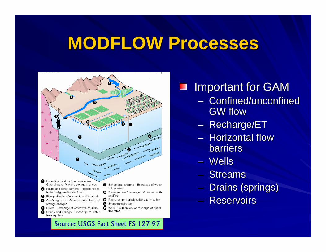
MODFLOW ProcessesMODFLOW Processes
Important for GAMImportant for GAM–– Confined/unconfined Confined/unconfined
GW flowGW flow–– Recharge/ETRecharge/ET–– Horizontal flow Horizontal flow
barriersbarriers–– WellsWells–– StreamsStreams–– Drains (springs)Drains (springs)–– ReservoirsReservoirs
"�����1�2 "/ "� ����"����� "�'+3 �(3

Model DomainsModel Domains
NorthernCarrizo-Wilcox
Model Area
CentralCarrizo-Wilcox
Model Area
SouthernCarrizo-Wilcox
Model Area
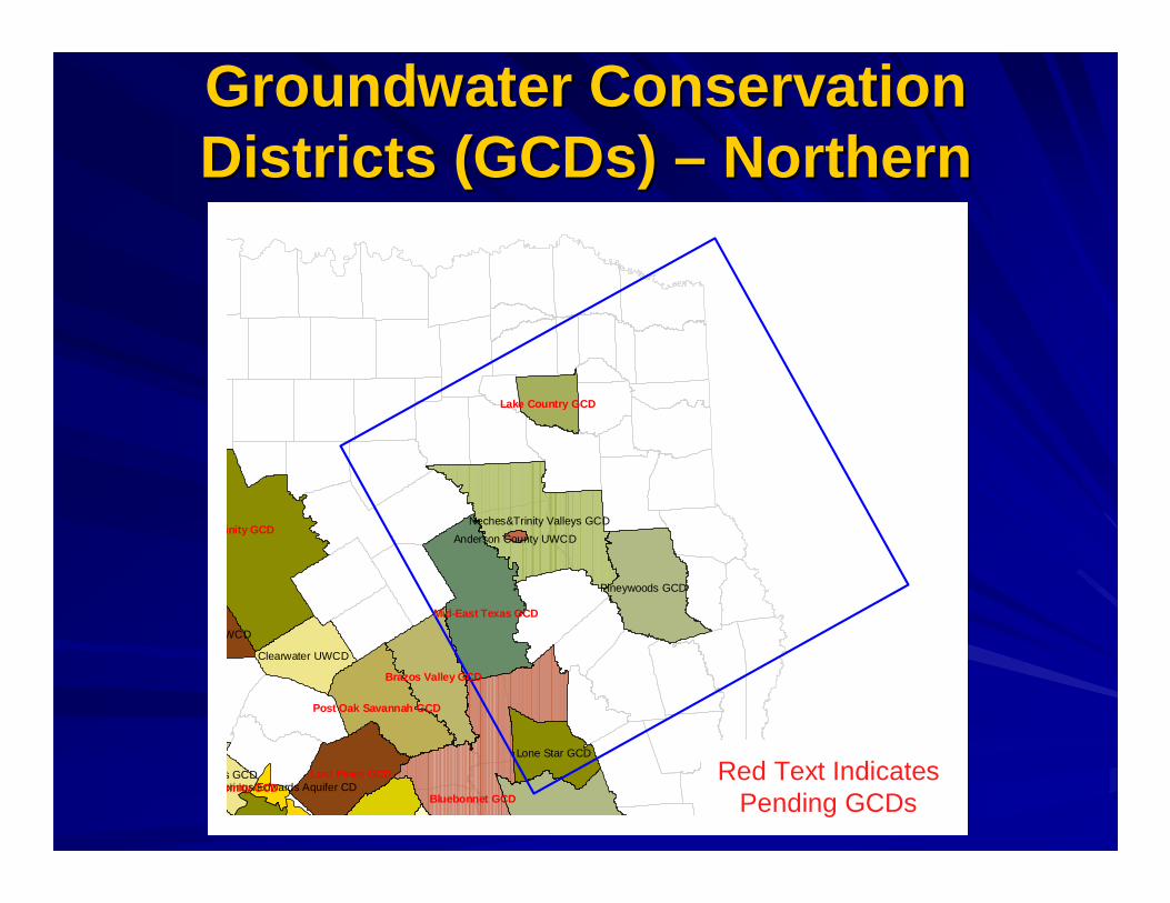
Groundwater Conservation Groundwater Conservation Districts (Districts (GCDsGCDs) ) –– NorthernNorthern
Neches&Trinity Valleys GCD
Pineywoods GCD
Lone Star GCD
Clearwater UWCD
WCD
s GCDprings/Edwards Aquifer CD
Anderson County UWCDinity GCD
Bluebonnet GCD
Mid-East Texas GCD
Lost Pines GCD
Brazos Valley GCD
Post Oak Savannah GCD
Lake Country GCD
rinity GCDRed Text Indicates
Pending GCDs
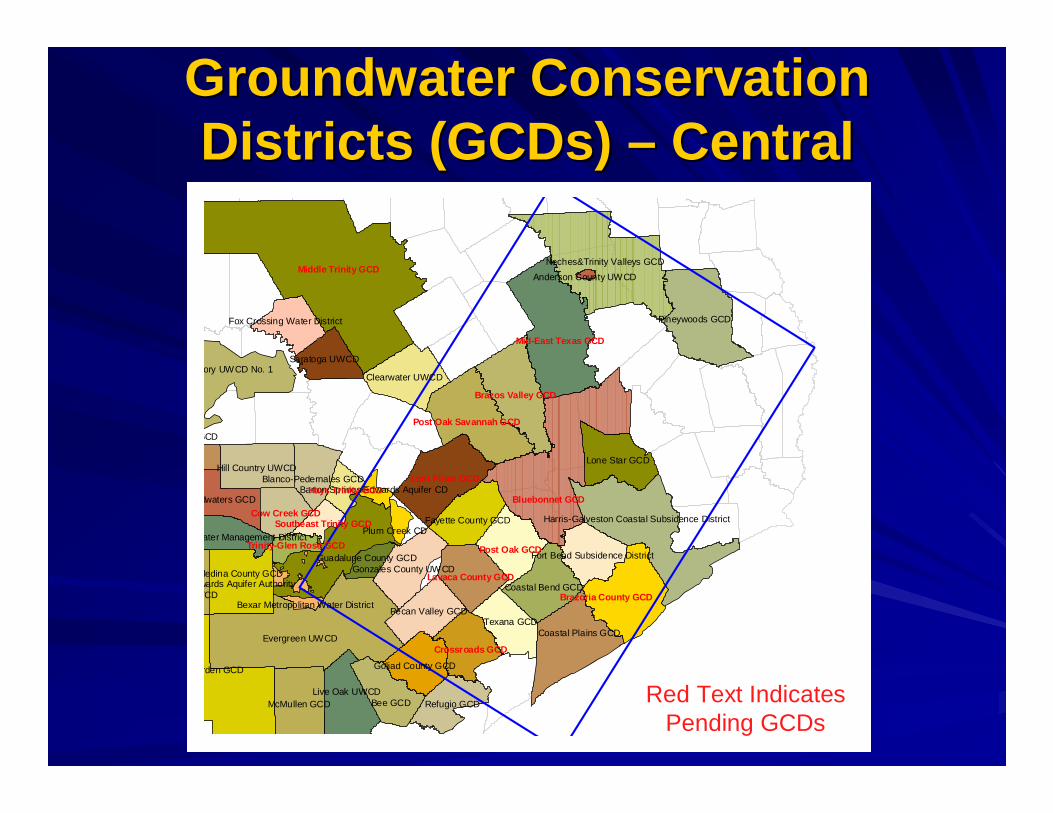
Groundwater Conservation Groundwater Conservation Districts (Districts (GCDsGCDs) ) –– CentralCentral
Red Text IndicatesPending GCDs
Evergreen UWCD
rden GCD
wards Aquifer Authority
Neches&Trinity Valleys GCD
Pineywoods GCD
ory UWCD No. 1
Bee GCD
Coastal Plains GCD
McMullen GCD
Lone Star GCD
WCD
Texana GCD
Live Oak UWCD
Medina County GCD
dwaters GCD
Refugio GCD
GCD
Harris-Galveston Coastal Subsidence District
Clearwater UWCD
Coastal Bend GCD
Hill Country UWCD
Pecan Valley GCD
Fayette County GCD
Goliad County GCD
Saratoga UWCD
Gonzales County UWCD
Fort Bend Subsidence District
Blanco-Pedernales GCD
Fox Crossing Water District
ater Management DistrictPlum Creek CD
Guadalupe County GCD
Barton Springs/Edwards Aquifer CD
Bexar Metropolitan Water District
Anderson County UWCDMiddle Trinity GCD
Bluebonnet GCD
Mid-East Texas GCD
Lost Pines GCD
Brazos Valley GCD
Brazoria County GCD
Post Oak Savannah GCD
Post Oak GCD
Crossr oads GCD
Lavaca County GCD
Cow Creek GCD
Hays Trinity GCD
Southeast Trinity GCD
Trinity-Glen Rose GCD

Groundwater Conservation Groundwater Conservation Districts (Districts (GCDsGCDs) ) –– SouthernSouthern
Evergreen UWCD
Wintergarden GCD
Edwards Aquifer Authority
Emerald UWCD
Hickory UWCD No. 1
Real-Edwards C and R District
Bee GCD
Coastal Plains GC
McMullen GCD
Lone
Uvalde County UWCDKinney County GCD
Sutton County UWCD
Texana GCD
Live Oak UWCD
Medina County GCD
Headwaters GCD
Refugio GCD
Kimble County GCD
Harris-Galveston
Clearwater UWCD
Coastal Bend GCD
Hill Country UWCD
Pecan Valley GCD
Fayette County GCD
Goliad County GCD
Saratoga UWCD
Plateau UWC And Supply District
Gonzales County UWCD
Menard County UWD
Fort Bend Subsiden
Blanco-Pedernales GCD
Springhills Water Management DistrictPlum Creek CD
Guadalupe County GCD
Barton Springs/Edwards Aquifer CD
Bexar Metropolitan Water District
Bluebonnet GCD
Lost Pines GCD
Brazos Valley GCD
Brazoria Co
Post Oak Savannah GCD
Post Oak GCD
Crossroads GCD
Lavaca County GCD
Cow Creek GCD
Hays Trinity GCD
Southeast Trinity GCD
Trinity-Glen Rose GCD
Red Text IndicatesPending GCDs
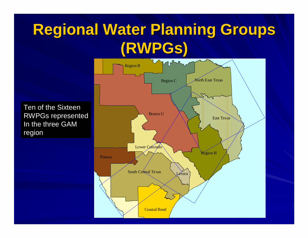
Regional Water Planning Groups Regional Water Planning Groups (RWPGs)(RWPGs)
Brazos GEast Texas
Region C
Region HPlateau
South Central Texas
Region B
Coastal Bend
Lower Colorado
North East Texas
Lavaca
Ten of the SixteenRWPGs representedIn the three GAMregion

River River BasinsBasins
Red
Sulphur
CypressCkSabine
Neches
BrazosColorado
Guadalupe
Trinity
San Antonio
Nueces
RioGrande
SanJacinto
Lavaca
Every majorriver basin isrepresented in thethree GAM modelareas

Model Grid ScaleModel Grid Scale
Gonzales County
Gonzales
Nixon
20,000 acres representsApproximately 5 grid blocks

Queen City & Sparta AquifersQueen City & Sparta Aquifers
The Queen City and Sparta Aquifers extend The Queen City and Sparta Aquifers extend from South Texas northeastward through East from South Texas northeastward through East Texas into Ark. & La.Texas into Ark. & La.–– Sediments of the Tertiary Claiborne GroupSediments of the Tertiary Claiborne Group–– Queen City aquifer consists of sand, looselyQueen City aquifer consists of sand, loosely--
cemented sands, and cemented sands, and interbeddedinterbedded claysclays–– Sparta Aquifer consists of sand and Sparta Aquifer consists of sand and interbeddedinterbedded clays clays
with massive basal sands which gently dip to the Gulf with massive basal sands which gently dip to the Gulf Coast (max thickness of 300 ft.)Coast (max thickness of 300 ft.)
–– Aquifers are separated by the Aquifers are separated by the WechesWeches Formation Formation which is a marine confining unit which is a marine confining unit
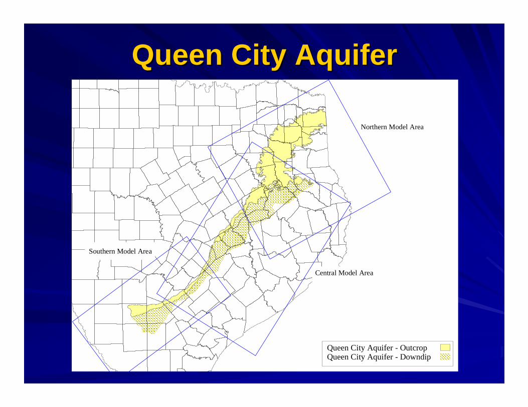
Queen City AquiferQueen City Aquifer
Northern Model Area
Central Model Area
Southern Model Area
Queen City Aquifer - OutcropQueen City Aquifer - Downdip
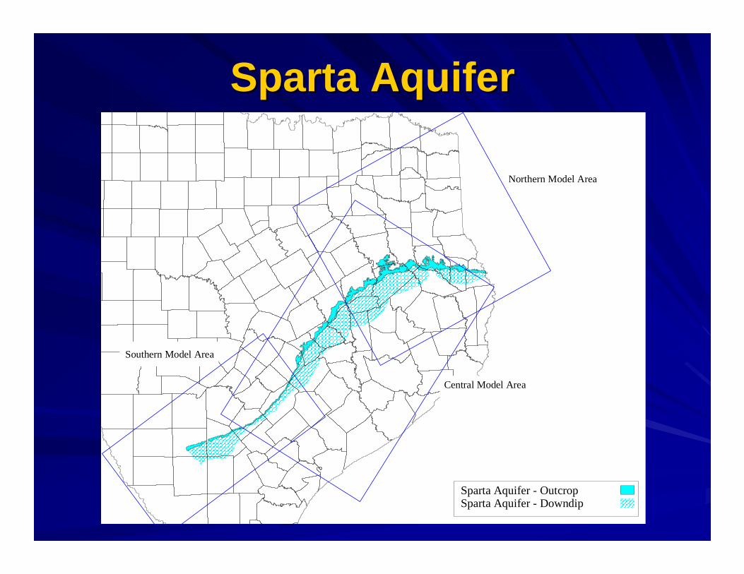
Sparta AquiferSparta Aquifer
Northern Model Area
Central Model Area
Southern Model Area
Sparta Aquifer - OutcropSparta Aquifer - Downdip
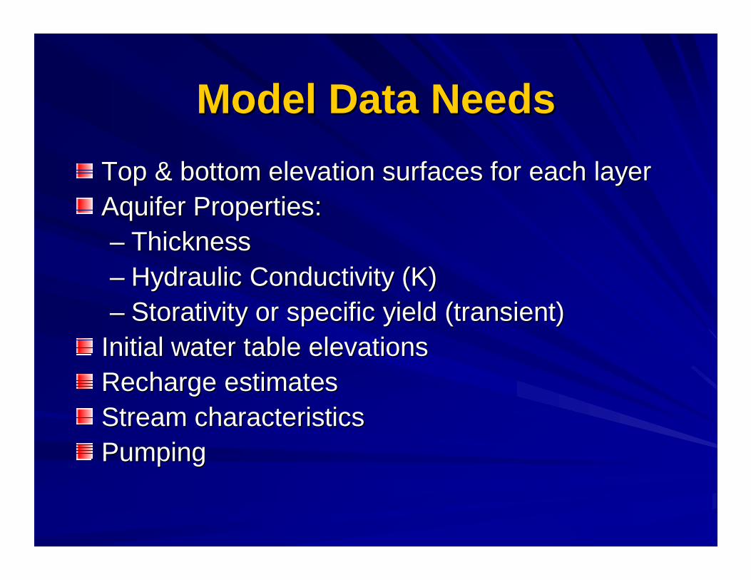
Model Data NeedsModel Data Needs
Top & bottom elevation surfaces for each layerTop & bottom elevation surfaces for each layerAquifer Properties:Aquifer Properties:–– ThicknessThickness–– Hydraulic Conductivity (K)Hydraulic Conductivity (K)–– Storativity or specific yield (transient)Storativity or specific yield (transient)
Initial water table elevationsInitial water table elevationsRecharge estimatesRecharge estimatesStream characteristicsStream characteristicsPumpingPumping

Key Data SourcesKey Data Sources
TWDB data at their website: TWDB data at their website: http://www.twdb.state.tx.us/data/data.htmhttp://www.twdb.state.tx.us/data/data.htm–– Queen City (1053 wells)Queen City (1053 wells)–– Sparta (587 wells)Sparta (587 wells)
County reports by TWDB & predecessorsCounty reports by TWDB & predecessorsU.S. Geological Survey reportsU.S. Geological Survey reportsUT Bureau of Economic Geology reportsUT Bureau of Economic Geology reportsLouisiana state publicationsLouisiana state publicationsTCEQ drillers logsTCEQ drillers logsBrune (1975) spring locations & flowsBrune (1975) spring locations & flows
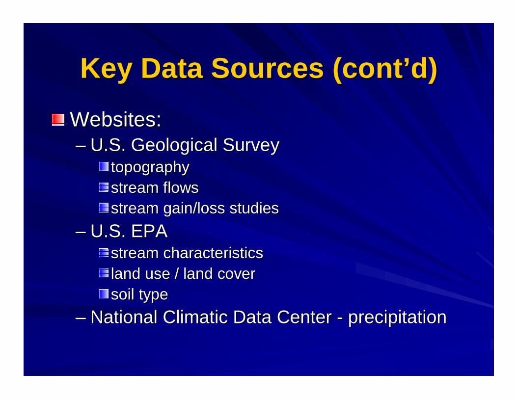
Key Data Sources (cont’d)Key Data Sources (cont’d)
Websites: Websites: –– U.S. Geological SurveyU.S. Geological Survey
topographytopographystream flowsstream flowsstream gain/loss studiesstream gain/loss studies
–– U.S. EPAU.S. EPAstream characteristicsstream characteristicsland use / land coverland use / land coversoil typesoil type
–– National Climatic Data Center National Climatic Data Center -- precipitationprecipitation
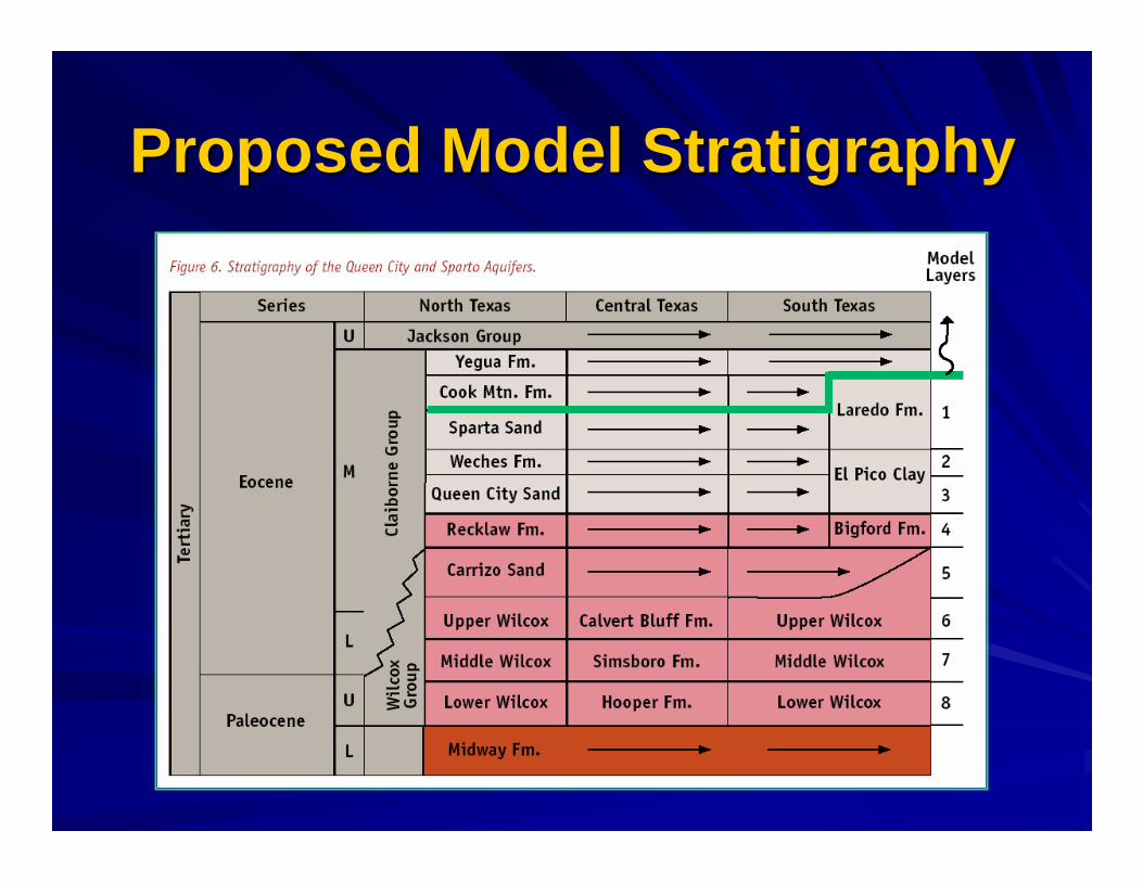
Proposed Model Proposed Model StratigraphyStratigraphy

Geologic Structure Data SourcesGeologic Structure Data Sources
Structure Structure –– Refers to the elevation of the tops of Refers to the elevation of the tops of the Queen City, the the Queen City, the WechesWeches, and the Sparta , and the Sparta formationsformationsTCEQ well log database Guevara & Garcia TCEQ well log database Guevara & Garcia (1972)(1972)–– 700 Logs available across the 3 model areas.700 Logs available across the 3 model areas.
The TWDB East Texas ModelThe TWDB East Texas Model–– Available data north of the Brazos RiverAvailable data north of the Brazos River
Sand thickness maps:Sand thickness maps:–– Queen City Queen City –– Guevara & Garcia (1972)Guevara & Garcia (1972)–– Sparta Sparta –– Payne (1968)Payne (1968)
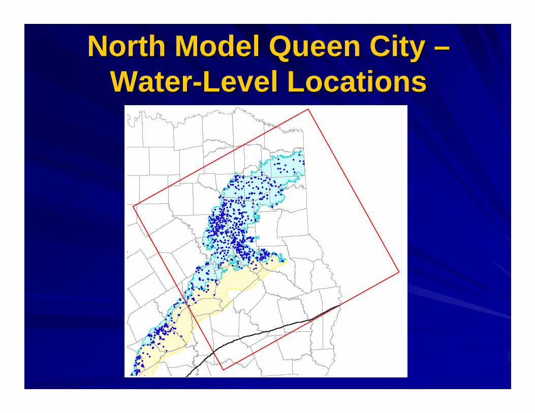
North Model Queen City North Model Queen City ––WaterWater--Level LocationsLevel Locations
��
�
�
�
��
�
��
��
� �
�� �
�
�
� �
���� �
��
�� ����
�
�
� ��
�� �
�� �
���� �
���
��
���
� ��
��
�
�
���
��� �
������
��
���
���
��
��
����
����
��
� ����� �
�
�� ���
�����������
�����
������
��������
� �����
�� ��
�
��
����������
�����
���
��
�
�������
��
�
�
�
�
�
�
� �
�
��
�
� ���
�� �
� �
��
��
� ���
�� ��
���
�������� �
��
�����
�
��
�����
�����
���� ��
�
� �������
����
�
����� ���
�
������������
���
����
�����
��������
� ����
���������
� ���
��
�� �
�� ��� ��� ���
��� ��� �
�� ��
���
�
������
��
�
��
�
�����
�����
��
��
���
��
�
�
���
������
� �
�
�����
� �������
����� �����
����
�
��������� ���
����
����
��������
�� ��
���
�� �� �
���
�����
������������
��� �
���
��������
������
������ �
����
���
�
��
�
��
��
�
���
�
� �����
����
���
��
���
����
������
�
���
�������
�
�
� �
��
�
�
� ����
��
�
��
�� �
��
��
����� ���������
� ���
��������
����
�
� ��
�
� ��
���
����
�
� �
����
�
�
�
��
�����
����
� �
�� � �� �� �
�
�����
���
���
�� ��
����
�
�
��
��
�� ���
�����
����� �
�����
��
�
� �
� ��
� ����
��
��
��
����
�
��
�� �
�
����
������
�� ��� ���
� �
����
� �
��
��
�
��
����� �
��
� ���
������� � ���
����
���
������
���
�
�
�
��
�
� �
� ����
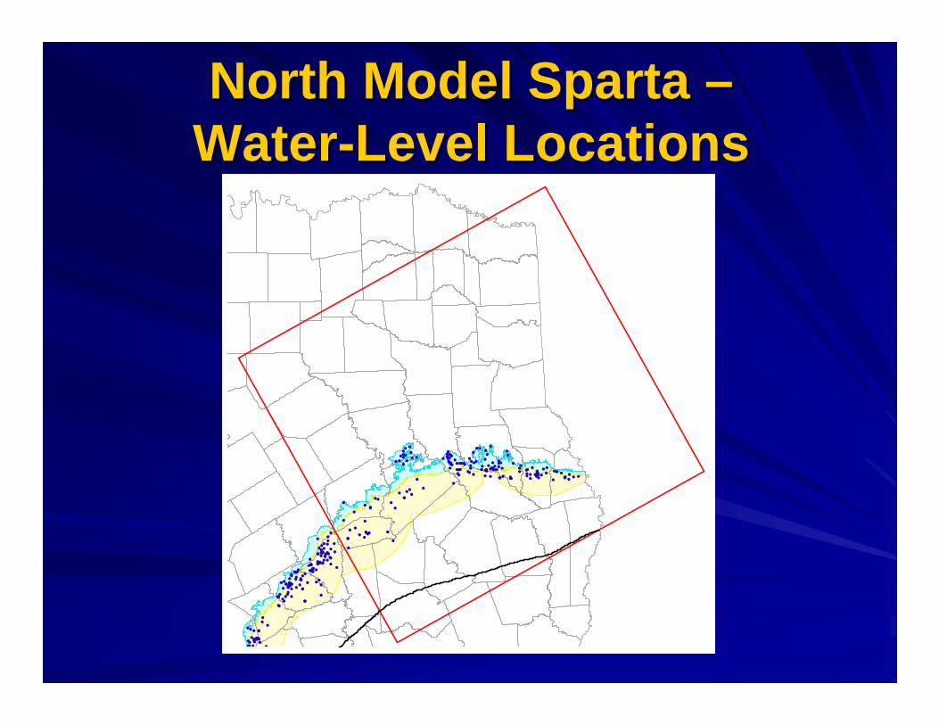
North Model Sparta North Model Sparta ––WaterWater--Level LocationsLevel Locations
�
�� �
����
��
�� �
�
��
���
��
� � ���
���
��
�
���������
��
�
��
�����
���
��� �
�
������
�
�
�
�
������
��� �
�������� �
����
��
�
�
�����
��
�
�� �
�� �
������ ������
�
��
����
��
�
����
���
��
��
��
��
�
�� �� ��
���
�
���
���� �
����
�����
��
�
�
�
��
��
�
�
�
�
�
��
�
��
��
�
�
�
��
�
�
� �
��
��
�
����
��
��
���
�
�
�
����
�
��
���
��
���� ���
���
�������
��
���
��
�
�
�
�
�
��� � ���� �
� ��
����
���
� ������
��
��
� �
�
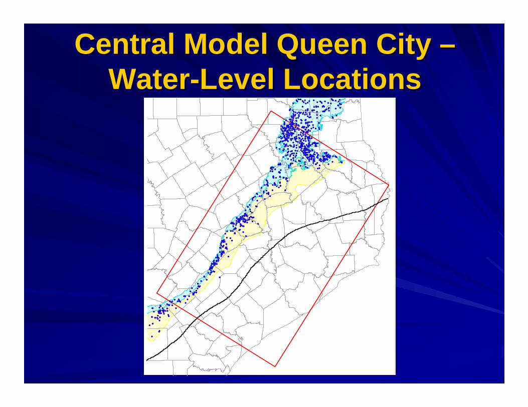
Central Model Queen City Central Model Queen City ––WaterWater--Level LocationsLevel Locations
��
�
�
��
�
��
�� � �
���
�
�
� �
���� �
��
�� ������
� ��
�� �
�� �
���� �
���
�� ���
� �� ��
�
�
���
��� �
����
� � �������
�
�������������
��� ��
�
��
��� ����
�
�
�
��
������
��
���
���
��
��
����
����
��
��
� �
� ����
��� �
��� ��������
�
�
�� �������������������
������
��������
� �����
�� ���
������������
�����
���
� ��
����� ��
��
�
�
�
���
����
��
����
� ���
�� ��
���
�����������
�����
�
��
�����
��������� ���
� �������
����
���������
�
���������������
����
�����
��������� ����
���������
� ���
� ��� �
�� ��� ��������� ��
� �
��
��
����
������
��
�
�
��
�
�����
�����
��
�� �
��
� ���
��
�
�
��
�
������
���
���
��
���
���
�
���
������
� �
�
�����
� �������
�������� ��
�����
������������
����
����
��������
�� �����
�� �� ����
���
��
������������
����
���
��������
������
������ �
����
� ��
�
��
�
��
��
�
���
�
� �����
����
���
��
���
����
����
��
�
���
�������
�
�
� �
� �
�
�� ����
�
�
�� �
�
��
��
��
������������������
��������
����
�
� ��
�� ��
���
����
�
� �
��
��
�
�
�
��
� ��������� �
�� � ���� �
�
�����
���
���
�� ��
�����
�
����
�� ���
�����
����� �
�����
��
�
��
� ��
� ���� ��
��
��
����
�
�
����
����� �
� ���
� �
��
��
�
��
��������� ���
�
�����
�
�
����
��������
���� �
�
���
��� � �
��
�
��
�����

Central Model Sparta Central Model Sparta ––WaterWater--Level LocationsLevel Locations
�
����
���
���
���
��
����
�� � ���
���
��
���
�����
���
��������������
�
��
��
�
���
�����
���
��� �
�
������
�
�
��
��������� ����������
�������
�
�����
��
�
����� ������� ������ �
��
��� ����
���������
��
��
��
�
���������
������������������
��
��
��
��������
���
���
����
�
��
�
�
�������
� �
�
�
���
���
��
��
��
�
��
��
�
�
�
���
�
� �
��
��
�
������ ��
�� ��
��
����
��
� ���
��
���� ���
������������
���
���
��
�
�
���� �����
� ��
����
���
� ��������
� �� �
�
�
�
��
��
��
� ���

South Model Queen City / El South Model Queen City / El Pico Pico ––WaterWater--Level LocationsLevel Locations
��
�
�
�� �
�
��
�
����� � ����� ��
�
�������
��������� ��
���
��� ���
��
�
�
��
������
��
���
���
��
��
����
����
��
��
� �
� ����
��� �
�����
�������
�� ���
�����������
�����
������
��������
� ����
���
���
�� ����������
�����
���� �
�
�������
��
�
�
�
�������
��
�
�
��
� ����
�������
��
���
���
�
��
����
���
��
����
��
�
�
��
�
������
���
���
�
��
�
��
��
�
���
�
��
�
��
��
���
�
�
�����
�
�
���
��
�������
���� �
�
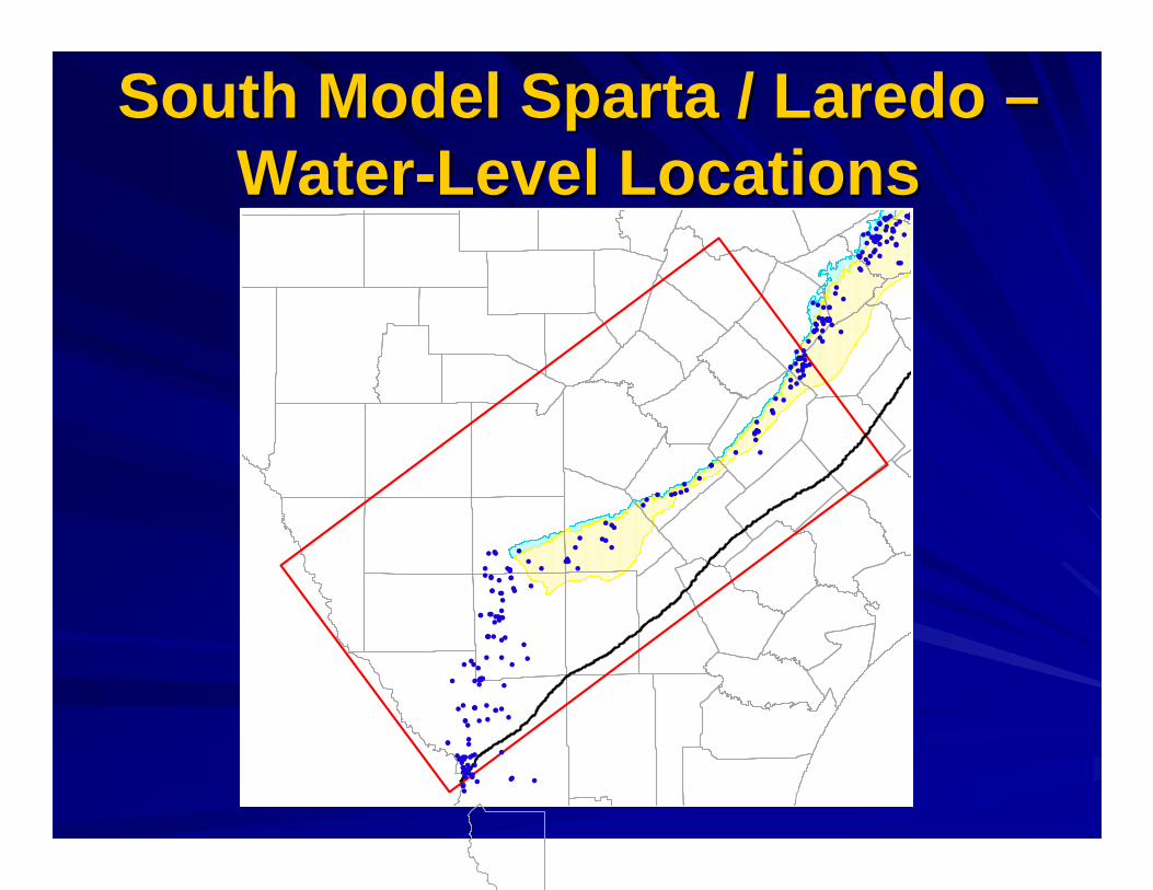
South Model Sparta / Laredo South Model Sparta / Laredo ––WaterWater--Level LocationsLevel Locations
�
� ��
� �����
�
� ��
�����
�� ���
�
����
����
� �
�
�
�
�����
��
�
� �
��
� �� ����
���
��
� �
�
�
����
����� ������� �����
�����
�
����
�����
�
�� �
�
���
�
�
���
����
�
���
������������
��
�
�
�
��
�
���������
�����
��
�
�� �
�� ������� ������ �
��
����
�
����
���
��
��
��
��
��
��
��
�����
���
���
���
�
�
��
��
��
�
��
�
�
������
�
� �
�
�
��
��
��
��
��
�
��
��
�
�
��
��
��
� ���
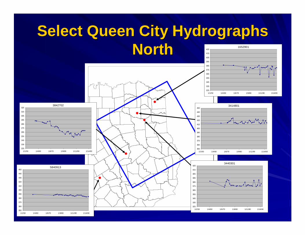
Select Queen City Hydrographs Select Queen City Hydrographs NorthNorth
3842702
225
235
245
255
265
275
285
295
305
315
325
1/1/50 1/4/60 1/6/70 1/9/80 1/11/90 1/14/00
5840913
350
360
370
380
390
400
410
420
430
440
450
1/1/50 1/4/60 1/6/70 1/9/80 1/11/90 1/14/00
3440301
325
335
345
355
365
375
385
395
405
415
425
1/1/50 1/4/60 1/6/70 1/9/80 1/11/90 1/14/00
3414801
350
360
370
380
390
400
410
420
430
440
450
1/1/50 1/4/60 1/6/70 1/9/80 1/11/90 1/14/00
1652901
325
335
345
355
365
375
385
395
405
415
425
1/1/50 1/4/60 1/6/70 1/9/80 1/11/90 1/14/00
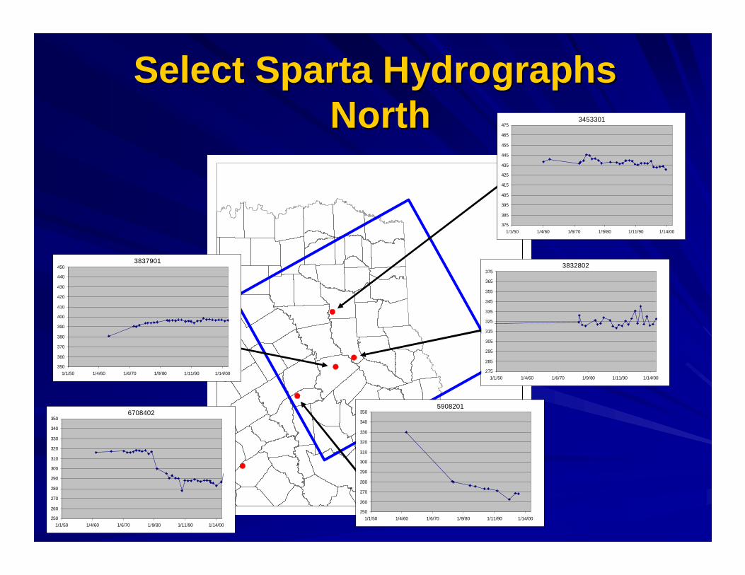
Select Sparta HydrographsSelect Sparta HydrographsNorthNorth
6708402
250
260
270
280
290
300
310
320
330
340
350
1/1/50 1/4/60 1/6/70 1/9/80 1/11/90 1/14/00
5908201
250
260
270
280
290
300
310
320
330
340
350
1/1/50 1/4/60 1/6/70 1/9/80 1/11/90 1/14/00
3837901
350
360
370
380
390
400
410
420
430
440
450
1/1/50 1/4/60 1/6/70 1/9/80 1/11/90 1/14/00
3832802
275
285
295
305
315
325
335
345
355
365
375
1/1/50 1/4/60 1/6/70 1/9/80 1/11/90 1/14/00
3453301
375
385
395
405
415
425
435
445
455
465
475
1/1/50 1/4/60 1/6/70 1/9/80 1/11/90 1/14/00
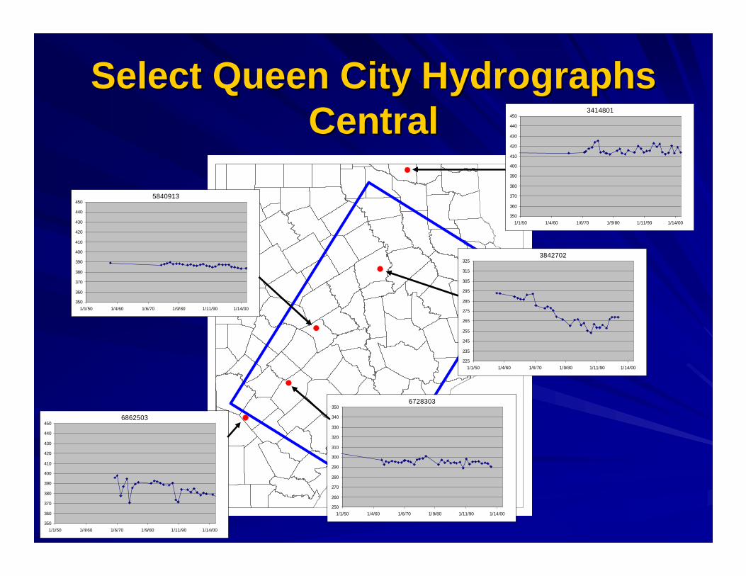
Select Queen City Hydrographs Select Queen City Hydrographs CentralCentral
6862503
350
360
370
380
390
400
410
420
430
440
450
1/1/50 1/4/60 1/6/70 1/9/80 1/11/90 1/14/00
6728303
250
260
270
280
290
300
310
320
330
340
350
1/1/50 1/4/60 1/6/70 1/9/80 1/11/90 1/14/00
5840913
350
360
370
380
390
400
410
420
430
440
450
1/1/50 1/4/60 1/6/70 1/9/80 1/11/90 1/14/00
3842702
225
235
245
255
265
275
285
295
305
315
325
1/1/50 1/4/60 1/6/70 1/9/80 1/11/90 1/14/00
3414801
350
360
370
380
390
400
410
420
430
440
450
1/1/50 1/4/60 1/6/70 1/9/80 1/11/90 1/14/00

Select Sparta Hydrographs Select Sparta Hydrographs CentralCentral
6729302
250
260
270
280
290
300
310
320
330
340
350
1/1/50 1/4/60 1/6/70 1/9/80 1/11/90 1/14/00
5856901
275
285
295
305
315
325
335
345
355
365
375
1/1/50 1/4/60 1/6/70 1/9/80 1/11/90 1/14/00
5908201
250
260
270
280
290
300
310
320
330
340
350
1/1/50 1/4/60 1/6/70 1/9/80 1/11/90 1/14/00
3832802
275
285
295
305
315
325
335
345
355
365
375
1/1/50 1/4/60 1/6/70 1/9/80 1/11/90 1/14/00
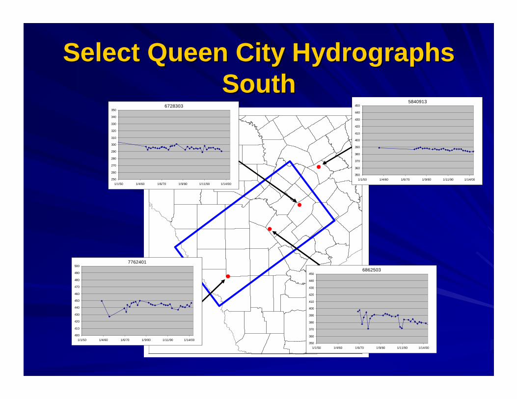
Select Queen City Hydrographs Select Queen City Hydrographs SouthSouth
6862503
350
360
370
380
390
400
410
420
430
440
450
1/1/50 1/4/60 1/6/70 1/9/80 1/11/90 1/14/00
6728303
250
260
270
280
290
300
310
320
330
340
350
1/1/50 1/4/60 1/6/70 1/9/80 1/11/90 1/14/00
7762401
400
410
420
430
440
450
460
470
480
490
500
1/1/50 1/4/60 1/6/70 1/9/80 1/11/90 1/14/00
5840913
350
360
370
380
390
400
410
420
430
440
450
1/1/50 1/4/60 1/6/70 1/9/80 1/11/90 1/14/00
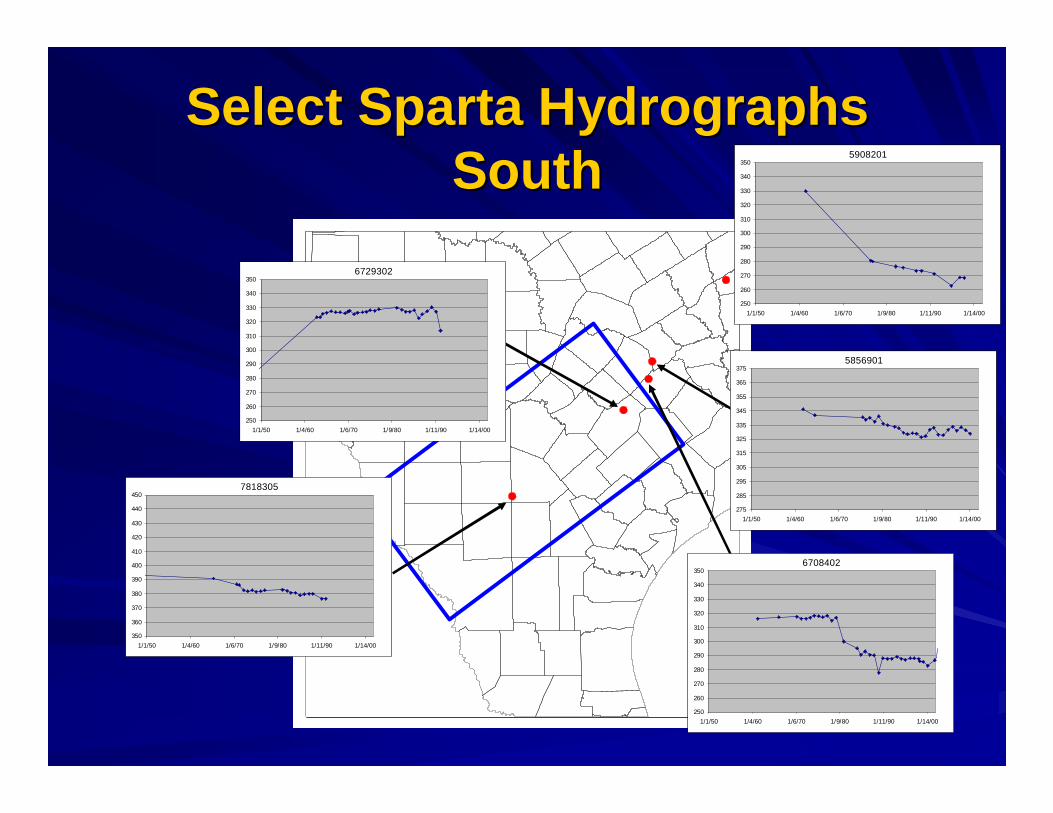
Select Sparta Hydrographs Select Sparta Hydrographs SouthSouth
7818305
350
360
370
380
390
400
410
420
430
440
450
1/1/50 1/4/60 1/6/70 1/9/80 1/11/90 1/14/00
6729302
250
260
270
280
290
300
310
320
330
340
350
1/1/50 1/4/60 1/6/70 1/9/80 1/11/90 1/14/00
6708402
250
260
270
280
290
300
310
320
330
340
350
1/1/50 1/4/60 1/6/70 1/9/80 1/11/90 1/14/00
5856901
275
285
295
305
315
325
335
345
355
365
375
1/1/50 1/4/60 1/6/70 1/9/80 1/11/90 1/14/00
5908201
250
260
270
280
290
300
310
320
330
340
350
1/1/50 1/4/60 1/6/70 1/9/80 1/11/90 1/14/00
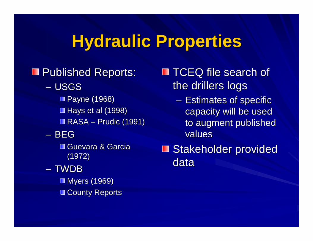
Hydraulic PropertiesHydraulic Properties
Published Reports:Published Reports:–– USGSUSGS
Payne (1968)Payne (1968)
Hays et al (1998)Hays et al (1998)
RASA RASA –– PrudicPrudic (1991)(1991)
–– BEGBEGGuevara & Garcia Guevara & Garcia (1972)(1972)
–– TWDBTWDBMyers (1969)Myers (1969)
County ReportsCounty Reports
TCEQ file search of TCEQ file search of the drillers logsthe drillers logs–– Estimates of specific Estimates of specific
capacity will be used capacity will be used to augment published to augment published valuesvalues
Stakeholder provided Stakeholder provided datadata

Current Data NeedsCurrent Data Needs
Queen City & Sparta data:Queen City & Sparta data:–– Geologic logsGeologic logs
–– Water levels (elevations)Water levels (elevations)
–– Aquifer propertiesAquifer properties
Data provided will be made publicly Data provided will be made publicly availableavailable
Data needed by April 30, 2003Data needed by April 30, 2003

Current Data Needs (cont’d) Current Data Needs (cont’d) ––Who to Contact?Who to Contact?
Van KelleyVan KelleyINTERA Inc.INTERA Inc.9111A Research Blvd9111A Research BlvdAustin, TX 78758Austin, TX 78758(512) 425(512) [email protected]@intera.com
Dr. Shirley WadeDr. Shirley WadeTexas Water Development BoardTexas Water Development BoardP.O. Box 13231P.O. Box 13231Austin, TX 78711Austin, TX 78711(512) 936(512) [email protected]@twdb.state.tx.us
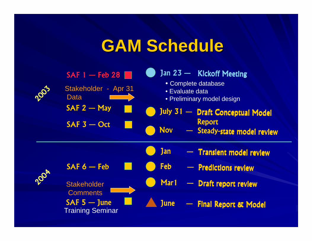
GAM ScheduleGAM Schedule
4����5' �4����5' �4����5' �4����5' �6666 � ������ ����������$ ����� ������ ����������$ ����� ������ ����������$ ����� ������ ����������$ ����������������������������
"7 �' �"7 �' �"7 �' �"7 �' �6666 ���+) ���+) ���+) ���+)
"7 �+ �"7 �+ �"7 �+ �"7 �+ �6666 $ ��$ ��$ ��$ ��
"7 �5 �"7 �5 �"7 �5 �"7 �5 �6666 - ��- ��- ��- ��
"7 �8 �"7 �8 �"7 �8 �"7 �8 �6666 �� �� �� ��
"7 �, �"7 �, �"7 �, �"7 �, �6666 4���4���4���4���
0 ��������0 ��������0 ��������0 ��������6666 "�����"�����"�����"���������������� ����������#������� ����������#������� ����������#������� ����������#
4���������4���������4���������4���������6666 ���������� ����������# ���������� ����������# ���������� ����������# ���������� ����������#
��������� ��������� ��������� ���������6666 ����������������#����������������#����������������#����������������#
$ ��' ����$ ��' ����$ ��' ����$ ��' ����6666 � �����������������#� �����������������#� �����������������#� �����������������#
4��������4��������4��������4��������6666 ������������9 �$ ���� ������������9 �$ ���� ������������9 �$ ���� ������������9 �$ ����
+**:
+**:
+**:
+**:
+**5
+**5
+**5
+**5
4���+5 �4���+5 �4���+5 �4���+5 �6666 ; ��<����$ ������; ��<����$ ������; ��<����$ ������; ��<����$ ������
Training Seminar
StakeholderComments
Stakeholder - Apr 31Data
• Complete database• Evaluate data• Preliminary model design
Meeting WrapMeeting Wrap--UpUp
Next meeting Next meeting –– MayMay–– Database reviewDatabase review
–– Preliminary conceptual modelPreliminary conceptual model
–– Preliminary approach to model Preliminary approach to model implementation implementation
Discussion / comments / questionsDiscussion / comments / questions
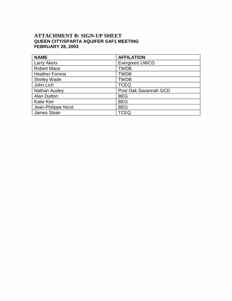
ATTACHMENT B: SIGN-UP SHEETQUEEN CITY/SPARTA AQUIFER SAF1 MEETINGFEBRUARY 28, 2003
NAME AFFILATIONLarry Akers Evergreen UWCDRobert Mace TWDBHeather Forrest TWDBShirley Wade TWDBJohn Lich TCEQNathan Ausley Post Oak Savannah GCDAlan Dutton BEGKatie Kier BEGJean-Philippe Nicot BEGJames Sloan TCEQ

1
Meeting Minutes for the
First Queen City/Sparta Groundwater Availability Model (GAM) Stakeholder Advisory Forum (SAF) Meeting
February 28, 2003
Bureau of Economic Geology
Austin, Texas
The first Stakeholder Advisory Forum (SAF) Meeting for the Queen City/Sparta Groundwater Availability Model (GAM) was held on February 28th from 1:30 until 3:30 PM at the Bureau of Economic Geology in Austin, Texas. Attachment A of these meeting minutes provides a list of all participants who signed up as attending the meeting.
The purpose of the first SAF meeting was to introduce stakeholders to the purpose of the GAM Program, the basics of groundwater flow and groundwater flow modeling, the proposed methodology to be used in modeling the Queen City and Sparta Aquifers, a summary of data to be reviewed, and an identification of data needs.
Meeting Introduction: Dr. Shirley Wade, TWDB
The meeting was initiated by Dr. Shirley Wade of the Texas Water Development Board (TWDB). She gave a brief introduction to the GAMs and discussed the current status of the GAM program. She then discussed groundwater availability and use of the GAMs, followed by a look at the future of the GAMs and opportunities for public involvement in GAM development.
SAF Presentation: Van Kelley, INTERA
Van Kelley, Project Manager for the INTERA Queen City/Sparta Team presented a prepared presentation. The presentation was structured according to the following outline:
1. Queen City – Sparta GAM team 2. GAM objectives 3. Basics of groundwater flow 4. Introduction to groundwater modeling 5. GAM specifications and applicability 6. Model data needs and data source review 7. Identification of data needs and information request 8. GAM schedule
The presentation is available on the GAM website (www.twdb.state.tx.us/gam).

2
Questions and Answers: Open Forum:
Q. Where does the aquifer end? Will we get more accurate boundaries of where the Queen
City and Sparta aquifers end?
A: The downdip limit of an aquifer has been defined by the TWDB as the line where total dissolved solids exceed 3000 ppm. Defining the extent of usable water is not the primary purpose of the GAMs, but some information on aquifer extent may be obtained from the water quality work that is part of the GAM scope. Water quality information for areas that are downdip of most water wells may be obtained from oil and gas wells if budget allows. Resistivity logs may also be used to estimate water quality.
Q: Are bad water lines well defined?
A: The extent of usable water is not well known in some areas, but better defined in others. If this study produces new data, the downdip aquifer boundaries as defined by the TWDB could conceivably change.
Q: Will the boundary be moved further downdip if the water quality standard is lowered?
A: The current aquifer boundary is set at 3000 ppm total dissolved solids, a value that already exceeds the limit for potable water.
Q: Will the 50-year prediction window for the GAM models roll forward on the 5-year
updates planned for the GAMs?
A: The time windows for calibration, validation, and 50-year prediction will move forward for future updates. The RWPGs will provide the predicted water use numbers for the updated GAMs.