Governance system Hungary - Waterways Forward · Rivers enter the country from the west, north and...
33
Governance system Hungary Budapest, 18 January 2012 András Magyarics National Directorate for Water Management (OVF) (former Central Directorate for Water and Environment -VKKI / PP9)
Transcript of Governance system Hungary - Waterways Forward · Rivers enter the country from the west, north and...

Governance system
Hungary
Budapest, 18 January 2012
András Magyarics
National Directorate for Water Management (OVF)
(former Central Directorate for Water and Environment -VKKI / PP9)
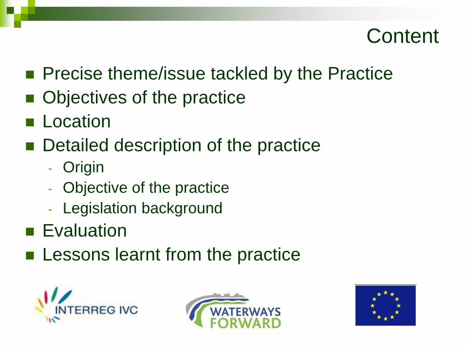
Content
Precise theme/issue tackled by the Practice
Objectives of the practice
Location
Detailed description of the practice- Origin
- Objective of the practice
- Legislation background
Evaluation
Lessons learnt from the practice

Precise theme/issue tackled by the PracticeThe handling of the state’s tasks in the field of the
multifunctional use of the inland waterways
Objectives of the practice
Forming of well organized structure for handling of the state’s role in the field of different use of the inland
waterways
Location- Country: Hungary
- NUTS 1: HU
- Whole territory of Hungary

Europe/Carpathian Basin/Hungary

Detailed description of the practice
Origin
Landlocked Hungary is situated in the centre of the Danube
Basin with its whole territory of 93.030 km2 belonging to the
Danube River Basin.

Rivers enter the country from the west, north and east and
drain towards the south.

In Hungary there is a dense river network and within it
there are 1484 kms possible navigable river stretches. In
addition we have the three above mentioned great lakes
with total 700 km2 free surface water.
The rivers are very variable in their size and - connecting
to it - the multifunctional use of them.
The main river is Danube. It traverses in the country,
forming border with Slovakia in the North-West and then
flowing southward into the territory of Croatia and
Republic of Serbia.
Danube runs through the country on 417 km from which
the first 142 km are common with Slovakia on its left
bank.
Important tributaries are the Lajta (Leitha), Rába,
Marcal, Garam (Hron), Ipoly (Ipel) and the Sió. As the
part of the transport route No. VII in the European Union,
the Danube represents a major waterway. Within the
whole Hungarian stretch a 378 kms long section is a
very important international waterway.
Major tributaries of Danube are River Tisza flowing 595
km down the eastern part of Hungary (and flow into
Danube in the territory of Serbia near Titel/Belgrade)
and River Dráva.
The inland Hungarian waterways within the rivers are
classified to different navigation transport classes from I. to
VI/b according to the UNECE regulations and DC -
recommendations.
Hungary has 7 neighbouring countries and with 5 of them
(Austria, Slovakia, Romania, Serbia, Croatia) river stretches
with common interest – common problems in the field of the
waterways maintenance and operation, common
navigational problems. There are bilateral agreements with
all neighbouring countries.
The cross border activities are running on basis of the
different organisation of the water management level.

Surface waters in Hungary

Sometimes there is not appropriate balance between the different forms of use (e.g. commercial and leisure ones) of the inland waterways.
The role of the organisations from the state side is to provide the secure multifunctional use of the waterways for everyone both of the participants of transport and recreation.
It has to provide as well as the balance among the all users.

Detailed description of the practice
Objective of the practice
In the past the Hungarian governments in power organised
different structures for the completion of the state’s tasks in
the field of the waterways administration.
The basis of the current nation-wide water management
system has organized in the middle of the 60’s.
In 1955 a central governmental body (called National Water
Management Office – “OVH”) and 12 territorial water
management directorates were established.
It means a two-level system.

Water management
units - 12 directorates

General centralized structure
administrative units - 19 counties

General & water management
administration units

Since 1990 we have a three-level system: the water management has got any higher state representation in one of the ministries – mixed with some other tasks: transport, environment, telecommunication, rural development etc. (Nowadays the water management issues are organized within the tasks of Ministry of Interior.)
In these years (about till 2004) the solution of the tasks of the development, operation and maintenance of the waterways was strongly centralized.
The initiation of the implementation of the activities was one of the tasks of the ministries and the mid-level ministerial bodies – e. g. „OVF” situated in the same decision-maker position.

The most important steps of the development, operation,
maintenance of the waterways/fairways were
implemented by central orders from the central
institutions so the territorial branches were merely the
executive bodies without serious decisional rights.
The splitting and transformation of the tasks and roles
between the central and territorial organizations in the
field of the water management sector has began in
2004 (Hungary is as EU member since this date) and
more and less went on to 2006.

Despite the system of the administrative structure’s network
not transformed basically, it has been a significant change
in the field of the decision making among the different levels
of the structure.
The role of the members of the management’s structure
modified. The territorial bodies all around the country know
best the local problems, the local situations being close
connection with the local stakeholders, users of the
waterways who have been involved into the common thinking
about the implementation of the most important goals in the
local water management including especially the
development, operation and maintenance of the waterways.

Territorial responsibility
The 12 territorial directorates - within their other numerous tasks - are directly responsible for the good condition of the rivers including the different categories of waterways.
Their continuous activities are: river engineering; river bed-, shoreline-, water-level regulation, maintenance and operate of the fairways, making of the marking plans, providing of the floating and coastal marking, mapping/charting, cooperation with the relevant local authorities.
They carry out the survey, collection, store, forwarding of data of river bed, shoreline as well as the waterways.

The initiations are coming from the territorial(local) level so in the process of the implementation of an idea (idea – proposal – decision – confirmation – planning - execution – evaluation - control) participates the relevant territorial water management bodies.

The higher central bodies have got (important) role in some parts of this process as well (e.g. evaluation and control) but their main role has been modified in the last some years.
The relevant ministry (nowadays the Ministry of Interior –the highest level of the water management network) and National Water Authority – OVF – (former Central Director-ate for Water and Environment –VKKI) as the mid-level body of the water management network are working shared nation-wide responsibility in their profession. It means that they coordinate, supervise, control all activities of the local directorates all around the country.
The ministry practices mostly the theoretical and OVF
(VKKI) the operational part of these roles.

They harmonise the local planning with the national development one in the different places of the water management activities
explore the possible international (funding of EU, Norwegian, Flanders, Swiss etc.) and national financial sources tracing its efficiently use,
concentrate all the form of the necessary source (human, financial) for the interest of the best outcomes.

The start of the operation of a new, decentralized water management system went on 2004/2006, butthis is a never ended process:
the upgrading/modernization of the administration network is a permanent purpose for each government – the end of this process is not possible identified.
Legislation background
Act. 1995. LVII. on Water Management
Act. 1995. LIII. on Environmental Protection
Act. 2000. XLII. on Water Traffic
Gov. Decree 151/2000. on inland waterways with
international importance
Gov. Decree 347/2006. on Environmental, Nature
Conversation and Water Management authorities
Gov. Decree 300/2011. on Water management
authorities
Gov. Decree 219/2007. on River Information Services

Legislation background
KöViM Decree 17/2002. on classification of
waterways for navigation
GKM Decree 27/2002. on marking of the
waterways

Evaluation
Lessons learnt from the practice There are generally good opinions about the new,
decentralized network.
There are positive experience about the shared responsibility
between the navigation (freight and passenger transport) and
waterway maintenance and operation. (Within the
governmental structure the transport sector is responsible for
the first one and the water management sector is responsible
for the second one.)
The changes of the government (2006, 2010) and the
ministerial structure during the 4 year long governance
period did not caused any disruption.

Evaluation
Lessons learnt from the practice
There are more decisional levels – but less responsible,
professional people.
Less and less involved people are in the all administrative
organisations all around the country – in all structural levels.
It should be more representation for heritage protection.
It should be more representation for tourism sector.

Thank you for your attention!

SWOT analysis
Strengths Weaknesses
+ well organized survey, data collection,
transfer, publicity
+ continuous 24/365 duty
+ correct connection with neighbouring country
in the joint stretch
+ well qualified staff
+
+ Existing general knowledge on waterway
maintenance thanks to the increased
amount of information
- Restoration process progresses slowly
- Reducing diffuse pollution control is still at
basic level
- Research and reduction of storm water
loading is still at basic level
- Co-operation among the different ministries
not good enough
- Quality of research and monitoring
information/data are varying
- Assessment of effects of restoration is scarce
- Monitoring network is sufficient only on the
three large lakes
- Joint ownership of water areas hinders
some projects because receiving the
approval of owners can be difficult
Opportunities Threats
+
+ Development of mapping/charting methods
+
+ speed vessels
-
-
-
-
- state has got a few sources for maintenance
and implementation
-

Organisational structure of (a) former
waterway administration
Ministry of Environment
and Water
(KvVM)
Ministry of Transport, Energy
and Telecommunication
(KEHM)
National Association of
Radio Distress-Signalling
and Infocommunications
(RSOE)
Central Directorate for
Water and
Environment
(VKKI)
Institute of Environmental
Protection and Water
Management
(VITUKI)
Environmental
and Water
Directorates (12)
National Navigation Authority
(NHH)

Organisational structure of recent
waterway administration
Ministry of Rural
Development
(VM)
Ministry of National
Development
(NFM)
National Association of
Radio Distress-Signalling
and Infocommunications
(RSOE)
Central Directorate for
Water and
Environment
(VKKI)
Institute of Environmental
Protection and Water
Management
(VITUKI)
Environmental
and Water
Directorates (12)
National Navigation Authority
(NHH)

Organisational structure of future
waterway administration
Towards to a possible sharing:
Ministry of Rural Development (VM) –
Ministry of Interior
(and its background organizations)

Organisational structure of a possible future
waterway administration
Ministry of Rural Development
(VM)
Ministry of Interior
(MoI)
Ministry of National
Development
(NFM)
National Association of
Radio Distress-Signalling
and Infocommunications
(RSOE)
Central Directorate for
Water and
Environment
(VKKI)
Institute of Environmental
Protection and Water
Management
(VITUKI)
Environmental
and Water
Directorates (12)
National Navigation Authority
(NHH)