
Goodbye 2012 . . . Hello 2013 F - dot.ca.gov · 1/28/2013 · Updates to FAA Airport and Heliport...
14
In This Issue January 2013 Volume 5 Issue 1 Goodbye 2012 . . . Hello 2013 F or the California Department of Transportation (Caltrans), Division of Aero- nautics, (Division), 2012 brought a mix of accomplishments and trials. With the passage of the Federal Aviation Administration (FAA) Reauthorization Bill, the federal share of AIP grants was reduced from 95 percent to 90 percent. The Division responded by proposing to increase the State match from 2.5 percent to 5 percent to reduce the negative impact on General Aviation and Reliever Airports, and the California Transportation Commission (CTC) adopted this change. However, continued Aeronautics budget shortfalls limited the ability to provide State matching grants, as well as delayed Annual Credit Grant payments, and put the 2012 Acquisi- tion and Development Program on hold. On the plus side, Airport Pavement Manage- ment System updates were completed for 85 airports under an FAA grant; six new hospital heliports were permitted; a new Aviation Planning Workshop was held, and the Aeronautics website was updated with more information for users, including new Public-Use Airport and Hospital Heliport maps. Continued on Page 7 California Department of Transportation Division of Aeronautics Goodbye 2012 … Hello 2013 Pages 1,7 Keys to Financing Projects Page 2 Advisory Circular Updates Page 3, 4, 6 Spaulding Airport Page 5 New and Updated Airports and Heliports Page 8 GA Airport Business Plan Guidebook Page 9 Flying Over Marine Sanctuaries and Refuges Pages 10--11 New Jerusalem Airport Pages 12-13 CAAP Reminders Page 14
-
Upload
trinhduong -
Category
Documents
-
view
217 -
download
0
Transcript of Goodbye 2012 . . . Hello 2013 F - dot.ca.gov · 1/28/2013 · Updates to FAA Airport and Heliport...
In This Issue
January 2013
Volume 5 Issue 1
Goodbye 2012 . . . Hello 2013
F or the California Department of Transportation (Caltrans), Division of Aero-nautics, (Division), 2012 brought a mix of accomplishments and trials. With the passage of the Federal Aviation Administration (FAA) Reauthorization
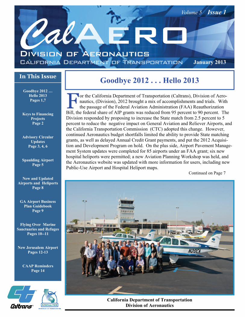
Bill, the federal share of AIP grants was reduced from 95 percent to 90 percent. The Division responded by proposing to increase the State match from 2.5 percent to 5 percent to reduce the negative impact on General Aviation and Reliever Airports, and the California Transportation Commission (CTC) adopted this change. However, continued Aeronautics budget shortfalls limited the ability to provide State matching grants, as well as delayed Annual Credit Grant payments, and put the 2012 Acquisi-tion and Development Program on hold. On the plus side, Airport Pavement Manage-ment System updates were completed for 85 airports under an FAA grant; six new hospital heliports were permitted; a new Aviation Planning Workshop was held, and the Aeronautics website was updated with more information for users, including new Public-Use Airport and Hospital Heliport maps. Continued on Page 7
California Department of Transportation Division of Aeronautics
Goodbye 2012 …
Hello 2013 Pages 1,7
Keys to Financing Projects Page 2
Advisory Circular Updates
Page 3, 4, 6
Spaulding Airport Page 5
New and Updated Airports and Heliports
Page 8
GA Airport Business Plan Guidebook
Page 9
Flying Over Marine Sanctuaries and Refuges
Pages 10--11
New Jerusalem Airport Pages 12-13
CAAP Reminders Page 14
Volume 5 Issue 1
Page 2
What May Be the Key to Financing Your Projects? By Tony Sordello
A lthough grant funding is limited this year, the California Department of Transportation (Caltrans), Division of Aeronautics, may still be able to help enhance your airport’s ability to provide general aviation services. How? The key may be the California Airport Loan
Program. Funds from this program are available now. There are three different types of loans available under this program.
Revenue Generation (application form DOA-0020) Matching Funds (application form DOA-0019) Airport Development (application form DOA-0013)
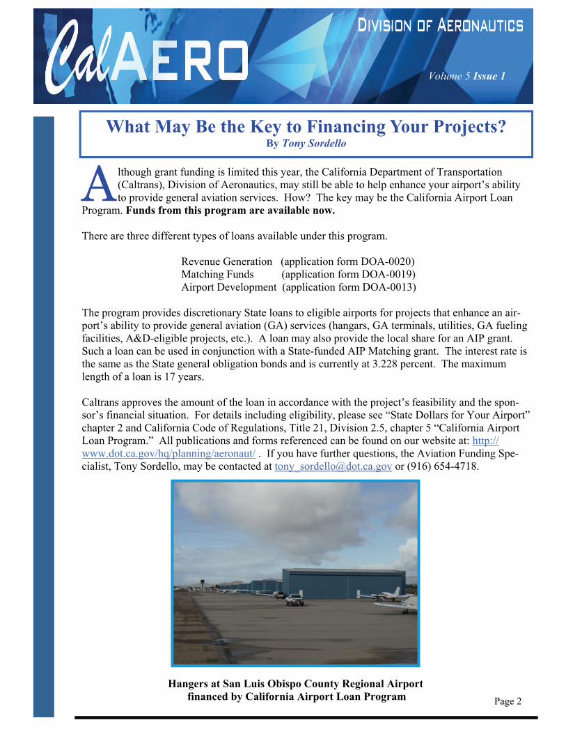
The program provides discretionary State loans to eligible airports for projects that enhance an air-port’s ability to provide general aviation (GA) services (hangars, GA terminals, utilities, GA fueling facilities, A&D-eligible projects, etc.). A loan may also provide the local share for an AIP grant. Such a loan can be used in conjunction with a State-funded AIP Matching grant. The interest rate is the same as the State general obligation bonds and is currently at 3.228 percent. The maximum length of a loan is 17 years. Caltrans approves the amount of the loan in accordance with the project’s feasibility and the spon-sor’s financial situation. For details including eligibility, please see “State Dollars for Your Airport” chapter 2 and California Code of Regulations, Title 21, Division 2.5, chapter 5 “California Airport Loan Program.” All publications and forms referenced can be found on our website at: http://www.dot.ca.gov/hq/planning/aeronaut/ . If you have further questions, the Aviation Funding Spe- cialist, Tony Sordello, may be contacted at [email protected] or (916) 654-4718. Hangers at San Luis Obispo County Regional Airport financed by California Airport Loan Program
Volume 5 Issue 1
D uring 2012, the Federal Aviation Administration (FAA) issued changes to the two main Advisory Circulars (ACs) related to Airport and Heliport designs. As a number of the changes are signifi-cant, sponsors of proposed airports and heliports, as well as owners and operators of existing facili-
ties, should become familiar with these new publications. On September 28, 2012, the FAA cancelled AC 150/5300-13, Airport Design, and issued AC 150/5300-13A. Some of the significant changes are summarized below: Runway Design Code (RDC) – The RDC value will be shown in terms such as C-IV-1200 or B-I-VIS
(VIS for runways with only visual approaches) Note: The holdover Airport Reference Code, or ARC, is now defined as the highest RDC for the airport minus the RDC visibility component.
1. The Aircraft Approach Category (values A-E, based on design aircraft approach speed) 2. Airplane Design Group (values I-VI, based on the most restrictive element of the design aircraft
wing span and tail height) 3. Approach Visibility Minimums (expressed in Runway Visual Range of 1200-4000, based on
planned approach procedure flight visibility in statute miles)
Runway Reference Code (RRC) – The new RRC (Paragraph 318) shares the same components as the RDC, but it is used to describe the current operational capabilities of a particular runway where no spe-cial operating procedures are necessary. Note: An RRC may change “as improvements are made to the runway and VAVAIDS,” and there are also minimum runway to taxiway separations associated with
RRCs. Continued on Page 4
Page 3
AC
AC AC
Updates to Federal Aviation Administration “Airport Design” and “Heliport Design” Advisory Circulars
By Jeff Brown
Updates to FAA Airport and Heliport Advisory Circulars Continued from Page 3
Runway Design Standards Matrix – Existing runway design tables have been consolidated into a new table and include an interactive matrix (Table 3-8). Hard copies for various RDC groups are included in Appendix 7.
Runway Protection Zone (RPZ) Standards – The RPZ standards (Paragraph 310) have been
updated, including a discussion of Approach and Departure RPZs. Declared Distances – The section on Declared Distances (Paragraph 323) has been expanded and
includes more figures to depict examples of different scenarios. Runway Incursion Prevention – A discussion of Taxiway design considerations (Paragraph 401.b.
(5)) to help reduce the likelihood of runway incursions. Appendices Consolidation – Much of the information formerly found in appendices of the AC
(such as Approach/Departure Standards, On-Airport Farming, Declared Distances, etc.) has been brought into the Runway (Chapter 3) and Taxiway (Chapter 4) sections.
Aircraft Characteristics Database – The “Airplane Data” appendix (previous Appendix 12) has
been replaced by an Aircraft Characteristics Database with updated aircraft information (in Appendix 1 and also on the FAA website to be incorporated into the FAA Airport GIS System).
Below is a link to the new FAA Airport Design AC: http://wwwA.faa.gov/documentLibrary/media/dvisory_Circular/150_5300_13A.pdf
On April 24, 2012, the FAA cancelled AC 150/5290-2B, Heliport Design, and issued AC 150/5290-2C. Some of the notable, if not in some instances controversial, changes for Hospital Heliports are shown below Note: Review the AC for General Aviation heliports as guidelines may differ. Some of the most significant changes are summarized below: Helicopter Overall Length designator – Design helicopter Overall Length (Paragraph 108.d), upon
which the heliport Final Approach and Take Off Area (FATO) size is predicated, is now designated as “D” instead of “OL” Note: The heliport Size Limitation marking will now reflect Overall Length instead of Rotor Diameter and be marked in a manner such as “D57”, for example, for a design helicopter with an overall length of 57 feet).
Elevated Heliport Touchdown and Liftoff Area (TLOF) size – For elevated heliports where the
FATO outside the TLOF is not load bearing (Paragraph 406.b. (1)), the minimum width and length or diameter is to be increased to the overall length (D) of the design helicopter (many existing rooftop heliports, particularly those with metal decks, have all of the FATO outside the TLOF in open air and will not meet the new guideline).
Continued on Page 6
Volume 5 Issue 1
Page 4
Volume 5 Issue 1
Page 5
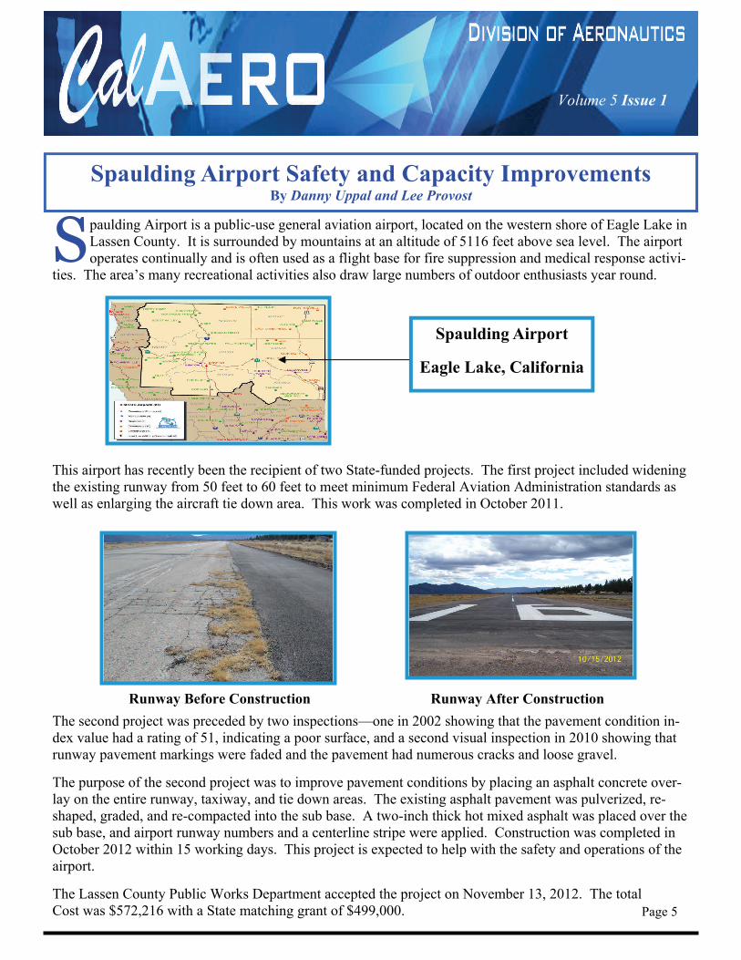
S paulding Airport is a public-use general aviation airport, located on the western shore of Eagle Lake in Lassen County. It is surrounded by mountains at an altitude of 5116 feet above sea level. The airport operates continually and is often used as a flight base for fire suppression and medical response activi-
ties. The area’s many recreational activities also draw large numbers of outdoor enthusiasts year round.
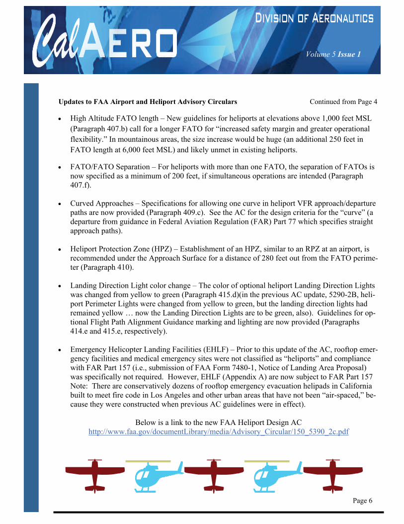
This airport has recently been the recipient of two State-funded projects. The first project included widening the existing runway from 50 feet to 60 feet to meet minimum Federal Aviation Administration standards as well as enlarging the aircraft tie down area. This work was completed in October 2011.
Runway Before Construction Runway After Construction
The second project was preceded by two inspections—one in 2002 showing that the pavement condition in-dex value had a rating of 51, indicating a poor surface, and a second visual inspection in 2010 showing that runway pavement markings were faded and the pavement had numerous cracks and loose gravel.
The purpose of the second project was to improve pavement conditions by placing an asphalt concrete over-lay on the entire runway, taxiway, and tie down areas. The existing asphalt pavement was pulverized, re-shaped, graded, and re-compacted into the sub base. A two-inch thick hot mixed asphalt was placed over the sub base, and airport runway numbers and a centerline stripe were applied. Construction was completed in October 2012 within 15 working days. This project is expected to help with the safety and operations of the airport. The Lassen County Public Works Department accepted the project on November 13, 2012. The total Cost was $572,216 with a State matching grant of $499,000.
Spaulding Airport Safety and Capacity Improvements By Danny Uppal and Lee Provost
Spaulding Airport
Eagle Lake, California
Volume 5 Issue 1
Page 6
Updates to FAA Airport and Heliport Advisory Circulars Continued from Page 4
High Altitude FATO length – New guidelines for heliports at elevations above 1,000 feet MSL (Paragraph 407.b) call for a longer FATO for “increased safety margin and greater operational flexibility.” In mountainous areas, the size increase would be huge (an additional 250 feet in FATO length at 6,000 feet MSL) and likely unmet in existing heliports.
FATO/FATO Separation – For heliports with more than one FATO, the separation of FATOs is now specified as a minimum of 200 feet, if simultaneous operations are intended (Paragraph 407.f).
Curved Approaches – Specifications for allowing one curve in heliport VFR approach/departure
paths are now provided (Paragraph 409.c). See the AC for the design criteria for the “curve” (a departure from guidance in Federal Aviation Regulation (FAR) Part 77 which specifies straight approach paths).
Heliport Protection Zone (HPZ) – Establishment of an HPZ, similar to an RPZ at an airport, is
recommended under the Approach Surface for a distance of 280 feet out from the FATO perime-ter (Paragraph 410).
Landing Direction Light color change – The color of optional heliport Landing Direction Lights
was changed from yellow to green (Paragraph 415.d)(in the previous AC update, 5290-2B, heli-port Perimeter Lights were changed from yellow to green, but the landing direction lights had remained yellow … now the Landing Direction Lights are to be green, also). Guidelines for op-tional Flight Path Alignment Guidance marking and lighting are now provided (Paragraphs 414.e and 415.e, respectively).
Emergency Helicopter Landing Facilities (EHLF) – Prior to this update of the AC, rooftop emer-
gency facilities and medical emergency sites were not classified as “heliports” and compliance with FAR Part 157 (i.e., submission of FAA Form 7480-1, Notice of Landing Area Proposal) was specifically not required. However, EHLF (Appendix A) are now subject to FAR Part 157 Note: There are conservatively dozens of rooftop emergency evacuation helipads in California built to meet fire code in Los Angeles and other urban areas that have not been “air-spaced,” be-cause they were constructed when previous AC guidelines were in effect).
Below is a link to the new FAA Heliport Design AC
http://www.faa.gov/documentLibrary/media/Advisory_Circular/150_5390_2c.pdf
Volume 5 Issue 1
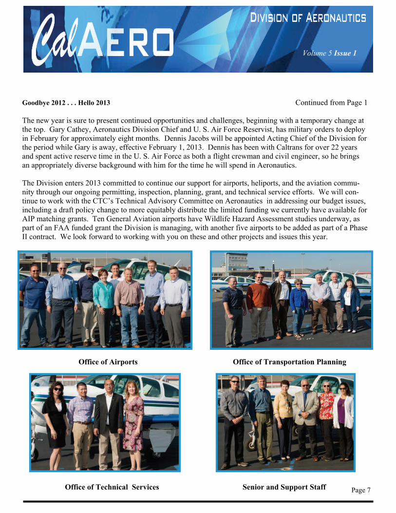
Goodbye 2012 . . . Hello 2013 Continued from Page 1 The new year is sure to present continued opportunities and challenges, beginning with a temporary change at the top. Gary Cathey, Aeronautics Division Chief and U. S. Air Force Reservist, has military orders to deploy in February for approximately eight months. Dennis Jacobs will be appointed Acting Chief of the Division for the period while Gary is away, effective February 1, 2013. Dennis has been with Caltrans for over 22 years and spent active reserve time in the U. S. Air Force as both a flight crewman and civil engineer, so he brings an appropriately diverse background with him for the time he will spend in Aeronautics. The Division enters 2013 committed to continue our support for airports, heliports, and the aviation commu-nity through our ongoing permitting, inspection, planning, grant, and technical service efforts. We will con-tinue to work with the CTC’s Technical Advisory Committee on Aeronautics in addressing our budget issues, including a draft policy change to more equitably distribute the limited funding we currently have available for AIP matching grants. Ten General Aviation airports have Wildlife Hazard Assessment studies underway, as part of an FAA funded grant the Division is managing, with another five airports to be added as part of a Phase II contract. We look forward to working with you on these and other projects and issues this year.
Office of Airports Office of Transportation Planning
Office of Technical Services Senior and Support Staff Page 7
Volume 5 Issue 1
Page 8
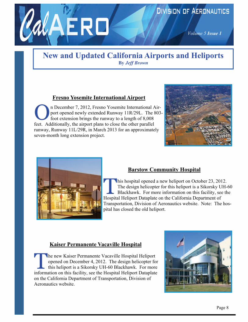
Fresno Yosemite International Airport
O n December 7, 2012, Fresno Yosemite International Air-port opened newly extended Runway 11R/29L. The 803-foot extension brings the runway to a length of 8,008
feet. Additionally, the airport plans to close the other parallel runway, Runway 11L/29R, in March 2013 for an approximately seven-month long extension project.
Barstow Community Hospital
T his hospital opened a new heliport on October 23, 2012. The design helicopter for this heliport is a Sikorsky UH-60 Blackhawk. For more information on this facility, see the
Hospital Heliport Dataplate on the California Department of Transportation, Division of Aeronautics website. Note: The hos-pital has closed the old heliport.
Kaiser Permanente Vacaville Hospital
T he new Kaiser Permanente Vacaville Hospital Heliport opened on December 4, 2012. The design helicopter for this heliport is a Sikorsky UH-60 Blackhawk. For more
information on this facility, see the Hospital Heliport Dataplate on the California Department of Transportation, Division of Aeronautics website.
New and Updated California Airports and Heliports By Jeff Brown
Volume 5 Issue 1
T he Airport Cooperative Research Program (ACRP) posted Report 77: Guidebook for Developing General Aviation Airport Business Plans on their website on November 15, 2012. The report consists of a guidebook and a CD-Rom designed to help airports develop and implement an airport business
plan and maximize financial self-sufficiency. The California Department of Transportation, Division of Aeronautics, supports the development of business plans, since surveys have shown that airports with such plans usually outperform those that do not. Report 77 notes that airports with business plans tend to:
Generate more revenue Reduce or eliminate expenses Secure more capital funding Rely less (or not at all) on subsidies Create more jobs
One of the more user-friendly parts of the guidebook is the tips to airport managers and community leaders that help take some of the guesswork out of creating an airport-specific business plan. It does this by pre-senting some best practices gained by others around the country as they developed such plans. Examples include notable elements from the Strengths, Weakness, Opportunities, and Threats (SWOT) Analysis, the Specific, Measureable, Attainable, Relevant, and Time-Bound (SMART) Models, and Goal, Reality, Op-tions, and Will (GROW) models. A key point made in the Guidebook is that a clear understanding of why and how an airport should mature in specific business areas spurs the type of community dialogue that helps chart its current and future direction. In tight economic times such as these, a review of this Guidebook should be helpful. It can be downloaded as a pdf file for free from the ACRP website at http://www.trb.org/Publications/
lurbs/168114.aspx
Page 9
General Aviation Airport Business Plan Guidebook Released By Derek Kantar
Volume 5 Issue 1
Page 10
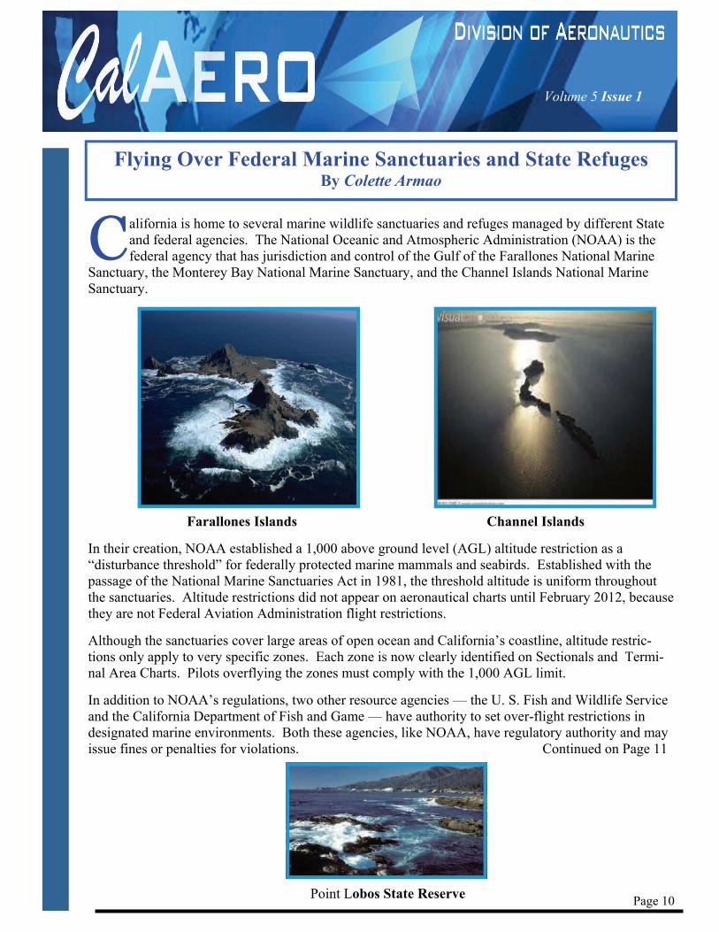
C alifornia is home to several marine wildlife sanctuaries and refuges managed by different State and federal agencies. The National Oceanic and Atmospheric Administration (NOAA) is the federal agency that has jurisdiction and control of the Gulf of the Farallones National Marine
Sanctuary, the Monterey Bay National Marine Sanctuary, and the Channel Islands National Marine Sanctuary.
Farallones Islands Channel Islands
In their creation, NOAA established a 1,000 above ground level (AGL) altitude restriction as a “disturbance threshold” for federally protected marine mammals and seabirds. Established with the passage of the National Marine Sanctuaries Act in 1981, the threshold altitude is uniform throughout the sanctuaries. Altitude restrictions did not appear on aeronautical charts until February 2012, because they are not Federal Aviation Administration flight restrictions.
Although the sanctuaries cover large areas of open ocean and California’s coastline, altitude restric-tions only apply to very specific zones. Each zone is now clearly identified on Sectionals and Termi-nal Area Charts. Pilots overflying the zones must comply with the 1,000 AGL limit.
In addition to NOAA’s regulations, two other resource agencies — the U. S. Fish and Wildlife Service and the California Department of Fish and Game — have authority to set over-flight restrictions in designated marine environments. Both these agencies, like NOAA, have regulatory authority and may issue fines or penalties for violations. Continued on Page 11
Point Lobos State Reserve
Flying Over Federal Marine Sanctuaries and State Refuges By Colette Armao
Volume 5 Issue 1
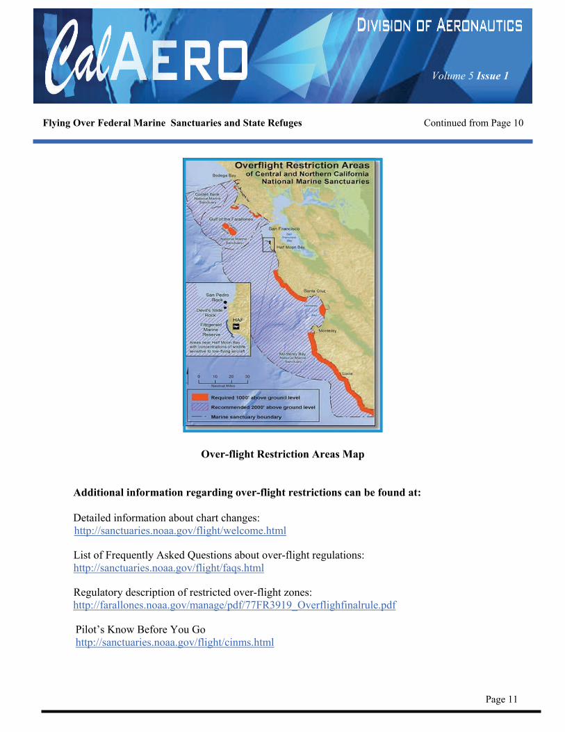
Flying Over Federal Marine Sanctuaries and State Refuges Continued from Page 10
Over-flight Restriction Areas Map
Additional information regarding over-flight restrictions can be found at: Detailed information about chart changes: http://sanctuaries.noaa.gov/flight/welcome.html List of Frequently Asked Questions about over-flight regulations: http://sanctuaries.noaa.gov/flight/faqs.html Regulatory description of restricted over-flight zones: http://farallones.noaa.gov/manage/pdf/77FR3919_Overflighfinalrule.pdf Pilot’s Know Before You Go http://sanctuaries.noaa.gov/flight/cinms.html
Page 11
Volume 5 Issue 1
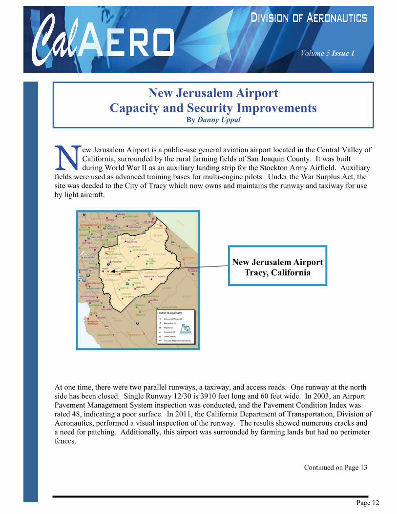
N ew Jerusalem Airport is a public-use general aviation airport located in the Central Valley of California, surrounded by the rural farming fields of San Joaquin County. It was built during World War II as an auxiliary landing strip for the Stockton Army Airfield. Auxiliary
fields were used as advanced training bases for multi-engine pilots. Under the War Surplus Act, the site was deeded to the City of Tracy which now owns and maintains the runway and taxiway for use by light aircraft.
At one time, there were two parallel runways, a taxiway, and access roads. One runway at the north side has been closed. Single Runway 12/30 is 3910 feet long and 60 feet wide. In 2003, an Airport Pavement Management System inspection was conducted, and the Pavement Condition Index was rated 48, indicating a poor surface. In 2011, the California Department of Transportation, Division of Aeronautics, performed a visual inspection of the runway. The results showed numerous cracks and a need for patching. Additionally, this airport was surrounded by farming lands but had no perimeter fences. Continued on Page 13
New Jerusalem Airport Capacity and Security Improvements
By Danny Uppal
New Jerusalem Airport Tracy, California
Page 12
Volume 5 Issue 1
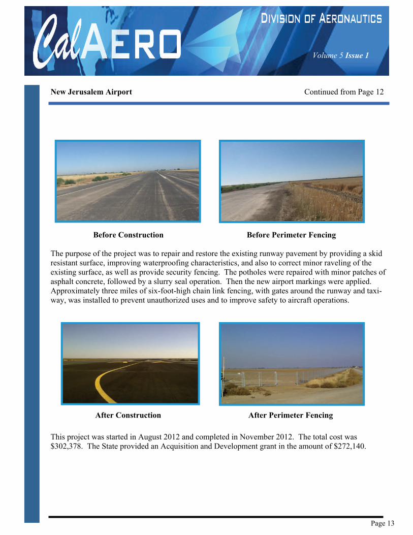
New Jerusalem Airport Continued from Page 12
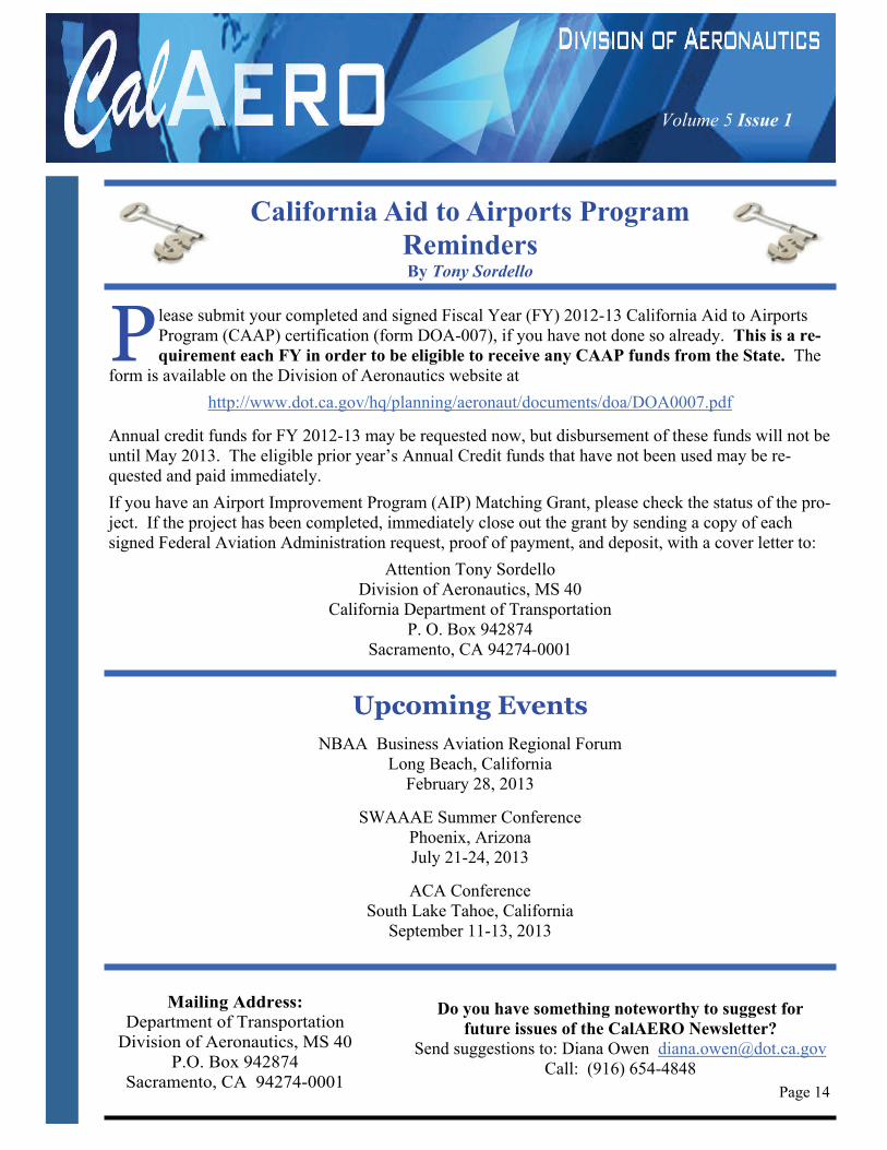
Before Construction Before Perimeter Fencing The purpose of the project was to repair and restore the existing runway pavement by providing a skid resistant surface, improving waterproofing characteristics, and also to correct minor raveling of the existing surface, as well as provide security fencing. The potholes were repaired with minor patches of asphalt concrete, followed by a slurry seal operation. Then the new airport markings were applied. Approximately three miles of six-foot-high chain link fencing, with gates around the runway and taxi-way, was installed to prevent unauthorized uses and to improve safety to aircraft operations.
After Construction After Perimeter Fencing
This project was started in August 2012 and completed in November 2012. The total cost was $302,378. The State provided an Acquisition and Development grant in the amount of $272,140.
Page 13
Volume 5 Issue 1
California Aid to Airports Program Reminders By Tony Sordello
Page 14
Upcoming Events
NBAA Business Aviation Regional Forum Long Beach, California
February 28, 2013
SWAAAE Summer Conference Phoenix, Arizona July 21-24, 2013
ACA Conference South Lake Tahoe, California
September 11-13, 2013
Mailing Address:
Department of Transportation Division of Aeronautics, MS 40
P.O. Box 942874 Sacramento, CA 94274-0001
Do you have something noteworthy to suggest for future issues of the CalAERO Newsletter?
Send suggestions to: Diana Owen [email protected] Call: (916) 654-4848
P lease submit your completed and signed Fiscal Year (FY) 2012-13 California Aid to Airports Program (CAAP) certification (form DOA-007), if you have not done so already. This is a re-quirement each FY in order to be eligible to receive any CAAP funds from the State. The
form is available on the Division of Aeronautics website at
http://www.dot.ca.gov/hq/planning/aeronaut/documents/doa/DOA0007.pdf
Annual credit funds for FY 2012-13 may be requested now, but disbursement of these funds will not be until May 2013. The eligible prior year’s Annual Credit funds that have not been used may be re-quested and paid immediately.
If you have an Airport Improvement Program (AIP) Matching Grant, please check the status of the pro-ject. If the project has been completed, immediately close out the grant by sending a copy of each signed Federal Aviation Administration request, proof of payment, and deposit, with a cover letter to:
Attention Tony Sordello Division of Aeronautics, MS 40
California Department of Transportation P. O. Box 942874
Sacramento, CA 94274-0001