Global Positioning System (GPS) Learning Objectives: By the end of this topic you should be able to:...
31
Global Positioning System (GPS)
-
Upload
lilian-dickerson -
Category
Documents
-
view
214 -
download
0
Transcript of Global Positioning System (GPS) Learning Objectives: By the end of this topic you should be able to:...

Global Positioning System(GPS)

Learning Objectives:By the end of this topic you should be able to:
• describe how satellite communications systems are used in global positioning,
• describe the advantages and disadvantages of using satellites for global positioning
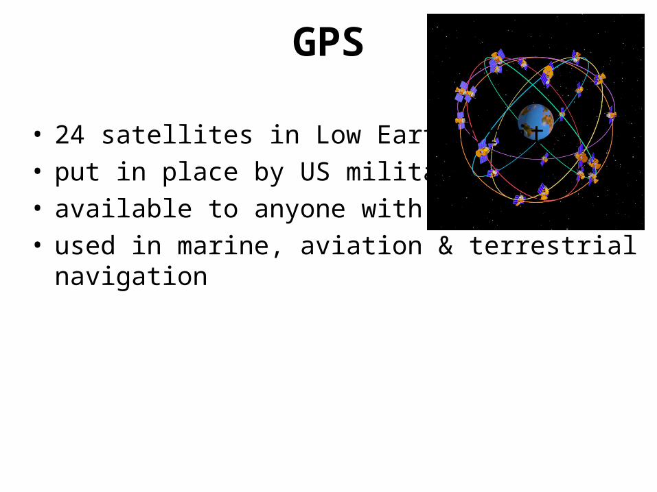
• 24 satellites in Low Earth Orbit• put in place by US military• available to anyone with a receiver• used in marine, aviation & terrestrial navigation
GPS

• need at least 3 satellites ‘in range’– line of sight
• uses ‘trilateration’ to determine position
GPS
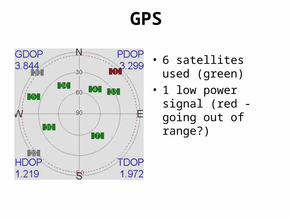
• 6 satellites used (green)• 1 low power signal (red
- going out of range?)
GPS
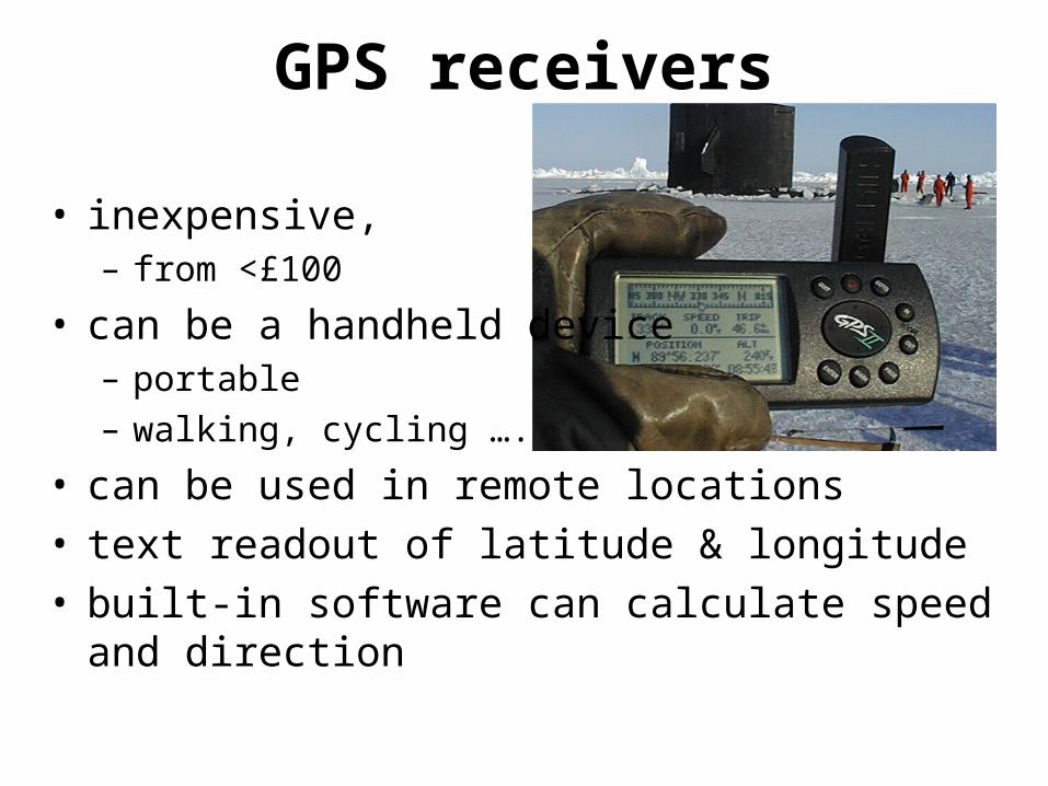
• inexpensive, – from <£100
• can be a handheld device– portable
– walking, cycling ….
• can be used in remote locations• text readout of latitude & longitude• built-in software can calculate speed and direction
GPS receivers
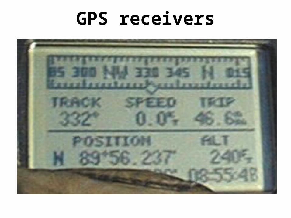
GPS receivers
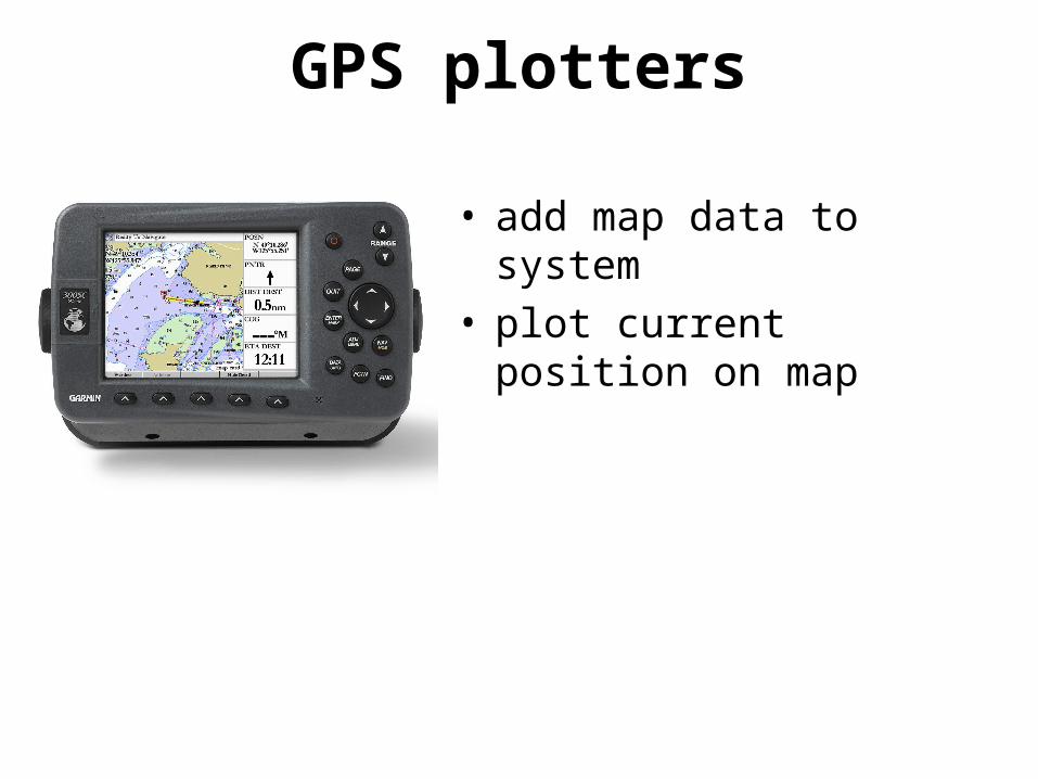
• add map data to system• plot current position on map
GPS plotters
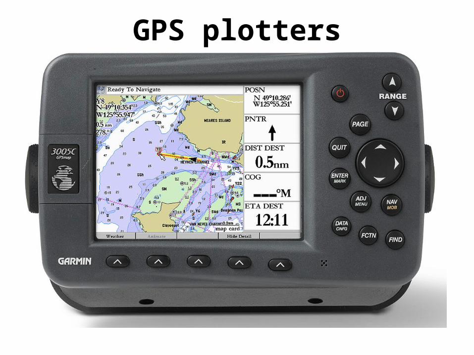
GPS plotters
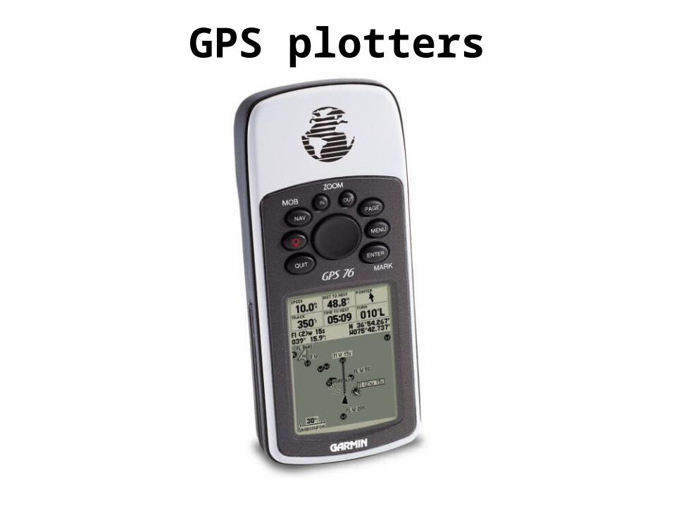
GPS plotters

GPS
PDA + GPS card
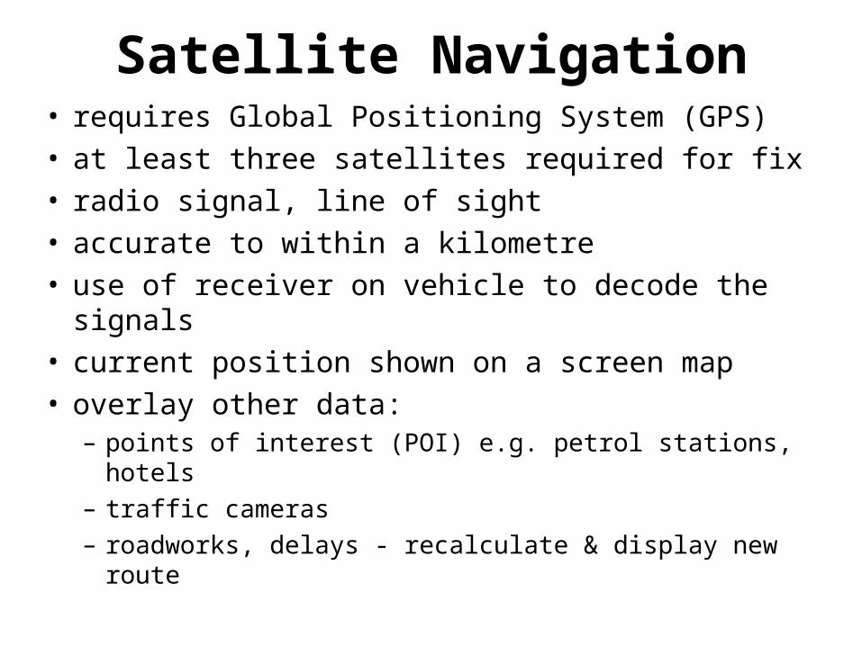
Satellite Navigation• requires Global Positioning System (GPS)• at least three satellites required for fix• radio signal, line of sight• accurate to within a kilometre• use of receiver on vehicle to decode the signals• current position shown on a screen map• overlay other data:
– points of interest (POI) e.g. petrol stations, hotels
– traffic cameras
– roadworks, delays - recalculate & display new route
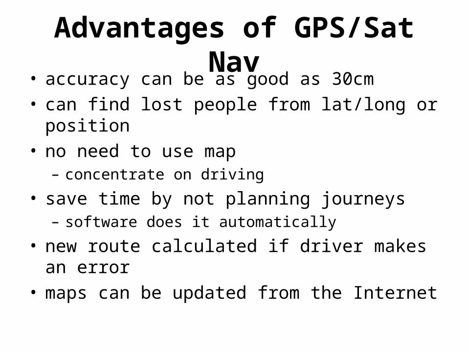
Advantages of GPS/Sat Nav• accuracy can be as good as 30cm• can find lost people from lat/long or position• no need to use map
– concentrate on driving
• save time by not planning journeys– software does it automatically
• new route calculated if driver makes an error• maps can be updated from the Internet
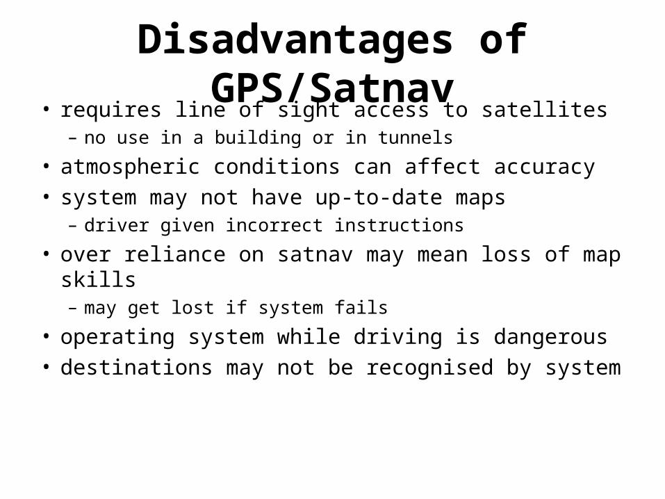
Disadvantages of GPS/Satnav• requires line of sight access to satellites
– no use in a building or in tunnels
• atmospheric conditions can affect accuracy• system may not have up-to-date maps
– driver given incorrect instructions
• over reliance on satnav may mean loss of map skills– may get lost if system fails
• operating system while driving is dangerous• destinations may not be recognised by system

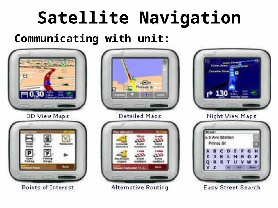
Satellite NavigationCommunicating with unit:• push buttons to set instructions,• voice to dictate instructions (voice recognition),• keyboard to type instructions,• use of predictive text,• touch screen, • joystick,• CDROM, DVD or mobile phone to input maps

Satellite NavigationCommunicating with unit:

Satellite NavigationCommunicating with unit:
Satellite NavigationCommunicating with unit:

Satellite NavigationCommunicating with unit:

Satellite NavigationCommunicating with unit:
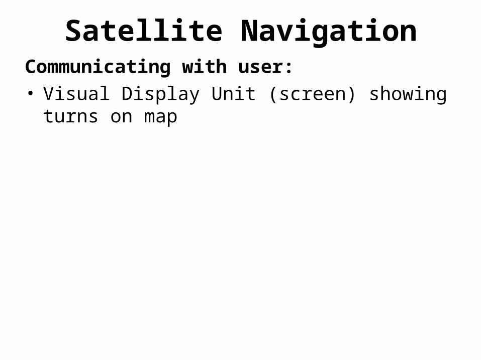
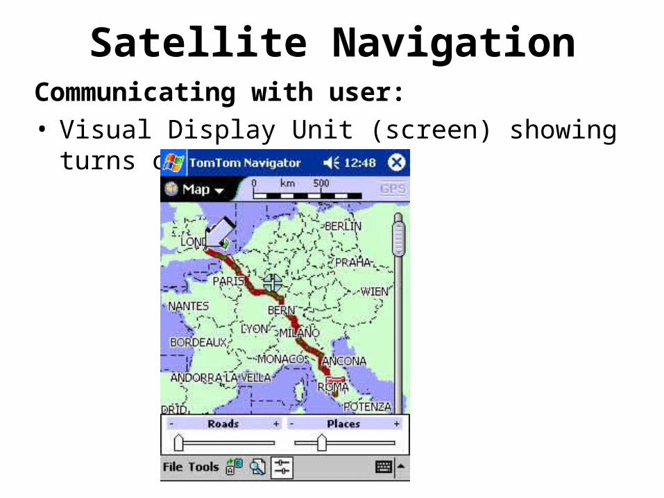
Satellite NavigationCommunicating with user:• Visual Display Unit (screen) showing turns on map
Satellite NavigationCommunicating with user:• Visual Display Unit (screen) showing turns on map
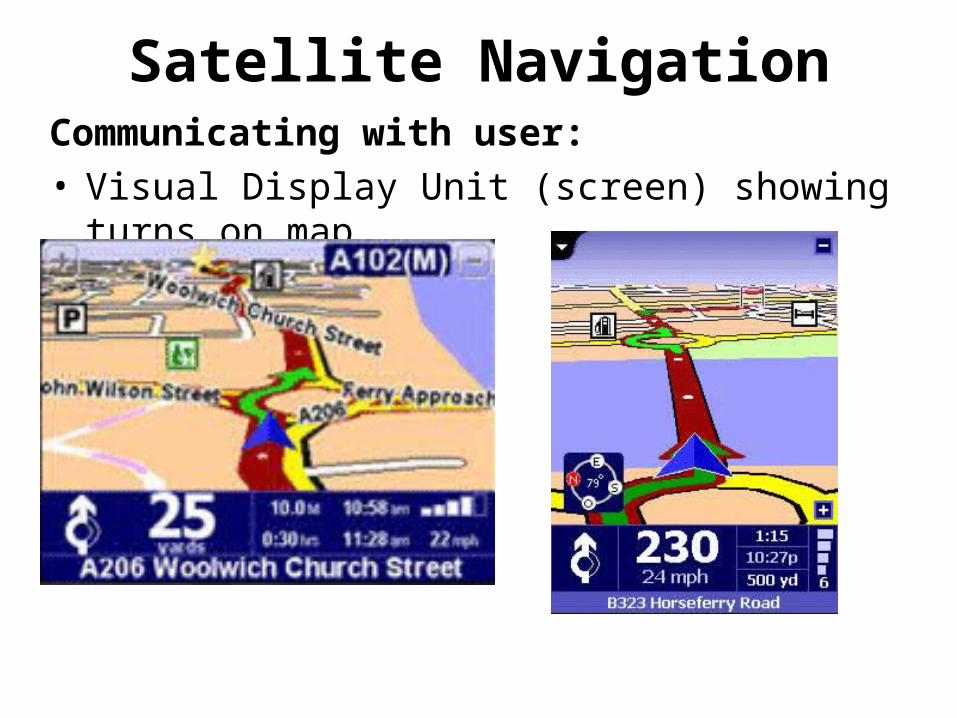
Satellite NavigationCommunicating with user:• Visual Display Unit (screen) showing turns on map

Satellite NavigationCommunicating with user:• Visual Display Unit (screen) showing turns on map• audio communication - voice synthesis

Satellite NavigationCommunicating with user:• Visual Display Unit (screen) showing turns on map• audio communication - voice synthesis

Satellite NavigationCommunicating with user:• Visual Display Unit (screen) showing turns on map• audio communication - voice synthesis
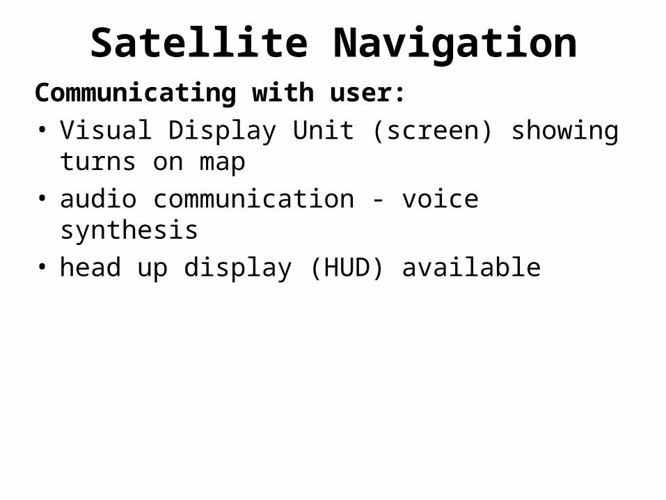
Satellite NavigationCommunicating with user:• Visual Display Unit (screen) showing turns on map• audio communication - voice synthesis• head up display (HUD) available
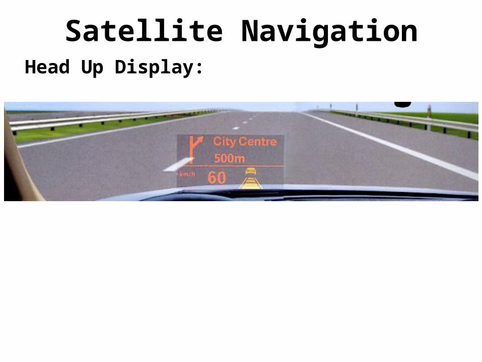
Satellite NavigationHead Up Display:

Satellite NavigationHead Up Display:
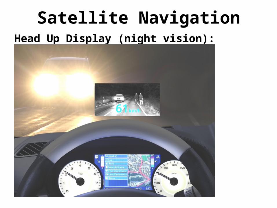
Satellite NavigationHead Up Display (night vision):
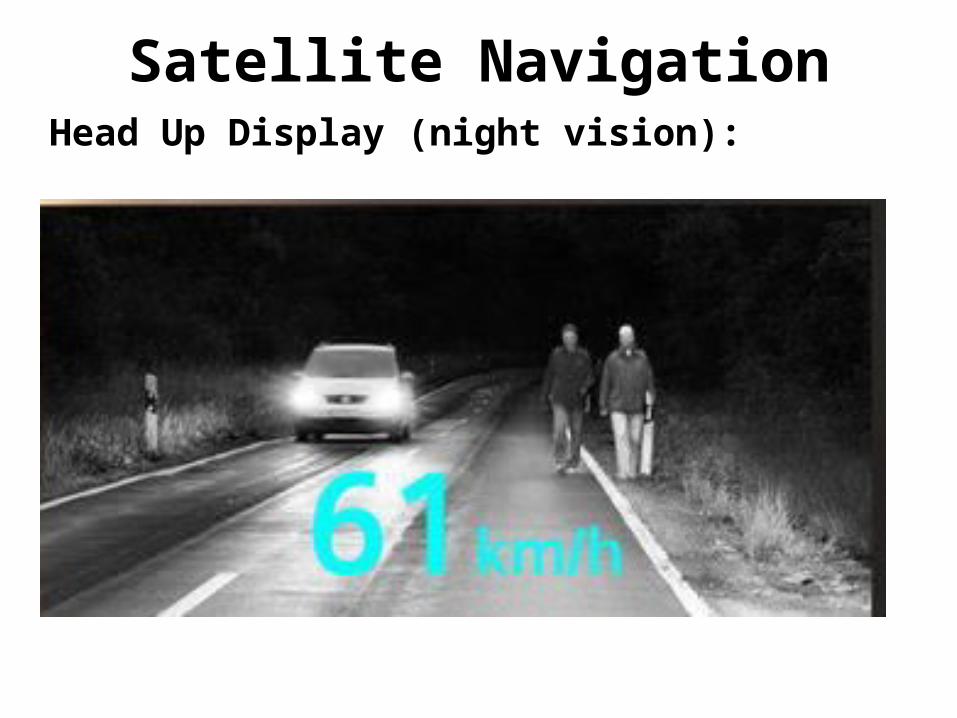
Satellite NavigationHead Up Display (night vision):