GLOBAL POSITIONING SYSTEM : Aher Sainath
17
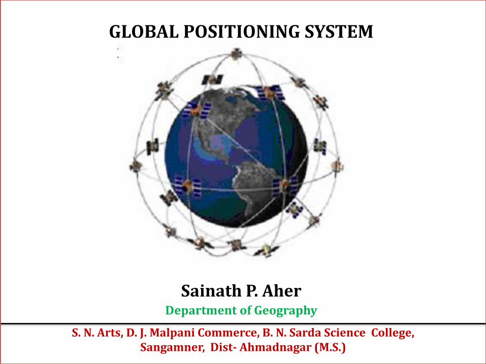
GLOBAL POSITIONING SYSTEM Sainath P. Aher Department of Geography S. N. Arts, D. J. Malpani Commerce, B. N. Sarda Science College, Sangamner, Dist- Ahmadnagar (M.S.)
-
Upload
saislideshere -
Category
Technology
-
view
151 -
download
2
Transcript of GLOBAL POSITIONING SYSTEM : Aher Sainath
GLOBAL POSITIONING SYSTEM
Sainath P. AherDepartment of Geography
S. N. Arts, D. J. Malpani Commerce, B. N. Sarda Science College, Sangamner, Dist- Ahmadnagar (M.S.)

GPS is a Global Position System
The GPS - Space-based - Global navigation satellite system (GNSS) -
Provides location and time information – In all weather- anywhere on the
Earth - Obstructed line of sight to four or more GPS satellites
It maintained by US States govt. & freely accessible by anyone - GPS receiver
The GPS project - Developed in 1973 to overcome the limitations of
previous navigation systems.
GPS was created by U.S. Department of Defense and was originally run
with GPS satellites. It became fully operational in 1994.
There are also the planned
Chinese Compass navigation system
European Union's Galileo positioning system
Indian navigation system - 2015

How it is operate ? - with the help 3 components

The GPS satellite system
• A GPS satellite is a satellite used by theNAVSTAR Global Positioning System.
• The first satellite in the system, Navstar 1, waslaunched Feb. 22, 1978.
• The GPS satellites circle Earth at altitude of about20,000 km and complete two full orbits every day
• As of October 2014, 68 Global PositioningSystem navigation satellites have been launched
The satellites : in spacesegment are orbiting - earthabout 12,000 miles above us.
2 complete orbits - 24 hours.
Travelling speeds ofsatellite 7,000 miles/ hour.
Weighs approximately 2,000 pounds and is about 17 feet across with the solar panels
Transmitter power is only 50 watts or less.
NAVIGATION SYSTEM USING TIMING AND RANGING

GPSs, GPS receiver & user segment

Control Segment
• Maps here

GPS Satellite Signals GPS satellites broadcast microwave signals to enable GPS receivers on or near the Earth's
surface to determine location and synchronized time.
The GPS system itself is operated by the U.S. Department of Defense (DoD) for use by
both the military and the general public.
GPS signals include ranging signals, used to measure the distance to the satellite, and
navigation messages. The navigation messages include ephemeris data, used to calculate
the position of each satellite in orbit, and information about the time and status of the
entire satellite constellation, called the almanac.

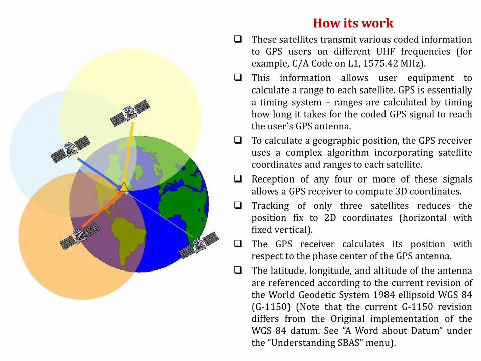
How its work These satellites transmit various coded information
to GPS users on different UHF frequencies (forexample, C/A Code on L1, 1575.42MHz).
This information allows user equipment tocalculate a range to each satellite. GPS is essentiallya timing system – ranges are calculated by timinghow long it takes for the coded GPS signal to reachthe user’s GPS antenna.
To calculate a geographic position, the GPS receiveruses a complex algorithm incorporating satellitecoordinates and ranges to each satellite.
Reception of any four or more of these signalsallows a GPS receiver to compute 3D coordinates.
Tracking of only three satellites reduces theposition fix to 2D coordinates (horizontal withfixed vertical).
The GPS receiver calculates its position withrespect to the phase center of the GPS antenna.
The latitude, longitude, and altitude of the antennaare referenced according to the current revision ofthe World Geodetic System 1984 ellipsoid WGS 84(G-1150) (Note that the current G-1150 revisiondiffers from the Original implementation of theWGS 84 datum. See “A Word about Datum” underthe “Understanding SBAS”menu).


Indian Regional Navigation Satellite System (IRNSS)
The Indian Regional Navigation Satellite
System (IRNSS) (Hindi: भारतीय के्षत्रीय नौवहन उपग्रहप्रणाली) is an autonomous regional satellite
navigation system being developed by the Indian
Space Research Organisation (ISRO) which
would be under complete control of the Indian
government.
The requirement of such a navigation system is
driven by the fact that access to foreign
government-controlled global navigation
satellite systems is not guaranteed in hostile
situations, as happened to Indian military
depending on American GPS during Kargil War.
The IRNSS would provide two services, with the
Standard Positioning Service open for civilian
use and the Restricted Service, encrypted one,
for authorized users (military).

Indian GPS Satellites
RNSS-1A : IRNSS-1A the first navigational satellite in the Indian Regional Navigation Satellite System series of
satellites to be placed in geosynchronous orbit was built at ISRO Satellite Centre, Bangalore,
costing 125 crore (US$20 million).
It has a lift-off mass of 1380 kg, and carries a navigation payload and a C-band ranging transponder, which
operates in L5 band (1176.45MHz) and S band (2492.028MHz).
An optimised I-1K bus structure with a power handling capability of around 1600 watts is used and is designed
for a ten-year mission.
The satellite was launched on-board PSLV-C22 on 1 July 2013 from the Satish Dhawan Space Centre at
Sriharikota, while the full constellation is planned to be placed in orbit by 2015.
IRNSS-1B : IRNSS-1B is the second out of seven in the Indian Regional Navigation Satellite System. It has been very precisely and
successfully placed in its orbit through PSLV-C24 rocket on 4 April 2014.
IRNSS-1C : 3rd - launched using India's PSLV-C26 - Satish Dhawan Space Centre on 16th of October 2014.
IRNSS-1D : 4th - launch is planned in March 2015.
IRNSS-1E : 5th - Its launch is planned in March 2015
IRNSS-1F : 6th - Its launch is planned in March 2015
IRNSS-1G : 7th Its launch is planned in March 2015.

Applications
GPS has a variety of applications on land, at sea and in the air.
Surveyors use GPS for an increasing portion of their work. GPS offers cost
savings by drastically reducing setup time at the survey site and
providing incredible accuracy.
GPS is now commonplace in automobiles as well. Currently these systems
allow a driver to keep track of where he or she is and suggest the best
route to follow to reach a designated location
GPS have many amazing application on Land, water and air
1) Agriculture 2) Aviation 3) Environment
4) Transportation 5) Marine Application 6) Military
7) Public Safety 8) Rail 9) Space
Land Surveying Land Surveying

GPS Surveying – Land Mapping
Global Positioning System (GPS) is a burgeoning technology, which
provides unequalled accuracy and flexibility of positioning for
navigation, surveying and GIS data capture.
The GPS technology has tremendous amount of applications in GIS
data collection, surveying, and mapping.
DGPS Survey Field Monitoring

GPS Survey

GPS Tracking

Land Surveying
GPS can help for …
Distance measurement
Enclosed area measurement
Speed measurement
Direction indication
Maps creation


![[P. Sainath] Everone Loves a Good Drought(](https://static.fdocuments.in/doc/165x107/577c7bec1a28abe05498af6e/p-sainath-everone-loves-a-good-drought.jpg)