Global Atlas 2015
16
World knowledge at your fingertips Print & Digital versions only $31.99
description
Â
Transcript of Global Atlas 2015

World knowledge at your fingertips
Print &Digital
versions
only $31.99

An outstanding practical atlasat an amazing price.This new edition of our best-selling atlas provides students with a broad range of maps, updated with the latest geographical statistics and data, all presented in a clear and striking design that makes it both easy to use and visually engaging.
Key features• over 300 stimulating maps coupled with information on 30 different global themes• clear use of fact files, cross-sections and illustrations to aid learning• the latest, most reliable statistical information available• stunning photos and satellite images• each double-page spread presented as an integrated broadsheet• tasks aids the development of students’ analytical and interpretive skills• integrates a wide range of information about relevant geographical events from Australia and around the world.
MACMILLAN
GLOBAL ATLAS
FOURTH EDITION

AustraliaComprehensive coverage
includes important political,
physical, natural, historical
and cultural perspectives.
Detailed maps for each
state, territory and
capital city are provided.
Continentsof the WorldSuperb maps of all world
countries, with a special
focus on important themes,
issues and events.
World ThemesMore than 30 different
global themes.

Australian states and territories
Clear maps andkeys make seeking information easy
Student’s understandingof map elements isenhanced throughsatellite images

Clear simpleexplanations help
explain topical issues
The latest statisticaldata from authoritativesources, including the
ABS Census 2011
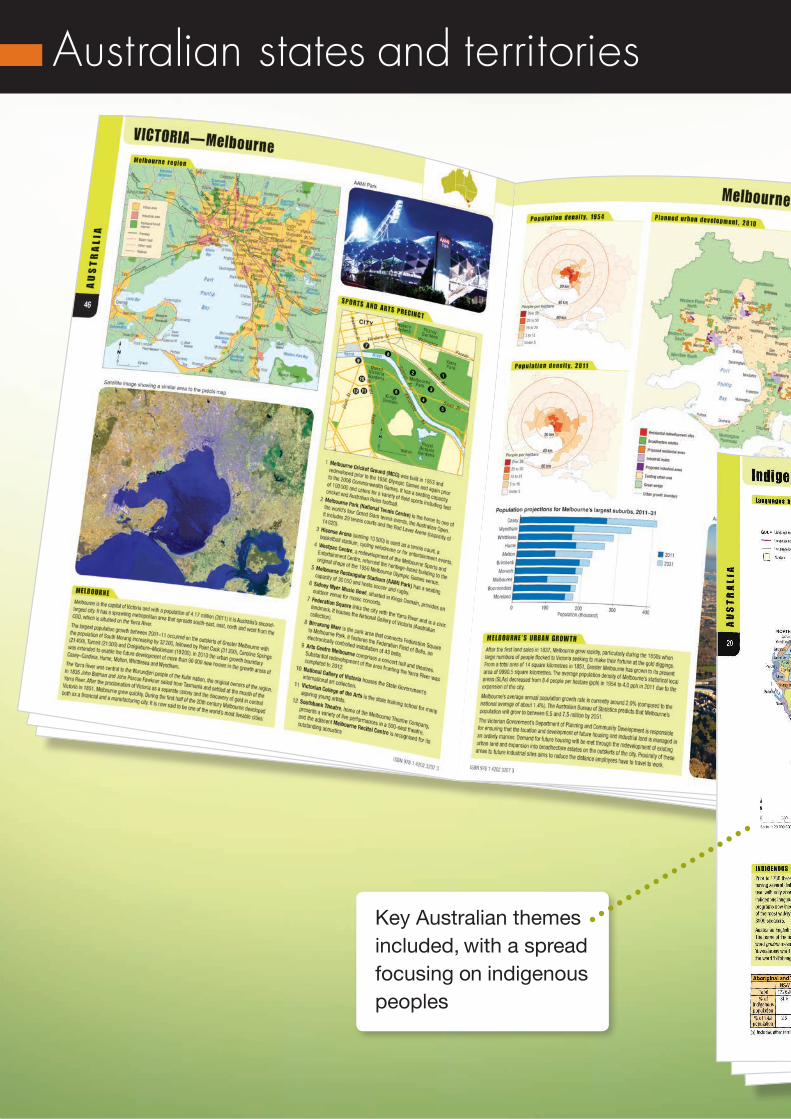
Australian states and territories
Key Australian themes included, with a spread focusing on indigenous peoples

All Australian capital cities covered in detail,
including current issues

Gazetter maps showthe locations of places and geographicalfeatures
Other countries and regions
‘Fact Files’ providekey information in clear and succinct points

Features such as graphs and
pie charts provideinformation clearly
Key countryinformation is
provided in maps and explanations

Other countries and regions
A huge array of dataand information onall global regions

A focus onAustralia’s place
in Asia, and Asian development

Other countries and regions
Photographs, maps, and graphs provideinformation on important global issues
Important globalthemes, and geographic issues and events are included for study
Clear, easy tointerpret and usedata is provided

Chloropleth maps use colours, patterns
and symbols torepresent global
information
Themes include:• environmental issues• population• quality of life issues • cultural features• economic development• trade and resource use• international conflict• international aid
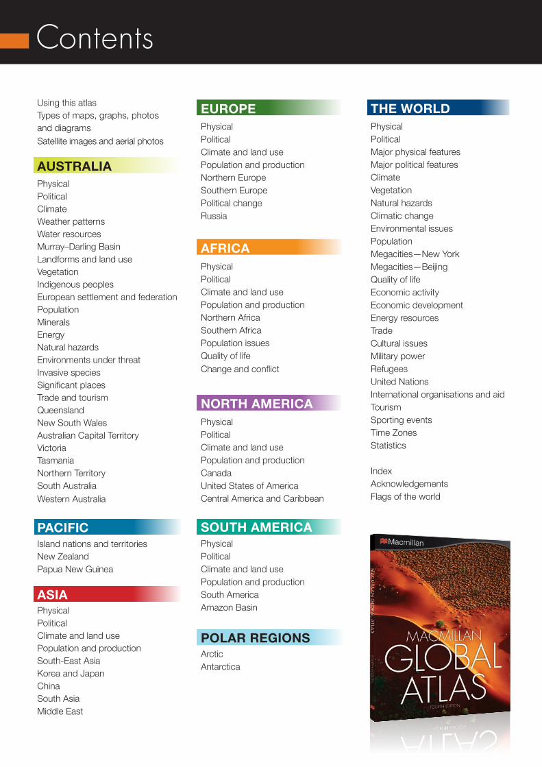
Contents
Using this atlasTypes of maps, graphs, photosand diagramsSatellite images and aerial photos
AUSTRALIAPhysical Political Climate Weather patterns Water resources Murray–Darling Basin Landforms and land use Vegetation Indigenous peoples European settlement and federation Population Minerals Energy Natural hazards Environments under threat Invasive species Significant places Trade and tourismQueensland New South Wales Australian Capital Territory Victoria Tasmania Northern Territory South Australia Western Australia
PACIFICIsland nations and territories New Zealand Papua New Guinea
ASIAPhysical Political Climate and land use Population and production South-East Asia Korea and Japan China South Asia Middle East
THE WORLDPhysical Political Major physical features Major political features Climate Vegetation Natural hazards Climatic change Environmental issues Population Megacities—New York Megacities—Beijing Quality of life Economic activity Economic development Energy resources Trade Cultural issues Military power Refugees United Nations International organisations and aid Tourism Sporting events Time Zones Statistics
Index AcknowledgementsFlags of the world
EUROPEPhysical Political Climate and land use Population and production Northern Europe Southern Europe Political change Russia
AFRICAPhysical Political Climate and land use Population and production Northern Africa Southern Africa Population issues Quality of life Change and conflict
NORTH AMERICAPhysical Political Climate and land use Population and production Canada United States of America Central America and Caribbean
SOUTH AMERICAPhysical Political Climate and land use Population and production South America Amazon Basin
POLAR REGIONSArctic Antarctica
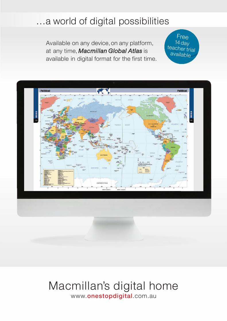
Available on any device, on any platform,at any time, Macmillan Global Atlas isavailable in digital format for the first time.
Macmillan’s digital homewww.onestopdigital.com.au
… a world of digital possibilitiesFree
14 dayteacher trial
available

This fully updated atlas integrates stunning maps with the latest geographical statistics and data.
The extensive range of map resources meet all secondary requirements:
• political• physical• gazetteer• précis• cartogram• street directory• digital terrain model (3D)• weather• topographic• chloropleth• flow• bathymetric.
Price list
Macmillan Global Atlas fourth edition print + eBook 978 1 4202 3207 3 $31.99
Macmillan Global Atlas fourth edition eBook only 978 1 4202 3208 0 $21.99
Title ISBN Price04
/15
www.macmillaneducation.com.au /secondary
For all enquiries call Customer Support on 1300 764 276 (option 4)
or email [email protected]
To order please email [email protected]
ABN: 4900 5024 313
HEAD OFFICELocked Bag 1, Prahran VIC 3181
Orders may also be placed with your usual educational bookseller.Prices are subject to change without notice.
Macmillan Education is committed to protecting your privacy. When you supply your email address, you give Macmillan Education permission to contact you by email about Macmillan Education products and services. Macmillan Education will only use the information provided by you for the intended purpose.