![Randolph Glacier Inventory: A Dataset of Global Glacier ... · Zheltyhina. 2012, Randolph Glacier Inventory [v2.0]: A Dataset of Global Glacier Outlines. Global Land Ice Measurements](https://static.fdocuments.in/doc/165x107/5f1037d37e708231d448062a/randolph-glacier-inventory-a-dataset-of-global-glacier-zheltyhina-2012-randolph.jpg)
Glacier View Meadows Ecology Club
27
Glacier View Meadows Ecology Club May 14, 2019 Daniel Bowker Forest and Fire Project Manager
Transcript of Glacier View Meadows Ecology Club
Glacier View Meadows
Ecology Club
May 14, 2019
Daniel Bowker
Forest and Fire Project Manager

OUR MISSION: To improve & maintain the ecological
health of the Poudre River Watershed through
community collaboration.
We work to achieve our mission by focusing on these key themes:
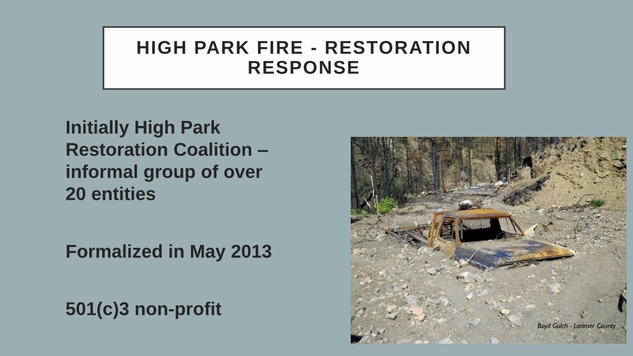
HIGH PARK FIRE - RESTORATION RESPONSE
Initially High Park
Restoration Coalition –
informal group of over
20 entities
Formalized in May 2013
501(c)3 non-profit Boyd Gulch - Larimer County


POST-FIRE RECOVERY WORK – SKIN GULCH
Post-fire flooding at Skin Gulch
damages Stove Prairie Rd & CO-14
Skin Gulch 2016 post restoration
completion

Post fire flooding at Poudre River
at Monroe TunnelOn-going post fire recovery work
POST FIRE RECOVERY WORK – UT3

Figure 10. A crown fire
races through the canopy
of a ponderosa pine
forest.
https://catalog.extension.oregonstate.edu
/em9172module3/html

Figure 28—
Prescribed fire in
the Manitou
Experimental Forest
on the Pike National
Forest, October
2014.
Reintroduction of
fire through
prescribed or
wildland fire use is a
vital component of
restoration as it
goes beyond
structural
restoration to
restore ecological
processes (photo:
S. Alton, U.S.
Forest Service).
RMRS-GTR-373Structure→process

The view along the South
Platte River in the Pike
National Forest, in 1903 and
2012. When wildfires burn in
dense forests today they are
often hotter and can destroy
more trees.
Denver Water Department archives and
Paula Fornwalt/U.S. Forest Service
https://www.npr.org/2018/06/14/618225625
/looking-to-history-to-combat-wildfires
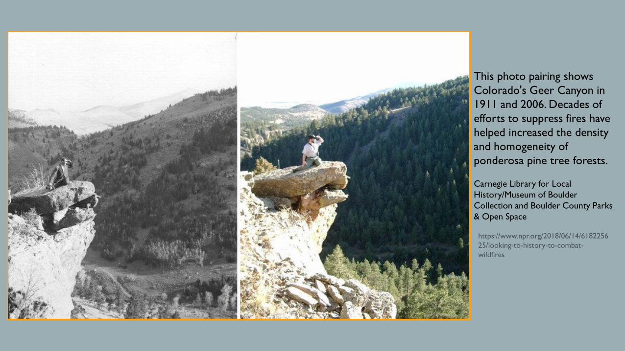
This photo pairing shows
Colorado's Geer Canyon in
1911 and 2006. Decades of
efforts to suppress fires have
helped increased the density
and homogeneity of
ponderosa pine tree forests.
Carnegie Library for Local
History/Museum of Boulder
Collection and Boulder County Parks
& Open Space
https://www.npr.org/2018/06/14/6182256
25/looking-to-history-to-combat-
wildfires

RMRS-GTR-373

Figure 18—Variation in forest
structure reflecting topographic
influences and underlying
moisture gradients. South-facing
slopes are characterized by open,
ponderosa pine woodlands with
trees occurring both in groups
and as scattered individuals.
Forest density increases in areas
with higher moisture, such as
north-facing slopes. The
proportion of Douglas-fir typically
increases as well with increasing
moisture. Aspen is also an
important component of forest
structure, typically occupying
areas with higher moisture
availability.
RMRS-GTR-373

Figure 14—Ponderosa pine woodland in the Roosevelt National Forest near Red Feather Lakes, Colorado, illustrating an open, low-density stand structure (photo: P. Brown, Rocky Mountain Tree-Ring Research, used with permission).
RMRS-GTR-373
Figure 15—Fine-scale (<1 acre) opening within a dry mixed-conifer forest in the Pike National Forest near Woodland Park, Colorado (photo: P. Brown, Rocky Mountain Tree-Ring Research, used with permission).
• Reduce stand density, focus on
removing stems <6” DBH
• Do not remove trees >18” DBH
• Preferentially retain ponderosa
pine over Douglas-fir
• Retain old trees
• Flat/spiky/dead top, smooth
orange bark, large lower
limbs
• Vary density with aspect, soil
moisture
• Establish openings, disconnect
canopy groups
• Retain coarse woody debris,
snags for wildlife

Stakeholder driven
Spatial analysis
Prioritizes hazards (wildfires) to critical watershed values (healthy forests, rivers, water supply)
Completed in 2017
WATERSHED RESILIENCE PLAN FORTHE UPPER POUDRE

• Diverse forests (type and density)
• Small, isolated areas of high wildfire hazard
• Intact, functional riparian areas
• Native riparian vegetation
• Floodplains connected to streams
• Upland areas with appropriate native groundcover
• Minimal impact of roads and development on watershed
function

Putting the
plan into
action
Where are other
agencies working?
Prioritize our work
to take advantage of
nearby mitigation
treatments
Create landscape
scale fuel break

COMMUNITY OUTREACH
• CPRW is working with
local communities
• Partnering with USFS,
CFRI, TNC to broaden
outreach & education
• Direct mailing
campaign with
American Forest
Foundation• Forester site visit
• Tours/workshops
• Landowner guide


Coalition for the Poudre River
Watershed
Colorado Forest Restoration Institute
The Nature Conservancy
US Forest Service
USFS Rocky Mountain Research Station
Natural Resources Conservation Service
and Fort Collins Conservation District
Division of Fire Prevention and Control
Colorado State Forest Service
Larimer County
Fire protection districts


Defensible space
resources:
Colorado State
Forest Service
Larimer County
Office of Emergency
Management
Local Fire Protection
District

•Develop a family disaster response plan complete with escape routes
and an emergency meeting place.
•Have an emergency go-kit with supplies readily available. This should
include prescription medication and back-up eye glasses/contacts.
•Review your homeowners/renters insurance policy to ensure you
have adequate coverage. If you do not have flood insurance, consider
purchasing it by contacting your local insurance agent.
•Arrange temporary housing outside of the threatened area. Make
arrangements for relocation of pets and animals.
•Place valuable papers and mementos in your car in case of
evacuation.

Potbelly Restaurant and Lounge Ben Delatour Scout Ranch
Red Feather Lakes Library Shambhala
Summits Secrets Stove Prairie Landing
Trout Tavern Glacier View Meadows
Dalonna Mae's Café Red Feather Lakes
Orville's Mt Margaret
Tomas Rogers Lady Moon Lake
The Forks North Rim Road
Livermore Community Center Parvin Lake
Crystal Lakes Community Center Mishawaka
The Golf Club At Fox Acres