GIS FOR CONTROL OF COMMUNICABLE DISEASES · • The existence of precise disease tracking was...
18
Add your company logo here on master slide GIS FOR CONTROL OF COMMUNICABLE DISEASES Presented by: Dr. Gaurav Aggarwal Public Health Specialist , Anti Malaria Officer, NVBDCP, Chandigarh
Transcript of GIS FOR CONTROL OF COMMUNICABLE DISEASES · • The existence of precise disease tracking was...
Add your company logo here on master slide
GIS FOR CONTROL OF COMMUNICABLE DISEASES
Presented by:
Dr. Gaurav Aggarwal
Public Health Specialist ,
Anti Malaria Officer, NVBDCP, Chandigarh

Add your company logo here on master slide
INTRODUCTION
• The existence of precise disease tracking was highlighted from 1854
when John Snow located cholera cases in London.
• Geospatial information system (GIS) is one of the effective tool to
mitigate and control the spread of vector borne, water borne and
airborne diseases.

Add your company logo here on master slide
INTRODUCTION…
• It cannot only provide a platform for preparation of geospatial mode
but by using other mathematical models, can be used for
development of predictive model using various climatic and
environmental factors.

Add your company logo here on master slide
METHODOLOGY
• The linelisting of the diseases like Malaria, Chikungunya, Dengue
was taken from state Headquarter, NVBDCP.
• GIS Mapping of diseases like Dengue, Malaria, Chikungunya,
Hepatitis, Cholera and Seasonal Influenza was made using
ARCGIS 10.x software.
• Transmission pattern of disease was mapped.

Add your company logo here on master slide
RESULTS
TRANSMISSION PATTERN
CHIKUNGUNYA
DENGUE MALARIA
GIS MAP BREEDING SITES
USE OF GIS IN VECTOR BORNE DISEASES
LINKING
TOPOGRAPHY
WITH DISEASE
COMPARITIVE
ANALYSIS OF
DISEASES

Add your company logo here on master slide
GIS MAP
CHIKUNGUNYA DENGUE

Add your company logo here on master slide
COMPARATIVE ANALYSIS OF DISEASE ACROSS
YEARS
MALARIA CASES 2016 MALARIA CASES 2015

Add your company logo here on master slide
DISEASE TRANSMISSION
MALARIA TRANSMISSION IN 2016

Add your company logo here on master slide
IDENTIFICATION OF BUFFER ZONE
Buffer zone for
Avian Iinfluenza
Add your company logo here on master slide
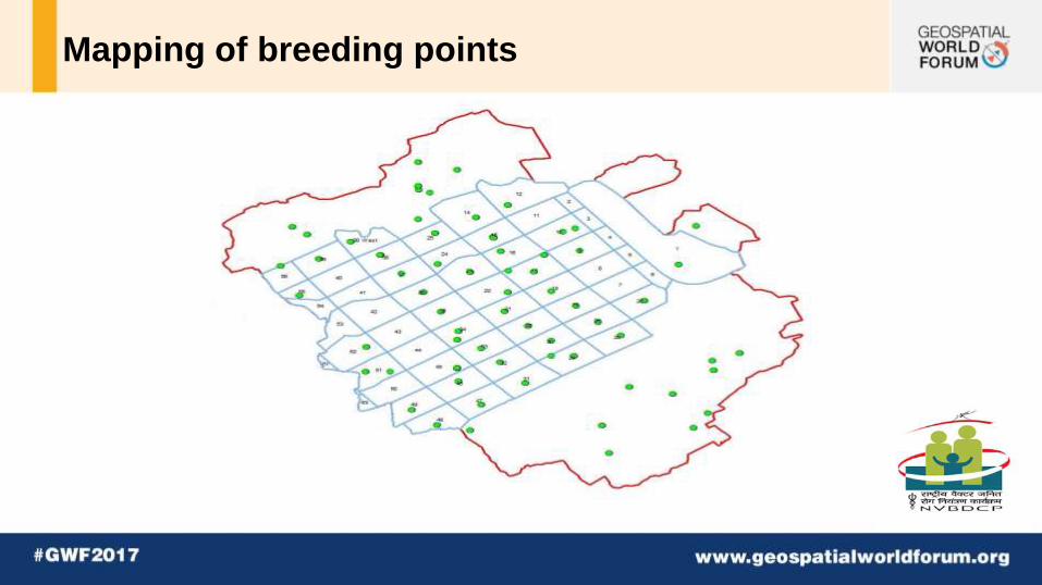
Mapping of breeding points

Add your company logo here on master slide
LINKAGES OF DISEASES WITH TOPOGRAPHY
GREEN BELTS
WATER BODIES
DENGUE CASES IN 2016

Add your company logo here on master slide
RESULTS….
TRANSMISSION PATTERN
CHOLERA
HEPATITIS E HEPATITIS A
GIS MAP TUBEWELL MAPPING
USE OF GIS IN WATER BORNE DISEASES
Add your company logo here on master slide
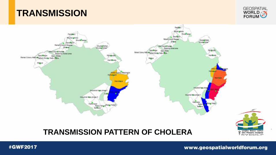
TRANSMISSION
TRANSMISSION PATTERN OF CHOLERA

Add your company logo here on master slide
GIS MAP
CHOLERA HEPATITIS
Add your company logo here on master slide
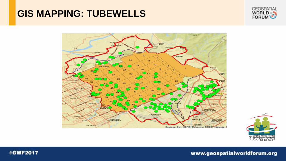
GIS MAPPING: TUBEWELLS

Add your company logo here on master slide
IMPLICATIONS
• Various airborne, water borne and vector borne diseases can be
predicted in advance which can help policy makers to effectively
plan out strategies for control of spread of diseases especially in
case of Vector borne diseases.
• Geospatial modelling of diseases can led to robust application of
analytics to track the geographical distribution and transmission
pattern of disease.

Add your company logo here on master slide
IMPLICATIONS….
• More precise disease tracking can also illuminate causes and spark
opportunities for prevention and control strategies.

Add your company logo here on master slide
THANKYOU