GIS Applications for ROW Management on New York Power Authority High Voltage Transmission Lines
26
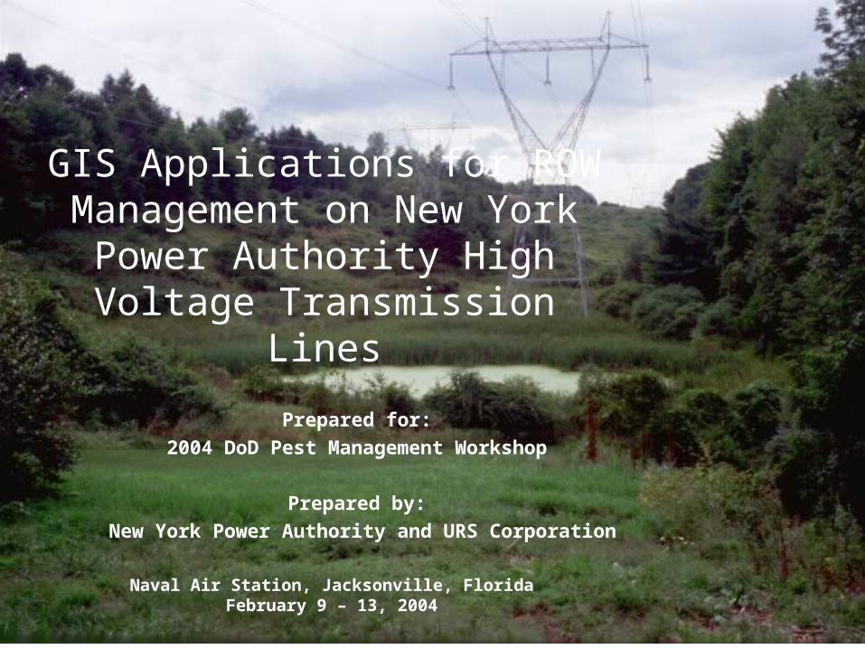
GIS Applications for ROW Management on New York Power Authority High Voltage Transmission Lines Prepared for: 2004 DoD Pest Management Workshop Prepared by: New York Power Authority and URS Corporation Naval Air Station, Jacksonville, Florida February 9 – 13, 2004
-
Upload
vance-drake -
Category
Documents
-
view
31 -
download
0
description
GIS Applications for ROW Management on New York Power Authority High Voltage Transmission Lines. Prepared for: 2004 DoD Pest Management Workshop Prepared by: New York Power Authority and URS Corporation. Naval Air Station, Jacksonville, Florida February 9 – 13, 2004. Presentation Team. - PowerPoint PPT Presentation
Transcript of GIS Applications for ROW Management on New York Power Authority High Voltage Transmission Lines
GIS Applications for ROW Management on New York
Power Authority High Voltage Transmission Lines
Prepared for:
2004 DoD Pest Management Workshop
Prepared by:
New York Power Authority and URS Corporation
Naval Air Station, Jacksonville, FloridaFebruary 9 – 13, 2004
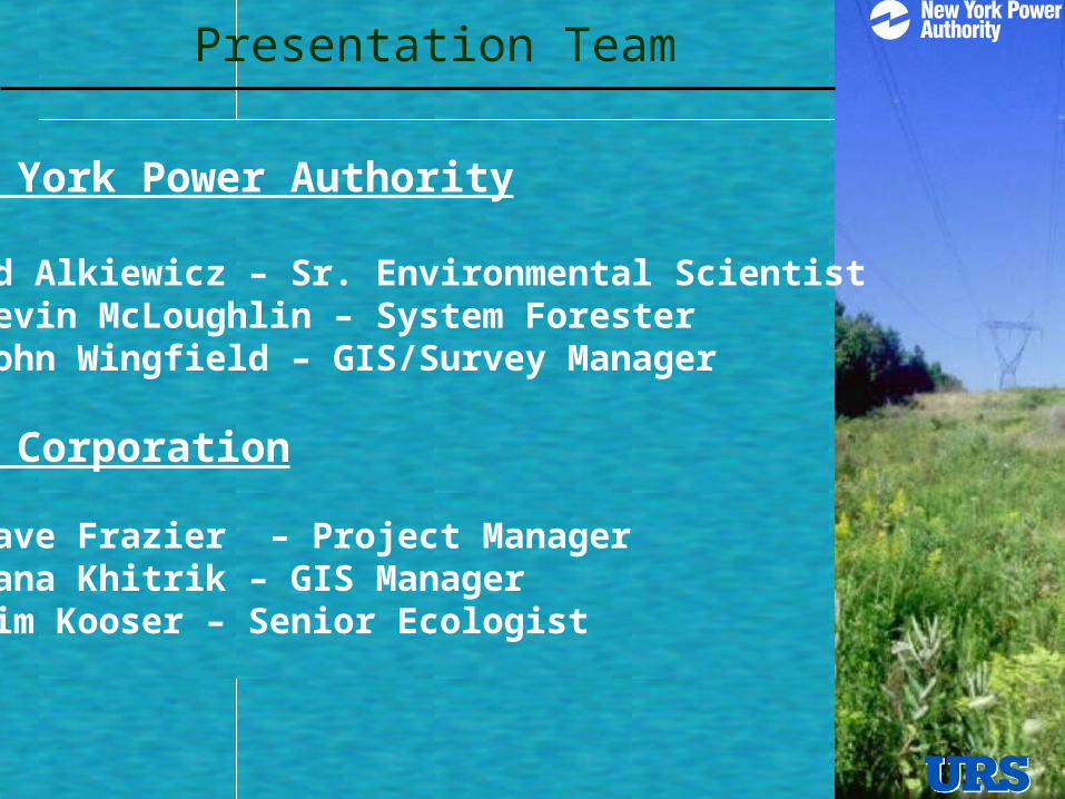
Presentation Team
New York Power Authority
Ed Alkiewicz – Sr. Environmental ScientistKevin McLoughlin – System Forester John Wingfield – GIS/Survey Manager
URS Corporation
Dave Frazier – Project ManagerLana Khitrik – GIS Manager Jim Kooser – Senior Ecologist
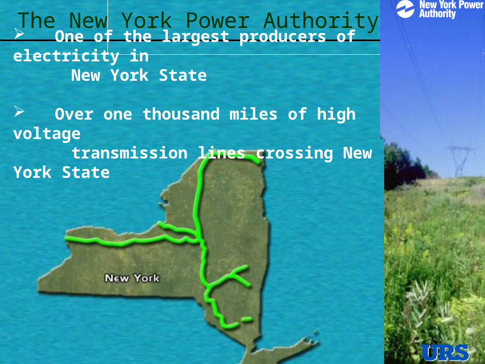
The New York Power Authority One of the largest producers of electricity in New York State
Over one thousand miles of high voltage transmission lines crossing New York State
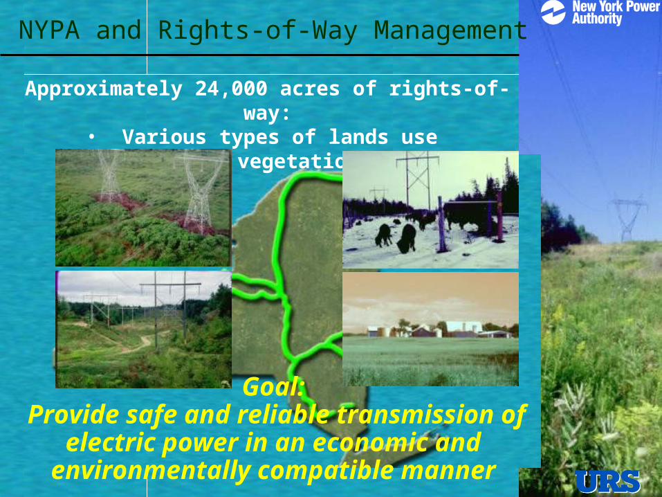
NYPA and Rights-of-Way Management
Approximately 24,000 acres of rights-of-way:• Various types of lands use • Various vegetation types
Goal: Provide safe and reliable transmission of electric
power in an economic and environmentally compatible manner
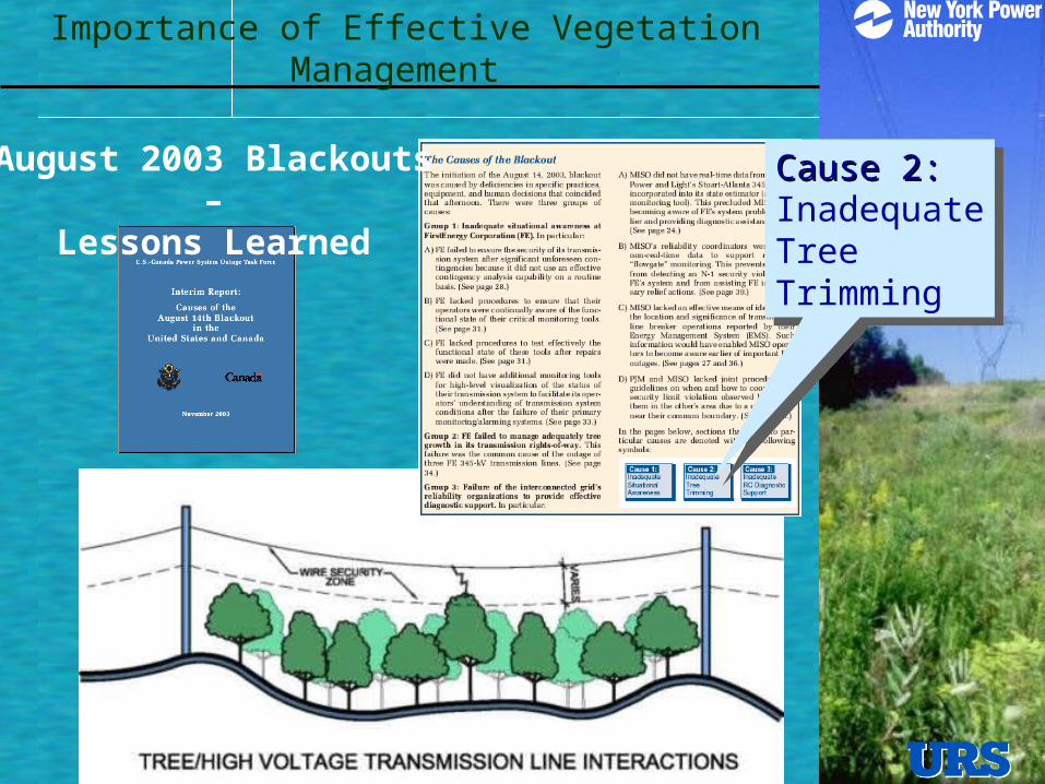
Importance of Effective Vegetation Management
Cause 2:Cause 2:InadequateTreeTrimming
Cause 2:Cause 2:InadequateTreeTrimming
August 2003 Blackouts –
Lessons Learned
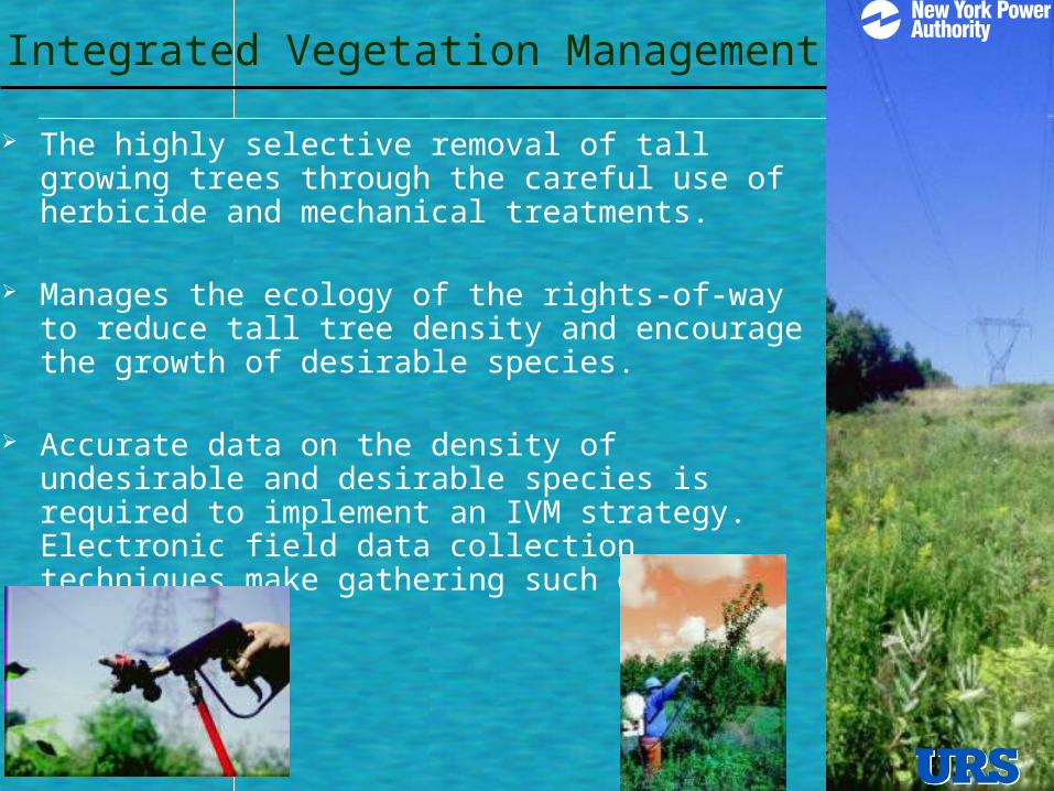
Integrated Vegetation Management
The highly selective removal of tall growing trees through the careful use of herbicide and mechanical treatments.
Manages the ecology of the rights-of-way to reduce tall tree density and encourage the growth of desirable species.
Accurate data on the density of undesirable and desirable species is required to implement an IVM strategy. Electronic field data collection techniques make gathering such data economical.
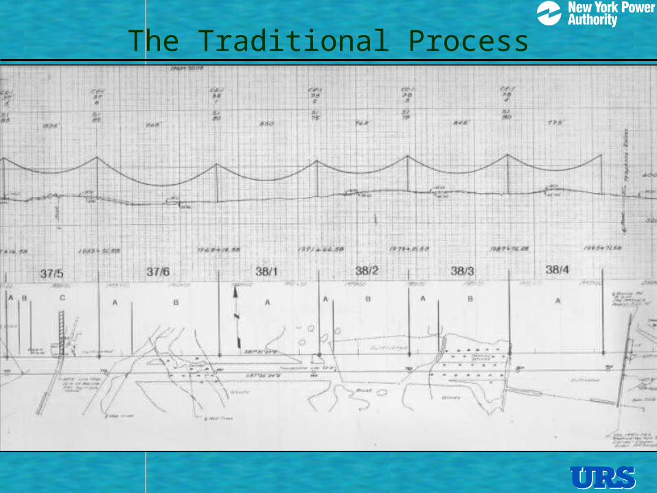
The Traditional Process
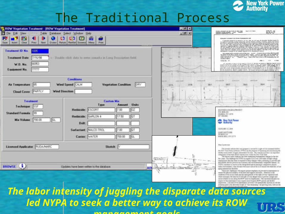
The Traditional Process
The labor intensity of juggling the disparate data sources led NYPA to seek a better way to achieve its ROW management goals
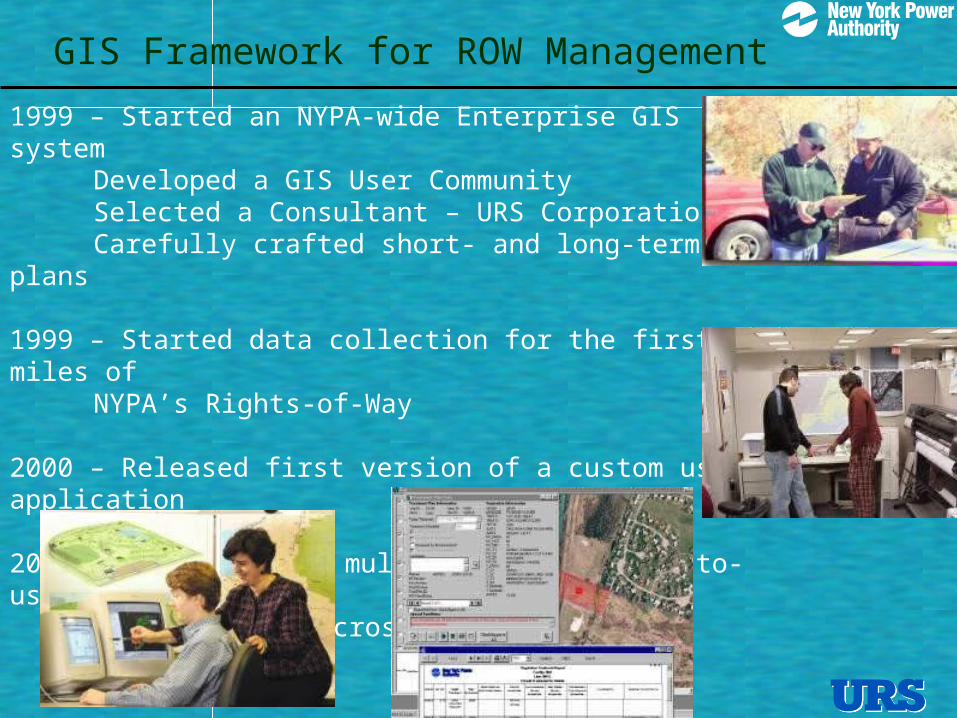
GIS Framework for ROW Management
1999 – Started an NYPA-wide Enterprise GIS systemDeveloped a GIS User CommunitySelected a Consultant – URS CorporationCarefully crafted short- and long-term plans
1999 – Started data collection for the first 200 miles of NYPA’s Rights-of-Way
2000 – Released first version of a custom user application
2001 – Multipurpose, multidiscipline, easy-to-usetool accepted across the board
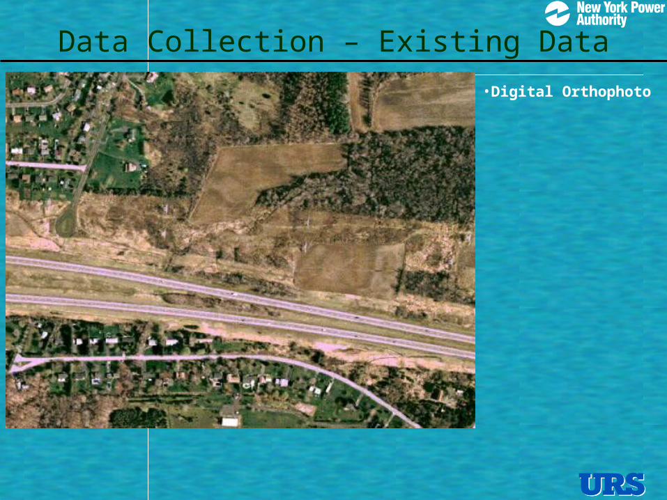
Data Collection – Existing Data
•Digital Orthophoto
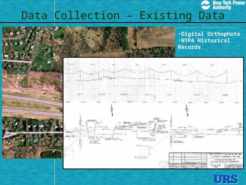
Data Collection – Existing Data
•Digital Orthophoto •NYPA Historical Records

Data Collection – Existing Data
•Digital Orthophoto •NYPA Historical Records•GIS Coverages from other agencies

Data Collection – Existing Data
•Digital Orthophoto •NYPA Historical Records•GIS Coverages from other agencies•State Regulated Wetlands
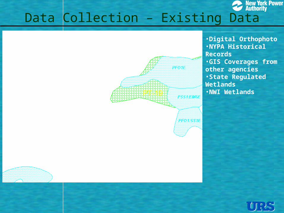
Data Collection – Existing Data
•Digital Orthophoto •NYPA Historical Records•GIS Coverages from other agencies•State Regulated Wetlands•NWI Wetlands
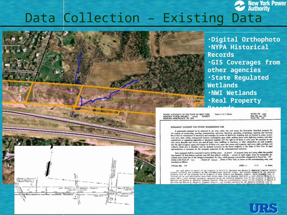
Data Collection – Existing Data
•Digital Orthophoto •NYPA Historical Records•GIS Coverages from other agencies•State Regulated Wetlands•NWI Wetlands•Real Property Records

•Digital Orthophoto •NYPA Historical Records•GIS Coverages from other agencies•State Regulated Wetlands•NWI Wetlands•Real Property Records•Tax Maps
Data Collection – Existing Data
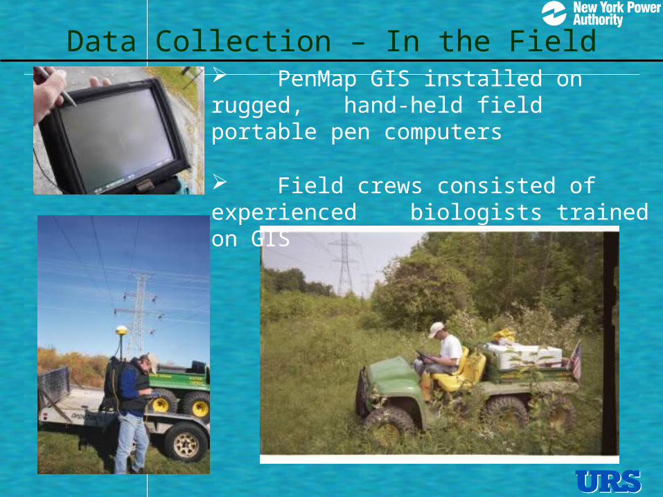
Data Collection – In the Field PenMap GIS installed on rugged,
hand-held field portable pen computers
Field crews consisted of experienced biologists trained on GIS
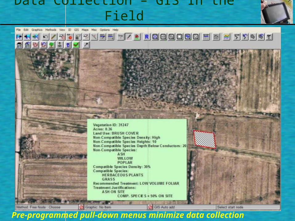
Data Collection – GIS In the Field
Pre-programmed pull-down menus minimize data collection effort

Data Collection
Once data collection was completed, the GIS contained dozens of accurate, current data sets

Data Collected in the Field
BuildingsStreams, CreeksForeign UtilitiesRoadsTrailsBridgesCulvertsBenchesGatesBoreholesWellsManholesPolesParking LotsAccess RoadsSteep slope
Vegetation polygon IDAcresNon-Compatible SpeciesNon-Compatible Species DensityNon-Compatible Species HeightsNon-Compatible Depth Below ConductorCompatible SpeciesCompatible Species DensityRecommended TreatmentTreatment JustificationsLand Use
Pre-programmed pull-down menus minimize data collection effort
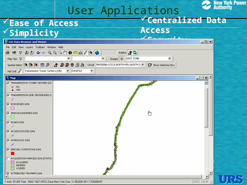
Ease of Access Simplicity
Ease of Access Simplicity
User ApplicationsCentralized Data AccessSecurity
Centralized Data AccessSecurity
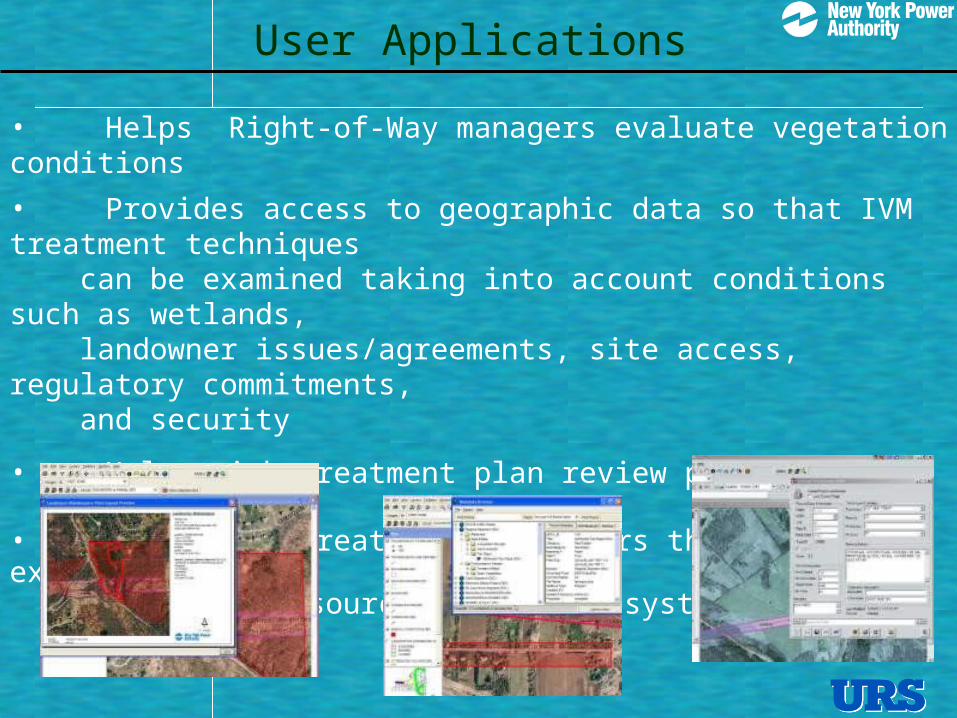
User Applications
• Helps Right-of-Way managers evaluate vegetation conditions
• Provides access to geographic data so that IVM treatment techniques can be examined taking into account conditions such as wetlands, landowner issues/agreements, site access, regulatory commitments, and security
• Helps with treatment plan review process
• A link for creating work orders through NYPA’s existing maintenance resource management system (MAXIMO)
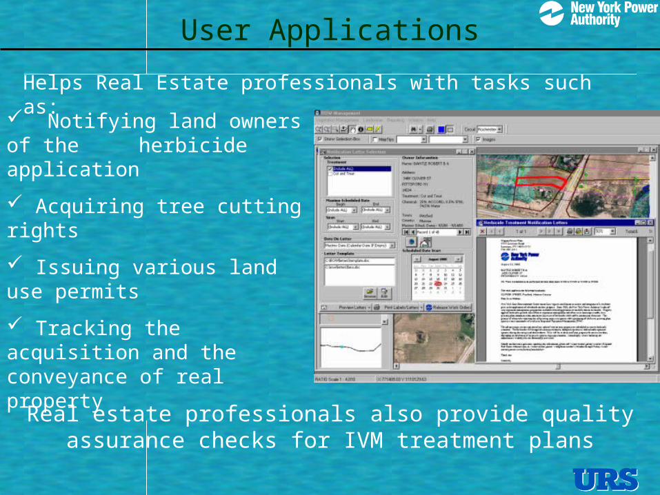
User Applications
Notifying land owners of the herbicide application
Acquiring tree cutting rights
Issuing various land use permits
Tracking the acquisition and the conveyance of real property
Real estate professionals also provide quality assurance checks for IVM treatment plans
Helps Real Estate professionals with tasks such as:
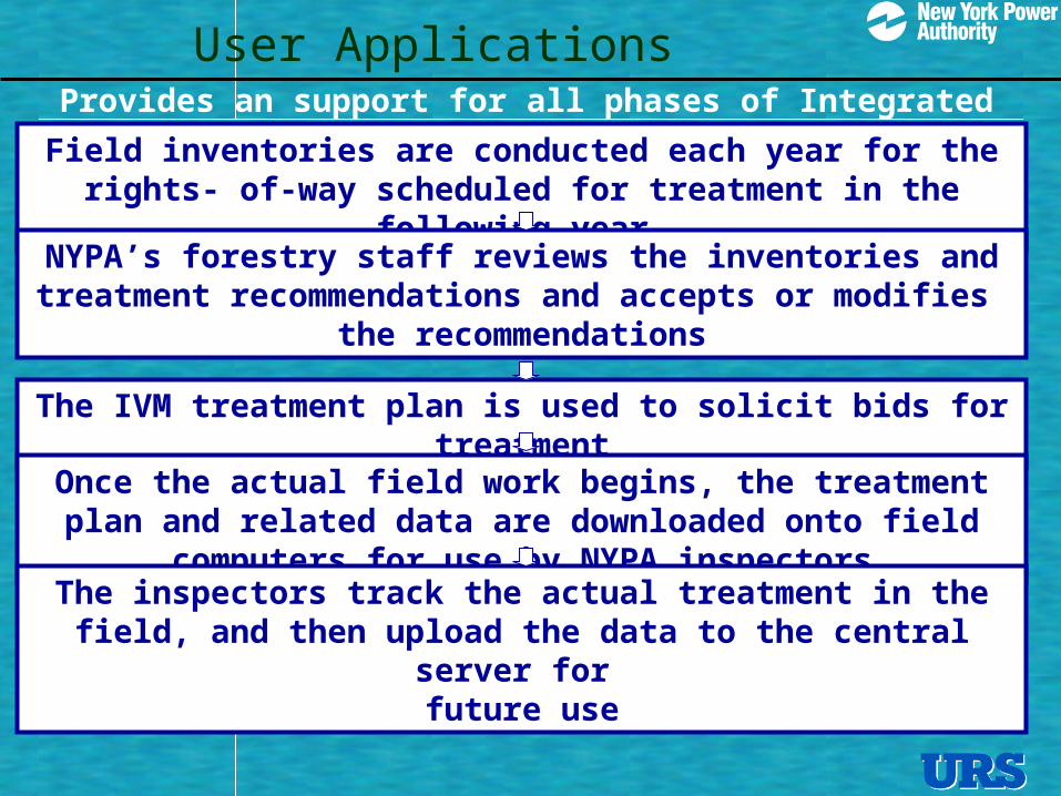
User ApplicationsProvides an support for all phases of Integrated
Vegetation Management Field inventories are conducted each year for the rights- of-way scheduled for treatment in the following year
NYPA’s forestry staff reviews the inventories and treatment recommendations and accepts or modifies
the recommendations
The IVM treatment plan is used to solicit bids for treatment
Once the actual field work begins, the treatment plan and related data are downloaded onto field computers for use by NYPA inspectors
The inspectors track the actual treatment in the field, and then upload the data to the central server for
future use
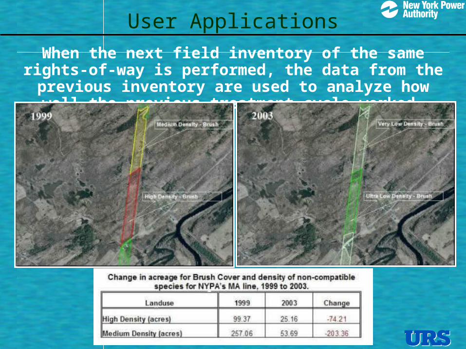
When the next field inventory of the same rights-of-way is performed, the data from the
previous inventory are used to analyze how well the previous treatment cycle worked
User Applications
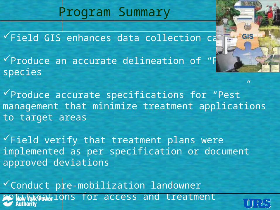
Program Summary
Field GIS enhances data collection capabilities
Produce an accurate delineation of “Pest” species
Produce accurate specifications for “Pest” management that minimize treatment applications to target areas
Field verify that treatment plans were implemented as per specification or document approved deviations
Conduct pre-mobilization landowner notifications for access and treatment
Produce reports for internal use or regulatory requirements