GI13-3 Using ESRI data in Autodesk ISD Products - … A look at Safe Software and Autodesk Autodesk...
14
1 Using ESRI data in Autodesk ISD Products 1.5 hr. Class 02-Dec-03 3:30pm - 5:00pm Session Description: We will focus on using data in a variety of ESRI formats within the Autodesk GIS product line, including Autodesk Map®, Autodesk MapGuide®, and Autodesk Envision®. We'll look at the many ways to read, write, and manage this data in a precise CAD and engineering environment. We'll also discuss Autodesk's strong relationship with Safe Software and the powerful FME SDP Server that provides a direct interface to dozens of industry- standard data types without any conversion. Finally, we'll review the standards of the Open GIS Consortium to enable GIS and CAD professionals to share geographic data in GML format, a version of XML for GIS. If you've ever had to convert spatial data from one format into another, you'll see how easy it is to work with these data types without keeping several versions of the same dataset. GI13-3
Transcript of GI13-3 Using ESRI data in Autodesk ISD Products - … A look at Safe Software and Autodesk Autodesk...

1
Using ESRI data in Autodesk ISD Products1.5 hr. Class 02-Dec-03 3:30pm - 5:00pmSession Description:
We will focus on using data in a variety of ESRI formats within the Autodesk GIS product line, including Autodesk Map®, Autodesk MapGuide®, and Autodesk Envision®. We'll look at the many ways to read, write, and manage this data in a precise CAD and engineering environment. We'll also discuss Autodesk's strong relationship with Safe Software and the powerful FME SDP Server that provides a direct interface to dozens of industry-standard data types without any conversion. Finally, we'll review the standards of the Open GIS Consortium to enable GIS and CAD professionals to share geographic data in GML format, a version of XML for GIS. If you've ever had to convert spatial data from one format into another, you'll see how easy it is to work with these data types without keeping several versions of the same dataset.
GI13-3
2
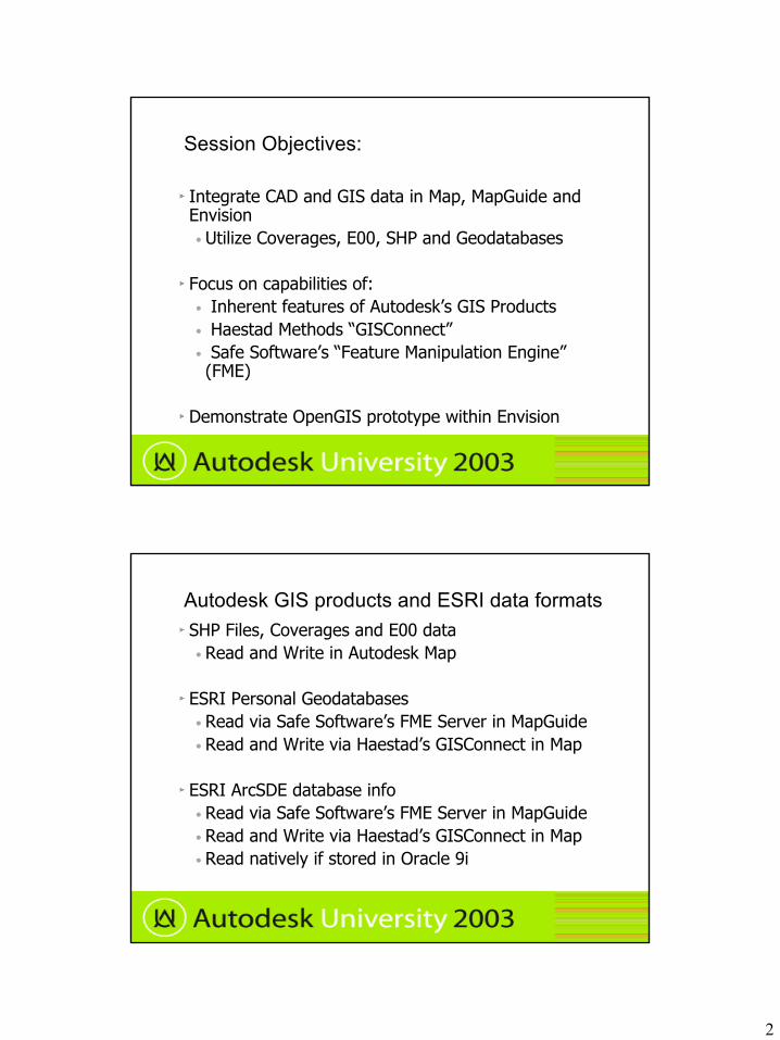
Session Objectives:
Integrate CAD and GIS data in Map, MapGuide and Envision• Utilize Coverages, E00, SHP and Geodatabases
Focus on capabilities of:• Inherent features of Autodesk’s GIS Products• Haestad Methods “GISConnect”• Safe Software’s “Feature Manipulation Engine” (FME)
Demonstrate OpenGIS prototype within Envision
Autodesk GIS products and ESRI data formatsSHP Files, Coverages and E00 data• Read and Write in Autodesk Map
ESRI Personal Geodatabases• Read via Safe Software’s FME Server in MapGuide• Read and Write via Haestad’s GISConnect in Map
ESRI ArcSDE database info • Read via Safe Software’s FME Server in MapGuide • Read and Write via Haestad’s GISConnect in Map• Read natively if stored in Oracle 9i

3
A look at Safe Software and Autodesk
Autodesk uses part of FME in Map and Envision for conversion and read/write capability
Reading/ writing ArcSDE and Personal Geodatabases currently requires ArcGIS to reside on the system. • ESRI’s API is used to make the
server-side connection. ESRI may expose this API in ArcGIS 9
Download trial version for evaluation at www.safe.com
A look at Haestad Methods and Autodesk
Haestad Methods offers GISConnect
Full support for vector data including Geodatabases, Shapefiles, Coverages and Feature Classes.
Work with ArcSDE data across your organization directly from AutoCAD or Autodesk Map.
A licensed version of ArcView 8.x, ArcEditor 8.x, or ArcInfo 8.x is required to use GISConnect.
See http://www.haestad.com for trial version and more info
4
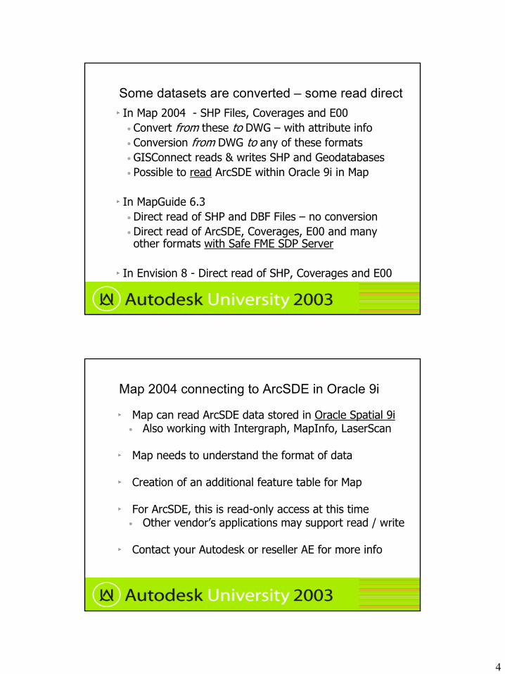
Some datasets are converted – some read directIn Map 2004 - SHP Files, Coverages and E00• Convert from these to DWG – with attribute info• Conversion from DWG to any of these formats• GISConnect reads & writes SHP and Geodatabases• Possible to read ArcSDE within Oracle 9i in Map
In MapGuide 6.3• Direct read of SHP and DBF Files – no conversion• Direct read of ArcSDE, Coverages, E00 and many other formats with Safe FME SDP Server
In Envision 8 - Direct read of SHP, Coverages and E00
Map 2004 connecting to ArcSDE in Oracle 9i
Map can read ArcSDE data stored in Oracle Spatial 9i• Also working with Intergraph, MapInfo, LaserScan
Map needs to understand the format of data
Creation of an additional feature table for Map
For ArcSDE, this is read-only access at this time• Other vendor’s applications may support read / write
Contact your Autodesk or reseller AE for more info

5
In Map 2004 – Import SHP, Coverage, E00
Map, Tools, Import• Pick data type
• Find directory path, hit OK to see files– Select coordinate system – if
needed » Select data column!» This is the .DBF data» Creates object data» Can push to Access or
other DB if needed
Data may need cleanup after importSHP data sometimes comes in after it has been in DXF format – easy to tell by fields in the .DBF file
Use Map’s drawing cleanup to increase accuracy
• Map, Tools, Drawing Cleanup– Select layers– Use Interactive
option to see cleanup
– Be careful cleaning up everything!
– You may need to create tolerances
6
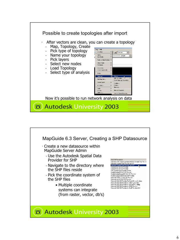
Possible to create topologies after import
After vectors are clean, you can create a topology• Map, Topology, Create• Pick type of topology• Name your topology• Pick layers• Select new nodes• Load Topology• Select type of analysis
Now it’s possible to run network analysis on data
MapGuide 6.3 Server, Creating a SHP DatasourceCreate a new datasource within MapGuide Server Admin• Use the Autodesk Spatial Data Provider for SHP
• Navigate to the directory where the SHP files reside
• Pick the coordinate system of the SHP files
• Multiple coordinate systems can integrate (from raster, vector, db’s)

7
MapGuide 6.3 Author – adding a SHP file
From the Map Layers in Author• New Layer - then pick the type of SHP file
MapGuide will tell you if you picked the wrong type
• Give the layer a name for the legend, then pick the SHP datasource previously created.
• Pick the SHP file from the list and hit OK to see the graphics
MapGuide 6.3 Author – theme on the SHP layer
Thematics can be added to the layer• Use the MapGuide Author
• Select the Properties of the layer
• Select the Styles Tab• Click on Theme and select if
it’s individual or a range• Theme settings allow access
to the .DBF data file• Select the Key Column and
the theme column from the .DBF

8
MapGuide 6.3 Author – theme on the SHP layer
Change the look of the themed data by editing the styles. This can be point, line or polygon data.
Select Change to edit the color, linestyle, hatch or thickness of each theme value
MapGuide 6.3 – Create a tooltip from the SHP file
Create tooltips by picking the Data Sources tab in Author
Pick on the Name, URL, Where tab to see the Name Column
Single line tooltips can be created from SHP data
9
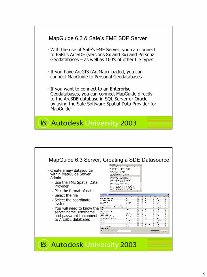
MapGuide 6.3 & Safe’s FME SDP Server
With the use of Safe’s FME Server, you can connect to ESRI’s ArcSDE (versions 8x and 3x) and Personal Geodatabases – as well as 100’s of other file types
If you have ArcGIS (ArcMap) loaded, you can connect MapGuide to Personal Geodatabases
If you want to connect to an Enterprise Geodatabases, you can connect MapGuide directly to the ArcSDE database in SQL Server or Oracle –by using the Safe Software Spatial Data Provider for MapGuide
MapGuide 6.3 Server, Creating a SDE Datasource
Create a new datasource within MapGuide Server Admin• Use the FME Spatial Data
Provider• Pick the format of data• Select the file• Select the coordinate
system• You will need to know the
server name, username and password to connect to ArcSDE databases
10
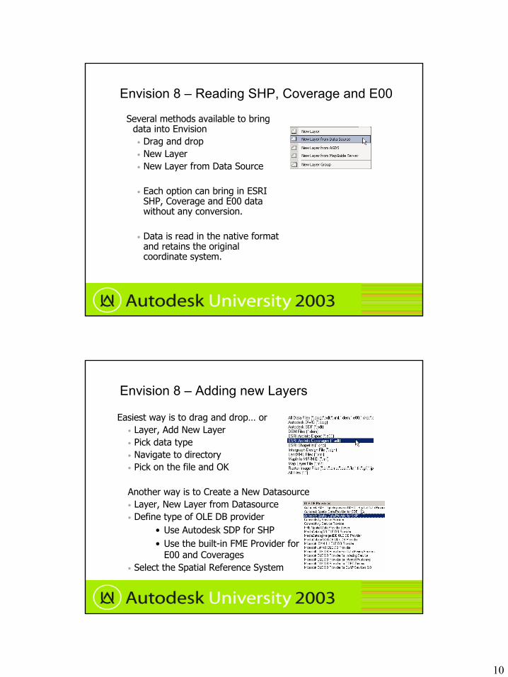
Envision 8 – Reading SHP, Coverage and E00
Several methods available to bring data into Envision• Drag and drop • New Layer• New Layer from Data Source
• Each option can bring in ESRI SHP, Coverage and E00 data without any conversion.
• Data is read in the native format and retains the original coordinate system.
Envision 8 – Adding new Layers
Easiest way is to drag and drop… or• Layer, Add New Layer• Pick data type• Navigate to directory• Pick on the file and OK
Another way is to Create a New Datasource• Layer, New Layer from Datasource• Define type of OLE DB provider
• Use Autodesk SDP for SHP• Use the built-in FME Provider for
E00 and Coverages• Select the Spatial Reference System
11
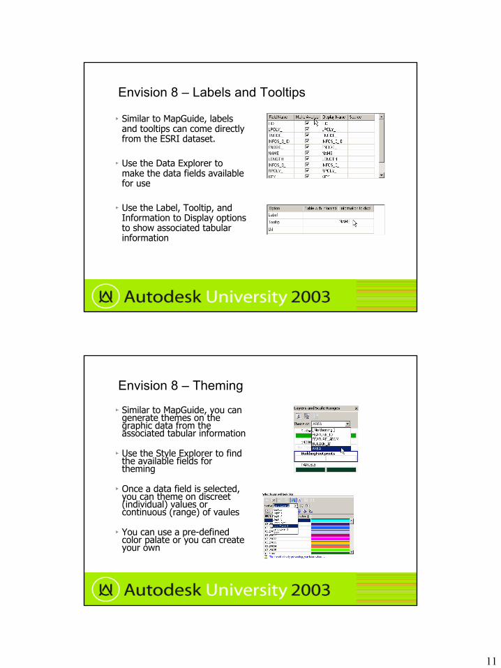
Envision 8 – Labels and Tooltips
Similar to MapGuide, labels and tooltips can come directly from the ESRI dataset.
Use the Data Explorer to make the data fields available for use
Use the Label, Tooltip, and Information to Display options to show associated tabular information
Envision 8 – Theming
Similar to MapGuide, you can generate themes on the graphic data from the associated tabular information
Use the Style Explorer to find the available fields for theming
Once a data field is selected, you can theme on discreet (individual) values or continuous (range) of vaules
You can use a pre-defined color palate or you can create your own
12
Autodesk and Open GIS
MapGuide 6.3 LiteView supports the Open GIS Consortium standards today
You should have received the LiteView Extension if you are on subscription with MapGuide
Some development has been prototyped in Envision 8 with The Open GIS Consortium and the Geospatial One Stop Portal
Oracle 9i interoperability toolkit standard are expected to be adopted by the Open GIS Consortium
Geography Markup Language - Definitions
The Geography Markup Language (GML) is an XML encoding for the transport and storage of geographic information, including both the geometry and properties of geographic features.
OGC`s XML-based language for describing and encoding geospatial information. An application of XML, a specification developed by members of the Open GIS Consortium. GML is an XML encoding for spatial data. In a sense, it is a schema-writing language for spatial information.
See http://www.opengis.org for more info
Autodesk supports GML version 2.1 and Open GIS Consortium (OGC) Web Map Service (WMS) 1.1.1 Implementation Specification for data exchange.

13
Oracle 9i Interoperability Toolkit
Autodesk and several other major vendors are teaming up to develop toolkits for Oracle 9i interoperability
Supports multiple applications (“best tool for the job”)
Increases Productivity
Increases Data Accessibility
Improves Communication between departments
Stronger data security
See www.autodesk.com/isd for more information
Topics Covered:
Integrate CAD and GIS data in Map, MapGuide and Envision• Utilize Coverages, E00, SHP and Geodatabases
Focus on capabilities of:• Inherent features of Autodesk’s GIS Products• Haestad Methods “GISConnect”• Safe Software’s “Feature Manipulation Engine” (FME)
Demonstrate OpenGIS prototype within Envision