Get out your warm-up page…number 1- 8. 1 2 4 3 5 6 7 1 Mexico 2 Guatemala 3 El Salvador 4 Honduras...
30
Get out your Get out your warm-up page… warm-up page… number 1- number 1- 8 8
-
Upload
meagan-lang -
Category
Documents
-
view
213 -
download
0
Transcript of Get out your warm-up page…number 1- 8. 1 2 4 3 5 6 7 1 Mexico 2 Guatemala 3 El Salvador 4 Honduras...

Get out your warm-up Get out your warm-up page…number 1-page…number 1-88

1
2
4
3
5
671 Mexico
2 Guatemala
3 El Salvador
4 Honduras
5 Nicaragua
6 Costa Rica
7 Panama
8
8 Belize

Physical Physical Geography Geography
of Latin of Latin AmericaAmerica

Andes MountainsAndes Mountains
• 7,000 miles long• Longest mountain
range in the world

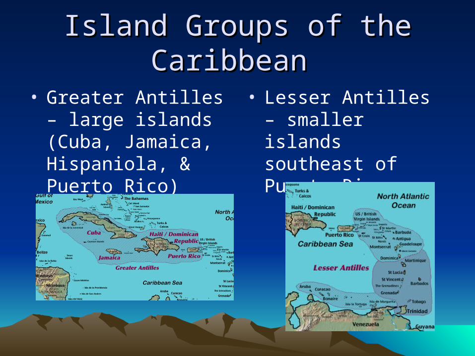
Island Groups of the Island Groups of the CaribbeanCaribbean
• Greater Antilles – large islands (Cuba, Jamaica, Hispaniola, & Puerto Rico)
• Lesser Antilles – smaller islands southeast of Puerto Rico
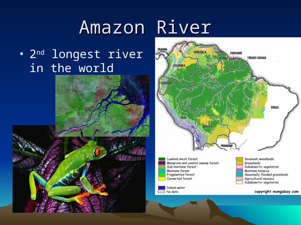
Amazon RiverAmazon River • 2nd longest river in the
world


Tropical ClimatesTropical Climates• Tropical
Rainforest and tropical savanna are the most common climates in Latin America.
• Ex.) The Amazon

Tropical Climates … Tropical Climates … continued …continued …• DeforestationDeforestation = the cutting down
and clearing away of trees in the rain forest


Slash & BurnSlash & Burn •Slash-and-burn farmingSlash-and-burn farming = traditionally used by migrant farmers, they cut down all the plants and strip any trees of bark. After the plants and trees have dried out, they are set on fire, the ash helps the soil, but the soil is only good for 2-3 years, when this happens the farmer moves on and the process repeats itself.


Vertical Climate ZonesVertical Climate Zones• Highland climates
are commonly arranged vertically by altitude into 4 major zones
• climate becomes colder as the elevation increases!!


Question???Question???• Can you travel to the equator and go
scuba diving in the morning and snowboarding in the afternoon?
YES YOU CAN!!!!!!! Because of Vertical Climate Zones

Comparing Climate Regions Comparing Climate Regions Buenos Aires, Argentina
34*S/ 58*W
0
10
20
30
40
50
60
70
80
J F M A M J J A S O N D
Dallas Texas 33*N/ 97*W
0
10
20
30
40
50
60
70
80
90
J F M A M J J A S O N D
What is the major difference you can see from the two climate charts?What is the major difference you can see from the two climate charts?
The two charts are opposite to each other – This is because Dallas is in the Northern Hemisphere and Buenos Aires is in the Southern Hemisphere. Our
winter is their summer, and our summer is their winter.


VegetationVegetation
• The natural vegetation of Latin America varies according to climate and ranges from lush tropical rainforest evergreens to desert cacti.
• canopy = the tops of tall trees that come together to form a dense covering.

Angel Falls Angel Falls ► Eastern VenezuelaEastern Venezuela► World’s tallest World’s tallest
waterfallwaterfall► 3,212ft 3,212ft
The water comes in a free fall of 979 meters !!
Angel Falls is 15 times higher than Niagara Falls!

Colca CanyonColca Canyon Deepest Canyon on the surface of the EarthDeepest Canyon on the surface of the Earth
► twice the depth of the twice the depth of the Grand CanyonGrand Canyon
► in the Andes in Peruin the Andes in Peru► 10,500 feet deep10,500 feet deep
This canyon is reportedly the deepest in the world, thought to be twice as deep as the Grand Canyon in the USA. Unlike most of the Grand Canyon, portions of Colca Canyon are habitable, with pre-Colombian terraced fields still supporting agriculture and human life.

Colca CanyonColca Canyon ……IN THE DEEPEST IN THE DEEPEST
PARTSPARTS……► Accessible only by boatAccessible only by boat► One of the worlds great One of the worlds great
natural challenges – natural challenges – the 1the 1stst expedition was expedition was in 1981. in 1981.
► Rafters have to Rafters have to navigate extreme navigate extreme white-waterwhite-water
► A breakneck plunge of A breakneck plunge of the river drops 3,000 the river drops 3,000 feet over 50 milesfeet over 50 miles
► So dangerous this So dangerous this canyon has only been canyon has only been seen by a handful of seen by a handful of people. people.

Iguacu Falls, BrazilIguacu Falls, Brazil► Has 270 waterfallsHas 270 waterfalls► the border between the border between
Brazil and ArgentinaBrazil and Argentina► Garganta del DiabloGarganta del Diablo
(Devil’s Throat) – a U (Devil’s Throat) – a U shaped 490 by 2300 shaped 490 by 2300 foot clifffoot cliff

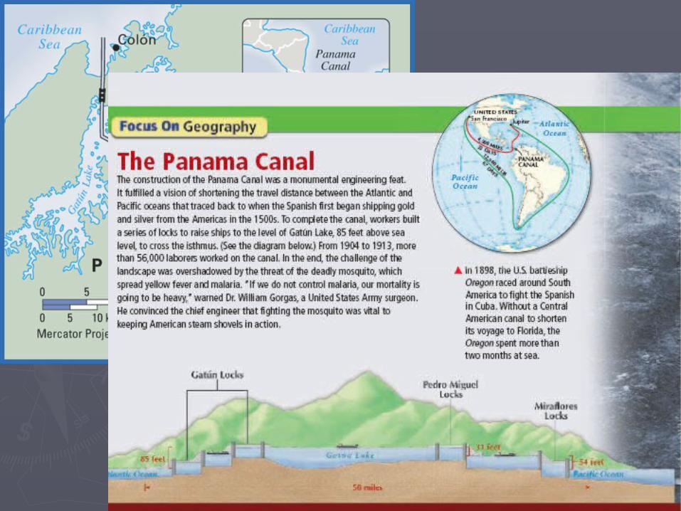
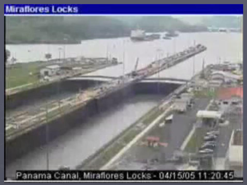
Panama Canal Panama Canal ► Canal system that splits the Canal system that splits the
country of Panama in half, country of Panama in half, allowing boat traffic to pass allowing boat traffic to pass through the isthmus of through the isthmus of Panama and not have to go Panama and not have to go all the way around South all the way around South America to have access America to have access between the Atlantic and between the Atlantic and Pacific oceans. Pacific oceans.

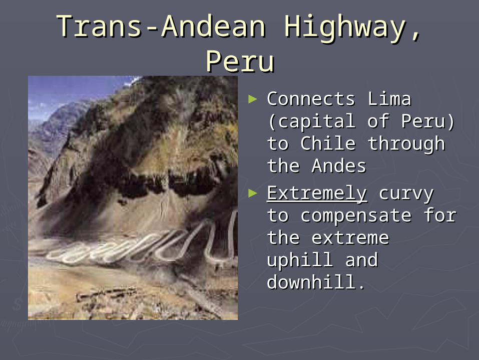
Trans-Andean Highway, PeruTrans-Andean Highway, Peru
► Connects Lima Connects Lima (capital of Peru) to (capital of Peru) to Chile through the Chile through the AndesAndes
► ExtremelyExtremely curvy to curvy to compensate for the compensate for the extreme uphill and extreme uphill and downhill. downhill.