Geospatial Data Abstraction Library(GDAL)-Utilities
31
Geospatial Data Abstraction Library(GDAL) Sabya Sachi
-
Upload
sabya-sachi-9715 -
Category
Documents
-
view
187 -
download
2
Transcript of Geospatial Data Abstraction Library(GDAL)-Utilities
Geospatial Data Abstraction Library(GDAL)
Sabya Sachi

Agenda
•Geospatial data•Introduction to GDAL•GDAL command line utilities

What is geospatial data?
•Data or information identifying the geographic location of features and boundaries on Earth
•Accessed, manipulated and analysed by Geographic Information System
•Two types: ▫Raster and Vector

•Raster data▫Contains rows and columns of data
cells(pixels)▫Each pixel stores a single
value consisting of colour and some additional information
▫Stored in various formats- from tif and jpeg to BLOB as in RDBMS

•Vector data▫Geographical features expressed as vectors▫Coordinates, points, lines, arcs and
polygons▫Geometries linked to database describing
the attributes▫Can be made to respect spatial attributes

Introduction to GDAL
A open source library for reading and writing raster geospatial data formats
Includes OGR library in its source tree which supports vector formats
Has various command line utilities for data translation and processing
Supports over 50 Raster formats Primarily developed by Frank Warmerdam
until version 1.3.2 when maintainership was transferred to GDAL/OGR Project management committee under Open Source geo spatial foundation

•Crossplatform- supported on Linux, Windows, Mac
•Supports various softwares to read and write multiple data formats▫Google Earth▫Delta GIS▫GRASS GIS▫Orfeo Toolbox▫……….
•Has all command line utilities compiled by Frank Warmerdam into a single software FWTools

GDAL Utility programs
22 utilities gdalinfo: report information about a file gdal_translate: Copy a raster file with control
of output format gdaladdo: Add overview to a file gdalwarp: Warp an image into new coordinate
system gdaltindex: Build a mapserver raster tile index gdalbuildvrt: Build a VRT from a list of
datasets
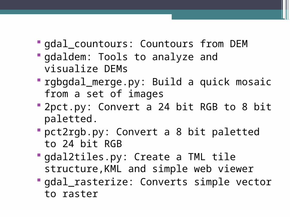
gdal_countours: Countours from DEM gdaldem: Tools to analyze and visualize
DEMs rgbgdal_merge.py: Build a quick mosaic
from a set of images 2pct.py: Convert a 24 bit RGB to 8 bit
paletted. pct2rgb.py: Convert a 8 bit paletted to 24
bit RGB gdal2tiles.py: Create a TML tile
structure,KML and simple web viewer gdal_rasterize: Converts simple vector to
raster

gdaltransform: Transform coordinates nearblack: Convert nearly black/white
border to exact value gdal_retile.py: Retiles a set of tiles or
build tiled pyramid levels gdal_grid: Create raster from scatter data gdal_proximity.py: Compute a raster
proximity map gdal_polygonize.py: Generate polygons
from raster gdal_sieve.py: Raster sieve filter gdal_fillnodata.py: Interpolate in non data
regions gdal-config:Get options required to build
software using GDAL

gdalinfo
•Lists various information about GDAL supported dataset
•Eg. Format driver, raster size, coordinate system, band data types, band min/max values, descriptions, nodata value etc…
•Syntax:

•An example output

gdal_translate• Converts data from one format into another• Can also perform rescaling and resampling• Syntax:

gdaladdo
•Build or rebuild overview images for most of the raster data formats
•Supports multiple resampling algorithms including nearest resampling cubic resampling etc.
•Syntax:

gdalwarp
•A utility for image mosaicing, reprojection and warping
•Mosiacing: Correcting geometric deformations
•Warping: Mapping a point to another in an mage without changing the data value at that point, results in distortion sometimes, aids in mosaicing.

•Syntax:
•Supports image mosaicing only if there is existing output image
•Doesn’t adjust existing output image spatial extent

gdaltindex
•Builds a shapefile with a record for each input raster file
•Shapefile: Contain nontopological geometry and attribute information for the spatial features in a data set.
•If a shapefile already exists, new data is appended to it.
•Used with mapserver

•Syntax:

gdaldem
•Used for analyzing and visualizing DEMs- Digital Elevation models
•Has seven modes of operation:▫Hillshade▫Slope▫Aspect▫Color relief▫TRI(Terrain Ruggedness Index)▫TPI(Topographic Position Index)▫Roughness

•Example: Original
dem image
100% 255 255 255 75% 235 220 175 50% 190 185 135 25% 240 250 150 0% 50 180 50

gdaldem color-relief clip.tif ramp.txt colored.tif
Coloured relief raster

gdaldem slope clip slope.tif -s 111120
Slope map

gdaldem aspect clip.tif aspect.tif
Aspect map

gdaldem hillshade clip.tif hillshade.tif -z 5 -s 111120
Hillshade- colour relief

gdal_merge
•A python utility•Automatically mosaic a set of images into
a single one•Images must be in same coordinate
system •Images have must have matching raster
bands•Resolution can be different•Can overlap

•Syntax:

•Example :
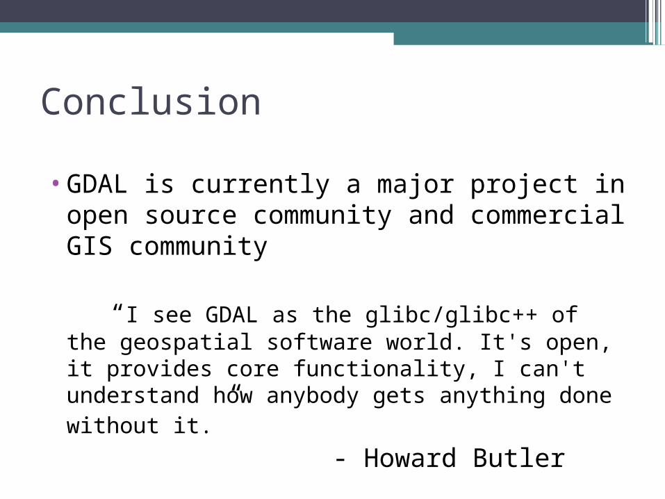
Conclusion
•GDAL is currently a major project in open source community and commercial GIS community
“I see GDAL as the glibc/glibc++ of the geospatial software world. It's open, it provides core functionality, I can't understand how anybody gets anything done without it.”
- Howard Butler
References
•http://en.wikipedia.org/wiki/Geoinformation
•http://www.webopedia.com/TERM/S/spatial_data.html
•http://en.wikipedia.org/wiki/Geographic_information_system
•http://www.geom.unimelb.edu.au/gisweb/GISModule/GIST_Vector.htm
•http://www.geom.unimelb.edu.au/gisweb/GISModule/GIST_Raster.htm
•http://www.gdal.org/gdal_utilities.html•http://en.wikipedia.org/wiki/GDAL•http://trac.osgeo.org/gdal/wiki/
UserDocs/RasterProcTutorial•http://www.gdal.org/ogr/
osr_tutorial.html•http://en.wikipedia.org/wiki/
Digital_elevation_model•http://research.dmsolutions.ca/?p=350

THANK YOU


![Reading Raster Data with GDAL - Utah State Universitychrisg/python/2009/lectures/ospy_slides4.pdf · Reading Raster Data with GDAL OS Python week 4: Reading raster data [1] Open Source](https://static.fdocuments.in/doc/165x107/5ed37959f9364d4fb52578d1/reading-raster-data-with-gdal-utah-state-chrisgpython2009lecturesospyslides4pdf.jpg)