Geology 229 Engineering Geology Lecture 13 - A college of ...lanbo/G229Lect112Physiography.pdf ·...
37
Geology 229 Engineering Geology Lecture 13 Physiographic Provinces (West, Ch. 13)
-
Upload
truongdung -
Category
Documents
-
view
226 -
download
6
Transcript of Geology 229 Engineering Geology Lecture 13 - A college of ...lanbo/G229Lect112Physiography.pdf ·...
Geology 229Engineering Geology
Lecture 13
Physiographic Provinces
(West, Ch. 13)
The definition of the term Physiography
Physiography (n.) The science which treats of the earth's exterior physical features, climate, life, etc., and of the physical movements or changes on the earth's surface, as the currents of the atmosphere and ocean, the secular variations in heat, moisture, magnetism, etc.; physical geography.
Source: OPTED v0.03 of Webster's Dictionary
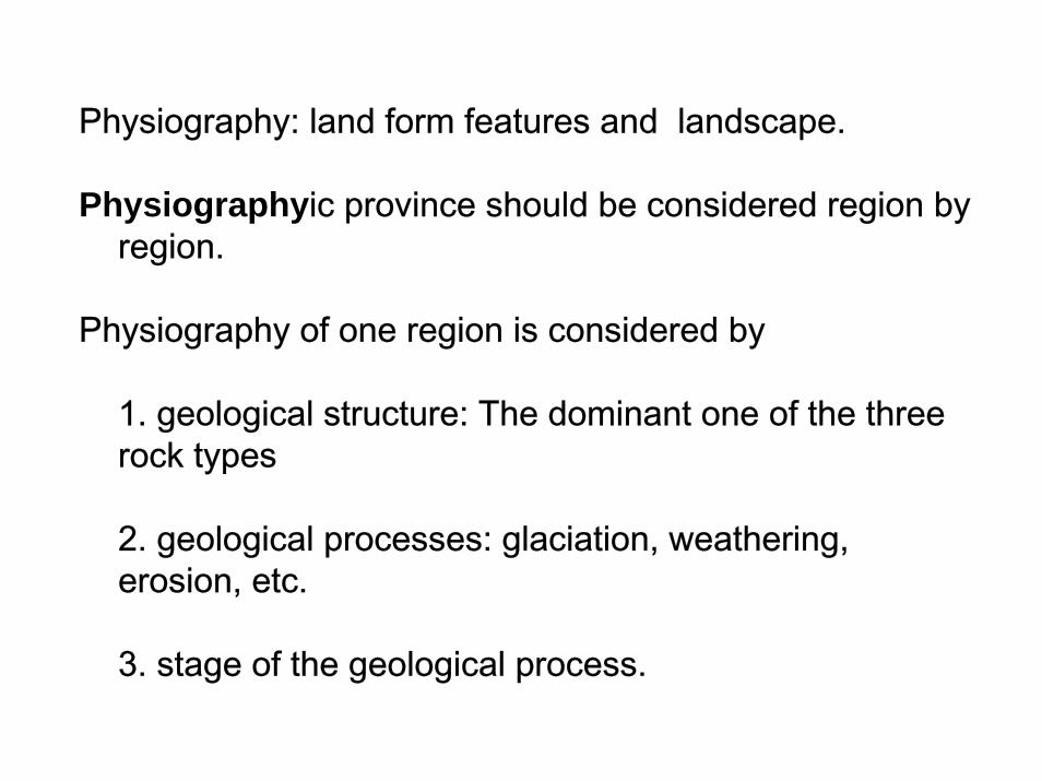
Physiography: land form features and landscape.
Physiographyic province should be considered region by region.
Physiography of one region is considered by
1. geological structure: The dominant one of the three rock types
2. geological processes: glaciation, weathering, erosion, etc.
3. stage of the geological process.
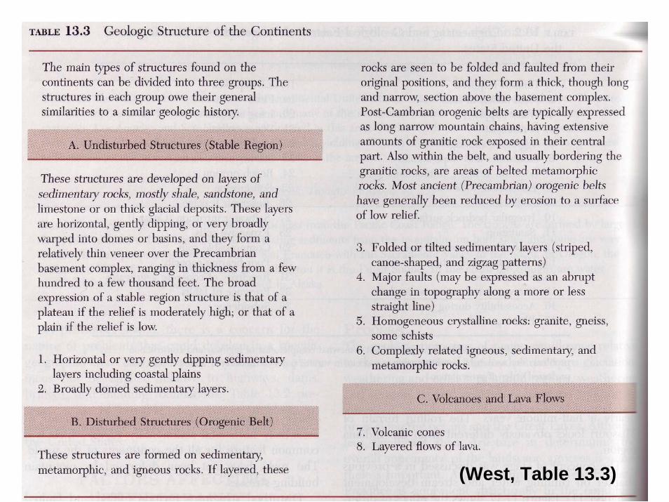
(West, Table 13.3)
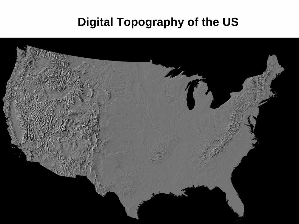
Digital Topography of the US
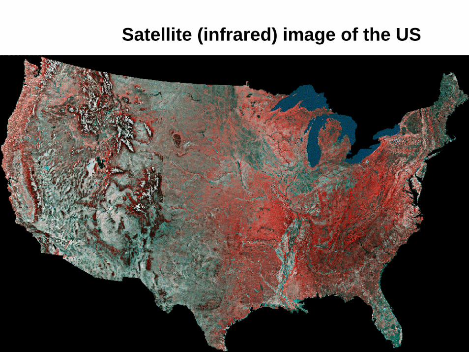
Satellite (infrared) image of the US
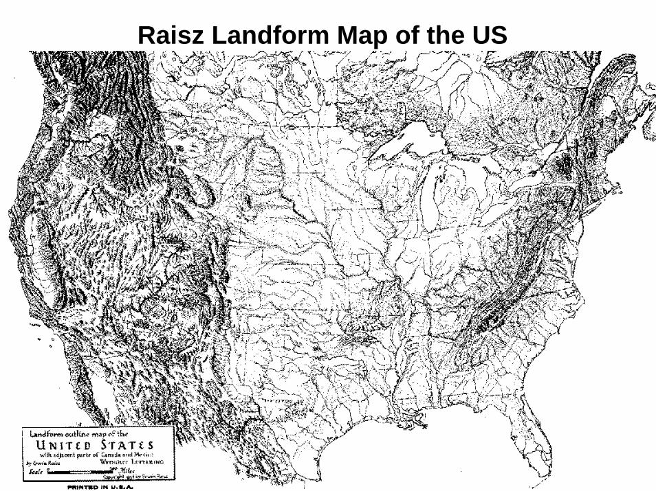
Raisz Landform Map of the US
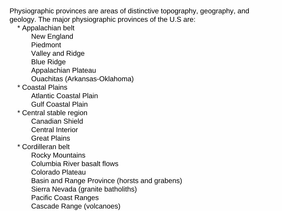
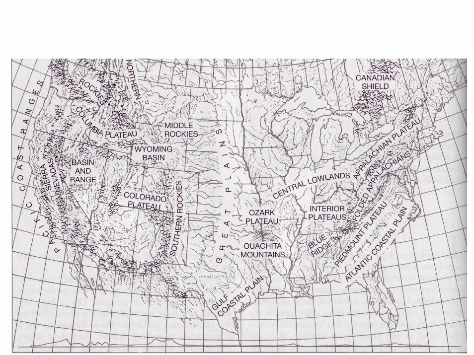
Physiographic provinces are areas of distinctive topography, geography, and geology. The major physiographic provinces of the U.S are:
* Appalachian beltNew EnglandPiedmontValley and RidgeBlue RidgeAppalachian PlateauOuachitas (Arkansas-Oklahoma)
* Coastal PlainsAtlantic Coastal PlainGulf Coastal Plain
* Central stable regionCanadian ShieldCentral InteriorGreat Plains
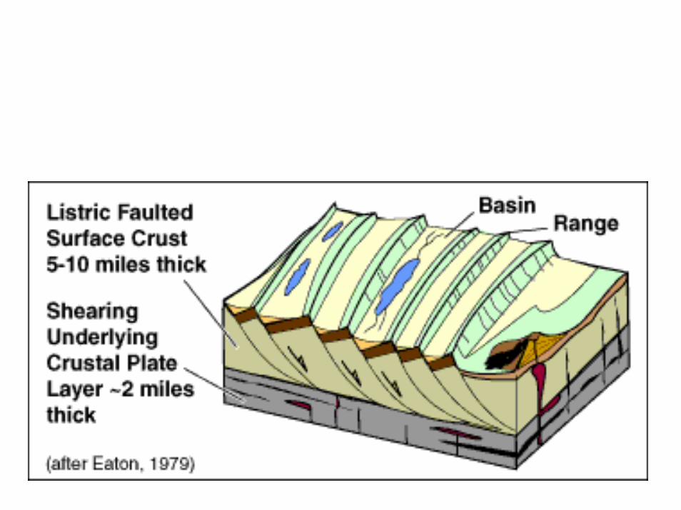
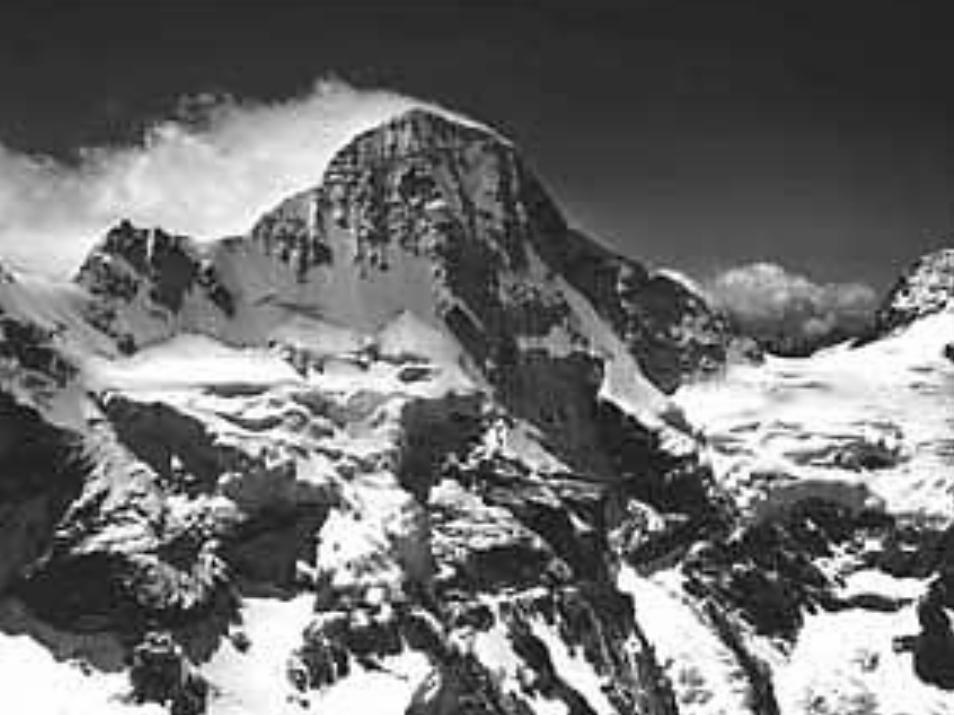
* Cordilleran beltRocky MountainsColumbia River basalt flowsColorado PlateauBasin and Range Province (horsts and grabens)Sierra Nevada (granite batholiths)Pacific Coast RangesCascade Range (volcanoes)
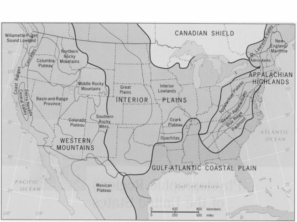
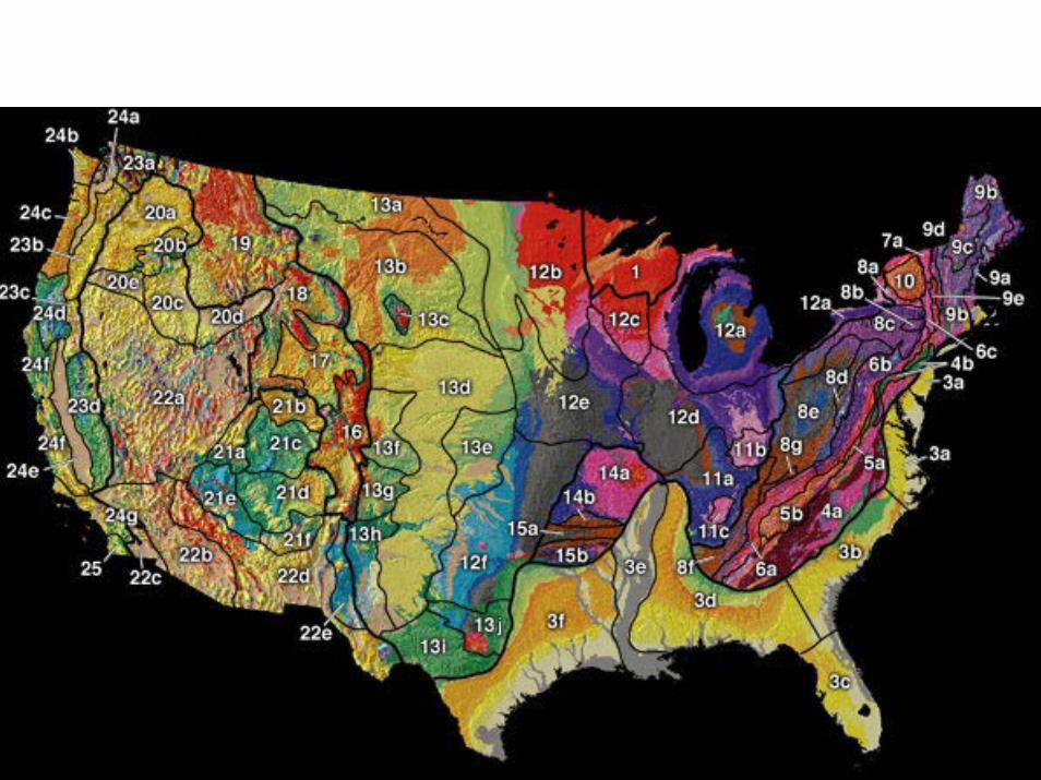
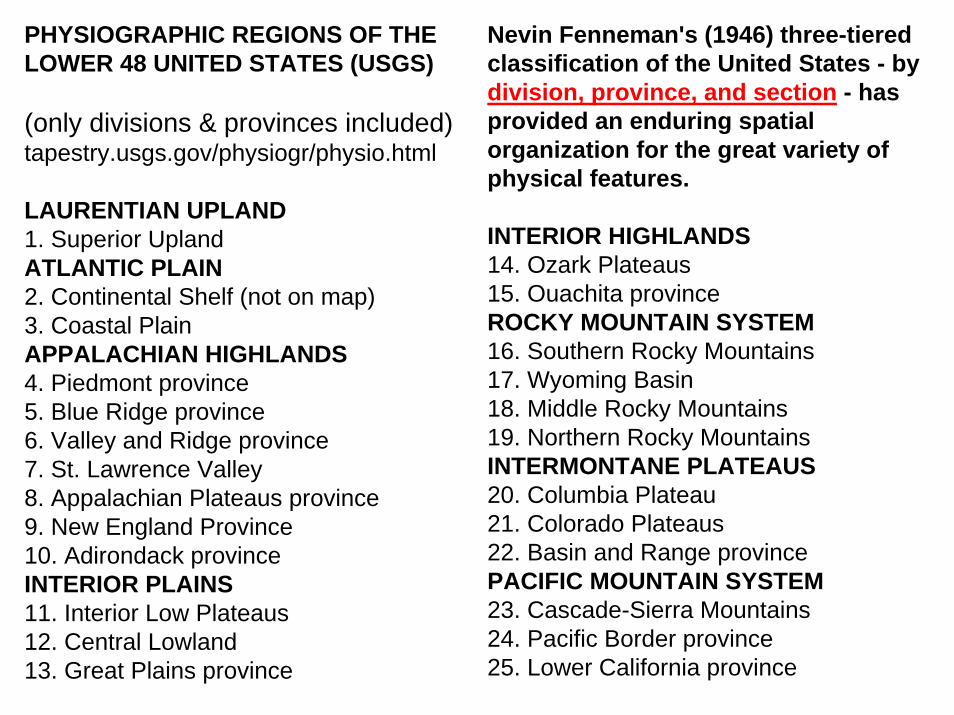
PHYSIOGRAPHIC REGIONS OF THE LOWER 48 UNITED STATES (USGS)
(only divisions & provinces included)tapestry.usgs.gov/physiogr/physio.html
LAURENTIAN UPLAND1. Superior Upland ATLANTIC PLAIN2. Continental Shelf (not on map) 3. Coastal Plain APPALACHIAN HIGHLANDS4. Piedmont province 5. Blue Ridge province 6. Valley and Ridge province 7. St. Lawrence Valley 8. Appalachian Plateaus province 9. New England Province 10. Adirondack province INTERIOR PLAINS11. Interior Low Plateaus 12. Central Lowland 13. Great Plains province
Nevin Fenneman's (1946) three-tiered classification of the United States - by division, province, and section - has provided an enduring spatial organization for the great variety of physical features.
INTERIOR HIGHLANDS14. Ozark Plateaus 15. Ouachita province ROCKY MOUNTAIN SYSTEM16. Southern Rocky Mountains 17. Wyoming Basin 18. Middle Rocky Mountains 19. Northern Rocky Mountains INTERMONTANE PLATEAUS20. Columbia Plateau 21. Colorado Plateaus 22. Basin and Range province PACIFIC MOUNTAIN SYSTEM23. Cascade-Sierra Mountains 24. Pacific Border province 25. Lower California province
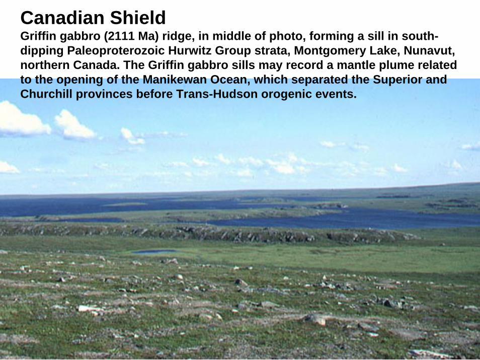
Canadian ShieldGriffin gabbro (2111 Ma) ridge, in middle of photo, forming a sill in south-dipping Paleoproterozoic Hurwitz Group strata, Montgomery Lake, Nunavut, northern Canada. The Griffin gabbro sills may record a mantle plume related to the opening of the Manikewan Ocean, which separated the Superior and Churchill provinces before Trans-Hudson orogenic events.
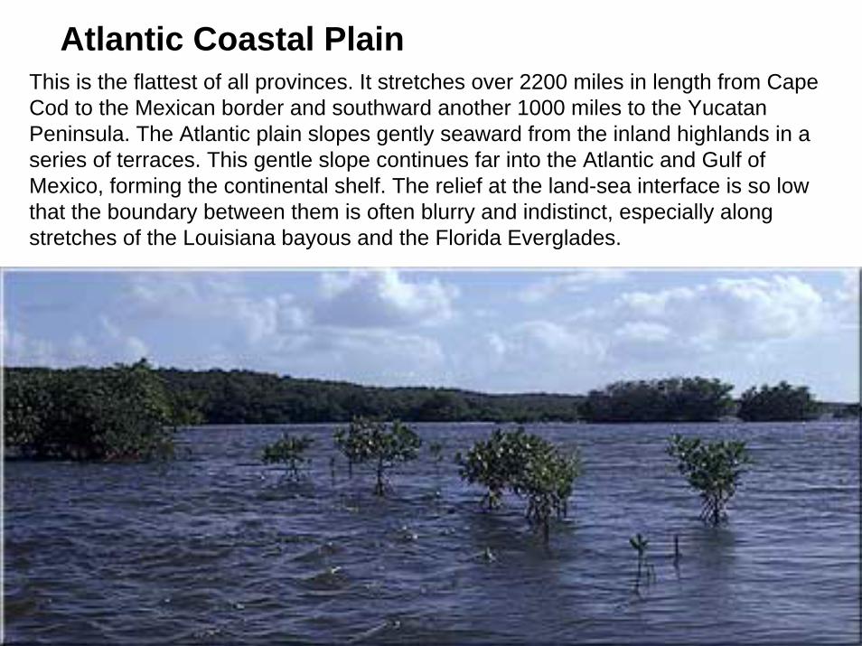
Atlantic Coastal PlainThis is the flattest of all provinces. It stretches over 2200 miles in length from Cape Cod to the Mexican border and southward another 1000 miles to the Yucatan Peninsula. The Atlantic plain slopes gently seaward from the inland highlands in a series of terraces. This gentle slope continues far into the Atlantic and Gulf of Mexico, forming the continental shelf. The relief at the land-sea interface is so low that the boundary between them is often blurry and indistinct, especially along stretches of the Louisiana bayous and the Florida Everglades.
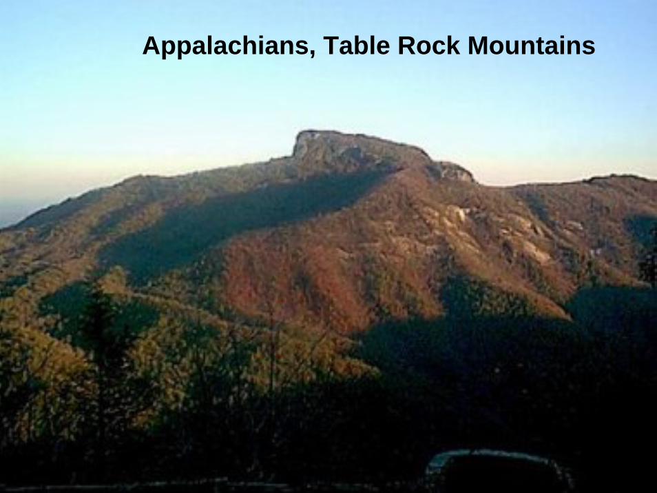
Appalachians, Table Rock Mountains
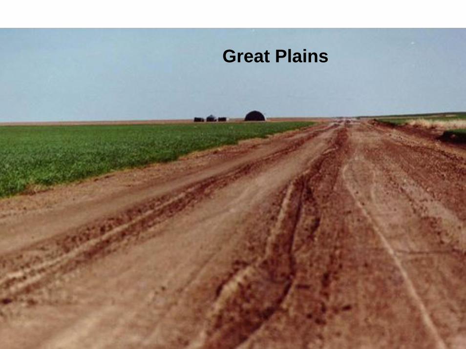
Great Plains
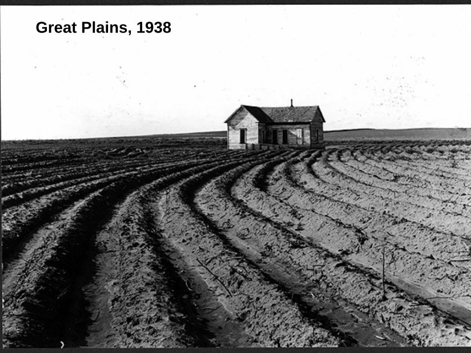
Great Plains, 1938
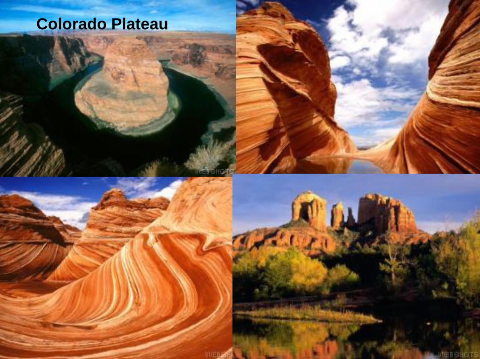
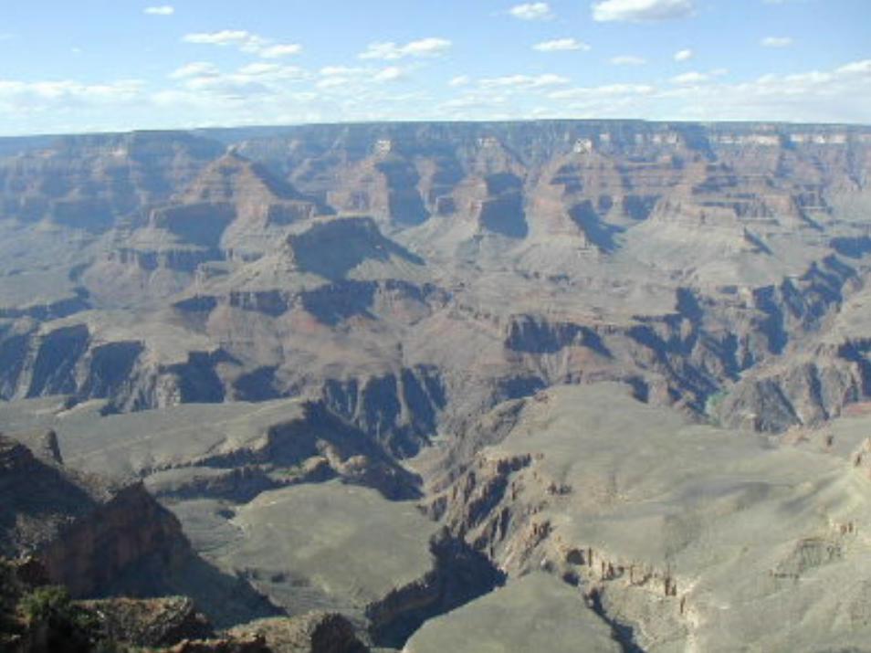
Colorado Plateau

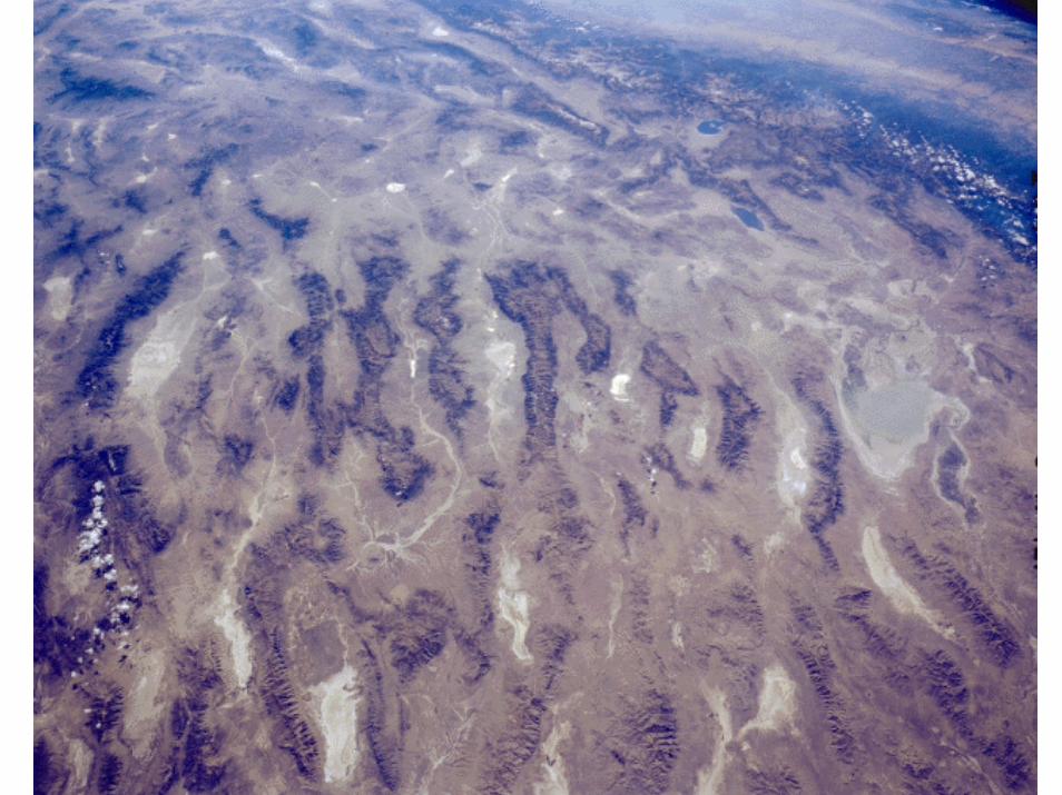
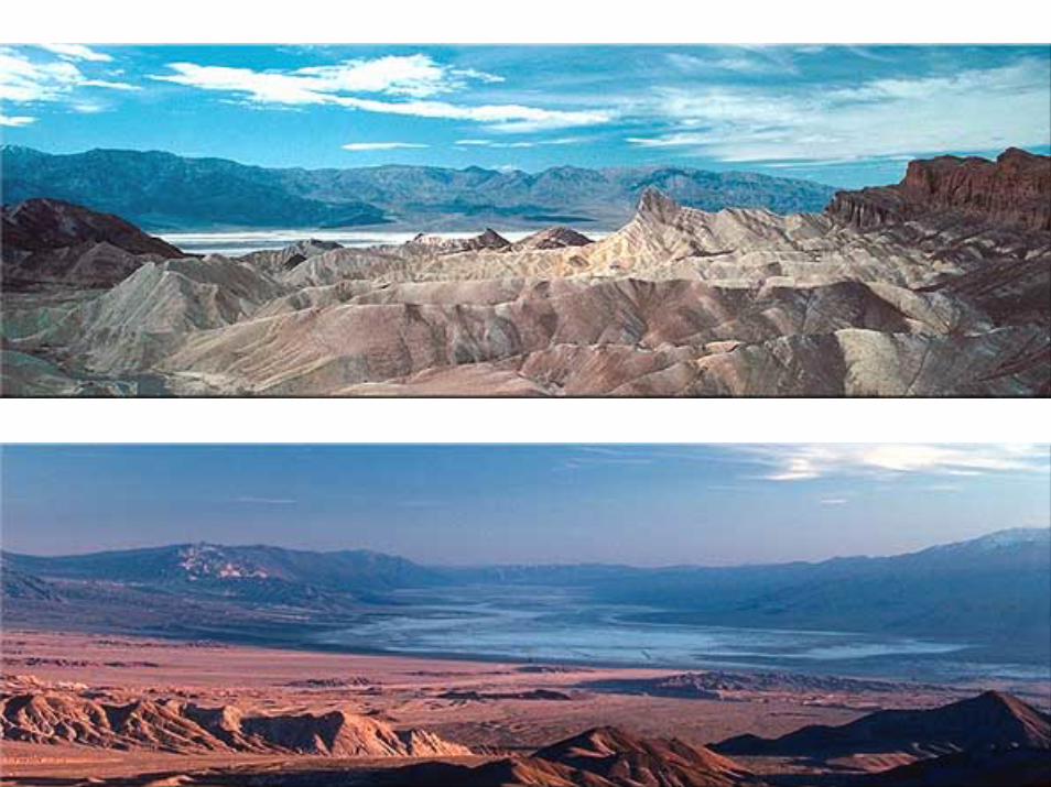
Basin and Range Province, Nevada, U.S.A. October 1984 Part of the intermontane basin region of central Nevada, known as the basin and range area, is featured in this panoramic, southwest-looking photograph. Apparent are long, dark, roughly parallel mountains spanning the center of the photograph, extending from the Stillwater Range immediately east of Carson Sink (near the middle right edge of the photograph) to Grant Range (near the left edge of the photograph). Interior drainage is a dominant feature of this landscape. The white features visible in most of the valleys are dry lakes (playas), typical of which is Alkali Flats, a highly reflective, salt-encrusted dry lake, southwest of which are Walker Lake (Nevada) and Mono Lake (California). Parts of the Sierra Nevada Mountains and San Joaquin Valley in California are visible at the top right of the photograph.
(Photo credit: NASA)
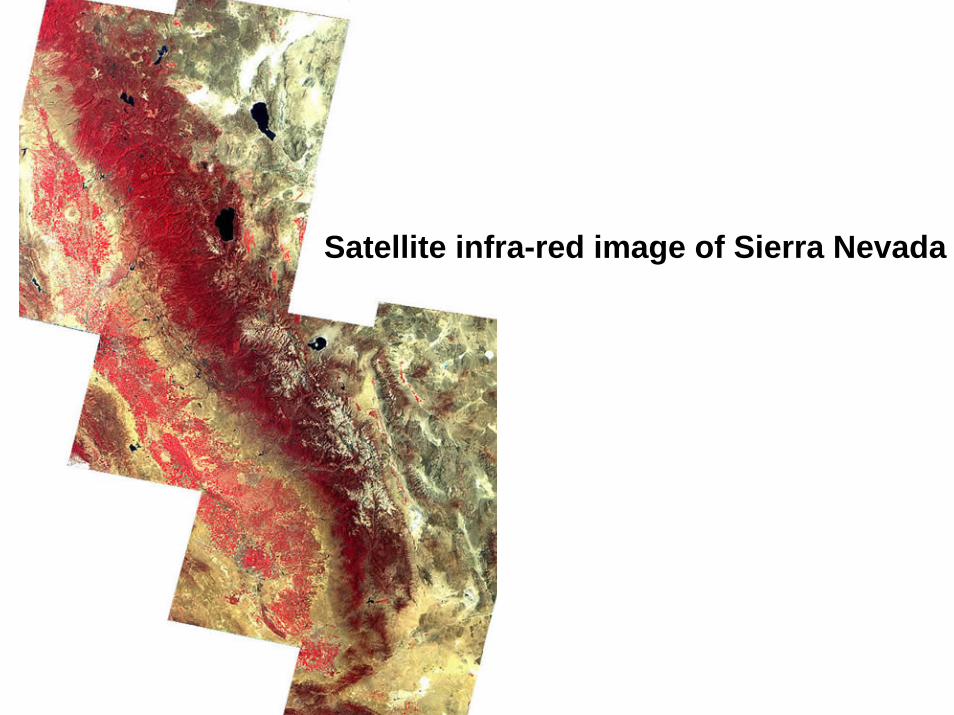
Satellite infra-red image of Sierra Nevada
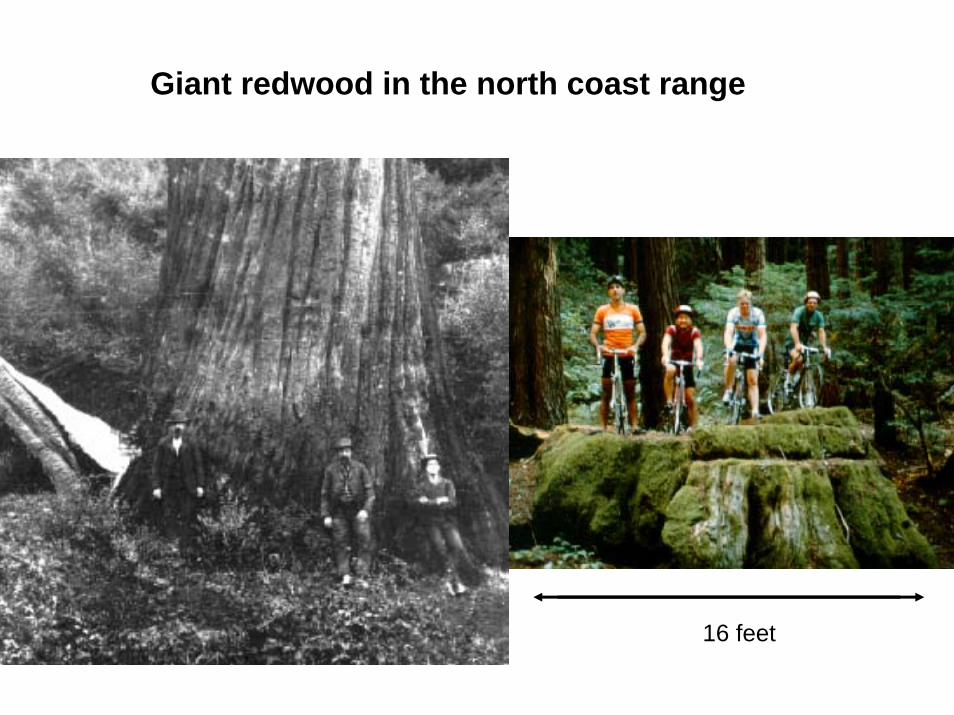
Giant redwood in the north coast range
16 feet

Yukon River, Alaska
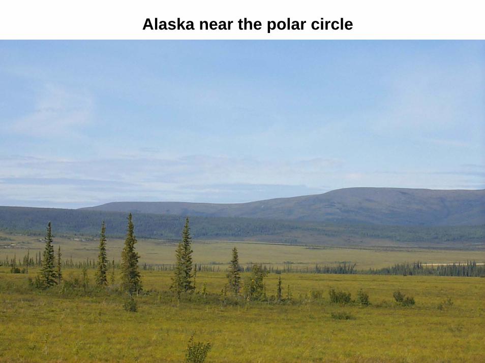
Alaska near the polar circle
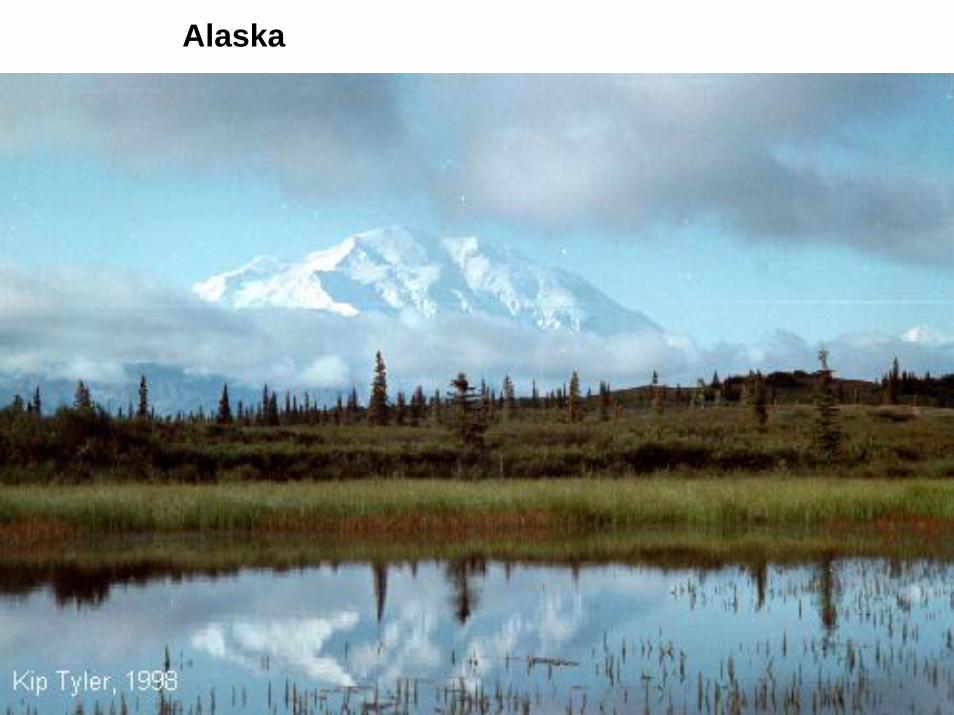
Alaska
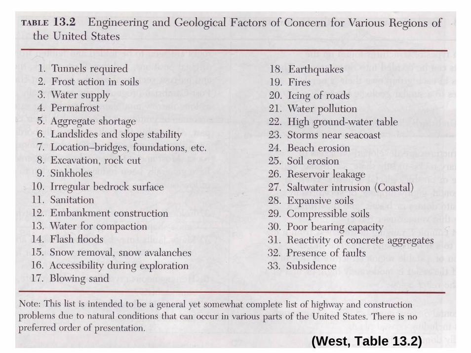
(West, Table 13.2)
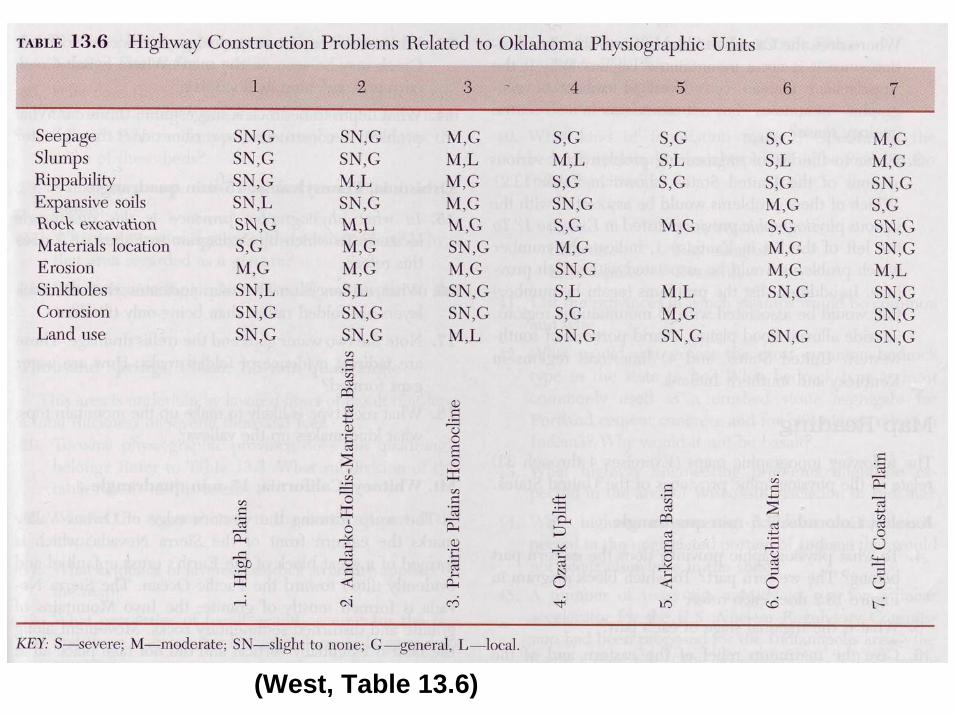
(West, Table 13.6)
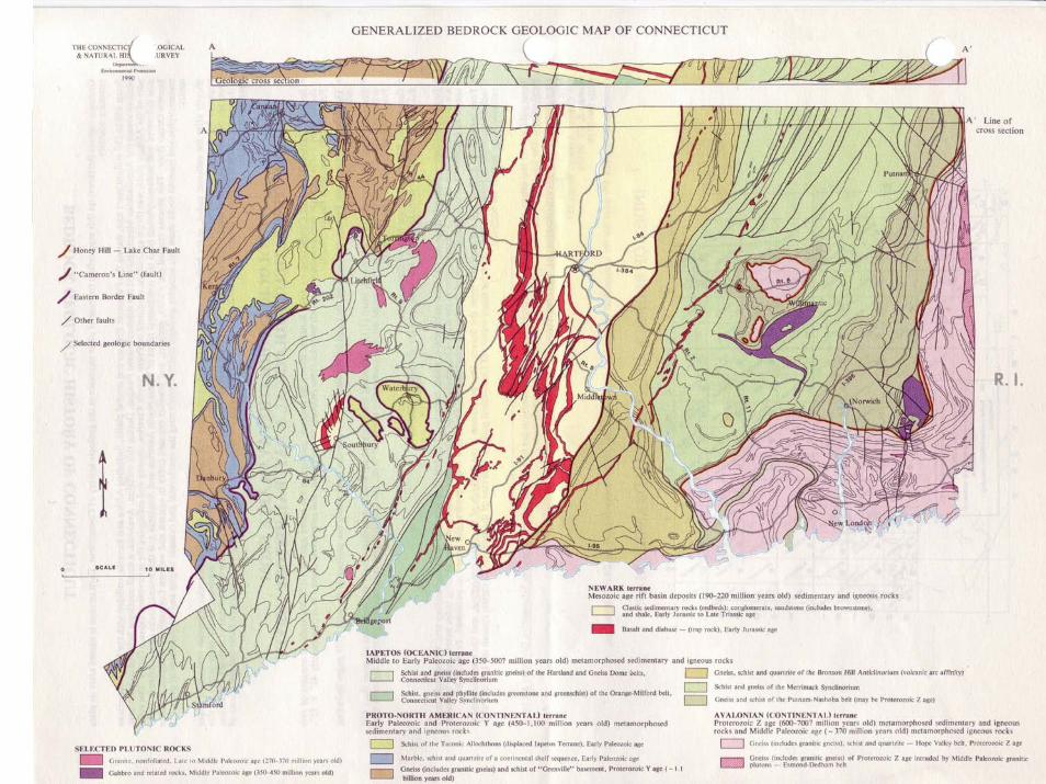
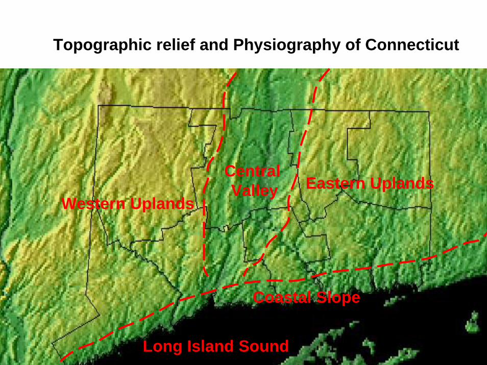
Topographic relief and Physiography of Connecticut
Western Uplands
Coastal Slope
Eastern Uplands
Long Island Sound
Central Valley
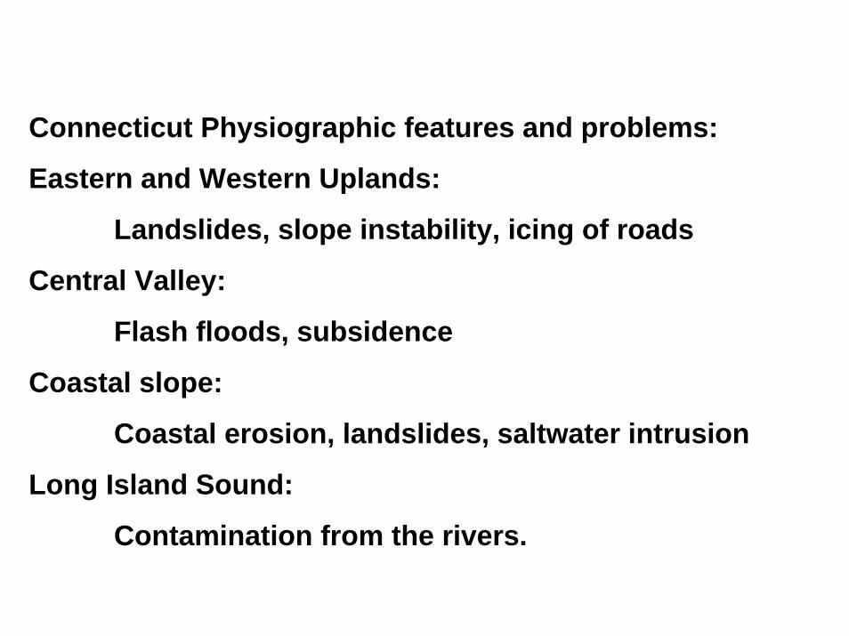
Connecticut Physiographic features and problems:
Eastern and Western Uplands:
Landslides, slope instability, icing of roads
Central Valley:
Flash floods, subsidence
Coastal slope:
Coastal erosion, landslides, saltwater intrusion
Long Island Sound:
Contamination from the rivers.