
Geological Mapping Training in Virtual Environment
17
Geological Mapping In A Virtual World Jacqui Houghton 1 , Annabeth Robinson 2 , Clare Gordon 1 , Geoff Lloyd 1 and Dan Morgan 1 . 1 University of Leeds, 2 Leeds College of Arts.
-
Upload
annabeth-robinson -
Category
Education
-
view
1.300 -
download
3
Transcript of Geological Mapping Training in Virtual Environment

Geological Mapping
In A Virtual World
Jacqui Houghton1, Annabeth Robinson2,
Clare Gordon1, Geoff Lloyd1 and Dan Morgan1.1 University of Leeds, 2 Leeds College of Arts.

Geological Mapping in a Virtual World
Update of a web-based mapping
project, from an original paper
exercise on the Moine thrust
geology of NW Scotland.
Then we discovered Unity and
instead we created…
A virtual field work environment
which allows training in, and
reinforcement of, mapping skills
in the class room.
Project consists of three parts:
• Programming – Annabeth
• Geology – Jacqui, Geoff, Dan
• Cartography – Clare
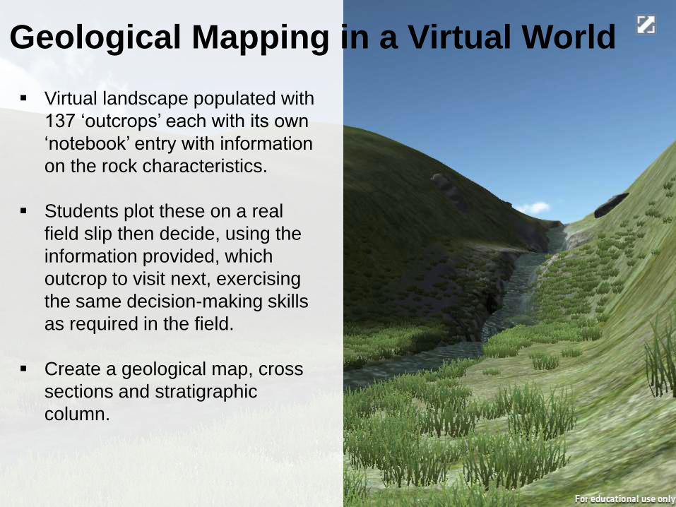
Virtual landscape populated with
137 ‘outcrops’ each with its own
‘notebook’ entry with information
on the rock characteristics.
Students plot these on a real
field slip then decide, using the
information provided, which
outcrop to visit next, exercising
the same decision-making skills
as required in the field.
Create a geological map, cross
sections and stratigraphic
column.
Geological Mapping in a Virtual World
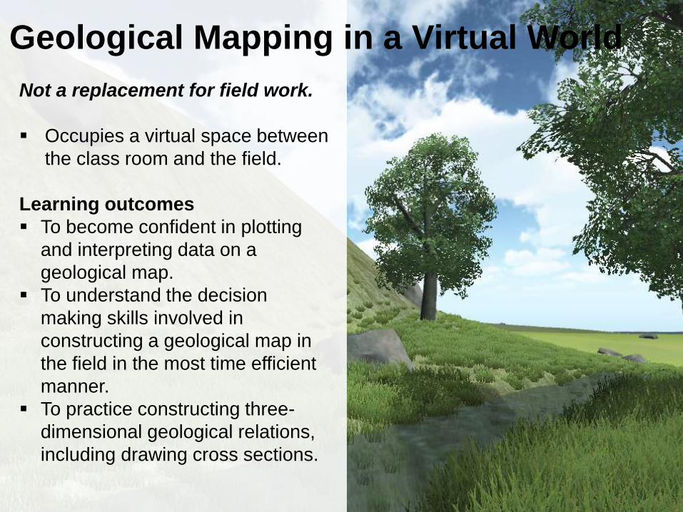
Not a replacement for field work.
Occupies a virtual space between
the class room and the field.
Learning outcomes
To become confident in plotting
and interpreting data on a
geological map.
To understand the decision
making skills involved in
constructing a geological map in
the field in the most time efficient
manner.
To practice constructing three-
dimensional geological relations,
including drawing cross sections.
Geological Mapping in a Virtual World

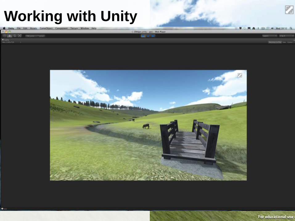
Current opening page
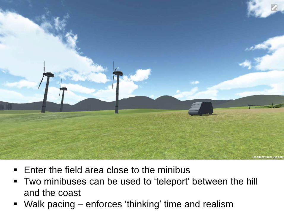
Enter the field area close to the minibus
Two minibuses can be used to ‘teleport’ between the hill
and the coast
Walk pacing – enforces ‘thinking’ time and realism
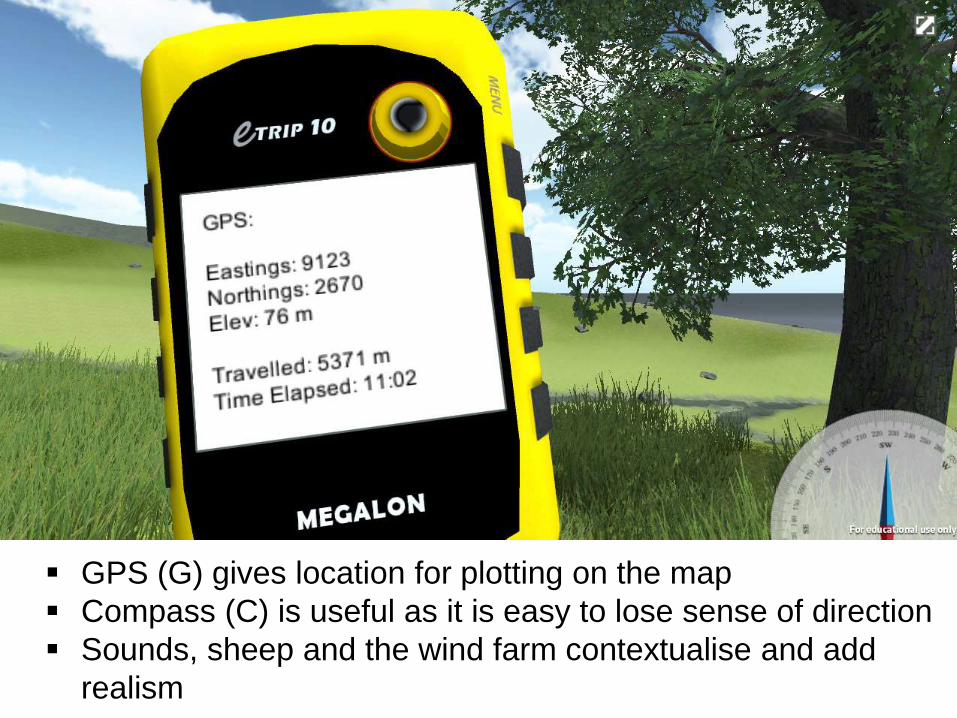
GPS (G) gives location for plotting on the map
Compass (C) is useful as it is easy to lose sense of direction
Sounds, sheep and the wind farm contextualise and add
realism

Once close to the outcrop a click brings up the notebook
Notebook: Details of the rock, fossils and structure
Measurements then plotted on the field slip and used to
make decision where to go next
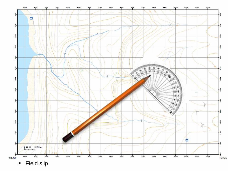
Field slip

Run in a two hour practical slot
as part of a maps course.
About 50 second year students,
who had already been on the
mapping training field trip to
Assynt.
Asked to do a northern transect,
produce a map and cross
section.
Initial response was a lot more
enthusiastic than we expected
for the gaming generation!
“I’m enjoying this way more than
is natural…”
The Test Run
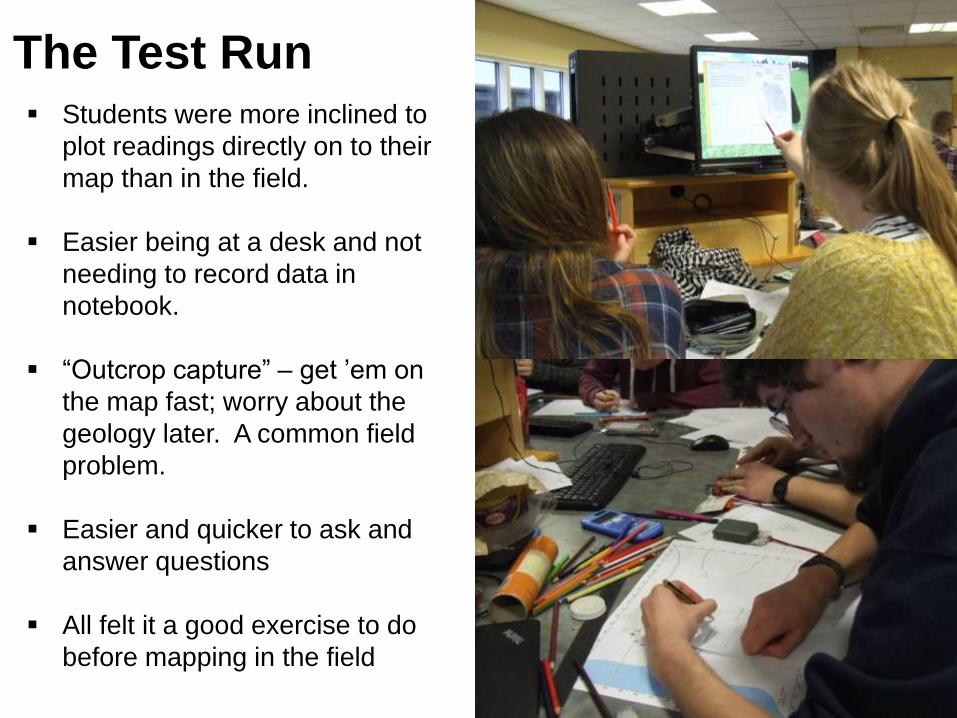
Students were more inclined to
plot readings directly on to their
map than in the field.
Easier being at a desk and not
needing to record data in
notebook.
“Outcrop capture” – get ’em on
the map fast; worry about the
geology later. A common field
problem.
Easier and quicker to ask and
answer questions
All felt it a good exercise to do
before mapping in the field
The Test Run
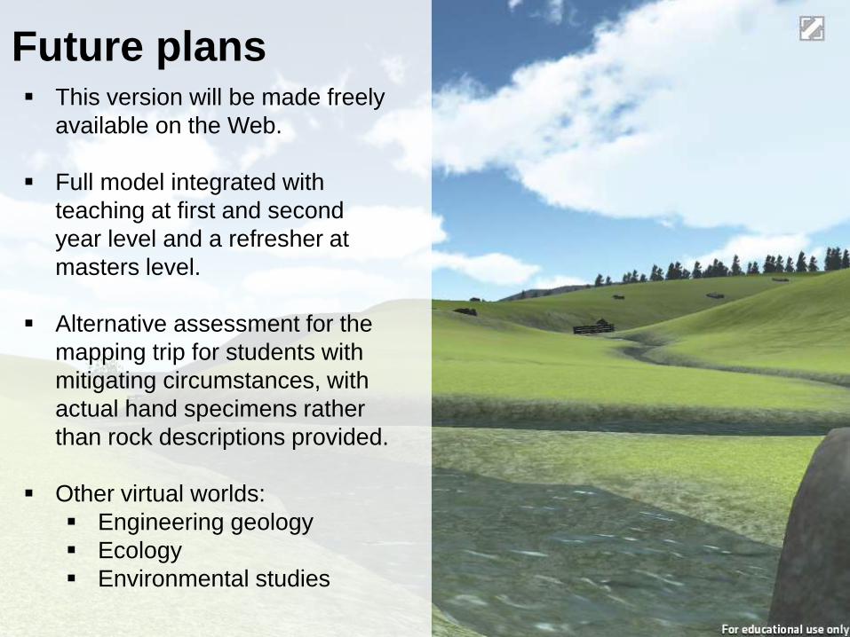
Future plans This version will be made freely
available on the Web.
Full model integrated with
teaching at first and second
year level and a refresher at
masters level.
Alternative assessment for the
mapping trip for students with
mitigating circumstances, with
actual hand specimens rather
than rock descriptions provided.
Other virtual worlds:
Engineering geology
Ecology
Environmental studies
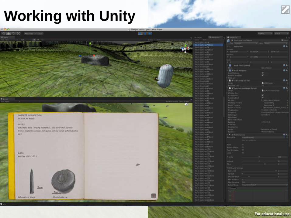
Working with Unity
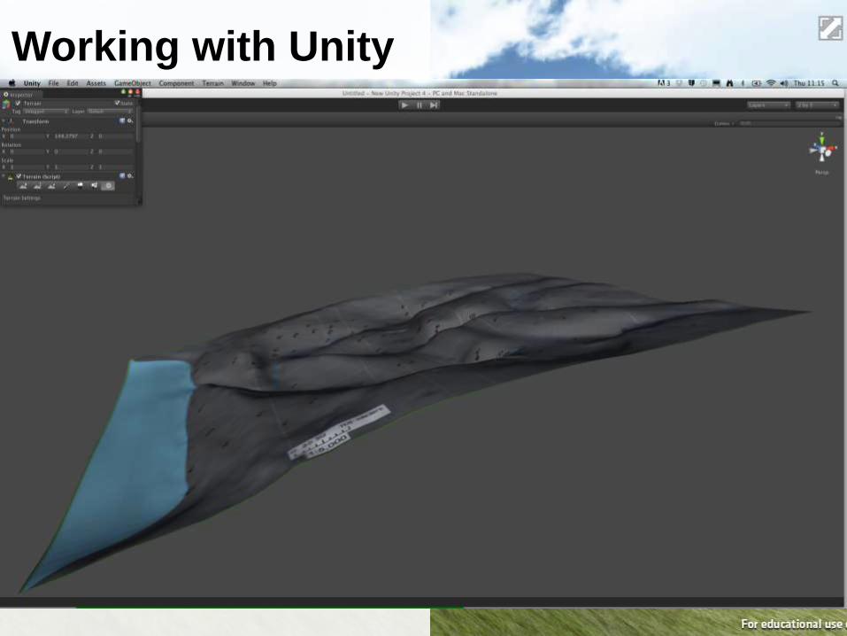
Working with Unity

Working with Unity
Working with Unity