Geologic Overview of Southern California Coastal Areas
56
Geologic Overview of Southern California Coastal Areas Continental Margin Coastal & Offshore Faulting Geology of Offshore Islands Orange County Coastal Geology Sediment & Sedimentary Rock Long Shore Currents and Coastal Cells Depositional vs. Erosional Coastlines Geology of San Onofre Landslide and tsunami hazards Geology of Dana Point area Mark Bordelon Irvine Valley College March 2012
Transcript of Geologic Overview of Southern California Coastal Areas
Geologic Overview of Southern California Coastal Areas
Continental Margin
Coastal & Offshore Faulting
Geology of Offshore Islands
Orange County Coastal Geology
Sediment & Sedimentary Rock
Long Shore Currents and Coastal Cells
Depositional vs. Erosional Coastlines
Geology of San Onofre
Landslide and tsunami hazards
Geology of Dana Point area
Mark Bordelon Irvine Valley College March 2012
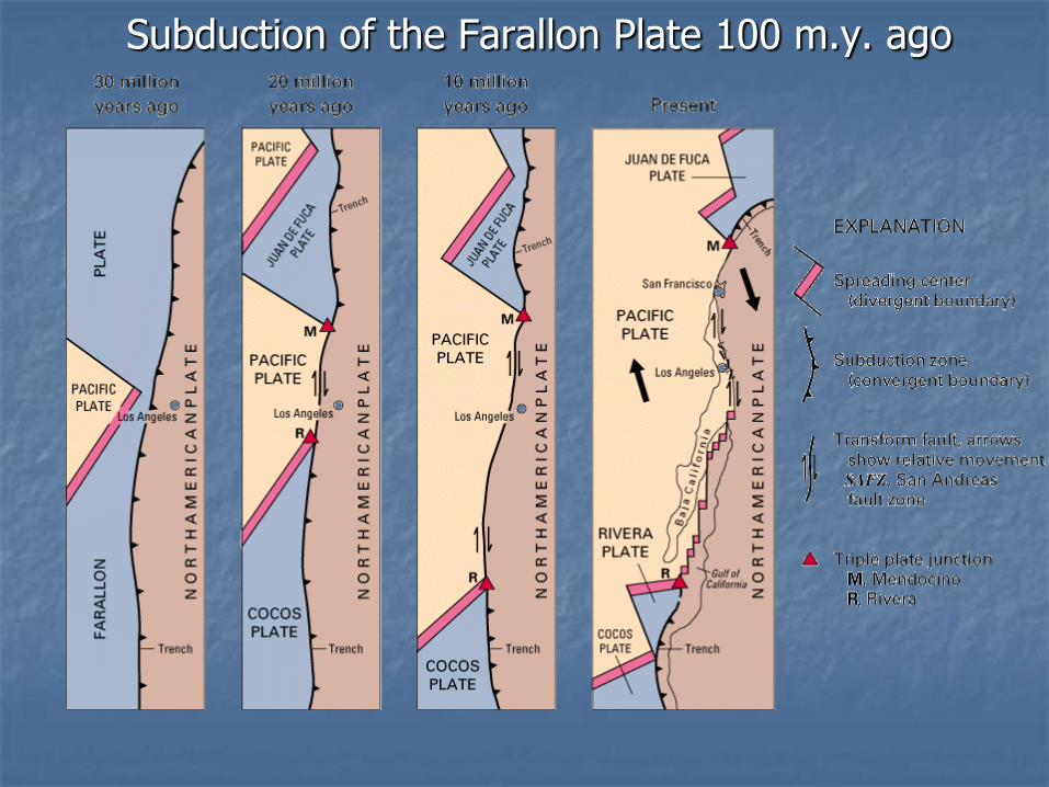
Subduction of the Farallon Plate 100 m.y. ago

Continental Margins Where land meets the ocean
Margins near plate boundaries are ―active.‖
Margins far from plate boundaries are ―passive.‖
Fig. 3.11

Physiographic Provinces of S. Calif.
http://scamp.wr.usgs.gov/scgeo
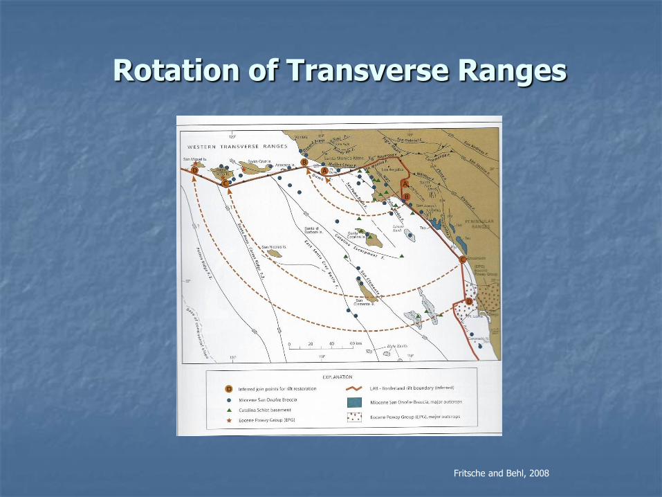
Rotation of Transverse Ranges
Fritsche and Behl, 2008
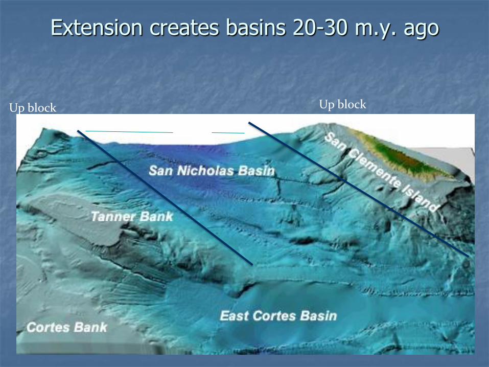
Extension creates basins 20-30 m.y. ago
Basin
Up block Up block
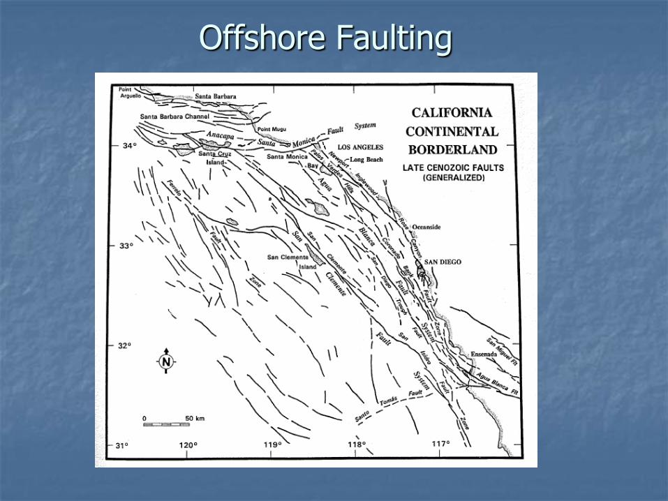
Offshore Faulting

Newport-Inglewood Fault Zone

Huntington Beach Oil Field (1920s)
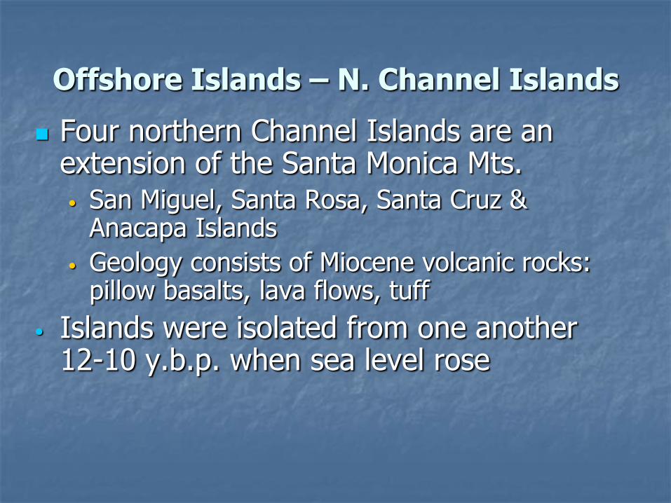
Offshore Islands – N. Channel Islands
Four northern Channel Islands are an extension of the Santa Monica Mts. • San Miguel, Santa Rosa, Santa Cruz &
Anacapa Islands
• Geology consists of Miocene volcanic rocks: pillow basalts, lava flows, tuff
• Islands were isolated from one another 12-10 y.b.p. when sea level rose
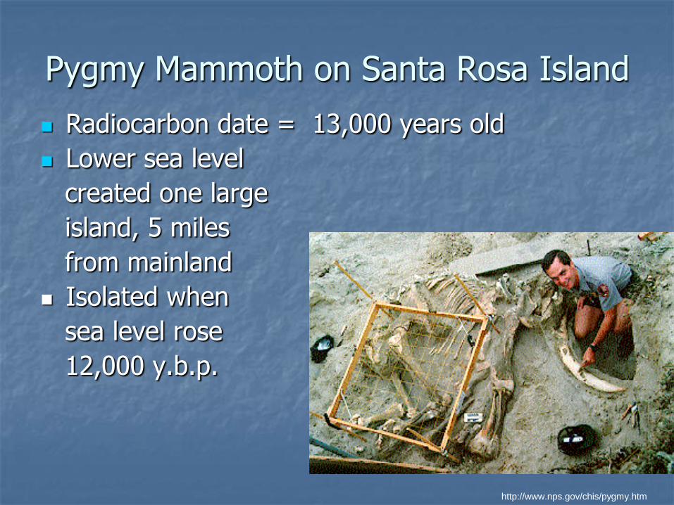
Pygmy Mammoth on Santa Rosa Island
Radiocarbon date = 13,000 years old
Lower sea level
created one large
island, 5 miles
from mainland
Isolated when
sea level rose
12,000 y.b.p.
http://www.nps.gov/chis/pygmy.htm
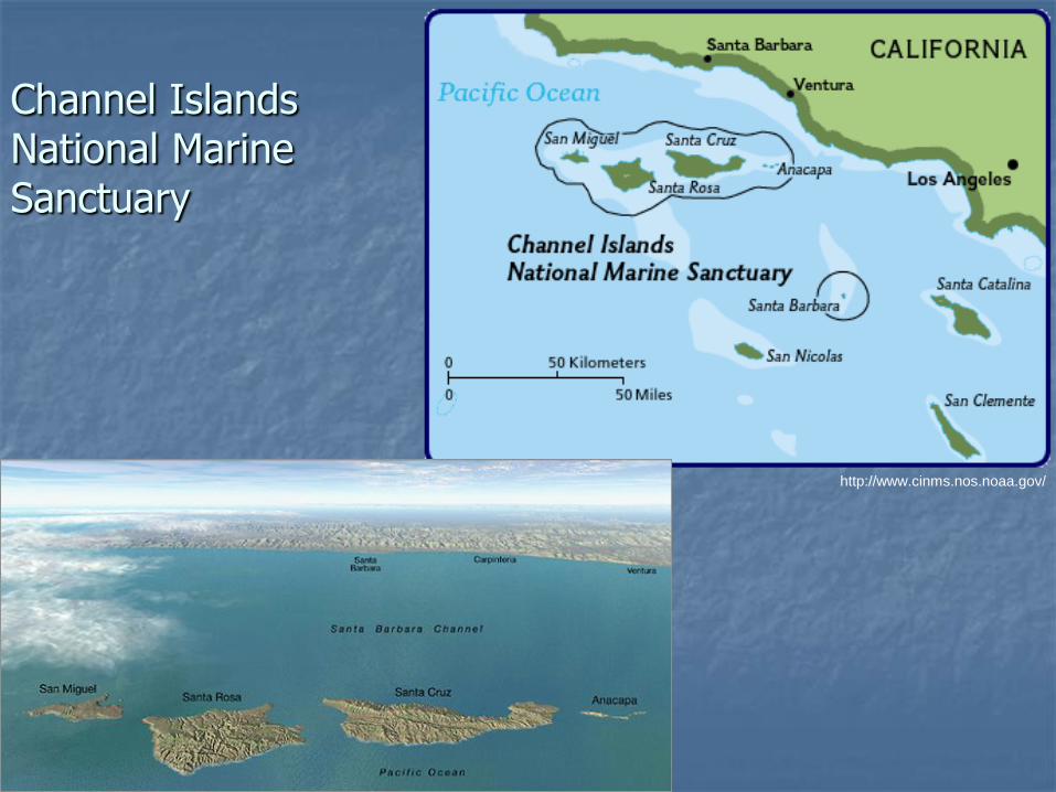
Channel Islands National Marine Sanctuary
http://www.cinms.nos.noaa.gov/

Offshore Islands – S. Channel Islands
• Southern islands include Catalina, San Clemente, Santa Barbara and San Nicolas Islands
• Remnants of up-faulted blocks
• Marine Terraces well-developed on San Clemente Island
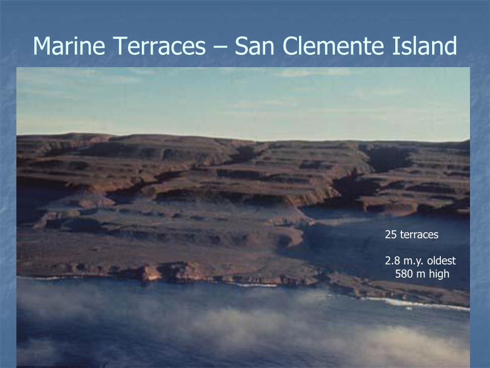
Marine Terraces – San Clemente Island
25 terraces 2.8 m.y. oldest 580 m high
Catalina Island
• Catalina Island has extensive outcrops of Catalina Schist on northern portion of island • Represents blueschist metamorphism which is
typical of subduction zones.
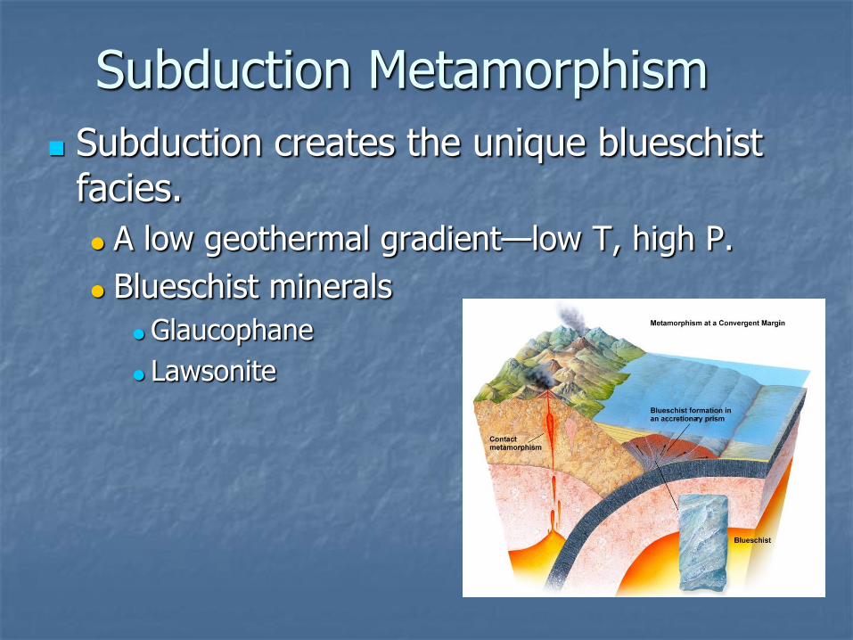
Subduction Metamorphism
Subduction creates the unique blueschist facies.
A low geothermal gradient—low T, high P.
Blueschist minerals
Glaucophane
Lawsonite
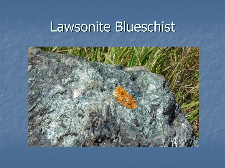
Lawsonite Blueschist
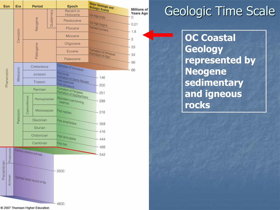
Geologic Time Scale
OC Coastal Geology represented by Neogene sedimentary and igneous rocks
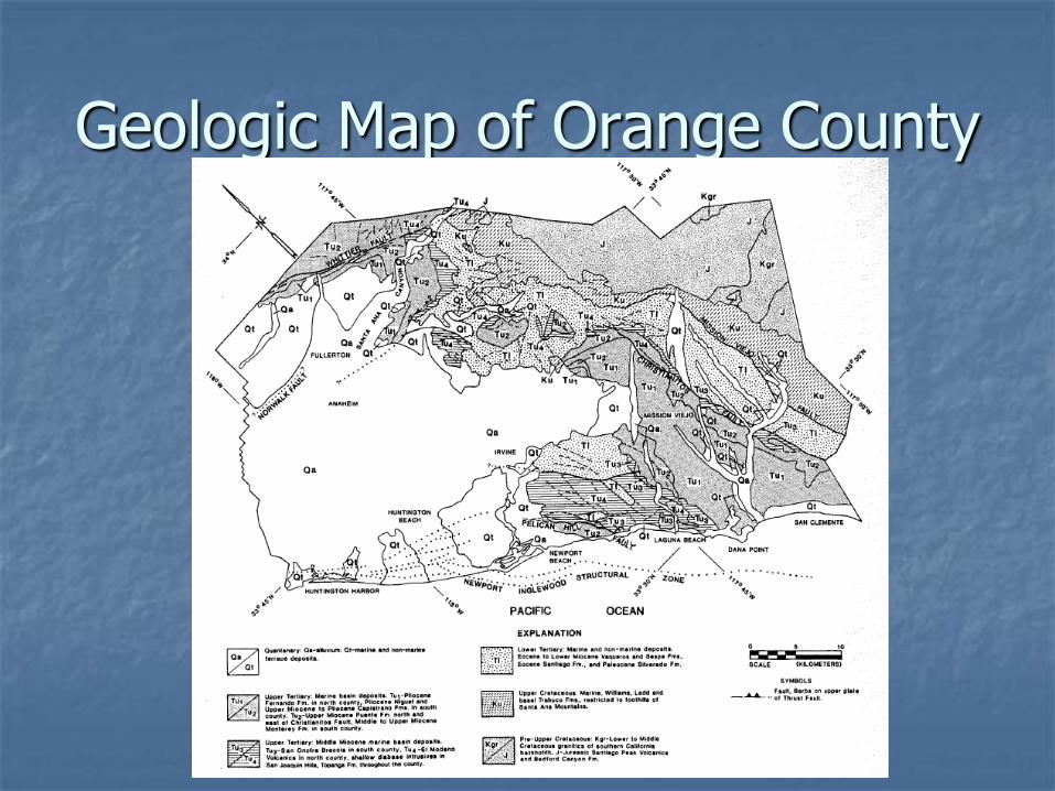
Geologic Map of Orange County

Sediment vs. Sedimentary Rock Drilling into the bottom of a coastal area, we encounter:
Soft mud and loose sand, silt, pebbles, and shells. Then:
Similar materials that are more solidified. Then:
Fragments of solid rock.
Cemented sand and silt.
Cemented shells.
Transition from loose sediment into cemented sedimentary rock.
This change occurs as burial depth increases.
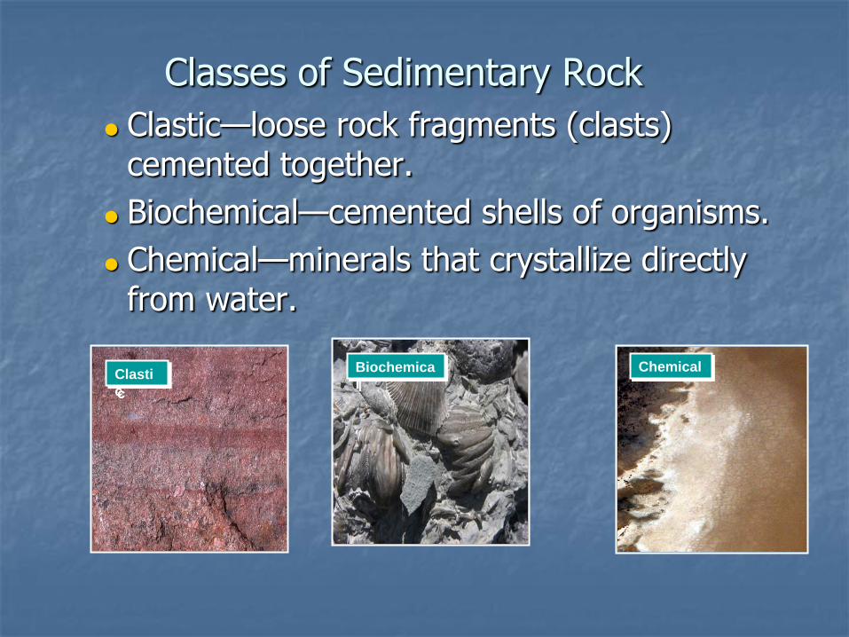
Classes of Sedimentary Rock
Clastic—loose rock fragments (clasts) cemented together.
Biochemical—cemented shells of organisms.
Chemical—minerals that crystallize directly from water.
Chemical Clasti
c
Biochemica
l

Beach
• Active Zone of sediment transportation
• Beach lies between:
• Erosional area above water level
• Depositional area below water level
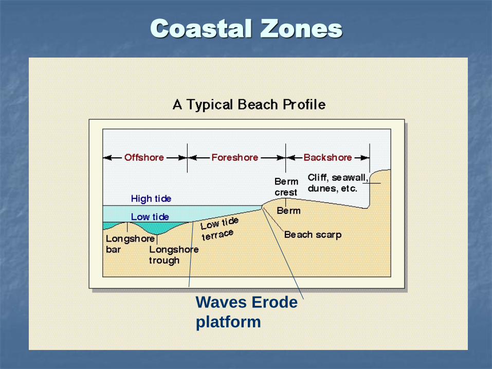
Coastal Zones
Waves Erode
platform

Summer vs. Winter Beach Profile

Sand Budgets
• Estimates of sand gains (inputs) and losses (outputs) to a beach
• Beach profile studies • Inputs:
• Rivers (Los Angeles, San Gabriel, Santa Ana) • Cliff erosion • Onshore transport of sediment by LSC
• Outputs: • Offshore transport of sediment by LSC • Submarine Canyons
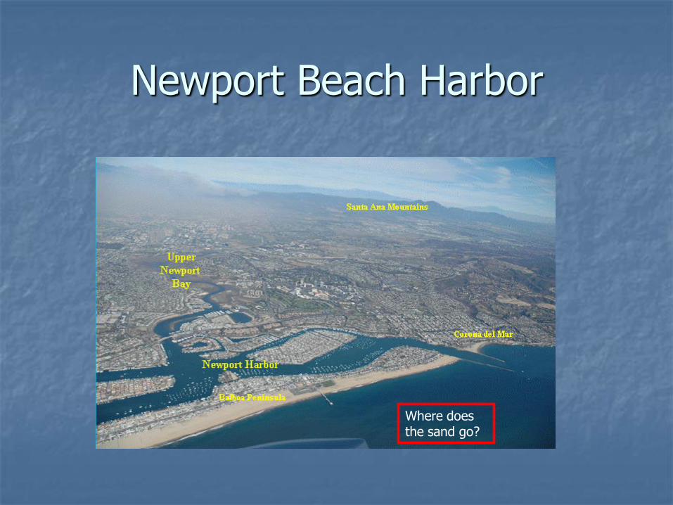
Newport Beach Harbor
Where does the sand go?
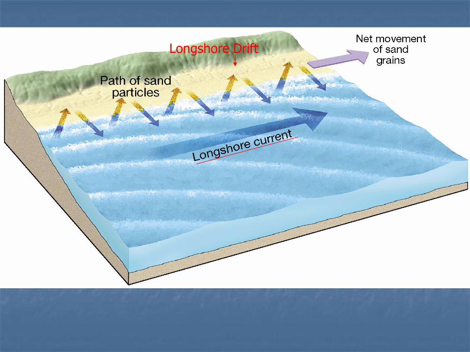
Longshore Drift
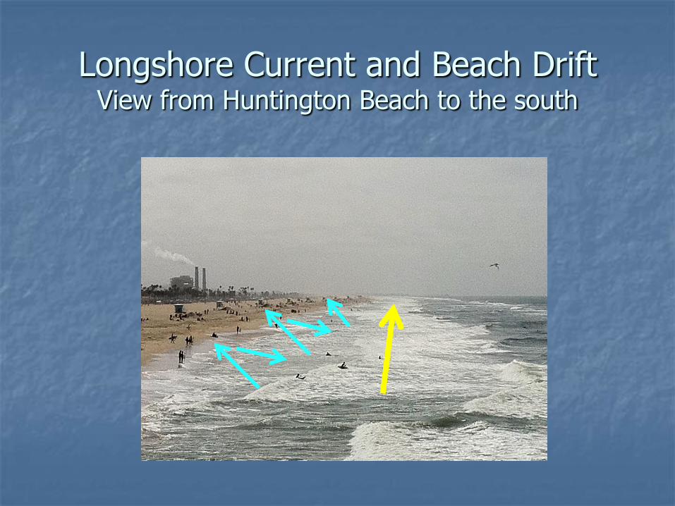
Longshore Current and Beach Drift View from Huntington Beach to the south

Oblique View of Submarine Canyons
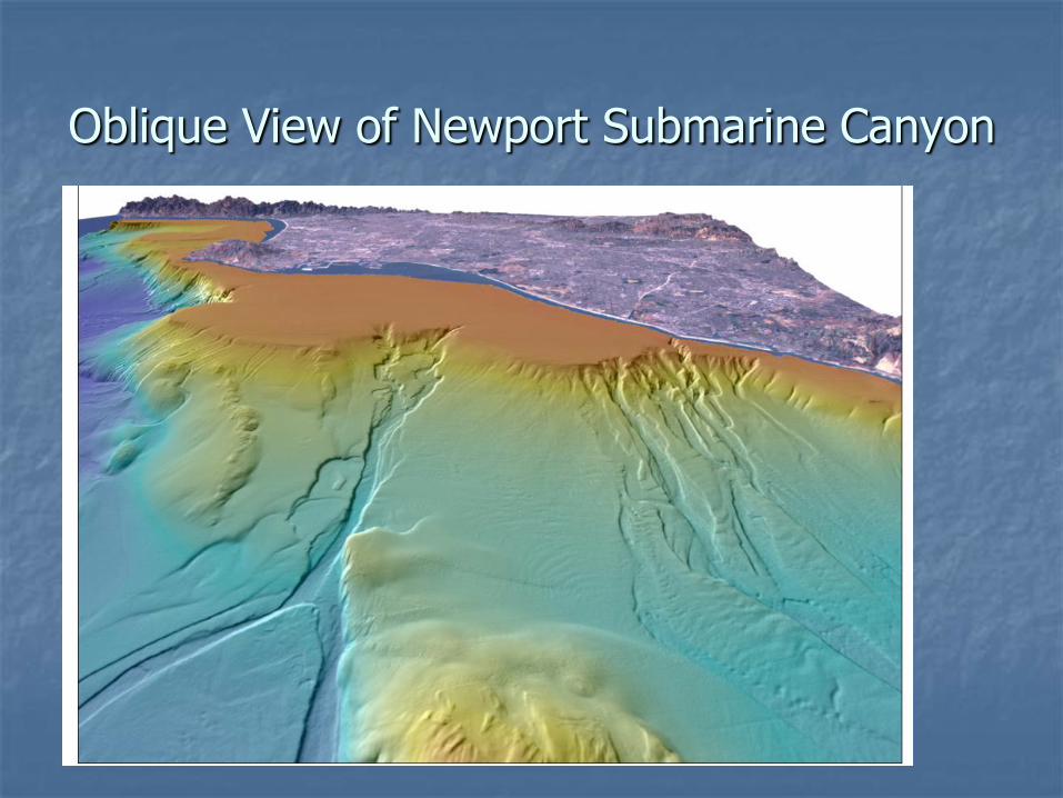
Oblique View of Newport Submarine Canyon
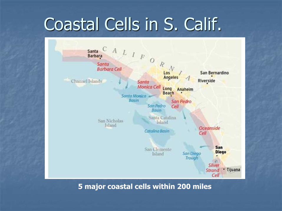
5 major coastal cells within 200 miles
Coastal Cells in S. Calif.
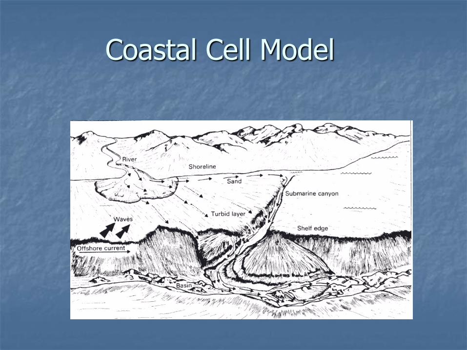
Coastal Cell Model

Depositional vs. Erosional Coasts
• Depositional Coasts • Rate of accumulation exceeds erosion
• LSC slowed, sand deposits
• Features: spits, deltas, barrier islands
• Erosional Coasts • Strong wave activity; erosion rates high
• Rate of erosion depends on
• Local geology
• Degree of wave exposure
• Tidal range
• Features: Cliffs, sea stacks, wave-cut platforms

Erosional
Shoreline
Features
(Exposure to wave
energy high; no
slowing of LSC)
Sea Arches
Sea Stacks- isolated rock remnants

Marine Terraces Elevated wave-cut platforms
Wave-cut Platforms
Emergent & Submergent Coasts
Emergent Coastlines
Result from uplift and/or sea level drop
Features: marine terraces
Submergent Coastlines
Result from downdrop and/or sea level rise
Features: estuaries
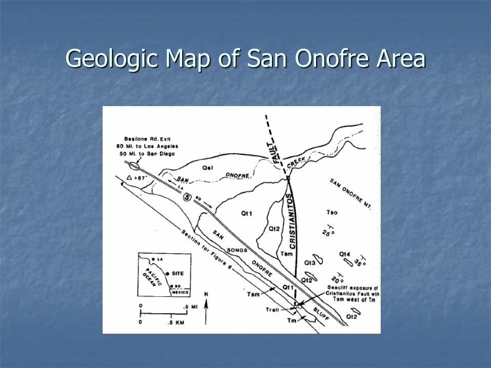
Geologic Map of San Onofre Area
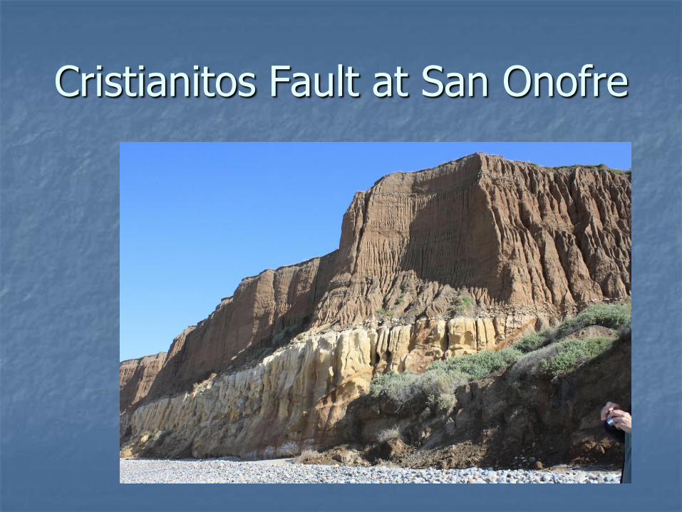
Cristianitos Fault at San Onofre

Stratigraphic Cross-Section at SONGS Area

Onshore & Offshore Marine Terraces – San Onofre Area
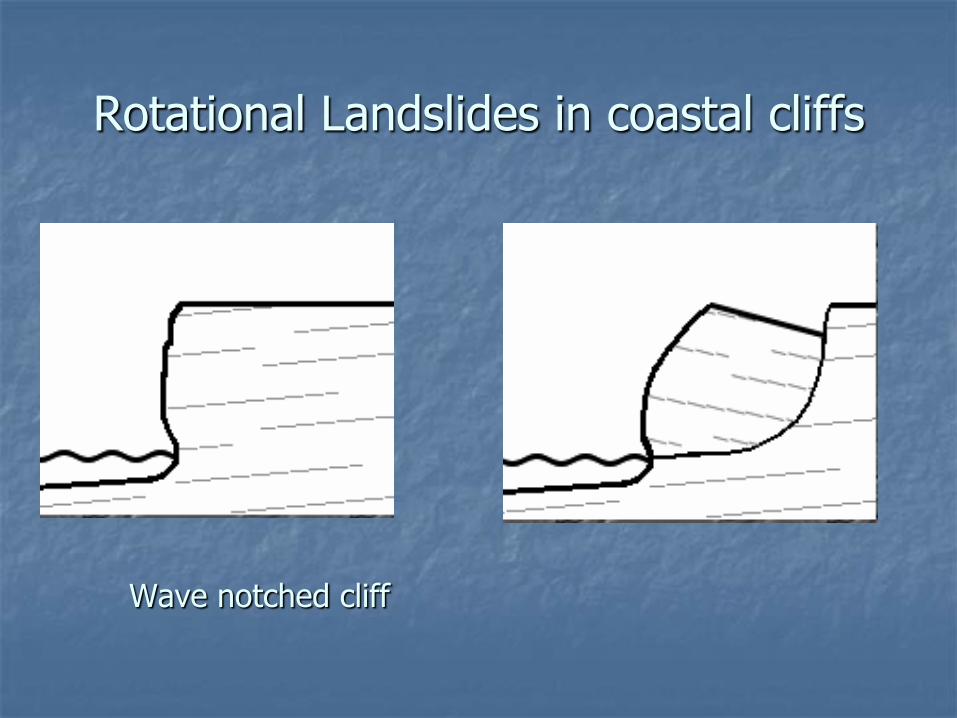
Rotational Landslides in coastal cliffs
Wave notched cliff

Translational Landslides in coastal areas

Tsunami Risk at SONGs
Honshu Earthquake 3/2011
Magnitude 9.0 (USGS)
Depth 19.9 mile
http://neic.usgs.gov/neis/eq_depot/2011/eq_110311_c0001xgp/neic_c0001xgp_l.html
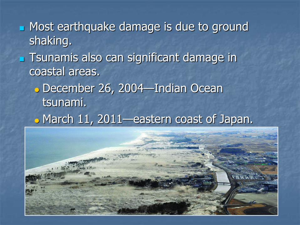
Most earthquake damage is due to ground shaking.
Tsunamis also can significant damage in coastal areas.
December 26, 2004—Indian Ocean tsunami.
March 11, 2011—eastern coast of Japan.

Fukushima power plant damage
The Fukushima nuclear power plant was damaged.
Water breached the seawalls placed to protect the plant.
Hydrogen explosions destroyed the reactor buildings.

Megathrust earthquakes


Dana Point Harbor
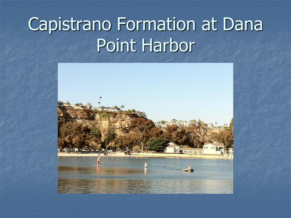
Capistrano Formation at Dana Point Harbor

Capistrano Formation at Dana Point Harbor

Capistrano Formation at Dana Point Harbor
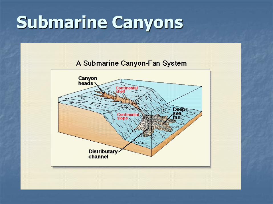
Submarine Canyons

http://eqdoc.home.netcom.com/salt2.html
Turbidite Deposits

Dana Cove Fault near Cannons Restaurant at Dana Pt. Harbor
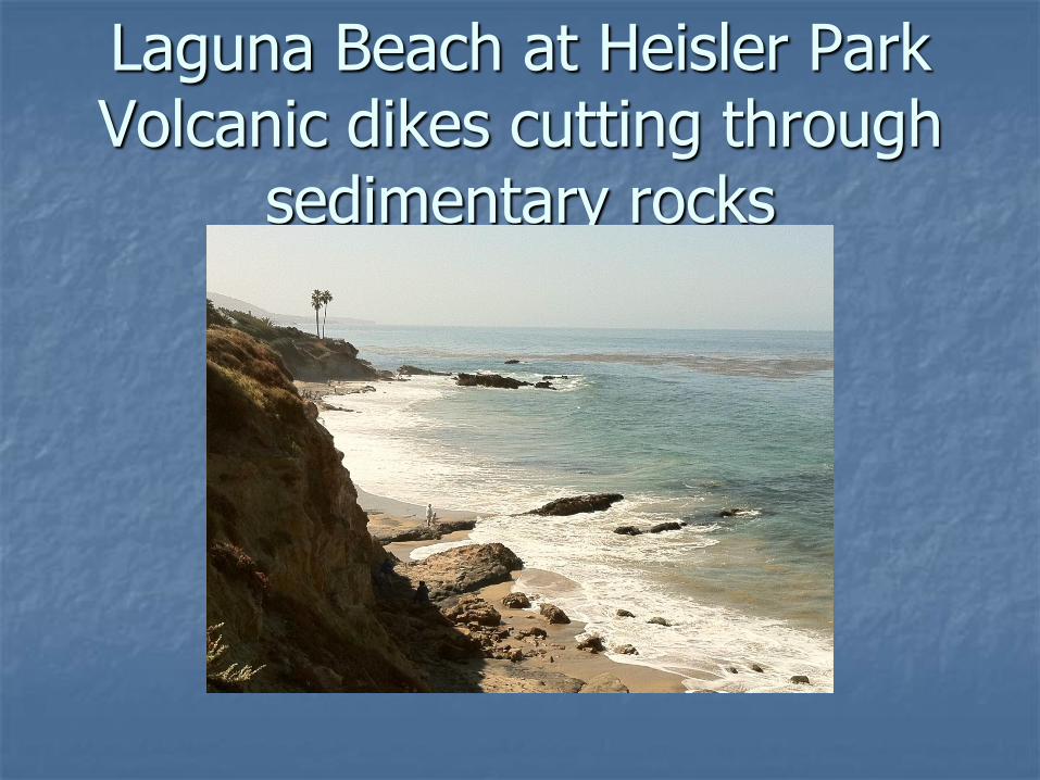
Laguna Beach at Heisler Park Volcanic dikes cutting through
sedimentary rocks

Sedimentary rock with tafoni weathering at Heisler Park