GEOINT Show Daily Day 1
28
Closer Look at the Human Terrain Pre-Symposium sessions focus on the increasingly important field of socio-cultural dynamics. Whether you call it human geography, socio-cultural dynamics or human terrain, the spatial-temporal study of human populations has become a major topic for GEOINT and all forms of intelligence analysis. In response to that growing interest, socio- cultural issues were a key theme for the Pre- Symposium Science & Technology Forum held on Sunday before the formal start of the GEOINT 2011 Symposium. A morning session, entitled “Socio-Cul- tural Dynamics: An Overview from a Diplo- macy, Development, Defense and Intelligence Perspective,” was followed later in the day by socio-cultural workshops on lessons learned and enabling technologies. e five presenters at the morning session began with CW5 Michael Harper, military deputy, Army Geospatial Center, who offered an insightful overview of the history of mili- tary uses of socio-cultural analysis. e fact of the panel and the military pres- ence is itself significant, Harper noted. “Ten years ago, you couldn’t have had a panel like this with people from DoD. It’s an indicator of how socio-cultural is progressing in the military.” Harper acknowledged that the Army has been slow at understanding the importance of socio-cultural information. While there were examples of successful uses, such as the CONFERENCE EXCLUSIVES DAILY AGENDA SHOW HIGHLIGHTS BREAKING NEWS Produced by Geospatial Intelligence Forum www.gif-kmi.com Integrated Geospatial Intelligence From Source to Decision Elevating Insight through… Advanced Imagery Products | Simple Access | Deep Expertise Visit GeoEye ® Booth #413 to apply for Web access to commercial satellite imagery through EyeQ ™ . Tahrir Square, Cairo, Egypt .50-meter GeoEye-1 Integrated Intelligence Capabilities Overwatch integrates intelligence data that improves workflow. Overwatch (Booth 549), a strategic business of Textron Systems Advanced Systems, an operating unit of Textron Systems, a Textron Inc. company, is demonstrating RemoteView Pro 3.2.2, the latest version of its imagery and geospatial analysis software with en- hancements that better integrate intelli- gence data and improve the intelligence workflow. “Data fusion and sharing across Overwatch’s integrated software solu- tions supports merged data streams, powerful analytical tools, and intuitive displays of the resulting information— creating new and needed capabilities for today’s analysts,” explained Stu- art Blundell, Overwatch vice president of geospatial products and services. “These RemoteView enhancements, to- gether with recently added extensions, come from our listening closely to our customers and then delivering reliable solutions for them to do their important work.” CONTINUED ON PAGE 4 ➥ Photo courtesy of Oscar Einzig CONTINUED ON PAGE 8 ➥
-
Upload
kmi-media-group -
Category
Documents
-
view
227 -
download
2
description
The official Show Daily magazine of the GEOINT 2011 Symposium.
Transcript of GEOINT Show Daily Day 1
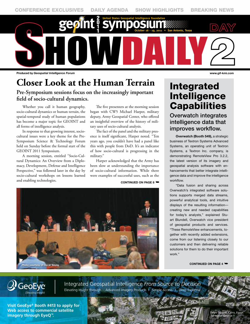
Closer Look at the Human TerrainPre-Symposium sessions focus on the increasingly important field of socio-cultural dynamics.
Whether you call it human geography, socio-cultural dynamics or human terrain, the spatial-temporal study of human populations has become a major topic for GEOINT and all forms of intelligence analysis.
In response to that growing interest, socio-cultural issues were a key theme for the Pre-Symposium Science & Technology Forum held on Sunday before the formal start of the GEOINT 2011 Symposium.
A morning session, entitled “Socio-Cul-tural Dynamics: An Overview from a Diplo-macy, Development, Defense and Intelligence Perspective,” was followed later in the day by socio-cultural workshops on lessons learned and enabling technologies.
The five presenters at the morning session began with CW5 Michael Harper, military deputy, Army Geospatial Center, who offered an insightful overview of the history of mili-tary uses of socio-cultural analysis.
The fact of the panel and the military pres-ence is itself significant, Harper noted. “Ten years ago, you couldn’t have had a panel like this with people from DoD. It’s an indicator of how socio-cultural is progressing in the military.”
Harper acknowledged that the Army has been slow at understanding the importance of socio-cultural information. While there were examples of successful uses, such as the
CONFERENCE EXCLUSIVES DaILy agENDa ShOw hIghLIghtS BREaKINg NEwS
Produced by Geospatial Intelligence Forum www.gif-kmi.com
Client: GeoEyeAd Title: EyeQ - Day 2Publication: NGA Imagery Cover Strip Trim: 8-1/2” x 1-3/4” • Bleed: 9” x 2-1/4” • Live: 1/4” in from trim
Integrated Geospatial Intelligence From Source to DecisionElevating Insight through… Advanced Imagery Products | Simple Access | Deep Expertise
Visit GeoEye® Booth #413 to apply for Web access to commercial satelliteimagery through EyeQ™.
Tahrir Square, Cairo, Egypt .50-meter GeoEye-1
GeoEye CoverStrip 8_5x1_75 Day 2 FA.indd 1 10/3/11 5:06 PM
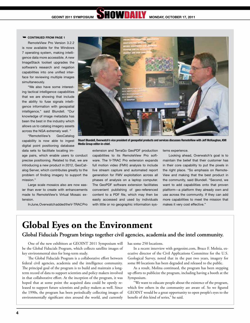
Integrated Intelligence CapabilitiesOverwatch integrates intelligence data that improves workflow.
Overwatch (Booth 549), a strategic
business of Textron Systems Advanced
Systems, an operating unit of Textron
Systems, a Textron Inc. company, is
demonstrating RemoteView Pro 3.2.2,
the latest version of its imagery and
geospatial analysis software with en-
hancements that better integrate intelli-
gence data and improve the intelligence
workflow.
“Data fusion and sharing across
Overwatch’s integrated software solu-
tions supports merged data streams,
powerful analytical tools, and intuitive
displays of the resulting information—
creating new and needed capabilities
for today’s analysts,” explained Stu-
art Blundell, Overwatch vice president
of geospatial products and services.
“These RemoteView enhancements, to-
gether with recently added extensions,
come from our listening closely to our
customers and then delivering reliable
solutions for them to do their important
work.”
COntinued On PAGe 4 ➥Photo courtesy of Oscar einzig
COntinued On PAGe 8 ➥
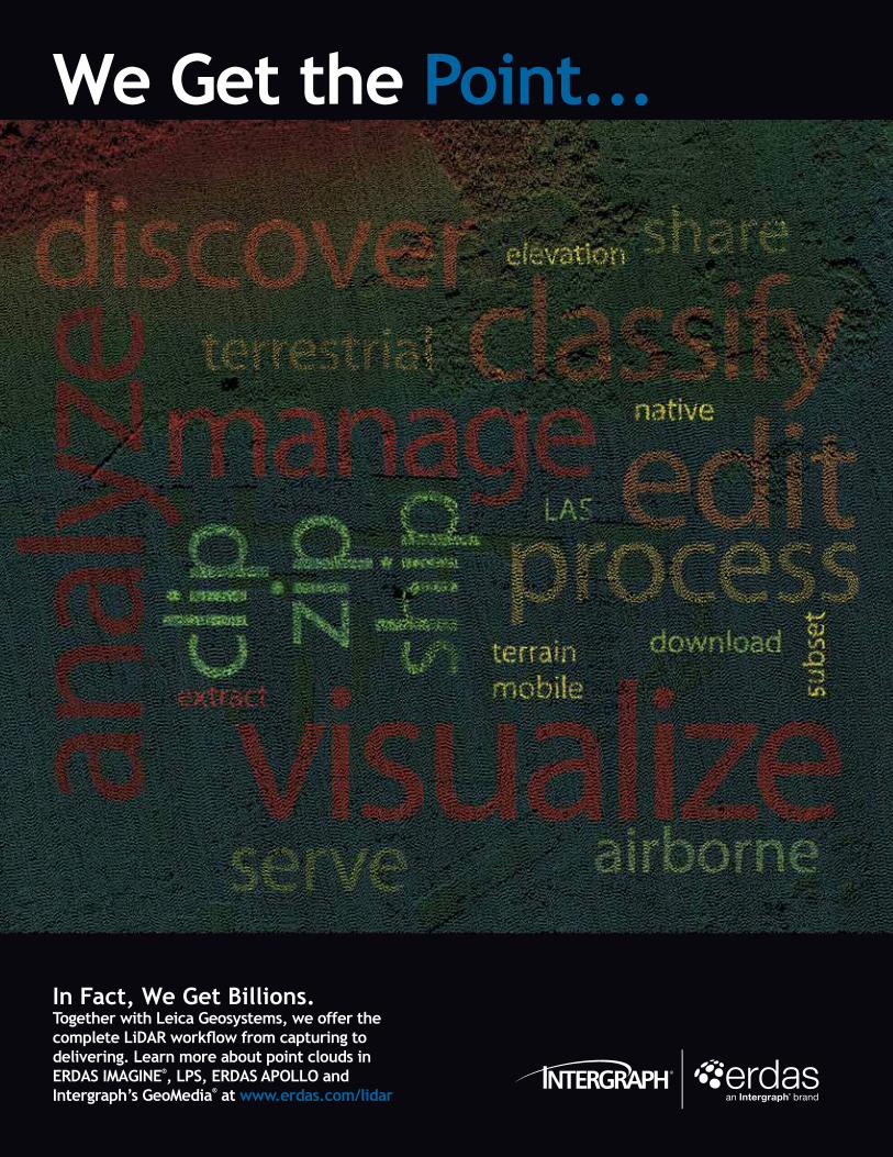
We Get the Point...
In Fact, We Get Billions. Together with Leica Geosystems, we offer the complete LiDAR workflow from capturing to delivering. Learn more about point clouds in ERDAS IMAGINE®, LPS, ERDAS APOLLO and Intergraph’s GeoMedia® at www.erdas.com/lidar
Booth# 529

Booth# 529
RemoteView Pro Version 3.2.2
is now available for the Windows
7 operating system, making intelli-
gence data more accessible. A new
ImageStack toolset upgrades the
software’s research and negation
capabilities into one unified inter-
face for reviewing multiple images
simultaneously.
“We also have some interest-
ing tactical intelligence capabilities
that we are showing that include
the ability to fuse signals intelli-
gence information with geospatial
intelligence,” said Blundell. “Our
knowledge of image metadata has
been the best in the industry which
allows us to catalog imagery assets
across the NGA extremely well. ”
“RemoteView’s GeoCatalog
capability is now able to ingest
digital point positioning database
data sets to facilitate locating im-
age pairs, which enable users to conduct
precise positioning. Related to that, we are
introducing a new product in 2012, GeoCat-
alog Server, which contributes greatly to the
problem of finding imagery to support the
mission.”
Large scale mosaics also are now eas-
ier than ever to create with enhancements
made to RemoteView’s Virtual Mosaic ex-
tension.
In June, Overwatch added the V-TRAC Pro
extension and TerraGo GeoPDF production
capabilities to its RemoteView Pro soft-
ware. The V-TRAC Pro extension expands
full motion video (FMV) analysis to include
live stream capture and automated report
generation for FMV exploitation across all
phases of analysis on a laptop computer.
The GeoPDF software extension facilitates
convenient publishing of geo-referenced
content to a PDF file, which may then be
easily accessed and used by individuals
with little or no geographic information sys-
tems experience.
Looking ahead, Overwatch’s goal is to
maintain the belief that their customer has
in their core capability to put the pixels in
the right place. “So emphasis on Remote-
View and making that the best product in
the community, said Blundell. “Second, we
want to add capabilities onto that proven
platform—a platform they already own and
use across the community. If they can add
more capabilities to meet the mission that
makes it very cost effective.”
➥ COntinued frOm PAGe 1
Stuart Blundell, Overwatch’s vice president of geospatial products and services discusses RemoteView with Jeff McKaughan, KMI Media Group editor-in-chief.
Global Eyes on the EnvironmentGlobal Fiducials Program brings together civil agencies, academia and the intel community.
One of the new exhibitors at GEOINT 2011 Symposium will be the Global Fiducials Program, which collects satellite images of key environmental sites for long-term study.
The Global Fiducials Program is a collaborative effort between federal civil agencies, academia and the intelligence community. The principal goal of the program is to build and maintain a long-term record of data to support scientists and policy makers involved in that collaborative effort. At the inception of the program, it was hoped that at some point the acquired data could be openly re-leased to support future scientists and policy makers as well. Since the 1990s, the program has been periodically collecting images of environmentally significant sites around the world, and currently
has some 250 locations. In a recent interview with gotgeoint.com, Bruce F. Molnia, ex-
ecutive director of the Civil Applications Committee for the U.S. Geological Survey, noted that in the past two years, imagery for some 80 locations has been degraded and released to the public.
As a result, Molina continued, the program has been stepping up efforts to publicize the program, including having a booth at the Symposium.
“We want to educate people about the existence of the program, which few others in the community are aware of. So we figured GEOINT would be a great opportunity to open people’s eyes to the benefit of this kind of series,” he said.
4
mOndAy, OCtOBer 17, 2011GeOint 2011 SymPOSium

We deliver quick, accurate, insightful imagery. You deliver quick, accurate, insightful decisions.
© 2
01
1 G
eoEy
e. A
ll R
igh
ts R
eser
ved
.
III
High-resolution imagesover Rikuzentakata, Japan,
collected by a GeoEye satellite
New and archived imagery
pushed to EyeQ™
Responders receiveddecision-critical
visual intelligence
When you’re protecting lives, fast access to accurate and timely geospatial content means all the difference in the world. GeoEye’s EyeQ™ services deliver new high-resolution imagery online, providing the timely insights you need to better accomplish your mission.
Elevating Insight for Better Decis ion Making
J A P A N E A RT H Q U A K E A N D TS U N A M I M a r c h 1 1 , 2 0 1 1
Discover how EyeQ played a pivotal role in recent global events, and see if you qualify for free access to imagery through EyeQ. Go to www.geoeye.com/eyeQ.
1249 HRS JST1239 HRS JST1021 HRS JST
Client: GeoEyeAd Title: Quick, Accurate, InsightfulPublication: Geospatial Intelligence ForumTrim: 8.375” x 10.875” • Bleed: 1/4” beyond trim • Live: 1/4” inside trim
Please visit us at booth #413
26963_NGA_EyeQ__GeospatialIntelligenceForum.indd 1 9/30/11 4:05 PM
Handling Real-time Color ImageryPV Labs provides new sensor and processing solution.
PV Labs Inc.(Booth 1213) is using GEOINT 2011 to launch its new 300 megapixel wide area motion imagery sensor and processing solution featuring a 15-inch stabilized aerial gimbal payload.
The company’s PSI Vision system provides an ISR platform for acquiring, processing and distributing real-time, color imagery col-lected over areas covering tens of square kilometers and can provide ground sampling distances (GSD) down to 0.3 meters. The sensor collects over 300 Megapixels of full motion video and is packaged in a next generation compact 15 inch stabilized turret offering 25 percent increased payload volume. In addition to offering best-in-class stabi-lization, the new turret maintains compatibility with the industry-standard envelope and interface of the MX15.
PSI Vision Tactical Content Management System (tCMS) enables a scalable processing architecture for assembling a mosaic of images into a single unified virtual focal plane in real-time. Leveraging the power of GPUs, the tCMS processes large amounts of data, making it immediately available for tactical and forensic operations. Users can retrieve and distribute data optimized for transmission over low-bandwidth links. The flexible Decoder API provides an open interface for development of tools and applications that work with existing in-frastructure.
PV Labs’ next generation of gimbal technology provides the high-est level of stabilization available in an aerial camera system with high targeting accuracy, achieving less than 5 microradians of line-of-sight
jitter and 1.5 milliradians of pointing accuracy in a 15 inch sphere. PV Labs’ 15 inch gimbal can be deployed on fixed-wing, rotorcraft and lighter-than-air vehicles and its compact size is particularly well-suited for unmanned aerial vehicles. The reduced size, weight and power footprint of the gimbal and processing system permits longer missions, significantly reducing cost of the fielded solution.
PV Labs’ solutions fit a variety of display devices including the iPad.
Video ExploitationNevion showcases video maximization systems.
nevion (Booth 1045), a provider of man-
aged video services for broadcasters, service
providers and government entities worldwide,
will use GEOINT 2011 to demonstrate com-
prehensive ISR solutions for government and
military organizations. The company is also
showcasing its new VideoIPath solution for
video exploitation of full motion video and
large volume streaming data (LVSD).
Nevion’s range and facility modernization,
surveillance and mission video systems pro-
vide real-time transport of video, data and te-
lemetry over any network infrastructure—fiber
overlay, SONET/SDH or IP—with VideoIPath
for managing and provisioning video services.
VideoIPath for IP networks provides IP
video transport with comprehensive, end-to-
end control, monitoring and management.
It features comprehensive managed video
services for complete provisioning, connec-
tion management, bandwidth optimization,
analytics and network inventory. It greatly
reduces the cost structure by bringing video
services into the IP environment, where scal-
ability is dramatically increasing and port
costs are decreasing.
The system now includes the VS902, a
powerful universal IP video transport plat-
form that accepts any SDI or ASI input and
provides both uncompressed encapsulation
to IP and a choice of JPEG 2000 or H.264
compression. It offers transport protected by
Streaming Intelligent Packet Switching (SIPS),
a technology developed by Nevion as a more
advanced transport protection method that
provides perfect protection switching in addi-
tion to packet loss protection.
The system simplifies the complexity of
video-over-IP services by adding a network
abstraction layer, allowing users to provision
and monitor services without having to con-
sider detailed configuration settings in each
network element. By auto-detecting available
video resources, It also can present appropri-
ate video end-points and service profiles to
users, enabling them to schedule and initiate
connections in an intuitive option-selection
process. VideoIPath manages bandwidth by
allocating the necessary resources without
overbooking.
VideoIPath is also available for optical
networks, providing a completely managed
video services system for fiber-based net-
works.
VideoIPath’s optical networking—driven
by Nevion Flashlink and Sublime optical com-
ponents—provides a highly cost-efficient so-
lution for intra- and inter-facility signal distri-
bution and management that assures quality,
protection and efficiency. The system’s Flash-
link ADP-3G module can add, drop or pass
signals on each layer, ensuring fast and safe
signal switching for all nodes in the network.
6
mOndAy, OCtOBer 17, 2011GeOint 2011 SymPOSium

We’ve connected our dots to help you better connect yours.Perhaps you’ve heard that Harris Corporation is building the largest business focused specifically on remote communications — Harris CapRock. If so, you’re probably wondering what that means for you.
For starters, it means you have access to the world’s most advanced terrestrial, wireless and satellite network for remote communications. It means you’ll get responsive, reliable communications connecting your operations anywhere on Earth. It means the most extensive local service and support in the most countries with teleports on 6 continents, 5 Network Operations Centers, 83 points of presence on a global terrestrial network and 140 countries served. It means we’re ready to meet all of your communication demands today and tomorrow.
So how will Harris CapRock better connect your dots? If you had to pin us down, we’d say “in every way.”
www.harriscaprock.com
© 2011 Harris CapRock Communications, Inc. All rights reserved. RElIabIlIty NEvER REaCHEd SO FaR™
HCC_MapAd_GEOINT.indd 1 10/13/11 2:44 PM
occupation of Japan after World II, that was not the cases in Viet-nam, or in the current conflicts until they were well under way.
To be sure, he said, those shortfalls were partly due to the fact that such analysis in not part of the Army’s core mission, which is to conduct kinetic operations.
At the same time however, “In Af-ghanistan and Iraq, had we considered socio-cultural in more detail up front, maybe we would have executed those operations differently. If we had had a more robust socio-cultural staff at a strategic level, we might have avoided mistakes,” he said.
As soon as you transition from be-ing focused on the kinetic part of the Army’s mission to non-kinetic opera-tions and focus on security and nation building, socio-cultural becomes hugely important at every level, Harper argued.
Looking back on his career, Harper recalled that in his first 20 years of service, he had never conducted battlefield preparation us-ing socio-cultural factors. But in 2004, he began getting calls from units in Iraq, whose commanders were asking to track socio-cul-tural factors that the Army hadn’t before. The codes used to track information in the current fight simply didn’t reflect many vital cultural issues, such as differences within the religion of Islam.
“You couldn’t input information such as this was a mosque with a certain orientation. So we had to build a data model to support what commanders were interested in tracking, and what they wanted to see in their common operating picture,” he said.
Since then, however, the Army and the Army Geospatial Cen-ter have made substantial progress. “If you look at our portfolio of programs today, we’re all over socio-cultural, from developing handheld apps to enable psyops and civil affairs soldiers to rapidly collect information, and quickly get that information back into a mission command environment so it can be shared,” Harper said.
In his remarks, Dan Plafcan, policy analyst and portfolio man-ager for socio-cultural analysis, Office of the Under Secretary of Defense for Intelligence, identified three areas of challenge and opportunity that GEOINT tradecraft is bringing to socio-cultural analysis.
First, he said, the expansiveness of GEOINT and the human geography part of it is so huge that there needs to be disciplinary forces to funnel these efforts in a way to provide the most bang for the buck. Second, people in the field need to think carefully about the downstream implications about a lot of the upstream work that’s being done now in GEOINT and human geography, and how that matches up with requirements and the context of use for the data. Finally, more clarity in terms is needed.
“We need a more question-focused and conceptually informed look at the kind of products that we need,” Plafcan continued. “Rather than human geography being mistakenly viewed as an added value, it needs to be brought into the center by showing its clear value for military operations across a broad spectrum.
“It’s not a topic or an empirical domain, but a form of analy-sis, which includes concepts as well as technologies. The focus is on populations or groups of people. If we can get sophisticated about technical specifications and other factors, we should be able to have that same sophistication about the social world. We don’t have that yet as a community,” he said.
“Our vision is the seamless integration of socio-cultural analy-sis into all-source—not a boutique or a specialty. The objective is to inform the full spectrum of military operations,” Plafcan added.
Lieutenant Colonel Lauren Kulinski, currently on assignment with the Department of State Humanitarian Information Unit, discussed how socio-cultural analysis and human geography can be integrated into diplomatic operations.
David Ellis, chief, Socio-Cultural Awareness Section, Irregular Threats Analysis Branch, Joint Intelligence Center Special Opera-tions Command, U.S. Special Operations Command, focused on what he called the “ideational components of cultural geospatial analysis.”
By that, Ellis referred to a range of ideas and beliefs of a popu-lation, which may be much harder to represent than other types of information. For examples, he pointed to such questions as the location of supporters of secular Arab nationalism in Libya, the susceptibility to calls for violence of different Hutu popula-tions residing in Tanzania, the extent of “tariqas,” or cross-tribal, values-based lodges in Somalia, and the degree to “political space” available to non-Islamist political parties in Egypt.
“There is an ideational aspect of culture that we don’t typically see in human terrain analysis,” Ellis said. “We may know where a mosque is, but what does that mosque mean in that context? If we look at the way the population views itself, and then figure out the meaning of the physical layer, then we can have a much clearer understanding of the population’s view of that space, not just what we see as the surface indicators.”
Ellis concluded with a call to analysts: “As you work on your products, you should ask yourself if you are helping your cus-tomer to understand the world that the population sees?”
Wrapping up the session, Elizabeth Lyon, geographer, Army Corps of Engineers, Engineer Research and Development Center, pointed to the good news that there are a lot of similarities be-tween the way the worlds of defense, intelligence, diplomacy and development view socio-cultural geography. But, she said, “We’re not at the point where we can point to one place and say a word, such as school, means the same thing, or we recognize the differ-ent components of that term. The Corps of Engineers thinks of a school as a structure, while the defense community might be interested in the alternative uses of a school as a building. The dip-lomatic community would be interested in how that school edu-cates the population. We have similar language, but we’re not yet in the same room in recognizing how we interact with each other.
“Mapping is really about the future. Where are we going, and how can we display that information?” asked Lyon, who recently was named as an adviser to the U.S. Geospatial Intelligence Foun-dation’s board of directors.
Lt. Col. Lauren Kulinski
➥ COntinued frOm PAGe 1
8
mOndAy, OCtOBer 17, 2011GeOint 2011 SymPOSium

We’ve connected our dots to help you better connect yours.Perhaps you’ve heard that Harris Corporation is building the largest business focused specifically on remote communications — Harris CapRock. If so, you’re probably wondering what that means for you.
For starters, it means you have access to the world’s most advanced terrestrial, wireless and satellite network for remote communications. It means you’ll get responsive, reliable communications connecting your operations anywhere on Earth. It means the most extensive local service and support in the most countries with teleports on 6 continents, 5 Network Operations Centers, 83 points of presence on a global terrestrial network and 140 countries served. It means we’re ready to meet all of your communication demands today and tomorrow.
So how will Harris CapRock better connect your dots? If you had to pin us down, we’d say “in every way.”
www.harriscaprock.com
© 2011 Harris CapRock Communications, Inc. All rights reserved. RElIabIlIty NEvER REaCHEd SO FaR™
HCC_MapAd_GEOINT.indd 1 10/13/11 2:44 PM
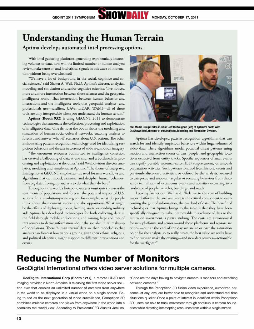
Understanding the Human TerrainAptima develops automated intel processing options.
With intel-gathering platforms generating exponentially increas-ing volumes of data, how will the limited number of human analysts review, make sense of, and find critical signals in this wave of informa-tion without being overwhelmed?
“We have a lot of background in the social, cognitive and so-cial sciences,” said Shawn A. Weil, Ph.D, Aptima’s director, analytics, modeling and simulation and senior cognitive scientist. “I’ve noticed more and more intersection between those sciences and the geospatial intelligence world. That intersection between human behavior and interactions and the intelligence tools that geospatial analysts and professionals use—satellites, UAVs, LiDAR, WAMI—all of those tools are only interpretable when you understand the human terrain.”
Aptima (Booth 932) is using GEOINT 2011 to demonstrate technologies that automate the collection, processing and exploitation of intelligence data. One demo at the booth shows the modeling and simulation of human social-cultural networks, enabling analysts to forecast and answer ‘what-if ’ scenarios about U.S. actions. The other is showcasing pattern recognition technology used for identifying sus-picious behaviors and threats in torrents of wide area motion imagery.
“The enormous resources committed to intelligence collection has created a ballooning of data at one end, and a bottleneck in pro-cessing and exploitation at the other,” said Weil, division director ana-lytics, modeling and simulation at Aptima. “The theme of Integrated Intelligence at GEOINT emphasizes the need for new workflows and algorithms that can model, examine, and decipher human behaviors from big data, freeing up analysts to do what they do best.”
Throughout the world’s hotspots, analysts must quickly assess the sentiments of populations and forecast the potential impact of U.S. actions. In a revolution-prone region, for example, what do people think about their current leaders and the opposition? What might be the effects of deploying troops, freezing assets, or sending military aid? Aptima has developed technologies for both collecting data in the field through mobile applications, and mining large volumes of text sources to derive information about the social-cultural make-up of populations. These ‘human terrain’ data are then modeled so that analysts can forecast how various groups, given their ethnic, religious, and political identities, might respond to different interventions and events.
Aptima has developed pattern recognition algorithms that can search for and identify suspicious behaviors within huge volumes of video data. These algorithms model potential threat patterns using motion and interaction events of cars, people, and geographic loca-tions extracted from entity tracks. Specific sequences of such events can signify possible reconnaissance, IED emplacement, or ambush preparation activities. Such patterns, learned from historic events and previously discovered activities, or defined by the analysts, are used to categorize and uncover irregular or revealing behaviors from thou-sands to millions of extraneous events and activities occurring in a landscape of people, vehicles, buildings, and roads.
Looking farther out, Weil said, “Relative to the cost of building major platforms, the analysis piece is the critical component to over-coming the glut of information, the overload of data. The benefit of technologies that Aptima brings to the table is that they have been specifically designed to make interpretable this volume of data so the return on investment is pretty striking. The costs are astronomical for new platforms and sensors—and those platforms and sensors are critical—but at the end of the day we are at or past the saturation point for the analysts so to really create the best value we really have to find ways to make the existing—and new data sources—actionable for the warfighter.”
KMI Media Group Editor-in-Chief Jeff McKaughan (left) at Aptima’s booth with Dr. Shawn Weil, director of the Analytics, Modeling and Simulation Division.
Reducing the Number of MonitorsGeoDigital International offers video server solutions for multiple cameras.
Geodigital international Corp (Booth 1217), a remote LiDAR and
imaging provider in North America is releasing the first video server solu-
tion ever that enables an unlimited number of cameras from anywhere
in the world to be displayed in a virtual world on a single screen. Be-
ing touted as the next generation of video surveillance, Panopticon 3D
combines multiple cameras and views from anywhere in the world into a
seamless real world view. According to President/CEO Alastair Jenkins,
“Gone are the days having to navigate numerous monitors and switching
between cameras.”
Through the Panopticon 3D fusion video experience, authorized per-
sonnel at any level are better able to recognize and understand real time
situations quicker. Once a point of interest is identified within Panopticon
3D, users are able to track movement through continuous camera bound-
aries while directing intercepting resources from within a single screen.
10
mOndAy, OCtOBer 17, 2011GeOint 2011 SymPOSium

© 2011 Raytheon Company. All rights reserved. “Customer Success Is Our Mission” is a registered trademark of Raytheon Company.
INTELLIGENCE.AT YOUR
FINGERTIPS.
APPSMARTMOBILE MARKETPLACE
™
Raytheon’s Appsmart marketplace delivers secure, critical technology to mobile devices, desktops and the Cloud — giving
warfi ghters, intelligence agents and fi rst responders access to key operational capabilities. With apps created by Raytheon and third-party developers, Appsmart provides access to technology
that supports a broad range of mission-critical tasks.
Market your app with a technology leader.Scan code above to learn more.
www.raytheon.com | Keyword: Get Appsmart
INNOVATION IN ALL DOMAINS
Follow us on:
The Right Multi-INT Will Aid AnalystsFusion in the Information Spectrum—Multi-INT panelists discuss paths forward.
Advances in processing power and storage make it possible to relieve the burden on analysts. However, much work needs to be done and the task won’t be easy, judging by a discussion about multi-INT analytics as an alternative to an all-source approach during GEOINT’s pre-sympo-sium science and technology forum.
The challenge is greater than simply combining different intelligence products in a timely fashion to yield something that users find worth-while and easily understandable. It also has to be suitable for what Mark Abrams, chief scientist in the NRO Mission Support Directorate, called the intelligence device of the future.
“How do I fit what I need into a smartphone?” he said.Although difficult, this can be done. Abrams gave an example of
the Haiti disaster relief effort. What was useful for first responders was information about population changes over time in an area, a bit of in-formation that could be pushed out over cellular networks.
As this example shows, the key to helping analysts do their job lies in correctly setting the dividing line between automated systems and humans. Dave Messinger, an associate research professor at the Center for Imaging Science at the Rochester Institute of Technology, noted that computers don’t get tired and are good at sorting through large sets of data. Where they stumble is when called upon to do sophisticated analy-sis. Fortunately, though, there’s another readily available system for this task.
“The brain is good at complex analysis,” Messinger said.Ideally, he said, this analysis would be done using a 4D physically
realistic model of the world, accurate in both space and time on an ap-propriate scale. Then an analyst could test a hypothesis against the model and compare it to actual data, thereby weeding out those theories that don’t fit reality and measurements. Messinger believes this capability will soon be available, and it will offer a near real time response.
In putting automated systems to use, care must be exercised, said Naval Postgraduate School remote sensing research professor Charlene Sailer. “We need to convey something about the data quality.”
That subject came up several times during the presentations. Some-times it involved data analysis and other times data integrity. For the latter, one suggestion was the use of the lowest level bit in a tamper re-sistance scheme. For the issue of the quality of data analysis, a proposed solution involved thresholding. More certain data would be depicted, for example, with higher intensity.
But thresholding, it was pointed out, is generally problematic. It may turn out later that measurements that fell below a threshold are actually useful. For instance, a Soviet-era missile detection system was actually being able to spot Scud missiles during the first Gulf War, if attention was paid to what before had been regarded as noise.
The solution, everyone agreed, was to never discard any of the raw data. A corollary to that is to measure everything. Curt Davis, director of the University of Missouri’s Center for Geospatial Intelligence, noted that having a wealth of data actually benefits computer-driven analysis.
Even inactivity, it was noted, is important. In a battlefield situation, for example, if nothing has changed then there’s no need to change tac-tics. In a disaster, if the population in an area remains the same, there may be no need to rush in additional supplies and assistance.
A final thread in the discussion was that in tackling multi-INT ana-lytics, the GEOINT community could benefit by looking in some un-usual places. Barry Tilton, a senior technical advisor in the NRO Mission Support Directorate, noted that movies could provide clues. Looking at what movies depict as magical technology could give clues about what users want before they know they want it.
However, looking afield for ideas about new capabilities sometimes turns up less than ideal solutions. During the Q&A session after the presentations, Chris Olsen, a remote sensing professor at the Naval Post-graduate School, related a story about investigating how the TV industry analyzed video feeds. There was some very sophisticated analysis going on, but it was being done by having hundreds of interns sitting through many hours of recorded video.
As Olsen said, “We do need something better.”
hooking Up Social Media and ISRSAS and AGI use GEOINT to unveil novel integration solution.
Integrating social media analysis into
the intelligence, surveillance and recon-
naissance collection process is vital to the
GEOINT community. Changes in sentiment
and spikes in certain conversation topics
can provide earlier awareness of threats.
Analytical Graphics inc.(AGi) (Booth 353),
an ISR analysis and visualization software
provider, and SAS (Booth 1005), a provider
of business analytics software and services,
are partnering to meet this need, and will be
unveiling a novel integration of their software
solutions at GEOINT 2011.
SAS Social Media Analytics consumes
social media content such as Twitter, Face-
book, Flickr and YouTube, and uncovers sen-
timent in 28 languages by filtering, categoriz-
ing and analyzing content. AGI’s off-the-shelf
software models, analyzes and visualizes
ISR systems. By bringing these offerings to-
gether, analysts and operators can better un-
derstand the ISR collection picture in real or
simulated time. “Integrating social media into
the ISR collection effort is critical for forensic,
real-time or forecasted ISR analysis, bringing
greater tactical situational awareness,” said
Todd Smith, AGI director, C4ISR.
“SAS can follow a specific topic or influ-
ential individuals through social media, track
changes in sentiment over time and then
compare this information to tactics or events
to determine after-action effects and to bet-
ter plan for the future,” said Karen Knowles,
president, SAS Federal. “We believe the com-
bination of our products with AGI’s will serve
an important national intelligence need.”
12
mOndAy, OCtOBer 17, 2011GeOint 2011 SymPOSium

right attitude/right approach/right alongside
www.goodrich.com
Goodrich ISR Systems supply forces around the world with intelligence,surveillance and reconnaissance products and support. By streamliningdata gathered from space-based and multiple air platforms, through ourintelligence exploitation systems, we help commanders access theinformation they need to make mission critical decisions.
For more information email: [email protected]
TIMELY BATTLEFIELD DECISIONSDEMAND ACCURATE INTELLIGENCE
See us at booth 257
27795_Goodrich_GeoIntDly_Oct11_280x216_v1_Tornado 04/10/2011 14:20 Page 1
It’s a Mobile world, after allThe Mobile GEOINT Applications panel.
The GEOINT community is embracing
smartphones, but there are pitfalls to consid-
er. These involve authentication and security,
being offline and lifecycle management. The
payoff, though, can be substantial, according
to a presentation at the pre-symposium sci-
ence and technology forum at GEOINT 2011.
For example, commercial devices cost
orders of magnitude less yet offer such perfor-
mance boosts as five times as much battery
life as a traditional military radio. Smartphones
can also increase the productivity of users.
A soldier in a training exercise, for example,
completed a projected eight hour job in half
an hour by downloading a Chinese translation
app.
On the technology front, authentication
and security are a challenge. Ideas on how to
solve this involve dongles and other attach-
ments, but it’s important to keep something
in mind.
“If you make it difficult, people won’t use
it,” warned Ben Tuttle, project scientist with
the National Geospatial-Intelligence Agency.
Given that many GEOINT users are sol-
diers in the field or first responders, the de-
gree of difficulty can’t be judged by what is
required in an office environment. Instead, it’s
important to keep in mind what can be done
quickly with one gloved hand. Feedback from
the field indicates that warfighters are looking
to accomplish tasks in, at most, two or three
clicks. For analysis, hitting that magic number
may be difficult.
What’s more, the use of these systems in
the field opens up the whole question of how to
secure them in case they are lost or stolen. This
may involve wiping them remotely, which can
be a challenge if they are offline. That problem
currently has no acceptable, industry wide so-
lution, Tuttle said.
Speaking of connectivity, it cannot be tak-
en for granted in the GEOINT world, said U.S.
Army Geospatial Center research geographer
Andrew Jenkins. “A lot of our users, soldiers,
need apps that can run disconnected.”
For geospatial information, the use of data-
bases and tiling can cut down on data set size,
making it possible to fit information about an
entire area into a pocket. But that can involve
a tradeoff, as moving a multitude of tiles from
one storage location to another can be time
consuming.
More and better smartphone program-
ming standards would also be useful, Jenkins
said. That would help when building apps and
it might also ensure that data can be shared
seamlessly, even for apps developed com-
pletely independently.
Somewhat surprisingly, the rapid pace of
mobile technology development also presents
a GEOINT challenge. The typical procurement
and development cycle for government agen-
cies runs in the years while mobile phones,
operating systems, and applications typically
have lifecycles that run months.
Jay Crossler is a principal systems engi-
neer with the Mitre Corp., a non-profit that ad-
vises the government on systems integration
and how best to use technology. He said that
the mobile product lifecycle will run 18 months,
which means that government agencies will
have to rethink—and speed up—their entire
procurement process. Given the rapid develop-
ment, for example, it cannot take a year to get a
phone approved.
As for apps, Crossler noted those can be
developed in two weeks, if the right person is
working on them. However, he cautioned that
running an app store is significantly harder than
it looks. Both Google and Apple have teams
dedicated to this because they’ve found it
necessary. Crossler predicted that many of the
government app stores springing up will either
be consolidated or phased out, as the difficulty
and cost in running them becomes apparent.
Even with these challenges, though, mo-
bile GEOINT offers too many advantages to
be stopped. At the presentation, for example,
an app was described that offered the ability
to share geotagged photos and text among a
trusted group. Another did the same for live
video feeds. Both could be useful in disaster
or tactical situations. Other apps displayed in-
formation about pirate attacks and offered the
ability to report them. Yet another analyzed ter-
rain and informed the user about the merits of
one route over another.
For mobile GEOINT, that small list may
be an example of the biggest driver for smart-
phone use. As Mitre’s Crossler said, “It’s all
about the apps.”
Diplomatic Facility Support PackageCACI and DigitalGlobe provide a turnkey preparation and planning tool.
Constant measures are taken to prepare for, and manage, planned and unplanned situations as they affect our foreign diplomatic facili-ties and personnel. Evolving international dynamics can rapidly trigger changes in the areas surrounding the facilities, driving the need to utilize contingency plans for the safe movement of diplomatic personnel. The rapid dissemination of up-to-date geospatial information and real-time situational updates can significantly enhance operational understanding and provide the decision-making support necessary for effective evacu-ation and recovery.
The Diplomatic Facility Support Package, a geospatial intelligence platform, improves interoperability between all necessary participants including partner nations. It provides a common operating picture that facilitates joint planning for, and response to, personnel movements. This solution for shared intelligence, developed by CACI (Booth 273) in conjunction with DigitalGlobe, enables accurate distribution of data supported by frequently updated vectors and imagery. Intelligence in-cludes community sourced data and participant feedback, reducing du-plication and enabling efficient and safe responses as an event unfolds.
14
mOndAy, OCtOBer 17, 2011GeOint 2011 SymPOSium

FIRSTWATCHDigitalGlobe’s FirstWatch service provides customers with rapid imagery-based analysis of the scope and magnitude of an event, as well as the event’s impact on critical infrastructure and populations. Spend less time collecting, processing, and analyzing information, and more time saving lives, resources, and time. To learn more, visit booth #337.
HIGH-QUALITY ANALYTICS
INFORMED RESPONSE
www.digitalglobe.com/�rstwatch | 800.496.1225DAMASCUS, SYRIA
MONITOR WORLD EVENTS
editOr Harrison Donnelly
editOr-in-Chief Jeffrey McKaughan
SeniOr COPy editOr Laura Davis
Art direCtOr Jennifer Owers
GrAPhiC deSiGner Kailey Waring
ShOw dAily COrreSPOndent Hank Hogan
ASSOCiAte PuBliSher Scott Parker
Chief exeCutive OffiCer Jack Kerrigan
Chief finAnCiAl OffiCer Constance Kerrigan
PuBliSher Kirk Brown
The OffiCiAl GeOint ShOw dAily is published by Geospatial Intelligence Forum and KMI Media
Group Sunday October 16, Monday October 17, Tuesday October 18, Wednesday October 19 and Thursday October 20. Magazine distribution is free to attendees and exhibitors
at GEOINT 2011 and available online at www.gif-kmi.com.
All Rights Reserved. Reproduction without permission is strictly forbidden. Copyright 2011.
Kmi mediA GrOuP
15800 Crabbs Branch Way, Suite 300 Rockville, MD 20855-2604 USA
Telephone: (301) 670-5700 Fax: (301) 670-5701 www.gif-kmi.com
Itt Booth Briefing Schedulemonday, October 17
11:30 A.m.Image Analysis on Demand: Enterprise and Mobile Apps with ENVI Technology
3:30 P.m.The New Age of 3D Exploitation: Introducing Advanced LiDAR Processing with E3De Software
tuesday, October 18
11:30 A.m.Human Geography Toolkit: Integrating Imagery with GIS
3:30 P.m.The New Age of 3D Exploitation: Introducing Advanced LiDAR Processing with E3De Software
wednesday, October 19
11:30 A.m.Image Dissemination to the Edge: Mobile Access to Large Imagery with IAS Technology
3:30 P.m.The New Age of 3D Exploitation: Introducing Advanced LiDAR Processing with E3De Software
Full Motion to the ForePanelists at video analysis workshop discuss a wide range of issues.
With its increasing importance for operations—and its seemingly intractable challenges for managing massive amounts of data—the world of full motion vid-eo and related technologies came in for intensive analysis during a lunch session yesterday at the Pre-Symposium Science & Technology Forum.
The session, entitled “WAS/WAPS/WAMI/FMV: Analysis of Video,” was moderated by Darryl Murdock, intelligence community account manager, Esri, and featured a number of representatives from companies involved in this fast-growing field.
Panelists offered a wide range of perspectives, covering a number of the many technological and operational issues involved in using video. Following are brief summaries of some of the ideas put forward by each.
Tom Murdoch Sr., advanced programs manager, geospatial intelligence, Gov-ernment Communications Systems Division, Harris Corp., emphasized the im-portance of timing as a foundation of video analysis.
“When I start thinking about time scales, the important thing is that we have a reference system that allows us to establish where we are right now, and what that means going forward and backward,” he said. “The two elements of time that I want to touch on are the synchronization of data, and the latency.”
Ed Bohling, chief technology officer and vice president, PAR Government, discussed the need to follow standards. “If we’re going to turn an application in a few months, we can’t do the data management over and over. We have to get it right the first time, so that people can roll out their applications.”
Dr. Paul Runkle, chief executive officer, Signal Innovations Group, explained the benefits of synthesizing video tracking data and SIGINT. “The integration of video tracks and SIGINT enables the association of specific identification with video tracks,” he said.
Brigadier General Brian A. Keller (ret.), vice president and senior ISR strate-gist, Intelligence Systems Business Unit, ISR Group, SAIC, formerly served as di-rector of military support (DMS) of the National Geospatial-Intelligence Agency. As DMS, he assisted the director in formulating and executing policy and manag-ing agency activities in order to accomplish NGA’s mission—with special focus on agency support to war fighting commanders.
With that experience, Keller addressed the operational context of what is im-portant for analysts, and what needs to be done to turn the tsunami of data from video and other sources into decision support.
“In isolation, wide area motion imagery is just not good enough,” he said. “With fusion, you can discover relationships that wouldn’t be seen with only one INT.”
Charlie Morrison, director, business development, IS&GS security, Lockheed Martin, identified activity-based intelligence as a key to the WAMI revolution.
Roger Thomas, executive vice president, homeland security, iMove, outlined his company’s technology for achieving 360 degree situational awareness, which he described as “Google Earth Street View on steroids.”
Stephen W. Long, director, ISR and BMC2 integration and technology, Northrop Grumman, emphasized the need to “get out of the analog era,” noting that despite the benefits of digital technology, analog tools are still part of some video systems. He also listed 10 laws of full motion video, beginning with the idea that the quality of a system is determined by the expertise of its least informed engineers.
16
mOndAy, OCtOBer 17, 2011GeOint 2011 SymPOSium
OUR CLIENTS
DNI
STRATCOM
CIANSANGA JIEDDOINSCOM DEPARTMENT OF TREASURY
DHSNASIC
INTELLIGENCE ANALYSIS LANGUAGE SERVICES INFORMATION TECHNOLOGY| |
OSDDTRA A
RL
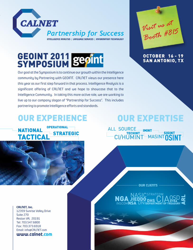
Our goal at the Symposium is to continue our growth within the Intelligence
community by Partnering with GEOINT. CALNET views our presence here
this year as our first step forward in that process. Intelligence Analysis is a
significant offering of CALNET and we hope to showcase that to the
Intelligence Community. In taking this more active role, we are working to
live up to our company slogan of “Partnership for Success”. This includes
partnering to promote Intelligence efforts and standards.
Visit us at
Booth #815
SYMPOSIUMGEOINT 2011 OCTOBER 16 - 19
SAN ANTONIO, TX
www.calnet.com
CALNET, Inc.12359 Sunrise Valley DriveSuite 270Reston VA, 20191Tel: 703.547.6800Fax: 703.373.6918Email: [email protected]
OUR EXPERTISEALL SOURCE
CI/HUMINTIMINT
MASINTSIGINT
OSINTTECHINT
OUR EXPERIENCENATIONAL STRATEGIC
OPERATIONAL
TACTICAL

tODay’S SESSION DESCRIptIONS
LunChtIME WORKShOPS
12:30 p.M. - 2:00 p.M.
gEOINt Support for Crisis Management: Operational Experience, Development Strategy, and Cooperation perspective for International actorsRoom 204
GEOINT has become an essential support tool for crisis management in the global arena. This international panel, chaired by the European Union Satellite Centre (EUSC), will discuss operational experience, strategic lessons-learned and the necessary institutional framework for effective cooperation involving such high-profile GEOINT organizations as the National Geospatial-Intelligence Agency (NGA), the Intelligence Fusion Centre (IFC, tbc) and the United Nations Department of Peacekeeping Operations (DPKO, tbc). The different missions of these key actors, their individual success stories and key leverage points, as well as their views on strategies to meet future challenges are presented. The panelists will discuss the increasing relevance of close and trustful cooperation for effective support to international missions and operations, and the special importance of clear legal frameworks as a necessary precondition. Examples for multilateral coordination of workload and data sharing will be presented. In this context, international cooperation will be addressed as a not only possible, but in fact necessary to overcome the ever-increasing demand for GEOINT services, as well as a possible answer to the constraining effects of budgetary limitations on operational effectiveness.
• adriano Baptista, Head of the Operations Division, European Union Satellite Centre (EUSC)
• Robert Lamon, Senior GEOINT Advisor, Office of International Affairs, National Geospatial-Intelligence Agency (NGA)
• tomaž lovrencic, Director, European Union Satellite Centre (EUSC)
BREAKOut tRACKS
2:00 p.M. - 4:00 p.M.
the gEOINt Dimension of Socio-Cultural analysisRoom 001
The geospatial dimension of socio-cultural dynamics reaches far beyond “human terrain.” This session sheds light on the wide range of national security activities that require geospatial and temporal comprehension of a deluge of socio-cultural information and data concepts confronting the U.S. government. Panelists include leaders from the diplomacy/development community, the defense/intelligence community and others experienced with harnessing the geospatial dimension of socio-cultural dynamics to efficiently and effectively drive security outcomes.
• Moderator: Richard J. O’Lear, Chief, Intelligence Community Strategic Studies Group (ODNI/CIA)
• Dr. gary Condon, Science & Technology Advisor, ISR Task Force, Office of the Under Secretary of Defense for Intelligence (OUSD(I))
• Dr. Joseph F. Fontanella, U.S. Army Geospatial Information Officer and Director, Army Geospatial Center (AGC)
• John. p. goolgasian, Deputy Lead for Online GEOINT Services, National Geospatial-Intelligence Agency (NGA)
• Col Sharon R. hamilton, U.S. Army, Director, Human Terrain System, Training and Doctrine Command (TRADOC)
• Reginald Dean hyde, Deputy Under Secretary of Defense (Intelligence & Security), Office of the Under Secretary of Defense for Intelligence (OUSD(I))
Future of International Commercial Satellite Imagery: a CEO perspectiveRoom 103
The commercial remote sensing industry has experienced tremendous growth in the past decade. First considered an innovative way for the U.S. government to sure up its national imaging collection ability, the CRS industry now has a strong international commercial market. What is next for the CRS industry? Will it push technological boundaries and build more sophisticated satellites or expand into other business services? Hear various perspectives on these questions by attending this session.
• Moderator: gil I. Klinger, Deputy Assistant Secretary of Defense, Space and Intelligence, Office of the Undersecretary of Defense for Acquisition, Technology and Logistics (OUSD(AT&L))
• Dr. Manfred Krischke, Chief Executive Officer, RapidEye AG• Marcello Maranesi, Chief Executive Officer, e-GEOS • Matthew O’Connell, Chief Executive Officer, President and
Director, GeoEye • John Schumacher, Chief Executive Officer, Astrium North
America • herbert F. Satterlee III, Chief Executive Officer, MDA
Information Systems • Jeffrey (Jeff) tarr, President and Chief Executive Officer,
DigitalGlobe
Nga’S Vision ImplementedBallroom A
A year after NGA launched its new vision at GEOINT 2010, key NGA leaders will describe significant accomplishments thus far and discuss the way ahead for realizing the vision in the next couple of years. Panel members—who include representatives from the Vision Implementation Team, Analysis and Production, InnoVision, and Acquisition—also will answer audience questions to provide greater insight into and context for NGA’s vision.
• Introductory Keynote: Michael a. Rodrigue, Director, Vision Integration Team, National Geospatial-Intelligence Agency (NGA)
• Moderator: Keith L. Barber, Director, National System for Geospatial-Intelligence Expeditionary Architecture IPO, National Geospatial-Intelligence Agency (NGA)
• Dr. ann M. Carbonell, Director, National System for Geospatial-Intelligence Open IT Environment, Initiative Office of the Director, National Geospatial-Intelligence Agency (NGA)
• Daniel M. Cotter, Chief Technology Officer, Office of the Chief Information Officer, Department of Homeland Security (DHS)
• tonya M. Crawford, Director, Acquisition Contracts, National Geospatial-Intelligence Agency (NGA)
• Dr. Robert h. Laurine Jr., NGA West Senior Executive, National Geospatial-Intelligence Agency (NGA)
• Mark J. Riccio, Senior Lead NGA Disaster Strategic Initiative, Chief Federal Bureau of Investigation NGA Support Team, National Geospatial-Intelligence Agency (NGA)
18
mOndAy, OCtOBer 17, 2011GeOint 2011 SymPOSium

• RemoteView™ GEOINT Leadership
• 3D GeoIntelligence
• Automated Feature Extraction
• Full Motion Video (FMV) Analysis
• LIDAR Based Solutions
• Multi-INT Data Fusion
• IMINT and GIS Integration
• Geospatial Data Management
• Smartphone Tools for the Tactical Edge
Overwatch is forging new frontiers with solutions that provide rapid and accurate geospatial and Multi-INT analysis capabilities. Thousands of US Defense and Intelligence analysts rely daily on Overwatch’s innovative technologies and solutions to provide situational awareness and understanding for full spectrum operations.
FORGING INTEGRATED INTELLIGENCEWITH MISSION PROVEN SOLUTIONS
Overwatch’s comprehensive imagery, geospatial, and Multi-INT solutions are used worldwide. To learn more about how Overwatch products and services can help you, please call (800) 937-6881 or email [email protected].
www.overwatch.com
© 2011 Overwatch Systems, Ltd. All right reserved. Overwatch Systems is a strategic business of Textron Systems Advanced Systems, an operating unit of Textron Systems, a Textron Inc. (NYSE: TXT) company. RemoteView is a trademark of Overwatch Systems, Ltd.
VISIT US AT GEOINT 2011 BOOTH #549
®
GIF Mag Ad - Overwatch - Oct 2011.indd 1 9/21/2011 11:51:05 AM

gEN KEIth B. aLEXaNDER, U.S. aRMyCommander, u.S. Cyber Command (uSCyBerCOm); director, national Security Agency
Gen. Keith B. Alexander, is the commander, U.S. Cyber Command (USCYBERCOM) and director, National Security Agency/chief, Cen-tral Security Service, Fort George G. Meade, Md.
aDRIaNO BaptIStahead of the Operations division, european union Satellite Centre
Adriano Baptista is currently head of the Op-erations Division of the European Union Satel-lite Centre (EUSC).
KEIth L. BaRBERdirector, national System for Geospatial-intelligence expeditionary Architecture iPO, national Geospatial-intelligence Agency
After serving as the Agency’s implementa-tion lead for achieving goal of “OnLine, On-Demand” services, Barber returned as the director, National System for Geospatial-Intel-ligence Expeditionary Architecture Integrated Program Office at the National Geospatial-Intelligence Agency.
DR. aNN M. CaRBONELLdirector, national System for Geospatial-intelligence Open it environment initiative, Office of the director of the national Geospatial-intelligence Agency
Dr. Ann M. Carbonell is the director of the NGA System for Geospatial-Intelligence (NSG) Open IT Architecture Initiative (Open IT) for the Director/NGA. Carbonell is currently re-sponsible for developing and implementing an open IT architecture supporting all strategic initiatives and improving access to and use of GEOINT content and applications regardless of role, mission, location or security domain.
BRUCE CaRLSONdirector, national reconnaissance Office
Bruce Carlson was appointed the 17th direc-tor of the National Reconnaissance Office on June 12, 2009. After retiring from the United States Air Force in January 2009, he served as a defense industry consultant and as a mem-ber of the Board of Directors of EADS North America. Carlson provides direction, guidance and supervision over all matters pertaining to the NRO and executes other authorities spe-cifically delegated by the Secretary of Defense and the Director of National Intelligence.
thE hONORaBLE JaMES R. CLappER JR.director of national intelligence
James R. Clapper Jr. was sworn in as the fourth Director of National Intelligence (DNI) on August 9, 2010. As DNI, Clapper oversees the U.S. intelligence community and serves as the principal intelligence adviser to the president.
DR. gaRy CONDONScience & technology Advisor, iSr task force, Office of the under Secretary of defense for intelligence
Dr. Gary Condon is the science and technol-ogy advisor to the ISR Task Force in the Office of the Under Secretary of Defense for Intel-ligence. Condon is also the associate leader of the Intelligence and Decision Technologies Group at MIT Lincoln Laboratory in Lexington, Mass.
DaNIEL M. COttERChief technology Officer, Office of the Chief information Officer, department of homeland Security
Daniel M. Cotter is responsible for overseeing programs for information sharing, enterprise architecture, enterprise data management, geospatial management, identity, credential-ing and access management, as well as the Homeland Security Information Network and the National Operations Center Common Op-erational Picture investments.
tONya M. CRawFORDdirector, Acquisition Contracts, national Geospatial-intelligence Agency
Tonya Crawford currently serves as the di-rector, Acquisition Contracts at the National Geospatial-Intelligence Agency.
thE hONORaBLE JOaN aVaLyN DEMpSEySenior vice President, Booz Allen hamilton
Joan Avalyn Dempsey is a senior vice presi-dent at Booz Allen Hamilton where she leads the firm’s intelligence business in central Maryland.
DR. JOSEph F. FONtaNELLau.S. Army Geospatial information Officer and director, u.S. Army Geospatial Center
Dr. Joseph F. Fontanella was selected to the senior executive service in January 2011 to serve as the director of the U.S. Army Geo-spatial Center in Alexandria, Va.
JOhN. p. gOOLgaSIaNdeputy lead for Online GeOint Services, national Geospatial-intelligence Agency
John P. Goolgasian has served as the imple-mentation lead for analytic depth since Janu-ary 2011.
COL ShaRON R. haMILtON, U.S. aRMydirector, human terrain System, training and doctrine Command
COL Sharon R. Hamilton was commissioned as a Military Intelligence Corps second lieu-tenant in 1985 and has served on active duty for the past 26 years.
REgINaLD DEaN hyDEdeputy under Secretary of defense (intelligence & Security), Office of the under Secretary of defense for intelligence
Reginald Dean Hyde is a career CIA National clandestine service operations officer. He has held a variety of senior leadership and man-agement positions in the Agency.
RyaN JOhNSONChief executive Officer, rapideye
Ryan Johnson is the new president and CEO of RapidEye Canada Ltd., which is part of a group of related companies, which includes Iunctus Geomatics Corp.
gIL I. KLINgERdeputy Assistant Secretary of defense, Space and intelligence, Office of the undersecretary of defense for Acquisition, technology and logistics
Gil I. Klinger is the deputy assistant secretary of Defense for Space and Intelligence within the Undersecretary of Defense for Acquisition, Technology and Logistics where he is respon-sible for acquisition oversight of all space and intelligence programs executed by the De-partment of Defense.
ROBERt LaMONSenior GeOint Advisor, Office of international Affairs, national Geospatial-intelligence Agency
Robert Lamon has worked for NGA and its predecessor organizations for 25+ years.
DR. ROBERt h. LaURINE JR.nGA west Senior executive, national Geospatial-intelligence Agency
Dr. Robert H. Laurine, Jr. has served as the NGA West Senior Executive (WX), since Au-gust 2010. As WX, he is a member of the NGA Board of Directors, supporting the execu-tion of NGA resources in St. Louis and nine other NGA locations. In addition, Laurine was recently appointed the lead of NGA’s Online GEOINT Services Initiative.
MS. LEtItIa a. LONgdirector, national Geospatial-intelligence Agency
Letitia A. Long was appointed the director of the National Geospatial-Intelligence Agency on August 9, 2010.
tODay’S SESSION paRtICIpaNtS
20
mOndAy, OCtOBer 17, 2011GeOint 2011 SymPOSium
tOMaž LOVRENCICdirector, european union Satellite Centre (euSC)
Tomaž Lovrencic’s responsibilities as direc-tor include management of production of GEOINT products based on satellite imagery for the support of EU’s Common Foreign and Security Policy missions and operations; rela-tions with EUSC key stakeholders, the twenty-seven EU Member States; and other activities of the EU Satellite Centre where space and security are involved.
MaRCELLO MaRaNESIChief executive Officer, e-GeOS
Marcello Maranesi is the chief executive of-ficer of e-GEOS, a company created by the Italian Space Agency (ASI) and Telespazio (a Finmeccanica/Thales company) for the worldwide commercialization of the COSMO-SkyMed Program.
MatthEw M. O’CONNELLChief executive Officer, President and director, Geoeye
Matthew M. O’Connell is GeoEye’s president, chief executive officer, and director.
RIChaRD J. O’LEaRChief, intelligence Community Strategic Studies Group
Richard J. O’Lear is the chief of the Intelli-gence Community Strategic Studies Group, a small office under CIA’s Executive Agency that does studies for the ODNI on topics of high priority interest.
MaRK J. RICCIOSenior lead nGA disaster Strategic initiative, Chief federal Bureau of investigation nGA Support team, national Geospatial-intelligence Agency
Mark J. Riccio is the senior lead for NGA’s Di-saster Strategic Initiative as well as the chief FBI NGA Support Team.
MIChaEL a. RODRIgUEdirector, vision integration team, national Geospatial-intelligence Agency
Michael A. Rodrigue serves as director, NGA Vision Integration Team (VIT). The VIT supports the director, deputy director and chief operat-ing officer in facilitating the successful coor-dination, integration and synchronization of activities realizing the NGA vision and strategic initiatives.
hERBERt F. SattERLEE IIIChief executive Officer, mdA information Systems inc.
Herbert F. Satterlee III has extensive experience leading and growing emerging companies.
JOhN SChUMaChERChief executive Officer, Astrium north America
John Schumacher is responsible for leverag-ing the company’s broad space product and technology offerings to meet the needs of U.S. customers.
JEFFREy (JEFF) taRRPresident and Chief executive Officer, digitalGlobe inc.
Jeffrey (Jeff) Tarr joined DigitalGlobe in April 2011 as president and CEO.
All keynotes and panels take place in Ballroom A of the henry B. Gonzalez Convention Center.
8:00 A.M. - 8:30 A.M.
Opening Ceremony and welcome remarksK. Stuart Shea, CEO & Chairman of the Board, USGIF; President, Intelligence, Surveillance and Reconnaissance Group, SAIC
8:30 A.M. - 8:45 A.M.
master of Ceremoniesthe honorable Joan avalyn Dempsey, Senior Vice President, Booz Allen Hamilton
8:45 A.M. - 9:30 A.M.
Keynotethe honorable James R. Clapper Jr., Director of National Intelligence
9:30 A.M. - 10:15 A.M.
KeynotegEN Keith B. alexander, U.S. Army, Commander, U.S. Cyber Command (USCYBERCOM), and Director, National Security Agency/Chief, Central Security Service (NSA/CSS)
10:15 A.M. - 10:45 A.M.
BreakBallroom A Foyer Lobby
tODay’S agENDa
Photo courtesy of Oscar einzig
2121
mOndAy, OCtOBer 17, 2011GeOint 2011 SymPOSium

10:45 A.M. - 11:30 A.M.
KeynoteMr. Bruce a. Carlson, Director, National Reconnaissance Office (NRO)
11:00 A.M. - 6:00 P.M.
Exhibit hall Open
11:30 A.M. - 12:15 P.M.
KeynoteMs. Letitia a. Long, Director, National Geospatial-Intelligence Agency (NGA)
12:00 - 2:00 P.M.
Lunch in the Exhibit hall
12:30 - 2:00 P.M.
Lunchtime workshop
GeOint Support for Crisis management: Operation experience, development Strategy and Cooperation Perspective for international ActorsRoom 204
• adriano Baptista, Head of the Operations Division, European Union Satellite Centre (EUSC)
• Robert Lamon, Senior GEOINT Advisor, Office of International Affairs, National Geospatial-Intelligence Agency (NGA)
• tomaž Lovrenčič, Director, European Union Satellite Centre (EUSC)
2:00 P.M. - 4:00 P.M.
Breakout tracks
the GeOint dimension of Socio-Cultural AnalysisRoom 001
• Moderator: Richard J. O’Lear, Chief, Intelligence Community Strategic Studies Group (ODNI/CIA)
• Dr. gary Condon, Science & Technology Advisor, ISR Task Force, Office of the Under Secretary of Defense for Intelligence (OUSD(I))
• Dr. Joseph F. Fontanella, U.S. Army Geospatial Information Officer and Director, Army Geospatial Center (AGC)
• John. p. goolgasian, Deputy Lead for Online GEOINT Services, National Geospatial-Intelligence Agency (NGA
• COL Sharon R. hamilton, U.S. Army, Director, Human Terrain System, Training and Doctrine Command (TRADOC)
• Reginald Dean hyde, Deputy Under Secretary of Defense (Intelligence & Security), Office of the Under Secretary of Defense for Intelligence (OUSD(I))
nGA’s vision implementedBallroom A
• Introductory Keynote: Michael a. Rodrigue, Director, Vision Integration Team, National Geospatial-Intelligence Agency (NGA)
• Moderator: Keith L. Barber, Director, National System for Geospatial-Intelligence Expeditionary Architecture IPO, National Geospatial-Intelligence Agency (NGA)
• Dr. ann M. Carbonell, Director, National System for Geospatial-Intelligence Open IT Environment Initiative Office of the Director, National Geospatial-Intelligence Agency (NGA)
• tonya M. Crawford, Director, Acquisition Contracts, National Geospatial-Intelligence Agency (NGA)
• Daniel M. Cotter, Chief Technology Officer, Office of the Chief Information Officer, Department of Homeland Security (DHS)
• Dr. Robert h. Laurine Jr., NGA West Senior Executive, National Geospatial-Intelligence Agency (NGA)
• Mark J. Riccio, Senior Lead NGA Disaster Strategic Initiative, Chief Federal Bureau of Investigation NGA Support Team, National Geospatial-Intelligence Agency (NGA)
future of international Commercial Satellite imagery: A CeO PerspectiveRoom 103
• Moderator: gil I. Klinger, Deputy Assistant Secretary of Defense, Space and Intelligence, Office of the Undersecretary of Defense for Acquisition, Technology and Logistics (OUSD(AT&L))
• Ryan Johnson, Chief Executive Officer, RapidEye AG• Marcello Maranesi, Chief Executive Officer, e-GEOS• Matthew O’Connell, Chief Executive Officer, President and
Director, GeoEye• John Schumacher, Chief Executive Officer, Astrium North
America• herbert F. Satterlee III, Chief Executive Officer, MDA
Information Systems• Jeffrey (Jeff) tarr, President and Chief Executive Officer,
DigitalGlobe
4:00 P.M. - 6:00 P.M.
Exhibit hall Networking Reception
all keynotes and panels take place in Ballroom a of the henry B. gonzalez Convention Center. all exhibit hall events take place in halls a & B of the Convention Center.
8:00 A.M. - 8:15 A.M.
uSGif Awards PresentationKeith J. Masback, President, USGIF and Kevin G. Jackson, Chair, USGIF Awards Subcommittee; and Assistant VP, Business Development Intelligence Systems Business Unit, SAIC
8:15 A.M. - 8:30 A.M.
Master of Ceremonies: Mg John M. Custer, U.S. Army (Ret.), Director of Federal Missions and Programs, EMC Corp.
8:30 A.M. - 9:15 A.M.
Keynotegen Douglas M. Fraser, U.S. Air Force, Commander, U.S. Southern Command (SOUTHCOM)
9:00 A.M. - 10:15 A.M.
tech talks(Tech Talks Theater, Exhibit Hall B)
tOMORROw’S agENDa
22
mOndAy, OCtOBer 17, 2011GeOint 2011 SymPOSium

9:15 A.M. - 10:15 A.M.
panel
Intelligence Integration • James g. Clark, Director, Intelligence, Surveillance and
Reconnaissance Innovations; Deputy Chief of Staff for ISR, Headquarters U.S. Air Force
• Mg (p) Mary a. Legere, U.S. Army, Commanding General, United States Army Intelligence and Security Command (INSCOM)
• Ed Mornston, Director, Joint Intelligence Task Force – Combating Terrorism, Directorate for Analysis, Defense Intelligence Agency (DIA)
• Douglas J. Naquin, Director, DNI Open Source Center• Kshemendra paul, Program Manager, Information Sharing
Environment, Office of the Director of National Intelligence (ODNI)
10:15 A.M. - 10:45 A.M.
Networking BreakBallroom A Lobby
10:45 A.M. - 11:30 A.M.
Keynotethe honorable w. Craig Fugate, Administrator, Federal Emergency Management Agency (FEMA)
11:00 A.M. - 6:00 P.M.
Exhibit hall Open
11:30 A.M. - 12:30 P.M.
panel
Forging Collaboration in the Coalition Environment• Moderator: Ltg Michael t. Flynn, U.S. Army, Assistant Director
of National Intelligence for Partner Engagement, Office of the Director of National Intelligence (ODNI)
• Brigadier N. R. Davies CBE MC, Commander, Intelligence Collection Group (ICG), United Kingdom
• BRIg David Collin gillian, Chief of (Australia) Defence Force Liaison Officer to the U.S. Joint Chiefs of Staff
• Major-general Vance J.h., OMM, MSC, CD, Director of Staff, Strategic Joint Staff, Canada
12:30 P.M. - 2:00 P.M.
Lunch in the Exhibit hall
12:30 P.M. - 2:00 P.M.
Lunchtime workshop
Commercial SaR Satellite workshopRoom 202
• Moderator: John Moeller, John Moeller, President, JJ Moeller & Associates
• Dr. Oliver Lang, Senior Application Development Manager, Astrium GEO-Information Services – Infoterra GmbH
• Sam park, Ph.D., Director, Radar Products & Services, Geospatial Division, MDA Information Systems Inc.
• Luca pietranera, Head, COSMO-SkyMed Product Innovation and Technical Support, e-GEOS
12:30 P.M. - 2:00 P.M.
Lunchtime workshop
Maritime ISRRoom 204
• Moderator: paul Sartorius, Lead, Maritime and Expeditionary Systems Integration, Information Systems & Global Services–National, Advanced Programs, Lockheed Martin
• Capt Raymond E. Chartier Jr., U.S. Navy, Director, Maritime Safety Office, National Geospatial-Intelligence Agency (NGA)
• Mark Mohler, Vice President, Programs, Acquisition and Engineering, TAPE
• Capt Jose Nieves, U.S. Coast Guard, Deputy Director, National Maritime Intelligence Center (NMIC)
• J. terry Simpson, Chief Technology Officer and Intelligence Enterprise Information Management Officer, Headquarters, Marine Corps
2:00 P.M. - 4:00 P.M.
Breakout tracks
Crowd Sourcing Intelligence: a Look at International Disaster Relief & RecoveryRoom 001
• Moderator: terrence Busch, Senior Intelligence Officer, Battlespace Visualization Division, Office for Joint Warfare Support, Defense Intelligence Agency (DIA)
• John Crowley, Fellow, Harvard Humanitarian Initiative’s Crisis Dynamics Program; Analyst, National Defense University (NDU)
• todd huffman, Private Consultant• Carl J. Stuekerjuergen, Senior Technical Advisor, Directorate
of Intelligence, Central Intelligence Agency (CIA)• Nathaniel wolpert, Disaster Response Team Lead, Domestic
Operations East/Homeland Security Division, National Geospatial-Intelligence Agency (NGA)
Defense Intelligence Information EnterpriseBallroom A
• Moderator: Kevin p. Meiners, Deputy Under Secretary of Defense (Portfolio, Programs & Resources), Under Secretary of Defense for Intelligence (OUSD(I))
• Edward J. Lane, Director, Information Sharing Group, Office of Mission Framework and Services, Ground Enterprise Directorate, National Reconnaissance Office (NRO)
• Richard h. Radcliffe, Director, International Intelligence Technology and Architectures, Office of the Undersecretary of Defense for Intelligence (OUSD(I))
• John a. Snevely, DCGS Family of Systems, OUSD(I)/ISR Programs
• Neill tipton, Director, Information Sharing and Partner Engagement, Deputy Under Secretary of Defense for Joint & Coalition Warfighter Support
• Kevin L. west, Deputy Director, Intelligence Surveillance and Reconnaissance Enterprise Programs, Office of the Undersecretary of Defense for Intelligence (OUSD(I))
• Richard E. Matthews, Deputy Director, Exploitation and Collaboration Division, Intelligence, Surveillance and Reconnaissance Task Force
gEOINt in Support of homeland SecurityRoom 103
• Moderator: Douglas R. Cavileer, Chairman, Interagency Council for Applied Homeland Security Technology (ICAHST)
• Dr. Suzette Kimball, Deputy Director, U.S. Geological Survey (USGS)
• Dr. John S. Morgan, Command Science Advisor, U.S. Army Special Operations Command (USASOC)
• Maj gen william N. Reddel III, U.S. Air Force, Adjutant General, New Hampshire National Guard
4:00 P.M. – 5:15 P.M.
tech talksExhibit Hall B
4:00 P.M. – 6:00 P.M.
Exhibit hall Networking Reception
7:00 P.M. – 11:00 P.M.
gEOwalk Corporate hospitality Night – San antonio Riverwalk
24
mOndAy, OCtOBer 17, 2011GeOint 2011 SymPOSium
United States Geospatial Intelligence Foundation
June 5GEOINTeraction Tuesday
2012GEOINTCOMMUNITYWEEK
Held annually in the Washington, D.C. area, GEOINT Community Week brings together stakeholders within the geospatial intelligence tradecraft for a week of networking, classified briefings, exhibits and learning workshops.
June 4-7Army Geospatial & Imagery Conference(SECRET//REL FVEY)
www.usgif.org
June 8USGIF Invitational
June 4USGIF Workshop Series
June 6NGA Tech Showcase East (TS//SI/TK)
June 7USGIF Technology Day

AtM MAChInES
Automated Teller Machines are located in the Lobby Bridge.
BuSInESS CEntER (thE uPS StORE)
lobby BridgeThe UPS Store Business Center inside the Henry B. Gonzalez Convention Center offers a full-range of services—from computer rentals to faxing, copies andmailing services.Emailstore4180@theupsstore.comPhone210-258-8950Fax210-258-8951
hours:Monday – Friday . . . . . . . . . . . . . . . . . . . . . . . . 8:00 A.M. - 6:30 P.M.Saturday . . . . . . . . . . . . . . . . . . . . . . . . . . . . . . . . . . . . 9:00 A.M. - 5 P.M.Sunday . . . . . . . . . . . . . . . . . . . . . . . . . . . . . . . . . . . . . .1:00 P.M. - 5 P.M.
EMAIL/IntERnEt ACCESS
exhibit halls A & B during regular expo hoursStay in touch by email and print boarding passes while you’re at the showin the Internet Café Booth 174 sponsored by USGIF.
EMERGEnCy/FIRSt AID
In case of emergency, please pick up any house phone and dial 911. Please inform security to fill out an incident report. If you are in need of first-aid, go to room H23 in the back of Exhibit Hall A.
LOSt & FOunD
Please bring found articles to the USGIF Show Management Office located in Booth 301. At the end of the show, all unclaimed articles will be forwarded to Henry B. Gonzalez Convention Center security.
MEALS & BREAKS
Continental breakfast is available to attendees with Full Symposium Passes in Ballroom A foyer & walkway on Monday, Tuesday and Wednesday:Monday, October 17 . . . . . . . . . . . . . . . . . . . .7:00 A.M. - 8:00 A.M.Tuesday, October 18 . . . . . . . . . . . . . . . . . . . .7:00 A.M. - 8:00 A.M.Wednesday, October 19 . . . . . . . . . . . . . . . .7:00 A.M. - 8:00 A.M.
Lunch for attendees and exhibit booth personnel is served each day in Exhibit Halls A & B:Monday, October 17 . . . . . . . . . . . . . . . . . . . 12:30 P.M. - 2:00 P.M.Tuesday, October 18 . . . . . . . . . . . . . . . . . . . 12:30 P.M. - 2:00 P.M.Wednesday, October 19 . . . . . . . . . . . . . . . 12:30 P.M. - 2:00 P.M.
MEDIA ROOM
All members of the media not registered in advance must report directly to the media room to complete their on-site registration before proceeding to the registration counter. Proper credentials are required for those who have not pre-registered.Room 002Sunday, October 16 . . . . . . . . . . . . . . . . . . . . . 1:00 P.M. - 4:30 P.M.Monday, October 17 . . . . . . . . . . . . . . . . . . . . 7:30 A.M. - 4:30 P.M.Tuesday, October 18 . . . . . . . . . . . . . . . . . . . . 7:30 A.M. - 4:30 P.M.Wednesday, October 19 . . . . . . . . . . . . . . . . 7:30 A.M. - 4:30 P.M.
REGIStRAtIOn hOuRS
west Registration - Outside Exhibit halls a & BSaturday, October 15 . . . . . . . . . . . . . . . . . . . 3:00 P.M. - 6:00 P.M.Sunday, October 16 . . . . . . . . . . . . . . . . . . . . . 8:00 A.M. - 7:00 P.M.Monday, October 17 . . . . . . . . . . . . . . . . . . . . 6:30 A.M. - 6:00 P.M.Tuesday, October 18 . . . . . . . . . . . . . . . . . . . . 7:00 A.M. - 6:00 P.M.Wednesday, October 19 . . . . . . . . . . . . . . . . 7:30 A.M. - 5:00 P.M.
ExhIBIt hALL hOuRS
exhibit halls A & BMonday, October 17 . . . . . . . . . . . . . . . . . . .11:00 A.M. - 6:00 P.M.Tuesday, October 18 . . . . . . . . . . . . . . . . . . .11:00 A.M. - 6:00 P.M.Wednesday, October 19 . . . . . . . . . . . . . . .11:00 A.M. - 5:00 P.M.
ShOW POLICIES
Badges & AttendanceGEOINT Symposium badges are non-transferable. Badges must be worn and visible at ALL Symposium-related activities. One-Day Exhibit Only Pass holders may upgrade to a Full Symposium Pass to attend Symposium sessions by paying the difference in the rate on the date of change. Badges may not be shared.
dress CodeUSGIF suggests business attire for all conference sessions, breakout tracks and the exhibit hall. Military officers and enlisted personnel are encouraged to wear a duty uniform or business suit. Business casual attire is recommended for the Welcome Reception, GEOWalk Corporate Hospitality Night and the Closing Celebration.
mobile Phones & PagersAs a courtesy to all speakers and your fellow attendees, please place all mobile devices in silent mode during all Symposium sessions. In addition, all cell phones must be answered outside of the meeting rooms.
PhotographyPhotography is not permitted without the prior approval of show management. By attending the GEOINT 2011 Symposium, you grant USGIF permission to use photographs taken by the official show photographer for future marketing purposes.
Solicitation PolicySolicitation of any kind is prohibited at the GEOINT 2011 Symposium. By registering to attend, you acknowledge this policy and agree that you will not advertise, represent or distribute literature for products or services to our exhibitors, attendees or staff without the express written approval of USGIF. Any attendee that violates this policy will forfeit their registration credentials.
GOInG GREEn
USGIF is committed to doing our part to keep the planet healthy by securing environmentally friendly meeting spaces such as the Henry B. Gonzalez Convention Center. The Henry B. Gonzalez Convention Center helps reduce their carbon impact by reducing waste, conserving energy and water and using recycled items such as trash bags, paper towels, copy paper and other items throughout the Convention Center. For more information, please visit http:// www.sahbgcc.com/default.asp?sanantonio=31.
MUSt KNOw aND whERE tO gO
26
mOndAy, OCtOBer 17, 2011GeOint 2011 SymPOSium