GEOGRAPHIC RESEARCH IN THE U.S. GEOLOGICAL … · system for use with remotely sensed ... Aircraft...
68
Transcript of GEOGRAPHIC RESEARCH IN THE U.S. GEOLOGICAL … · system for use with remotely sensed ... Aircraft...
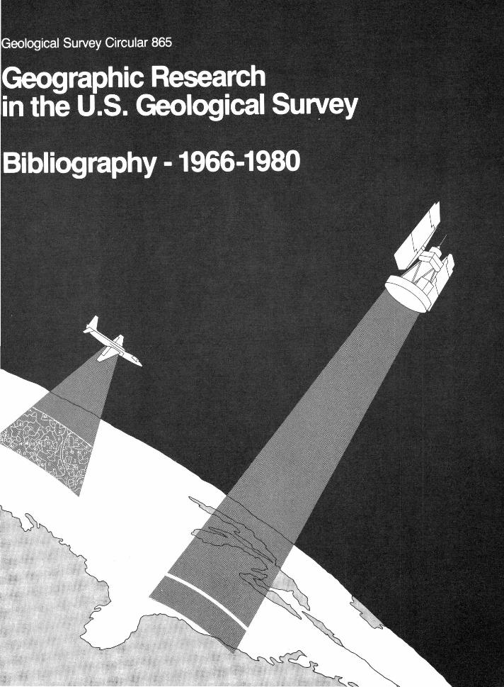


GEOGRAPHIC RESEARCH IN THE U.S. GEOLOGICAL SURVEY:
BIBLIOGRAPHY - 1966-1980
By Mary E. Graziani
Geological Survey Circular 865
1982

United States Department of the Interior JAMES G. WATT, Secretary
Geological Survey Dallas L. Peck, Director
Free on application to Distribution Branch, Text Products Section, U. S. Geological Survey, 604 South Pickett Street, Alexandria, VA 22304

CONTENTS
Page
Introduction....................................................... 1
Historical Background.............................................. 1
Description of Bibliography........................................ 3
Bibliographic Entries.............................................. 5
Author Index....................................................... 49
Subject Index...................................................... 54


GEOGRAPHIC RESEARCH IN THE U.S. GEOLOGICAL SURVEY: BIBLIOGRAPHY - 1966-1980
By
Mary E. Graziani
INTRODUCTION
This bibliography was compiled to provide a record of geographic research, particularly research utilizing remotely sensed data, undertaken in the Geological Survey from 1966 through 1980. It also provides specific information about the availability of reports, papers, maps, and other publications which resulted from this research. Many of the cited reports deal specifically with testing the use of satellite and high-altitude remotely sensed data in a geographic context, some of which was performed in anticipation of, and in conjunction with, the launching of the first Earth observation satellites.
Although geography is a science utilized in many multidisciplinary projects, the entries in this bibliography pertain only to research undertaken or sponsored by the Geological Survey's Office of Geographic Research, Geography Program, or Geographic Applications Program.
HISTORICAL BACKGROUND
Although the first Chief Geographer of the Geological Survey was appointed in 1882 to head up the topographic mapping program, it was not until the early 1960's when the decision was made to assume responsibility for the publication of The National Atlas of the United StateS
that the role of geography as a discipline assumed a new status in the Survey. In 1965, Arch C. Gerlach, then Chief of the Geography and Map Division of the Library of Congress, came to the Survey on a loan basis to act as Editor of the Atlas and to head up the National Atlas Project in the Topographic Division. In December 1967, Mr. Gerlach was appointed Staff Geographer (later Chief Geographer), and after a few months the Office of the Chief Geographer was established in the Director's Office to initiate and carry out geographic research and to provide advisory, planning, liaison, and coordination functions in the field of geography in the Geological Survey, the Department of the Interior, and other Federal agencies and national and international organizations.
Beginning in 1966, the Geographic Applications Program (GAP) initiated several research projects to demonstrate the value and use of remote sensing technology and data in the field of geography with funding support from the Department of the Interior's Earth Resources Observation Systems (EROS) Program and the National Aeronautics and Space Administration. The direction of this Program was assigned in 1968 to the Chief Geographer, who coordinated the research carried out through contracts with various university departments of geography, professional associations, and a few private firms.

Among the in-house research projects carried out by the Geographic Applications Program were the Central Atlantic Regional Ecological Test Site (CARETS) project, the Census Cities projec~ the Phoenix-Tucson (Arizona) land use project, and the Ozarks Regional Commission cooperative land use mapping project. Concurrent with these projects were exploratory research and development of a geographic information system for handling and analyzing land resource data, and the development of a land use and land cover classification system for use with remotely sensed data. James R. Anderson, a professor at the University of Florida who had worked on the agricultural section of the National Atlas, was selected to lead the land use classification system research work.
Mr. Anderson was appointed Chief Geographer in 1972 to continue the research for a land use and land cover classification and the land use mapping of the Nation. In 1973, the Office of the Chief Geographer and the Geographic Applications Program were renamed the Geography Program.
Development and testing of the two-level land use and land cover classification system for use with high-altitude and remote sensor data continued, and in late 1974, the Geological Survey received funding from Congress to initiate a Land Use Data and Analysis (LUDA) Program under which the entire United States would be mapped using this system. The program provided for the systematic and comprehensive collection and update of land use and land cover data on a nationwide basis at scales of 1:250,000 and 1:100,000,
2
with demonstration mapping of selected urban areas at 1:50,000 and 1:24,000.
In April 1975, in order to more effectively meet the Nation's rapidly increasing need for multidisciplinary Earth and other natural science and related engineering information needs, the Geological Survey formally established the Land Information and Analysis (LIA) Office. Included in the new LIA organization were the Geography Program, the Earth Resources Observation Systems (EROS) Program, the Resource and Land Investigations (RALI) Program, and two related research programs from other divisions of the USGS--the Environmental Impact Analysis Program and the Earth Sciences Applications Program.
The Geography Program's responsibilities in LIA were to collect and analyze land use data on a nationwide basis, develop methods of applying these data, and demonstrate their usefulness to the solution of problems arising from the interaction of land use practices and environmental factors. The data compiled were to be stored in digital form for computer manipulation and displayed in map and statistical formats. Some other research aims were to experiment with automated land use and land cover classification data and detection of changes for future uses of land, as well as to develop accuracy/reliability standards for land use mapping.
A reorganization plan was approved in late November 1979 by the Department of the Interior to establish a National Mapping Division in the Geological Survey

which would include the Geography Program, the Topographic Division, and certain elements of the Publications Division. The addition of the functions of the Geography Program to this new organization would expand the products, services, and research potential of the new Division. Within the National Mapping Division, the Geography Program became the Office of Geographic Research. When the reorganization became effective in mid-1980, Anderson accepted the position of Senior Scientist in the Office of the Chief, National Mapping Division, and Richard E. Witmer, who had joined the USGS in 1974, was appointed Chief of the Office of Geographic Research.
Primary functions of the new Office of Geographic Research remained unchanged except for the addition of the responsibility for research and investigations on domestic names for national standardization and information services. Today, work continues on conducting geographic research and investigations for the land use and land cover program, related research projects, and on participating in multidisciplinary studies employing the techniques and methods of modern geographic analysis.
BIBLIOGRAPHY
Citations in this bibliography include reports, papers, maps, and other publications listed in alphabetical-chronological order by author or, in the absence of an individual author, by contracting agency or university. Because many were prepared in response to specific research projects and by
3
contract with various universities and other scientific groups, distribution copies of individual reports, papers, maps, etc., may no longer be available from the Geological Survey. However, copies of the majority of the papers and reports are on file in the Office of Geographic Research, National Mapping Division, Reston, Va. We have included the primary preparing agency, university, or scientific group as well as contract or grant numbers in each entry in order to provide as much information as possible to researchers. In some cases funding for this research was awarded through several different agencies, but we have not attempted to include all agencies in each entry.
A few experimental maps, including two land use and land cover maps in full color, have been included. Standard land use and land cover and associated maps placed on open file and published in the L-series by the Geological Survey have not been included in this bibliography.
Indexes by subject and by author are provided to aid researchers.
Geological Survey open-file reports or maps are on file for reference use in USGS libraries, Public Inquiries Offices, or National Cartographic Information Center (NCIC) offices located in Reston, Va., Denver, Colo., or Menlo Park, Calif. Most of the open-file reports, although no maps, may be reproduced on a cost basis by request to the USGS OpenFile Services Section, Western Distribution Branch, u.s. Geological Survey, Box 25425, Federal Center,

Denver, CO 80225. When ordering, please indicate the open-file number, if known, as well as the author and title.
Reports or maps which have an NTIS number indicated in the entry may be ordered from the National Technical Information Service (NTIS), U.S. Department of Commerce,
4
Springfield, VA 22161. When ordering, please include the NTIS number shown in the entry.
For further information concerning this geographic research, contact the Chief, Office of Geographic Research, National Mapping Division, u.s. Geological Survey, Mail Stop 521, Reston, VA 22092.

Ackerman, E.A., and Alexander, R.H., 1975, Toward a national land use information system: U.S. Geological Survey and National Aeronautics and Space Administration; prepared under Interagency Memorandum of Understanding No. S-70243-AG; Final Report, v. 3, 68 p. [NTIS Report No. E-77-10015. Report also referred to as CARETS.]
Aldrich, S.A., Aldrich, F.T., and Rudd, R.D., 1969, The employment of weather satellite imagery in effort to identify and locate the forest-tundra ecotone in Canada: Corvallis, Oregon State University; prepared under U.S. Geological Survey Grant No. 14-08-0001-G-24; 32 p.
__________ 1971, An effort to identify the canadian foresttundra ecotone signature on weather satellite imagery: University of Michigan Symposium on Remote Sensing of Environment, Ann Arbor, Mich., May 1971, Proceedings, v. 2, p. 9-20.
Alexander, P.B., Forjen, Wendell, and Gogarty, Ray, 1969, Geographic analysis of infrared imagery obtained over the Bitterroot region of western Montana and eastern Idaho: Missoula, University of Montana Department of Geography; prepared under U.S. Geological Survey Grant No. 14-08-0001-G-22; 44 p.
5
Alexander, R.H., 1968, Mission 73 and associated tests: National Aeronautics and Space Administration Earth Resources Aircraft Program Status Review, 1st, Houston, Tex., September 1968, Proceedings, v. 1, p. 3-1 - 3-33.
__________ 1969a, Geographic applications program--reports completed and in preparation: U.S. Geological Survey; prepared under National Aeronautics and Space Administration Contract No. W-12570, Task No. 160-75-01-30-10; 13 p.
------~--1969b, Geography Program review and integration: National Aeronautics and Space Administration Earth Resources Aircraft Program Status Review, 2d, Houston, Tex., September 1969, Proceedings, v. 1, p. 17-1 - 17-23.
1972, Central Atlantic --------regional ecological test site: National Aeronautics and Space Administration Earth Resources Program Review, 4th, Houston, Tex., January 1972, Proceedings, v • 3 , p. 7 2-1 - 7 2-2 3.
1973a, Land use classifi---------cation and change analysis using ERTS-1 imagery in CARETS: Symposium on Significant Results Obtained from the Earth Resources Technology Satellite-!, New Carrollton, Md., March 1973, Proceedings, v. 1, sec. B, p. 923-930.

-----------1973b, ERTS regional scale overview linking land use and environmental processes in CARETS: Symposium on Significant Results Obtained from the Earth Resources Technology Satellite-!, New Carrollton, Md., March 1973, Proceedings, v. 1, sec. B, p. 931-937.
__________ 1974, CARETS land use maps: u.s. Geological Survey Open-File Report 74-148, scale 1:250,000, 8 maps.
___________ 1977, Land use and land cover maps for geologic hazard planning, in Anderson, J.R., ed., Remote sensing of the electro magnetic spectrum: Association of American Geographers, v. 4, no. 4, p. 142-147.
__________ 1979, Central Atlantic regional ecological test site-A prototype regional environmenmental information system: u.s. Geological Survey and National Aeronautics and Space Administration; prepared under Interagency Memorandum of Understanding No. S-70243-AG; Final Report, v. 1, 360 p. [NTIS Report No. N-80-15526. Report also referred to as CARETS.]
Alexander, R.H., Bowden, L.W., Marble, D.F., and Moore, E.G., 1968, Remote sensing of urban environments: Symposium on Remote Sensing of Environment, 5th, University of Michigan, Ann Arbor, Mich., April 1968, Proceedings, p. 889-911. [NTIS Report No. N-69-33685.]
6
Alexander, R.H., Bowden, L.W., Marble, D.F., Simonett, David, and Wilson, Jack, 1968, Report on the Apollo VII imagery--USGS Geography Group: Paper presented at the NASA/MSC Apollo 7 Science Screening, Houston, Tex., December 1968.
Alexander, R.H., Buzzanell, P.J., Fitzpatrick, K.A., Lins, H.F., Jr., and McGinty, H.K., III, 1975a, Norfolk and environs--a land use perspective: u.s. Geological Survey and National Aeronautics and Space Administration; prepared under Interagency Memorandum of Understanding No. S-70243-AG; Final Report, v. 2, pt. A, 64 p. [NTIS Report No. E-77-10014. Report also referred to as CARETS.]
1975b, Norfolk and ----------environs--a land use perspec-tive: u.s. Geological Survey and National Aeronautics and Space Administration; prepared under Interagency Memorandum of Understanding No. S-70243-AG; Final Report, v. 2, pt. B [map supplement], 11 plates. [NTIS Report No. E-77-10014. Report also referred to as CARETS.]
Alexander, R.H., DeForth, P.W., Fitzpatrick, K.A., Lins, H.F., Jr., and McGinty, H.K., III, 1975, Interpretation, compilation and field verification procedures in the CARETS project: u.s. Geological Survey and National Aeronautics and Space Administration; prepared under Interagency Memorandum of Understanding No. S-70243-AG; Final Report, v. 5, 117 p. [NTIS Report No. E-77-10016. Report also referred to as CARETS.]

Alexander, R.H., Fitzpatrick, K.A., Letke, K.S., Lins, H.F., Jr., and McGinty, H.K., III, 1976 [1977], Land use and land cover--Central Atlantic regional ecological test site (CARETS), 1972: U.S. Geological Survey Miscellaneous Field Studies Map MF-798, scale 1:500,000, 5 maps.
Alexander, R.H., Fitzpatrick, K.A., Lins, H.F., Jr., and McGinty, H.K., III, 1975, Land use and environmental assessment in the Central Atlantic region: National Aeronautics and Space Administration Earth Resources Survey Symposium, Houston, Tex., June 1975, Proceedings, v. I-C, p. 1683-1727.
Alexander, R.H., Lewis, J.E., Jr., Lins, H.F., Jr., Jenner, C.B., Outcalt, S.I., and Pease, R.W., 1976, Applications of Skylab data to land use and climatological analysis: u.s. Geological Survey and National Aeronautics and Space Administration; prepared under Interagency Memorandum of Understanding No. S-70243-AG; Final Report, Skylab/EREP Investigation 469, Part A. [NTIS Report No. E-77-10123. Report also referred to as CARETS.]
Altman, N.D., 1972, The applicability of photographic sensors to urban and regional planning with specific reference to the area served by the Tennessee Valley Authority: Evanston, Ill., Northwestern University Department of Geography; prepared under U.S. Geological Survey Contract No. 14-08-0001-12009; Technical Report 71-4, 17 p.
Anderson, J.R., 1970, A review and evaluation of land use classification schemes used in studies of the AAG Commission on Geographic Applications of Remote Sensing: Gainesville, University of Florida Department of Geography: prepared under u.s. Geological Survey Contract No. 14-08-0001-12009; Technical Report 70, 40 p.
__________ 1973a, Land use analysis with remote sensor data: American Congress on Surveying and Mapping Annual Meeting, 33d, Washington, D.C., March 1973, Proceedings, p. 230-235.
__________ 1973b, The u.s. Geological Survey and land use mapping: Environmental Protection Agency Conference on Environmental Quality Sensors, 2d, Las Vegas, Nev., October 1973, Proceedings, p. V-1 - V-16.
1973c, Applications of ----------remote sensing to land use planning: Paper presented at Conservation Congress for Land Use Planning, Louisville, Ky., November 1973, 8 p.
__________ 1974a, ERTS-1 and data for national land use planning: Canaveral Council of Technical Societies Space Congress, 11th, Cocoa Beach, Fla., Proceedings, p. 3-25 - 3-28.
1974b, Land use data from ----------remote sensing for resource
7
planning: Kodak Seminar-Aerial Photography as a Planning Tool, Rochester, N.Y., October 15-16, 1973, Proceedings, p. 10-14.

__________ 1974c, Land use implications of orbital surveys: Paper presented at Battelle Institute Conference on Land Use Planning: Implications for Citizens and State and Local Governments, Columbus, Ohio, March 1974, 7 p.
__________ 1975, Regional analysis and the use of remote sensing, in Manual of remote sensing: American Society of Photogrammetry, v. 2, p. 1950-1952.
_________ 1976a, Applications to land-use mapping and planning, in ERTS-1, A new window on our planet: u.s. Geological Survey Professional Paper 929, p. 223-224.
__________ 1976b, Land use mapping and data compilation in U.S.G.S., in Innovations in land use management: Grand Forks, University of North Dakota Press, p. 9-20.
__________ 1977a, Land use and land cover changes--a framework for monitoring: u.s. Geological Survey Journal of Research, v. 5, no. 2, p. 143-153.
__________ 1977b, Land use and land cover map and data compilation in the u.s. Geologia! Survey: William T. Pecora Memorial Symposium on Mapping with Remote Sensor Data, 2d, Sioux Falls, S. Oak., 1976, Proceedings, p. 1-12.
__________ 1977c, The role of remote sensing in the discipline of geography, in Remote sensing of the electro magnetic spectrum: Association of American Geographers, v. 4, no. 3, p. 3-8.
__________ ed., 1977d, Land use and land cover maps and statistics from remotely sensed data, v. 4, no. 4, of Remote sensing of the electro magnetic spectrum: Association of American Geographers, 193 p.
__________ 1978, Land use and land cover mapping and related research in u.s. Geological Survey: State University of New York Applied Geography Conference, Binghamton, N.Y., 1978, Proceedings, v. 1, p. 7-18.
-------1979a, Geographers in government: Professional Geographer, v. 31, no. 3, p. 265-270.
1979b, Geographic infor----------
8
mation systems in land use planning and management: State University of New York Applied Geography Conference, Binghamton, N.Y., 1979, [Proceedings], v. 2, p. 4-11.
1979c, Land resource --------information and world food production: Paper presented at American Society of Photogrammetry and American Congress on Surveying and Mapping Fall Meeting, Sioux Falls, S. Dak., September 17-20, 1979, 19 p.
Anderson, J.R., and Beetschen, c.w., 1976, National Atlas of the United States--Second Edition: Paper presented at American Congress on Surveying and Mapping Annual Meeting, 36th, Washington, D;C., February 22-28, 1976.

Anderson, J.R., Hallam, C.A., and Witmer, R.E., 1979, Applied geography in the U.S. Geological Survey, in Henry, N. F., and Frazier, J.W., eds., Research in contemporary and applied geography--A discussion series: Binghamton, State University of New York, v. 3, no. 3, 73 p.
Anderson, J.R., Hardy, E.E., and Roach, J.T., 1972, A land-use classification system for use with remote-sensor data: u.s. Geological Survey Circular 671, 16 p.
Anderson, J.R., Hardy, E.E., Roach, J.T., and Witmer, R.E., 1976, A land use and land cover classificaton system for use with remote sensor data: u.s. Geological Survey Professional Paper 964, 28 p.
Anderson, J.R., and Lins, H.F., Jr., 1978, Coastal applications of USGS land use data: American Society of Civil Engineers Coastal Zone 1 78 Symposium on Technical, Environmental, Socioeconomic, and Regulatory Aspects of Coastal Zone Management, San Francisco, Calif., March 1978, Proceedings, p. 943-964.
Anderson, J.R., and Place, J.L., 1971, Regional land use mapping--the Phoenix pilot project: International Workshop on Earth Resources Survey Systems, Ann Arbor, Mich., May 1971, Proceedings, v. 2, p. 197-210.
Anderson, J.R., and Witmer, R.E., 1978, The use of remotely sensed data in the land use and land cover map and data compilation program of the U.S. Geological Survey: European Seminar on Regional Planning and Remote Sensing, Toulouse, France, June 20-24, 1977, Proceedings, p. 52-61.
1980, Land resource planning applications of land use mapping and inventory from remotely sensed data: International Symposium on Remote Sensing of the Environment, 14th, San Jose, Costa Rica, April 1980, Proceedings, v. 1, p. 429-443.
Anderson, K.E., 1978, Spatial analysis in a data base environment, in Dutton, G., ed., First international advanced study symposium on topological data structures for geographic information systems: Cambridge, Mass., Harvard Papers on Geographic Information Systems, v. 2.
-----1979, A geographic
9
information system for land use data in the United States of America: Paper presented at U.N. Regional Cartographic Conference for the Americas, 2d, Mexico City, September 3-14, 1979, 16 p.

Anderson, K.E., Guptill, S.C., Hallam, C.A., and Mitchell, W.B., 1977, Developing and using a geographic information system for handling and analyzing land resource data, in Anderson, J.R., ed., Remote sensing of the electro magnetic spectrum: Association of American Geographers, v. 4, no. 4, p. 67-83.
Aschmann, Homer, 1970, Prolegomena to the remote sensing of environmental quality: Riverside, University of California Department of Geography; prepared under u.s. Geological Survey Contract No. 14-08-0001-12009; Technical Report 70-3, 13 p.
Association of American Geographers, 1968, Final report of the AAG Commission on Geographic Applications of Remote Sensing for May 1967 -May 1968: Johnson City, East Tennessee State University Department of Geography; prepared under u.s. Geological Survey Contract No. 14-08-0001-10921; 41 p.
__________ 1969, Final report of the AAG Commission on Geographic Applications of Remote Sensing for May 1968 - May 1969: Johnson City, East Tennessee State University Department of Geography; prepared under u.s. Geological Survey Contract No. 14-08-0001-10921; no. 2, 132 p.
Bendelow, S.W., and Goodyear, F.F., 1975, Utility of CARETS products to local planners--an evaluation: u.s. Geological Survey and National Aeronautics and Space Administration; prepared under Interagency Memorandum of Understanding No. S-70243-AG; v. 13, 46 p. [NTIS Report No. E-77-10023. Report also referred to as CARETS.]
Berlin, G.L., 1969, Waveform and computer analysis of geographic phenomena recorded on color and color infrared multispectral imagery from aerial and orbital altitudes: Boca Raton, Florida Atlantic University Department of Geography; prepared under u.s. Geological Survey Contract No. 14-08-0001-10936; Interagency Report NASA-155, 156 p.
Betak, J.F., 1967, Object identification in aerial photographs--a preliminary report: Evanston, Ill., Northwestern University Department of Geography; prepared under u.s. Geological Survey Contract No. 14-08-0001-10654; 15 p.
__________ 1969a, Some more observations on visual cues in aerial photographs: Evanston, Ill., Northwestern University Department of Geography; prepared under u.s. Geological Survey Contract No. 14-08-0001-10654; 245 p.
10

__________ 1969b, Two-dimensional syntax and visual cues in aerial photographs: Evanston, Ill., Northwestern University Department of Geography; prepared under u.s. Geological Survey Contract No. 14-08-0001-10654; 29 p.
Binsell, Ronald, 1967, Dwelling unit estimation from aerial photography: Evanston, Ill., Northwestern University Department of Geography; prepared under u.s. Geological Survey Contract No. 14-08-0001-10654; 37 p.
Bowden, L.W., 1968a, Multi-sensor signatures of urban morphology, function, and evolution: Riverside, University of California Department of Geography; prepared under u.s. Geological Survey Contract No. 14-08-0001-10674; Status Report 2, Technical Report 2 (revised), 36 p.
1968b, Imaging the variable environment--selected samples from the United States: Riverside, University of California Department of Geography; prepared under u.s. Geological Survey Contract No. 14-08-0001-10674; Status Report 2, Technical Report 3, 30 p.
1968c, Southern California ----------regional resource studies: National Aeronautics and Space Administration Aircraft Program Status Review, 1st, Houston, Tex., September 1968, Proceedings, v. 1, p. 4-1 - 4-29.
1971, Studies in remote ----------sensing of southern California and related environments: Riverside, University of California Department of Geography; prepared under u.s. Geological Survey Contract No. 14-08-0001-10674; Interagency Report USGS-222, Final Report, 18 p.
Bowden, L.W., and Alexander, R.H., 1968, Geographic remote sensing tests in southern California, Spring 1968, in Pascucci, R.F., and North, G.W., 1968, Mission summary and data catalog: u.s. Geological Survey and National Aeronautics and Space Administration Southern California Remote Sensing Program, 14 p.
Bowden, L.W., Thrower, N.J.W., and Tiedemann, C.E., 1967, Status report on remote sensing of southern California and related environments, Part !--Discussion and observations: Riverside, University of California Department of Geography; prepared under u.s. Geological Survey Contract No. 14-08-0001-10674; Status Report 1, 103 p.
Brassel, K.E., and Fegeas, R., 1979, An algorithm for shading of regions on vector display devices: Computer Graphics, v. 13, no. 2, p. 126-133.
Brooner, W.G., 1970, Agricultural crop discrimination with color infrared photography--a study in Douglas County, Kansas:
11
Lawrence, University of Kansas Department of Geography and Center for Research, Inc.; prepared under U.S. Geological Survey Contract No. 14-08-0001-12077; Final Report, app. 1, 92 p.

Buzzanell, P.J., 1975, Potential usefulness of CARETS data for environmental impact assessment: u.s. Geological Survey and National Aeronautics and Space Administration: prepared under Interagency Memorandum of Understanding No. S-70243-AG: Final Report, v. 11, 72 p. [NTIS Report No. N-77-10021. Report also referred to as CARETS.]
Buzzanell, P.J., and McGinty, H.K., III, 1975, Environmental problems in the coastal and wetlands ecosystems of Virginia Beach, Virginia: u.s. Geological Survey and National Aeronautics and Space Administration: prepared under Interagency Memorandum of Understanding No. S-70243-AG: Final Report, v. 10, 13 p. [NTIS Report No. N-77-10020. Report also referred to as CARETS.]
Calkins, H.W., 1974, Examination of selected geographic information systems and digitizing methods, in Tomlinson, R.F., A report to the Geography Program of the U.S. Geological Survey concerning the development of geographical data handling capability: Ottawa, Canada, International Geographical Union Commission on Geographical Data Sensing and Processing: prepared under u.s. Geological Survey Grant No. 14-08-0001-G-67: Part 2.
Cheng, Leslie, 1969, The relationship between temperature and latent heat transfer at the ground during the night: Toronto, Canada, University of Toronto Department of Geography: prepared under u.s. Geological Survey Contract No. 14-08-0001-11259: Technical Report No. 4, 12 p.
Cochrane, G.R., 1968, False-color film fails in practice: Photogrammetric Engineering and Remote Sensing, v. 34, no. 11, p. 1142-1146.
Crawford, N.C., 1967a, The detection of past landscapes from remote sensor data, in Studies in the ~pplication of remote sensing to historical geography, Part 1: Johnson City, East Tennessee State University Remote Sensing Institute: prepared under Office of Naval Research Contract No. N00014-67-0102-0001: Technical Report 2, 51 p.
_________ 1967b, The application of remote sensor data to historical geography--a case study of the Asheville Basin, in Studies in the application of remote sensing to historical geography, Part 2: Johnson City, East Tennessee State University Remote Sensing Institute; prepared under Office of Naval Research Contract No. N00014-67-0102-0001: Technical Report 3, 69 p.
Curry, Leslie, and MacDougall, E.B., 1968, The statistical information content of remotely sensed imagery: Paper presented at Canadian Aeronautics and Space Institute Avionics and Natural Resources Symposium, Ottawa, Canada, January 15-16, 1968, 14 p.
DeAngelis, Robert, 1980, Irrigated cropland, 1979, Hockley and Lamb Counties, Texas: u.s. Geological Survey Open-File Report 80-0168, scale 1:250,000.
12

Dolan, Robert, Hayden, B.P., and Felder, w., 1979, Shoreline periodicities and edge waves: Journal of Geology, v. 87, p. 175-185.
Dolan, Robert, Hayden, B.P., and Lins, H.F., Jr., 1980, Barrier islands: American Scientist, v. 68, no. 1, p. 16-25.
Dolan, Robert, Hayden, B.P., and Vincent, C.L., 1975, Shore zone land use and land cover--Central Atlantic regional ecological test site: u.s. Geological Survey and National Aeronautics and Space Administration; prepared under Interagency Memorandum of Understanding No. s~70243-AG; Final Report, v. 9, 47 p. [NTIS Report No. N-77-10019. Report also referred to as CARETS.]
Dolan, Robert, Lins, H.F., Jr., and Stewart, John, 1980, Geographical analysis of Fenwick Island, Maryland, a middle Atlantic coast barrier island: u.s. Geological Survey Professional Paper 1177-A, 24 p.
Dolan, Robert, and Vincent, Linwood, 1973, Evaluation of land use mapping from ERTS in the shore zone of CARETS: Symposium on Significant Results Obtained from the Earth Resources Technology Satellite-!, New Carrollton, Md., March 1973, Proceedings, v. 1, sec. B, p. 939-948.
Douglass, R.W., 1970, Application of remote sensing techniques to water-oriented outdoor recreation planning: Johnson City, East Tennessee State University Remote Sensing Institute; prepared under Office of Naval Research Contract No. 14-08-0001-12009; Technical Report 69-2, Interagency Report NASA-191, 17 p. [NTIS Report No. PBl-94810.]
Dueker, K.J., 1966, Spatial data systems: Evanston, Ill., Northwestern University Department of Geography; prepared under u.s. Geological Survey Contract No. 14-08-0001-10654; Technical Reports 4, 5, 6.
Dueker, K.J., and Horton, F.E., 1971, Remote sensing and geographic urban information systems: Iowa City, University of Iowa Institute of Urban and Regional Research; prepared under u.s. Geological Survey Contract No. 14-08-0001-12505; Technical Report 3, 33 p.
Edgerton, A.T., Trexler, D.T., Sakamoto, s., and Jenkins, J.E., 1969, Microwave radiometric studies and ground truth measurements of the NASA/USGS southern California test site:
13
El Monte, Calif., AerojetGeneral Corp. Space Division; prepared under u.s. Geological Survey Contract No. 14-08-0001-11425; Interagency Report NASA-149, 43 p.

Ellefsen, R.A., Ennis, R.A., Gaydos, L.J., Morrissey, L.A., Newland, W.L., Thelin, G.P., and Wray, J.R., 1977, Computeraided mapping of land use and land cover using Landsat multispectral scanner data, in Anderson, J.R., ed., Remote sensing of the electro magnetic spectrum: Association of American Geographers, v. 4, no. 4, p. 84-102.
Ellefsen, R.A., Gaydos, L.J., and Wray, J.R., 1976, Computer aided mapping of land use, in ERTS-1, A new window on our planet: u.s. Geological Survey Professional Paper 929, p. 234-243.
Ellefsen, R.A., Gaydos, L.J., Swain, P.H., and Wray, J.R., 1974, New techniques in mapping urban land use and monitoring change for selected U.S. metropolitan areas--an experiment employing computer-assisted analysis of ERTS-1 MMS data: International Society for Photogrammetry Symposium on Remote Sensing and Photo Interpretation, Commission 7, Banff, Canada, October 7-11, 1974, Proceedings, v. 1, p. 51-63.
Ellefsen, R.A. and Peruzzi, Duilio, 1976, Land-use change detection from Landsat and Skylab satellites: International Society for Photogrammetry 13th Congress, Commission 7, Helsinki, Finland, 1976, Proceedings, p. 1-6.
Ellefsen, R.A., Swain, P.H., ~nd Wray, J.R., 1973, Urban land-use mapping by machine processing of ERTS-1 multispectral data--a San Francisco Bay area example: Purdue University Conference on Machine Processing of Remotely Sensed Data, West Lafayette, Ind., 1973, Proceedings, p. 2-A-7 - 2-A-22.
Ellison, J.H., and Williams, L.O., [1969], Measurement on radar images of number of valleys per unit area as a discriminant of sedimentary rock types in the physiographic regions of Tennessee: Johnson City, East Tennessee State University Remote Sensing Institute; prepared under Office of Naval Research Contract No. 00014-67-A-0102-0001; Technical Report 7, 34 p.
Environmental Systems Research Institute, 1976, DIMECNV: A system for converting scannerdigitized mapping data tapes to polygon format: Environmental Systems Research Institute and u.s. Geological Survey, 9 p. [NTIS Report No. PB 266438/AS.]
Eyre, L.A., 1969, An investigation by remote sensing of vacant and unutilized land in an urbanized coastal area of southeast Florida: Boca Raton, Florida Atlantic University Department of Geography; prepared under u.s. Geological Survey Contract No. 14-08-0001-10936; 33 p.
14

Eyton, J.R., 1970, A preliminary investigation of enhancement techniques using IR ektachrome processed as a negative and a positive: Grand Forks, University of North Dakota Department of Geography; prepared under u.s. Geological Survey Contract No. 14-08-0001-12009; Technical Report 69-6 and Supplement 69-A, Interagency Report USGS-197, 17 p.
Fegeas, R.G., 1974a, Computer generated map of Ajo, Arizona, 1971: u.s. Geological Survey Open-File Report 74-90, scale 1:250,000, 1 p., 2 sheets, 4 tables.
__________ 1974b, Computer generated map of Mesa, Arizona, 1971: u.s. Geological Survey Open-File Report 74-88, scale 1:250,000, 1 p., 2 sheets, 4 tables.
__________ 1974c, Computer generated map of Tucson, Arizona, 1971: u.s. Geological Survey OpenFile Report 74-89, scale 1:250,000, 1 p., 2 sheets, 5 tables.
__________ 1978, The graphic input procedure--an operational line segment/polygon graphic to digital conversion, in Dutton, G., ed., First international advanced study symposium on topological data structures for geographic information systems: Cambridge, Mass., Harvard Papers on Geographic Information Systems, v. 7.
1979, Quikdig: system doc----------umentation manual: Amherst, N.Y., State University of New York at Buffalo Geographic Information Systems Laboratory, 220 p.
Fegeas, R.G., and Kewer, P.M., 1977, Transfer of land use and land cover and associated maps into digital format, in Anderson, J.R., ed., Remote sensing of the electro magnetic spectrum: Association of American Geographers, v. 4, no. 4, p. 55-66.
Feng, J.S., Ellefsen, R.A., and Wray, J.R., 1973, An operational application of orthophotomapping in a system of urban change detection--an example from the San Francisco Bay region: American Society of Photogrammetry and American Congress on Surveying and Mapping Orthophoto Workshop II, San Jose, Calif., Proceedings, p. 36-43.
Fitzpatrick, K.A., 1975, Cost, accuracy and consistency comparisons of land use maps made from.high-altitude aircraft photography and ERTS imagery: u.s. Geological Survey and National Aeronautics and Space Administration; prepared under Interagency Memorandum of Understanding No. S-70243-AG; Final Report, v. 6, 61 p. [NTIS Report No. E-77-10017. Report also referred to as CARETS.]
15

Fitzpatrick, K.A, and Lins, H.F., Jr., 1972, A preliminary evaluation of land use mapping and change detection capabilities using an ERTS image covering a portion of the CARETS region: u.s. Geological Survey progress report under NASA/ERTS Experiment 125, 14 p. [NTIS Report No. N72-30314.]
Fitzpatrick-Lins, Katherine, 1978a, Accuracy and consistency comparisons of land use and land cover maps made from highaltitude photographs and Landsat Multispectral imagery: u.s. Geological Survey Journal of Research, v. 6, no. 1, p. 23-40.
__________ 1978b, Accuracy of selected land use and land cover maps in the greater Atlanta region, Georgia: u.s. Geological Survey Journal of Research, v. 6, no. 2, p. 169-173.
1978c, An evaluation of ----------errors in mapping land use changes for the Central Atlantic Regional Ecological Test Site: u.s. Geological Survey Journal of Research, v. 6, no. 3, p. 339-346.
__________ 1980, Accuracy of selected land use and land cover maps at scales of 1:250,000 and 1:100,000: u.s. Geological Survey Circular 829, 24 p.
Fitzpatrick-Lins, Katherine, and Chambers, M.J., 1977, Determination of accuracy and information content of land use and land cover maps at different scales, in Anderson, J.R., ed., Remote sensing of the electro magnetic spectrum: Association of American Geographers, v. 4, no. 4, p. 41-54.
16
Gallagher, D.B., Kleckner, R.L., and Lins, H.F., Jr., 1977, Applications of land use and land cover maps and data compiled from remotely sensed data: in Anderson, J.R., ed., Remote sensing of the electro magnetic spectrum: Association of American Geographers, v.4, no. 3, p. 117-125.
Gaydos, L.J., 1978, Low-cost computer classification of land cover in the Portland area, Oregon, by signature extension techniques: u.s. Geological Survey Open-File Report 78-186, 9 p.
Gaydos, L.J., and Newland, W.L., 1978, Inventory of land use and land cover of the Puget Sound Region using Landsat digital data: u.s. Geological Survey Journal of Research, v. 6, no. 6, p. 807-814.
Gaydos, L.J., Wray, J.R., and Guptill, S.C., 1977, Digital land cover classification of the Washington urban area derived from Landsat data, 1972 and 1973: u.s. Geological Survey map tape DOI/DF77/003. [NTIS Tape No. PB246-650/3WN.]
Gerlach, A.C., 1966, Geographic applications of remote sensor data from aircraft and spacecraft: Paper presented at International Geographical Union Regional Conference, Mexico City, Mexico, August 3-8, 1966.

1967, Utilization of ----------orbital data through inter-national and national organizations: Paper presented at Association of American Geographers Meeting, St. Louis, Mo., April 1967.
__________ 1968a, Advances in geographic and thematic mapping applications of remote sensor data: University of Michigan Symposium on Remote Sensing of Environment, 5th, Ann Arbor, Mich., April 1968, Proceedings, p. 191-196.
__________ 1968b, A decade of spacecraft and remote sensor development for peaceful, scientific purposes: Paper presented at University of Michigan Summer Institute of Geographic Applications of Remote Sensing, 15 p.
__________ 1968c, Spacecraft and remote sensor development for peaceful, scientific purposes: Paper presented at Meeting of Pan American Institute of Geography and History Directing Council, 11th, Mexico City, Mexico, August 1-9, 1968.
__________ 1968d, The Geographic Applications Program: National Aeronautics and Space Administration Earth Resources Aircraft Program Status Review, 1st, Houston, Tex., September 1968, Proceedings, v. 1, p. 1-1 - 1-4.
1968e, Use of space photo-__________ graphs and imagery in geographic education: Paper presented at Council for Geographic Education Annual Meeting, 54th, Kansas City, November 1968, 8 p.
1969a, The Geographic ----------Applications Program of the u.s. Geological Survey: Photogrammetric Engineering and Remote Sensing, v. 35, no. 1, p. 58-60.
1969b, Summary, objec-----------tives, and progress in the Geographic Applications Program: National Aeronautics and Space Administration Earth Resources Aircraft Program Status Review, 2d, Houston, Tex., September 18, 1969, Proceedings, v. 1, p. 11-1 - 11-12.
1970, Introductory ----------comments on the USGS Geographic Applications Program: National Aeronautics and Space Administration Earth Resources Program Status Review, 3d, Houston, Tex., December 1970, Proceedings, v. 1, p. 1-1 - 1-5.
__________ 1972, The Geography and Human-Cultural Resources Working Group of the EROS Program: National Aeronautics and Space Administration Earth Resources Program Review, 4th, Houston, Tex., January 1972, Proceedings, v. 3, p. 70-1 -70-4.
17

Gerlach, A.C., and Wray, J.R., 1971, Problems of urban development and growth: National Aeronautics and Space Administration Conference on Remote Sensing of the Chesapeake Bay, Wallops Island, Va., April 1971, Proceedings, 9 p.
Goodell, H.G., and Reed, w., 1971, The potential of remote sensing as a data base for state agencies: the Virginia model: Charlottesville, University of Virginia Department of Environmental Sciences; prepared under u.s. Geological Survey Contract No. 14-08-0001-12540; Interagency Report USGS-210, 131 p.
Goodell, H.G., Woolheater, C.M., and Echternacht, K.L., 1972, Environmental application of remote sensing methods to coastal zone land use and marine resource management-final report: Charlottesville, University of Virginia Department of Environmental Sciences; prepared under u.s. Geological Survey Contract No. 14-08-0001-12540; Interagency Report USGS-243, v. 1, v. 2 {apps. A-E) , v. 3 {app. F), v. 4 (apps. G-J), 132 p. [NTIS Report No. PB 214-547.]
Graziani, M.E., 1977, Selected publications--USGS Geography Program staff, in Anderson, J.R., ed., Remote sensing of the electro magnetic spectrum: Association of American Geographers, v. 4, no. 4, p. 156-165.
Greene, G.M., 1980, Testing an urban climate simulator: u.s. Geological Survey Professional Paper 1099-E, 17 p.
Griffiths, T.B., Howard, W.A., and Kracht, J.B., 1971, Developing remote sensing display modes to satisfy urban planning data input needs: Denver, Colo., University of Denver Department of Geography; prepared under u.s. Geological Survey Contract No. 14-08-0001-11979; Interagency Report USGS-207, 37 p.
Gumerman, G.J., 1971, The identification of archaeological sites by false color infrared aerial photography: Prescott, Ariz., Prescott College Department of Anthropology; prepared under u.s. Geological Survey Grant No. 14-08-0001-G-34; Interagency Report USGS-211, 15 p. [NTIS Report No. PB 204-540LL.]
Gumerman, G.J., and Neely, James, 1971, An archaeological survey of the Tehuacan Valley, Mexico --a test of color infrared photography: Prescott, Ariz., Prescott College Department of Anthropology; prepared under u.s. Geological Survey Grant No. 14-08-0001-G-34; 17 p.
Guptill, S.C., 1978a, An evaluative technique for categorical maps, in Geographical Analysis:
18
Columbus, Ohio State University Press, v. 10, no. 3, p. 248-261.

__________ 1978b, The impact of computer graphics, data manipulation software, and computing equipment on spatial data structures, in Dutton, G., ed., First international advanced study symposium on topological data structures for geographic information systems: Cambridge, Mass., Harvard Pap~rs on Geographic Information Systems, v. 2.
________ 1978c, An "optimal" filter for showing nominal data: U.S. Geological Survey Journal of Research, v. 6, no. 2, p. 161-167.
__________ 1979, A digital cartographic data base for land use and land cover and associated maps, in Mapping software and cartographic data bases: Cambridge, Mass., Harvard University Laboratory for Computer Graphics and Spatial Analysis, p. 99-106.
__________ 1980, The development and use of digital cartographic data bases: in Blaser, A., ed., Data base techniques for pictorial applications: Berlin, Heidelberg, Springer-Verlag, p. 65-77.
Hallam, C.A., 1978, A system for land analysis: State University of New York Applied Geography Conference, Binghamton, N.Y., 1978 [Proceedings], v. 1, p. 19-34.
Hammer, R.M., 1970, Evaluation of Apollo 9 photographs of the Sudan: Ashland, Southern Oregon College Department of Geography; Interagency Report USGS-130, 44· p.
Hannah, J.W., [1969], A feasibility study for the application of remote sensors to selected urban and regional land use planning studies: Johnson City, East Tennessee State University Remote Sensing Institute; prepared under Office of Naval Research Contract No. N00014-67-A-0102-0001; Technical Report 11, 61 p.
Haralick, R.M., Caspall, F., and Simonett, D.S., 1970, Using radar imagery for crop discrimination--a statistical and conditional probability study: Remote Sensing of the Environment, v. 1, p. 131-142.
Hart, J.F., 1980, Land use change in a Georgia Piedmont county: Annals, Association of American Geographers, v. 70, no. 4, p. 492-527.
Hayden, B.P. and Dolan, Robert, [1979], Barrier islands, lagoons, and marshes: u.s. Geological Survey unpublished report, 23 p.
Hayden, B.P., Dolan, Robert, Rea, c.c., and Felder, W.N., 1979, Erosion rates--how representative are they?: Shore and Beach, April 1979, p. 25-30.
Henderson, F.M., 1970, Consistency of road network detection using color space photography:
19
Lawrence, University of Kansas Department of Geography and Center for Research, Inc.; prepared under u.s. Geological Survey Contract No. 14-08-0001-12077; Final Report, app. 2, 71 p.

Henderson, F.M., and Simonett, D.S., 1970, Space technology as a tool in delimiting transportation networks: Association of American Geographers Annual Meeting, 66th, San Francisco, Calif., August 23-26, 1970, Proceedings, v. 2, p. 71-73.
Hirsch, S.A., 1980, Cartographic considerations for merging digital spatial data files: American Society of Photogrammetry and American Congress on Surveying and Mapping Fall Technical Meeting, Niagara Falls, N.Y., October 7-10, 1980, Proceedings, ASP Technical Papers, p. DP-2-C-1 -DP-2-C-16.
Honea, R.B., 1969a, The derivation of trade areas and traffic flows from remote sensing imagery: Johnson City, East Tennessee State University; prepared under Office of Naval Research Contract No. N00014-67-A-0102-0001; Technical Report 15, 20 p.
__________ 1969b, Determination of landform texture from radar imagery: Johnson City, East Tennessee State University; prepared under Office of Naval Research Contract No. N00014-67-A-0102-0001; Technical Report 16, 15 p.
__________ 1970, Interpretation of selected transportation systems from remote sensor imagery of the Tellico project area: Johnson City, East Tennessee State University Department of Geography; prepared under u.s. Geological Survey Contract No. 14-08-0001-12009; Technical Report 70-2, 19 p.
Honea, R.B., and Prentice, V.L., 1968, Selected bibliography of remote sensing: Association of American Geographers Commission on Geographic Applications of Remote Sensing; prepared under u.s. Geological Survey Contract No. 14-08-0001-10921; Technical Letter NASA-129, 34 p.
Horton, F.E., 1970, The application of remote sensing techniques to selected inter and intra urban data acquisition problems: National Aeronautics and Space Administration Earth Resources Program Review, 3d, Houston, Tex., December 1970, Proceedings, v. 1, p. 3-1 - 3-12.
----------1971, The application of remote sensing techniques to urban data acquisition: International Workshop on Earth Resources Survey Systems, Ann Arbor, Mich., May 1971, Proceedings, v. 2, p. 213-223.
__________ 1972, The application of remote sensing techniques to inter and intra urban analysis-final report: Iowa City, University of Iowa Institute of Urban and Regional Research; prepared under u.s. Geological Survey Contract No. 14-08-0001-12505; Interagency Report USGS-250, 234 p. [NTIS Report No. PB-214-449.]
Horton, F.E., and Marble, D.F., 1969, Housing quality in urban areas--data acquisition and classification through the analysis of remote sensor imagery: National Aeronautics and Space Administration Earth Resources Aircraft Program Status Review, 2d, Houston, Tex., September 1969, Proceedings, v. 1, p. 15-1 - 15-13.
20

Horton, F.E •. , Pease, R.W., Johnson, c.w., Senger, L.W., and Simonett, D.S., 1969, Apollo 9 screening review: u.s. Geological Survey unpublished report, dated April 11, 1969.
Howard, J.Y., 1971, Determination of land use change with the use of aerial photography: Metropolitan Washington Council of Governments; prepared under U.S. Geological Survey Contract No. 14-08-0001-12708; Technical Report No. 3, Interagency Report USGS-251, 28 p.
Huffman, E.T., Bay, C.A., and Pascucci, R.F., 1969, Analysis of multi-sensor data for Office of Emergency Preparedness purposes: Alexandria, Va., Raytheon Company Autometric Operations; prepared under u.s. Geological Survey under Contract No. 14-08-0001-11505; 52 p.
International Geographical Union, 1975, First interim report on digital geographic data handling activities in the u.s. Geological Survey: International Geographical Union Commission on Geographical Data Sensing and Processing; prepared under u.s. Geological Survey Grant No. 14-08-0001-G-215; October 1975, 247 p.
__________ 1976a, First interim report on digital geographic data handling activities in the u.s. Geological Survey: International Geographical Union Commission on Geographical Data Sensing and Processing; prepared under u.s. Geological Survey Grant No. 14-08-0001-G-215; revised March 1976, 365 p.
__________ 1976b, Second interim report on digital spatial data handling in the U.S. Geological Survey: International Geographical Union Commission on Geographical Data Sensing and Processing; prepared under u.s. Geological Survey Grant No. 14-08-0001-G-215; 255 p.
Johnson, c.w., 1969, Imperial Valley land-use studies--a continuum from Mission 73 to Apollo 9: National Aeronautics and Space Administration Earth Resources Aircraft Program Status Review, 2d, Houston, Tex., September 1969, Proceedings, v. 1, p. 14-1 - 14-10.
Johnson, c.w., Bowden, L.W., and Pease, R.W., 1969a, A system of regional agricultural land use mapping tested against small scale Apollo 9 color infrared photography of the Imperial Valley (California): Riverside, University of California Department of Geography; prepared under u.s. Geological Survey Contract No. 14-08-0001-10674; Status Report 3, Technical Report 5, Interagency Report NASA-183, 96 p.
1969b, Evaluation of ---------Apollo 9 SQ-65 experiment (Imperial Valley): Riverside, University of California Department of Geography; prepared under u.s. Geological Survey Contract No. 14-08-0001-10674; 6 p.
Johnson, Robert, 1980a, Irrigated cropland, 1978, Chase, Dundy,
21
and Perkins Counties, Nebraska: u.s. Geological Survey OpenFile Report 80-0641, scale 1:250,000.

__________ 1980b, Irrigated cropland, 1978, Cheyenne and Sherman Counties, Kansas: u.s. Geological Survey Open-File Report 80-0640, scale 1:250,000.
Johnson, Thomas, 1980a, Irrigated cropland, 1978, Laramie County, Wyoming: u.s. Geological Survey Open-File Report 80-0638, scale 1:250,000.
_________ 1980b, Irrigated cropland, 1978, Kit Carson, Phillips, and Yuma Counties, Colorado: u.s. Geological Survey Open-File Report 80-0639, scale 1:250,000.
Jonas, Peter, and Wright, Bruce, 1980a, Irrigated cropland, 1978, Cherry County, Nebraska: u.s. Geological Survey Open-File Report 79-1626, scale 1:250,000.
---------1980b, Irrigated cropland, 1978, Todd County, South Dakota: u.s. Geological Survey Open-File Report 79-1627, scale 1:250,000.
Kleckner, R.L., 1978, A national program for land use and land cover mapping using remotely sensed data: Joint Conference on Sensing of Environmental Pollutants, 4th, New Orleans, La., November 6-11, 1977, p. 91-94.
22
Kracht, J.B., and Howard, W.A., 1970, Applications of remote sensing, aerial photography, and instrumented imagery interpretation to urban area studies: Denver, Colo., University of Denver Department of Geography; prepared under u.s. Geological Survey Contract No. 14-08-0001-11979; Interagency Report USGS-199, 35 p.
Lancaster, M.J., 1969, Suggested areas of geographic investigation using remote sensing imagery of the Tennessee Valley test site (Tellico project area) : State University of New York at Binghamton, Department of Geography unpublished report, 13 p.
Latham, J.P., 1968, Instrumentation of image analysis and TV simulation techniques: National Aeronautics and Space Administration Earth Resources Aircraft Program Status Review, 1st, Houston, Tex., September 1968, Proceedings, v. 1, p. 9-1 - 9-29.
----------1972, Simulating and interpreting aerial or orbital TV observations of geographic patterns: Boca Raton, Florida Atlantic University Department of Geography; prepared under u.s. Geological Survey Contract No. 14-08-0001-10936; Interagency Report USGS-223, 108 p. [NTIS Report No. PB 209618/LL.]
_________ 1979a, Land use change analysis and current remotely sensed patterns in Pennsylvania: Paper presented at American Society of Photogrammetry Annual Meeting, Washington, D.C., March 18-24, 1979, 8 p.

---------1979b, Land use change in Pennsylvania's third quarter of the 20th century: Paper presented at Association of American Geographers Annual Meeting, 75th, Philadelphia, Pa., April 22-25, 1979.
_________ 1979c, Land use change in Pennsylvania: 1950s to 1970s: Paper presented at Southeastern Division Association of American Geographers Annual Meeting. Nashville, Tenn., November 19, 1979, 6 p.
Lewis, A.J., 1968, Evaluation of multiple polarized radar imagery for the detection of selected cultural features: Lawrence, University of Kansas; prepared under u.s. Geological Survey Contract No. 14-08-0001-10848; Interagency Report NASA-130, 28 p.
Lindgren, D.T., 197la, Color infrared (CIR) photography--a tool for environmental analysis: Hanover, N.H., Dartmouth College Department of Geography; prepared under u.s. Geological Survey Contract No. 14-08-0001-12958; Interagency Report USGS-219, 24 p. [NTIS Report No. PB 204472/LL.]
__________ 197lb, Dwelling unit estimation with color-IR photos: Photogrammetric Engineering and Remote Sensing, v. 37, no. 4, p. 373-377.
Lins, H.F., Jr., 1979a, Energy development at Kenai, Alaska: Annals, Association of American Geographers, v. 69, no. 2, p. 289-303.
1979b, Some legal consid-----------erations in remote sensing: Photogrammetric Engineering and Remote Sensing, v. 5, no. 6, p. 741-748.
1980, Patterns and trends ----------of land use and land cover on Atlantic and Gulf Coast barrier islands: u.s. Geological Survey Professional Paper 1156, 164 p.
Lins, H.F., Jr., and Milazzo, V.A., 1972, The use of small-scale multi-band photography for detecting land use changes: University of Michigan International Symposium on Remote Sensing of Environment, 8th, Ann Arbor, Mich., October 1972, Proceedings, p. 325-343.
Loelkes, G.L., 1972, Bureau and agency reports: National Aeronautics and Space Administration Earth Resources Program Review, 4th, Houston, Tex., January 1972, Proceedings, v. 3, p. 74-1 - 74-12.
1977, Specifications for ----------land use and land cover and associated maps: u.s. Geological Survey Open-File Report 77-555, 103 p.
Loelkes, G.L., Hardin, I.L.,
23
Jessen, E., Napier, E.C., Johnson, R.A., and Good, W.B., 1977, The compilation process for land use and land cover and associated maps, in Anderson, J.R., ed., Remote sensing of the electro magnetic spectrum: Association of American Geographers, v. 4, no. 4, p. 20-40.

Loelkes, G.L., and McCullough, B.A., 1975, Ozarks pilot land use data base test and demonstration-final report: Little Rock, Ark., Ozarks Regional Commission and u.s. Geological Survey, 33 p.
MacDougall, E.B., 1968a, Coherent optical data processing and remotely sensed imagery: Toronto, Canada, University of Toronto Department of Geography; prepared under u.s. Geological Survey Contract No. 14-08-0001-11259; Interagency Report NASA-145, 63 p.
__________ 1968b, A note on a possible automated image interpretation system: Toronto, Canada, University of Toronto Department of Geography; prepared under u.s. Geological Survey Contract No. 14-08-0001-11259; Technical Report No. 3, 5 p.
__________ 1969, Spatial filtering: Toronto, Canada, University of Toronto Department of Geography, Discussion Paper No. 1, July 1969, 26 p. [Also presented at the International Geographical Union Commission on Quantitative Methods Invitational Conference, University of Michigan, Ann Arbor, July 1969.]
MacPhail, D.o., and Campbell, L.F., Jr., 1970, TheEl Paso (TexasNew Mexico) study area--a comparative analysis of Gemini 5 and Apollo 6 and 9 space photography: Boulder, University of Colorado Department of Geography; prepared under U.S. Geological Survey Contract No. 14-08-0001-12009; Technical Report 69-8, 47 p.
McGinty, H.K., III, 1975, User evaluation of experimental land use maps and related products from the Central Atlantic test site: u.s. Geological Survey and National Aeronautics and Space Administration; prepared under Interagency Memorandum of Understanding No. S-70243-AG; Final Report, v. 12, 175 p. [NTIS Report No. E-77-10022. Report also referred to as CARETS.]
Mallon, H.J., and Howard, J.Y., 197la, Inventory of existing aerial photography of the metropolitan Washington area: Metropolitan Washington Council of Governments; prepared under u.s. Geological Survey Contract No. 14-08-0001-12708; Remote Sensing Project, Technical Report No. 1, 66 p.
197lb, Land use determina-----------tion by remote sensor analysis: Metropolitan Washington Council of Governments; prepared under u.s. Geological Survey Contract No. 14-08-0001-12708; Technical Report No. 2, Interagency Report USGS-220, 67 p.
197lc, An assessment of ---------
24
remote sensor imagery in the determination of housing quality data: Metropolitan Washington Council of Governments; prepared under u.s. Geological Survey Contract No. 14-08-0001-12708; Technical Report No. 4, Interagency Report USGS-228, 39 p. [NTIS Report No. PB2-11380.]
__________ 1972a, Benefits from remote sensing data utilization in urban planning processes and system recommendations: Metropolitan Washington Council of Governments: prepared under u.s. Geological Survey Contract No. 14-08-0001-12708: Technical Report No. 6, Interagency Report USGS-227, 40 p. [NTIS Report No. PB2-10933.]
__________ 1972b, Proposed experimental programs for testing remote sensor applications in the metropolitan Washington area: Metropolitan Washington Council of Governments: prepared under u.s. Geological Survey Contract No. 14-08-0001-12708: Technical Report No. 7, Interagency Report USGS-221, 16 p.
_________ 1972c, Remote sensing project--final report: Metropolitan Washington Council of Governments: prepared under U.S. Geological Survey Contract No. 14-08-0001-12708: Interagency Report No. USGS-226, 27 p. [NTIS Report No. PB2-11379.]
Mallon, H.J., and Howard, J.Y., and Karch, K.M., 1971, An examination of applications of remote sensing data to Metropolitan Washington Council of Governments' planning requirements: Metropolitan Washington Council of Governments: prepared under u.s. Geological Survey Contract No. 14-08-0001-12708: Interagency Report USGS-224, 59 p. [NTIS Report No. PB2-09684.]
Manji, A.S., 1968, Uses of conventional aerial photography in urban areas--review and bibliography: Evanston, Ill., Northwestern University Department of Geography; prepared under u.s. Geological Survey Contract No. 14-08-0001-10654; Interagency Report NASA-131, 27 p.
Marble, D.F., and Horton, F.E., 1968, Remote sensing and the study of planning of urban areas: National Aeronautics and Space Administration Earth Resources Aircraft Program Status Review, 1st, Houston, Tex., September 1968, Proceedings, v. 1, p. 7-1 - 7-9.
1969, Extraction of urban ----------data from high and low resolu-tion images: University of Michigan International Symposium on Remote Sensing of Environment, 6th, Ann Arbor, Mich., October 1969, Proceedings, p. 807-818.
Marble, D.F. and others, 1971, Remote sensors as data sources for urban research and planning: Evanston, Ill., Northwestern University Department of Geography; prepared under u.s. Geological Survey Contract No. 14-08-0001-10654; Interagency Report USGS-212, 285 p.
Mealor, W.T., Jr., and Prunty, M.C., 1969, Vegetative changes caused by fire in the Florida flatwoods as observed by remote sensing: Athens, University of Georgia; prepared under u.s. Geological Survey Contract No.
25
14-08-0001-11251; Interagency Report NASA-148, 10 p.

Meier, M.F., Alexander, R.H., and Campbell, W.J., 1966, Multispectral sensing tests at South Cascade Glacier, Washington: University of Michigan Symposium on Remote Sensing of Environment, 4th, Ann Arbor, Mich., April 1966, Proceedings, p. 145-159.
Metropolitan Washington Council of Governments, 1976, An analysis of the usefulness of the USGS land use measures in a regional planning process: Metropolitan Washington Council of Governments; prepared under u.s. Geological Survey Contract No. 14-08-0001-13558; 41 p.
Milazzo, V.A., 1974a, Change in land use detected from Skylab imagery as evidence of urban area growth: Paper presented at American Geophysical Union Annual Meeting, 55th, Washington, D.C., April 1974.
--------~1974b, Some findings on the applications of ERTS and Skylab imagery for metropolitan land use analysis: International Symposium on Remote Sensing of the Environment, 9th, Ann Arbor, Mich., April 15-19, 1974, Proceedings, p. 569-585.
__________ 1975, Land use and land cover, 1972, Lycoming County, Pennsylvania: u.s. Geological Survey Miscellaneous Field Studies Map MF-684, scale 1:50,000, 2 sheets.
__________ 1980, A review and evaluation of alternatives for updating u.s. Geological Survey land use and land cover maps: u.s. Geological Survey Circular 826, 19 p.
Milazzo, V.A., Ellefsen, R.A., and Schwarz, o.w., 1977, Updating land use and land cover maps, in Anderson, J.R., ed., Remote sensing of the electro magnetic spectrum: Association of American Geographers, v. 4, no. 4, p. 103-116.
Milazzo, V.A., Foster, K.E., and Gibson, L.J., 1973, Urban land use mapping in Southern Arizona--the Tucson example: Conference on Remote Sensing of Arid Lands, 4th, Tucson, Ariz., November 1973, Proceedings, p. 10-31.
Milazzo, V.A., Hallam, C.A., and Anderson, K.E., 1978, An integrated system of graphic and digital data production: Paper presented at Association of American Geographers Annual Meeting, 74th, New Orleans, La., April 9-12, 1978.
Milazzo, V.A., and Lins, H.F., Jr., 1972, The use of small-scale photography for detecting land use change: American Society of Photogrammetry and American Congress on Surveying and Mapping Fall Convention, Columbus, Ohio, October 11-14, 1972, Proceedings, p. 270-292.
Miller, s.w., 1980, A compact raster format for handling spatial data: American Society of Photogrammetry and American Congress on Surveying and Mapping Fall Technical Meeting, Niagara Falls, N.Y., October 7-10, 1980, Proceedings, ACSM Technical Papers, p. CD-4-A-1 -CD-4-A-18.
26

Minnich, R.A., Bowden, L.W., and Pease, R.W., 1969, Mapping montaine vegetation in Southern California from color infrared imagery: Riverside, University of California Department of Geography; prepared under u.s. Geological Survey Contract No. 14-08-0001-10674; Status Report 3·, Interagency Report NASA-152, 53 p.
Mitchell, W.B., 1978, Geographic information systems in a Federal government environment, in Dutton, G., ed., First international advanced study symposium on topological data structures for geographic information systems: Cambridge, Mass., Harvard Papers on Geographic Information Systems, v. 2.
Mitchell, W.B., Fegeas, R.G., Fitzpatrick, K.A., and Hallam, C.A., 1977, Geographic information system development in the CARETS project: u.s. Geological Survey and National Aeronautics and Space Administration; prepared under Interagency Memorandum of Understanding No. S-70243-AG; Final Report, v. 4, 71 p. [NTIS Report No. N-78-24592/LLC. Report also referred to as CARETS.]
Mitchell, W.B., Guptill, S.C., Anderson, K.E., Fegeas, R.G., and Hallam, C.A., 1977, GIRAS-A geographic information retrieval and analysis system for handling land use and land cover data: u.s. Geological Survey Professional Paper 1059, 16 p.
Moore, E.G., 1968, Side-looking radar in urban research--a case study: Evanston, Ill., Northwestern University Department of Geography; prepared under u.s. Geological Survey Contract No. 14-08-0001-10654; Interagency Report NASA-138, 24 p.
1969a, Assignment of -----housing aggregates to quality classes--the potential of photographic sensors: Evanston, Ill., Northwestern University Department of Geography; prepared under u.s. Geological Survey Contract No. 14-08-0001-10654; 116 p.
1969b, A note on applica------tions of remote sensing informa-tion to basic research in urban geography: Evanston, Ill., Northwestern University Department of Geography; prepared under u.s. Geological Survey Contract No. 14-08-0001-10654; 7 p.
-----1970, Application of remote sensors to the classi-fication of aerial data at different scales--a case study in housing quality: Remote Sensing of Environment, v. 1, p. 109-121.
Moore, E.G., Anderson, D., Schneider, c., Soot, s., and Wellar, B., 1966, Multispectral photography in urban research:
27
Evanston, Ill., Northwestern University Department of Geography unpublished report, 16 p.

Moore, E.G., and Wellar, B.S., 1968a, Experimental applications of multiband photography in urban research: Illinois State Academy of Science Transactions, v. 61, no. 1, p. 80-88.
__________ 1968b, Remote sensor imagery in urban research--some potentialities and problems: Evanston, Ill., Northwestern University Department of Geography; prepared under u.s. Geological Survey Contract No. 14-08-0001-10654; Interagency Report NASA-118, 29 p.
----------1969, Urban data collec-tion by airborne sensor: Journal of the American Institute of Planners, v. 35, no. 1, p. 35-43.
Moore, R.K., and Simonett, o.s., 1967a, Potential research and earth resource studies with orbiting radars--results of recent studies: American Institute of Aeronautics and Astronautics Annual Meeting, 4th, Anaheim, Calif., October 1967, AIAA Paper No. 67-767, 22 p.
_________ 1967b, Radar remote sensing in biology: BioScience, v. 17, no. 6, p. 384-390.
Mower, R.D., 1970, Using multispectral imagery for the discrimination of selected tropical land uses--a Puerto Rican example: Lawrence, University of Kansas Department of Geography and Center for Research, Inc.; prepared under u.s. Geological Survey Contract No. 14-08-0001-12077; 3d Annual Report, app. 3, 63 p.
Mullens, R.H., Jr., 1969, Analysis of urban residential environments using color infrared aerial photography--an examination of socioeconomic variables and physical characteristics of selected areas in the Los Angeles basin: Los Angeles, University of California; prepared under u.s. Geological Survey Contract No. 14-08-0001-10674; Interagency Report NASA-153, 159 p.
Neumann, A.M., and Simonett, D.S., 1970, Crop discrimination in the Lawrence, Kansas, area by means of color, color infrared, and multiband photography: Lawrence, University of Kansas Department of Geography and Center for Research, Inc.; prepared under u.s. Geological Survey Contract No. 14-08-0001-12077; 3d Annual Report, app. 4, 91 p.
Nicholas, F.W., and Lewis, J.E., Jr., 1980, Relationships between aerodynamic roughness and land use and land cover in Baltimore, Maryland: u.s. Geological Survey Professional Paper 1099-C, 36 p.
North, G.W., 197la, Remote sensing of environmental pollution: United Nations International Workshop for Earth Resources Survey Systems, Ann Arbor, Mich., May 3-14, 1971, Proceedings, v. 2, p. 291-301.
197lb, Remote sensing for ----------
28
pollution and environmental quality studies: International Symposium on Remote Sensing of Environment, 7th, Ann Arbor, Mich., May 17-2i, 1971, Proceedings, v. 2, p. 973-987.

Nunnally, N.R., [1968], Integrated landscape analysis with radar imagery: Johnson City, East Tennessee State University Remote Sensing Institute; prepared under Office of Naval Research Contract No. N00014-67-A-0102-0001; Technical Report 1, 29 p.
__________ 1969a, Introduction to remote sensing--the physics of electromagnetic radiation: Johnson City, East Tennessee State University Department of Geography; prepared under U.S. Geological Survey Contract No. 14-08-0001-10921; 39 p.
__________ 1969b, Radar as a tool for regional investigations: Johnson City, East Tennessee State University Remote Sensing Institute; prepared under National Aeronautics and Space Administration Contract No. R-09-020-024, Task No. 160-75-01-32-10; Interagency Report NASA-67, 27 p. [NTIS Report No. N72-18162.]
__________ 1971, Bibliography of remote sensing applications for planning and administrative studies: Johnson City, East Tennessee State University Department of Geography; prepared under u.s. Geological Survey Contract No. 14-08-0001-12009; Technical Report 71-1, 65 p. [NTIS Report No. PB2-09633.]
Nunnally, N.R., and Witmer, R.E., 1968, A strategy for developing classification of land use as interpreted from remote sensor imagery: Boca Raton, Florida Atlantic University Department of Geography; prepared under u.s. Geological Survey Contract No. 14-08-0001-10921; Technical Report 1, 8 p.
1970a, A land use inter-----------pretation experiment: Johnson City, East Tennessee State University Department of Geography; prepared under u.s. Geological Survey Contract No. 14-08-0001-12009; Technical Report 69-5, Interagency Report USGS-198, 22 p.
__________ 1970b, Remote sensing for land use studies: Photogrammetric Engineering and Remote Sensing, v. 36, no. 5, p. 449-453.
Orth, D.J., 1980, A national geographic-names data base: CANOMA, Toronto, canada, July 1980, v. 6, no. 1, p. 25-30.
Palmer, E.C., and Witmer, R.E., 1974, Summary report on present capability of states to generate land use information: Association of American Geographers; prepared under u.s. Geological Survey Contract No. 14-08-0001-13702; unpublished report, 5 p.
29

Pascucci, R.F., and North, G.W., 1968a, Mission 73: summary and data catalog: Alexandria, Va., Raytheon Company Autometric Operation; prepared under u.s. Geological Survey Contract No. 14-08-0001-11417; Interagency Report NASA-132, 286 p.
__________ 1968b, Southern California remote sensing test program-ground truth photography: Alexandria, Va., Raytheon Company Autometric Operation; prepared under u.s. Geological Survey Contract No. 14-08-0001-11417; Interagency Report NASA-132, 56 p.
__________ 1969, Analysis of data from remote sensing systems: Paper presented at New Mexico State University and American Astronautical Society Symposium, Las Cruces, N.Mex., October 23-25, 1969, 22 p.
Pascucci, R.F., North, G.W., Albrizio, Rose Anne, and Shelkin, B.D., 1969, Geographic analysis of multiple sensor data from the NASA/USGS Earth Resources Program: Alexandria, Va., Raytheon Company Autometric Operation; prepared under u.s. Geological Survey Contract No. 14-08-0001-11505; Interagency Report NASA-156, 188 p.
__________ 1969, Geographic analysis of multiple sensor data from the NASA/USGS Earth Resources Program--Supplement I: Alexandria, Va., Raytheon Company Autometric Operation; prepared under u.s. Geological Survey Contract No. 14-08-0001-11505; Supplement, 9 p.
Pate, Maynard, [1969], A feasibility study of remote sensor application to urban and regional transportation planning: Johnson City, East Tennessee State University Department of Geography; prepared under Office of Naval Research Contract No. N00014-67-A-0102-0001; Technical Report 10, 70 p.
Pearson, B.R., 1970, Remote sensing and urban analysis--a project supportive bibliography: Iowa City, University of Iowa Institute of Urban and Regional Research; prepared under u.s. Geological Survey Contract No. 14-08-0001-12502; Interagency Report USGS-204, 17 p. [NTIS Report No. PB 199123/LL.]
Pease, R.W., 1969a, Multispectral separations from multilayer films: Riverside, University of California Department of Geography; prepared under u.s. Geological Survey Contract No. 14-08-0001-11914; Interagency Report USGS-196, 23 p.
1969b, Plant tissue and ----------the color infrared record: Riverside, University of California Department of Geography; prepared under u.s. Geological Survey Contract No. 14-08-0001-10674; Interagency Report NASA-147, Status Report 3, Technical Report 2, 16 p.
----------1969c, Predicting the
30
relative dye layer densities of color infrared transparencies: Riverside, University of California Department of Geography; prepared under u.s. Geological Survey Contract No. 14-08-0001-10674; Interagency Report NASA-146, 30 p.

__________ 1969d, Surface energy exchange phenomena interpreted from IR experiments: National Aeronautics and Space Administration Earth Resources Aircraft Program Status Review, 2d, Houston, Tex., September 1969, Proceedings, v. 1, p. 16-1 - 16-16.
__________ 1970a, Climatology of urban-regional systems: National Aeronautics and Space Administration Earth Resources Program Review, 3d, Houston, Tex., December 1970, Proceedings, v. 1, p. 4-1 - 4-11.
__________ 1970b, Color infrared film as a negative material: Riverside, University of California Department of Geography; prepared under u.s. Geological Survey Contract No. 14-08-0001-11914; Interagency Report USGS-201, 10 p.
__________ 1970c, More information relating to the high-altitude use of color infrared film: Riverside, University of California Department of Geography; prepared under u.s. Geological Survey Contract No. 14-08-0001-11914; Interagency Report USGS-195, 10 p. [NTIS Report No. PB 193512/LL.]
__________ 1971, Climatology of urban-regional systems: International Workshop on Earth Resources Survey Systems, Ann Arbor, Mich., Proceedings, v. 2, p. 225-240.
Pease, R.W., Alexander, R.H., and Pease, S.R., 1970, Mapping terrestrial radiation emission with the RS-14 scanner: Riverside, University of California Department of Geography; prepared under u.s. Geological Survey Contract No. 14-08-0001-11914; Technical Report 3, Interagency Report USGS-200, 12 p.
Pease, R.W., and Bowden, L.W., 1968, Making color infrared film a more effective high-altitude sensor: Riverside, University of California Department of Geography: prepared under u.s. Geological Survey Contract No. R-14-08-0001-10674; Technical Letter NASA-117, 31 p.
Pease, R.W., Jenner, C.B., and Lewis, J.E., 1977, Methods for analysis of the impact of land use on climate, in Anderson, J.R., ed., Remote sensing of the electro magnetic spectrum: Association of American Geographers, v. 4, no. 4, p. 126-141.
1980, The influences of ----------land use and land cover on climate--an analysis of the Washington-Baltimore area that couples remote sensing with numerical simulation: u.s. Geological Professional Paper 1099-A, 39 p.
Pease, R.W., Lewis, J.E., and Outcalt, S.I., 1976, Urban terrain climatology and remote sensing: Annals, Association of American Geographers, v. 66, no. 4, p. 557-569.
31

Pease, R.W., and Nichols, D.A., 1976, Energy balance maps from remote sensed imagery: Photogrammetric Engineering and Remote Sensing, v. 42, no. 11, p. 1367-1373.
Pease, S.R., and Pease, R.W., 1972, Photographic films as remote sensors for measuring albedos of terrestrial surfaces: Riverside, University of California; prepared under u.s. Geological Survey Contract No. 14-08-0001-11914; Interagency Report USGS-225, 43 p. [NTIS Report No. PB 210777/LL.]
Peplies, R.W., 1968, Land use and regional analysis: National Aeronautics and Space Administration Earth Resources Aircraft Program Status Review, 1st, Houston, Tex., September 1968, Proceedings, v. 1, p. 5-l - 5-16, apps.
__________ 1970, The feasibility of using remote sensors for geographic research: Johnson City, East Tennessee State University Remote Sensing Institute; prepared under Office of Naval Research Contract No. N00014-67-A-0102-0001; Final Report, 67 p.
Peplies, R.W., and Wilson, J.D., 1970, Analysis of space photo of a humid and forested region-a case study of the Tennessee Valley: Johnson City, East Tennessee State University Remote Sensing Institute; prepared under U.S. Geological Survey Contract No. 14-080-0001-12009; Technical Report 70-6, Interagency Report USGS-206, 65 p. [NTIS Report No. PB 201490/LL .]
Peruzzi, Duilio, 1974, A cartographic challenge in the multiscale mapping of land use from remote sensor data: Paper presented at International Cartographic Association International Conference on Cartography, 7th, Madrid, Spain, April 27-May 4, 1974, 16 p.
Peterson, Florence, 1969, An urban land use study of Lawrence, Kansas using K-band radar, in Simonett, D.S., ed., The utility of radar and other remote sensors in thematic land use mapping from spacecraft: u.s. Geological Survey; prepared under National Aeronautics and Space Administration Contract No. R-90-020-024, Task No. 160-75-01-32-10; Interagency Report NASA-140, p. 38-45.
Peterson, R.M., 1969, Observations on the geomorphology and land use of part of the Wasatch Range, Utah, in Simonett, D.S., ed., The utility of radar and other remote sensors in thematic land use mapping from spacecraft: u.s. Geological Survey; prepared under National Aeronautics and Space Administration Contract No. R-90-020-024, Task No. 160-75-01-32-10; Interagency Report NASA-140, p. 76-113.
Peterson, R.M., Cochrane, G.R., Morain, S.A., and Simonett, D.S., 1969, A multi-sensor study of plant communities of Horsefly Mountain, Oregon, in Remote Sensing in Ecology: Athens, University of Georgia Press, p. 63-94.
32

Pionke, H.B., and Kleckner, R.L., 1979, Hydrologic data, in Beatty, M.T., Petersen, G.W., and Swindale, L.D., eds., Planning the uses and management of land: Madison, Wis., American Society of Agronomy, Crop Science Society of America, and Soil Science Society of America, p. 117-141.
Place, J.L., 1970a, Land use studies in Arizona: Arizona Regional Ecological Test Site Workshop (ARETS Seminar) , Tucson, Ariz., October 1970, Proceedings, p. 23-27.
1970b, Regional land use ----------studies: National Aeronautics and Space Administration Earth Resources Aircraft Program Review, 3d, Houston, Tex., December 1970, Proceedings, v. 1, p. 5-l - 5-9.
__________ 1971, A computerized land use model and map of the Phoenix quadrangle: University of Arizona Symposium on Applied Remote Sensing of Earth Resources in Arizona, 2d, Tucson, Ariz., November 1971, Proceedings, p. 31-34.
___________ 1972a, An automated map and model of land use in the Phoenix quadrangle, Arizona: National Aeronautics and Space Administration Earth Resources Program Review, 4th, Houston, Tex., January 1972, Proceedings, v. 3, p. 71-1 - 71-19.
__________ 1972b, Geographic investigations associated with the EROS Program of the Department of the Interior: University of Arizona Conference on Remote Sensing in Arid Lands, 3d, Tucson, Ariz., Proceedings, p. 318-327.
__________ 1973, Change in land use in the Phoenix (1:250,000} quadrangle, Arizona, between 1970 and 1973--successful use of a proposed land use classification system: Symposium on Significant Results Obtained from the Earth Resources Technology Satellite-!, New Carrollton, Md., March 1973, Proceedings, v. 1, sec. B, p. 899-906.
1974, Land use mapping and ----------modelling for the Phoenix quad-rangle: u.s. Geological Survey and National Aeronautics and Space Administration~ Final Report for ERTS-1 Investigation 186, 36 p. [NTIS Report No. E74-10382.]
1976, Monitoring change ----------in land use over large regions, in ERTS-1, A new window on our planet: u.s. Geological Survey Professional Paper 929, p. 230-233.
1977, The land use and ----------
33
land cover map and data program of the u.s. Geological Survey-an overview, in Anderson, J.R., ed., Remote sensing of the electro magnetic spectrum: Association of American Geographers, v. 4, no. 4, p. 1-9.

Place, J.L., and Wray, J.R., 1972, Automated plotting and update of land use maps and related information in south central Arizona: University of Arizona Conference on Remote Sensing in Arid Lands, 3d, Tucson, Ariz., Proceedings, p. 328-343.
Pluhowski, E.J., 1977, Application of remotely sensed land use information to improve estimates of streamflow characteristics: U.S. Geological Survey and National Aeronautics and Space Administration; prepared under Interagency Memorandum of Understanding No. S-70243-AG; Final Report, v. 8, 85 p. [NTIS Report No. N78-15541. Report also referred to as CARETS.]
Poole, D.H., [1969a], The development of criteria for recognizing and identifying slope failure forms as depicted by remote sensor returns: Johnson City, East Tennessee State University Remote Sensing Institute; prepared under Office of Naval Research Contract No. N00014-67-0102-0001; Technical Report 12, 59 p.
__________ [1969b], The distribution of slope failure forms as depicted by remote sensor returns: Johnson City, East Tennessee State University Remote Sensing Institute; prepared under Office of Naval Research Contract No. N00014-67-0102-0001; Technical Report 13, 36 p.
[1969c], An evaluation of ----------the utility of available remote sensor returns for a study of slope failure phenomena: Johnson City, East Tennessee State University Remote Sensing Institute; prepared under Office of Naval Research Contract No. N00014-67-0102-0001; Technical Report 14, 36 p.
1970, Tellico project------------projected land use as deter-mined by remote sensing imagery: Johnson City, East Tennessee State University Remote Sensing Institute; prepared under U.S. Geological Survey Contract No. 14-08-0001-12009; 19 p.
Poole, D.H., and Sarno!, J.D, 1967, The advantages of ektachrome infrared interpretation as an aid to the study of slope failure forms: Johnson City, East Tennessee State University Remote Sensing Institute; prepared under Office of Naval Research Contract No. N00014-67-0102-0001; 5 p.
Prunty, M.C., 1969, Remote sensing analysis of grassland fire phenomena--the Florida test sites, 1968-69: National Aeronautics and Space Administration Earth Resources Aircraft Program Status Review, 2d, Houston, Tex., September 1969, Proceedings, v. 1, p. 12-1 -12-12.
34
Rapp, R.H., and Sprinsky, W.H., 1968, Gridding of near vertical unrectified space photographs: Columbus, Ohio State University: prepared under u.s. Geological Survey Contract No. 14-08-0001-10666: Interagency Report NASA-122, 46 p.
Ratzlaff, J.R., and Simonett, o.s., 1970, The question of resolution in land use studies from spacecraft photography: Lawrence, University of Kansas Department of Geography and Center for Research in Engineering Science: prepared under u.s. Geological Survey Contract No. 14-08-0001-12077: 10 p.
Raytheon Company, Autometric Operation, 1968, Analysis of multisensor data: Alexandria, Va.: prepared for u.s. Geological Survey and National Aeronautics and Space Administration: Interagency Report NASA-142, 35 p.
Reed, W.E, Goodell, H.G., and Emmitt, G.D., 1972, Remote sensing as a source of data for outdoor recreation planning: u.s. Geological Survey, 218 p. [NTIS Report No. PB2-09617.]
Reed, W.E., and Lewis, J.E., 1975, Land use information and air quality planning: u.s. Geological Survey and National Aeronautics and Space Administration: prepared under Interagency Memorandum of Understanding No. S-70243-AG: Final Report, v. 7, 91 p. [NTIS Report No. E-77-10018. Report also referred to as CARETS.]
1978, Land use and land -----cover information and air quality planning: u.s. Geological Survey Professional Paper 1099-B, 43 p.
Resnick, I.L., 1970, Investigation of the time variation of spectral signature: San Diego, Calif., TRACOR Inc.: prepared under u.s. Geological Survey Contract No. 14-08-0001-12083: TRACOR doc. no. T 70 SD 1026 U, 43 p.
Rhynsburger, Dierk, 1973, Analytic delineation of Thiessen polygons: Geographical Analysis, v. 5, no. 2, p. 133-144.
Rosenfield, G.H., 1980, Letter to the Editor commenting ~ Landsat wildland mapping accuracy, by W.J. Todd, o.G. Gehring, and J.F. Haman: Photogrammetric Engineering and Remote Sensing, v. 46, no. 12, p. 1543.
Rosenfield, G.H., and Melley, M.L., 1980, Applications of statistics to thematic mapping: Photogrammetric Engineering and Remote Sensing, v. 46, no. 10, p. 1287-1294.
Rudd, R.D., 1971, Macro land use mapping with simulated space photos: Photogrammetric and Remote Sensing, v. 37, no. 4, p. 365-372.
35
Rudd, R.D., Highsmith, R.M., Jr., 1970, The use of air photo mosaics as simulators of spacecraft photography in land use mapping: Corvallis, Oregon State University; prepared under U.S. Geological Survey Contract No. 14-08-0001-12009; Interagency Report USGS-194, 22 p. [NTIS Report No. PB 194811/LL.]
Rushton, Gerard, and Hultquist, Nancy, 1970, Remote sensing techniques for evaluating systems of cities--a progress report: Iowa City, University of Iowa Institute of Urban and Regional Research; prepared under U.S. Geological Survey Contract No. 14-08-0001-12505; Technical Report No. 2, 19 p.
Sabol, Joseph, 1969, The relationship between population and radar-derived area of urban places, in Simonett, D.S., ed., The utility of radar and other remote sensors in thematic land use mapping from spacecraft: U.S. Geological Survey; prepared under National Aeronautics and Space Administration Contract No. R-90-020-024, Task No. 160-75-01-32-10; Interagency Report NASA-140, p. 46-57.
Sarno!, J.D., 1968, Rural land use analysis via ektachrome infrared photo interpretation: Johnson City, East Tennessee State University Remote Sensing Institute; prepared under Office of Naval Research Contract No. N00014-67-A-0102-0001; Technical Report 4, 73 p.
Schmitt, R.P., 1970, Land use data acquisition with photographic sensors--an operational test: Iowa City, University of Iowa Institute of Urban and Regional Research; pr·epared under u.s. Geological Survey Contract No. 14-08-0001-12505; Technical Report No. 1, 9 p.
Schneider, C.H.P., 1967, Material identification in urban areas from gray tone variations in multispectral photography: Evanston, Ill., Northwestern University Department of Geography; prepared under u.s. Geological Survey Contract No. 14-08-0001-10654; 41 p.
Schwarz, D.W., 1976, A beginner's guide to EDITOR an interactive multispectral image interpretation system: u.s. Geological Survey Geography Program unpublished paper, 46 p.
Schwarz, D.E., 1970, Environmental factors influencing the uniformity of space photography as a data base for urban and agricultural land use mapping: Lawrence, University of Kansas Department of Geography and Center for Research, Inc.; prepared under u.s. Geological Survey Contract No. 14-08-0001-12077; Final Report, app. 5, 23 p.
Schwarz, D.E., and Caspall, Fred, 1968, The use of radar in the discrimination and identification of agricultural land use:
36
Symposium on Remote Sensing of Environment, 5th, Ann Arbor, Mich., April 1968, Proceedings, p. 233-247.

Schwarz, D.E., and Mower, R.D., 1969, The potential for deriving landform regions from radar imagery--a Puerto Rican example, in Simonett, D.S., ed., The utility of radar and other remote sensors in thematic land use mapping from spacecraft: U.S. Geological Survey; prepared under National Aeronautics and Space Administration Contract No. R-90-020-024, Task No. 160-75-01-32-10; Interagency Report NASA-140, p. 23-36.
Schwarz, D.E., Simonett, D.S., Jenks, G.F., and Ratzlaff, J.R., 1969, The construction of thematic land use map with spacecraft photography, in The utility of radar and other remote sensors in thematic land use mapping from spacecraft: Lawrence, University of Kansas Center for Research in Engineering Science; prepared under U.S. Geological Survey Contract No. 14-08-0001-10848; Interagency Report NASA-170, 2d Annual Report, app. 1, p. 11-92.
Schwertz, E.L., Jr., 1979, The local growth management guidebook: Research Triangle Park, N.C., Southern Growth Policies Board, 191 p.
Senger, L.W., III, 1969, An application of the concepts of the Los Angeles residential environment study to the Ontario-upland region of California, addendum to Analysis of urban residential environments using color infrared aerial photography--an examination of socioeconomic variables and physical characteristics of selected areas in the Los Angeles basin, by R.H. Mullens: Los Angeles, University of California; prepared under u.s. Geological Survey Contract No. 14-08-0001-10674; Interagency Report NASA-153, p. 160-175.
Simonett, D.S., 1968a, Land evaluation studies with remote sensors in the infrared and radar regions: Lawrence, University of Kansas Center for Research in the Engineering Sciences; prepared under u.s. Geological Survey Contract No. 14-08-0001-10848; Interagency Report NASA-126, 31 p.
__________ 1968b, Potential of radar remote sensors as tools in reconnaissance geomorphic, vegetation, and soil mapping:
37
Lawrence, University of Kansas Center for Research in the Engineering Sciences: prepared under u.s. Geological Survey Contract No. 14-08-0001-10848; Interagency Report NASA-125, 7 p.

__________ 1968c, Thematic land-use mapping with spacecraft photography and radar: National Aeronautics and Space Administration Earth Resources Aircraft Program Status Review, 1st, Houston, Tex., September 1969, Proceedings, v. 1, p. 8-1 - 8-20, apps.
_________ 1969a, Remote sensing studies in geography--a review: Paper prepared for unpublished volume honoring Professor K.C. Edwards, 9 p.
1969b, Revised 90-day ----------Apollo 9 science report: Lawrence, University of Kansas Center for Research in the Engineering Sciences, 12 p.
1969c, Thematic land use ----------mapping--some potentials and problems: National Aeronautics and Space Administration Earth Resources Aircraft Program Status Review, 2d, Houston, Tex., September 1969, Proceedings, v. 1, p. 13-1 - 13-43.
__________ 1969d, The utility of radar and other remote sensors in thematic land use mapping from spacecraft: Lawrence, University of Kansas Center for Research in Engineering Science; prepared under u.s. Geological Survey Contract No. 14-08-0001-10848; Interagency Report NASA-140, 1st Annual Report, 113 p.
1969e, The utility of ----------radar and other remote sensors in thematic land use mapping from spacecraft: Lawrence, University of Kansas Center for Research in Engineering Science; prepared under u.s. Geological Survey Contract No. 14-08-0001-10848; 2d Annual Report, 279 p.
1970, The utility of ----------photography and other remote sensor imagery in thematic land use mapping from spacecraft and aircraft: Lawrence, University of Kansas Department of Geography and Center for Research, Inc.; prepared under u.s. Geological Survey Contract No. 14-08-0001-12077; Final Report, 460 p.
Simonett, D.S., and Brooner, W.G., 1969, Crop-type discrimination with color infrared photography--preliminary results in Douglas County, Kansas, in The utility of radar and other remote sensors in thematic land use mapping from spacecraft:
38
Lawrence, University of Kansas Department of Geography and Center for Research, Inc.; prepared under u.s. Geological Survey Contract No. 14-08-0001-10848; Interagency Report NASA-174, 2d Annual Report, app. 5, p. 271-279.

Simonett, o.s., Cochrane, G.R., Morain, S.A., and Egbert, D.o., 1969, Environment mapping with spacecraft photography--A central Australian example, in The utility of radar and other remote sensors in thematic land use mapping from spacecraft: Lawrence, University of Kansas Department of Geography and Center for Research, Inc.; prepared under u.s. Geological Survey Contract No. 14-08-0001-10848: Interagency Report NASA-172, 2d Annual Report, app. 3, p. 126-176.
Simonett, o.s., and Coiner, J.C., 1970, The susceptibility of environments to low resolution imaging: Lawrence, University of Kansas Department of Geography and Center for Research Inc.; prepared under U.S. Geological Survey Contract No. 14-08-0001-12077: Final Report, app. 6, 71 p.
Simonett, o.s., Eagleman, J.E., Erhart, A.B., Rhodes, D.C., and Schwarz, D.E., 1967, The potential of radar as a remote sensor in agriculture--a study with K-band imagery in western Kansas: Lawrence, University of Kansas Center for Research Inc.: CRES Technical Report No. 61-21, 13 p.
Simonett, o.s., Eagleman, J.R., Marshall, J.R., and Morain, S.A., 1969, The complementary roles of aerial photography and radar imaging related to weather conditions, in The utility of radar and other remote sensors in thematic land use mapping from spacecraft: Lawrence, University of Kansas Department o~Geography and Center for Research, Inc.; prepared under u.s. Geological Survey Contract No. 14-08-0001-10848: Interagency Report NASA-17~ 2d Annual Report, app. 4, p. 180-267.
Simonett, o.s., Henderson, F.M.,
39
and Egbert, D.O., 1969, On the use of space photography for identifying transportation routes--a summary of problems (preliminary), in The utility of radar and other remote sensors in thematic land use mapping from spacecraft: Lawrence, University of Kansas Department of Geography and Center for Research, Inc.; prepared under u.s. Geological Survey Contract No. 14-08-0001-10848; Interagency Report NASA-171, 2d Annual Report, app. 2, p. 96-125.

Simonett, D.S., Henderson, F.M., Jenks, G.F., and Ratzlaff, J.R., 1970, Thematic land use mapping with spacecraft photography in the Dallas-Fort Worth area, Texas: Lawrence, University of Kansas Department of Geography and Center for Research, Inc.~ prepared under u.s. Geological Survey Contract No. 14-08-0001-12077~ Final Report, app. 7, 41 p.
Simpson, R.B., 1969a, APQ-97 imagery of New England--a geographic evaluation: International Symposium on Remote Sensing of Environment, 6th, Ann Arbor, Mich., October 1969, Proceedings, p. 909-925.
----------1969b, Geographic evalu-ation of radar imagery of New England: Hanover, N.H., Dartmouth College Department of Geography~ prepared under u.s. Geological Survey Grant No. 14-08-0001-G-8 and National Aeronautics and Space Administration Contract No. W-12572~ Interagency Report NASA-163, 41 p.
1970, Production of a ----------high altitude land use map and data base for Boston: Hanover, N.H., Dartmouth College Department of Geography~ prepared under U.S. Geological Survey Contract No. 14-08-0001-12640; Interagency Report USGS-205, 41 p. [NTIS Report No. PB 1999989/LL.]
1971, Annotated exhibits ----------on retrieval of information from the Boston land use data bank: Hanover, N.H., Dartmouth College Department of Geography~ prepared under u.s. Geological Survey Contract No. 14-08-0001-12958; Technical submission No. 3.
__________ 1973, Urban-field land use of southern New England--a first look: Earth Resources Technology Satellite-! Symposium, Greenbelt, Md., September 1972, Proceedings, p. 100-107.
Simpson, R.B., and Lindgren, D.T., 1970, Recognition of settlement patterns against a complex background: Hanover, N.H., Dartmouth College Department of Geography; prepared under U.S. Geological Survey Grant No. 14-08-0001-G-8 and National Aeronautics and Space Administration Contract No. W-12572; Interagency Report USGS-208, 41 p. [NTIS Report No. PB 200874/LL.]
1973, Land use of northern ----------
40
megalopolis: Symposium on Significant Results Obtained from the Earth Resources Technology Satellite-!, New Carrollton, Md., March 5-9, 1973, Proceedings, v. 1, sec. B, p. 973-979.

Simpson, R.B., Lindgren, D.T., and Goldstein, William, 1974, Largearea land use from ERTS-1 imagery: Paper presented at Association of American Geographers Annual Meeting, 70th, Seattle, Wash., April 28-May 1, 1974, 7 p.
Simpson, R.B., Lindgren, D.T., Rum!, D.J., and Goldstein, William, 1973, Investigation of land use of northern megalopolis using ERTS-1 imagery: Hanover, N.H., Dartmouth College Department of Geography; prepared under National Aeronautics and Space Administration Contract No. NAS 5-21749; 56 p. [NTIS Report No. N74-34753/LL.]
Simpson, R.B., Yuill, R.S., and Lindgren, D.T., 1972, Urbanfield land use from RB-57 photography--the Boston and New Haven areas, final report: Hanover, N.H., Dartmouth College Department of Geography; prepared under u.s. Geological Survey Contract No. 14-08-0001-12958 and National Aeronautics and Space Administration Contract No. W-12572; Interagency Report USGS-252, 84 p.
Smith, G.N., 1968, The photogrammetric approach to the gridding of space photographs: Columbus, Ohio State University Department of Geodetic Science; prepared under u.s. Geological Survey Contract No. 14-08-0001-10666; Interagency Report NASA-162, 67 p.
Swain, P.H., 1976, Land use classification and mapping by machineassisted analysis of Landsat multispectral scanner data: West Lafayette, Ind., Purdue University Laboratory for Applications of Remote Sensing; prepared under U.S. Geological Survey Contract No. 14-08-0001-14725; LARS Information Note 11276, 143 p.
Thelin, G.P., Johnson, T.L., and Johnson, R.A., 1981, Mapping irrigated cropland on the High Plains using Landsat, in Satellite Hydrology, Proceedings of the William T. Pecora Memorial Symposium on Remote Sensing, 5th, July 1979, Sioux Falls, S.Dak.: Minneapolis, Minn., American Water Resources Association, p. 715-721.
Thompson, Derek, and Solomon, Eric, 1974, Land use in the Washington urbanized area, 1970-1972, a piloL inquiry into the utility of urban land use data derived from remote sensing: College Park, University of Maryland Department of Geography; prepared under u.s. Geological Survey Contract No. 14-08-0001-13702; 135 p.
Thrower, N.J.W., and Senger, L.W., 1970, Satellite photography as
41
a geographic tool for land use mapping of the southwestern United States, 1 July 1968 -31 January 1970: Los Angeles, University of California Department of Geography; prepared under u.s. Geological Survey Contract No. 14-08-0001-12009; Technical Report 69-3, Interagency Report USGS-193, 21 p.
Thrower, N.J.W., Senger, L.W., and Mullens, R.H., 1970, Land use in the southwestern United States from Gemini and Apollo imagery: Annals, Association of American Geographers, v. 60, no. 1, map supplement no. 12, scale 1:1,000,000.
Tobler, W.R., 1968, Satellite confirmation of settlement size coefficient: Ann Arbor, University of Michigan Department of Geography; prepared under National Aeronautics and Space Administration Task No. 160-75-01-35-10; Interagency Report NASA-151, 6 p.
Tomlinson, R.F., 1974, A report to the Geography Program of the u.s. Geological Survey concerning the development of geographical data handling capability: Ottawa, Canada, International Geographical Union Commission on Geographical Data Sensing and Processing; prepared under u.s. Geological Survey Grant No. 14-08-0001-G-67; Parts 1 and 2 [only Part 2 available].
Tomlinson, R.F., Calkins, H.W., and Marble, D.F., 1976, Computer handling of geographical data: Paris, France, UNESCO Press, 214 p.
u.s. Geological Survey, 1966a, Detailed plan for Geographic Applications Program at the u.s. Geological Survey as sponsored by the Earth Resources Survey Office of NASA: u.s. Geological Survey unpublished paper, 8 p.
1966b, Detailed plan and ----------status report of u.s. Geological Survey research in remote sensing under the Natural Resources Space Applications Program: u.s. Geological Survey unpublished paper, 60 p.
1970a, Environmental -----------conditions and resources of southwestern Mississippi: u.s. Geological Survey Special Report, 58 p.
----------1970b, Geographic applica-tions program review: u.s. Geological Survey unpublished discussion papers 1 to 9, August 1969 - October 1970.
1972, A land use classifi-----------cation scheme for use with remote sensor data: u.s. Geological Survey and Interagency Steering Committee on Land Use Information and Classification, Parts A and B, 205 p.
1973a, Land use map, 1970, ----------Washington urban area, D.C., Maryland, and Virginia: u.s. Geological Survey Miscellaneous Investigations Map I-858-A, scale 1:100,000.
__________ 1973b, Annotated orthophoto map, 1970, Washington urban area, D.C., Maryland, and Virginia: u.s. Geological Survey Miscellaneous Investigations Map I-858-B, scale 1:100,000.
__________ 1973c, Census tracts, 1970, Washington urban area, D.C., Maryland, and Virginia: u.s. Geological Survey Miscellaneous Investigations Map I-858-C, scale 1:100,000.
42

1973d, Office of the Chief ----------Geographer, Geographic Applica-tions Program: u.s. Geological Survey unpublished paper, 5 p.
__________ 1973e, San Francisco land use, 1970, in Atlas of urban and regional change: u.s. Geological Survey Open-File Report, 44 sheets. [Census Cities Project, J.R. Wray, principal investigator.]
__________ 1975a, Boston land use, 1972, in Atlas of urban and regional change: u.s. Geological Survey Open-File Report 75-201, scale 1:187,500, 11 sheets. [Census Cities Project, J.R. Wray, principal investigator.]
__________ 1975b, Cedar Rapids land use change, 1970-1972, in Atlas of urban and regional change: U.S. Geological Survey OpenFile Report 75-202, scale 1:62,500, 2 sheets. [Census Cities Project, J.R. Wray, principal investigator.]
__________ 1975c, Land use change map, 1970-1972, Washington urban area, D.C., Maryland, and Virginia: u.s. Geological Survey Miscellaneous Investigations Map I-858-D, scale 1:100,000.
1975d, Land use and land ----------cover, 1972, Kentucky River area development district: U.S. Geological Survey Miscellaneous Field Studies Map MF-683, scale 1:125,000.
1975e [1976], Land use ----------and land cover, 1972, Lycoming County, Pennsylvania: compiled by V.A. Milazzo: u.s. Geological Survey Miscellaneous Field Studies Map MF-684, scale 1:50,000, 2 sheets.
1975f, New Haven land use, ----------1972, in Atlas of urban and regional change: U.S. Geological Survey Open-File Report 75-200, scale 1:250,000, 13 sheets. [Census Cities Project, J.R. Wray, principal investigator.]
__________ 1975g, Phoenix land use, 1970, in Atlas of urban and regional change: u.s. Geological Survey Open-File Report 75-203, scale 1:62,500, 22 sheets. [Census Cities Project, J.R. Wray, principal investigator.]
1975h, Pontiac land use, ----------1970, in Atlas of urban and regional change: u.s. Geological Survey Open-File Report 75-199, scale 1:62,500, 18 sheets. [Census Cities Project, J.R. Wray, principal investigator.]
1975i, Tucson land use ----------
43
change, 1970-1972, in Atlas of urban and regional change: u.s. Geological Survey Open-File Report 75-204, 4 sheets. [Census Cities Project, J.R. Wray, principal investigator.]

__________ 1976a, Greater Pittsburgh region, Pennsylvania, in Atlas of urban and regional change: u.s. Geological Survey OpenFile Report 75-28-A, -B, -c, scale 1:50,000, 50 sheets. [Census Cities Project, J.R.
Wray, principal investigator.]
__________ 1976b, San Francisco land use change, 1970-1972, in Atlas of urban and regional change: U.S. Geological Survey Open-File Report 76-396, scale 1:62,500, 44 sheets. [Census Cities Project, J.R. Wray, principal investigator.]
----~----1977, Index to Geological Survey land use and land cover and associated maps, 1:100,000 and 1:250,000-scale series: u.s. Geological Survey (issued annually since January 1977 except 1980) •
__________ 1978a, Land cover map from Landsat, 1973, with place names, Washington urban area, D.c., Maryland, and Virginia: u.s. Geological Survey Miscellaneous Field Investigations Map I-858-E, scale 1:100,000.
__________ 1978b, Land cover map from Landsat, 1973, with census tracts, Washington urban area, D.C., Maryland, and Virginia: u.s. Geological Survey Miscellaneous Investigations Map I-858-F, scale 1:100,000.
----------1978c, Land use and land cover classification and mapping, in Ellis, M.Y., ed., Coastal mapping handbook: u.s. Geological Survey and National Oceanic and Atmospheric Administration, p. 66-98.
__________ 1978d, Land use and land cover, Kansas City, Missouri: Kansas, 1973: U.S. Geological Survey Miscellaneous Investigations Map I-1117, scale 1:250,000, color.
__________ 1979, Program for technical assistance in the analysis of land resources-annual report: u.s. Geological Survey unpublished report, 12 p.
1980a, Land use and land ----------cover, 1973, West Palm Beach, Florida: u.s. Geological Survey Land Use and Land Cover Map L-85, scale 1:250,000, color.
1980b, Land use and land ----------cover map in the Greater Pittsburgh region, Pennsylvania, 1973: u.s. Geological Survey Miscellaneous Investigations Map I-1248, scale 1:125,000.
u.s. Geological Survey and Autometric/Raytheon Company, 1968, u.s. Geological Survey and National Aeronautics and Space Administration, Southern California remote sensing test program: u.s. Geological Survey and Autometric/Raytheon Company, 18 p.
U.S. Government Work Group 7 on Physical Basin Characteristics for Hydrologic Analyses, 1978, Physical basin characteristics for hydrologic analyses, Ch. 7, in National handbook of recommended methods for water-data acquisition: Wa$hington, D.C., u.s. Government Printing Office, p. 7-1 - 7-38.
44

Vonnegut, C.J., 1978, Data handling enhancement for Landsat image processing--final report: Sunnyvale, Calif., Institute for Advanced Computation, 4 v.
Walters, R.L., 1968, Radar bibliography for geoscientists: Lawrence, University of Kansas Center for Research Inc.; prepared under u.s. Geological Survey Contract No. 14-08-0001-10848; CRES Technical Report 61-30, 28 p.
Wellar, Barry, 1967, Generation of housing quality data from multiband aerial photographs: Evanston, Ill., Northwestern University Department of Geography; prepared under u.s. Geological Survey Contract No. 14-08-0001-10654; Interagency Report NASA-119, 104 p.
Wellar, B. s., 1968a, Thermal infrared imagery in urban studies: Evanston, Ill., Northwestern University Department of Geography; prepared under u.s. Geological Survey Contract No. 14-08-0001-10654; Interagency Report NASA-135, 34 p.
1968b, Utilization of ----------multi-band aerial photographs in urban housing quality studies: Evanston, Ill., Northwestern University Department of Geography; prepared under U.S. Geological Survey Contract No. 14-08-0001-10654; Interagency Report NASA-120, 21 p.
1969, Hyperaltitude photo-__________ graphy as a data base in urban and transportation research: Evanston, Ill., Northwestern University Department of Geography; prepared under u.s. Geological Survey Contract No. 14-08-0001-10654; 47 p.
Westerlund, F.V., 1972, Urban and regional planning utilization of remote sensing data--a bibliography and review of pertinent literature: Seattle, University of Washington Department of Urban Planning; prepared under u.s. Geological Survey Contract No. 14-08-0001-12864; Interagency Report USGS-242, 220 p.
Wiedel, J.W., and Kleckner, R.L., 1974, Using remote sensor data for land use mapping and inventory--A user guide: Association of American Geographers; prepared under u.s. Geological Survey Contract No. 14-08-0001-13702; Interagency Report USGS-253, 63 p. [NTIS Report No. PB 242-813/AS.]
Williams, L.O., [1968], Radar--an aid to geologic mapping of crystalline rocks at test site 46, North Carolina:
45
Johnson City, East Tennessee State University Remote Sensing Institute; prepared under Office of Naval Research Contract No. N00014-67-A-0102-0001; Technical Report 5, 20 p.

__________ [1969a], Interpretation of linear elements on the radar image of the Hot SpringsAsheville-Hendersonville area, North Carolina: Johnson City, East Tennessee State Pniversity Remote Sensing Institute; prepared under Office of Naval Research Contract No. N00014-67-A-0102-0001; Technical Report 6, 26 p.
----~----[1969b], Preliminary study of colors on selected remote sensor images of water bodies in the Asheville, North Carolina test area: Johnson City, East Tennessee State University Remote Sensing Institute; prepared under Office of Naval Research Contract No. N00014-67-A-0102-0001; Technical Report 8, 22 p.
Williams, L.O., and Samol, J.D., 1969, Effects on photographs of water by variation of sediment and algal content under controlled conditions: Johnson City, East Tennessee State University Remote Sensing Institute; prepared under Office of Naval Research Contract No. N00014-67-A-0102-0001; Technical Report 9, 6 p.
Wilson, J.E., 1968, Ground truth procedures: u.s. Geological Survey unpublished paper, 7 p.
__________ 1969, Sensor detection capabilities study: u.s. Geological Survey Circular 616, 26 p.
Witmer, R.E., 1970a, Measuring forest resource patterns imaged on high altitude color infrared photography of the Tellico test site: Johnson City, East Tennessee State University Department of Geography; prepared under u.s. Geological Survey Contract No. 14-08-0001-12009; Interagency Report USGS-209, 26 p.
__________ 1970b, Tellico test site land use map: Johnson City, East Tennessee State University Department of Geography; prepared under u.s. Geological Survey Contract No. 14-08-0001-12009; Technical Report 69-4, Interagency Report USGS-192, 6 p., map in 8 sheets, scale 1:24,000.
---------- [1974], Compatibility of the u.s. Geological Survey land use classification system and the land use classification systems of New York, Arizona, and Minnesota: Johnson City, Tennessee State University; prepared under u.s. Geological Survey Contract No. 14-08-0001-13702; unpublished final report, 52 p.
__________ 1977, The USGS land use and land cover classification system, in Anderson, J.R., ed., Remote sensing of the electro magnetic spectrum: Association of American Geographers, v. 4, no. 4, p. 10-19.
46
__________ 1978a, Application of the USGS land use and land cover maps and data in resource planning and management: State University of New York Applied Geography Conference, Binghamton, N.Y., Proceedings, p. 35-42.
__________ 1978b, The USGS land use and land cover classification system: Integrated Inventories of Renewable Natural Resources Workshop, Tucson, Ariz., Proceedings, u.s. Forest Service General Technical Report RM-55, p. 178-182.
___________ 1978c, U.S. Geological Survey land use and land cover classification system: Journal of Forestry, v. 76, no. 10, p. 661-666.
Wray, J.R., 1970, Census cities project and atlas of urban and regional change: National Aeronautics and Space Administration Earth Resources Program Review, 3d, Houston, Tex., December 1970, Proceedings, v. 1, sec. 2, p. 1-16.
__________ 197la, CARETS [Central Atlantic Regional Ecological Test Site] regional data center and a sample of uses and user services: Paper presented at USGS/NASA CARETS Users Conference, Washington, D.C., June 1971, 6 p.
___________ 197lb, Census cities project and atlas of urban and regional change: International Workshop on Earth Resources Survey Systems, Ann Arbor, Mich., Proceedings, v. 2, p. 243-259.
----------197lc, Remote sensing of environmental complexes and the impact of human and cultural activities: CENTO Seminar on the Application of Remote Sensors in the Determination of Natural Resources, Ankara, Turkey, Proceedings, p. 152-161.
__________ 1972a, The census cities project--a status report for 1971: National Aeronautics and Space Administration Earth Resources Program Review, 4th, Houston, Tex., January 1972, Proceedings, v. 3, p. 73-1 -73-21.
__________ 1972b, Cartographic aspects of an operational system for detecting urban change by remote sensing: Paper presented at International Cartographic Association Conference, 6th, Ottawa, Canada, 13 p.
1972c, An evaluation of -----------the pre-ERTS simulation imagery for detection of metropolitan land use change: u.s. Geological Survey unpublished Technical Report GAP-ETR-5, NASA/ERTS Experiment SR-273, Task 19, 3 p.
1972d, A remote sensing -----------
47
system for detecting gross land use change in metropolitan areas, in A land use classification scheme for use with remote sensor data: Interagency Steering Committee on Land Use Information and Classification report, u.s. Geological Survey, Part A, p. 89-102.

__________ 1973, A preliminary appraisal of ERTS-1 imagery for the comparative study of metropolitan regions: Earth Resources Technology Satellite-! Symposium, Greenbelt, Md., September 1972, Proceedings, p. 95-99.
__________ 1975, Cartographic aspects of an operational system for detecting urban change by remote sensing, in Manual of remote sensing: American Society of Photograrnmetry, v. 2, p. 1854-1860.
__________ 1977, Some present and potential applications of research and development activities in the Geography Program of the u.s. Geological Survey, in Anderson, J.R., ed., Remote sensing of the electro magnetic spectrum: Association of American Geographers, v. 4, no. 4, p. 148-155.
__________ 1980a, Computer-plotted map of land use and land cover, Three Mile Island and vicinity, with census tracts: Remote Sensing Quarterly, v. 2, no. 3, p. 52-54.
__________ 1980b, Examples of automated cartography in presenting land use and land cover maps and data: Auto Carto IV, International Symposium on Cartography and Computing Applications in Health and Environment, Reston, Va., November 4-8, 1979, Proceedings, v. 2, p. 156-157.
1980c, Land use and land ----------cover in the Greater Pittsburgh region, 1973: U.S. Geological Survey Miscellaneous Investigations Map I-1248, scale 1:125,000.
Wright, Bruce, 1980a, Irrigated cropland 1978, Curry County, New Mexico: u.s. Geological Survey Open-File Report 80-0169, scale 1:250,000.
1980b, Irrigated cropland, ----------1978, Texas County, Oklahoma: u.s. Geological Survey Open-File Report 80-0170, scale 1:250,000.
Yuill R.S., 1971, Areal measurement error with a dot planimeter-some experimental estimates:
48
Hanover, N.H., Dartmouth College Department of Geography; prepared under u.s. Geological Survey Contract No. 14-08-0001-12958; Interagency Report USGS-213, 9 p.

NAME
Ackerman, E.A. A1brizio, Rose Anne Aldrich, F.T. Aldrich, S.A. Alexander, P.B. Alexander, R.H. Altman, N.D. Anderson, D. Anderson, J.R. Anderson, K.E. Aschmann, Homer Association of American Autometric Operation Bay, C.A. Beetschen, C.W. Bendelow, s.w. Berlin, G.L. Betak, J.F. Binsell, Ronald Bowden, L.W. Brassel, K.E. Brooner, W.G. Buzzanell, P.J. Calkins, H.W. Campbell, L.F., Jr. Campbell, W.J. Caspall, F.: Fred Chambers, M.J. Cheng, Leslie Cochrane, G.R. Coiner, J.C. Crawford, N.C. Curry, Leslie DeAngelis, Robert DeForth, P.W. Dolan, Robert Douglass, R.W. Dueker, K.J. Eagleman, J.E. Eag1eman, J.R. Echternacht, K.L. Edgerton, A.T. Egbert, D.O. E11efsen, R.A.
AUTHOR INDEX
Geographers
49
PAGE
5 30 5 5 5 5, 6, 7, 11, 26, 31 7 27 7, 8, 9 9, 10, 26, 27 10 10 See Raytheon Company 21 8 10 10 10, 11 11 6, 11, 21, 27, 31 11 11, 38 6, 12 12, 42 24 26 19, 36 16 12 12, 32, 39 39 12 12 12 6 13, 19 13 13 39 39 18 13 39 14, 15, 26

NAME
Ellison, J.H. Emmitt, G.D. Ennis, R.A. Environmental Systems Research Institute Erhart, A.B. Eyre, L.A. Eyton, J.R. Fegeas, R.; R.G. Felder, W.; W.N. Feng, J. s. Fitzpatrick, K.A. Fitzpatrick-Lins, Katherine Forjen, Wendell Foster, K.E. Gallagher, D.B. Gaydos, L.J. Gerlach, A.C. Gibson, L.J. Gogarty, Ray Goldstein, William Good, W.B. Goodell, H.G. Goodyear, F.F. Graziani, M.E. Greene, G.M. Griffiths, T.B. Gumerman, G. J. Guptill, S.C. Hallam, C.A. Hammer, R.M. Hannah, J.W. Haralick, R.M. Hardin, I. L. Hardy, E. E. Hart, J .F. Hayden, B.P. Henderson, F.M. Highsmith, R.M., Jr. Hi r sc h, S • A. Honea, R.B. Horton, F.E. Howard , J. Y. Howard, W.A. Huffman, E.T. Hultquist, Nancy International Geographical Union Jenkins, J.E. Jenks, G.F.
so
PAGE
14 35 14 14 39 14 15 11, 15, 27 13, 19 15 6, 7, 15, 16, 27 16 5 26 16 14, 16 16, 17, 18 26 5 41 23 18, 35 10 18 18 18 18 10, 16, 18, 19, 27 9, 10, 19, 26, 27 19 19 19 23 9 19 13, 19 19, 20, 39, 40 36 20 20 13, 20, 21, 25 21, 24, 25 18, 22 21 36 21, 24 13 37, 40
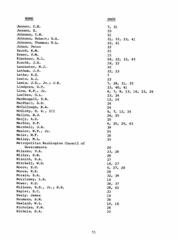
NAME
Jenner, C.B. Jessen, E. Johnson, c.w. Johnson, Robert; R.A. Johnson, Thomas; T.L. Jonas, Peter Karch, K.M. Kewer, P.M. Kleckner, R.L. Kracht, J .B. Lancaster, M. J. Latham, J.P. Letke, K.S. Lewis, A.J. Lewis, J.E., Jr.; J.E. Lindgren, D.T. Lins, H.F., Jr. Loelkes, G.L. MacDougall, E.B. MacPhail, D.O. McCullough, B.A. McGinty, H. K., III Mallon, H. J. Manji, A. S. Marble, D.F. Marshall, J.R. Mealor, W.T., Jr. Meier, M.F. Melley, M.L. Metropolitan Washington Council of
Governments Milazzo, V.A. Miller, s.w. Minnich, R.A. Mitchell, W.B. Moore, E.G. Moore, R.K. Morain, S.A. Morrissey, L.A. Mower, R.D. Mullens, R.H., Jr.; R.H. Napier, E.C. Neely, James Neumann, A.M. Newland, W.L. Nicholas, F.W. Nichols, D.A.
51
PAGE
7, 31 23 21 21, 22, 23, 41 22, 41 22 25 15 16, 22, 33, 45 18, 22 22 22, 23 7 23 7, 28, 31, 35 23, 40, 41 6, 7, 9, 13, 16, 23, 26 23, 24 12, 24 24 24 6, 7, 12, 24 24, 25 25 6, 20, 25, 42 39 25 26 35
26 23, 26 26 27 10, 27 6, 27, 28 28 32, 39 14 28, 37 28, 42 23 18 28 14, 16 28 32

NAME
North, G.W. Nunnally, N.R. Orth, D.J. Outcalt, S.I. Palmer, E.C. Pascucci, R.F. Pate, Maynard Pearson, B.R. Pease, R.W. Pease, S. R. Peplies, R.W. Peruzzi, Duilio Peterson, Florence Peterson, R.M. Pionke, H.B. Place, J.L. Pluhowski, E.J. Poole, D.H. Prentice, V.L. Prunty, M.C. Rapp, R.H. Ratzlaff, J.R. Raytheon Company, Autometric Operation Rea, c.c. Reed , W. ; W. E • Resnick, I.L. Rhodes, D.C. Rhynsburger, Dierk Roach, J.T. Rosenfield, G.H. Rudd, R.D. Ruml, D.J. Rushton, Gerard Sabol, Joseph Sakamoto, s. Samol, J.D. Schmitt, R.P. Schneider, C. Schneider, C.H.P. Schwarz, D.E. Schwarz, D.W. Schwertz, E.L., Jr. Senger, L.W.; L.W. III Shelkin, B.D. Simonett, David; D.S.
Simpson, R.B.
52
PAGE
28, 30 29 29 7, 31 29 21, 30 30 30 7, 21, 2 7, 30, 31, 32 31, 32 32 14, 32 32 32 33 9, 33, 34 34 34 20 25, 34 35 35, 37, 40 35, 44 19 18, 35 35 39 35 9 35 5, 35, 36 41 36 36 13 34, 36, 46 36 27 36 36, 37, 39 26, 36 37 21, 37, 41, 42 30 6, 19, 20, 21, 28, 32, 35, 37, 38, 39, 40 40, 41

NAME
Smith, G.N. Solomon, Eric Soot, s. Sprinsky, W.H. Stewart, John Swain, P.H. Thelin, G.P. Thompson, Derek Thrower, N.J.W. Tiedemann, C.E. Tobler, W.R. Tomlinson, R.F. Trexler, D.T. u.s. Geological Survey U.S. Government Work Group 7
on Physical Basin Characteristics for Hydrologic Analyses
Vincent, C.L. Vincent, Linwood Vonnegut, C.J. Walters, R.L. Wellar, B.: Barry: B.S. Westerlund, F.V. Wiedel, J.W. Williams, L.O. Wilson, Jack: J.E. Wilson, J.D. Witmer, R.E. Woolheater, C.M. Wray, J.R. Wright, Bruce Yuill, R.S.
53
PAGE
41 41 27 35 13 14, 14, 41 11, 11 42 42 13 4 2,
44 13 13 45 45
41 41
41, 42
43, 44
27, 28, 45 45 45 14, 45, 46 6, 46 32 9, 29, 46, 47 18 14, 15, 16, 18, 22, 48 41, 48
34, 4 7, 48

SUBJECT
ACCURACY STUDIES
AERIAL AND SPACE PHOTOGRAPHY AND OTHER IMAGERY
AGRICULTURAL DATA
APOLLO AND GEMINI IMAGERY
ARCHAEOLOGICAL/HISTORICAL SITE IDENTIFICATION
ARIZONA
ATLAS OF URBAN AND REGIONAL CHANGE
AUTOMATED DATA
BIBLIOGRAPHIES
CALIFORNIA
CARETS
CLIMATOLOGY
COASTAL STUDIES
COMPUTER AUTOMATED DATA
COMPUTER CLASSIFICATION OF LAND USE DATA
COMPUTERIZED CARTOGRAPHIC TECHNIQUES
SUBJECT INDEX
54
PAGE
15, 16, 46
11, 17, 21, 22, 23, 24, 25, 29, 30, 32, 35, 36, 37, 41
11, 12, 21, 22, 36, 39,
6, 19, 21, 24, 38, 42
12, 18
See under Regional Studies
43, 44, 47
See Computer Automated Data or Spatial Data
See Remote Sensing -Bibliographies
See under Regional Studies
See under Regional Studies
7, 12, 18, 28, 31, 32, 35, 39
9, 13, 19, 23
9, 10, 11, 15, 16, 17' 19' 20, 21, 24, 27, 33, 41, 42, 48
10, 14, 15, 16, 19, 20, 27, 41, 48
10, 14, 15, 16, 19, 20, 24, 26, 27, 33, 41, 42, 48

SUBJECT
COMPUTERIZED GEOGRAPHIC INFORMATION SYSTEMS
CROP DISCRIMINATION
DIGITAL DATA
ENERGY STUDIES
ENVIRONMENTAL STUDIES
EROS PROGRAM
ERTS/LANDSAT DATA
FLORIDA
FOREST INTERPRETATION
GEOGRAPHIC ANALYSES AND STUDIES
GEOGRAPHIC APPLICATIONS PROGRAM (GAP}
GEOGRAPHIC NAMES
GEOMORPHOLOGY
GEORGIA
GROUND TRUTH VERIFICATION
HAZARDS STUDIES (See also Environmental Studies}
HIGH PLAINS--OGALLALA AQUIFER
HYDROLOGIC DATA
55
PAGE
9, 12, 14, 15, 19, 21, 27, 33, 42
11, 19, 21, 22, 28, 38
See Computer Automated Data or Spatial Data
23, 31
6, 10, 11, 12, 13, 18, 19, 21, 23, 28, 35, 36, 39, 42, 47
17, 33
6, 7, 14, 16, 26, 35, 40, 41, 45, 48
See under Regional Studies
5, 32, 46
5, 6, 7, 8, 9' 10, 11, 13, 15, 16, 18, 19, 20, 22, 23, 24, 25, 26, 28, 29, 30, 31, 32, 33, 37' 39, 40, 41, 43, 44, 45, 46
See USGS Geography Program
29
32
See under Regional Studies
6, 13, 30, 46
6, 13, 28, 48
See under Regional Studies
21, 22, 33, 34, 41, 48

SUBJECT
IDAHO
INFRARED, COLOR INFRARED (CIR), AND FALSE COLOR IMAGERY
INTERNATIONAL USE OF REMOTE SENSOR DATA AND DATA ON FOREIGN AREAS
KANSAS
LANDSAT
LAND USE AND RESOURCES PLANNING
LAND USE CHANGE STUDIES
LAND USE DATA
LAND USE/COVER CLASSIFICATION SYSTEMS
LAND USE/COVER MAPPING ACCURACY
LAND USE/COVER MAPPING AND DATA COMPILATION
LAND USE/COVER MAP UPDATE
LEGAL CONSIDERATIONS OF REMOTE SENSING
MONTANA
MULTISPECTRAL IMAGERY
56
PAGE
See under Regional Studies
51 11, 121 151 21, 231 31, 341 36, 311 45, 46
5, 17, 18, 19, 281 37, 39
See under Regional Studies
See ERTS/Landsat Data
6, 7, 8, 9, 101 12, 131 141 18, 191 20, 21, 22, 23, 24, 251 26, 28, 29, 321 33, 351 37, 40, 451 48
5, 81 12, 13, 14, 15, 16, 19, 21, 22, 23, 26, 33, 43, 44, 47, 48
5, 6, 7, 8, 9, 12, 131 15, 21, 22, 23, 25, 27, 28, 30, 33, 361 40, 411 421 43, 441 47, 48
51 7, 9, 29, 42, 461 47
151 161 35
6, 11 8, 91 12, 131 141 15, 161 22, 23, 24, 26, 27, 321 331 341 351 371 381 391 40, 41, 421 4 3, 441 451 461 471 48
26, 34
23
See under Regional Studies
111 141 261 271 281 30, 35, 36

SUBJECT
NATIONAL AERONAUTICS AND SPACE ADMINISTRATION (NASA) EARTH RESOURCES PROGRAM
NATIONAL ATLAS OF THE USA
NEW ENGLAND
OUTDOOR RECREATION PLANNING DATA
OZARKS REGION
PENNSYLVANIA
RADAR IMAGERY
REGIONAL STUDIES
Arizona, Phoenix/Tucson
California
CARETS (Central Atlantic Regional Ecological Test Site)
Census Cities/Atlas of Urban and Regional Change
Florida
Georgia
High Plains--Ogallala Aquifer
Idaho
Kansas
57
PAGE
5, 6, 11, 17, 19, 20, 21, 22, 23, 25, 30, 31, 32, 33, 34, 38, 47
8
See under Regional Studies
13, 35
See under Regional Studies
See under Regional Studies
14, 19, 20, 23, 27, 28, 29, 36, 37' 38, 39, 40, 45, 46
5, 6, 7, 8, 9, 11, 12, 13, 14, 15, 18, 19, 20, 21, 22, 23, 24, 25, 26, 27, 28, 30, 32, 33, 34, 36, 37, 39, 40, 41, 42, 44, 45, 46, 4 7' 48
9, 15, 26, 33, 34, 43
11, 14, 15, 21, 27, 28, 37, 43, 44
5, 6, 7, 10, 12, 13, 16, 24, 27, 35, 47
43, 44, 47
14, 25, 34, 44
15, 19
12, 21, 22, 41, 48
5
11, 28, 32, 38, 39, 44

SUBJECT
REGIONAL STUDIES (Continued)
Montana
New England Region and Boston
North Carolina '
Ozarks Region
Pennsylvania
Tennessee (Tellico Project)
Texas/New Mexico
Virginia
Washington, D.C., Metropolitan Area
REMOTE SENSING - BIBLIOGRAPHIES AND LISTS OF IMAGERY
REMOTE SENSOR DATA AND DATA INTERPRETATION
REMOTE SENSOR EVALUATION STUDIES
SETTLEMENT PATTERNS AND SIZE
SKYLAB
SLOPE FAILURE FORM STUDIES
SPATIAL DATA (See also Computer Automated Data)
STATISTICAL DATA FROM REMOTELY SENSED IMAGERY (See also
Computer Automated Data, etc.)
58
PAGE
5
40, 41, 4 3,
12, 45, 46
24
22, 23, 26, 43, 44, 48
20, 22, 32, 34, 46
24, 40
6, 12, 18
24, 25, 26, 31, 42, 43, 44
18, 20, 24, 25, 29, 30, 45
5, 6, 9, 10, 11, 12, 13, 14, 16, 18, 19, 20, 21, 22, 23, 24, 25, 26, 28, 29, 30, 32, 34, 35, 36, 37, 38, 39' 40, 41, 45, 46, 47
5, 10, 11, 12, 13, 15, 19, 20, 21, 22, 2 3, 24, 25, 27, 28, 29, 30, 31, 32, 34, 35, 36, 37, 38, 39, 4 0, 41, 45, 46
40, 42
7, 26
34
9, 11, 13, 15, 19, 20, 24, 26, 35
8, 12, 35
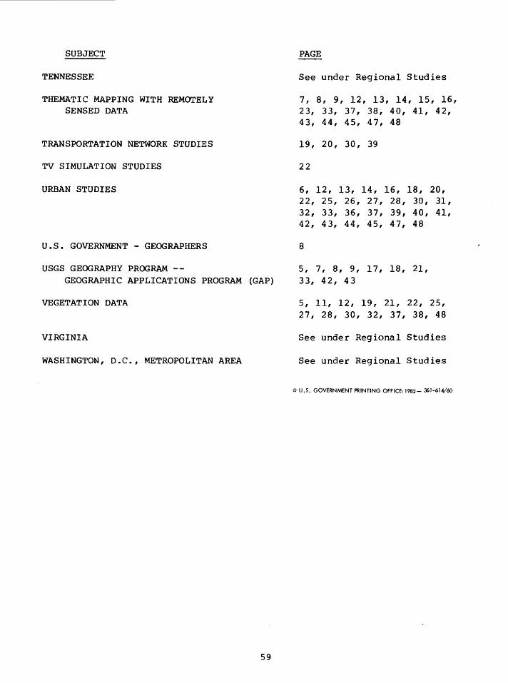
SUBJECT
TENNESSEE
THEMATIC MAPPING WITH REMOTELY SENSED DATA
TRANSPORTATION NETWORK STUDIES
TV SIMULATION STUDIES
URBAN STUDIES
U.S • GOVERNMENT - GEOGRAPHERS
USGS GEOGRAPHY PROGRAM --GEOGRAPHIC APPLICATIONS PROGRAM (GAP)
VEGETATION DATA
VIRGINIA
WASHINGTON, D.C., METROPOLITAN AREA
59
PAGE
See under Regional Studies
7, 8, 9, 12, 13, 14, 15, 16, 23, 33, 37, 38, 40, 41, 42, 43, 44, 45, 47, 48
19, 20, 30, 39
22
6, 12, 13, 14, 16, 18, 20, 22, 25, 26, 27, 28, 30, 31, 32, 33, 36, 37, 39, 40, 41, 42, 43, 44, 45, 47, 48
8
5, 7, 8, 9, 17, 18, 21, 33, 42, 43
5, 11, 12, 19, 21, 22, 25, 27, 28, 30, 32, 37, 38, 48
See under Regional Studies
See under Regional Studies
"k U.S. GOVERNMENT PRINTING OFFICE: 1982- 361-614/60