Geographic Information Systems
20
Geographic Information Systems Geographic Information Systems GIS Definition
-
Upload
ryder-hardin -
Category
Documents
-
view
40 -
download
0
description
Geographic Information Systems. GIS Definition. Locations. Networks. Areas. Because most information has a spatial component ESRI, GE SmallWorld. 1. GIS is Important. GIS is Important. It helps temporal reasoning as well S. H. Gage, J. Helly and M. Colunga, GIS/EM4 2000. GIS is Useful. - PowerPoint PPT Presentation
Transcript of Geographic Information Systems

Geographic Information SystemsGeographic Information Systems
GIS Definition

1. GIS is Important1. GIS is Important
Because most information has a spatial componentESRI, GE SmallWorld
LocationsLocations
NetworksNetworks
AreasAreas
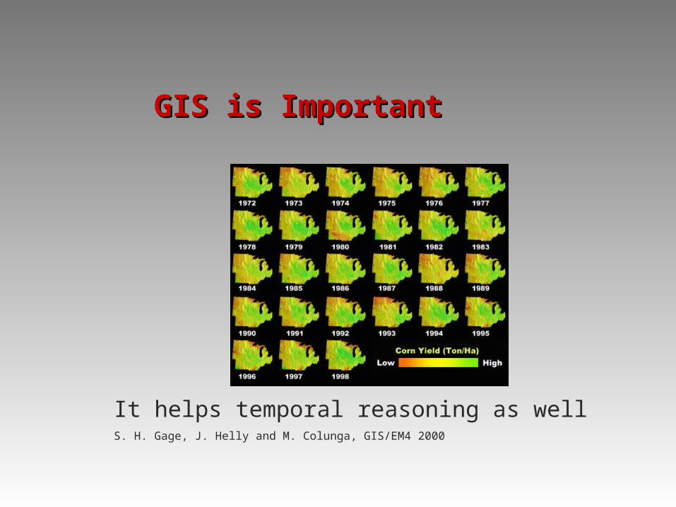
GIS is ImportantGIS is Important
It helps temporal reasoning as wellS. H. Gage, J. Helly and M. Colunga, GIS/EM4 2000

GIS is UsefulGIS is Useful
The “W” questions
Where, what, when, why, how, who, what if…
GIS shows “what” are “where”, and helps us to think other “W”s
It helps generate and test hypothesis
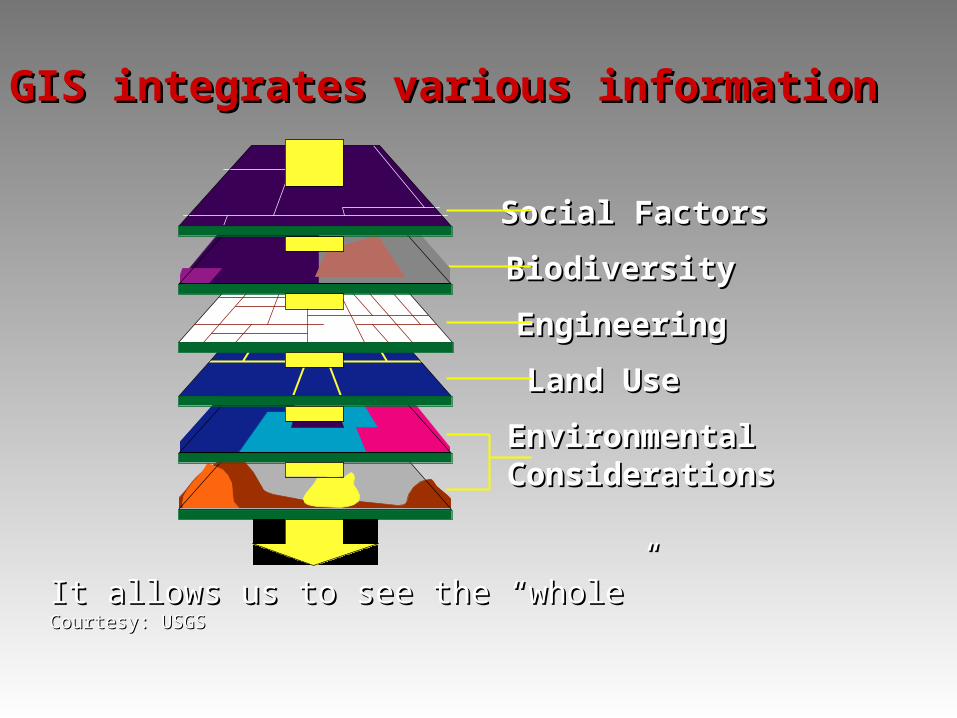
Social FactorsSocial Factors
BiodiversityBiodiversity
EngineeringEngineering
Land UseLand Use
EnvironmentalEnvironmentalConsiderationsConsiderations
It allows us to see the “whole”It allows us to see the “whole”Courtesy: USGSCourtesy: USGS
GIS integrates various informationGIS integrates various information

GIS is UsefulGIS is Useful
GIS is used by a wide range of disciplines
It changed the way we operate
It opened many opportunities

A Few FactsA Few Facts
NCGIA/NSF grants
GIS programs in government agencies
GIS consulting firms and contracts
GIS conferences, journals, and professional societies
http://erg.usgs.gov/isb/pubs/gis_poster http://www.ncgia.ucsb.edu http://www.ucgis.org

2. What is a GIS2. What is a GIS
An early effort, Ian McHarg, 1969

What is a GISWhat is a GIS
A process oriented definition:
A GIS is a computer-based system that provides for the collection, storage, analysis, and display of geo-referenced data.
A problem solving oriented definition:
A decision support system involving the integration of spatially referenced data in a problem solving
environment.

What is a GISWhat is a GIS
Data Information Knowledge Intelligence (DIKI)
What is a GISWhat is a GIS
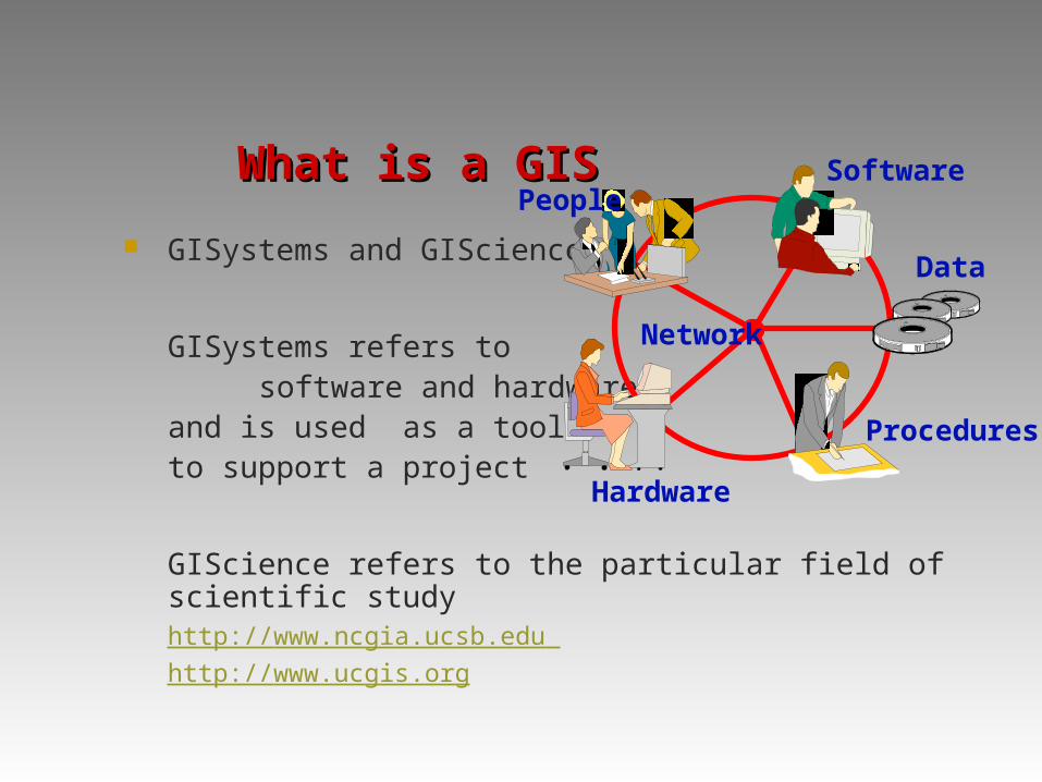
GISystems and GIScience
GISystems refers to
software and hardware, and is used as a tool to support a project
GIScience refers to the particular field of scientific studyhttp://www.ncgia.ucsb.edu http://www.ucgis.org
PeopleSoftware
Data
Procedures
Hardware
Network

3. Related Fields3. Related Fields
Manual cartography
DBMS (Data base management system)
CAD (Computer-aided drafting)
Computer Mapping
AM/FM (Automated Mapping/Facility Management)
LIS (Land information system)
GIS
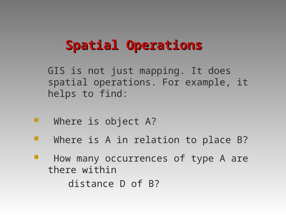
Spatial OperationsSpatial Operations
GIS is not just mapping. It does spatial operations. For example, it helps to find:
Where is object A?
Where is A in relation to place B?
How many occurrences of type A are there within
distance D of B?
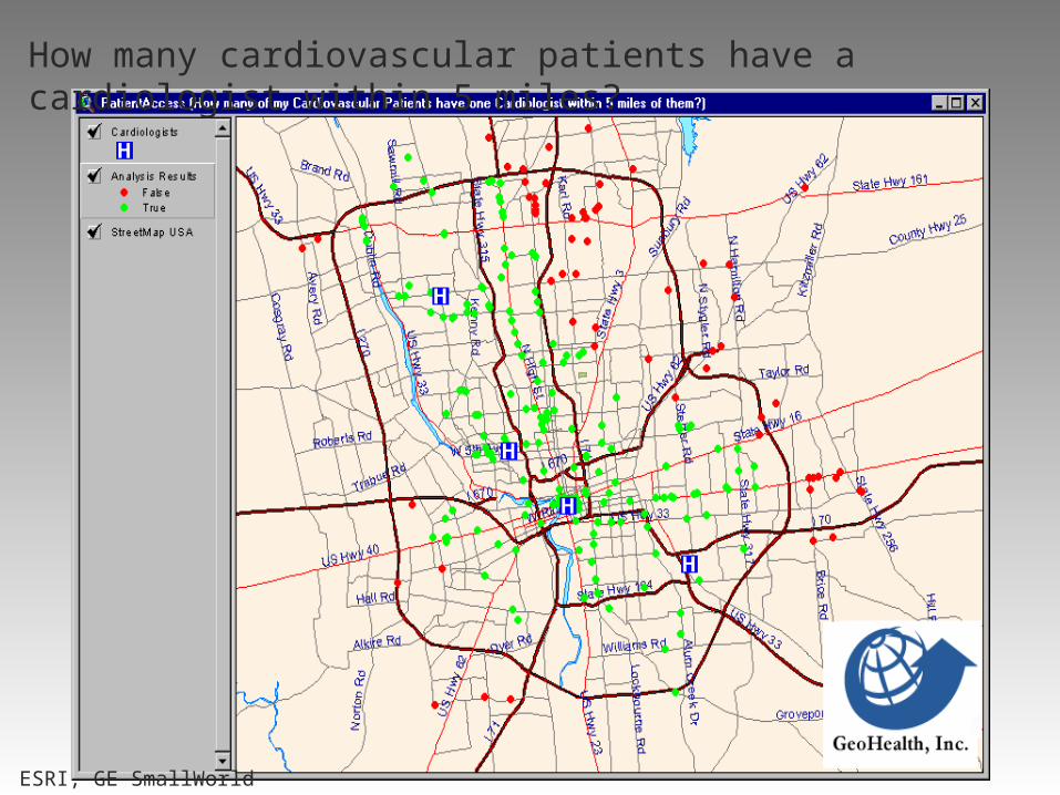
How many cardiovascular patients have a cardiologist within 5 miles?
ESRI, GE SmallWorld
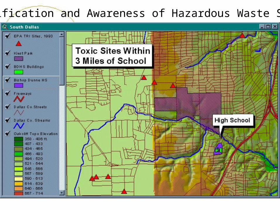
Identification and Awareness of Hazardous Waste Sites
Spatial OperationsSpatial Operations
What is the value of function Z at position X?
How large is B (area, perimeter, count of inclusions)?
What is the result of intersecting various kinds of spatial data?
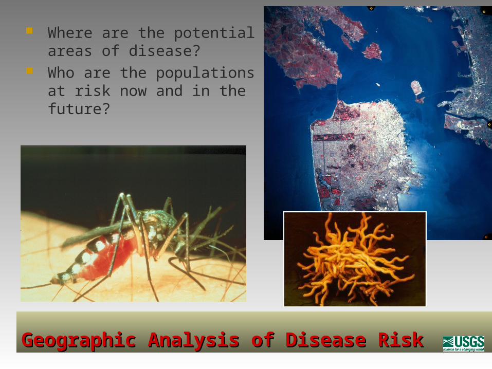
Geographic Analysis of Disease RiskGeographic Analysis of Disease Risk
Where are the potential areas of disease?
Who are the populations at risk now and in the future?

Spatial OperationsSpatial Operations
What is the path of least cost, resistance, or
distance along the ground from X to Y along pathway P?
What is at point X1, X2?
What objects are next to objects having certain
combinations of attributes?

Dispatching delivery vans, taxis, or repair trucksDispatching delivery vans, taxis, or repair trucks

5. Readings5. Readings
Chpt 1