GEODESY FORUM - un-ggim-americas.org
20
GEODESY FORUM FOR UN GGIM: AMERICAS Geodesy for Sustainable Americas Geodesy in the Americas Sonia Costa
Transcript of GEODESY FORUM - un-ggim-americas.org
GEODESY FORUM
FOR UN GGIM:
AMERICAS
Geodesy for Sustainable Americas
Geodesy in the Americas
Sonia Costa
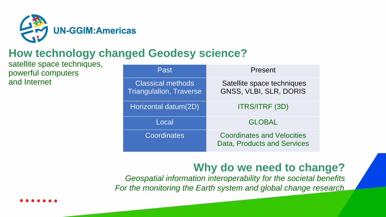
How technology changed Geodesy science?satellite space techniques, powerful computers and Internet
Why do we need to change?Geospatial information interoperability for the societal benefits
For the monitoring the Earth system and global change research
Past Present
Classical methodsTriangulalion, Traverse
Satellite space techniquesGNSS, VLBI, SLR, DORIS
Horizontal datum(2D) ITRS/ITRF (3D)
Local GLOBAL
Coordinates Coordinates and VelocitiesData, Products and Services
Geospatial information interoperability for the societal benefits
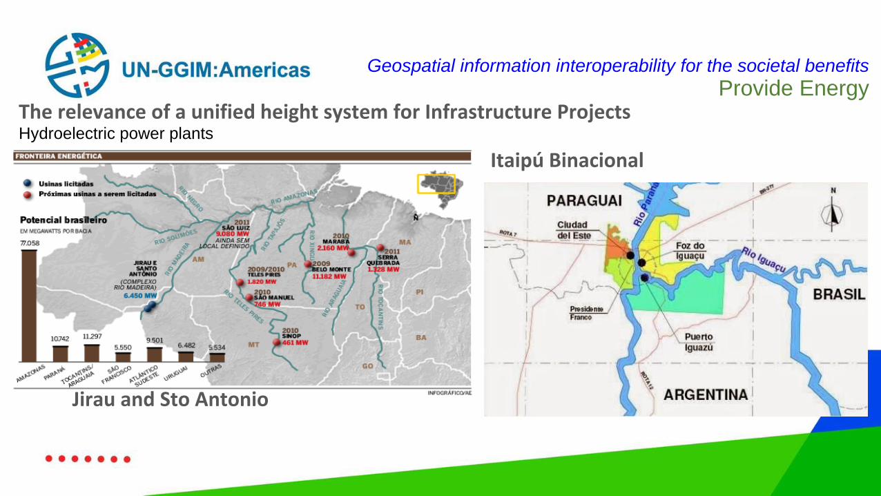
Provide EnergyThe relevance of a unified height system for Infrastructure ProjectsHydroelectric power plants
Itaipú Binacional
Jirau and Sto Antonio
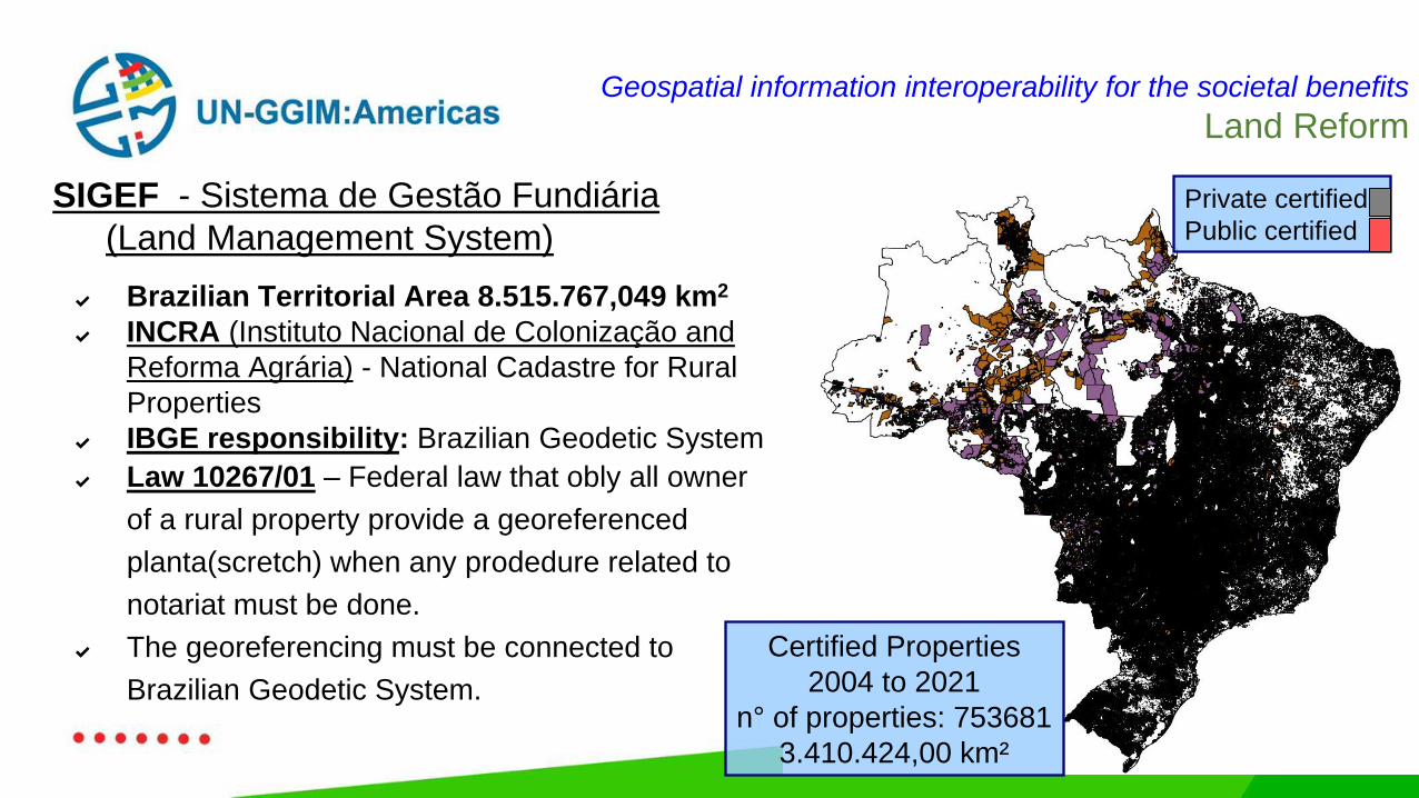
SIGEF - Sistema de Gestão Fundiária
(Land Management System)
Geospatial information interoperability for the societal benefits
Land Reform
✔ Brazilian Territorial Area 8.515.767,049 km2
✔ INCRA (Instituto Nacional de Colonização and
Reforma Agrária) - National Cadastre for Rural
Properties
✔ IBGE responsibility: Brazilian Geodetic System
✔ Law 10267/01 – Federal law that obly all owner
of a rural property provide a georeferenced
planta(scretch) when any prodedure related to
notariat must be done.
✔ The georeferencing must be connected to
Brazilian Geodetic System.
Certified Properties
2004 to 2021
n° of properties: 753681
3.410.424,00 km²
Private certified
Public certified
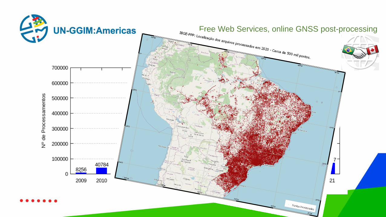
Free Web Services, online GNSS post-processing
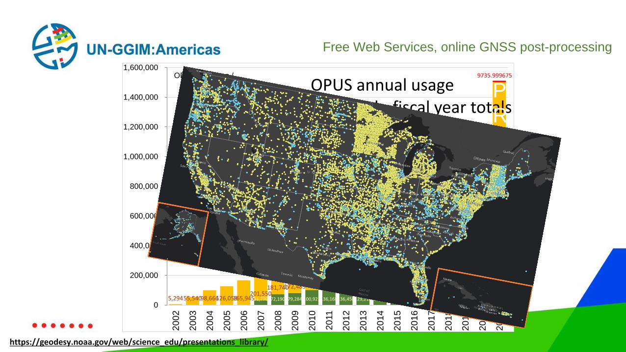
Free Web Services, online GNSS post-processing
31,770 72,190 79,284 100,921136,168136,450129,218134,339141,988129,234154,958118,519109,894158,910219,0845,29455,54098,666126,058165,945201,550
181,740172,485170,703205,551285,476231,098256,579297,521311,633
379,271524,903367,760
883,950
1,282,096368 976 1727
1389
1123
14932117
1869 2440
2551
7242
3538
8496
9735.999675
0
200,000
400,000
600,000
800,000
1,000,000
1,200,000
1,400,000
1,600,000
20
02
20
03
20
04
20
05
20
06
20
07
20
08
20
09
20
10
20
11
20
12
20
13
20
14
20
15
20
16
20
17
20
18
20
19
20
20
20
21
OPUS solutions / year OPUS annual usage
stacked bar graph, fiscal year totals
OPUS-S (solution shared)
OPUS-S (not shared)
OPUS-RS
P
R
E
D
I
C
T
E
D
https://geodesy.noaa.gov/web/science_edu/presentations_library/
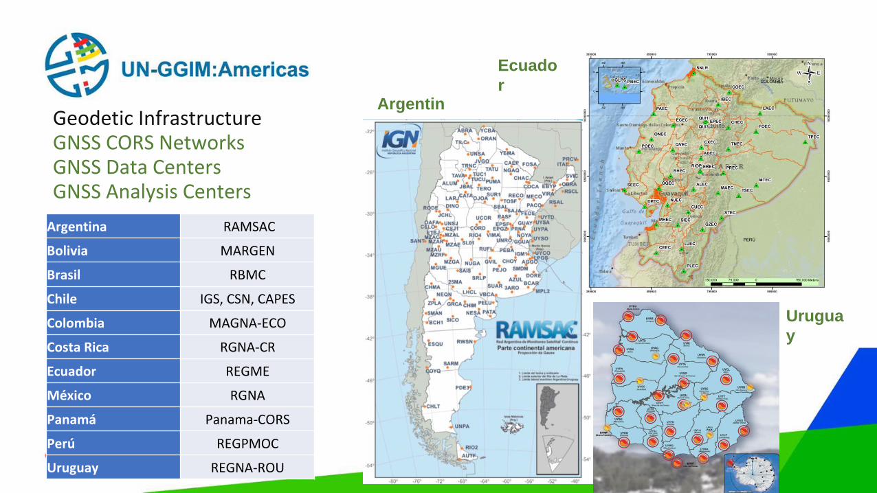
Geodetic InfrastructureGNSS CORS NetworksGNSS Data CentersGNSS Analysis Centers
Argentin
a
Argentina RAMSAC
Bolivia MARGEN
Brasil RBMC
Chile IGS, CSN, CAPES
Colombia MAGNA-ECO
Costa Rica RGNA-CR
Ecuador REGME
México RGNA
Panamá Panama-CORS
Perú REGPMOC
Uruguay REGNA-ROU
Ecuado
r
Urugua
y
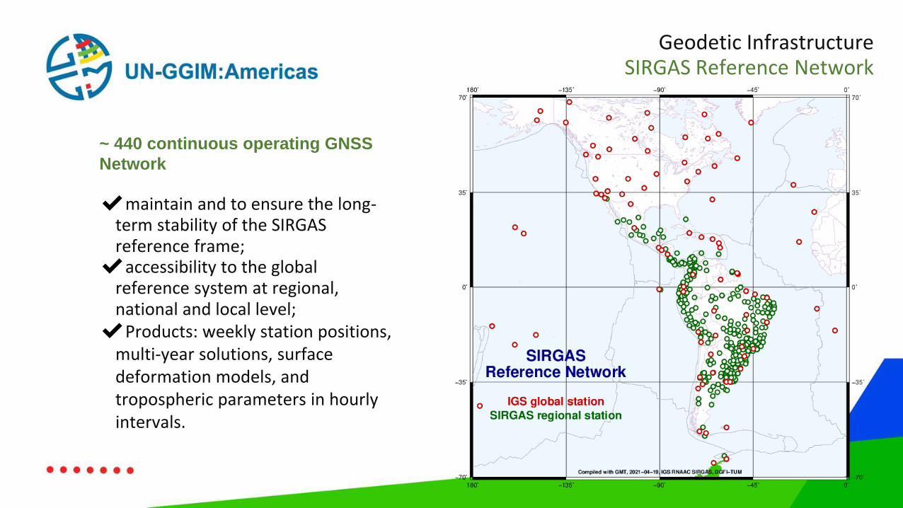
~ 440 continuous operating GNSS
Network
✔maintain and to ensure the long-term stability of the SIRGAS reference frame;✔accessibility to the global
reference system at regional, national and local level;✔Products: weekly station positions,
multi-year solutions, surface deformation models, and tropospheric parameters in hourly intervals.
Geodetic InfrastructureSIRGAS Reference Network
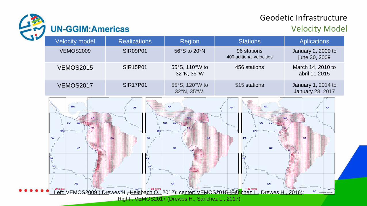
Velocity model Realizations Region Stations Aplications
VEMOS2009 SIR09P01 56°S to 20°N 96 stations 400 aditional velocities
January 2, 2000 to
june 30, 2009
VEMOS2015 SIR15P01 55°S, 110°W to
32°N, 35°W
456 stations March 14, 2010 to
abril 11 2015
VEMOS2017 SIR17P01 55°S, 120°W to
32°N, 35°W,
515 stations January 1, 2014 to
January 28, 2017
Left: VEMOS2009 ( Drewes H., Heidbach O., 2012); center: VEMOS2015 (Sánchez L., Drewes H., 2016);
Right : VEMOS2017 (Drewes H., Sánchez L., 2017)
Geodetic InfrastructureVelocity Model
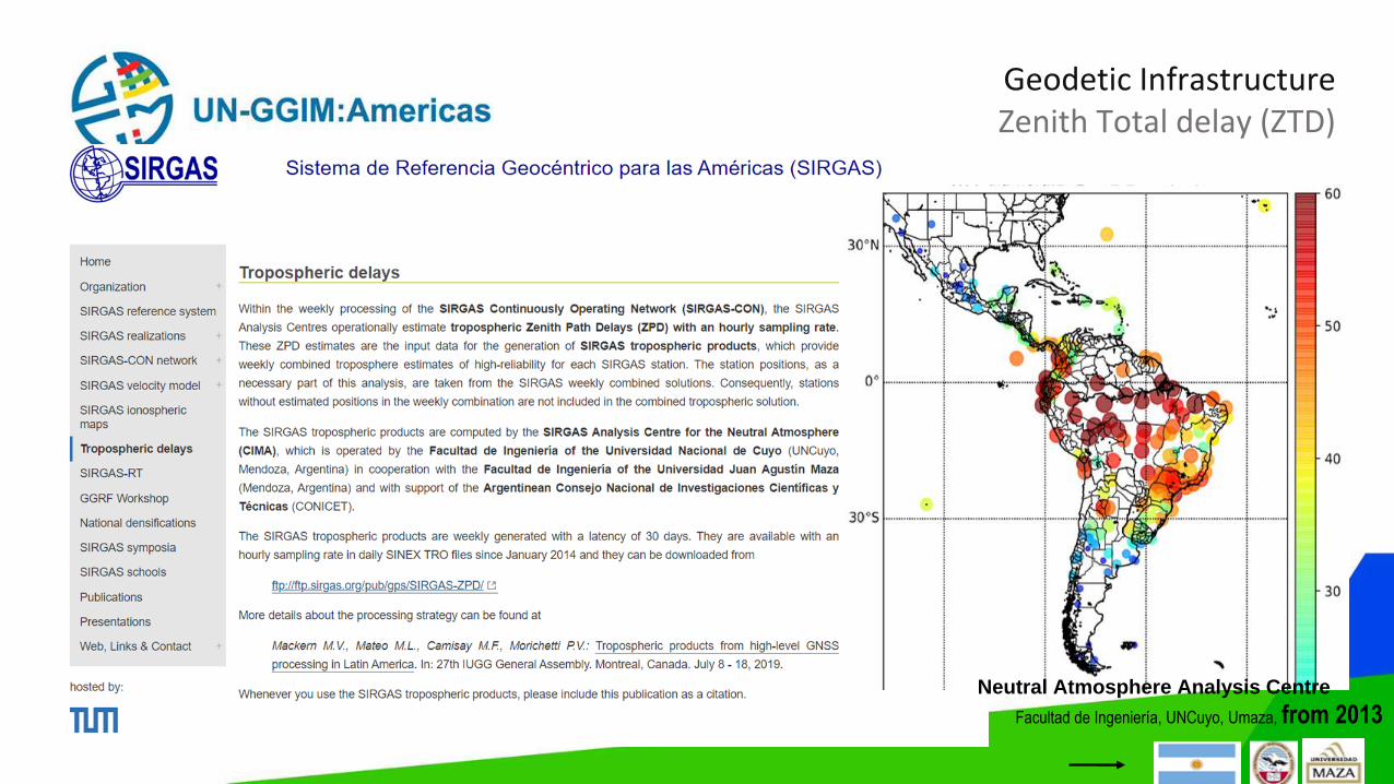
Geodetic InfrastructureZenith Total delay (ZTD)
Facultad de Ingeniería, UNCuyo, Umaza, from 2013Neutral Atmosphere Analysis Centre
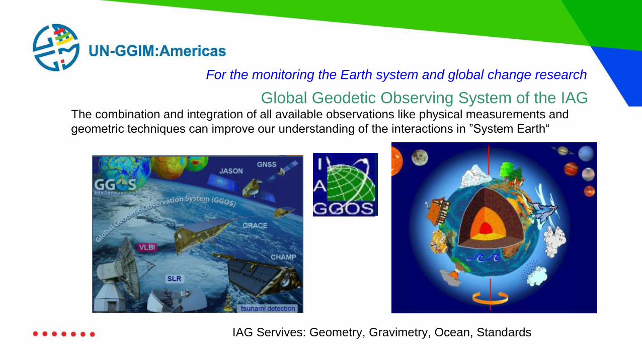
Global Geodetic Observing System of the IAGThe combination and integration of all available observations like physical measurements and
geometric techniques can improve our understanding of the interactions in ”System Earth“
IAG Servives: Geometry, Gravimetry, Ocean, Standards
For the monitoring the Earth system and global change research
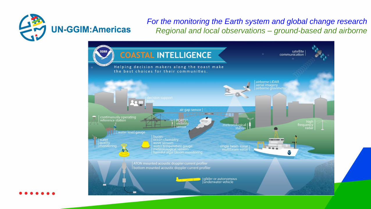
For the monitoring the Earth system and global change research
Regional and local observations – ground-based and airborne
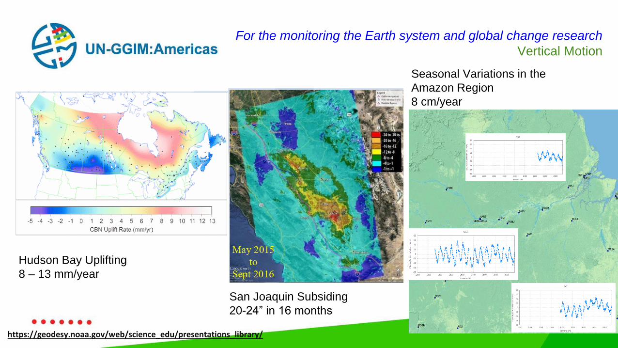
For the monitoring the Earth system and global change research
Vertical Motion
Hudson Bay Uplifting
8 – 13 mm/year
San Joaquin Subsiding
20-24” in 16 months
Seasonal Variations in the
Amazon Region
8 cm/year
https://geodesy.noaa.gov/web/science_edu/presentations_library/
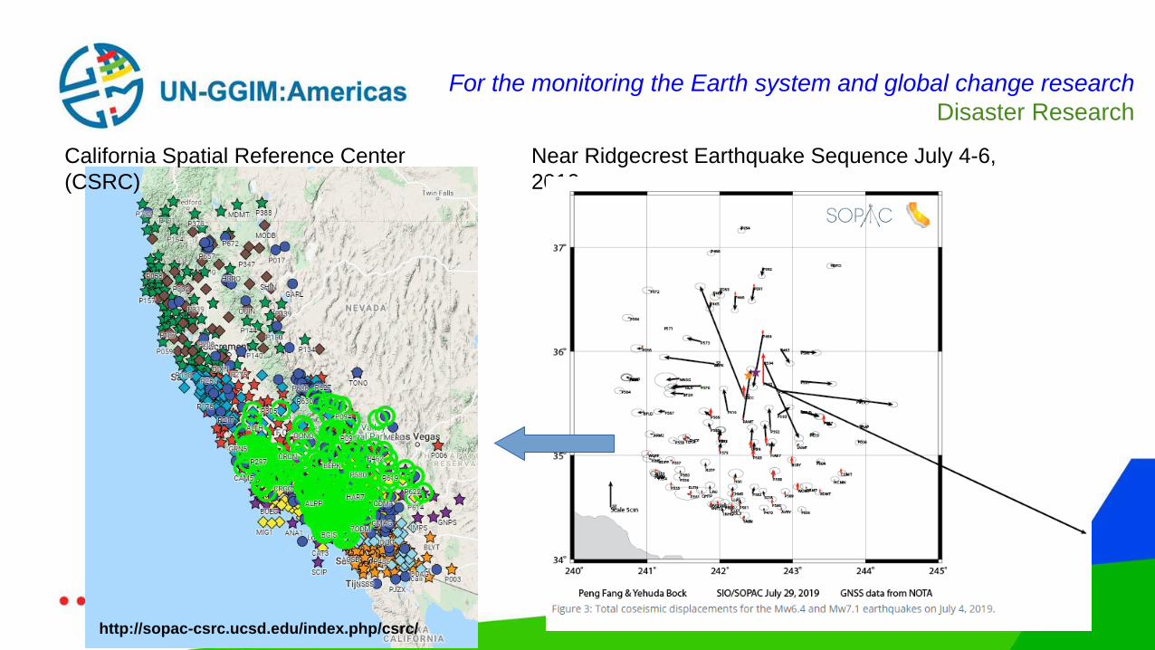
For the monitoring the Earth system and global change research
Disaster Research
California Spatial Reference Center
(CSRC)
http://sopac-csrc.ucsd.edu/index.php/csrc/
Near Ridgecrest Earthquake Sequence July 4-6,
2019
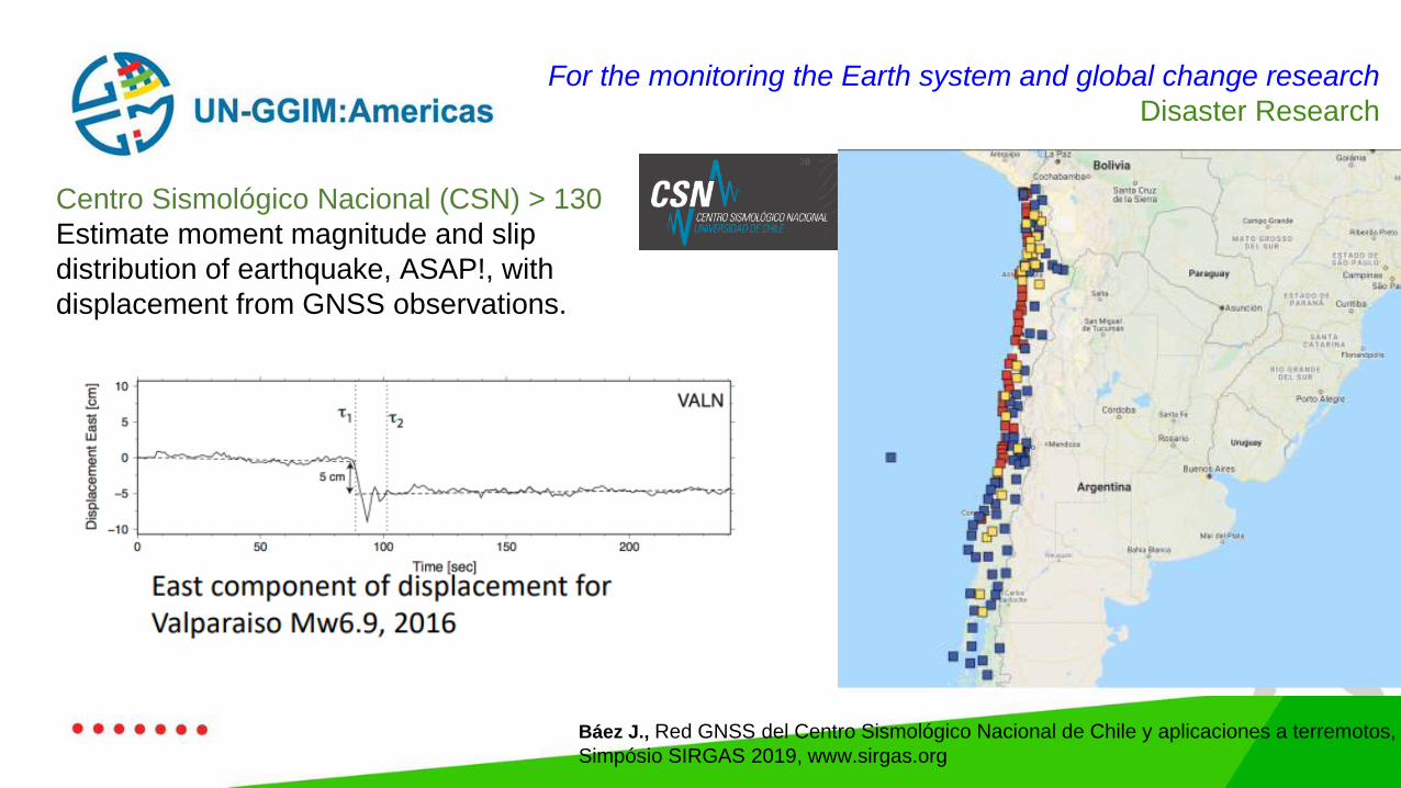
Centro Sismológico Nacional (CSN) > 130
Estimate moment magnitude and slip
distribution of earthquake, ASAP!, with
displacement from GNSS observations.
Báez J., Red GNSS del Centro Sismológico Nacional de Chile y aplicaciones a terremotos,
Simpósio SIRGAS 2019, www.sirgas.org
For the monitoring the Earth system and global change research
Disaster Research
For the monitoring the Earth system and global change research
Weather Research
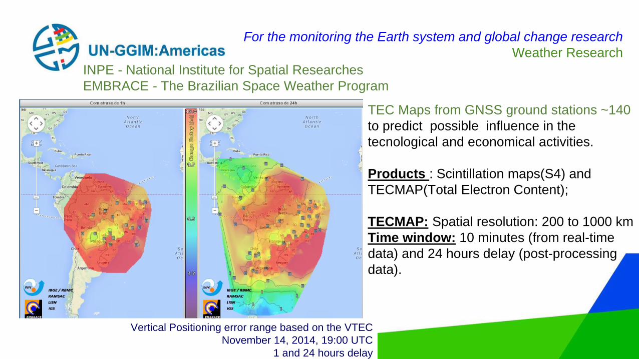
INPE - National Institute for Spatial Researches
EMBRACE - The Brazilian Space Weather Program
TECMAP : November 14, 2014 at 19:00 UTC
1 and 24 hours delay
Vertical Positioning error range based on the VTEC
November 14, 2014, 19:00 UTC
1 and 24 hours delay
TEC Maps from GNSS ground stations ~140
to predict possible influence in the
tecnological and economical activities.
Products : Scintillation maps(S4) and
TECMAP(Total Electron Content);
TECMAP: Spatial resolution: 200 to 1000 km
Time window: 10 minutes (from real-time
data) and 24 hours delay (post-processing
data).
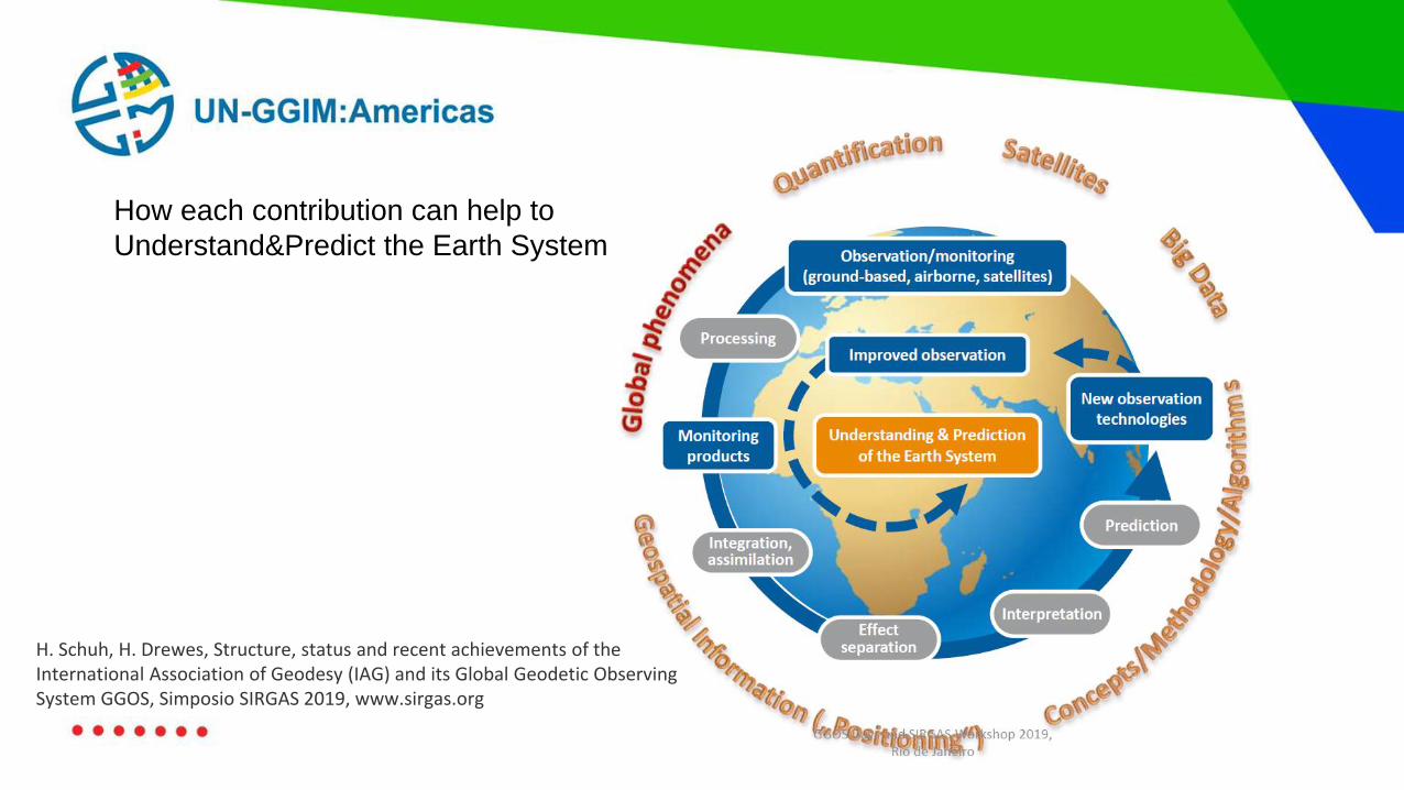
How each contribution can help to
Understand&Predict the Earth System
H. Schuh, H. Drewes, Structure, status and recent achievements of the International Association of Geodesy (IAG) and its Global Geodetic Observing System GGOS, Simposio SIRGAS 2019, www.sirgas.org
Technology pushes Geodesy towards "Global Sense!"
Heterogeneous knowledge, experience, resources and infrastructure
We need to build on...
✔Capacity building and training under a strong
cooperation&collaboration between countries and SIRGAS;
✔Clear and simple communication/outreach about geodesy and the
importance of geospatial information interoperability – ITRF. IHRF and
geodetic infrastructure;
✔Better geodetic infrastructures: Geodetic Observatories, National
CORS Networks;
✔Geodetic Data Sharing for reliable models, products and services,
✔ Participate through IGS stations, GPSonBM, etc...
Today's scenario in the Americas and Caribbean
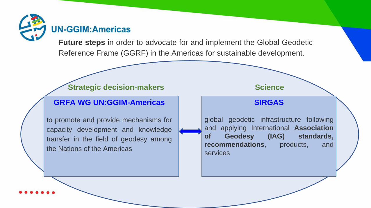
GRFA WG UN:GGIM-Americas
to promote and provide mechanisms for
capacity development and knowledge
transfer in the field of geodesy among
the Nations of the Americas
Strategic decision-makers Science
Future steps in order to advocate for and implement the Global Geodetic
Reference Frame (GGRF) in the Americas for sustainable development.
SIRGAS
global geodetic infrastructure following
and applying International Association
of Geodesy (IAG) standards,
recommendations, products, and
services
GEODESY FORUM
FOR UN GGIM:
AMERICAS
THANK YOU!