Geo l10 physio_india_part_2_0.2
60
Indian Geography Physical geography of India
Transcript of Geo l10 physio_india_part_2_0.2
Indian GeographyPhysical geography of India
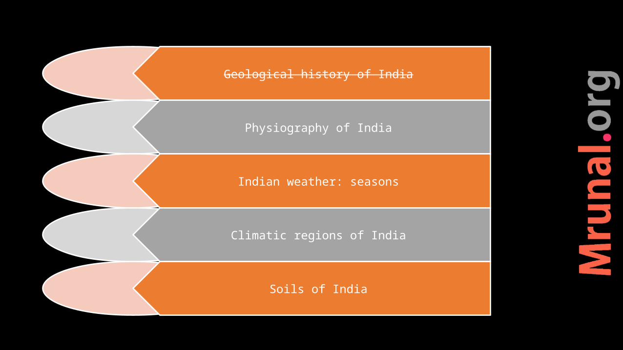
Geological history of India
Physiography of India
Indian weather: seasons
Climatic regions of India
Soils of India
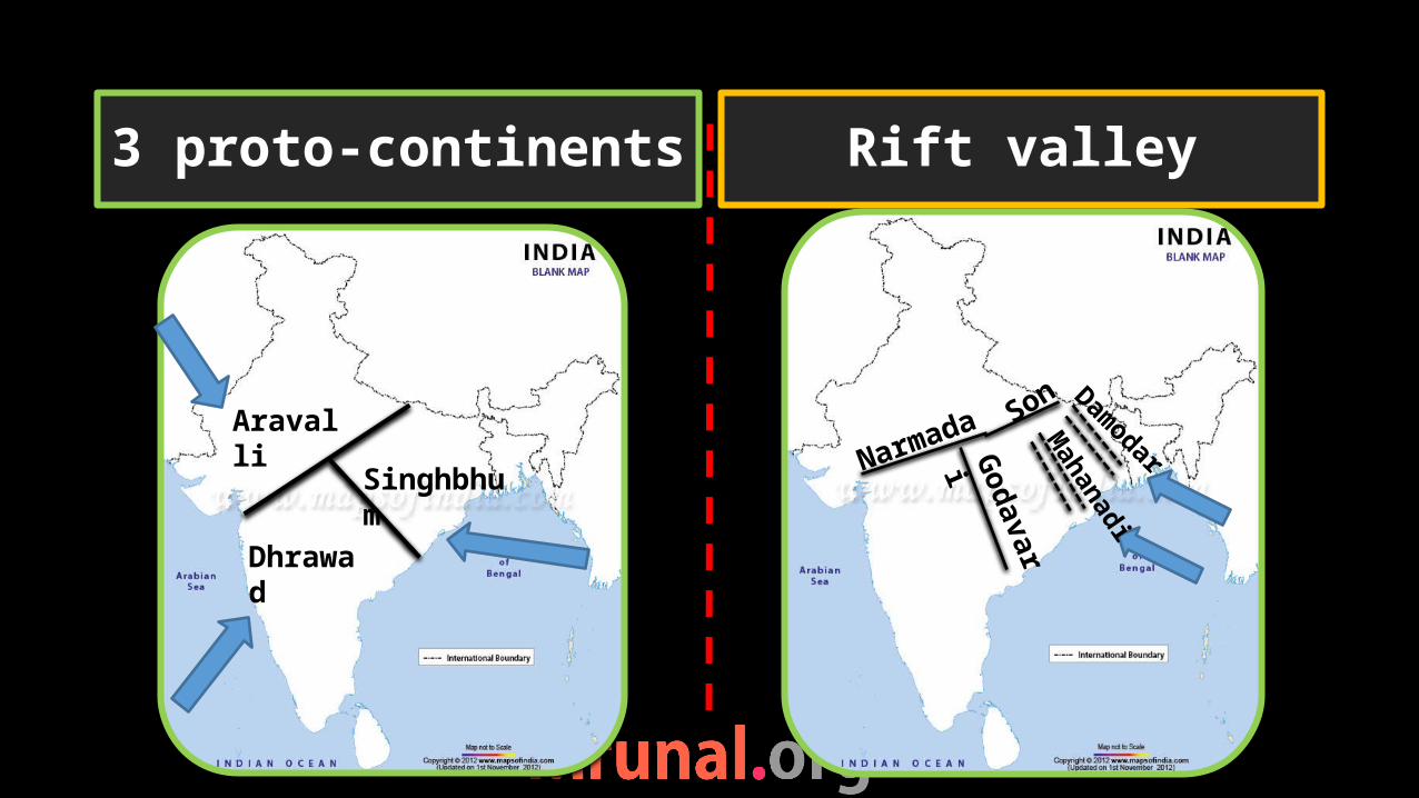
3 proto-continents Rift valley
Aravalli
Dhrawad
SinghbhumNarmada Son
GodavariM
ahanadi
Damodar
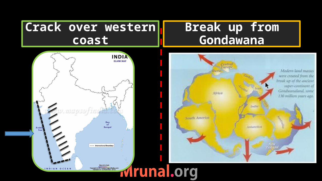
Crack over western coast
Break up from Gondawana
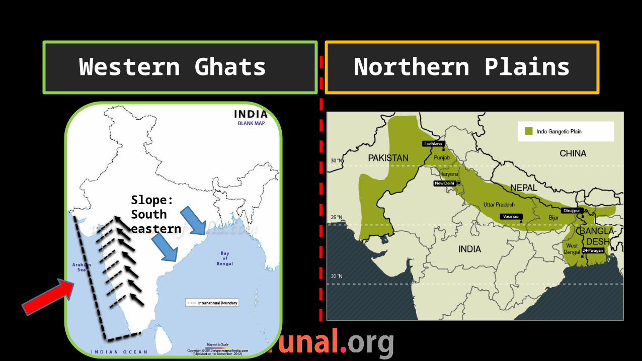
Western Ghats Northern Plains
Slope: South eastern

Northern mountains
Northern plains
Peninsular plateau
Coastal plains
Physiography of India
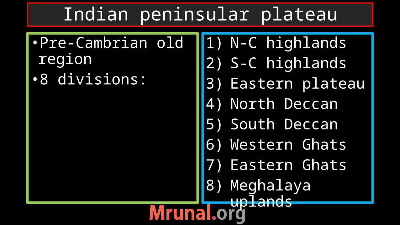
•Pre-Cambrian old region•8 divisions:
1) N-C highlands2) S-C highlands3) Eastern plateau4) North Deccan5) South Deccan6) Western Ghats7) Eastern Ghats8) Meghalaya
uplands
Indian peninsular plateau
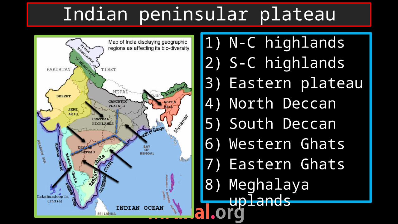
1) N-C highlands2) S-C highlands3) Eastern plateau4) North Deccan5) South Deccan6) Western Ghats7) Eastern Ghats8) Meghalaya
uplands
Indian peninsular plateau
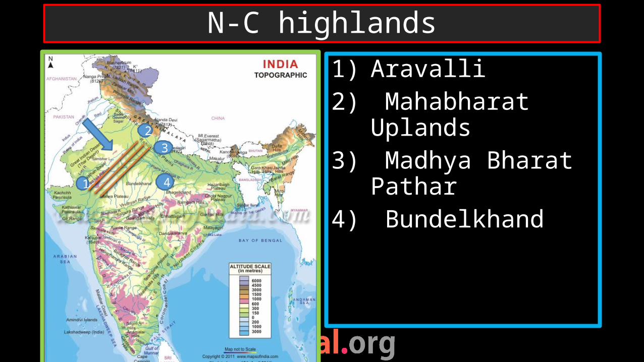
1) Aravalli2) Mahabharat
Uplands3) Madhya Bharat
Pathar4) Bundelkhand
N-C highlands
1 4
32
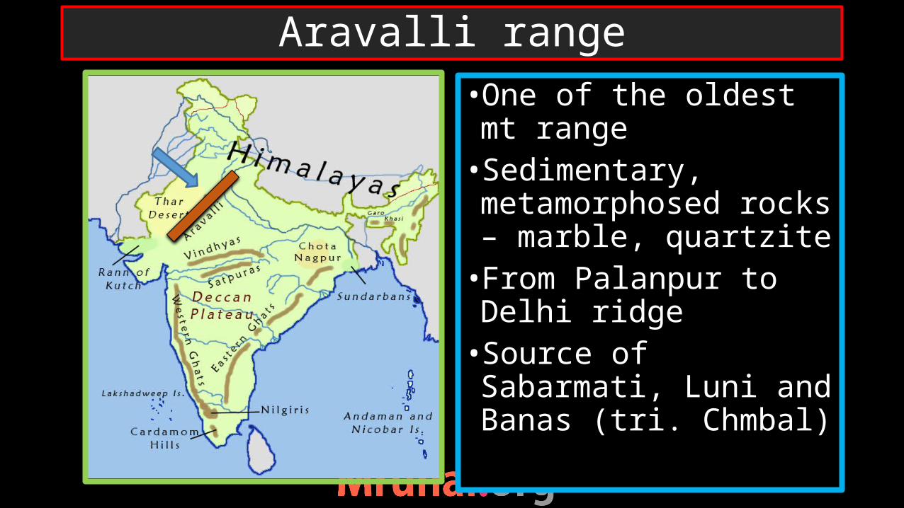
•One of the oldest mt range•Sedimentary, metamorphosed rocks – marble, quartzite•From Palanpur to Delhi ridge•Source of Sabarmati, Luni and Banas (tri. Chmbal)
Aravalli range
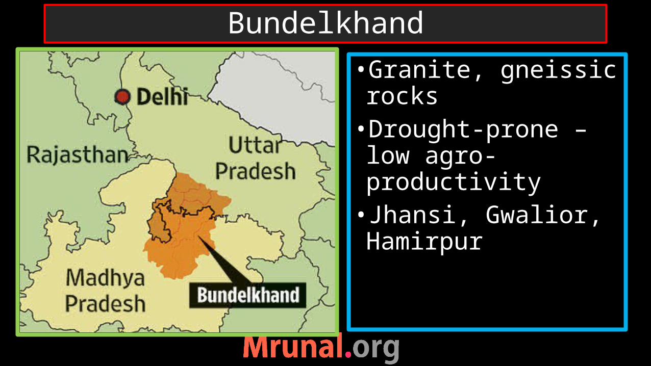
•Granite, gneissic rocks•Drought-prone – low agro-productivity• Jhansi, Gwalior, Hamirpur
Bundelkhand
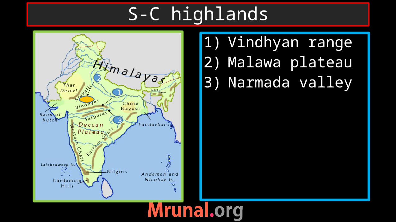
1) Vindhyan range2) Malawa plateau3) Narmada valley
S-C highlands
1
2
3
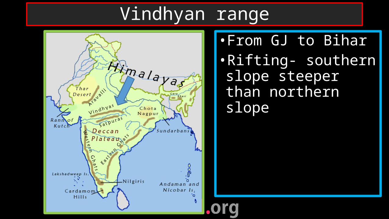
•From GJ to Bihar •Rifting- southern slope steeper than northern slope
Vindhyan range
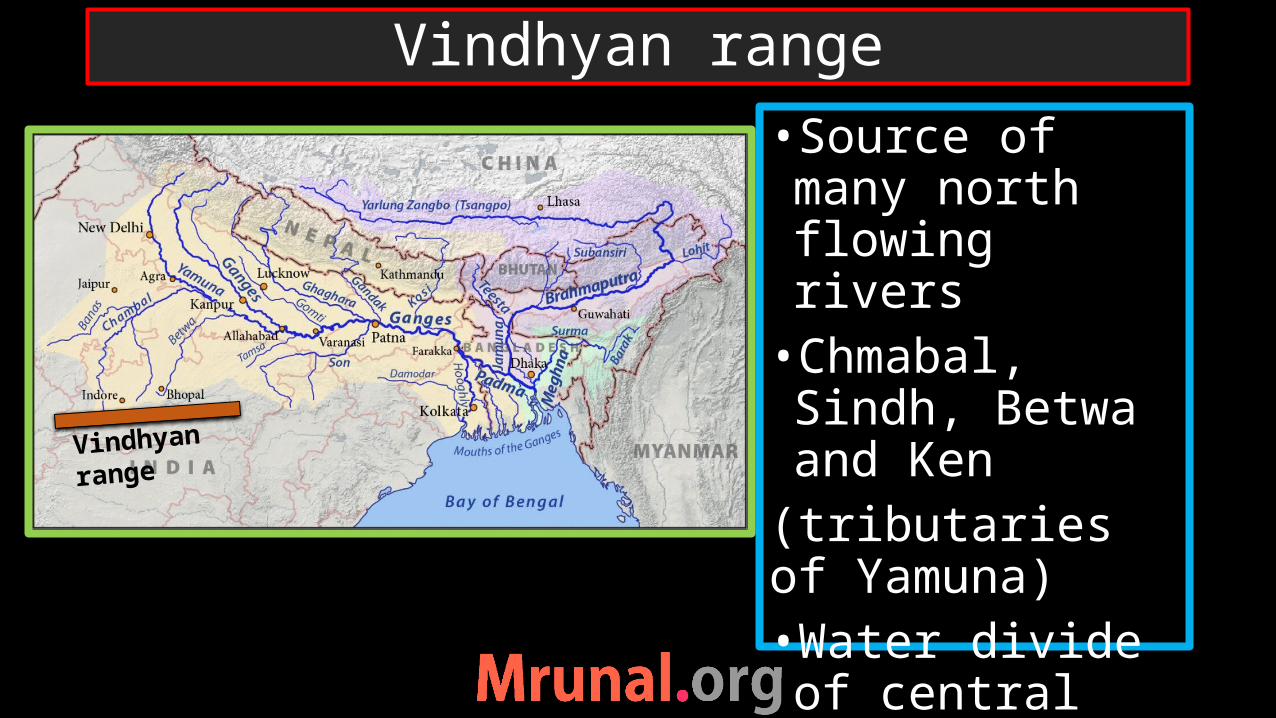
•Source of many north flowing rivers•Chmabal, Sindh, Betwa and Ken
(tributaries of Yamuna)•Water divide of central India
Vindhyan range
Vindhyan range
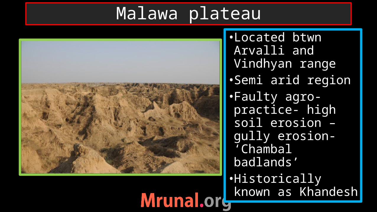
•Located btwn Arvalli and Vindhyan range•Semi arid region•Faulty agro-practice- high soil erosion – gully erosion- ‘Chambal badlands’•Historically known as Khandesh
Malawa plateau
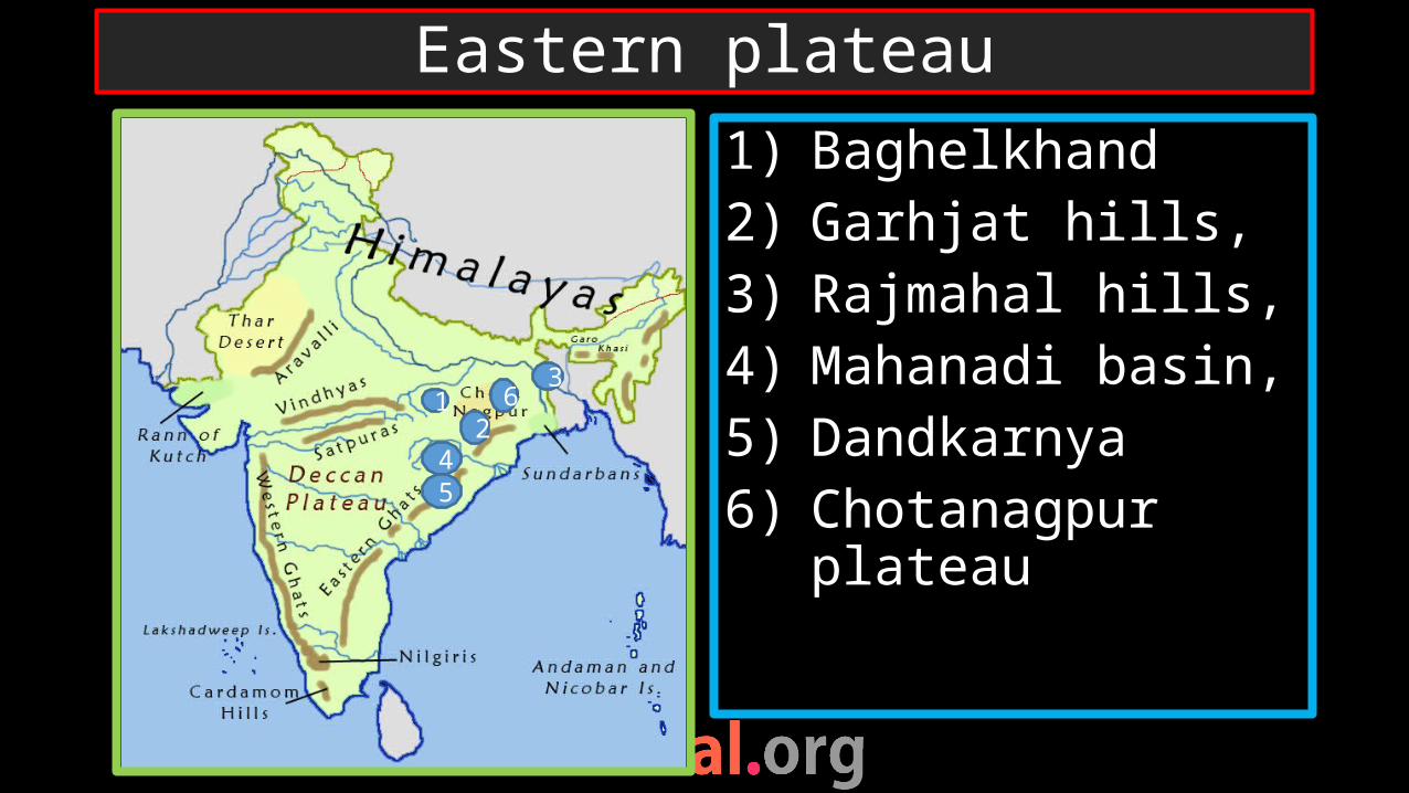
1) Baghelkhand2) Garhjat hills, 3) Rajmahal hills, 4) Mahanadi basin, 5) Dandkarnya6) Chotanagpur
plateau
Eastern plateau
12
36
45
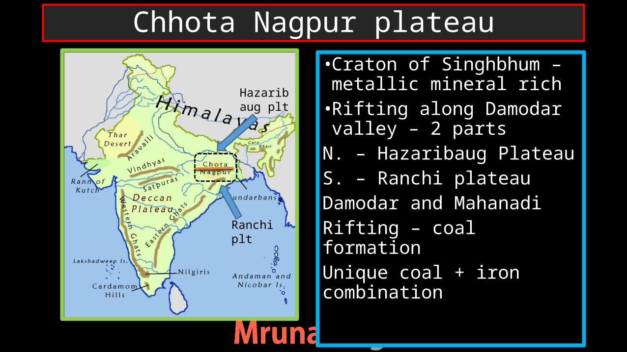
•Craton of Singhbhum – metallic mineral rich•Rifting along Damodar valley – 2 parts
N. – Hazaribaug PlateauS. – Ranchi plateauDamodar and MahanadiRifting – coal formationUnique coal + iron combination
Chhota Nagpur plateau
Ranchi plt
Hazaribaug plt
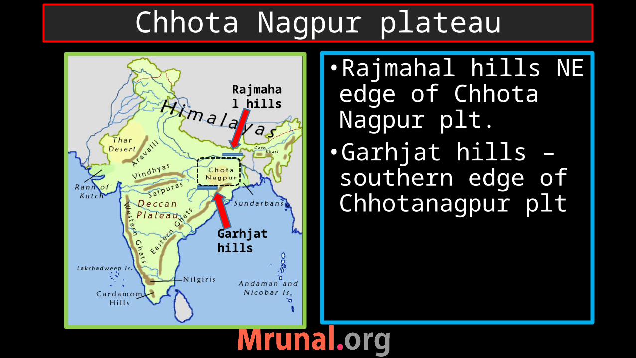
•Rajmahal hills NE edge of Chhota Nagpur plt.•Garhjat hills – southern edge of Chhotanagpur plt
Chhota Nagpur plateau
Garhjat hills
Rajmahal hills
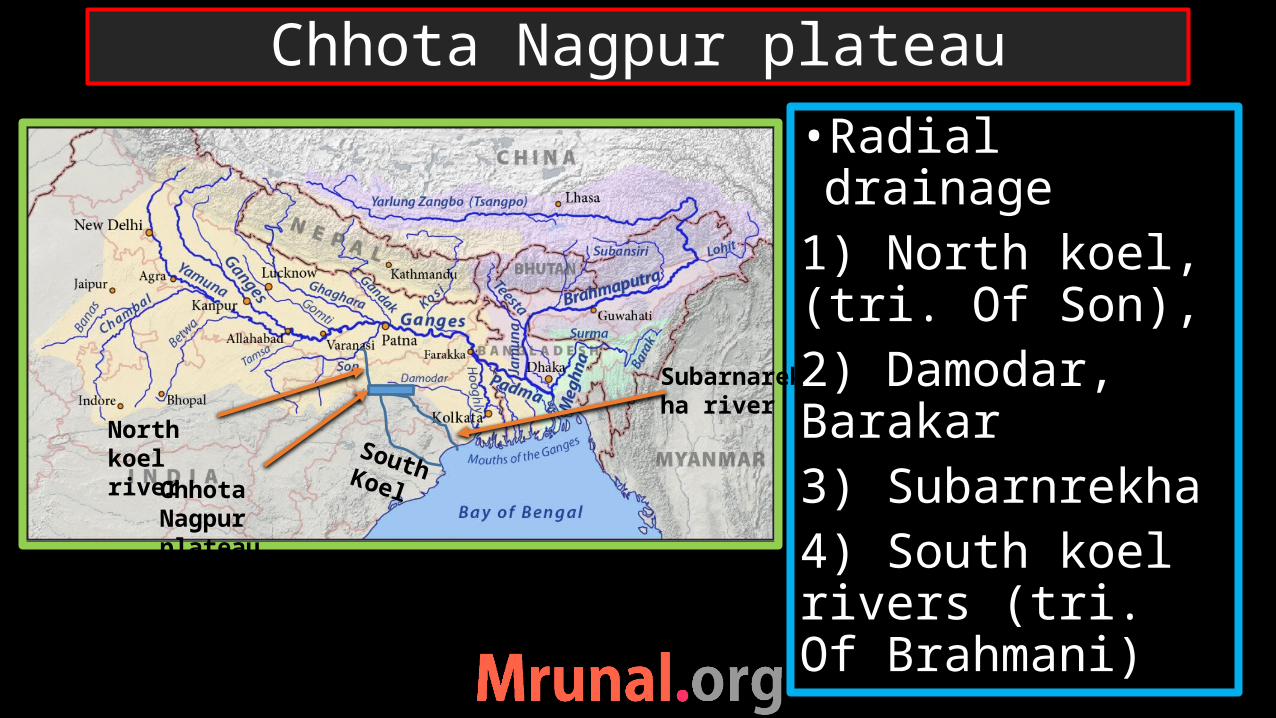
•Radial drainage1) North koel, (tri. Of Son), 2) Damodar, Barakar3) Subarnrekha4) South koel rivers (tri. Of Brahmani)
Chhota Nagpur plateau
Chhota Nagpur plateau
North koel river
Subarnarekha river
South Koel
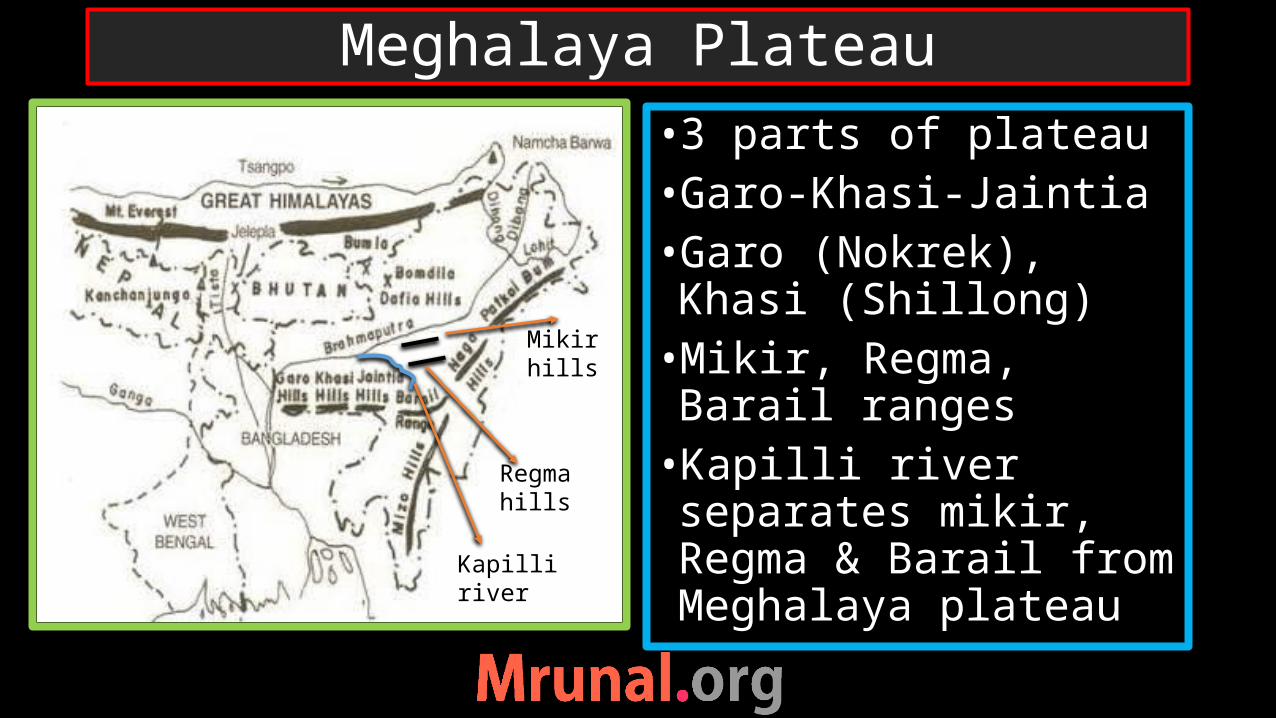
•3 parts of plateau•Garo-Khasi-Jaintia•Garo (Nokrek), Khasi (Shillong)•Mikir, Regma, Barail ranges•Kapilli river separates mikir, Regma & Barail from Meghalaya plateau
Meghalaya Plateau
Mikir hills
Regma hills
Kapilli river

•Extension of Peninsular block•Separated from Chhotanagpur plateau•Down warping along Rajmahal –garo hills = ‘malda gap’•Ganga-Brahmaputra flow through the Malda gap
Meghalaya Plateau
Rajmahal hills
Malda gap
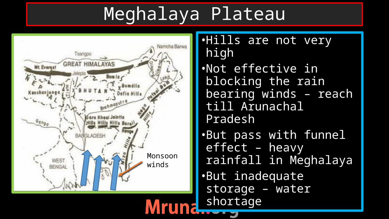
•Hills are not very high•Not effective in blocking the rain bearing winds – reach till Arunachal Pradesh•But pass with funnel effect – heavy rainfall in Meghalaya•But inadequate storage – water shortage
Meghalaya Plateau
Monsoon winds

• India pass over Reunion hot spot•Basaltic lava flow•Layer over layer of lava formation•Look like steps – traps
Deccan traps

•Satpura range (Rajpipla, Gawilgarh, Mahaev, Maikal, Amarkantak plt.)•Maharastra plateau
North Deccan
Satpura range
MH plateau
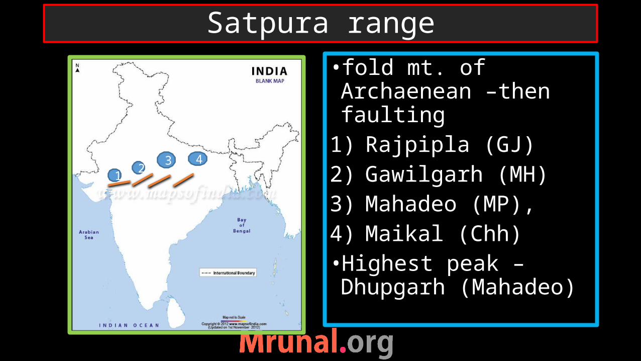
• fold mt. of Archaenean –then faulting
1) Rajpipla (GJ)2) Gawilgarh (MH) 3) Mahadeo (MP), 4) Maikal (Chh)•Highest peak – Dhupgarh (Mahadeo)
Satpura range
12
3 4
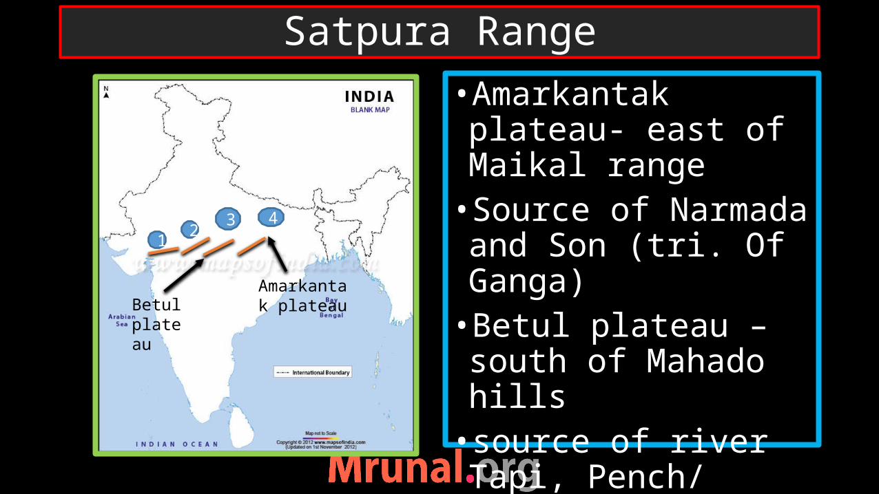
•Amarkantak plateau- east of Maikal range•Source of Narmada and Son (tri. Of Ganga)•Betul plateau – south of Mahado hills•source of river Tapi, Pench/ Wainganga river (Tri. Of Godavari)
Satpura Range
12
3 4
Betul plateau
Amarkantak plateau
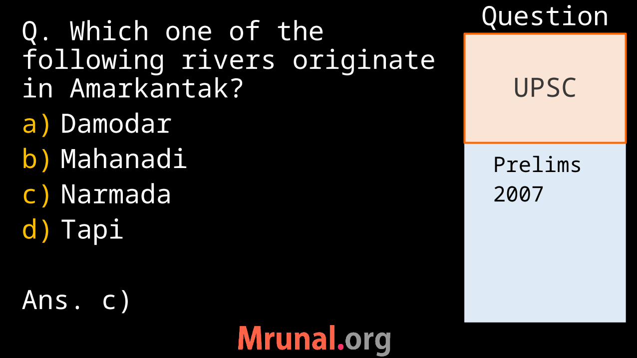
Prelims2007
Q. Which one of the following rivers originate in Amarkantak?a) Damodarb) Mahanadic) Narmadad) Tapi
Ans. c)
UPSC
Question
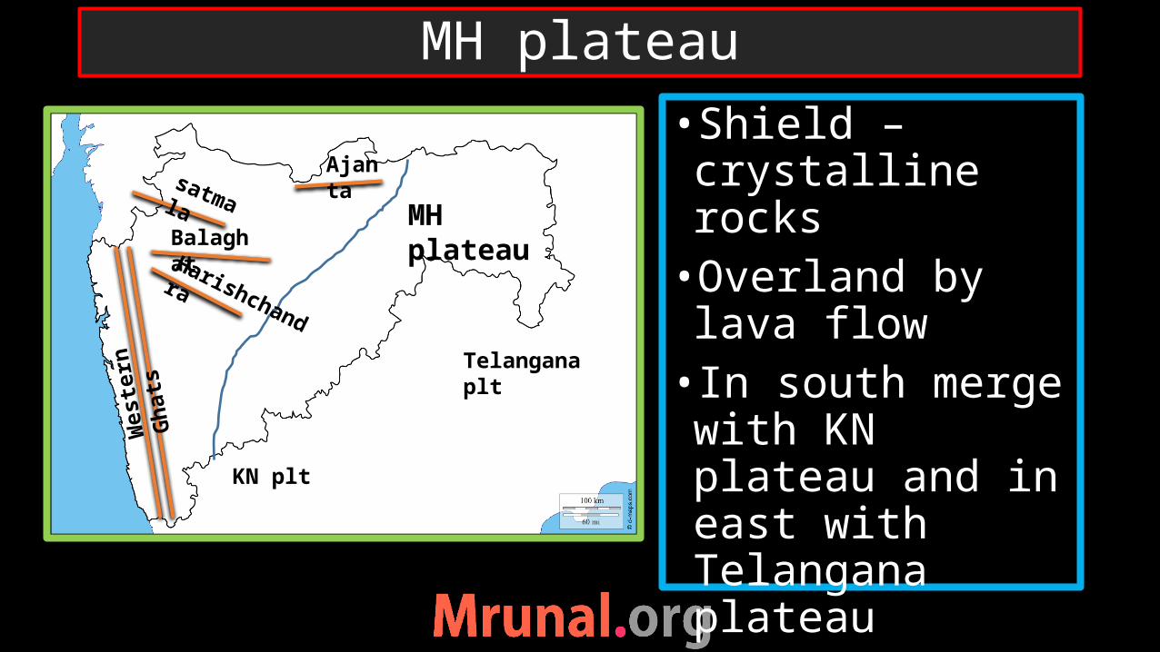
•Shield –crystalline rocks•Overland by lava flow• In south merge with KN plateau and in east with Telangana plateau
MH plateau
MH plateau
Ajantasatmala
BalaghatHarishchandra
Telangana plt
KN plt
Wes
tern
Gha
ts

1) KN -Dharwad plt•One of the oldest physiographical region
2) Telangana plateau
South Deccan
2
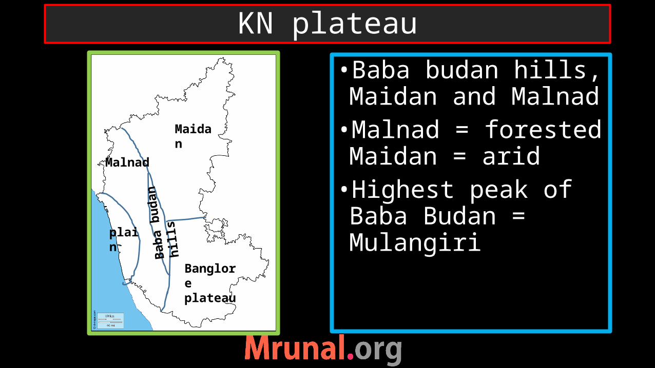
•Baba budan hills, Maidan and Malnad•Malnad = forested Maidan = arid•Highest peak of Baba Budan = Mulangiri
KN plateau
plain
Malnad
Maidan
Banglore plateau
Baba
bud
an h
ills
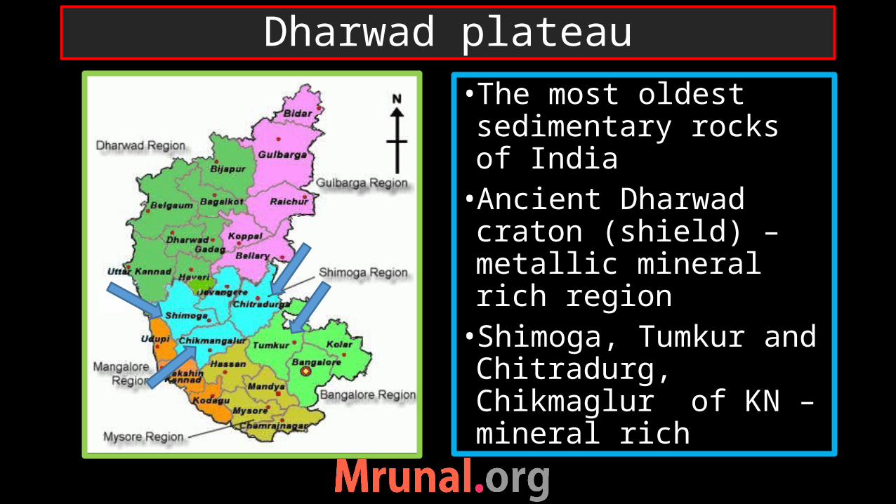
•The most oldest sedimentary rocks of India•Ancient Dharwad craton (shield) – metallic mineral rich region•Shimoga, Tumkur and Chitradurg, Chikmaglur of KN – mineral rich
Dharwad plateau
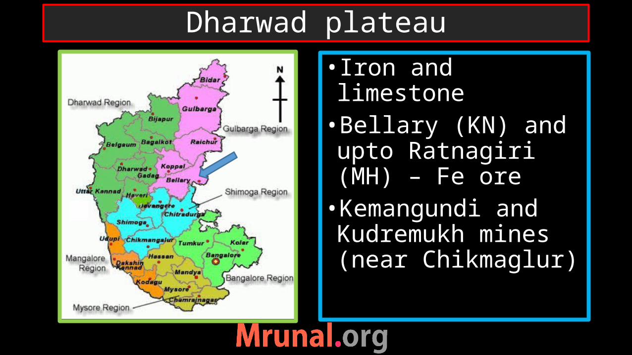
• Iron and limestone•Bellary (KN) and upto Ratnagiri (MH) – Fe ore•Kemangundi and Kudremukh mines (near Chikmaglur)
Dharwad plateau
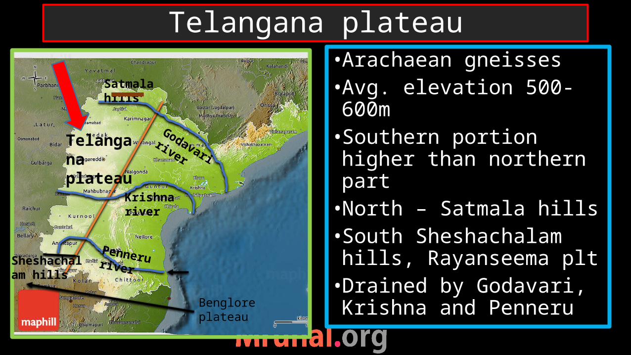
•Arachaean gneisses •Avg. elevation 500-600m•Southern portion higher than northern part•North – Satmala hills•South Sheshachalam hills, Rayanseema plt•Drained by Godavari, Krishna and Penneru
Telangana plateau
Godavari river
Krishna river
Penneru river
Benglore plateau
Telangana plateau
Satmala hills
Sheshachalam hills
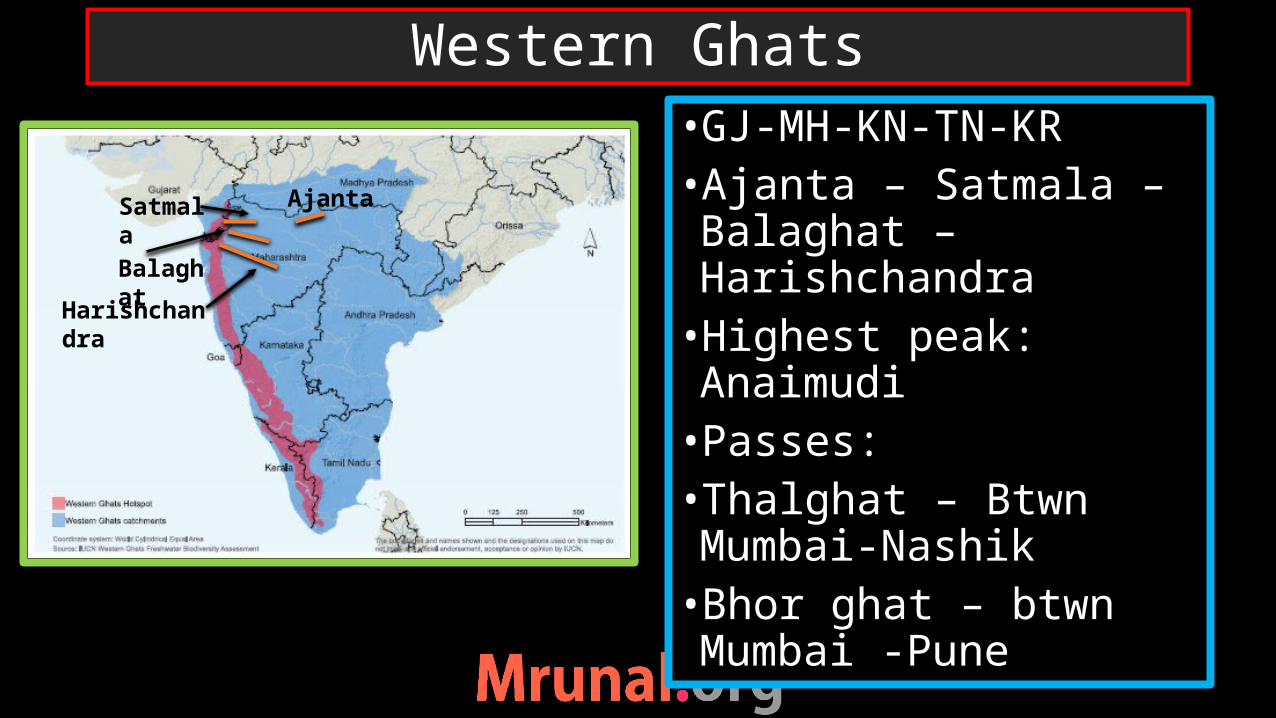
•GJ-MH-KN-TN-KR•Ajanta – Satmala – Balaghat – Harishchandra•Highest peak: Anaimudi•Passes:•Thalghat – Btwn Mumbai-Nashik•Bhor ghat – btwn Mumbai -Pune
Western Ghats
AjantaSatmala
Balaghat
Harishchandra

•More rainfall in KN•Steeper in MH, lower and broader in KN•KR – isolated hills – rain bearing wind pass between gaps
Western Ghats: Rainfall pattern
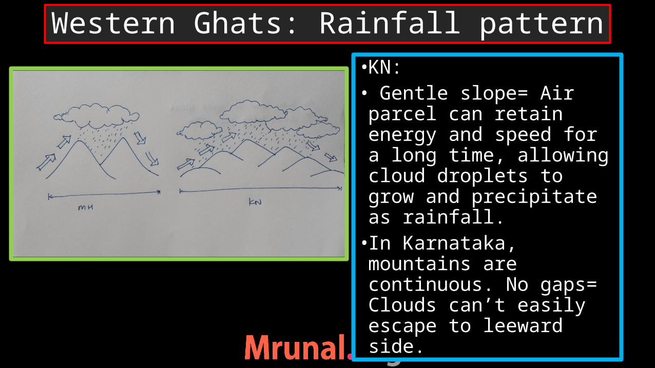
•KN:• Gentle slope= Air parcel can retain energy and speed for a long time, allowing cloud droplets to grow and precipitate as rainfall.• In Karnataka, mountains are continuous. No gaps= Clouds can’t easily escape to leeward side.
Western Ghats: Rainfall pattern
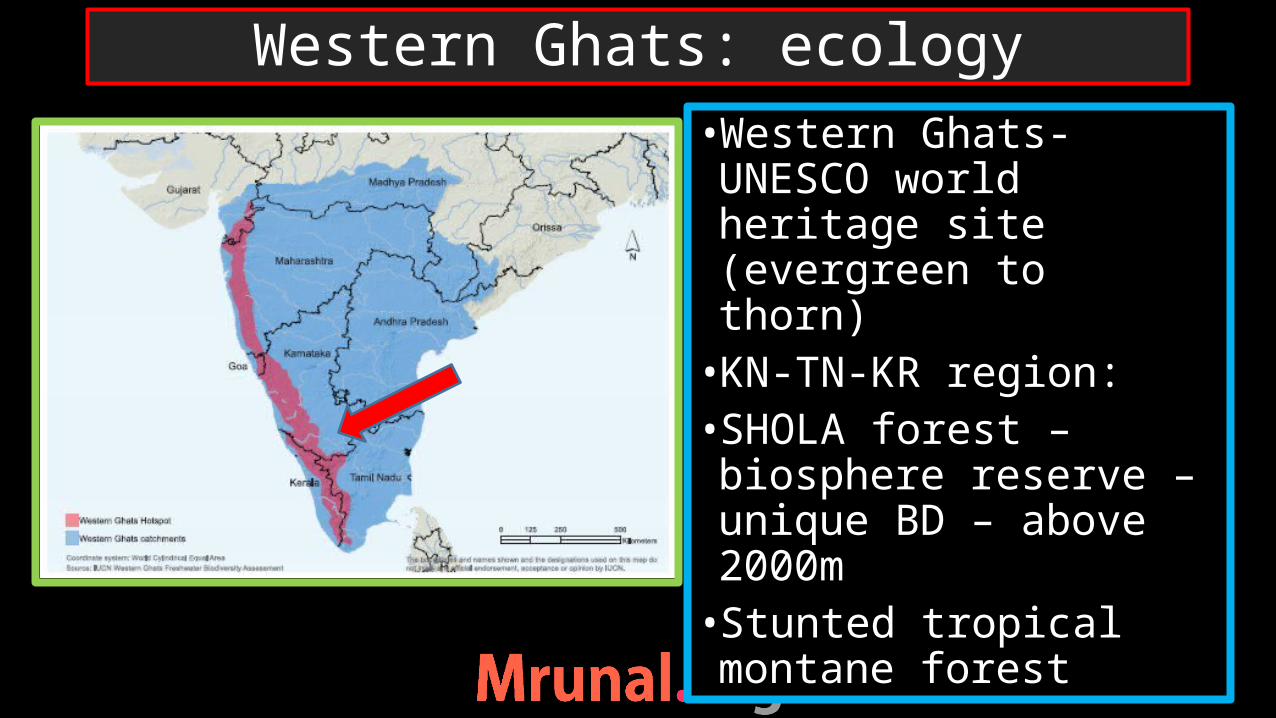
•Western Ghats- UNESCO world heritage site (evergreen to thorn)•KN-TN-KR region:•SHOLA forest –biosphere reserve –unique BD – above 2000m •Stunted tropical montane forest
Western Ghats: ecology

•KN-KR-TN region:•Bandipur-Waynad-Mudumalai NP • Largest population of leopards • leopards + tigers+ wild dogs• TN – tea-coffee •KN –rubber, coffee, cashew plantation•KR- spices
Western Ghats: ecology and agriculture
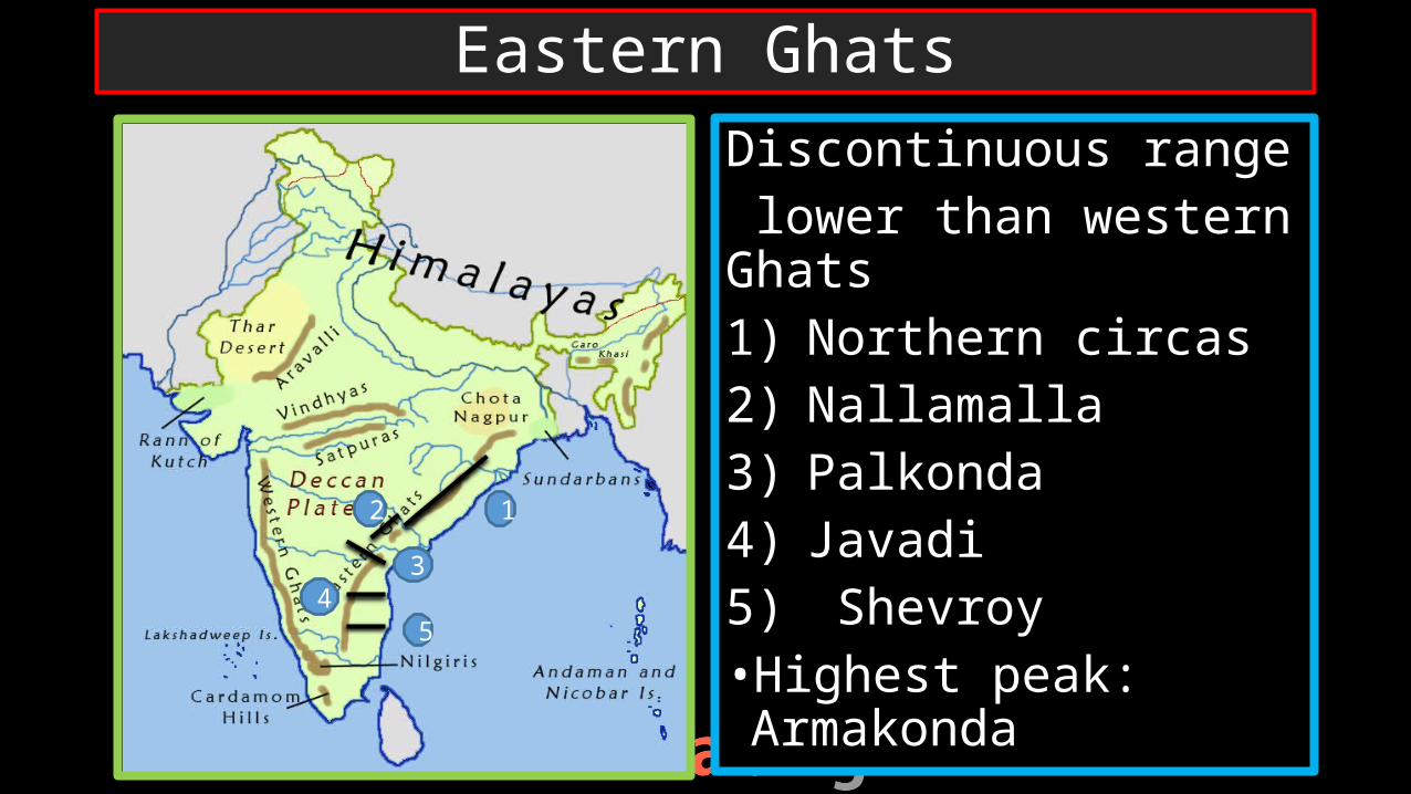
Discontinuous range lower than western Ghats 1) Northern circas2) Nallamalla3) Palkonda4) Javadi5) Shevroy•Highest peak: Armakonda
Eastern Ghats
12
34
5
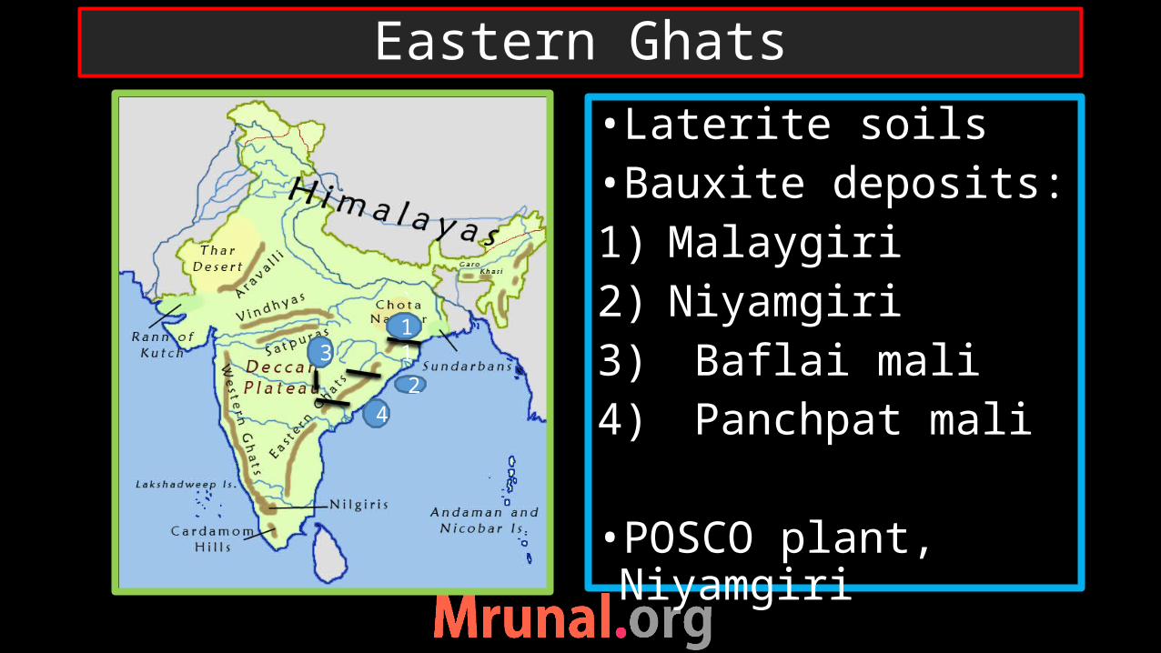
•Laterite soils•Bauxite deposits:1) Malaygiri2) Niyamgiri3) Baflai mali4) Panchpat mali
•POSCO plant, Niyamgiri
Eastern Ghats
`112
4
3
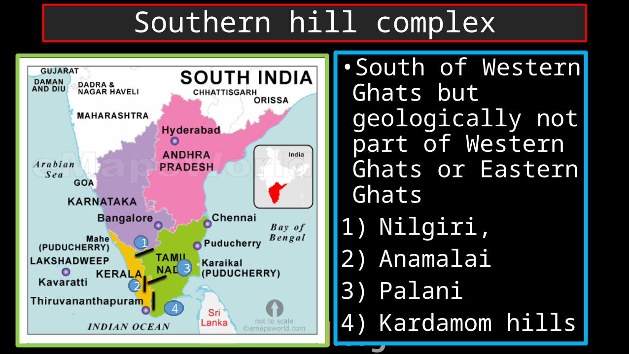
•South of Western Ghats but geologically not part of Western Ghats or Eastern Ghats
1) Nilgiri,2) Anamalai3) Palani4) Kardamom hills
Southern hill complex
1
23
4
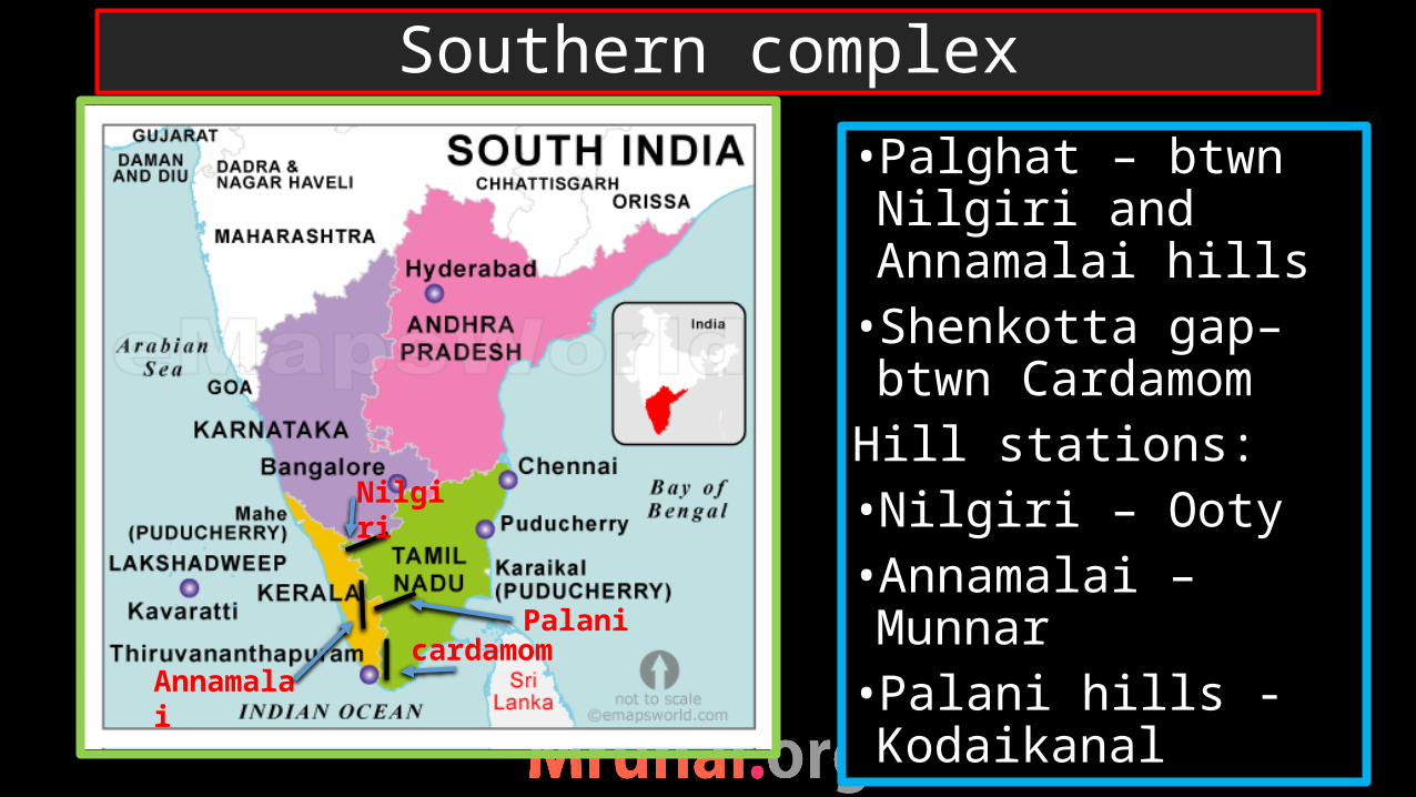
•Palghat – btwn Nilgiri and Annamalai hills•Shenkotta gap– btwn Cardamom
Hill stations:•Nilgiri – Ooty•Annamalai – Munnar•Palani hills - Kodaikanal
Southern complex
Nilgiri
Palanicardamom
Annamalai
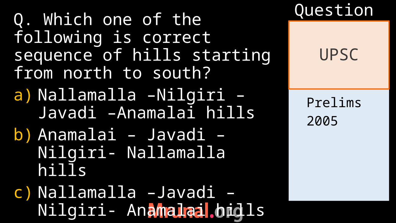
Prelims2005
Q. Which one of the following is correct sequence of hills starting from north to south?a) Nallamalla –Nilgiri –Javadi –
Anamalai hillsb) Anamalai – Javadi –Nilgiri-
Nallamalla hillsc) Nallamalla –Javadi – Nilgiri-
Anamalai hills
UPSC
Question
Prelims2005
d) Anamalai – Nilgiri – javadi- Nallamalai
UPSC
Question
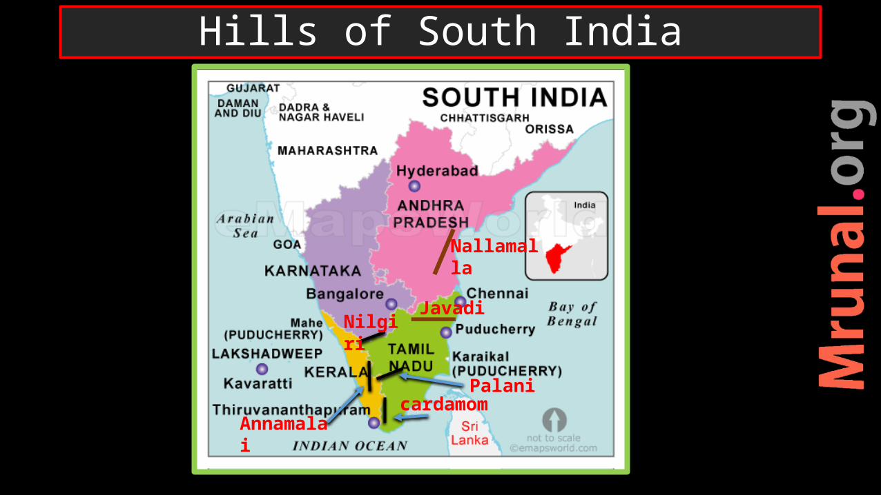
Hills of South India
Nilgiri
Palanicardamom
Annamalai
Nallamalla
Javadi
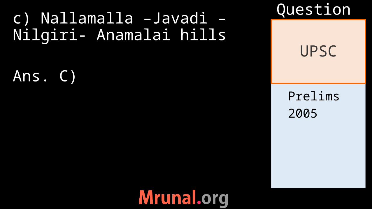
Prelims2005
c) Nallamalla –Javadi – Nilgiri- Anamalai hills
Ans. C)
UPSC
Question

Prelims2008
Q. Which of the following hills are found where Western Ghats and Eastern Ghats meet?a) Anamalai hillsb) Cardamom hillsc) Nilgiri hillsd) Shevroy hills
UPSC
Question
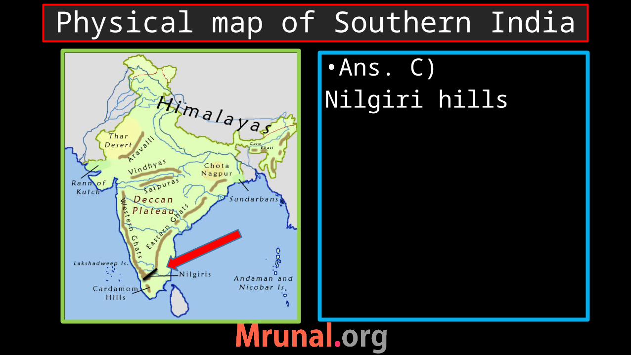
•Ans. C)Nilgiri hills
Physical map of Southern India
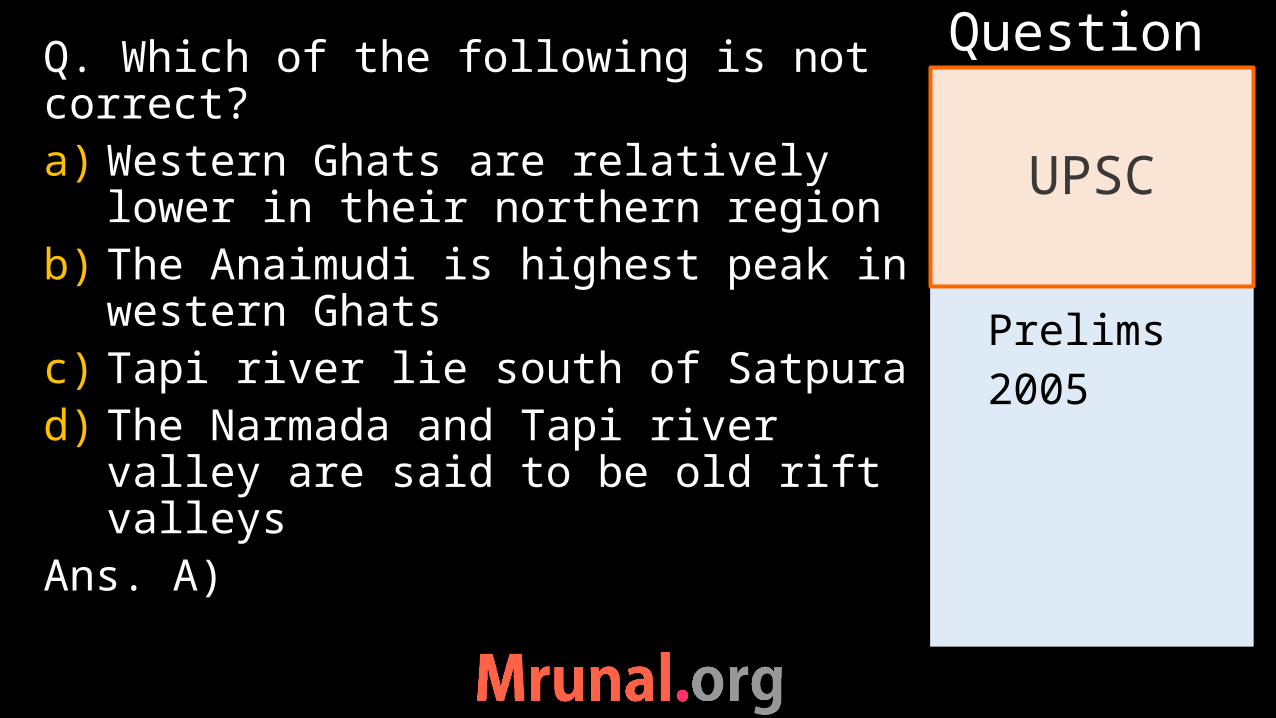
Prelims2005
Q. Which of the following is not correct?a) Western Ghats are relatively
lower in their northern regionb) The Anaimudi is highest peak in
western Ghatsc) Tapi river lie south of Satpurad) The Narmada and Tapi river
valley are said to be old rift valleys
Ans. A)
UPSC
Question
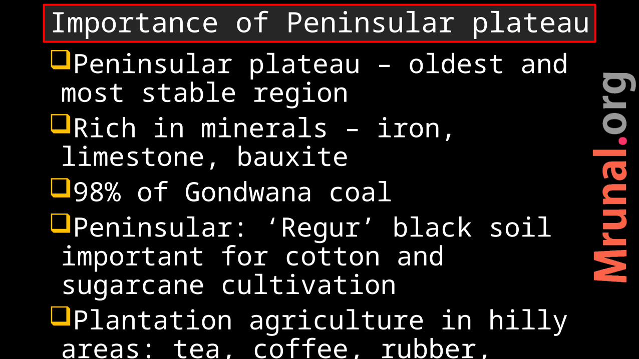
Peninsular plateau – oldest and most stable region
Rich in minerals – iron, limestone, bauxite
98% of Gondwana coalPeninsular: ‘Regur’ black soil important for cotton and sugarcane cultivation
Plantation agriculture in hilly areas: tea, coffee, rubber, spices, cashews
Importance of Peninsular plateau
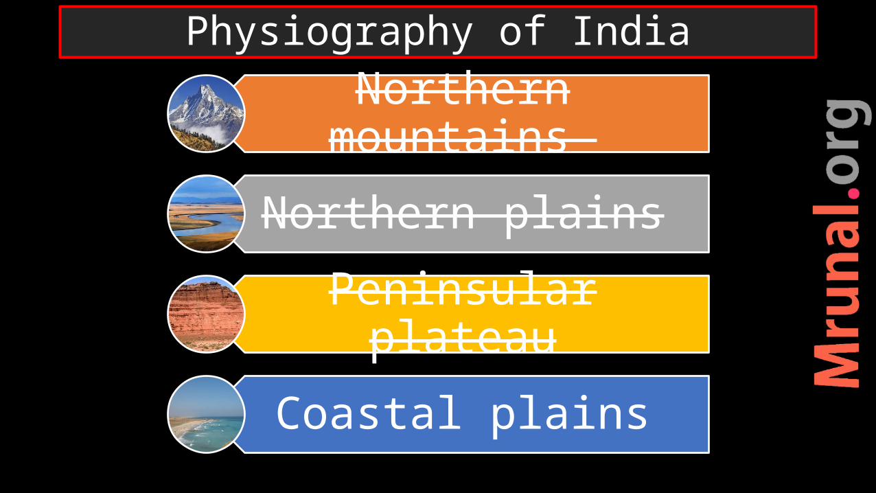
Northern mountains
Northern plains
Peninsular plateau
Coastal plains
Physiography of India
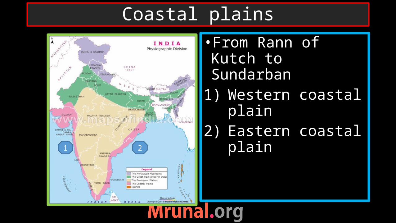
•From Rann of Kutch to Sundarban
1) Western coastal plain
2) Eastern coastal plain
Coastal plains
1 2
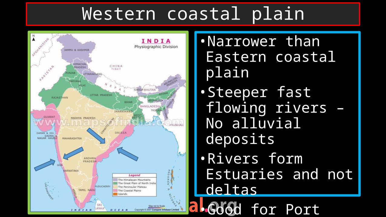
•Narrower than Eastern coastal plain•Steeper fast flowing rivers – No alluvial deposits•Rivers form Estuaries and not deltas•Good for Port development
Western coastal plain
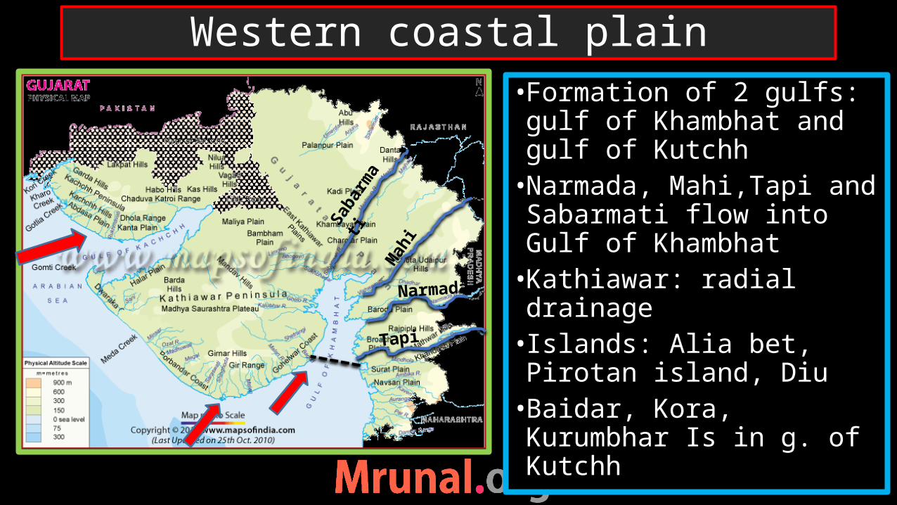
• Formation of 2 gulfs: gulf of Khambhat and gulf of Kutchh•Narmada, Mahi,Tapi and Sabarmati flow into Gulf of Khambhat•Kathiawar: radial drainage• Islands: Alia bet, Pirotan island, Diu•Baidar, Kora, Kurumbhar Is in g. of Kutchh
Western coastal plain
Saba
rmati
Mah
i
Narmada
Tapi
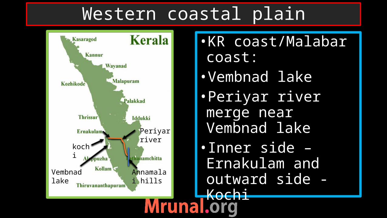
•KR coast/Malabar coast:•Vembnad lake•Periyar river merge near Vembnad lake• Inner side – Ernakulam and outward side - Kochi
Western coastal plain
kochi
Vembnad lake
Periyar river
Annamalai hills
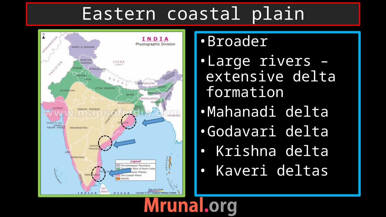
•Broader •Large rivers –extensive delta formation•Mahanadi delta•Godavari delta• Krishna delta• Kaveri deltas
Eastern coastal plain

•Odisha coast: •Wheeler Is. –missile testing•Chilka lake (biggest)•Olive ridley turtles –Ganjam coast- (nr. Mouth of Rushikulya river)
Eastern Coastal Plain
Wheeler Is.
Rushikulya river
Chilka lake
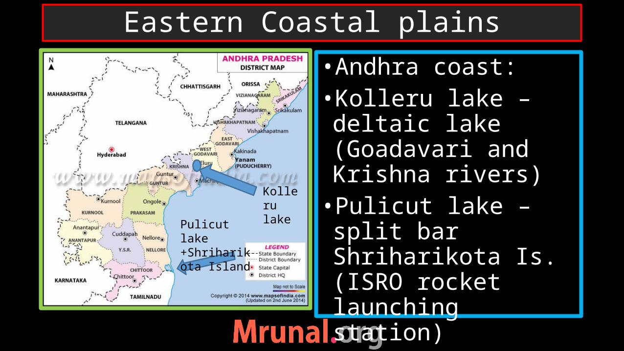
•Andhra coast:•Kolleru lake –deltaic lake (Goadavari and Krishna rivers)•Pulicut lake – split bar Shriharikota Is. (ISRO rocket launching station)
Eastern Coastal plains
Kolleru lake
Pulicut lake +Shriharikota Island
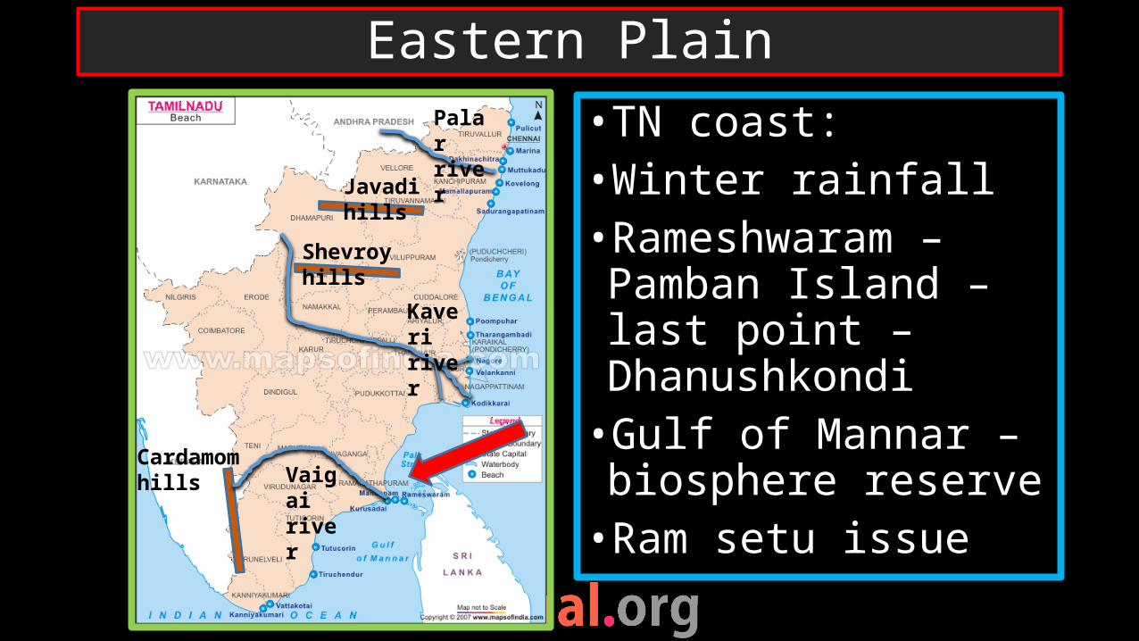
•TN coast:•Winter rainfall•Rameshwaram – Pamban Island – last point – Dhanushkondi•Gulf of Mannar – biosphere reserve•Ram setu issue
Eastern PlainPalar river
Vaigai river
Kaveri river
Cardamom hills
Shevroy hills
Javadi hills

Northern mountains
Northern plains
Peninsular plateau
Coastal plains
Physiography of India