Geo l1 geomorphology_longi_lat_0.1
96
Geography
Transcript of Geo l1 geomorphology_longi_lat_0.1

Geography

ATLAS
Diagram
Conceptual clarity
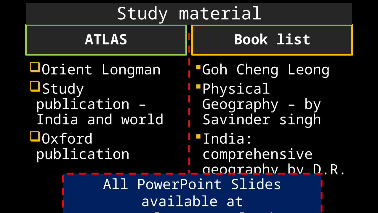
ATLAS
Orient LongmanStudy publication – India and world
Oxford publication
Goh Cheng LeongPhysical Geography – by Savinder singh
India: comprehensive geography by D.R. Khullar
Book list
Study material
All PowerPoint Slides available at Mrunal.org/Download

Physical
Geomorphology
Climatology
OceanographySchemes of the Geography Lectures
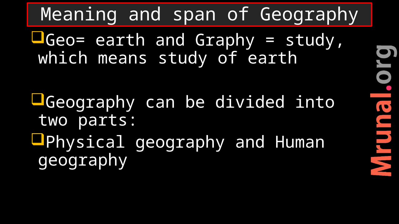
Geo= earth and Graphy = study, which means study of earth
Geography can be divided into two parts:
Physical geography and Human geography
Meaning and span of Geography
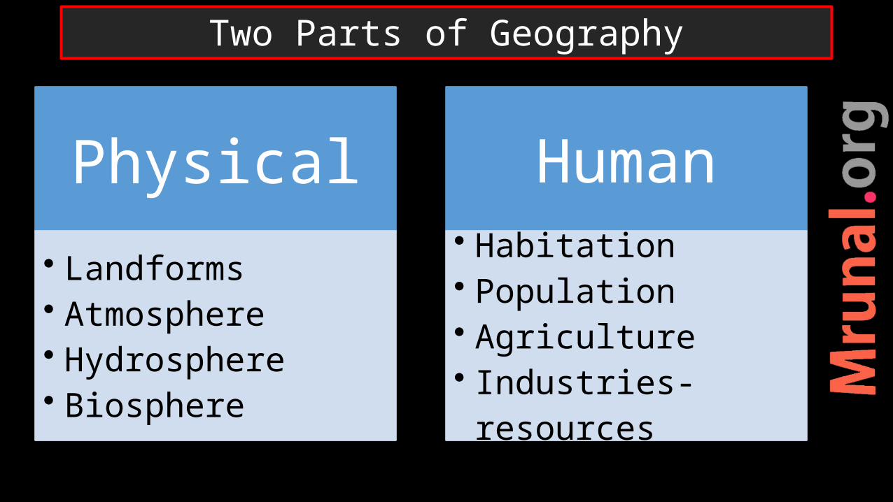
Physical
• Landforms• Atmosphere• Hydrosphere• Biosphere
Human
• Habitation• Population• Agriculture• Industries- resources
Two Parts of Geography
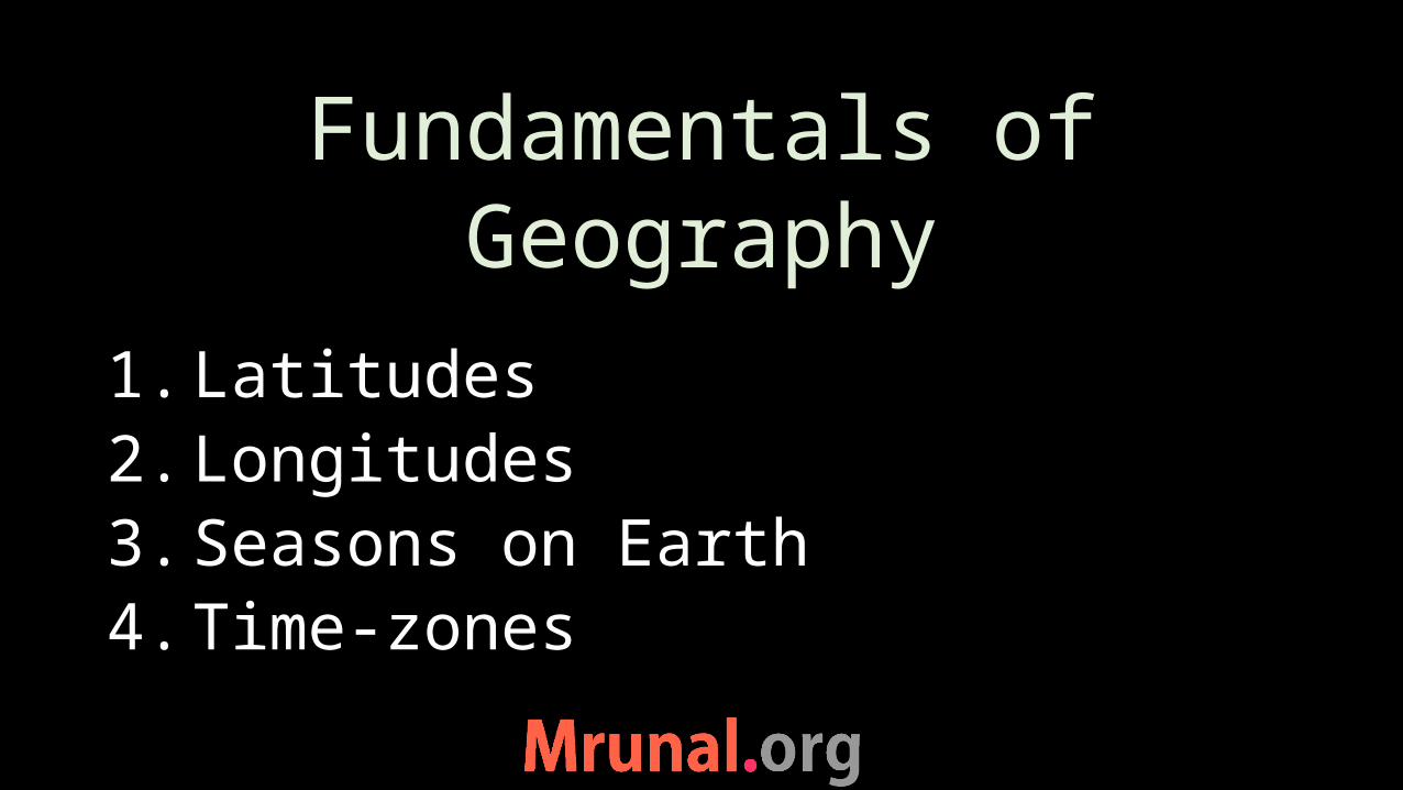
Fundamentals of Geography
1. Latitudes2. Longitudes3. Seasons on Earth4. Time-zones
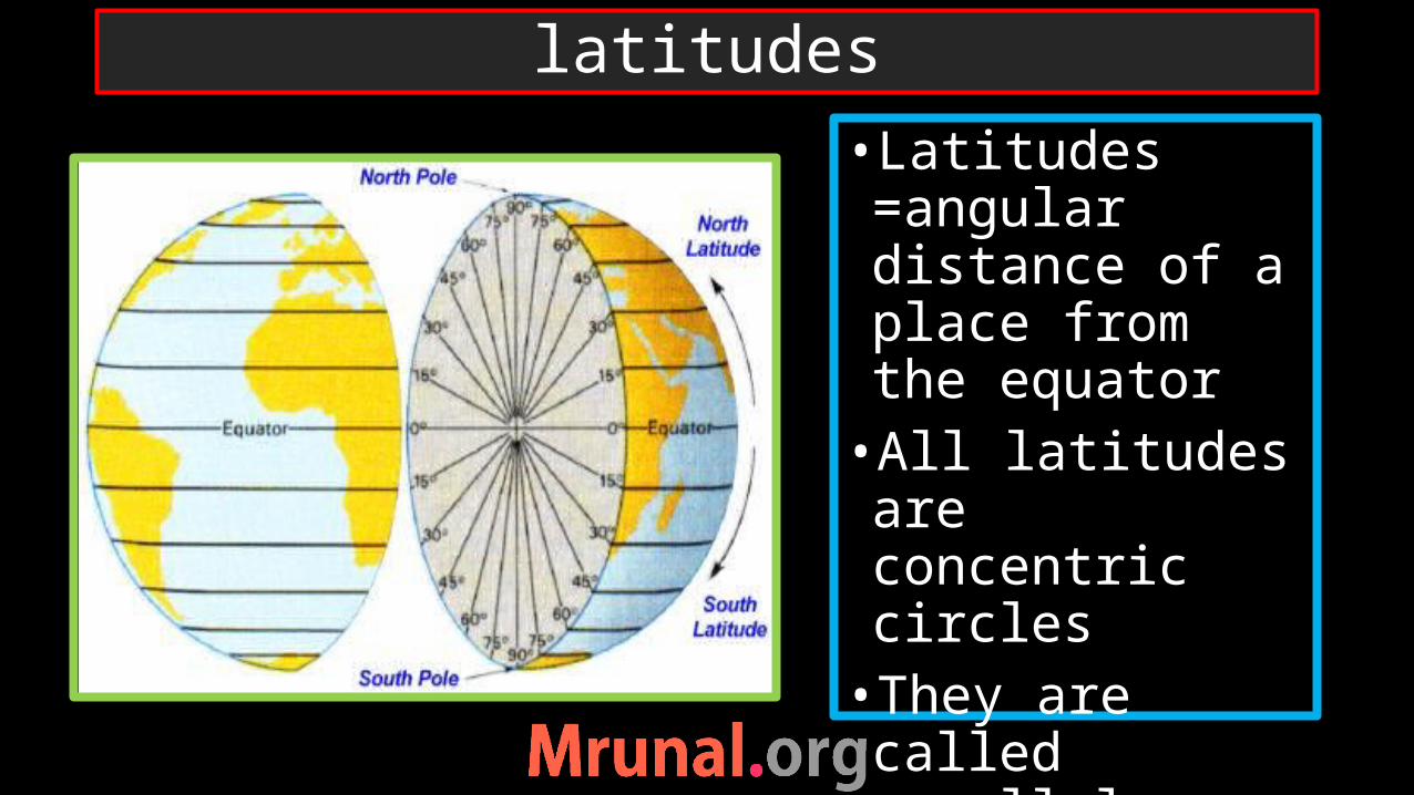
latitudes
•Latitudes =angular distance of a place from the equator•All latitudes are concentric circles•They are called parallels as well
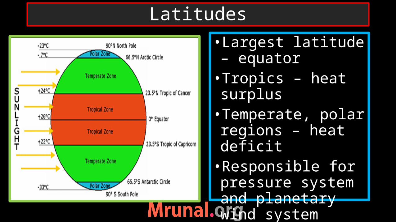
Latitudes
•Largest latitude – equator•Tropics – heat surplus•Temperate, polar regions – heat deficit•Responsible for pressure system and planetary wind system
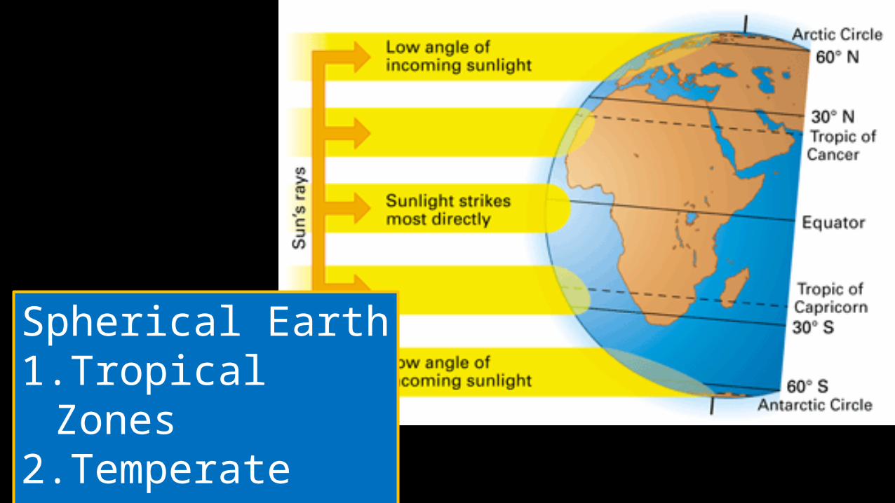
Spherical Earth1.Tropical Zones2.Temperate
Zones
1. Skip 2. Attempt 3. Mark n Review
Q. Who among the following was first to state that Earth was spherical?
A.AristotleB.CopernicusC.PtolemyD.Strabo
UPSC Prelims 2001
Correct Answer is A
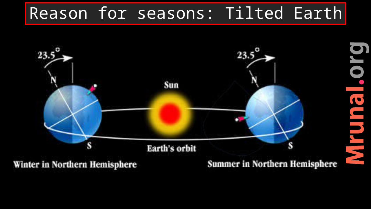
Reason for seasons: Tilted Earth
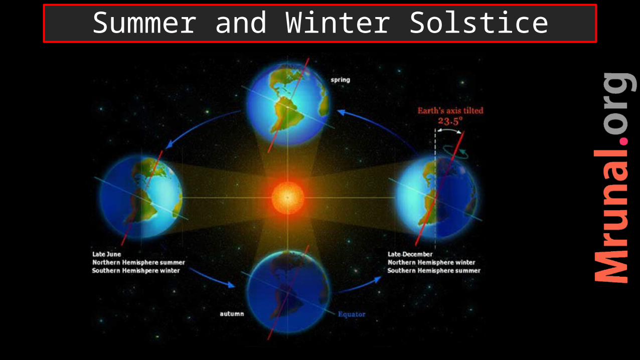
Summer and Winter Solstice
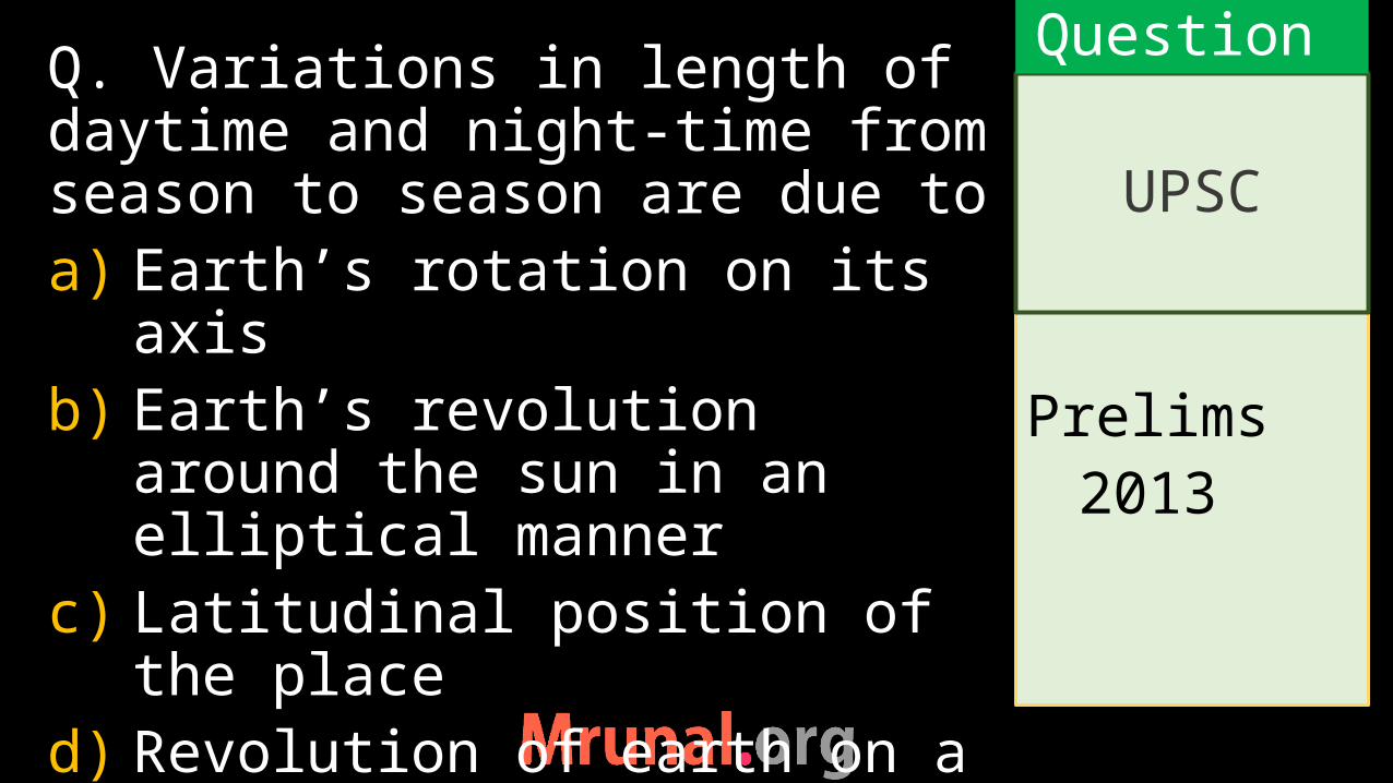
Prelims
2013
Q. Variations in length of daytime and night-time from season to season are due to a) Earth’s rotation on its axisb) Earth’s revolution around the
sun in an elliptical mannerc) Latitudinal position of the
placed) Revolution of earth on a
tilted axis
UPSC
Question
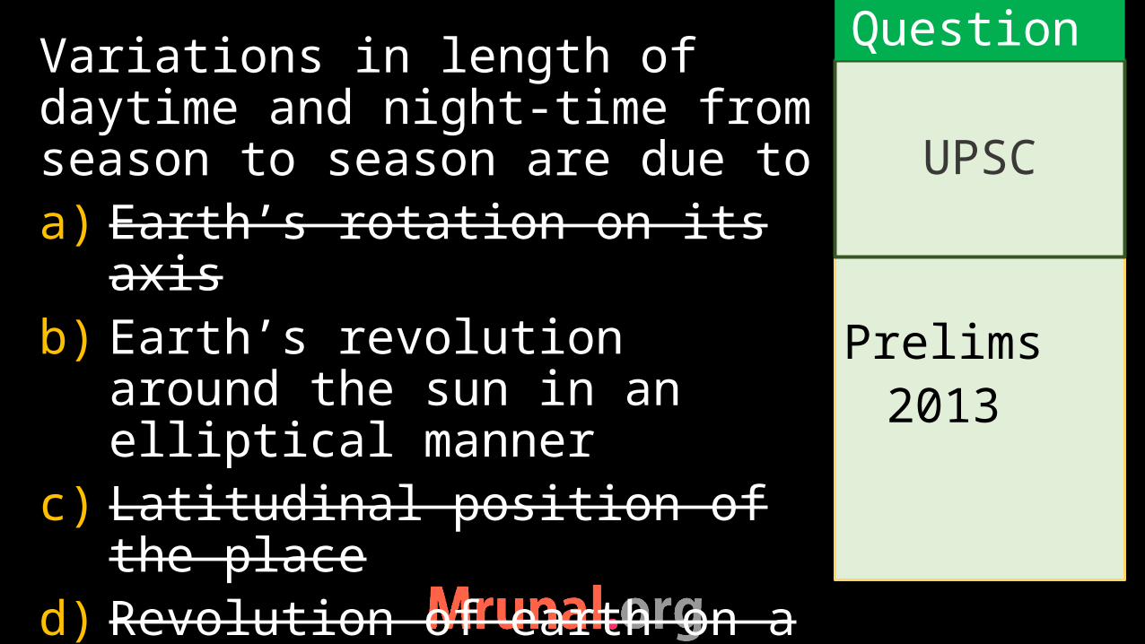
Prelims
2013
Variations in length of daytime and night-time from season to season are due to a) Earth’s rotation on its axisb) Earth’s revolution around the
sun in an elliptical mannerc) Latitudinal position of the
placed) Revolution of earth on a
tilted axis
UPSC
Question

Daylight Saving in Temperate regions
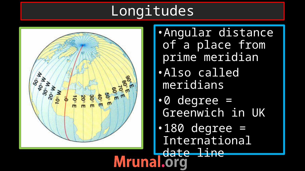
Longitudes
•Angular distance of a place from prime meridian •Also called meridians•0 degree = Greenwich in UK•180 degree = International date line
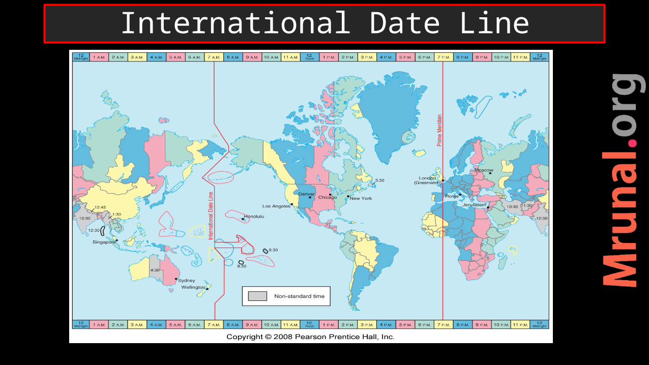
International Date Line
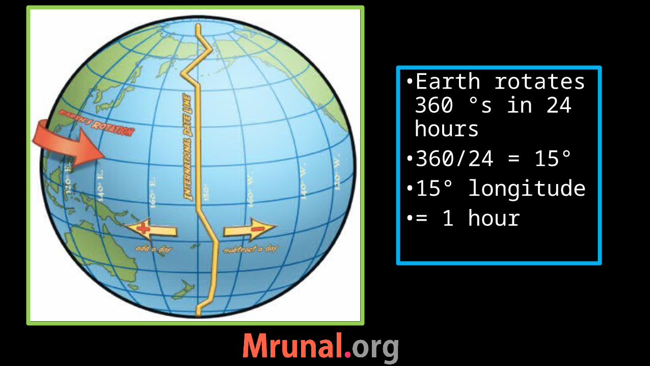
•Earth rotates 360 °s in 24 hours•360/24 = 15°•15° longitude •= 1 hour

31st Dec MorningRussia
30th Dec MorningAlaska
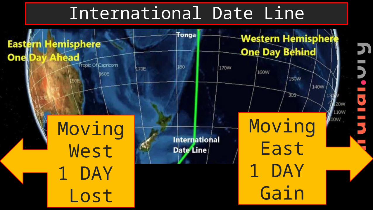
International Date Line
Moving West
1 DAY Lost
Moving East
1 DAY Gain

1) Every country selects its standard meridian. 2) Angular distance between standard meridian of a nation to Greenwich meridian time (GMT)
Standard time
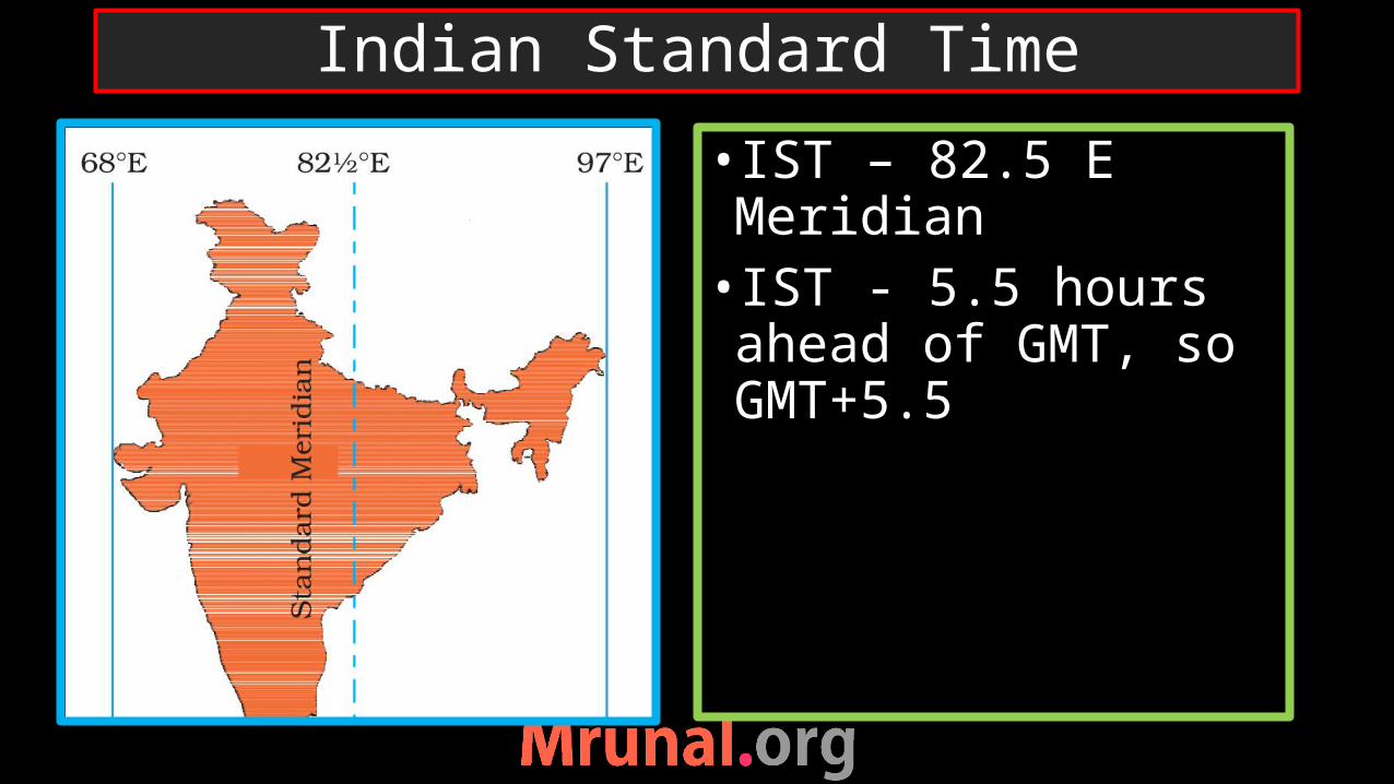
• IST – 82.5 E Meridian• IST - 5.5 hours ahead of GMT, so GMT+5.5
Indian Standard Time

British launched Chaibagaan time (1 hr ahead of IST) 150 years ago in Assam
After independence – rejected2007 DST study – rejected – admin challenges
Jan 2014 CM of Assam – declare to apply Chaibagaan time
Chaibagaan time zone
IST
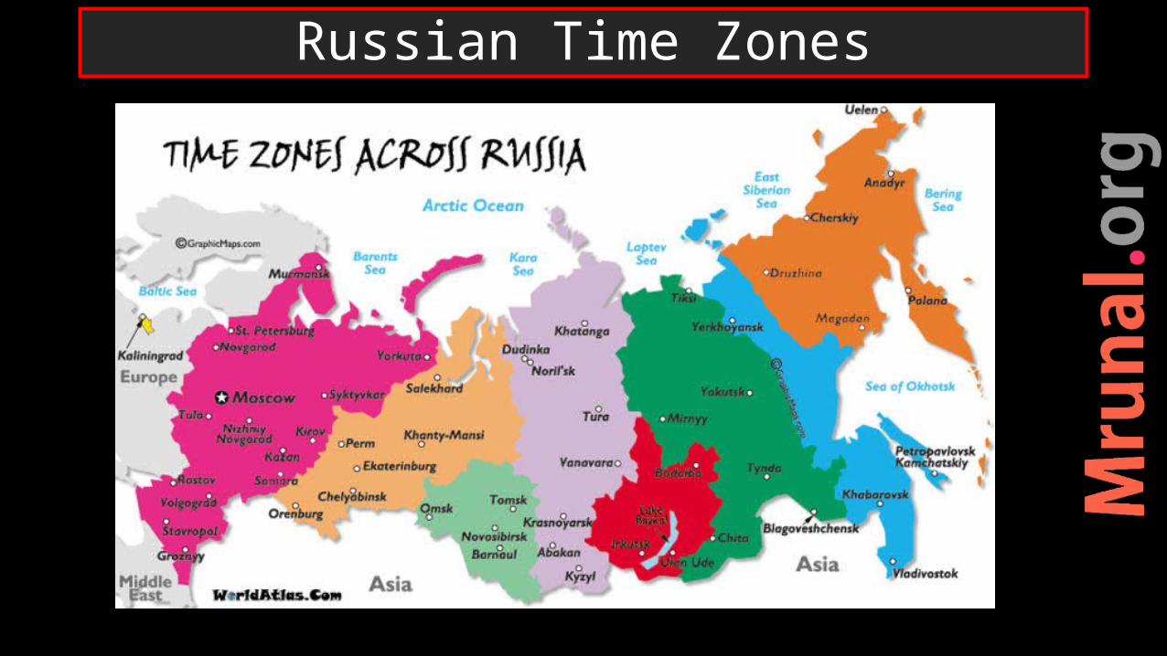
Russian Time Zones

If 12 noon at GMT what is the time at 75 °E?• Difference = 75 °• 15 ° => 1 hour• 75 ° => 5 hours• East (means add) 12 +5 = 5
pm
Timezones
Question

If 12 noon at GMT what is the time at 30 °W?• Difference = 30 °• 15 ° => 1 hour• 30 ° => 2 hours• East (means minus) 12 - 2 =
10 am
Timezones
Question

Prelims 1999
Q. If it is 10.00 am IST, then what would be the local time at Shillong on 92 deg E Longitude?a) 9.38 amb) 10.38 amc) 10.22 amd) 9.22 am
Ans. B)
UPSC
Exercise
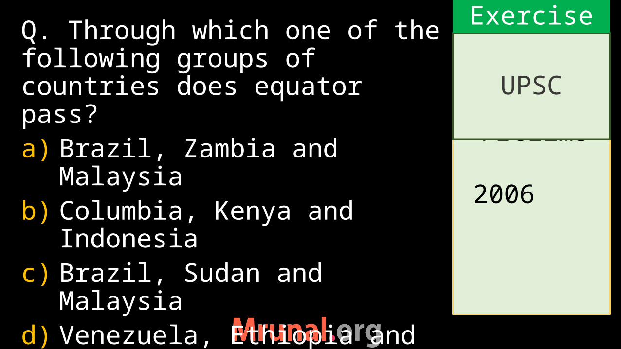
Prelims 2006
Q. Through which one of the following groups of countries does equator pass?a) Brazil, Zambia and Malaysiab) Columbia, Kenya and
Indonesiac) Brazil, Sudan and Malaysiad) Venezuela, Ethiopia and
Indonesia
UPSC
Exercise

Prelims 2008
Q. Which of the following cities is nearest to the equator ? a) Colombob) Jakartac) Manilad) Singapore
UPSC
Exercise

Prelims 2008
Q. Which one of the following straits is nearest to the International Date Line? a) Malacca Straitb) Bering straitc) Strait of Floridad) Strait of Gibraltar
UPSC
Exercise

Malacca strait
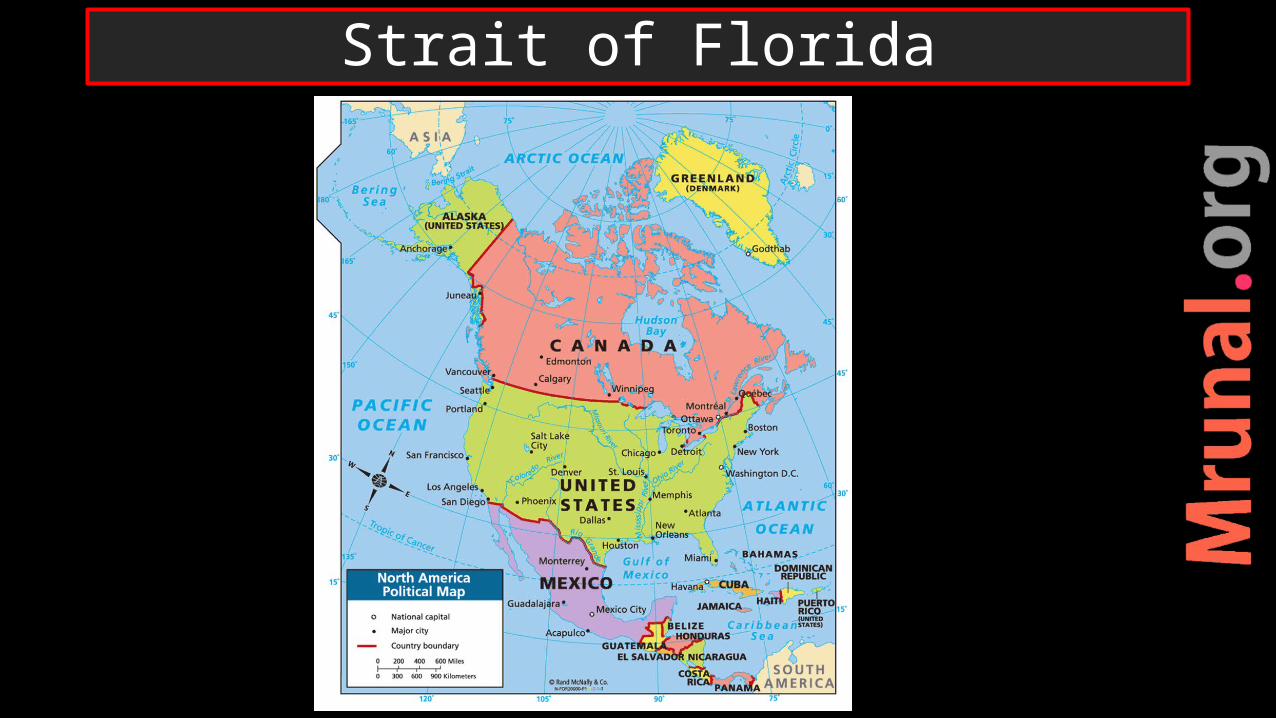
Strait of Florida
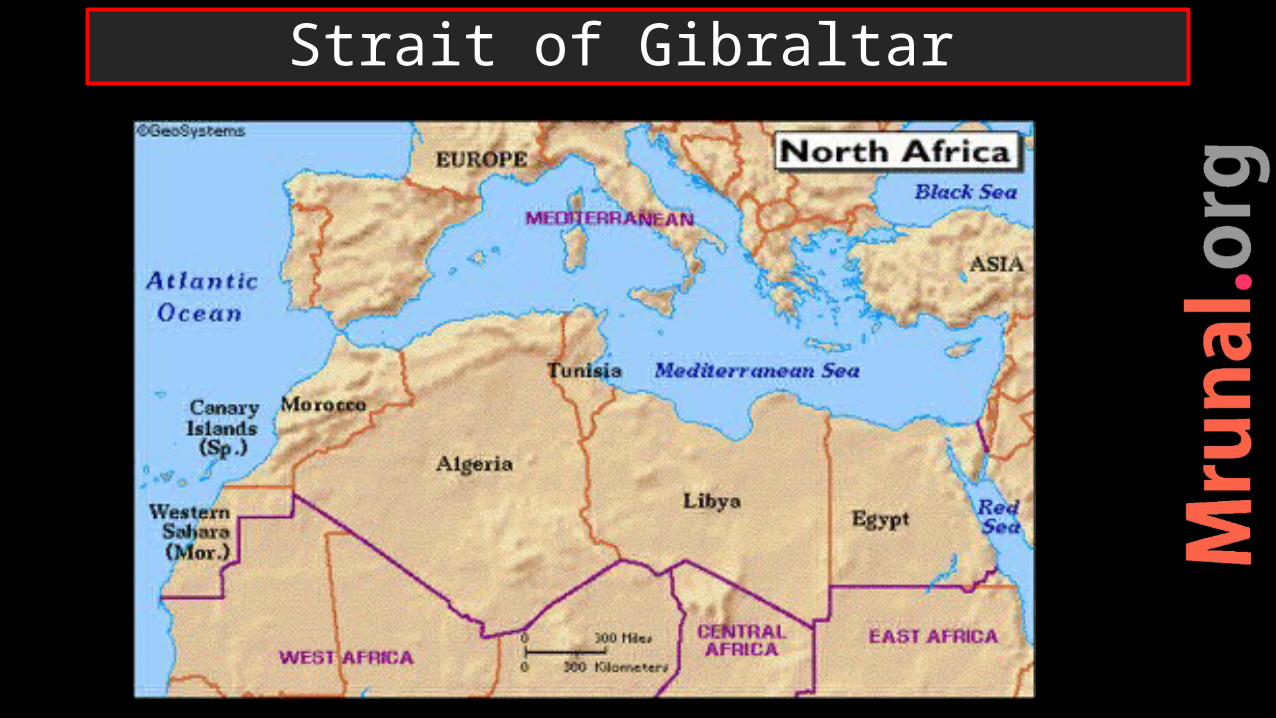
Strait of Gibraltar

Prelims 2009
Q. Consider the following countries: 1. Australia2. Namibia3. Brazil4. ChileThrough which of the above does the Tropic of Capricorn pass?
UPSC
Exercise

Prelims 2009
a) 1 onlyb) 2,3 and 4c) 1,2 and 3d) 1,2,3,4
UPSC
Exercise
1. Longitude2. Latitude3. Reason for
Seasons on Earth4. Time zones
Self StudyNCERT Class6: Chapter 2- Longitudes, Latitudes and time-zones
Map: Greenwich line passes through which famous cities and countries of the world?
Map: IST line passes through which famous cities and states of India?
NCERT

Geomorphology
Origin of the EarthNebula TheoryTheory of Laplace Overview
Geomorphology

Gaseous cloud of H, He – radiation –cooling- Contracting •Separation of outer ring – 9 parts => 9 planets
Origin of earth – Nebular theory of Laplace
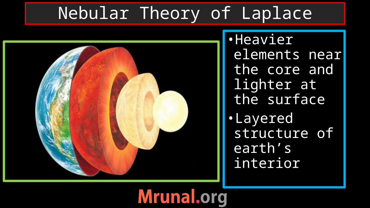
•Heavier elements near the core and lighter at the surface•Layered structure of earth’s interior
Nebular Theory of Laplace

1. Density study:2. Temperature study3. Structural study - Direct evidences- Indirect evidences
Interior of the Earth
Geomorphology

•Outer layer (continents)– SIAL•Mantle and oceanic crust – SIMA•Core – Ni +Fe
Edward Suess
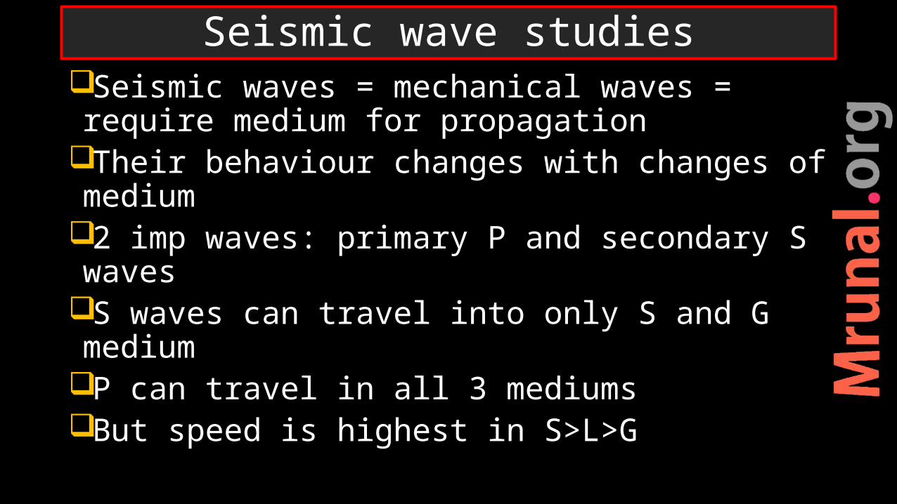
Seismic waves = mechanical waves = require medium for propagation
Their behaviour changes with changes of medium
2 imp waves: primary P and secondary S waves
S waves can travel into only S and G medium
P can travel in all 3 mediumsBut speed is highest in S>L>G
Seismic wave studies

S-wave Propagation

P-waves propagation
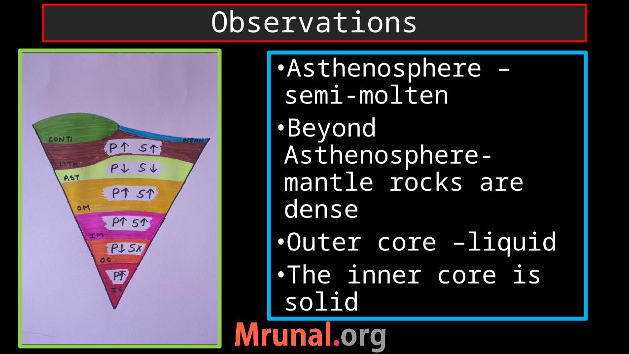
Observations
•Asthenosphere –semi-molten•Beyond Asthenosphere- mantle rocks are dense •Outer core –liquid •The inner core is solid
Self StudyClass11 Chapter3: Interior of Earth
NCERT
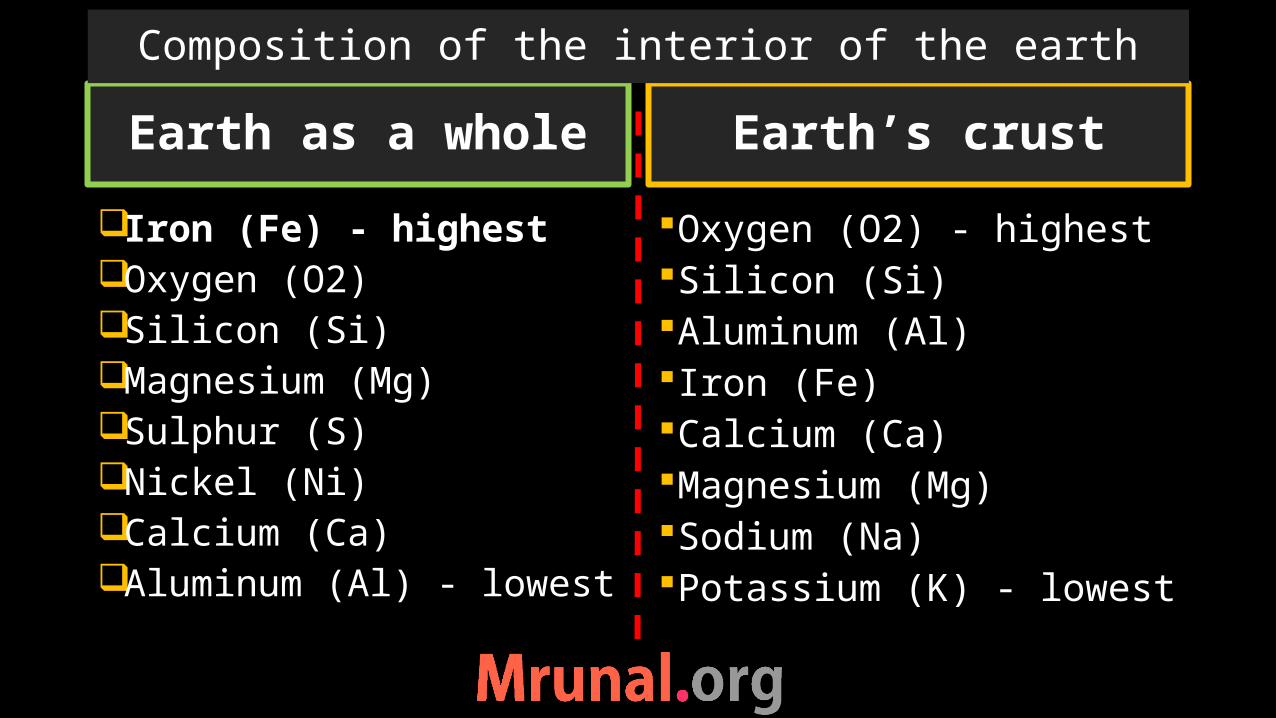
Earth as a whole
Iron (Fe) - highestOxygen (O2)Silicon (Si)Magnesium (Mg)Sulphur (S)Nickel (Ni)Calcium (Ca)Aluminum (Al) - lowest
Oxygen (O2) - highestSilicon (Si)Aluminum (Al)Iron (Fe)Calcium (Ca)Magnesium (Mg)Sodium (Na)Potassium (K) - lowest
Earth’s crust
Composition of the interior of the earth
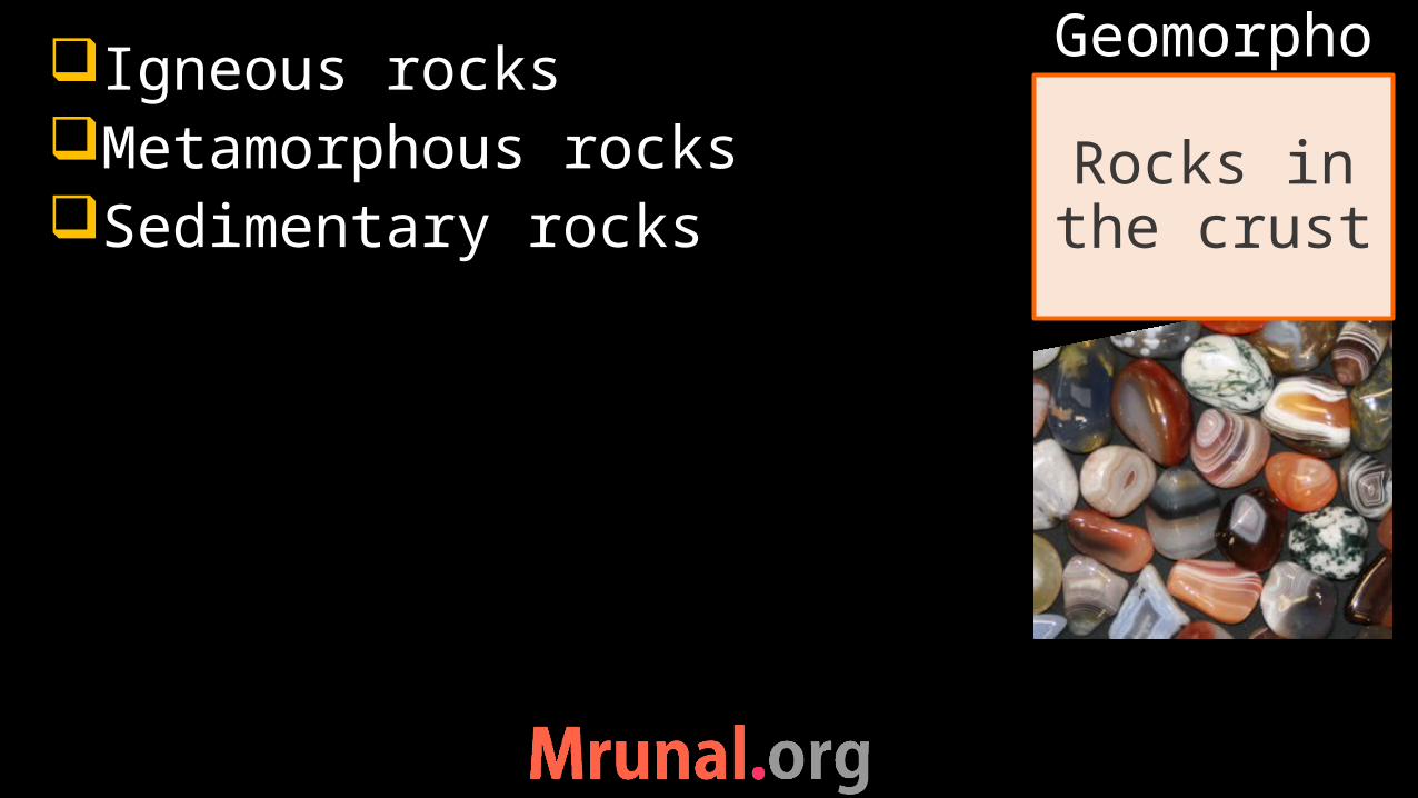
Igneous rocksMetamorphous rocksSedimentary rocks
Rocks in the crust
Geomorpho
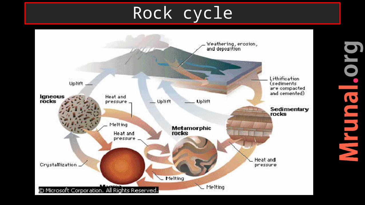
Rock cycle
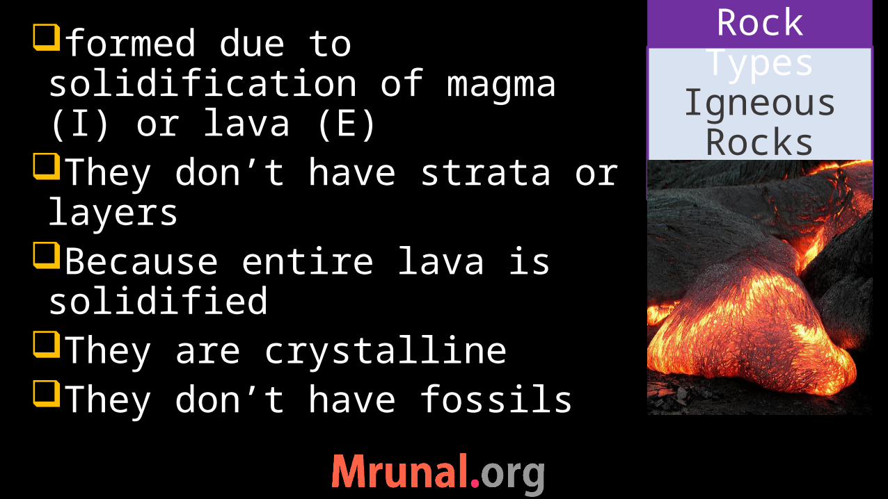
formed due to solidification of magma (I) or lava (E)
They don’t have strata or layers
Because entire lava is solidified
They are crystallineThey don’t have fossils
IgneousRocks
Rock Types
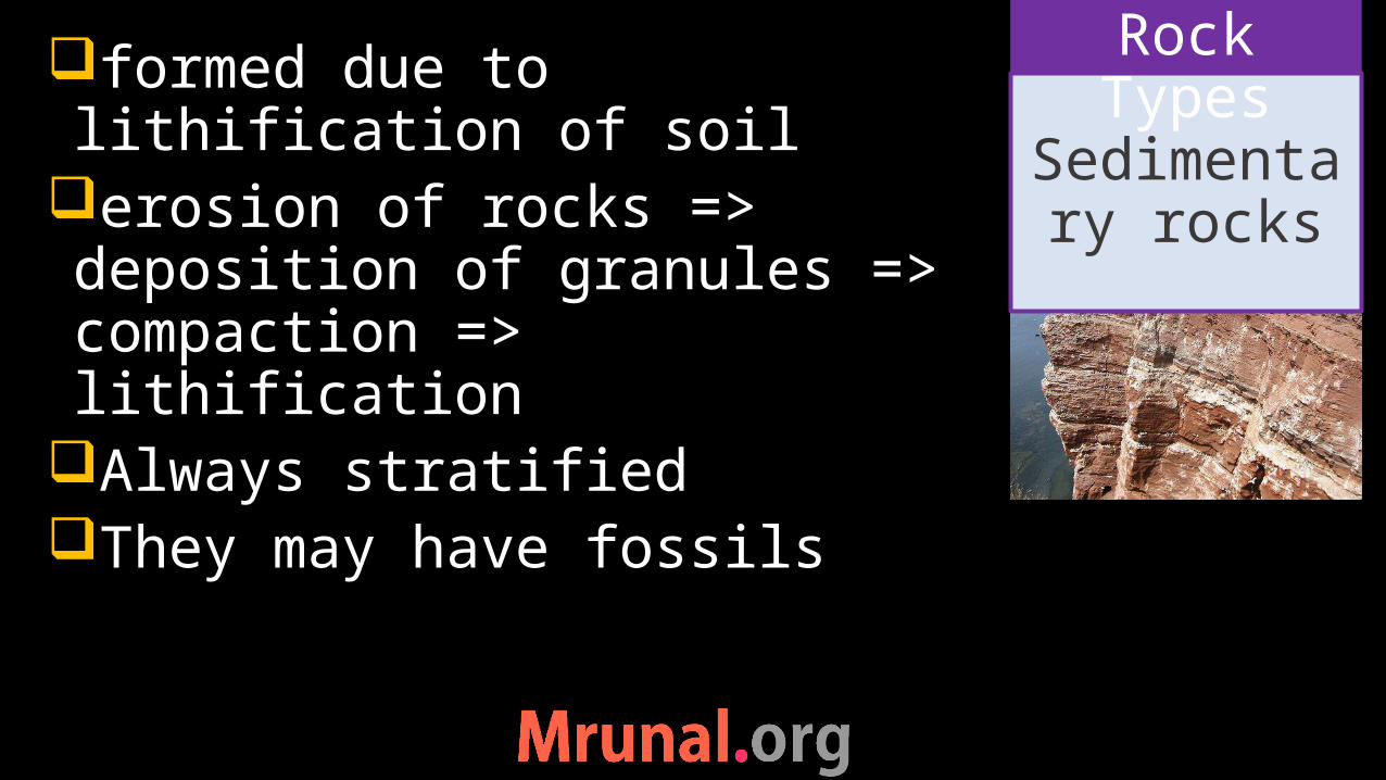
formed due to lithification of soil
erosion of rocks => deposition of granules => compaction => lithification
Always stratifiedThey may have fossils
Sedimentary rocks
Rock Types
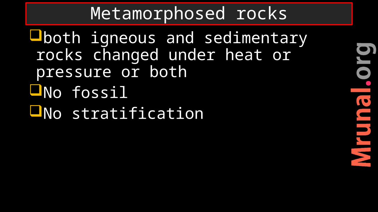
both igneous and sedimentary rocks changed under heat or pressure or both
No fossilNo stratification
Metamorphosed rocks
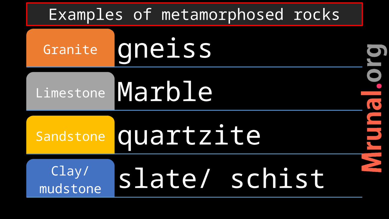
gneissGranite
MarbleLimestone
quartziteSandstone
slate/ schistClay/mudstone
Examples of metamorphosed rocks
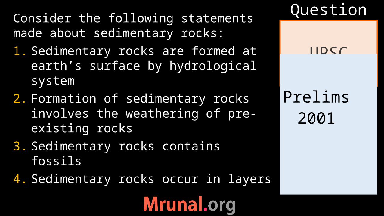
Consider the following statements made about sedimentary rocks:1. Sedimentary rocks are formed at
earth’s surface by hydrological system
2. Formation of sedimentary rocks involves the weathering of pre-existing rocks
3. Sedimentary rocks contains fossils4. Sedimentary rocks occur in layers
UPSC
Question
Prelims
2001

Prelims 2001
Q. Quartzite is metamorphosed from:a) Limestoneb) Obsidianc) Sandstoned) shale
UPSC
Question
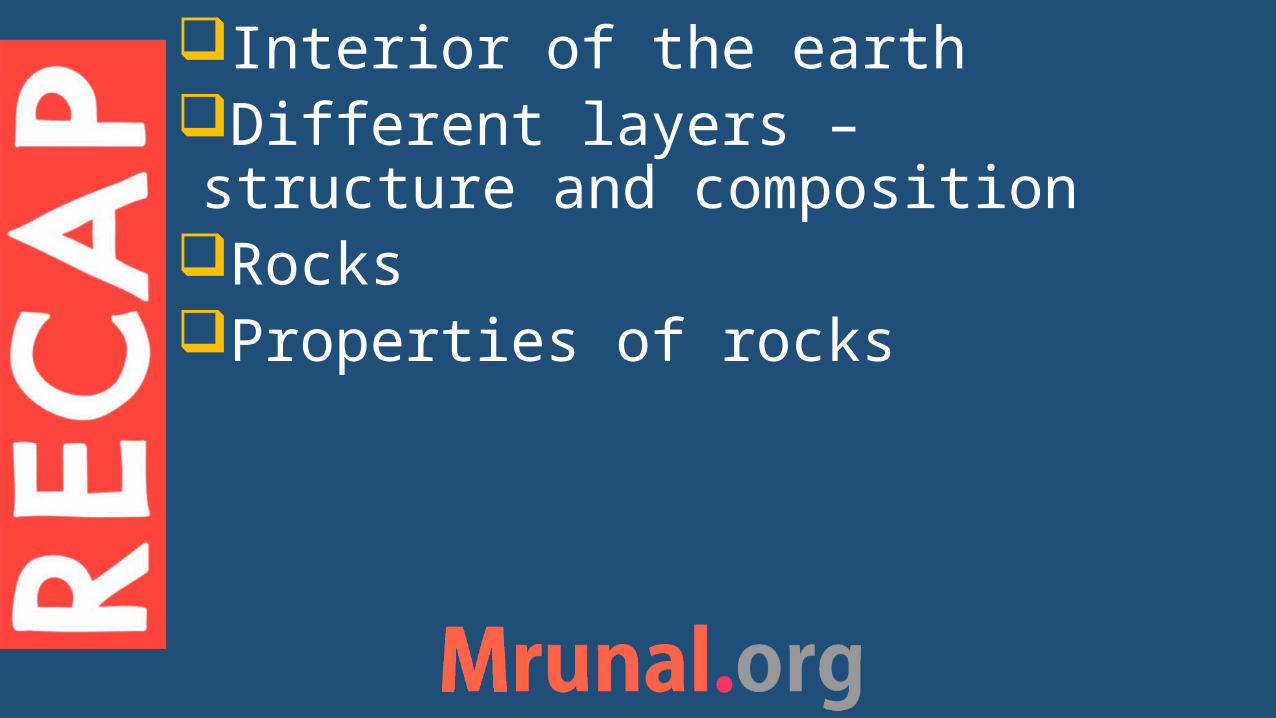
Interior of the earth Different layers – structure and composition
Rocks Properties of rocks
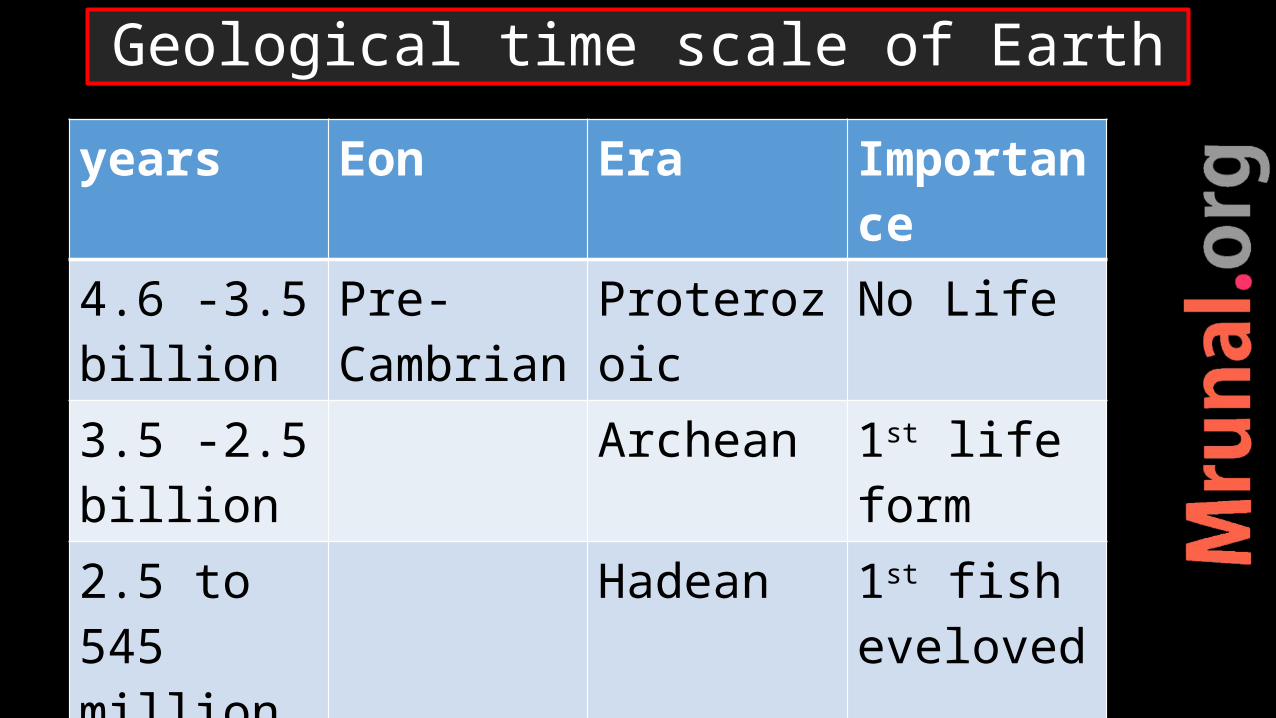
Geological time scale of Earth
years Eon Era Importance
4.6 -3.5 billion
Pre-Cambrian
Proterozoic No Life
3.5 -2.5 billion
Archean 1st life form
2.5 to 545 million
Hadean 1st fish eveloved
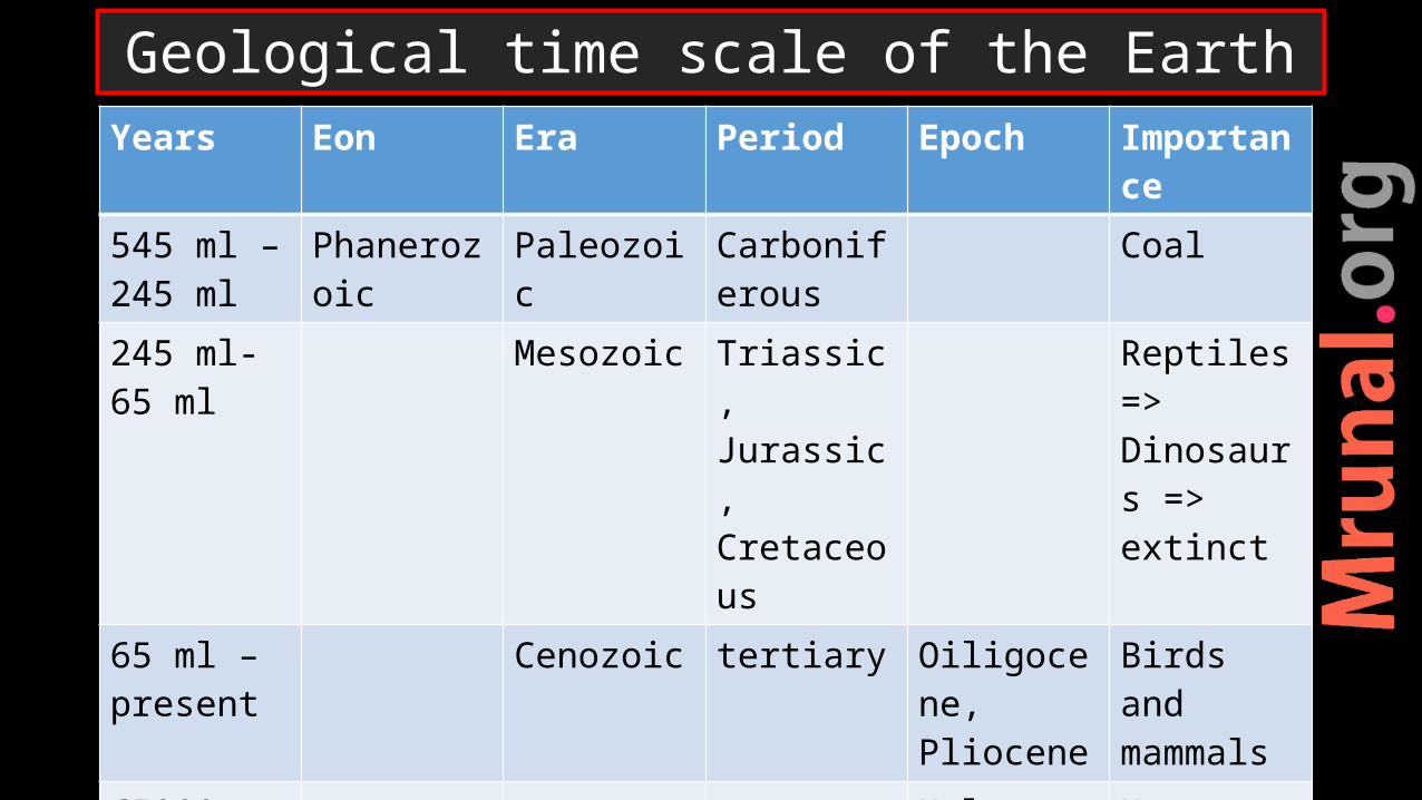
Years Eon Era Period Epoch Importance
545 ml – 245 ml
Phanerozoic Paleozoic Carboniferous
Coal
245 ml-65 ml
Mesozoic Triassic, Jurassic, Cretaceous
Reptiles => Dinosaurs => extinct
65 ml – present
Cenozoic tertiary Oiligocene,Pliocene
Birds and mammals
65000 years quaternary Holocene Human
Geological time scale of the Earth
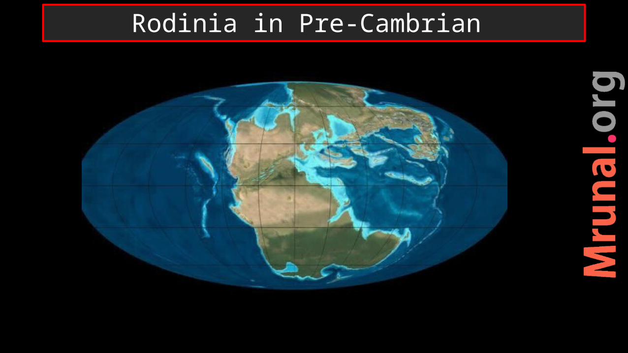
Rodinia in Pre-Cambrian
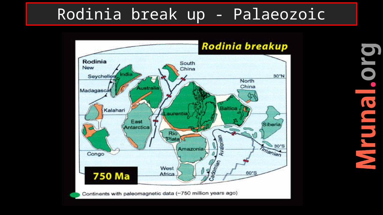
Rodinia break up - Palaeozoic
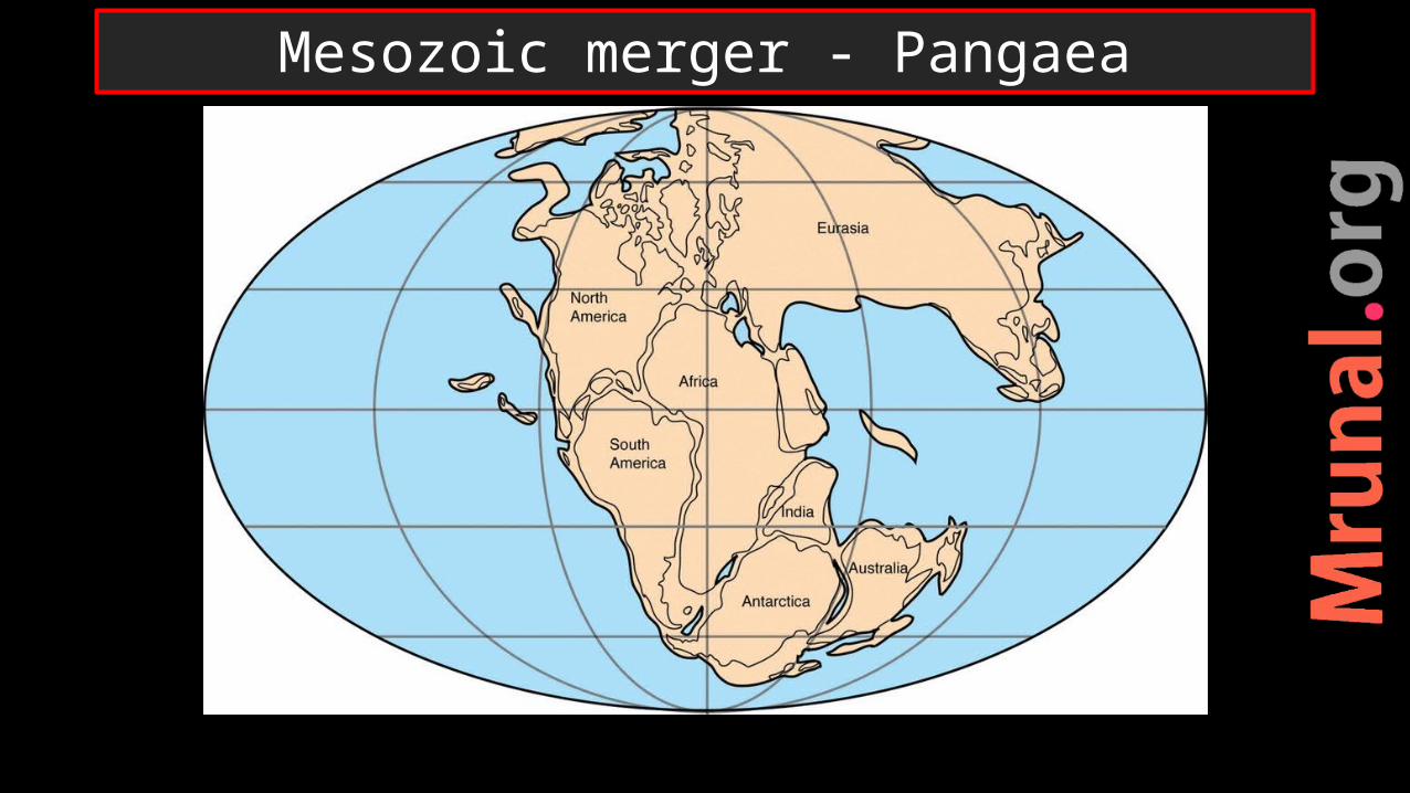
Mesozoic merger - Pangaea
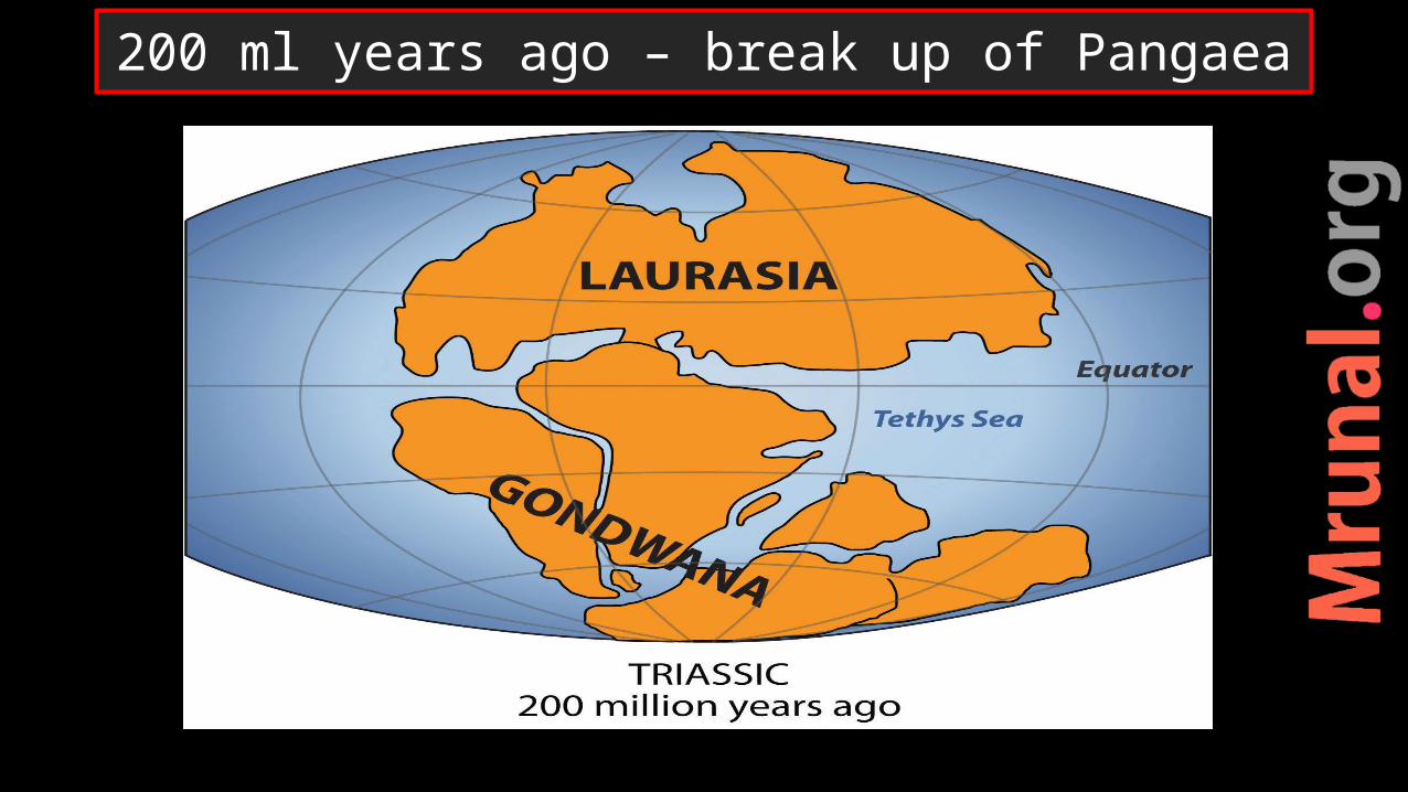
200 ml years ago – break up of Pangaea
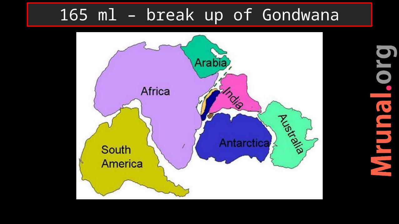
165 ml – break up of Gondwana
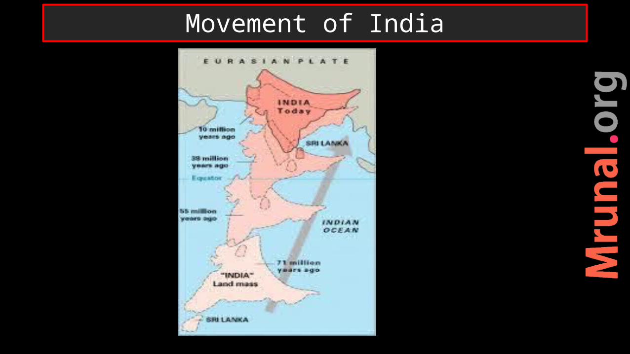
Movement of India
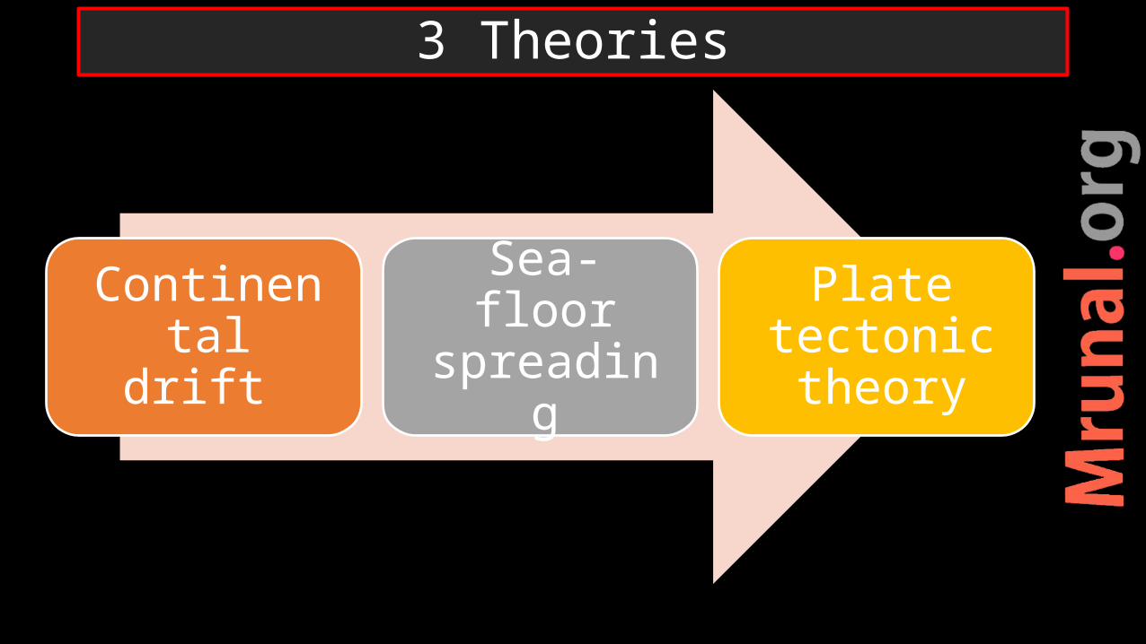
Continental drift
Sea-floor spreading
Plate tectonic theory
3 Theories
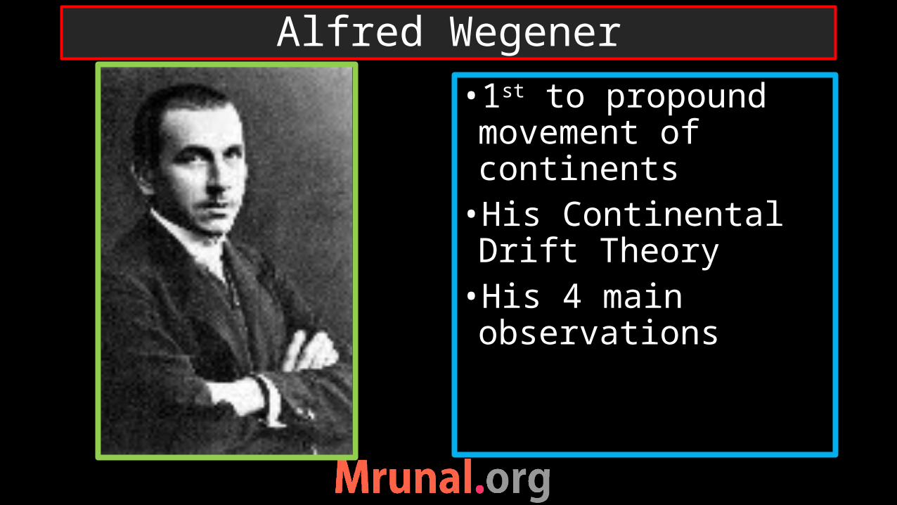
Alfred Wegener
•1st to propound movement of continents•His Continental Drift Theory•His 4 main observations
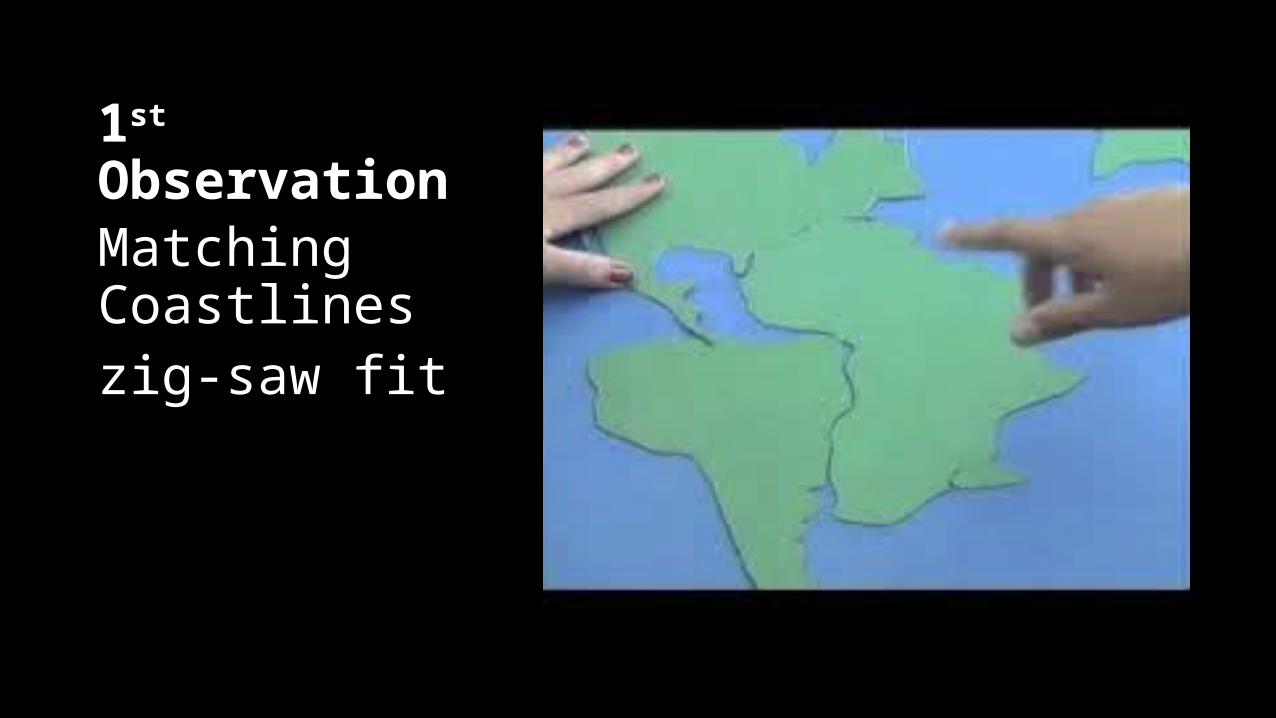
1st ObservationMatching Coastlineszig-saw fit
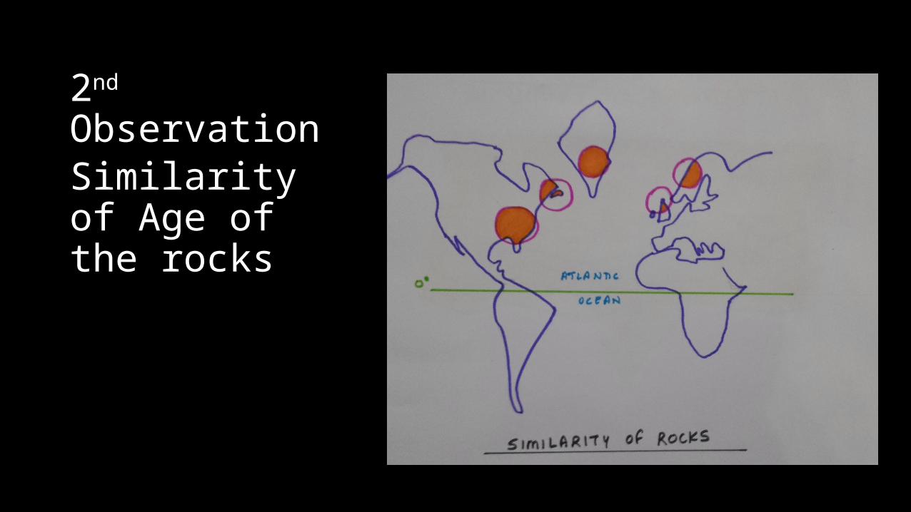
2nd ObservationSimilarity of Age of the rocks

3th ObservationFossil evidences
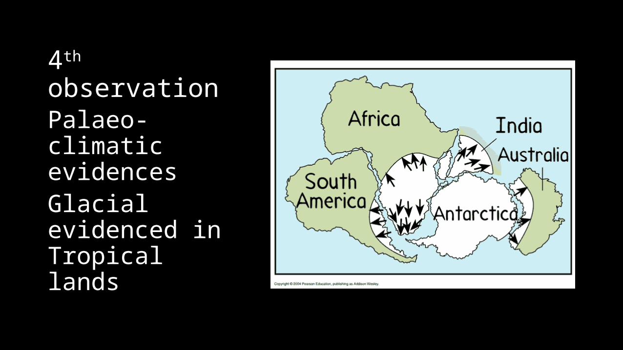
4th observationPalaeo-climatic evidencesGlacial evidenced in Tropical lands

Super continent - PangaeaOcean – PanthalasaContinent – SIAL rocksOcean – SIMA rocksMid- Mesozoic Pangaea broke up and drifted apart
Continental Drift Theory
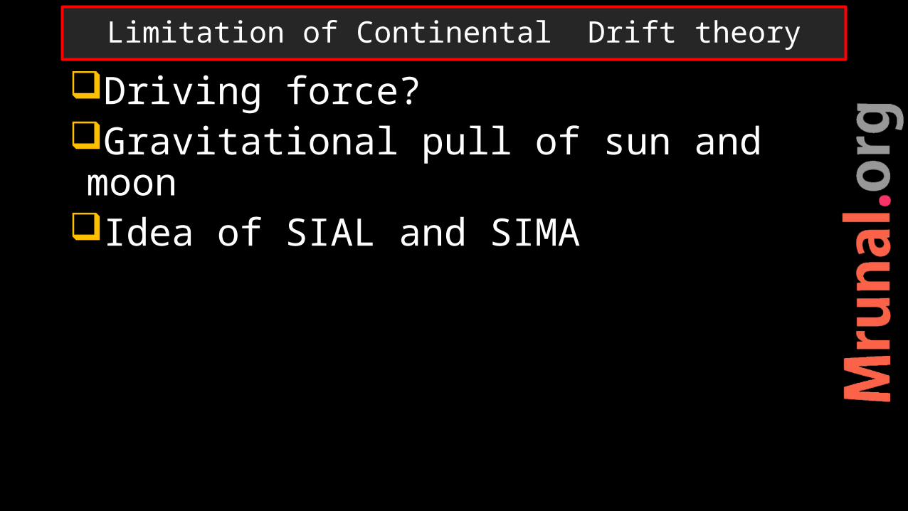
Driving force?Gravitational pull of sun and moonIdea of SIAL and SIMA
Limitation of Continental Drift theory
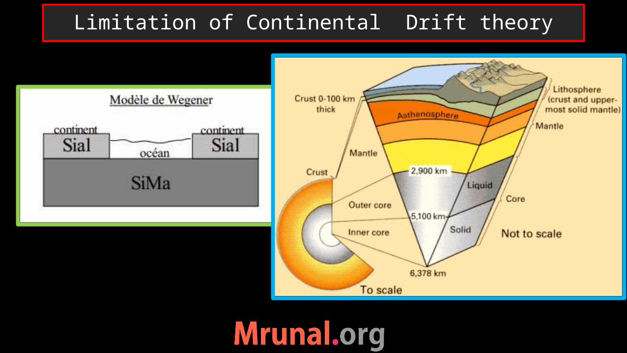
Limitation of Continental Drift theory
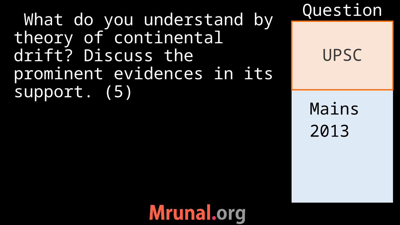
Mains2013
What do you understand by theory of continental drift? Discuss the prominent evidences in its support. (5)
UPSC
Question

Prelims2014
Q. Which of the following phenomena might have influenced the evolution of organisms?1. Continental drift2. Glacial cycles
Ans. Both
UPSC
Question
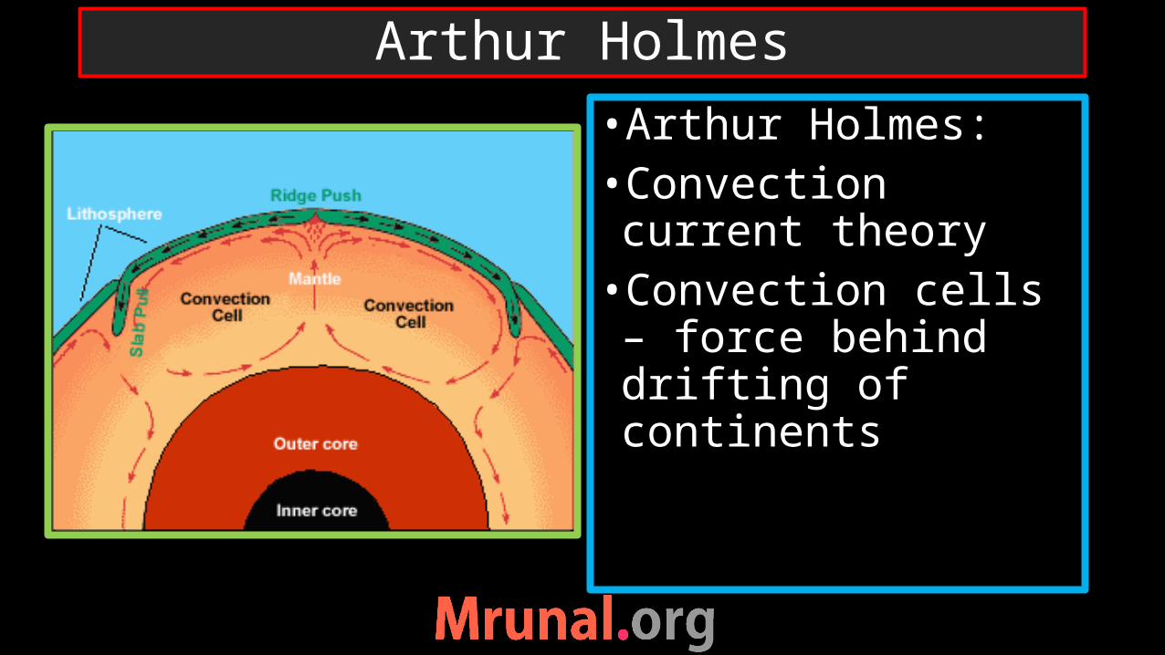
Arthur Holmes
•Arthur Holmes:•Convection current theory•Convection cells – force behind drifting of continents

Continental drift Sea-floor spreading Plate tectonic theory
3 Theories
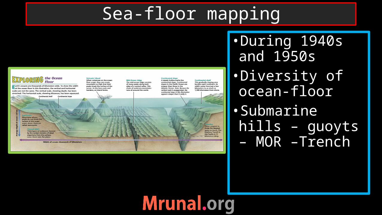
Sea-floor mapping
•During 1940s and 1950s•Diversity of ocean-floor•Submarine hills – guoyts – MOR –Trench
Questions:1) Ocean crust not older than mid-Mesozoic 2) Age increase away from MOR3) Sea-mounts deformed at trenches
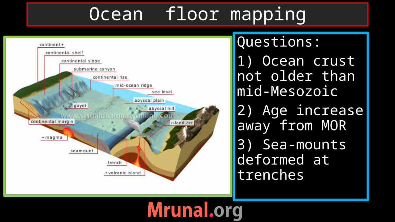
Ocean floor mapping

1960s Harry Hass and Dietz answered question regarding ocean mapping using convection theory
revealed mystery of mid-oceanic ridge and trenches
Sea floor spreading Theory

Mid- Oceanic Ridge
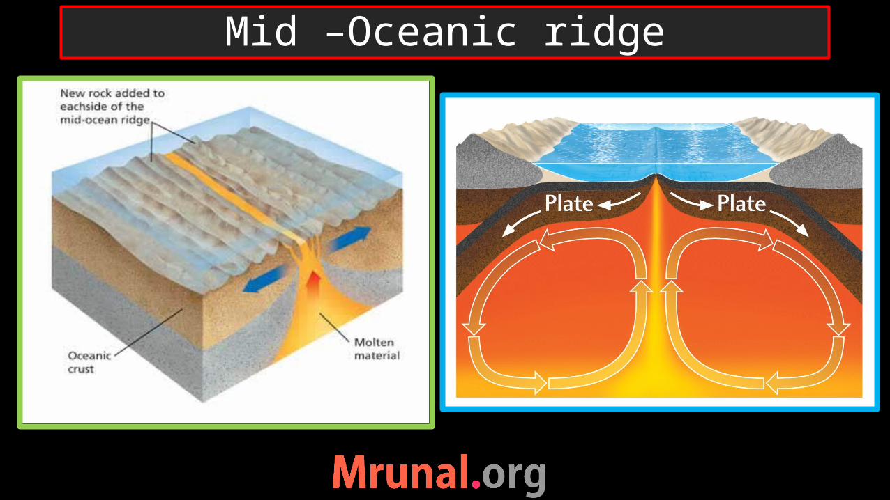
Mid –Oceanic ridge

Rising limb of current breaks the Ocean crust
Basaltic eruptionAccumulation of lava – ridge => MORNew Oceanic crustDivergent limb – expansion of ocean crust
MOR

Trenches
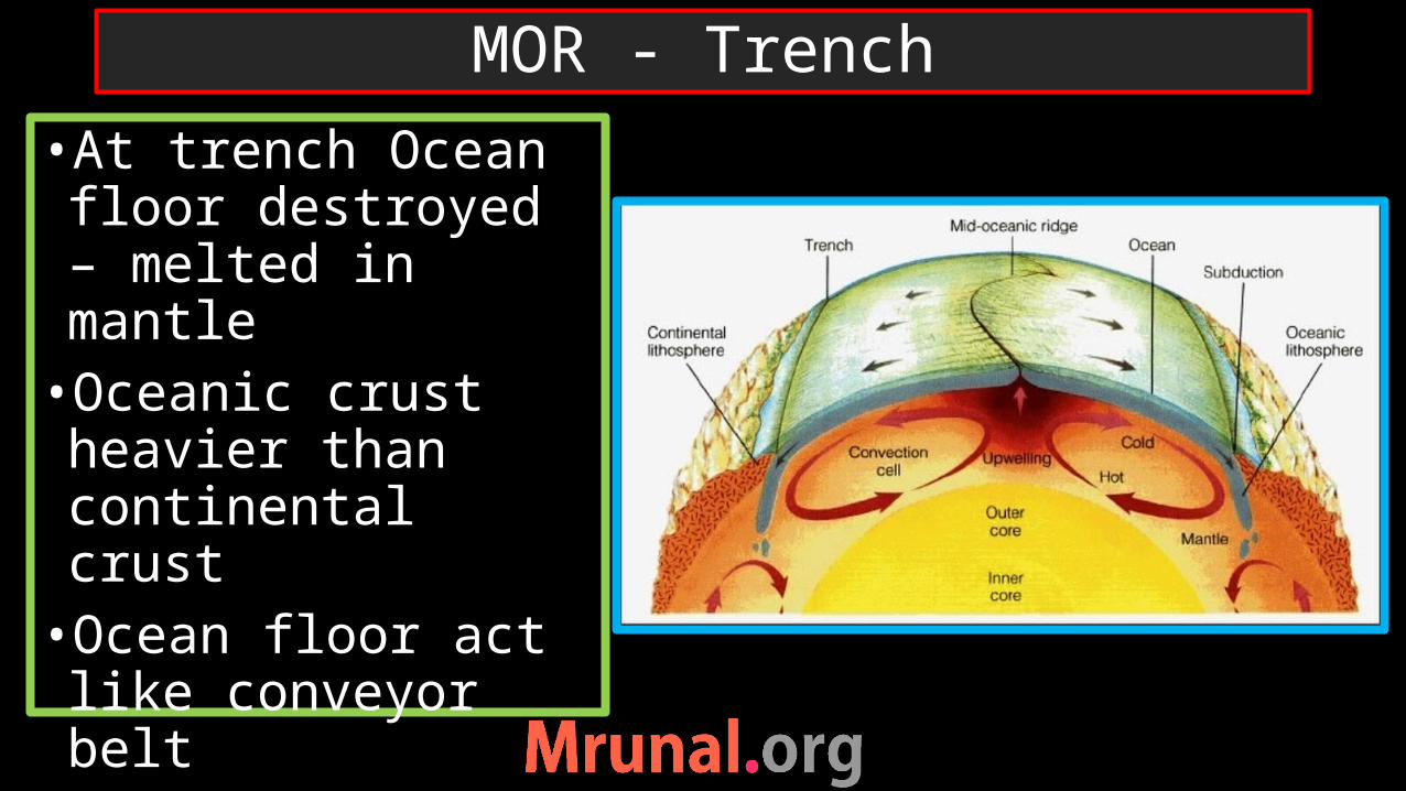
•At trench Ocean floor destroyed – melted in mantle•Oceanic crust heavier than continental crust•Ocean floor act like conveyor belt•Ocean floor – cyclic process – 300 ml yrs
MOR - Trench

Mariana trench

Prelims 2006
Q. In which one of the following oceans the Diamantina Trench is located?a) Pacific Oceanb) Atlantic Oceanc) Indian Oceand) Arctic Ocean
Ans. C)
UPSC
Question

Diamantine trench
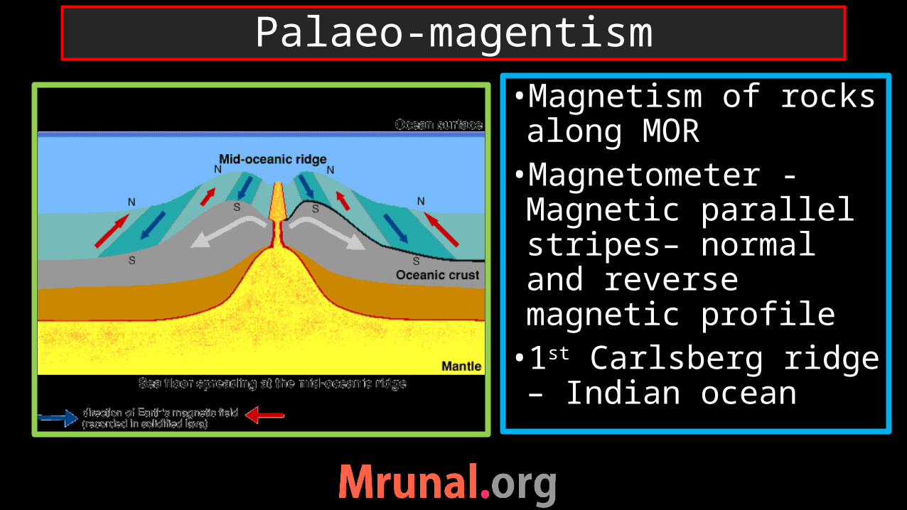
Palaeo-magentism
•Magnetism of rocks along MOR •Magnetometer -Magnetic parallel stripes– normal and reverse magnetic profile •1st Carlsberg ridge – Indian ocean
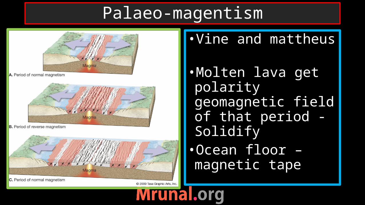
•Vine and mattheus •Molten lava get polarity geomagnetic field of that period -Solidify•Ocean floor – magnetic tape
Palaeo-magentism
conclusion1) Periodic reversal of magnetic field of the earth2) Rate of sea-floor spreading decided by age + distance between two equal magnetic stripesAtlantic – 1.0 cm/ yearIndian – 1.5 cm/yearPacific – 6.0 cm/year
Palaeo-magnetism

Prelims 2011
Q. Between India and East Asia, the navigation time and distance can be greatly reduced by which of the following?a) Deepening Malacca strait
between Indonesia and Malaysia
b) Opening a new canal across Kra Isthmus between gulf of Siam and Andaman sea
UPSC
Question

Continental drift
Sea-floor spreading
Plate tectonic theory
3 Theories