Geo Information Research in Yangon/UCSY located 16.81 latitude and 96.16 longitude it is situated at...
49
Geo Information Research in Yangon/UCSY • Myint Myint Sein
Transcript of Geo Information Research in Yangon/UCSY located 16.81 latitude and 96.16 longitude it is situated at...

Geo Information Researchin Yangon/UCSY
• Myint Myint Sein
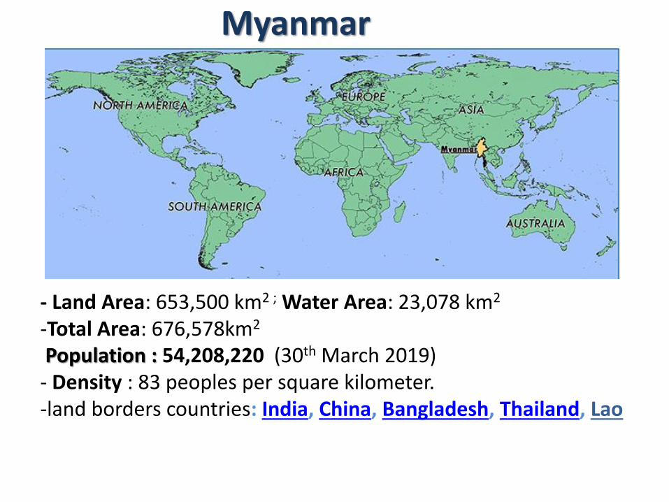
- Land Area: 653,500 km2 ; Water Area: 23,078 km2
-Total Area: 676,578km2
Population : 54,208,220 (30th March 2019) - Density : 83 peoples per square kilometer.-land borders countries: India, China, Bangladesh, Thailand, Lao
Myanmar

located 16.81 latitude and 96.16 longitude
it is situated at 30 meters above sea level.
standard time zone is UTC/GMT +6:30 hours3
Location of Yangon
Yangon Region

Ministries & Universities
• MIMU
• Survey Department,
• Ministry of Forest
• Ministry of Agriculture
• Ministry of Housing
• …………
• Universities

Ministry of Agriculture, Livestock and Irrigation
Department of Rural Development
• Water Supply Project - Government Budget, JICA, UNICEF
• Rural Electrification Project - Government Budget, World Bank, GIZ
• Ever Green Village Development Project - Government Budget
• Village Development Planning Project ( VDP) –Government Budget, Lift Fund
• National Community-Driven Development Project (NCDDP) –World Bank
• Enhancing Rural Livelihoods and Incomes Project (ERLIP) – ADB

In 2008 and 2009, collected the WASH data supported by UNICEF.
Wash: Water supply, sanitation and hygiene
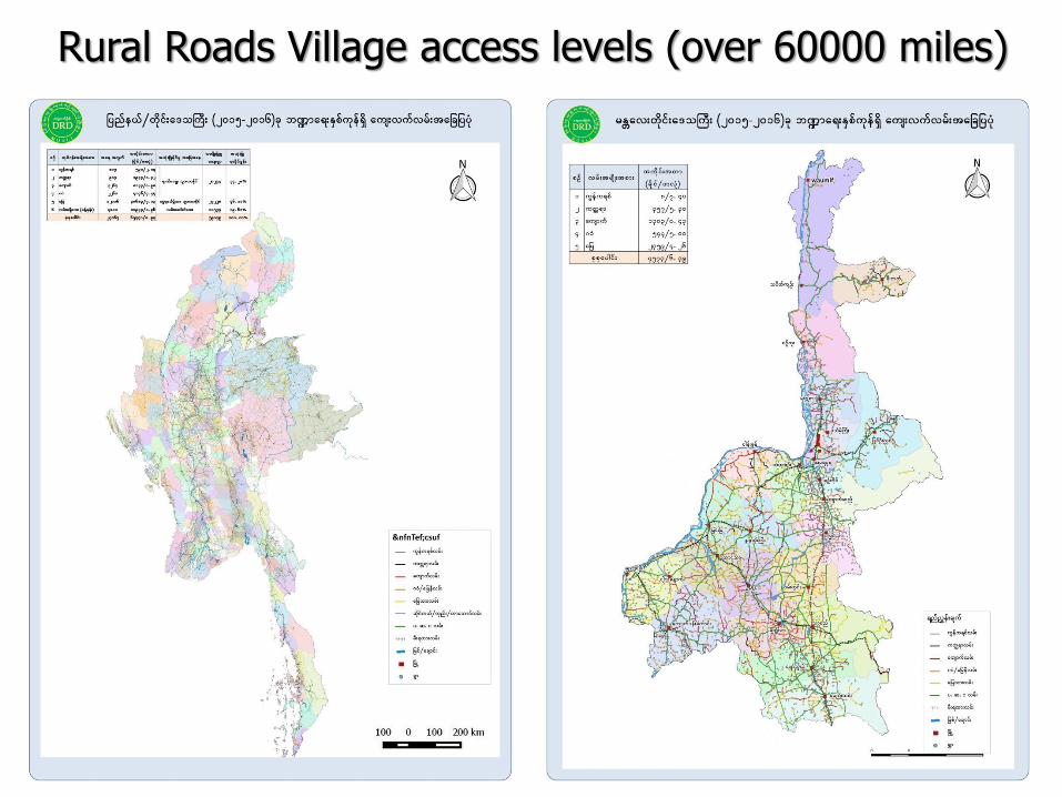
Rural Roads Village access levels (over 60000 miles)

Development Projects Townships
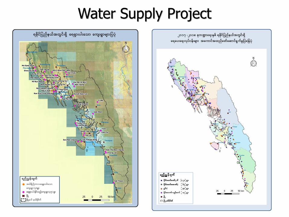
Water Supply Project

Rural Electrification Project

ရန္က ုန္န္ကန္္ပ ်ဴတာတကတာတ သ ိုလ္
University of Computer Studies, Yangon

The research focuses on
Location Based Services,
Traffic Management, Security Monitoring,
Environmental Changes Detection,
Disaster Mitigation,
Mobile Application,
Smart Tourism and so on.
Started in 2011
http://www.ucsy.edu.mm/GoGISLab.do

- offer many advantages to the users to get more useful informaton near to their location.
- allow users on the go with access to services from portable devices.

Database
latitude, longitude and position vectors
Location of public service(bus, station, Supermarket,….)
Famous places and its image and Road
Downtown Region
For creating the image data sets of YANGON city, the downtownarea of Yangon is divided into 4x,xxx parts of sub images from GoogleEarth. The parameters of each part is approximately 0.15 squarekilometer.

Rectangular Range Circular Range


Location and Transportation Services
Location –based services provide the user for getting day to
day information like city routes, point of interest (POI), public
transport schedules, etc..

Android Application for Bus Transit Route

The morphological operation is used to extract building feature with
the use of modified morphological building index (MBI).
Speed Up Robust Feature (SURF) method is used for image
registration and tested area of this method is shown in following
figure.
(a) Putative matched points
(including outliers)
(b) Matching points
(Inliers only)
(c) Registered Image
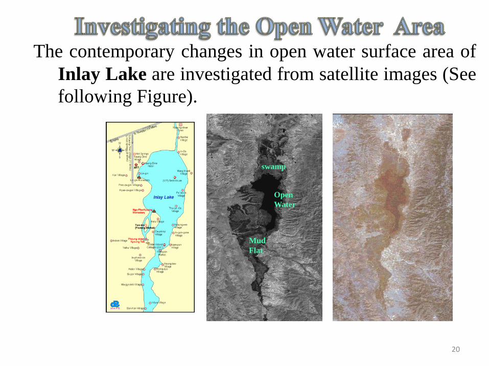
The contemporary changes in open water surface area of
Inlay Lake are investigated from satellite images (See
following Figure).
Open
Water
swamp
Mud
Flat
20
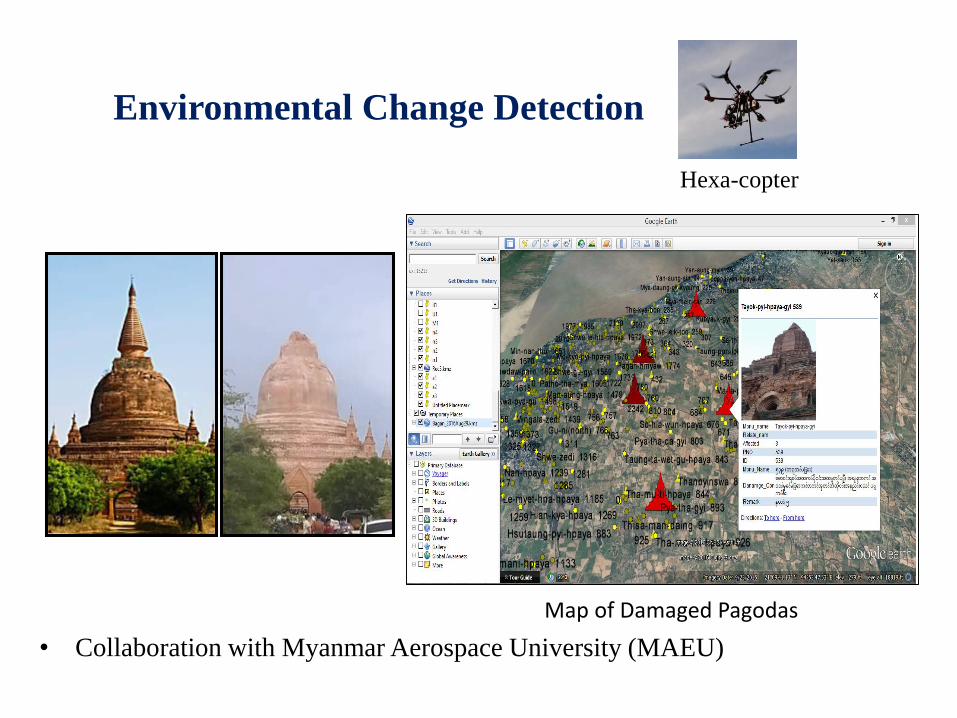
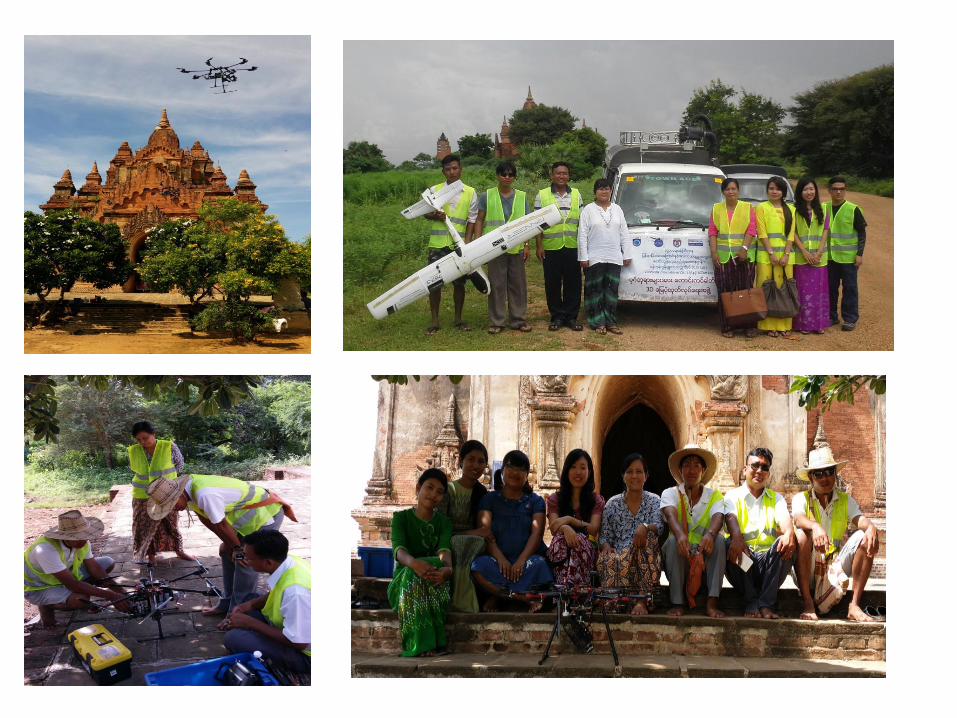
• Collaboration with Myanmar Aerospace University (MAEU)
Environmental Change Detection
Hexa-copter
Map of Damaged Pagodas
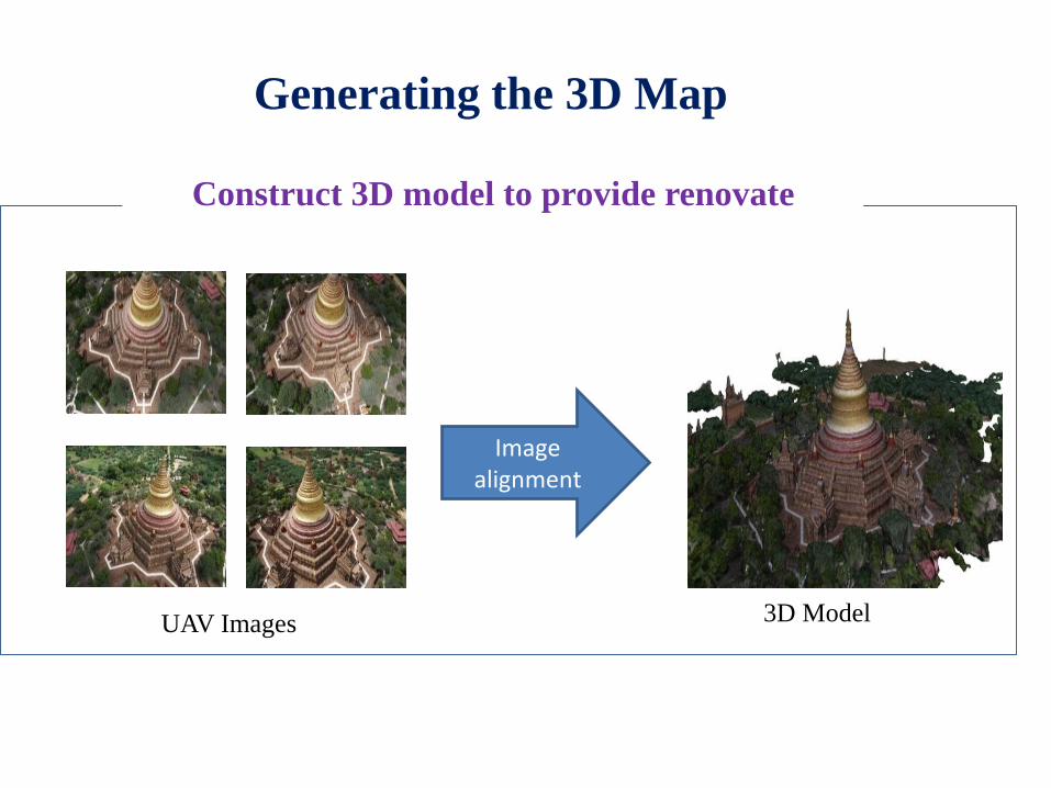
UAV Images 3D Model
Construct 3D model to provide renovate
Image alignment
Generating the 3D Map

Vector map of Yangon
Location of Emergency services
Yangon Emergency Service
Disaster MitigationEmergency Respond System
Optimal Route Finding to support Fire Emergency Service
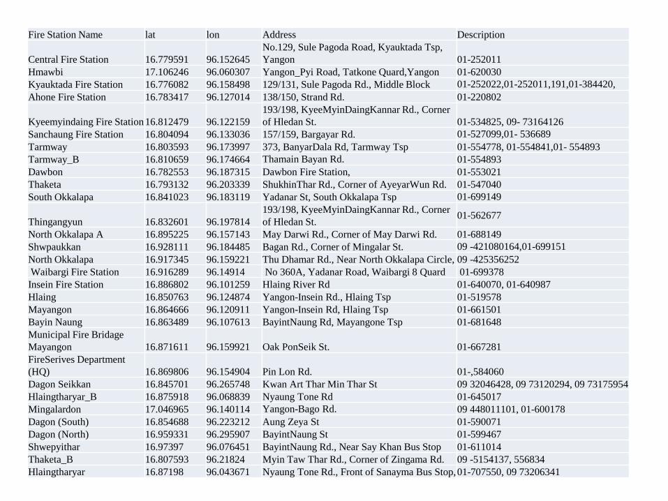
Fire Station Name lat lon Address Description
Central Fire Station 16.779591 96.152645
No.129, Sule Pagoda Road, Kyauktada Tsp,
Yangon 01-252011
Hmawbi 17.106246 96.060307 Yangon_Pyi Road, Tatkone Quard,Yangon 01-620030
Kyauktada Fire Station 16.776082 96.158498 129/131, Sule Pagoda Rd., Middle Block 01-252022,01-252011,191,01-384420,
Ahone Fire Station 16.783417 96.127014 138/150, Strand Rd. 01-220802
Kyeemyindaing Fire Station 16.812479 96.122159
193/198, KyeeMyinDaingKannar Rd., Corner
of Hledan St. 01-534825, 09- 73164126
Sanchaung Fire Station 16.804094 96.133036 157/159, Bargayar Rd. 01-527099,01- 536689
Tarmway 16.803593 96.173997 373, BanyarDala Rd, Tarmway Tsp 01-554778, 01-554841,01- 554893
Tarmway_B 16.810659 96.174664 Thamain Bayan Rd. 01-554893
Dawbon 16.782553 96.187315 Dawbon Fire Station, 01-553021
Thaketa 16.793132 96.203339 ShukhinThar Rd., Corner of AyeyarWun Rd. 01-547040
South Okkalapa 16.841023 96.183119 Yadanar St, South Okkalapa Tsp 01-699149
Thingangyun 16.832601 96.197814
193/198, KyeeMyinDaingKannar Rd., Corner
of Hledan St.01-562677
North Okkalapa A 16.895225 96.157143 May Darwi Rd., Corner of May Darwi Rd. 01-688149
Shwpaukkan 16.928111 96.184485 Bagan Rd., Corner of Mingalar St. 09 -421080164,01-699151
North Okkalapa 16.917345 96.159221 Thu Dhamar Rd., Near North Okkalapa Circle, 09 -425356252
Waibargi Fire Station 16.916289 96.14914 No 360A, Yadanar Road, Waibargi 8 Quard 01-699378
Insein Fire Station 16.886802 96.101259 Hlaing River Rd 01-640070, 01-640987
Hlaing 16.850763 96.124874 Yangon-Insein Rd., Hlaing Tsp 01-519578
Mayangon 16.864666 96.120911 Yangon-Insein Rd, Hlaing Tsp 01-661501
Bayin Naung 16.863489 96.107613 BayintNaung Rd, Mayangone Tsp 01-681648
Municipal Fire Bridage
Mayangon 16.871611 96.159921 Oak PonSeik St. 01-667281
FireSerives Department
(HQ) 16.869806 96.154904 Pin Lon Rd. 01-,584060
Dagon Seikkan 16.845701 96.265748 Kwan Art Thar Min Thar St 09 32046428, 09 73120294, 09 73175954
Hlaingtharyar_B 16.875918 96.068839 Nyaung Tone Rd 01-645017
Mingalardon 17.046965 96.140114 Yangon-Bago Rd. 09 448011101, 01-600178
Dagon (South) 16.854688 96.223212 Aung Zeya St 01-590071
Dagon (North) 16.959331 96.295907 BayintNaung St 01-599467
Shwepyithar 16.97397 96.076451 BayintNaung Rd., Near Say Khan Bus Stop 01-611014
Thaketa_B 16.807593 96.21824 Myin Taw Thar Rd., Corner of Zingama Rd. 09 -5154137, 556834
Hlaingtharyar 16.87198 96.043671 Nyaung Tone Rd., Front of Sanayma Bus Stop,01-707550, 09 73206341
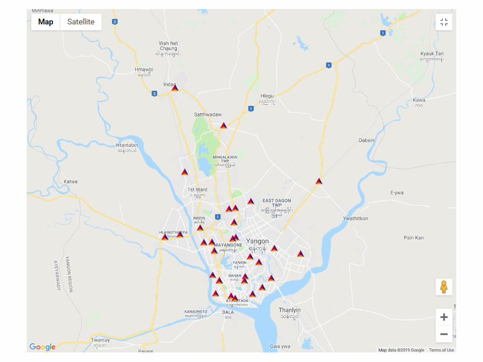

Emergency Response System
The development of efficient optimal route finding system
for urgent need of emergency services is very important to
save the valuable lives and property.
Because of the weak road network infrastructure, the
emergency vehicles face many problems to go the incident
location in time.

Warning Alarm System
The multi-date satellite satellite images acquired by NASA-
Landsat7 are applied in our research works.
GIS and hydrological modeling can be used to predict and
manage such emergency events for humans’ societies.

Myanmar Hazard Calendar
Hazard Jan Feb Mar Apr May Jun Jul Aug Sep Oct Nov Dec
Cyclone
High
Temperature
Low
Temperature
Drought
Squalls and
Thunderstorm
Flood
Heavy Rain
Monsoon
Depression
Hail

Mone Dam
➢ Northern two miles from Sadoketaya
town.
➢ Situated on Mone Stream
➢ Water catchment area is 1467 sq mile
➢ Rainfall amount 47
➢ Average height level of water is 125
➢ Area of Dam - 4320 (length) 200
(height)
➢ Water diversion tunnels - 36
(diameter) 3625 (length)
➢ Mone creek can be overflow water due to torrential rain from
Chin hill and Rakhine hill .
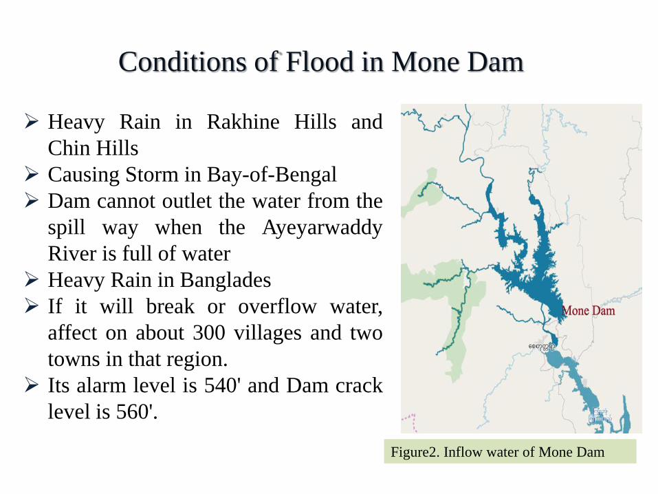
Conditions of Flood in Mone Dam
➢ Heavy Rain in Rakhine Hills and
Chin Hills
➢ Causing Storm in Bay-of-Bengal
➢ Dam cannot outlet the water from the
spill way when the Ayeyarwaddy
River is full of water
➢ Heavy Rain in Banglades
➢ If it will break or overflow water,
affect on about 300 villages and two
towns in that region.
➢ Its alarm level is 540' and Dam crack
level is 560'.
Figure2. Inflow water of Mone Dam
33
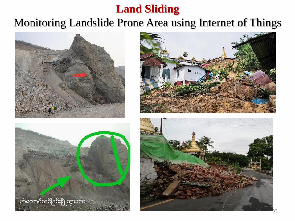
Land Sliding
Monitoring Landslide Prone Area using Internet of Things
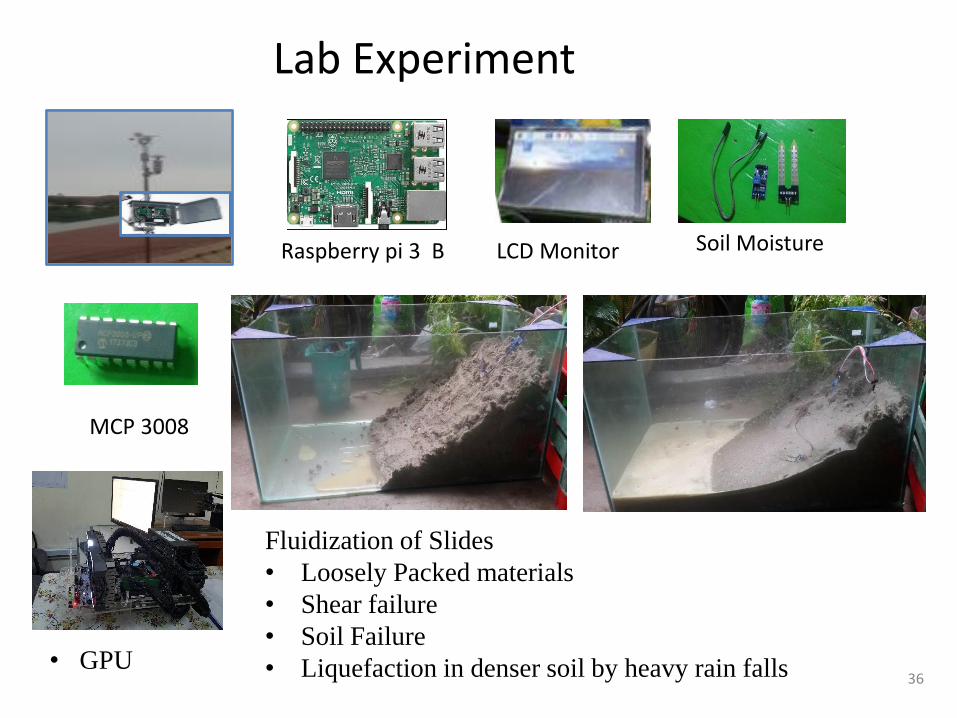
Soil Moisture
MCP 3008
Raspberry pi 3 B
• GPU
LCD Monitor
Lab Experiment
36
Fluidization of Slides
• Loosely Packed materials
• Shear failure
• Soil Failure
• Liquefaction in denser soil by heavy rain falls

No. (2) S. H. S
No.(1) S. H. S
No (4) S.M. S
No (5) S.M. S- - - - - - - - - - -
- - - - - - - - - - - -

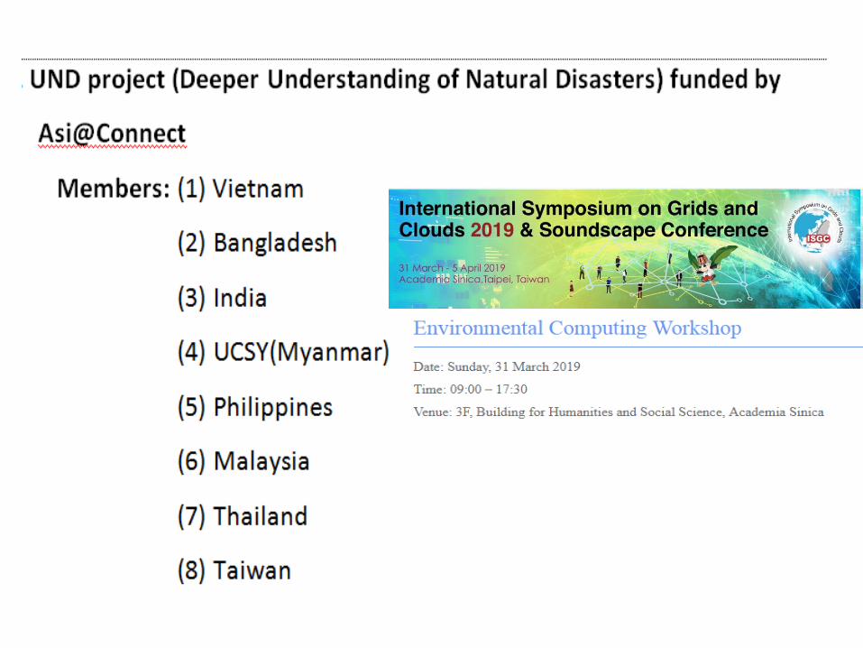
The collaborative Research projects of GIS Lab., withsome ASEAN countries are as following:
1. Software Defined System on Disaster Mitigationand Smart Cities (ASEAN IVO-project 2016~2019)
Members: Malaysia, Singapore, Thailand,Myanmar(UCSY),Vietnam,Philippines, Japan

2. Cambodia NerveNet Field Testing (OperationManagement and Content Development to PromoteConnctedness of Cambodia Rural Area)(ASEAN IVO-project, 2016~2019)Members:

Smart Museum
Collaborated Project : Museum Pool NECTEC Thailand, Lao, UCSY
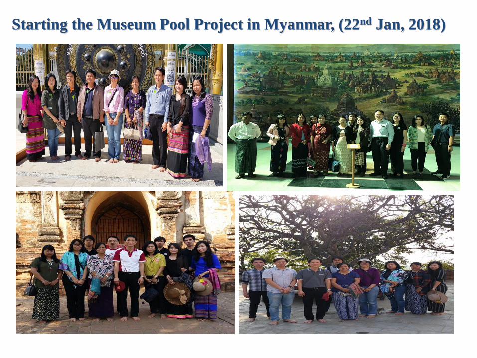
Starting the Museum Pool Project in Myanmar, (22nd Jan, 2018)

Preparation of the History of Bagan Pagoda


45
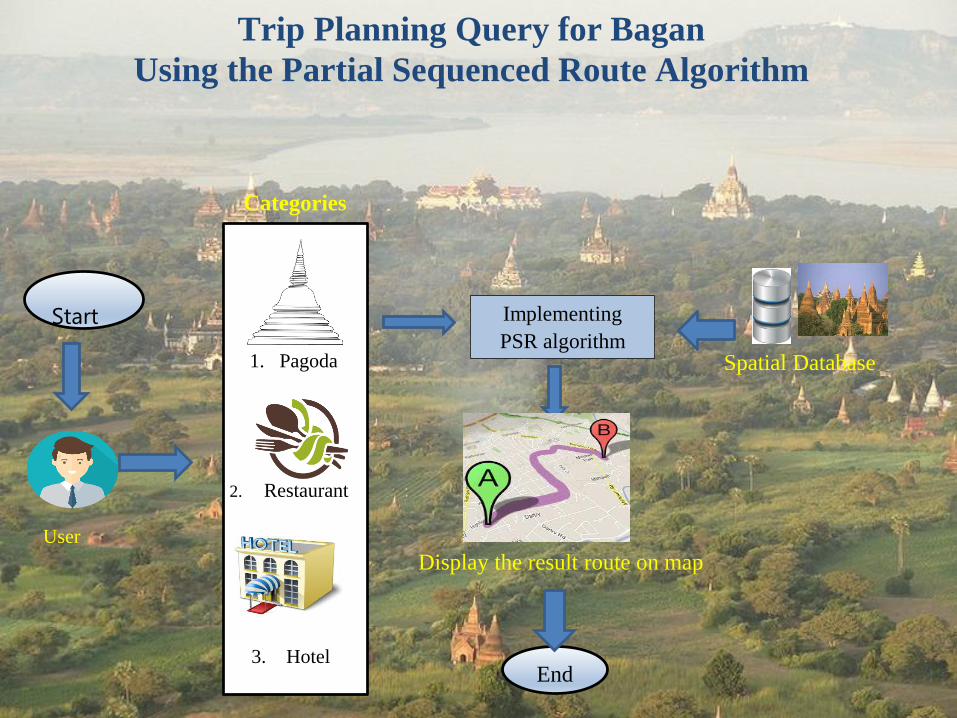
Trip Planning Query for Bagan
Using the Partial Sequenced Route Algorithm
End
User
Spatial Database
Start Implementing
PSR algorithm
3. Hotel
2. Restaurant
1. Pagoda
Categories
Display the result route on map
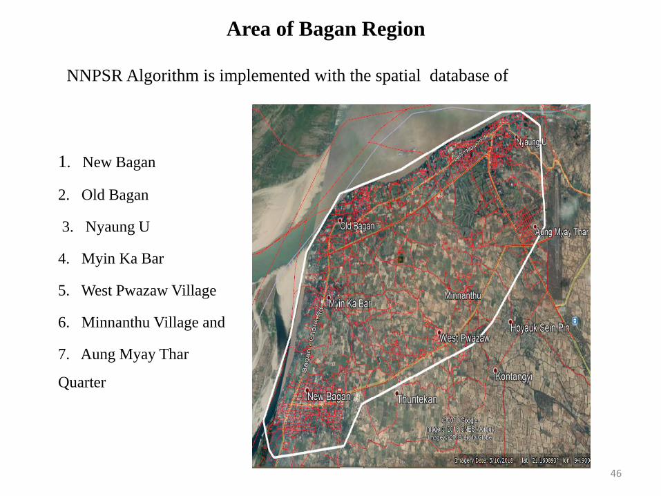
Area of Bagan Region
46
1. New Bagan
2. Old Bagan
3. Nyaung U
4. Myin Ka Bar
5. West Pwazaw Village
6. Minnanthu Village and
7. Aung Myay Thar
Quarter
NNPSR Algorithm is implemented with the spatial database of
47
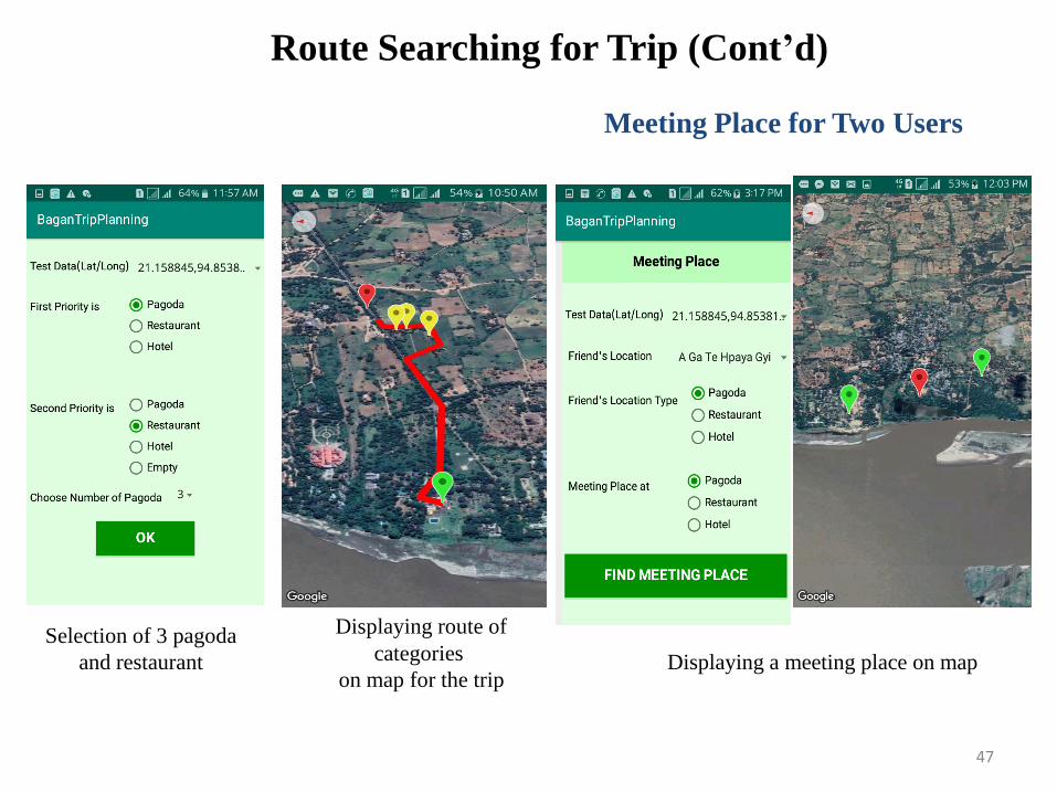
Selection of 3 pagoda
and restaurant
Displaying route of
categories
on map for the trip
Route Searching for Trip (Cont’d)
Meeting Place for Two Users
Displaying a meeting place on map
UTB, Japan Singapore, Thailand Myanmar LAOS Thailand Malaysia