Inspire 2014 – AAA: Target Marketing with Predictive and Geo-spatial Analytics

GEO-ANALYTICS IN RISK MANAGEMENT –TWO DECADES OF INSURANCE MARKET EXPERIENCE
Image: used under license from Shutterstock.com
ESRI UC 2016 – Business Summit, San Diego
Andreas SiebertHead Geospatial Solutions – Corporate Underwriting
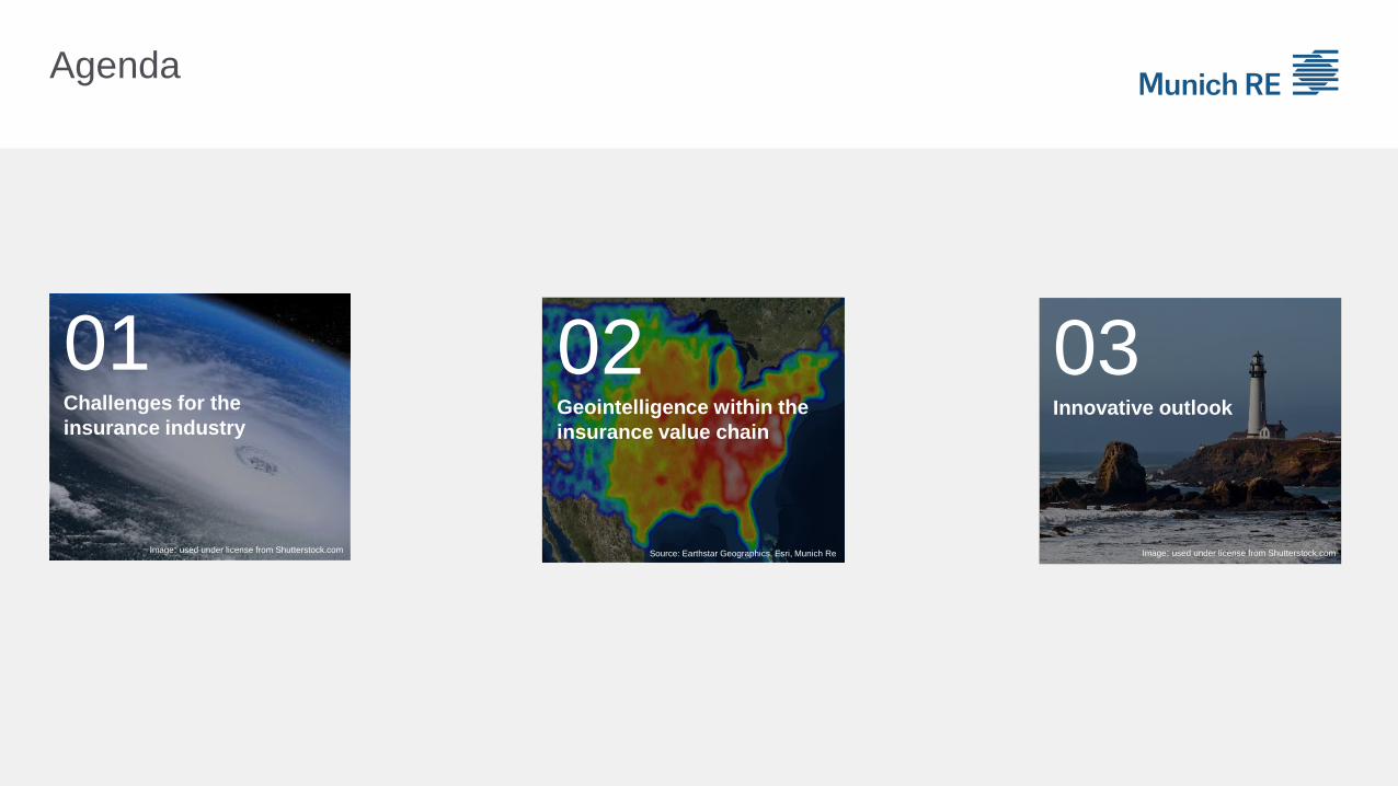
Agenda
02Geointelligence within the
insurance value chain
01Challenges for the
insurance industry
03Innovative outlook
Image: used under license from Shutterstock.com Source: Earthstar Geographics, Esri, Munich Re Image: used under license from Shutterstock.com

Geointelligence and NATHAN 3Image: used under license from Shutterstock.com
Challenges for the
insurance industry
01

Location-based requirements to the insurance industry
Increasing value concentrations and insurance penetration also in risk prone areas
More detailed risk transparency and risk modelling required (cat modelling)
Higher and more costly losses from natural catastrophes (vulnerabilities)
Accumulation control is a key in our business model
Complexe interdependencies between different lines of business
Dramatic changes in the known risk landscape: new risks (cyber), new technologies (drones),
pandemics, aging infrastructure
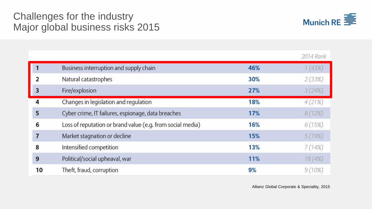
Allianz Global Corporate & Speciality, 2015
Challenges for the industryMajor global business risks 2015
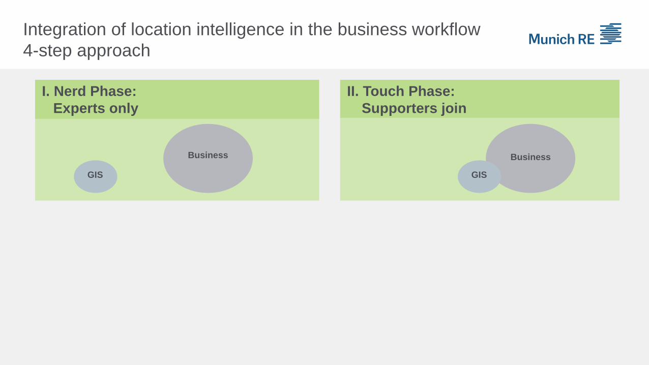
I. Nerd Phase:
Experts only
II. Touch Phase:
Supporters join
IV. ROI Phase:
Return can be measured
III. Integration Phase:
Community forms
Business
GIS
GIS
Business
Business
GIS
Business
GIS
Integration of location intelligence in the business workflow
4-step approach
Source: Andreas Siebert, Munich Re, 2014

02
Source: Earthstar Geographics, Esri, Munich Re
Geointelligence
within the insurance value chain

Worldmap of Natural Hazards
…the nucleus of location-based underwriting
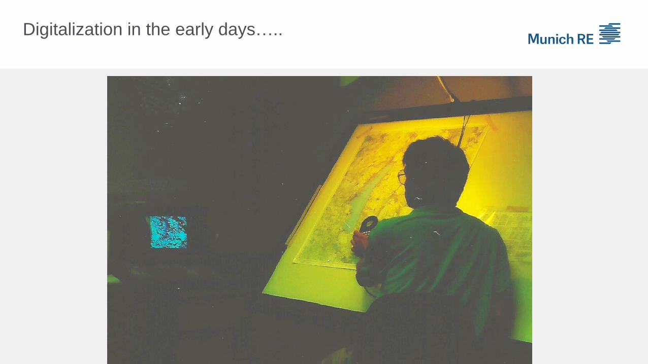
Digitalization in the early days…..
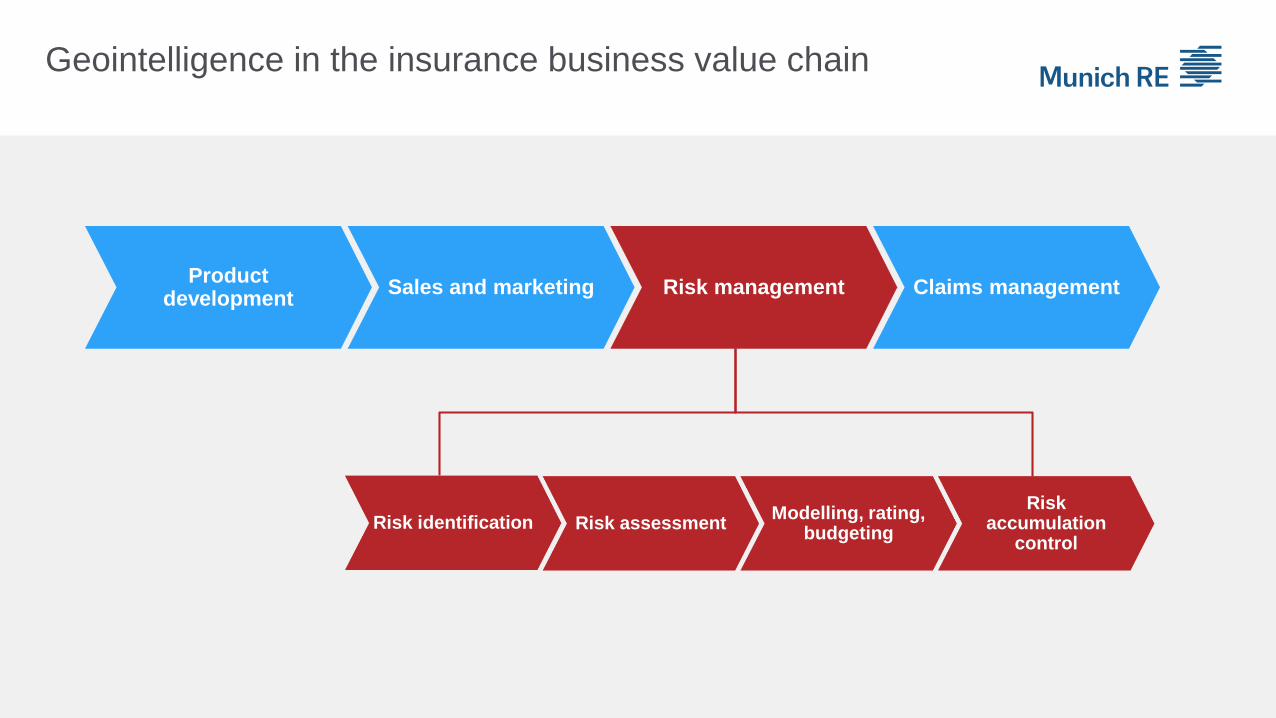
Geointelligence in the insurance business value chain
Product development
Sales and marketing Risk management Claims management
Risk identification Risk assessmentModelling, rating,
budgeting
Risk accumulation
control
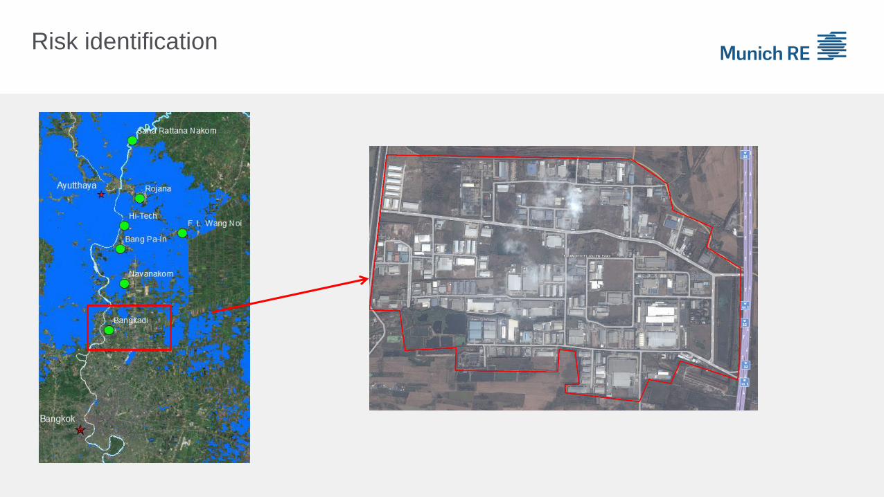
Risk identification

Risk analytics

Claims management
Number of Risk
Locations Percentage
Affected by Ike 1400 58 %
Not affected by Ike 1000 42 %
Sum 2400 100 %
Footprint Analysis
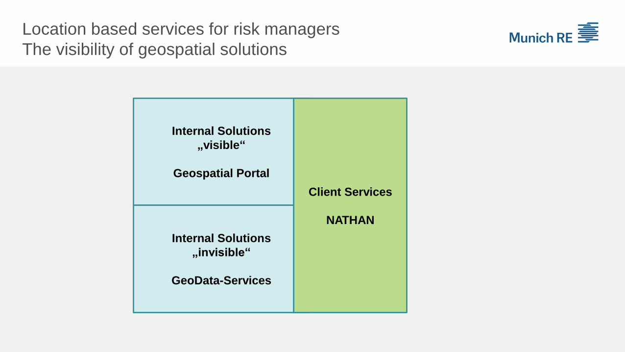
Location based services for risk managers
The visibility of geospatial solutions
Internal Solutions
„visible“
Geospatial Portal
Internal Solutions
„invisible“
GeoData-Services
Client Services
NATHAN
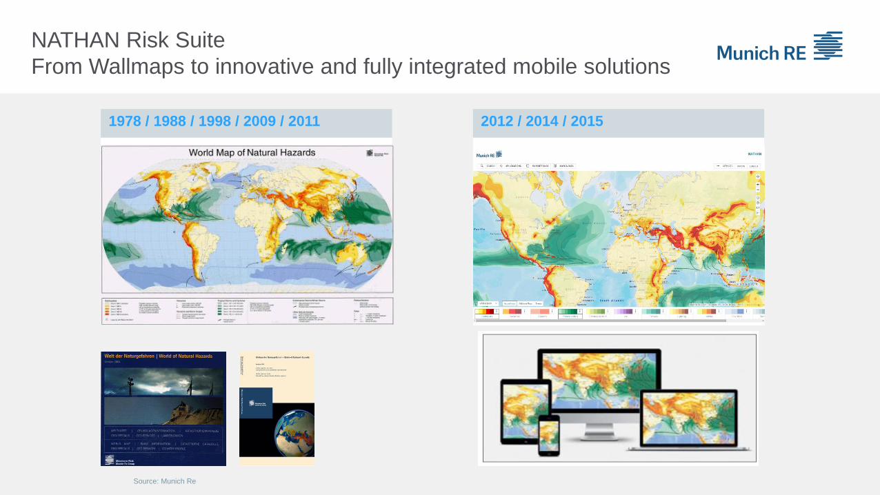
1978 / 1988 / 1998 / 2009 / 2011 2012 / 2014 / 2015
NATHAN Risk Suite
From Wallmaps to innovative and fully integrated mobile solutions
Source: Munich Re
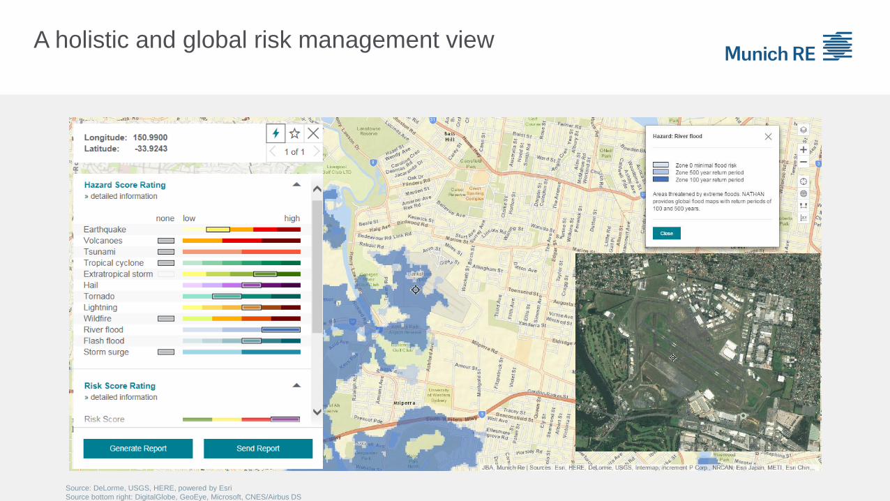
Source: DeLorme, USGS, HERE, powered by Esri
Source bottom right: DigitalGlobe, GeoEye, Microsoft, CNES/Airbus DS
A holistic and global risk management view
Innovative Outlook03
Image: used under license from Shutterstock.com
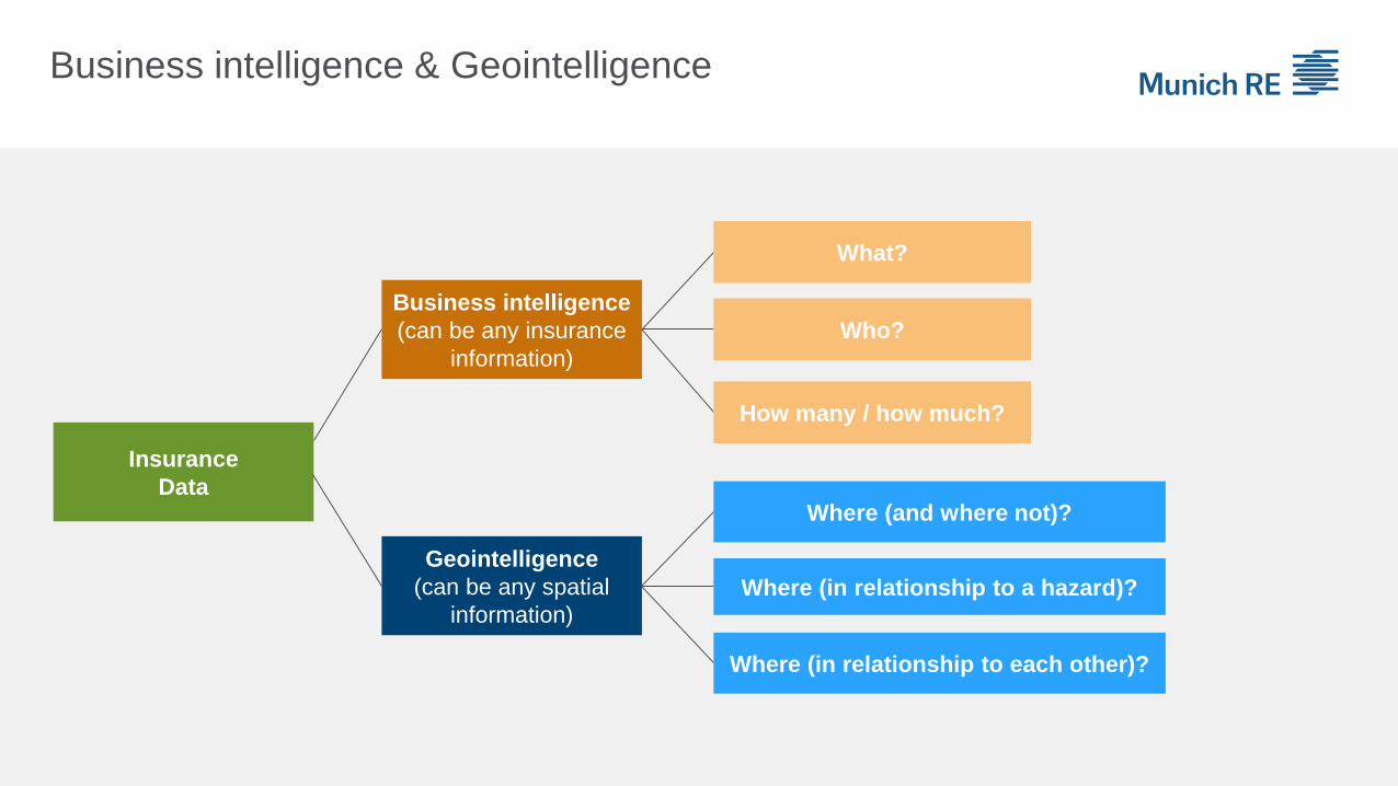
Business intelligence & Geointelligence
Insurance
Data
Business intelligence
(can be any insurance
information)
What?
Who?
How many / how much?
Geointelligence
(can be any spatial
information)
Where (and where not)?
Where (in relationship to a hazard)?
Where (in relationship to each other)?
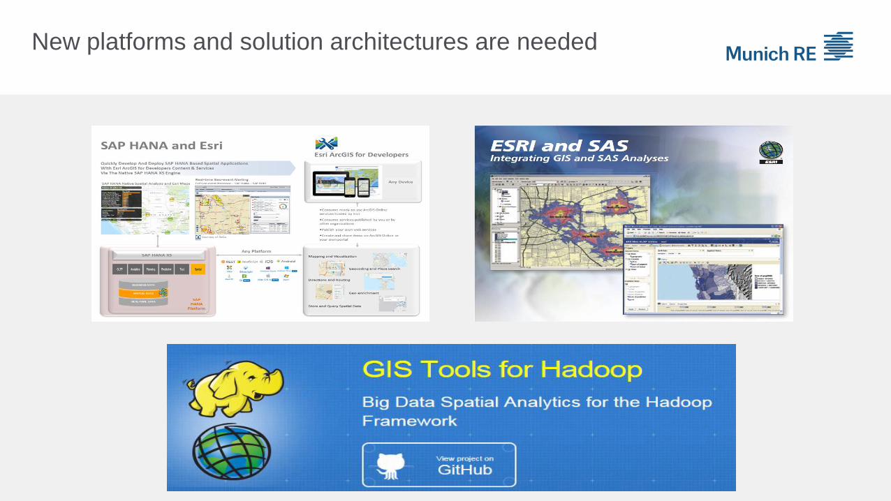
New platforms and solution architectures are needed
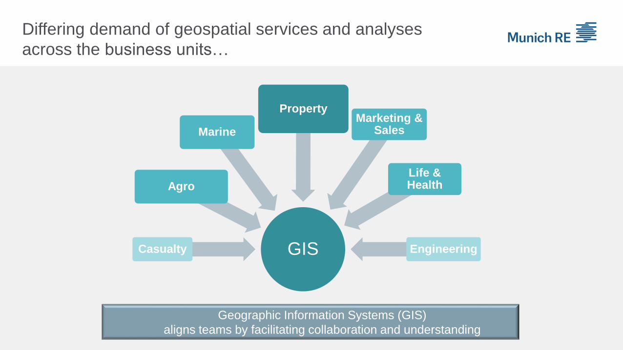
GISCasualty
Agro
Marine
PropertyMarketing &
Sales
Life & Health
Engineering
Geographic Information Systems (GIS)
aligns teams by facilitating collaboration and understanding
Differing demand of geospatial services and analyses
across the business units…

Geospatial Portal
Summary
New challenges – new analytics
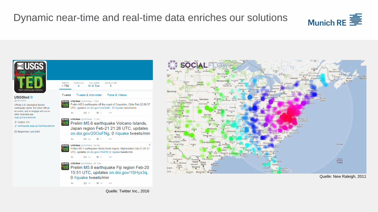
Dynamic near-time and real-time data enriches our solutions
Quelle: New Raleigh, 2011
Quelle: Twitter Inc., 2016
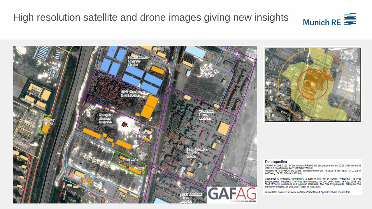
High resolution satellite and drone images giving new insights

Geospatial Portal
Summary
Big data analytics with AIS data supports marine risk assessment

Geospatial Portal
Summary
Spatial-temporal visualization of pandemic risks for Life & Health business
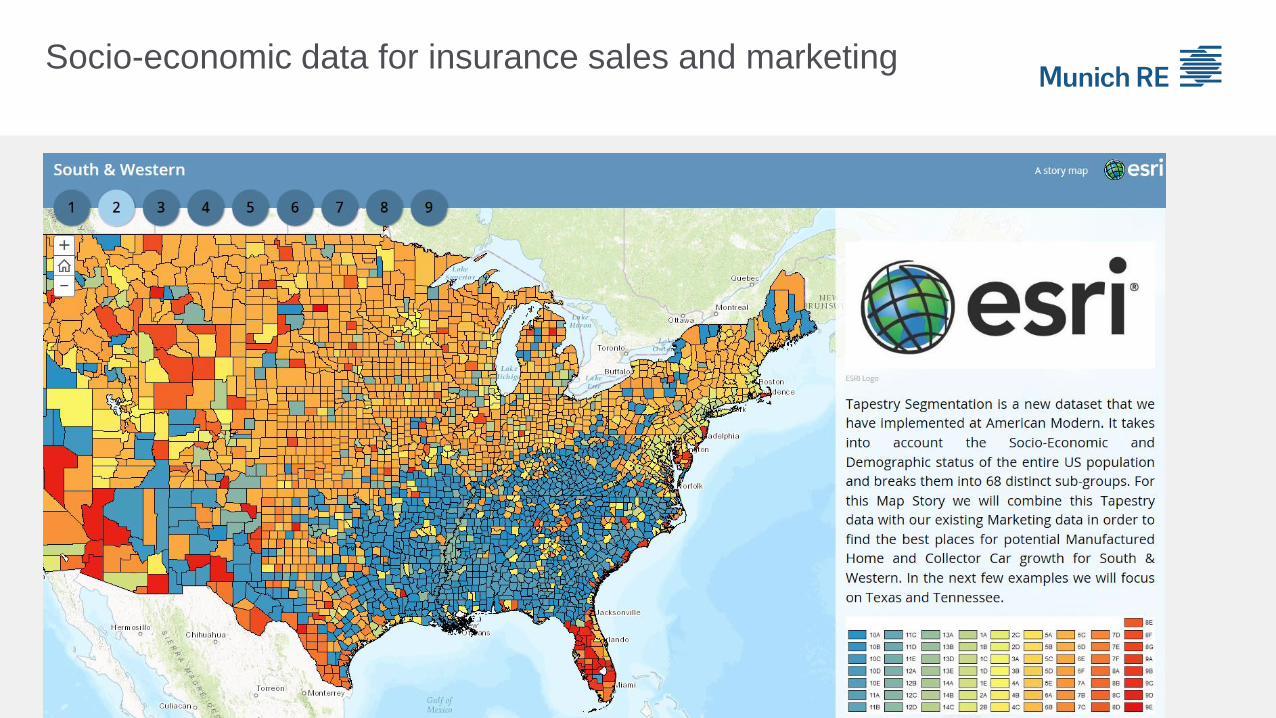
Socio-economic data for insurance sales and marketing

Geospatial Portal
Summary
Steering sales activities based on market potentials

Collaboration within the insurance ecosystem
offering tailor-made solutions
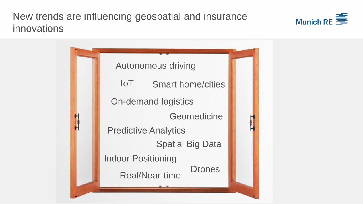
New trends are influencing geospatial and insurance
innovations
Smart home/cities
Autonomous driving
IoT
Spatial Big Data
Predictive Analytics
Real/Near-timeDrones
Indoor Positioning
On-demand logistics
Geomedicine
Thank you very much for your attention!
© 2014 Münchener Rückversicherungs-Gesellschaft © 2014 Munich Reinsurance Company Image: used under license from Shutterstock.com
Andreas Siebert
Email: [email protected]
Linkedin: https://de.linkedin.com/in/andreassiebert