GA Record Template · Web viewThe specification scope is described in terms of product hierarchy....
24
Wind Multiplier Dataset Data Product Specifications Tina Yang
Transcript of GA Record Template · Web viewThe specification scope is described in terms of product hierarchy....

Wind Multiplier DatasetData Product Specifications
Tina Yang

Department of IndustryMinister for Industry: The Hon Ian Macfarlane MPParliamentary Secretary: The Hon Bob Baldwin MPSecretary: Ms Glenys Beauchamp PSM
Geoscience AustraliaChief Executive Officer: Dr Chris PigramThis paper is published with the permission of the CEO, Geoscience Australia
© Commonwealth of Australia (Geoscience Australia) 2016
With the exception of the Commonwealth Coat of Arms and where otherwise noted, this product is provided under a Creative Commons Attribution 4.0 International Licence. (http://creativecommons.org/licenses/by/4.0/legalcode)
Geoscience Australia has tried to make the information in this product as accurate as possible. However, it does not guarantee that the information is totally accurate or complete. Therefore, you should not solely rely on this information when making a commercial decision.
Geoscience Australia is committed to providing web accessible content wherever possible. If you are having difficulties with accessing this document please email [email protected].
Wind Multiplier Dataset – Data Product Specifications
Contents
1 Overview.............................................................................................................................................. 11.1 Data product specification title.......................................................................................................11.2 Reference date............................................................................................................................... 11.3 Responsible party.......................................................................................................................... 11.4 Language....................................................................................................................................... 11.5 Terms and definitions..................................................................................................................... 11.6 Abbreviations and acronyms..........................................................................................................21.7 Informal description of the data product.........................................................................................2
2 Specification scope.............................................................................................................................. 42.1 Scope identification - dataset.........................................................................................................42.2 Scope identification – themes........................................................................................................42.3 Scope identification – layers...........................................................................................................4
3 Data product identification................................................................................................................... 63.1 Title................................................................................................................................................ 63.2 Abstract.......................................................................................................................................... 63.3 Topic category................................................................................................................................ 63.4 Geographic description.................................................................................................................. 63.5 Purpose.......................................................................................................................................... 63.6 Spatial representation type.............................................................................................................63.7 Spatial resolution............................................................................................................................ 73.8 Supplemental information...............................................................................................................7
4 Data content and structure.................................................................................................................. 84.1 Image identifier............................................................................................................................... 84.2 Image description........................................................................................................................... 84.3 Image type..................................................................................................................................... 84.4 Specification of additional image information.................................................................................8
4.4.1 Domain..................................................................................................................................... 84.4.2 Attribute.................................................................................................................................... 8
5 Reference systems............................................................................................................................ 105.1 Spatial reference system..............................................................................................................105.2 Temporal reference system..........................................................................................................10
6 Data quality........................................................................................................................................ 116.1 Positional accuracy...................................................................................................................... 116.2 Attribute accuracy........................................................................................................................ 116.3 Logical consistency......................................................................................................................126.4 Completeness.............................................................................................................................. 12
7 Data capture...................................................................................................................................... 13
8 Data Maintenance.............................................................................................................................. 14
9 Data product delivery......................................................................................................................... 159.1 Delivery format information..........................................................................................................159.2 Delivery medium information........................................................................................................15
Wind Multiplier Dataset – Data Product Specifications

10 Metadata.......................................................................................................................................... 1610.1 Abstract...................................................................................................................................... 1610.2 Lineage...................................................................................................................................... 1610.3 Access........................................................................................................................................ 1610.4 Use limitations............................................................................................................................ 1610.5 Keywords................................................................................................................................... 17
References........................................................................................................................................... 18
Acknowledgements............................................................................................................................... 19
Appendix A Improvements on Wind Multiplier Computation Software..................................................20
Wind Multiplier Dataset – Data Product Specifications
1 Overview
1.1 Data product specification titleWind Multiplier Dataset
1.2 Reference date
January 2016
1.3 Responsible partyHazard and Risk Infrastructure and Applications Section
Community Safety and Earth Monitoring Division
Geoscience Australia
Cnr Jerrabomberra Avenue and Hindmarsh Drive Symonston ACT
GPO Box 378 Canberra ACT 2601 Australia
Tel: 1800 800 173 | Fax: +61 2 6249 9999 | Email: [email protected]
URL: http://www.ga.gov.au | ABN: 80 091 799 039
1.4 Language
English
1.5 Terms and definitions
Term Definition
Wind multipliers Factors, in the form of gridded spatial data, used to transform regional wind speeds to local wind speeds by considering local effects. The wind multipliers consist of direction, terrain, shielding and topographic multiplier data.
Terrain multiplier The wind multiplier that accounts for variation in wind speed with variation of upwind aerodynamic roughness lengths.
Shielding multiplier The wind multiplier that adjusts the wind speed when shielding objects are within the upwind shielding zone of a building.
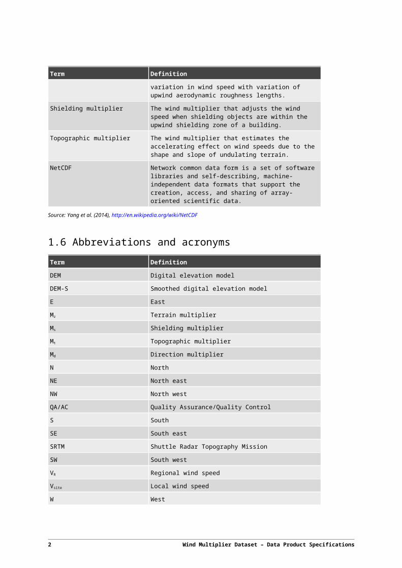
Topographic multiplier The wind multiplier that estimates the accelerating effect on
Wind Multiplier Dataset – Data Product Specifications 1
Term Definition
wind speeds due to the shape and slope of undulating terrain.
NetCDF Network common data form is a set of software libraries and self-describing, machine-independent data formats that support the creation, access, and sharing of array-oriented scientific data.
Source:Yang et al. (2014), http://en.wikipedia.org/wiki/NetCDF
1.6 Abbreviations and acronyms
Term Definition
DEM Digital elevation model
DEM-S Smoothed digital elevation model
E East
Mz Terrain multiplier
Ms Shielding multiplier
Mt Topographic multiplier
Md Direction multiplier
N North
NE North east
NW North west
QA/AC Quality Assurance/Quality Control
S South
SE South east
SRTM Shuttle Radar Topography Mission
SW South west
VR Regional wind speed
Vsite Local wind speed
W West
1.7 Informal description of the data productWind multipliers are factors that transform regional wind speeds to local wind speeds, mathematically describing the influences of terrain, shielding and topographic effects. Local wind speeds are critical to wind-related activities such as hazard and risk assessment.
The wind multiplier dataset is of national coverage divided into one degree of arc by one degree of arc tiles (approximately 112 km by 112 km at the equator with a reducing E-W coverage towards the southerly latitudes).
The wind multiplier dataset is comprised of three elements:
2 Wind Multiplier Dataset – Data Product Specifications

Terrain multiplier
Shielding multiplier
Topographic multiplier
For each tile extent there are eight layers (one for each of the cardinal and inter-cardinal directions) for each of the terrain, shielding and topographic multipliers.
Each layer is of the NetCDF data format with a one arc second by one arc second cell resolution (approximately 30 m by 30 m at the equator with a reducing E-W coverage towards the southerly latitudes).
The wind multiplier values were derived from input datasets including land cover and DEM according to the adaptations of AS/NZS 1170.2:2011 (incorporating Amendment Nos 1, 2 and 3) using the Geoscience Australia Wind Multiplier Computation Software 2.0 (https://github.com/GeoscienceAustralia/Wind_multipliers/commit/a40c0e6b80498d084ea54f145a35a30205c3bdfd ). The methodology for geo-computationally evaluating these effects is documented in Yang et al. (2014). The computational algorithms have passed Quality Assurance/Quality Control (QA/AC) tests.
This wind multiplier dataset should be updated when the source data or the computation software is updated. The current dataset was created using the Geoscience Australia Wind Multiplier Computation Software 2.0 in January 2016 with input data:
National dynamic land cover dataset version 2 (with data range 01/01/2012 ~ 31/12/2013), and
1 second SRTM derived digital elevation models (DEM-S) version 1.0.
Wind Multiplier Dataset – Data Product Specifications 3

2 Specification scope
The specification scope is described in terms of product hierarchy.
2.1 Scope identification - datasetWind multiplier dataset
Level
Dataset
Level name
Wind multipliers (terrain, shielding and topographic)
Extent
Complete Australian continental coverage (within the longitude between 113º and 154º and the latitude between -10º and -44º).
2.2 Scope identification – themes
Wind multiplier themes
Level
Theme
Level name
Terrain multiplier
Shielding multiplier
Topographic multiplier
Extent
Each theme spatially covers Australia within the longitude between 113º and 154º and the latitude between -10º and -44º. For parallel computation purposes, Australia is divided into 824 tiles with dimension of 1 by 1 arc degree. Wind multipliers are computed for each tile for eight directions, resulting in a total of 6,592 layers for each theme.
2.3 Scope identification – layersWind multiplier theme layers
4 Wind Multiplier Dataset – Data Product Specifications

Level
Dataset layers within each of the three themes
Level name
Wind multiplier layers
Extent
Each theme is divided into tiles with 1 by 1 arc degree for eight directions, represented by layers. Therefore, each layer spatially covers about 1 by 1 arc degree within the longitude between 113º and 154º and the latitude between -10º and -44º.
Wind Multiplier Dataset – Data Product Specifications 5

3 Data product identification
3.1 TitleWind Multiplier Dataset
3.2 Abstract
The wind multiplier dataset is composed of terrain, shielding and topographic multipliers. For each of the three multipliers there are individual tiles of 1 by 1 arc degree coverage (approximately 12,000 km2). Each tile contains eight raster datasets, one for each of the cardinal and inter-cardinal wind directions, at a grid resolution of 1 arc second (approximately 900 m2). The dataset is in NetCDF format.
3.3 Topic categoryWind multipliers dataset for transforming regional wind speeds to local wind speeds using methodologies based on AS/NZS 1170.2:2011.
3.4 Geographic description
The wind multiplier dataset covers the landmass and near coastal islands of Australia. The bounding box for this data is as follows,
North bounding latitude: -10º
South bounding latitude: -44º
West bounding longitude: 113º
East bounding longitude: 154º
3.5 PurposeWind multiplier data can be accessed by interested parties to estimate local wind speeds from regional wind speeds. Local wind speeds are critical to wind-related activities such as hazard and risk assessment. Other activities include agricultural growth and moisture demand applications along with energy-related applications such as wind farm developments.
3.6 Spatial representation type
The form of the wind multiplier dataset is regular gridded raster data.
6 Wind Multiplier Dataset – Data Product Specifications

3.7 Spatial resolutionSpatial resolution of the wind multiplier dataset is 1 arc second.
3.8 Supplemental information
The source DEM’s spatial resolution is 1 arc second (about 30 m), and the source land cover dataset’s spatial resolution is 250 m. The processing algorithm resamples the land cover dataset’s resolution to that of the input DEM, so that the DEM’s resolution is not otherwise degraded. Therefore the output wind multiplier dataset’s spatial resolution is 1 arc second.
Wind Multiplier Dataset – Data Product Specifications 7
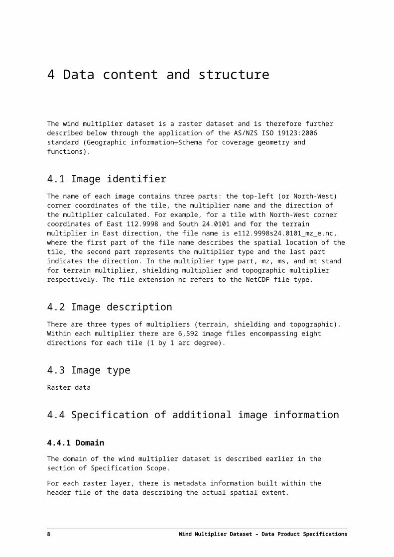
4 Data content and structure
The wind multiplier dataset is a raster dataset and is therefore further described below through the application of the AS/NZS ISO 19123:2006 standard (Geographic information—Schema for coverage geometry and functions).
4.1 Image identifierThe name of each image contains three parts: the top-left (or North-West) corner coordinates of the tile, the multiplier name and the direction of the multiplier calculated. For example, for a tile with North-West corner coordinates of East 112.9998 and South 24.0101 and for the terrain multiplier in East direction, the file name is e112.9998s24.0101_mz_e.nc, where the first part of the file name describes the spatial location of the tile, the second part represents the multiplier type and the last part indicates the direction. In the multiplier type part, mz, ms, and mt stand for terrain multiplier, shielding multiplier and topographic multiplier respectively. The file extension nc refers to the NetCDF file type.
4.2 Image description
There are three types of multipliers (terrain, shielding and topographic). Within each multiplier there are 6,592 image files encompassing eight directions for each tile (1 by 1 arc degree).
4.3 Image typeRaster data
4.4 Specification of additional image information
4.4.1 Domain
The domain of the wind multiplier dataset is described earlier in the section of Specification Scope.
For each raster layer, there is metadata information built within the header file of the data describing the actual spatial extent.
4.4.2 Attribute
Values
The wind multiplier dataset includes three different themes, each with different values:
Terrain multiplier: Mz
8 Wind Multiplier Dataset – Data Product Specifications

Shielding multiplier: Ms
Topographic multiplier: Mt
Range
The multiplier value ranges differ for each wind multiplier.
Terrain multiplier: 0.75 - 1.120
Shielding multiplier: 0.765 - 1.0
Topographic multiplier: 1.0 - 1.539
For each of the raster layers, there is metadata information built within the header file of the data describing the actual value range.
Wind Multiplier Dataset – Data Product Specifications 9
5 Reference systems
5.1 Spatial reference systemWGS 84 (EPSG:4326)
5.2 Temporal reference system
Gregorian calendar
10 Wind Multiplier Dataset – Data Product Specifications

6 Data quality
6.1 Positional accuracyInputs
The source dataset DEM is 1 arc second Shuttle Radar Topography Mission (SRTM) Smoothed Digital Elevation Models Version 1.0 from Geoscience Australia. The horizontal positional error of the 1 arc second SRTM DEM-S 1.0 is the same as for the raw SRTM 1 arc second data, with 90% of tested locations within 7.2 m for Australia (Geoscience Australia, 2011). More details can be found from http://www.ga.gov.au/metadata-gateway/metadata/record/gcat_72759.
Outputs
When computing wind multipliers, for each tile, the input land cover data was resampled to the input DEM. Therefore, the positional accuracy of the output wind multiplier data is essentially the same as that of the 1 arc second SRTM DEM-S 1.0.
6.2 Attribute accuracy
Inputs
The source 1 arc second DEM has been tested against 1,198 Permanent Survey Marks for the elevation accuracy and the result shows 99% of points are within a height difference of less than 9.602 m (Geoscience Australia, 2011). The DEM-S accuracy is improved to be approximately 5 m due to the smoothing process (Geoscience Australia, 2011).
The accuracy of the National Dynamic Land Cover Dataset of Australia Version 2 (http://www.ga.gov.au/metadata-gateway/metadata/record/gcat_83868) was assessed against more than 22, 000 field validation sites and the results show a high degree of consistency with extensive independent field base datasets (Geoscience Australia, 2015).
Outputs
The accuracy of wind multiplier values have been verified against Australian wind loading standard AS/NZS 1170.2:2011 and the understandings of how each multiplier is impacted by the local effects in reality. Although they are not quantified for each of the tests, the results show qualitative agreement with the general knowledge that the higher wind multiplier values usually appear on steeper topography, more open terrain and denser upwind shielding obstructions.
Wind multipliers values generated by the software used to produce this dataset have been used in wind hazard and risk analysis. The results are considered to be qualitatively correct.
Wind Multiplier Dataset – Data Product Specifications 11
6.3 Logical consistencyThe logical consistency is appropriately viewed as a measure of internal validity. A logically consistent spatial dataset is not necessarily accurate. In the context of wind multipliers, logical consistency has been tested through unit tests to check if the outputs from the computation software conform to the algorithms described in Yang et al. (2014).
For each unit test, the expected values of the test data are calculated alternatively in accordance with the algorithm described in Yang et al. (2014). Then the computation output from the input test data was compared with the expected values. The test results show that the computation software output highly conforms to its expected values with almost equal values up to at least the second decimal place.
Different unit tests have been designed for each multiplier to validate some essential algorithms within the computation software.
For the terrain multiplier, functions of terrain class reclassification and the convolution to producing moving average values were tested for their validities.
For the shielding multiplier, the function of combining the slope and aspect with the original shielding factors was tested. The convolution function was also tested.
For the topographic multiplier, unit tests were designed to test the algorithm on finding peaks and the overall algorithm on the calculation of the topographic multiplier.
6.4 Completeness
The wind multiplier dataset is complete within the Australian geographic extent defined in Section 3.4.
12 Wind Multiplier Dataset – Data Product Specifications
7 Data capture
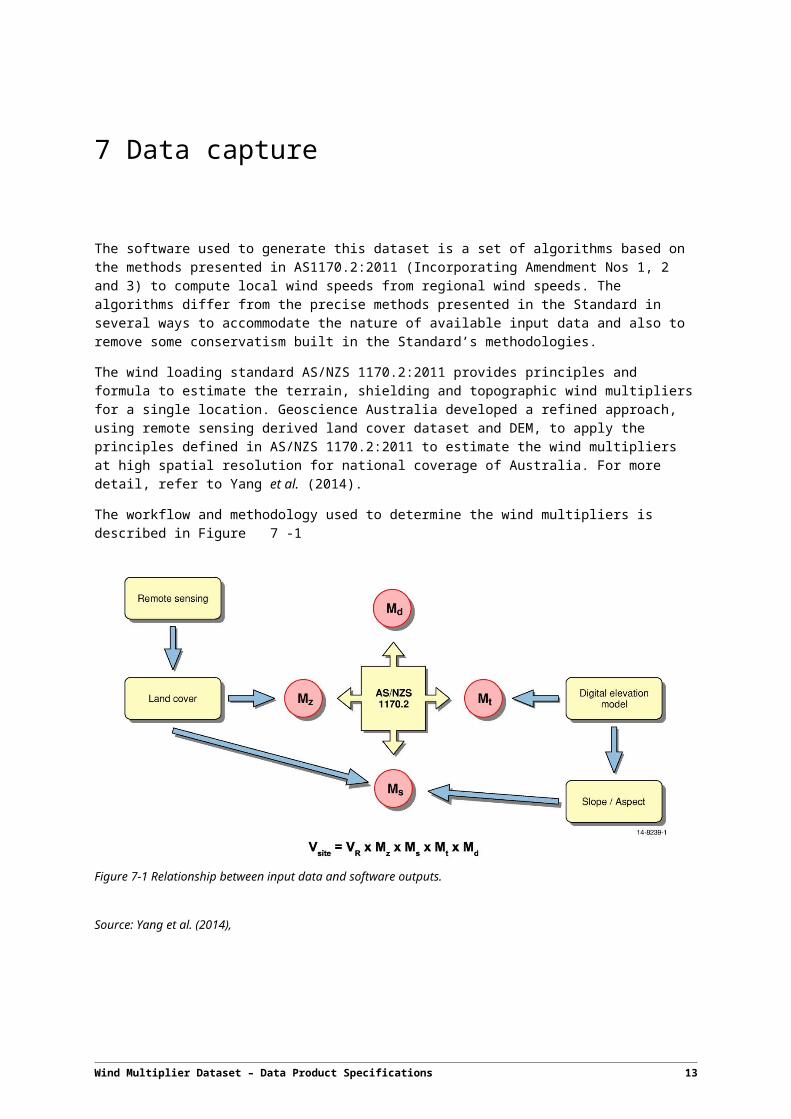
The software used to generate this dataset is a set of algorithms based on the methods presented in AS1170.2:2011 (Incorporating Amendment Nos 1, 2 and 3) to compute local wind speeds from regional wind speeds. The algorithms differ from the precise methods presented in the Standard in several ways to accommodate the nature of available input data and also to remove some conservatism built in the Standard’s methodologies.
The wind loading standard AS/NZS 1170.2:2011 provides principles and formula to estimate the terrain, shielding and topographic wind multipliers for a single location. Geoscience Australia developed a refined approach, using remote sensing derived land cover dataset and DEM, to apply the principles defined in AS/NZS 1170.2:2011 to estimate the wind multipliers at high spatial resolution for national coverage of Australia. For more detail, refer to Yang et al. (2014).
The workflow and methodology used to determine the wind multipliers is described in Figure 7-1
Figure 7-1 Relationship between input data and software outputs.
Source: Yang et al. (2014),
Wind Multiplier Dataset – Data Product Specifications 13
8 Data Maintenance
If the source data (land cover or DEM) is updated, the wind multiplier dataset should be reproduced.
If the wind multiplier computation principles are updated within the Australian wind loading standard, the computation software algorithm should be updated accordingly. In this case, the wind multipliers should be reproduced.
The Wind Multiplier Computation Software is under ongoing improvement and maintenance. When a major release of the software happens, which affects the wind multiplier output, the wind multiplier dataset should be reproduced.
14 Wind Multiplier Dataset – Data Product Specifications
9 Data product delivery
9.1 Delivery format informationFormat
NetCDF
Format name
NETCDF3_CLASSIC
Specification
NETCDF3_CLASSIC is one of the flavours of NetCDF files, which is supported by version 3 of the NetCDF library. The reason the NetCDF is chosen is that this format is prevalent within atmospheric science for supporting the creation, access and sharing of array-oriented scientific data. The reason to choose NETCDF3_CLASSIC is its easy integration with ArcGIS 10.0 and above, where the output can be easily visualised.
Structure of the delivery file
The wind multiplier folder includes three subfolders: terrain, shielding and topographic. Under each subfolder, the individual image files are stored.
Language
English
9.2 Delivery medium information
Units of delivery
Users can download the whole dataset. Each tile’s file names contain the coordinates of top-left corner of this tile’s spatial extent. Therefore from file names, users can choose the individual tiles for their geographic areas of interest.
Size of the unit
1.05 TB for the whole dataset, 52 MB for one raster file.
Medium name
online
Wind Multiplier Dataset – Data Product Specifications 15
10 Metadata
Many of the core metadata elements as defined in ISO 19115 have been addressed earlier in this document. This section lists some additional metadata items.
10.1 AbstractWind multipliers are factors that transform regional wind speeds to local wind speeds considering local effects of wind direction, terrain, shielding and topographic influences. In order to assess the local wind hazard, wind multipliers need to be computed, so that the regional wind can be factored to provide local wind speeds.
This data package includes national coverage of terrain, shielding and topographic multipliers. The national coverage includes tiles with dimension about 1 by 1 degree of arc in NetCDF format. Each multiplier contains eight directions for the tile coverage.
10.2 Lineage
This data package was produced using input data including the:
National dynamic land cover dataset version 2 (with data range 01/01/2012 ~ 31/12/2013), and
1 second SRTM derived digital elevation models (DEM-S) version 1.0.
The script used was the Wind Multiplier Computation Software 2.0 (https://github.com/GeoscienceAustralia/Wind_multipliers).
The input DEM was split into 824 tiles with dimension of 1 arc degree by 1 arc degree. Each DEM tile was then used to extract the same extent of land cover from the input land cover dataset. For each tile, the extracted land cover was resampled according to the DEM, so that they are in the same geographic coordinate system and have the same resolution. After that the methodology described in Yang et al. (2014) was used to compute the wind multipliers.
10.3 AccessThe dataset is available under a Creative Commons Attribution 4.0 International Licence.
10.4 Use limitations
Geoscience Australia has tried to make the information in this product as accurate as possible. However, it does not guarantee that the information is totally accurate or complete. Therefore, you should not solely rely on this information. Key limitations/approximations include the following:
16 Wind Multiplier Dataset – Data Product Specifications

The principles from the wind loading standard AS/NZS 1170.2:2011 are for single locations. However, to compute wind multipliers automatically for large areas, adaptations and modelling have to be made to use national land cover and elevation data. Tests have been performed to measure the variation from AS/NZS 1170.2:2011 and all care has been taken to validate the results; nevertheless the validation is at best indicative.
The computation varies from the wind loading standard AS/NZS 1170.2:2011 by removing the conservatism. The AS/NZS 1170.2:2011 standard is known to be conservative in its approach to calculating the shielding and topographic multipliers. A refined method was used to remove the conservatism, which is described in Yang et al. (2014).
The implementation of topographic multiplier computation is simplified and varied from the wind loading standard AS/NZS 1170.2:2011 in several aspects. Firstly, the standard AS/NZS 1170.2:2011 only provides the escarpment factors in some cases, however to automate the computation for all cases, a model has to be developed to calculate the escarpment factor for a given topographic profile. Secondly, the algorithm to compute the topographic multiplier finds the crest locations including very small hillocks which should be ignored by the standard.
Elevation data is a critical input into the model. The 1 second of arc resolution elevation data (DEM) used in this model was the best available national scale elevation dataset at the time of modelling. The wind multiplier values are sensitive to variations in the quality, resolution and coverage of elevation data and should therefore be used with this understanding.
Land cover data is an input into the model. The land cover data (250 m) used in this model was the best available national scale land cover dataset at the time of modelling. The built-up area data only identifies the extent of the urban environment. Central Business District (CBD) areas were not included whereas these are indicated as shielding agents in the AS/NZS 1170.2:2011
10.5 KeywordsNatural hazards, wind, geospatial, terrain multiplier, topographic multiplier, shielding multiplier
Wind Multiplier Dataset – Data Product Specifications 17
References
Geoscience Australia, 2011. 1 second SRTM Derived Products User Guide. Available online at http://www.ga.gov.au/corporate_data/72759/1secSRTM_Derived_DEMs_UserGuide_v1.0.4.pdf
Geoscience Australia, 2015. Dynamic Land Cover Dataset Version 2 – Product Description. Available online at http://www.ga.gov.au/metadata-gateway/metadata/record/gcat_83868
Yang, T., Nadimpalli, K., and Cechet, R. P., 2014. Local wind assessment in Australia: computation methodology for wind multipliers. Record 2014/33. Geoscience Australia: Canberra.
18 Wind Multiplier Dataset – Data Product Specifications
Acknowledgements
The author would like to thank a number of people who assisted with the planning, development, leverage, testing and release of the software that has enabled the inaugural production of a national coverage wind multiplier dataset. In particular we would like to thank
Craig Arthur, Martin Wehner, Martine Woolf and Mark Edwards from the Community Safety Group
Duncan Moore, Kristen Walker and Dmitar Butrovski from the National Location Information Group
Joshua Sixsmith from the National Earth and Marine Observation Group
Daniel Wild, Alex Ip, Duncan Gray, Vanessa Newey and Ole Nielsen from the ICT Innovation and Services
All present and past colleagues at Geoscience Australia who contributed to the development of either the methodology or the software.
Wind Multiplier Dataset – Data Product Specifications 19

Appendix A Improvements on Wind Multiplier Computation SoftwareWind multiplier computation software Version 2.0 has several improvements compared to Version 1.0:
Replaced the GDAL sub-processes with GDAL API, so that NCI parallel processing can run smoothly without missing tiles.
Updated the output tile extent by excluding the overlapping areas.
Simplified the output folder structure.
Updated the terrain multiplier algorithm as per AS/NZS 1170.2 (2011) incorporating recent amendments 1, 2and 3.
Updated the topographic multiplier algorithm to include the Tasmania factor as per AS/NZS 1170.2 (2011).
Updated the topographic multiplier algorithm to remove the conservatism associated with the topographic multiplier as described in Yang et al. (2014), but with a modification (For topographic features such as shallow hills and escarpments where Mt < 1.4, a linear interpolation is constructed so that the percentage of reduction is gradually increased from 0 at point (Mt = 1) to 10 at point (Mt = 1.4))
Updated the shielding multiplier convolution mask from 8 points to 7 points by considering the Engineer's opinion.
More information about the Wind Multiplier Computation Software can be found on https://github.com/GeoscienceAustralia/Wind_multipliers.
20 Wind Multiplier Dataset – Data Product Specifications